

Aside from the short, easy trail around Maroon Lake, the moderately difficult Crater Lake Trail is probably the most popular hike in Colorado’s magnificent Maroon Bells Recreation Area. The 1.5-mile hike (plus 1/3 mile on the Maroon Lake Trail) takes visitors to over 10,000 feet, ending at a fantastic basin near the confluence of Minnehaha Gulch and West Maroon Creek Valley. Attempt it in the morning for the best, sun-soaked views of the jagged Maroon Bells, and hike in the fall to experience the splendid colors of the trail’s many aspens.


The hike
Like the Maroon Lake Trail, this hike begins at the end of Maroon Creek Road. (Note: After 8:30 am in the summer, visitors will be required to take the free RFTA shuttle from Aspen Highlands Village.) In fact, starting from the day-use parking area, the route covers approximately 1/3 mile of the Maroon Lake Trail (detailed description here), before veering off at the so-called “Deadly Bells Kiosk.” Bear right at the signed junction, officially joining the Crater Lake Trail.
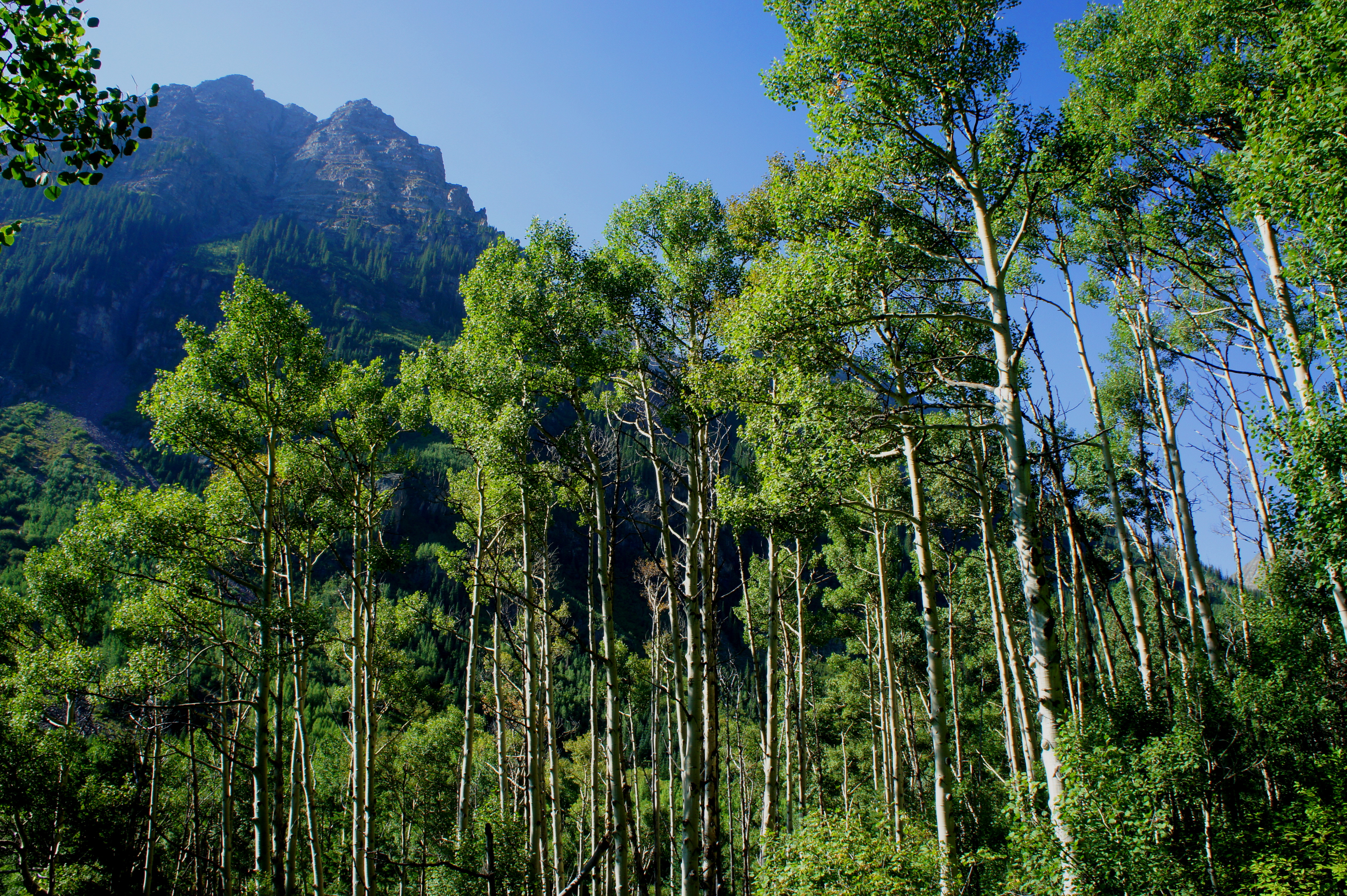
The rocky path begins by gradually climbing through a tremendous aspen stand, traversing a minor, cascading creek, and slowly edging away from the Maroon Creek Trail. On a busy day, you are likely to encounter a flurry of hikers—and can even hear the chatter of other visitors down in the ravine below.
A few minutes from the start, hikers will reach a trail junction; stay right. From here, the incline steepens but the ambiance of quaking aspens continues. While the views back to Maroon Lake are obscured, Pyramid Peak (14,018’) comes into the frame to the south. One can get a shot of both Pyramid and the twin Maroon Peaks from a spot about ½ mile up the trail, where tree cover is interrupted by a boulder-strewn rock slide.
Just after ascending the first of two pairs of switchbacks on the hike, look back to east for a nice bird’s eye view of Maroon Lake, now around 300 feet below.

A quarter mile later, the trail climbs a second pair of shaded switchbacks, then enters an extensive boulder field. Look—and listen—for mouse-like pikas scurrying every which way, curiously eyeing the human visitors. The rocky ditch also offers excellent views of Maroon Peak (14,156’) and North Maroon Peak (14,014’), simply two of the most photogenic mountains in Colorado.

Beyond the boulder field—at a point roughly 1.5 miles from the parking area—the Crater Lake Trail crests a ridge leading to the first view of the hike’s namesake, downhill to the southwest. From here the trail descends around 50 feet to a route junction; stay left to head to the lake. It is another 2/10 mile—mostly downhill—from here to Crater Lake.
Situated in a bend in the West Maroon Creek Valley, Crater Lake lies in a picturesque meadow, created by receding glaciers following the most recent Ice Age. It is possible to peer miles up the valley to the south, where some ambitious backpackers will find and conquer 12,500-foot West Maroon Pass. To the west, of course, the Maroon Bells feel toweringly close, and a high ridgeline named the Sleeping Sexton fills out the view to the northeast. The contrast of colors is astounding, as the lush green gives way to yellow, pink, grey, and of course, maroon.

Meanwhile, the lake itself is mostly still and peaceful, naturally dammed at one end with logs and brush. Take a while to soak in the landscape before heading back, a much easier, downhill return to the trailhead. Adventurous day-hikers may backtrack to the trail fork and climb to Buckskin or Willow Pass, adding a rigorous 5-6 miles to the round-trip hike.

The out-and-back to Crater Lake and back clocks in at about 3.6 miles and should take, on average, 2-3 hours to complete.

What a coincidence! The blog I read prior to this was two women who just hiked from Crested Butte to Aspen, and 11 mile hike. They came through the area you just wrote about and had a few of the same photos.
Awesome! I’d love to do a hike like that – Crested Butte to Aspen, or Aspen to Snowmass.
Pingback: Trading Post Trail (Red Rocks Park, CO) | Live and Let Hike
Pingback: Lost Lake Trail (San Isabel National Forest, CO) | Live and Let Hike
Kevin and I had such a fun time doing this hike! It is probably my most favorite place on earth! It was a little challenging as the terrain changes. I would do it again in a heartbeat. We were so pooped we couldnt even drive back to Denver so we drove over to Glenwood, had dinner and stayed at The Colorado Hotel for the night and drove down Monday instead. One of my favorite memories ever. Thanks Kevin!