
Centuries upon centuries of freezing, thawing, and riverine erosion have carved the Dalles of the St. Croix, a basalt gorge that is one of the main natural attractions on the Minnesota-Wisconsin border and a popular destination for visitors from the Twin Cities and beyond. The St. Croix River separates the two states—and two “interstate” parks—with the east side including more acreage and arguably better trail network. Wisconsin’s Interstate Park boasts glacial potholes, waterfalls, high cliffs, and pretty Lake O’ the Dalles—much of which can be seen on this 1.25-mile hike, combining the Summit Rock, Echo Canyon, and River Bluff Trails. Lace up your boots for this surprisingly challenging and very rocky jaunt, one of the best in the park.

The hike
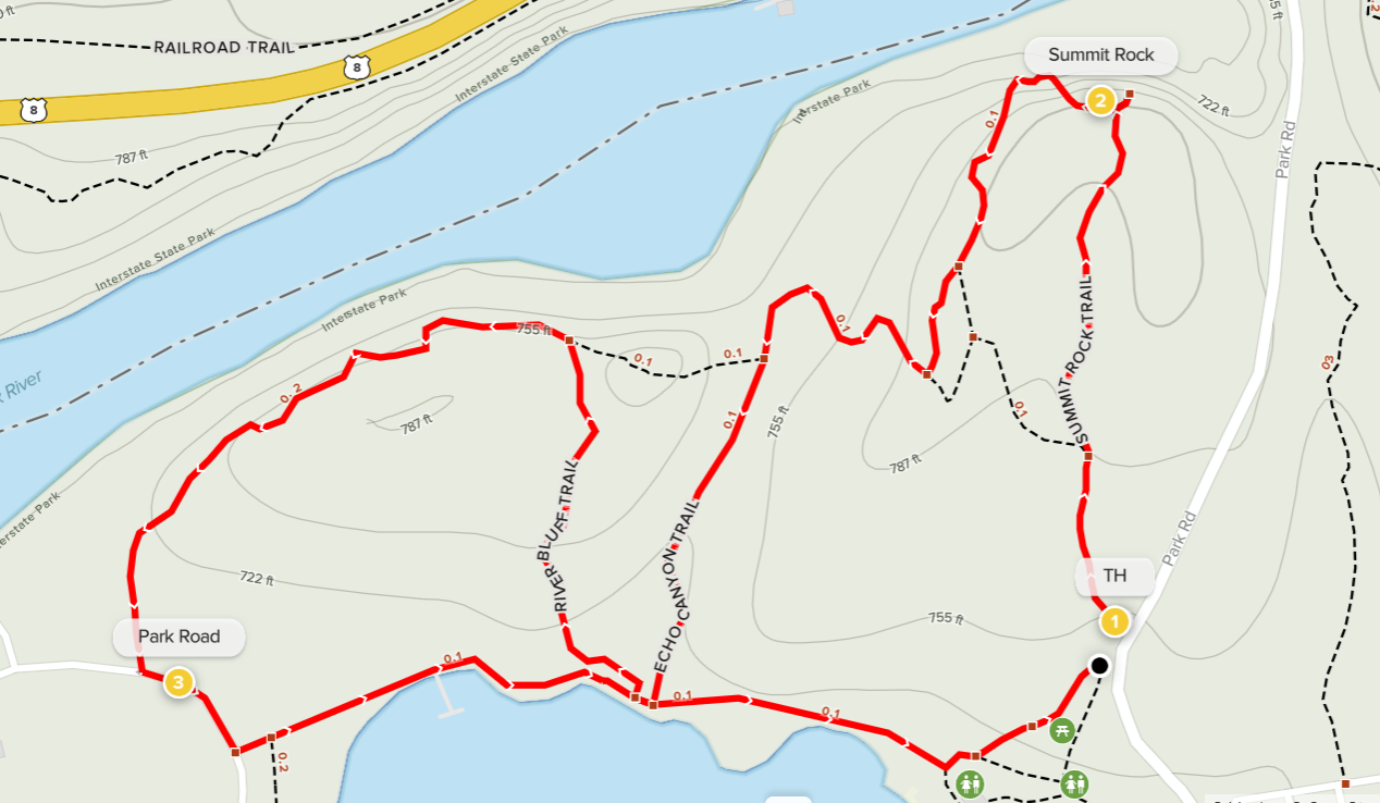
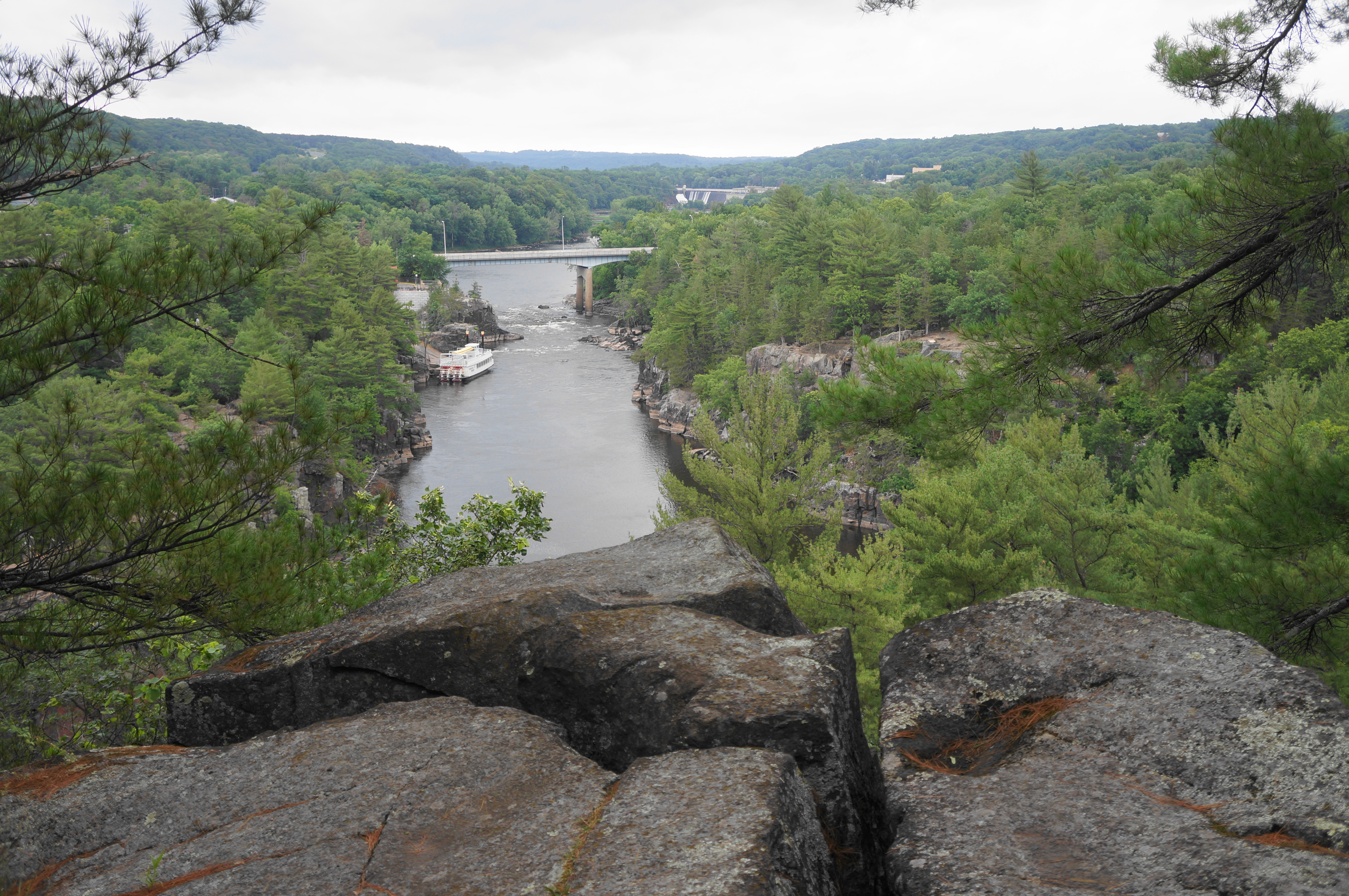
Head south from St. Croix Falls, Wisconsin and bear west on Park Road, the main thoroughfare in Interstate Park. Plan to stay on the winding road for about 2.5 miles; just before the beach at Lake O’ the Dalles, bear right and park at the small roadside parking lot for the Summit Rock Trail. South of the narrowest point in the gorge, the Summit Rock Trail explores a perched bluff area above the Dalles, offering the best views of the St. Croix River on the hike.

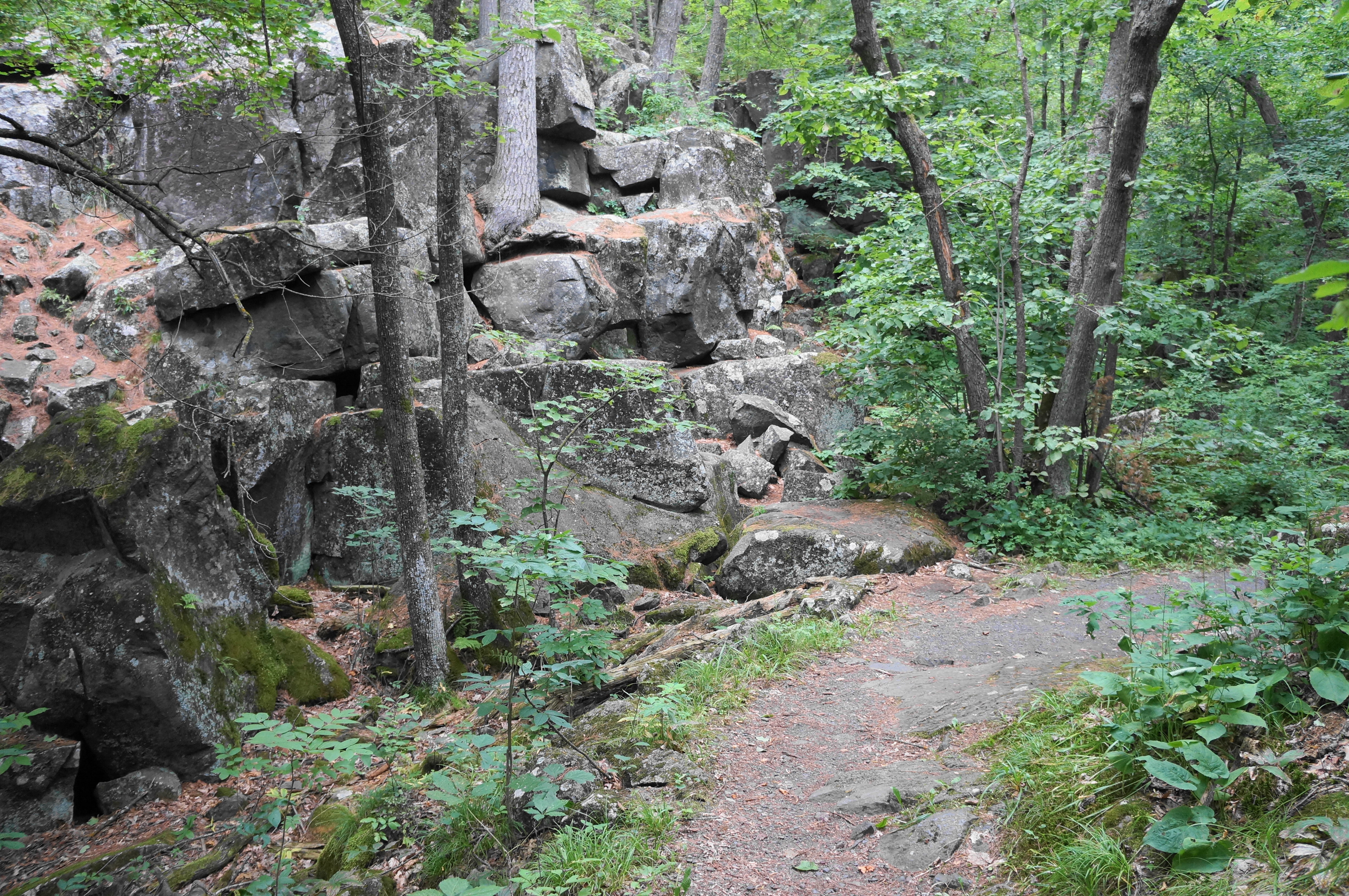
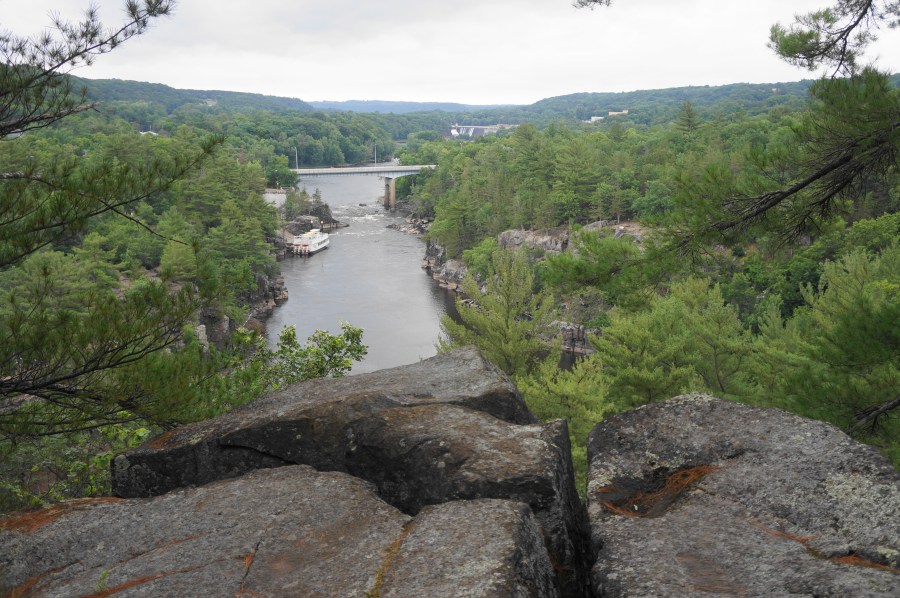
The trail begins by climbing a stone staircase, entering the Dalles of the St. Croix River State Natural Area. The first junction comes at around 100 yards into the hike, and visitors should bear right to see the best views. Make your way through a passage with a mossy basalt outcrop on the left, then climb another narrow staircase as the singletrack comes to a flattop overlooking the Dalles of the St. Croix. This is the most impressive gorge along the St. Croix drainage, though it is visibly dammed upstream. The uplands beyond are part of the quaint towns of Taylors Falls, Minnesota and St. Croix Falls, Wisconsin, largely hidden by the dense deciduous tree cover.
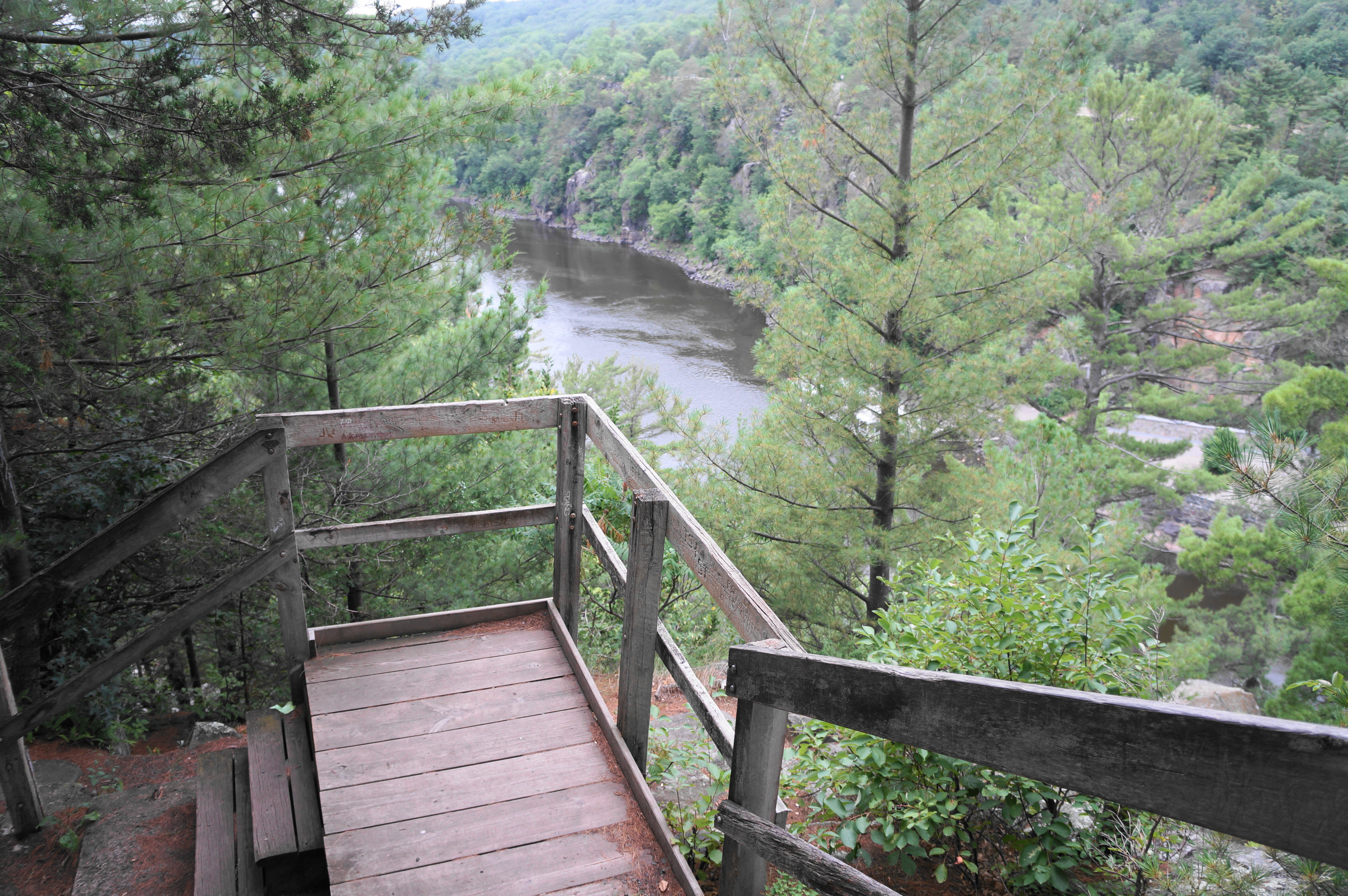
After this initial overlook, head west as the Summit Rock Trail crests its namesake, following a creaky wooden staircase with railings. Additional views can be had from the trail’s high point, although tall pines partly obscure the vista.
After dropping down another wooden stairway, a variety of trails—laden with pine needles—seem to head off in all directions except right, where the basalt cliffs drop more than 60 feet to the river below. Generally stay on the most evident path, which parallels the bluff, with views largely obscured by the dense pine thicket.

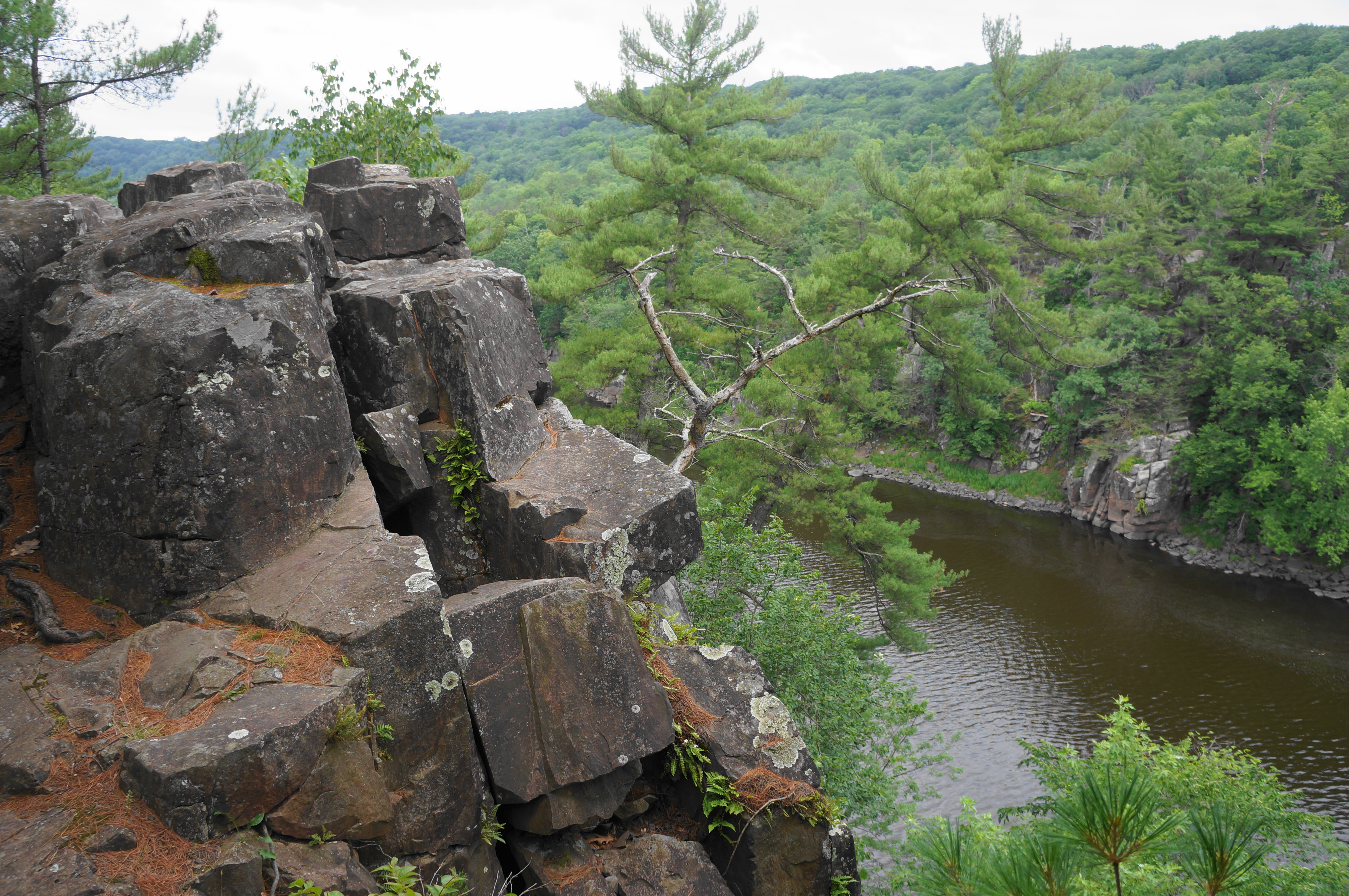
Soon the Summit Rock Trail turns away from the river, finding a break in the cliffs and descending steeply to a junction at 3/10 mile. Head right, then descend additional stairs and bear right again at the next, unmarked fork. By now, hikers are on the graveled Echo Canyon Trail, a confusing track with few views of the river but surprises around every corner amid the labyrinth of basalt notches and outcrops. At around 4/10 mile, look for an arrow pointing left and follow it, avoiding the temptation to drop down what seems like the main trail heading for the riverbank. (Note: If you are approaching the St. Croix by way of a steep descent, this is the wrong way!)
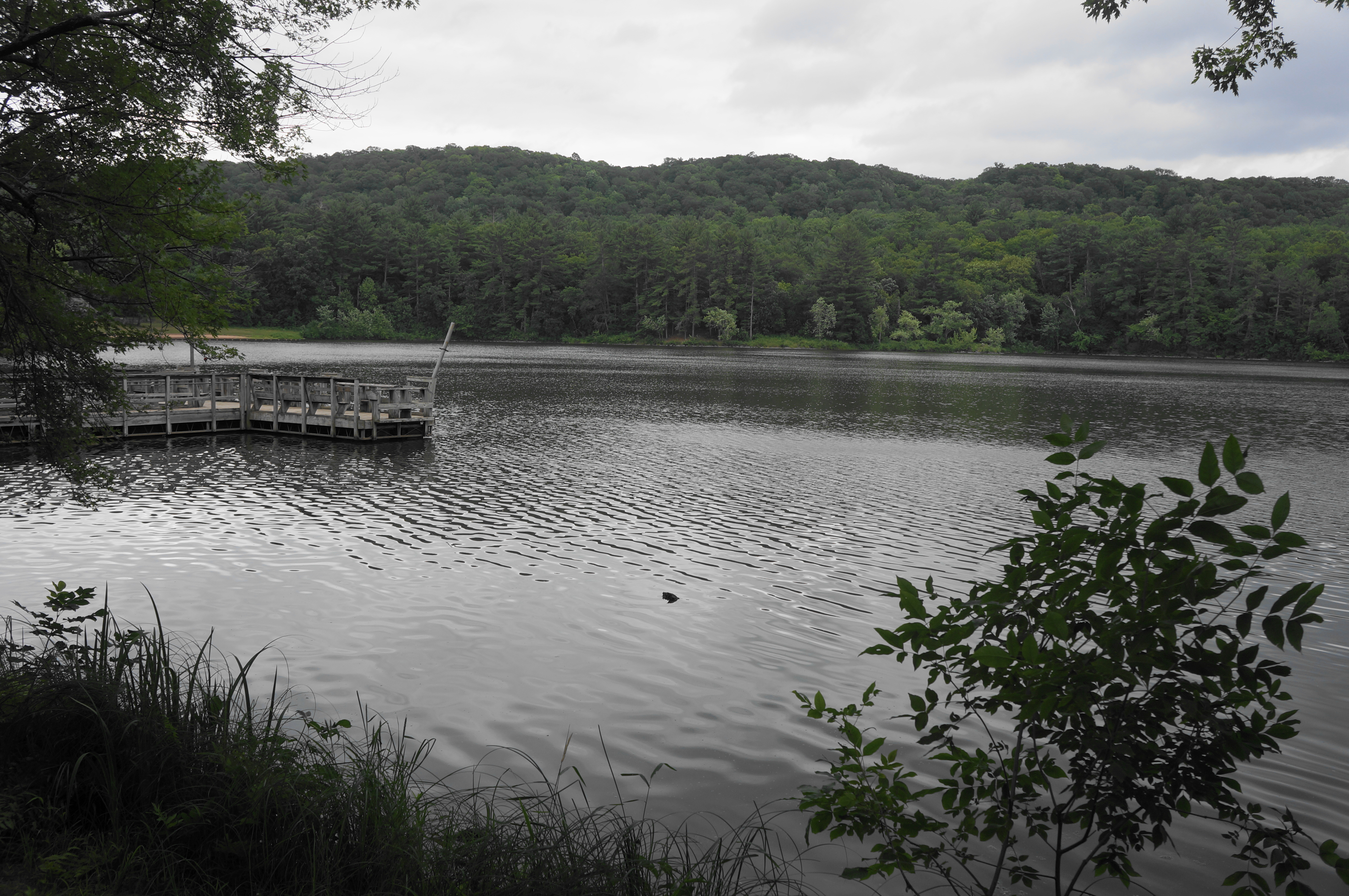
Continue to the base of a massive basalt sentinel and rock pile, then move further away from the river and up a canyon with high walls on the right. One can begin to spot the lake ahead through the trees. Descend to the north shores of Lake O’ the Dalles, where the Echo Canyon Trail ends. Bear right on the Lake O’ the Dalles Trail, which encircles the still 25-acre lake popular with anglers.

In less than a half a minute, however, another trail heads off back into the woods—this is the River Bluff Trail, the final of the trio of intersecting trails on the hike. Follow the narrow path as it heads up steps again, then comes to a flat and marshy area on the left and approaches the confluence of two canyons. Follow the hiker signs, going up the left drainage, returning to the bluffs high above the St. Croix River. The views here are also obscured, but the tall cliffs of the Minnesota side remain visible (and occasionally dotted with hikers and climbers).


Follow the river westward, with gravel returning to mark the onward trail, and then bear south as the track leaves the St. Croix behind. Descend to an opening, where the River Bluff Trail ends and intersects with Park Road, a stone’s throw from the River Bottoms Picnic Area and Boat Launch. As the trail disappears, simply head left along the road, returning to the shores of the lake, where the Lake O’ the Dalles Trail can be found again.


Heading left on this trail, the route passes a small fishing pier and returns to the start of the River Bluff and Echo Canyon Trails in quick succession. This time stay straight on the Lake O’ the Dalles Trail, a level and easy track. Enjoy views of the lake as you approach the beach area. Just before the beach house, bear left and find a staircase that leads up to a small picnic area with grills. From here, take a right to return to the parking area and Summit Rock Trailhead, completing the 1.25-mile walk.