
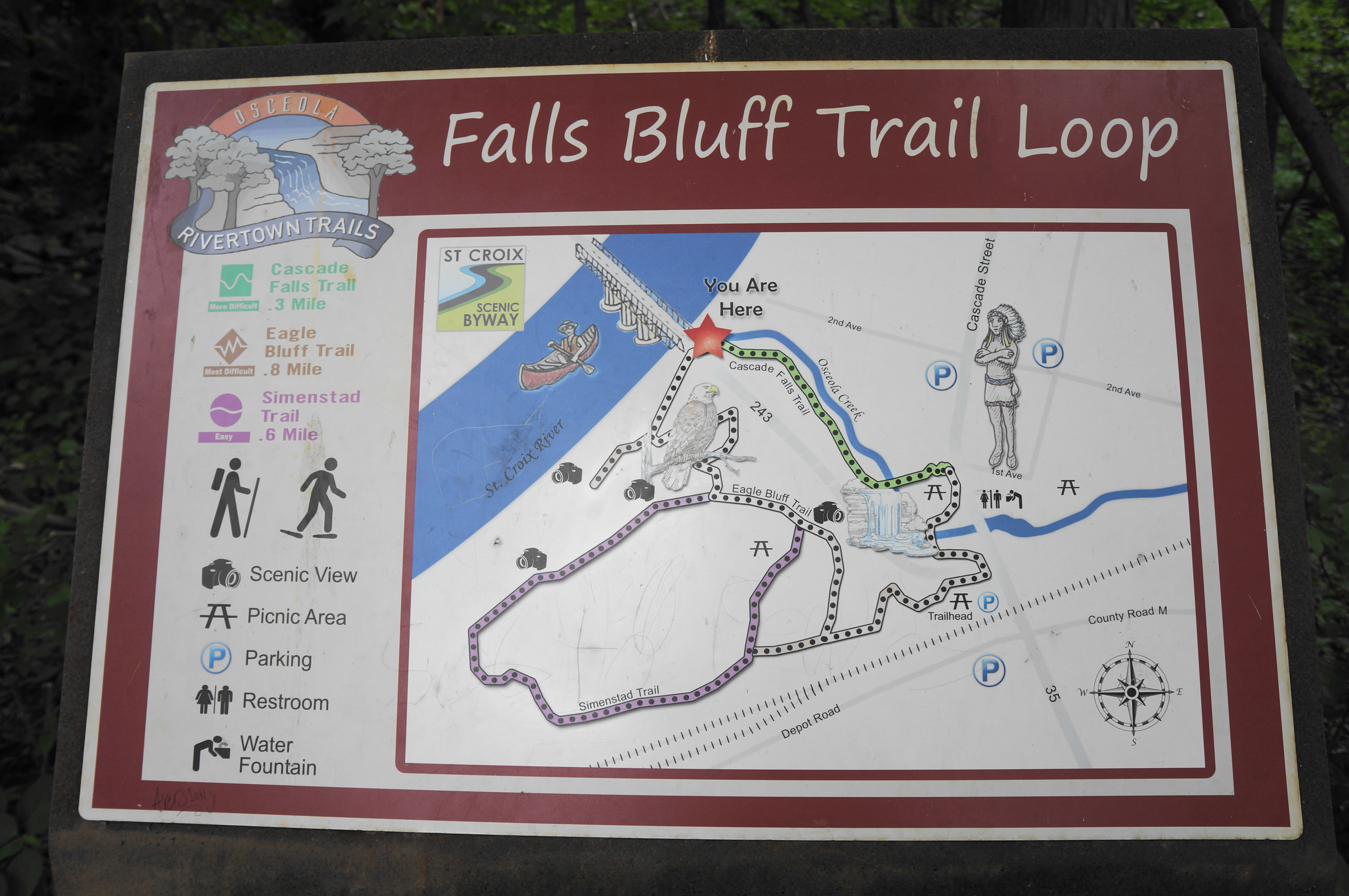
Osceola, Wisconsin, situated on the St. Croix River and border with Minnesota, is a charming small town that is a popular day trip for Twin Cities residents. It owes its destination status in part to the natural landscapes immediately surrounding it, from the high bluffs to the gentle riverside to the surprisingly robust Cascade Falls, a 25-foot waterfall visible from the town center. The best of these natural surroundings can be explored on the moderately-challenging Falls Bluff Trail Loop, actually a network of three paths—the Cascade Falls, Eagle Bluff, and Simenstad Trails—that be combined to make for a short but surprisingly rugged outing. (Note: As of summer 2022, the quickest route to Cascade Falls—a 135-step staircase—was closed for rehabilitation, but the falls are still accessible by way of a roundabout (and more scenic) jaunt that ascends and descends Eagle Bluff, on the west flank of town.)

The hike
Wilke Glen and Cascade Falls are usually accessible by way of a short but steep staircase that drops from the corner of Route 35 and 1st Ave in Osceola. However, as of summer 2022, this section was closed, requiring that visitors to the falls re-route on a track that swings to the south of Osceola Road (Route 243) before entering the glen from its mouth. This is a bit frustrating, as one can see Cascade Falls from the sidewalk, through a break in the trees—but the reroute requires a diversion considerably out of the way to get to the base of the chute.

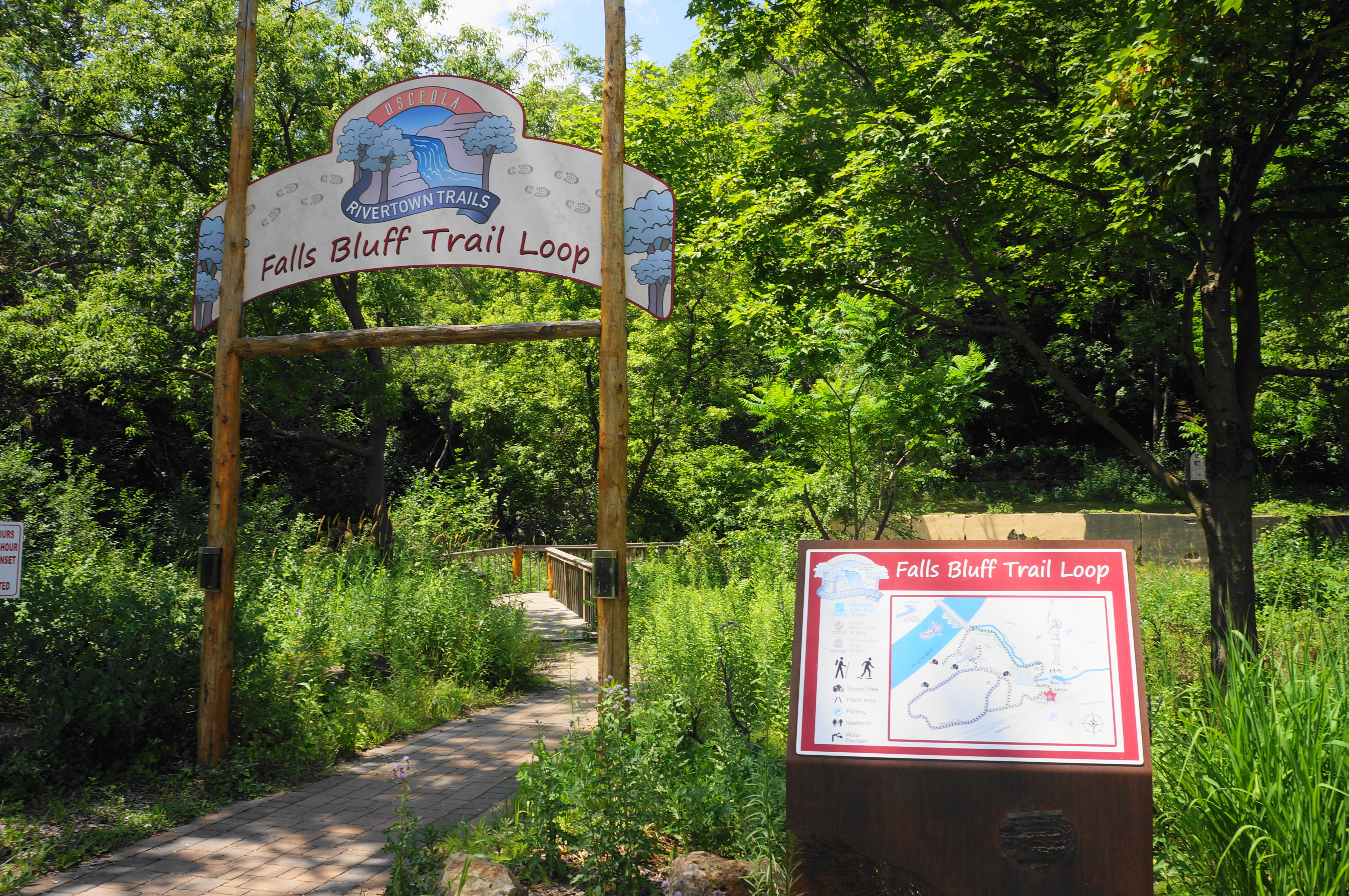
While the closure makes the journey certainly more inconvenient, the advantage is that the crowds thin considerably, and the extra effort affords nice vistas in itself. (Note: Even on a busy weekday in summer, when the town was bustling with visitors, I had Cascade Falls to myself.) To start on the detour route, walk south along Route 35 (N. Cascade Road), passing the Watershed Café, and cross Osceola Road to the south side, where there are elaborate and hokey signs (and a map) indicating the start of the Falls Bluff Trail Loop, perhaps the natural crown jewel of Osceola. (Note: As a slight detour, one can also follow the paved path behind the Watershed Café, crossing a bridge over Osceola Creek and a minor drop called Geiger Falls.)


Follow the trail that begins here, ascending an initial staircase as it enters the dense woods and reaches a gravel road. Follow the gravel track as it ascends the upland above Osceola, then look for a marked singletrack trail heading right: this is the Eagle Bluff Trail, which eventually connects with the Cascade Falls Trail.

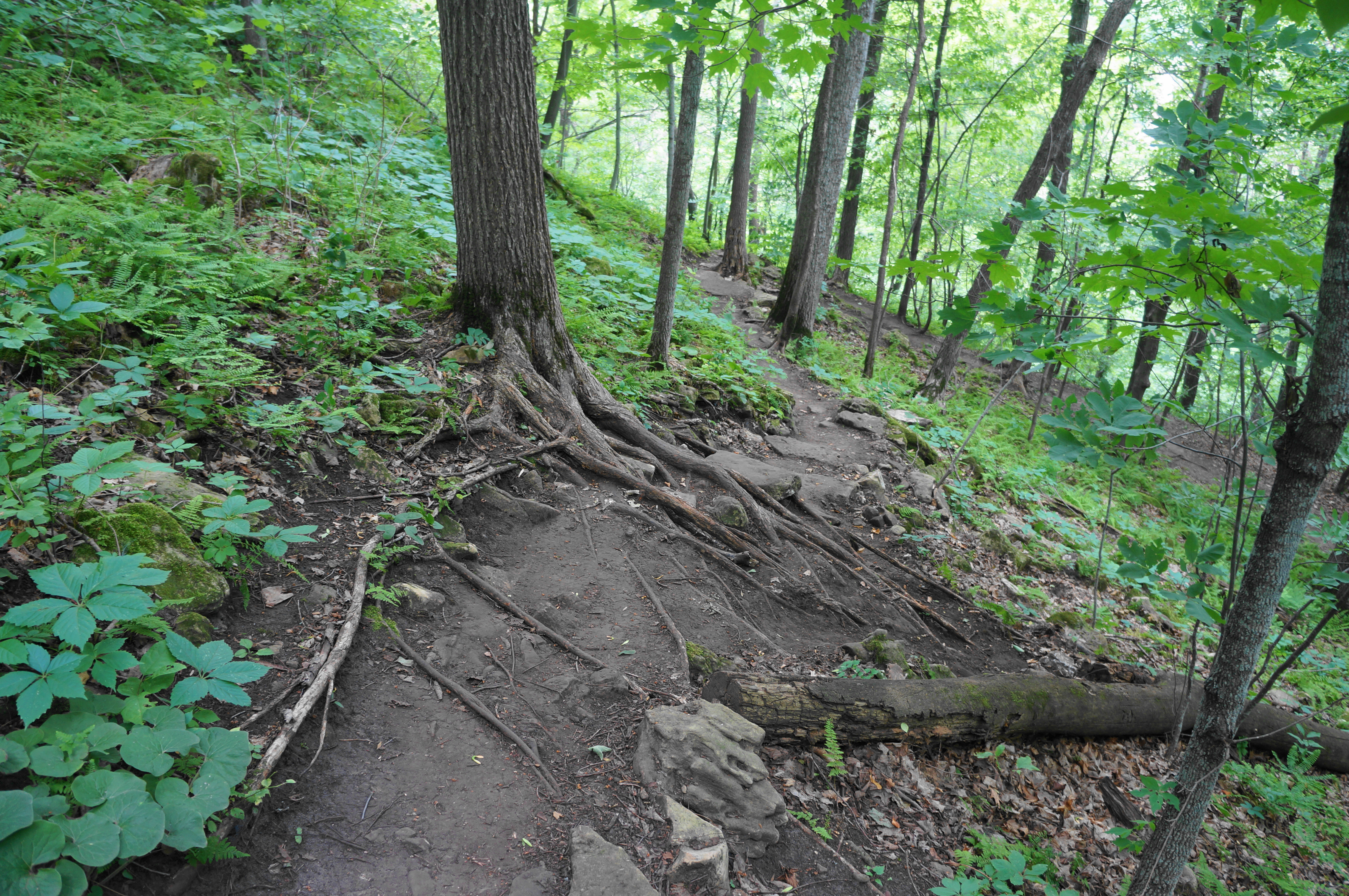
The Eagle Bluff Trail is a surprisingly rugged and challenging route, climbing a root-laden slope before flattening off for a brief period, in sight of a water tower on the left. Occasional window views through the trees offer a distant look at the brick facades of downtown Osceola, with the fairgrounds and baseball fields beyond. At 3/10 mile, take a right at the fork, beginning a sharp descent that includes a steep switchback requiring careful footing. As the route drops down a level, it skirts what appears to be a 3-foot-deep sinkhole (likely the remains of a root system) before continuing on, in the direction of Osceola Creek and the St. Croix River.


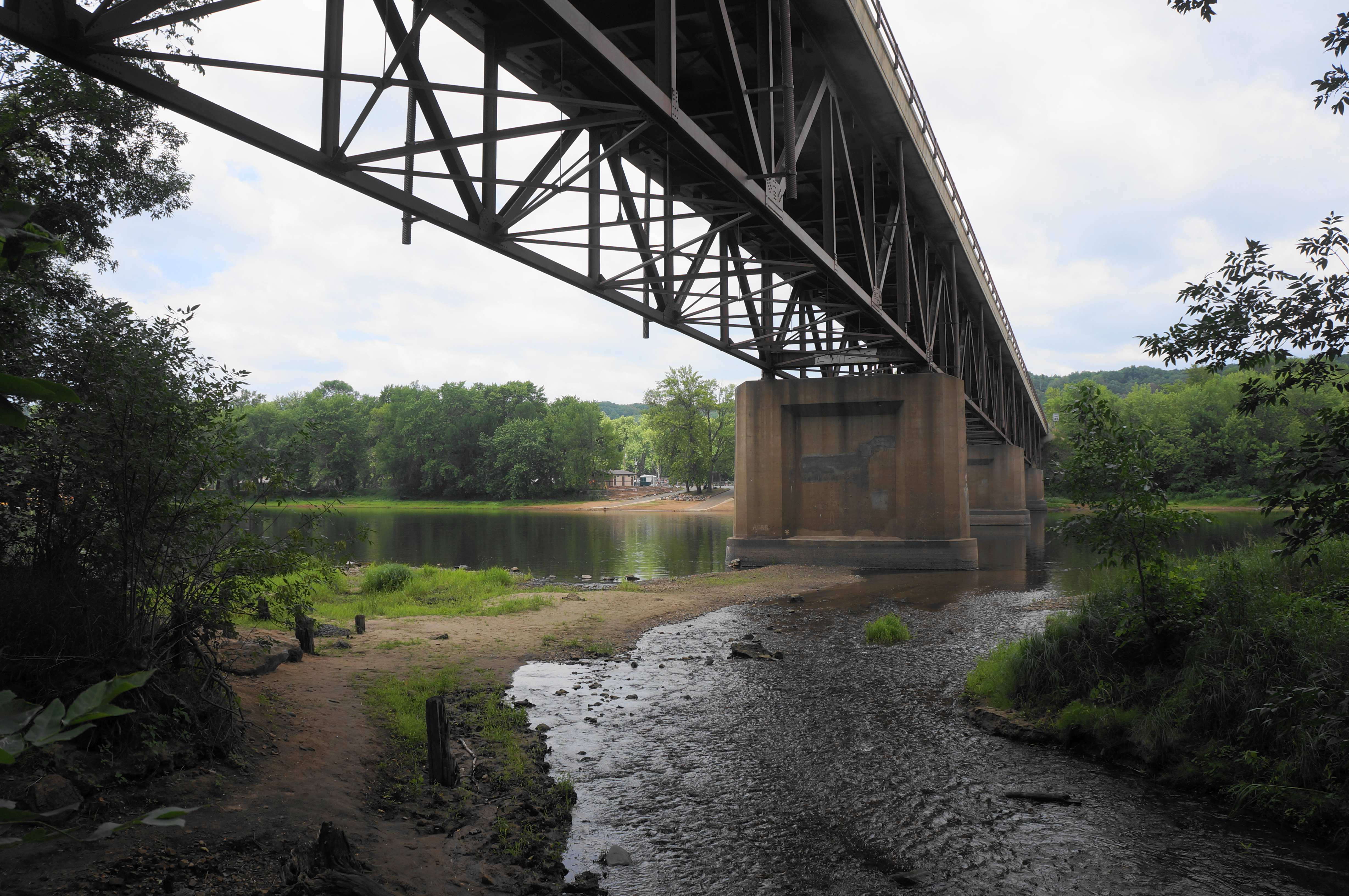
Soon the descent resumes, and the noisy car sounds of Route 243 grow louder and brasher. Once down in the floodplain, the slope finally eases, and hikers reach a signed junction; bear left at the next two junctions, following a short spur to check out a modest viewpoint, with obscured views of the St. Croix River.

Return to the main trail and head straight, following the signs for the falls. Stay left at a subsequent fork, dropping to a point that is level with the river and directly under the Highway 243 Bridge. Even with the sound of traffic overhead, the river bank is peaceful, teeming with the sounds of insects, frogs, and birds. Edge your way eastward to the start of Wilke Glen and mouth of Osceola Creek, a perennial stream fed by Cascade Falls.
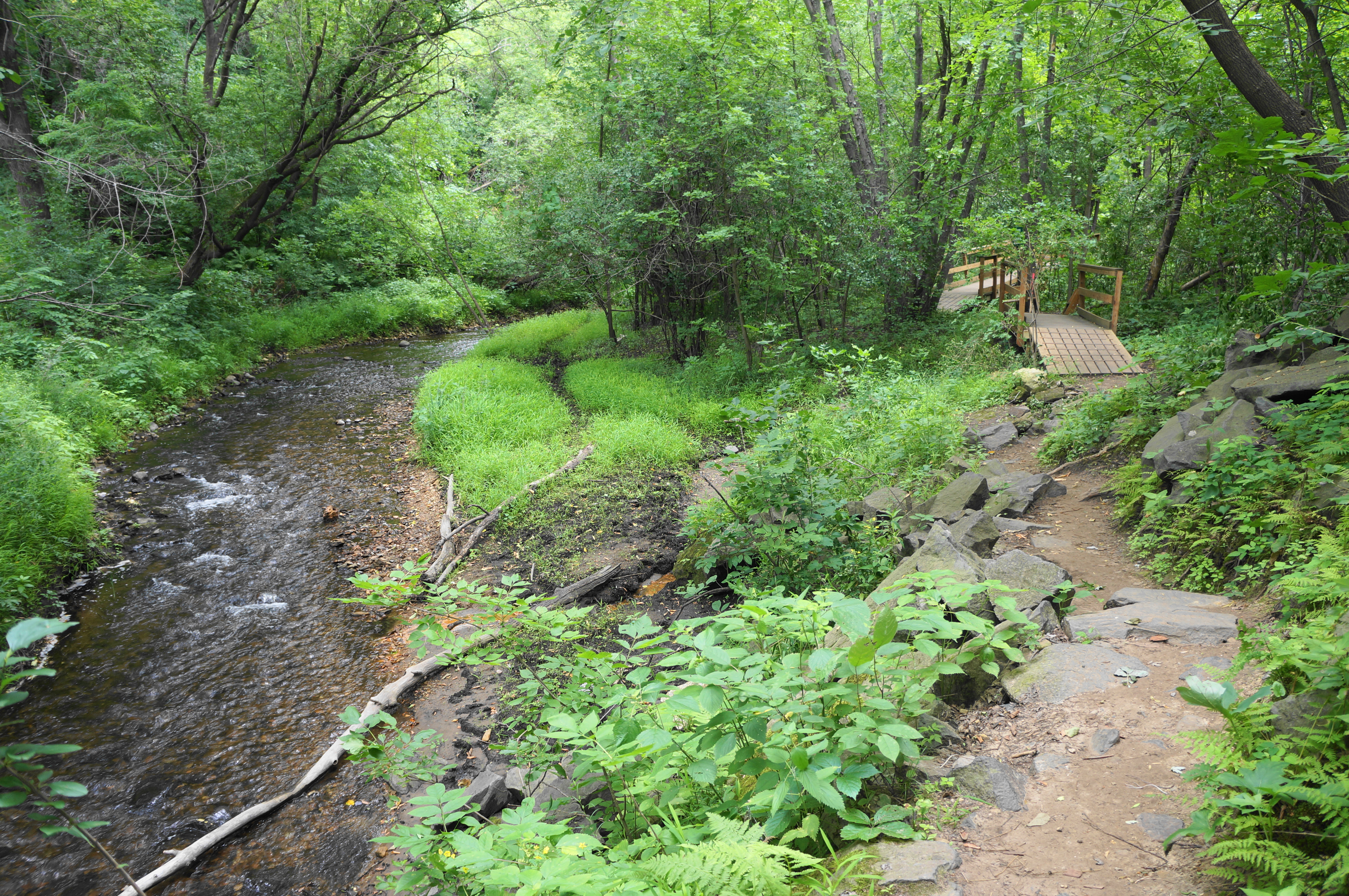
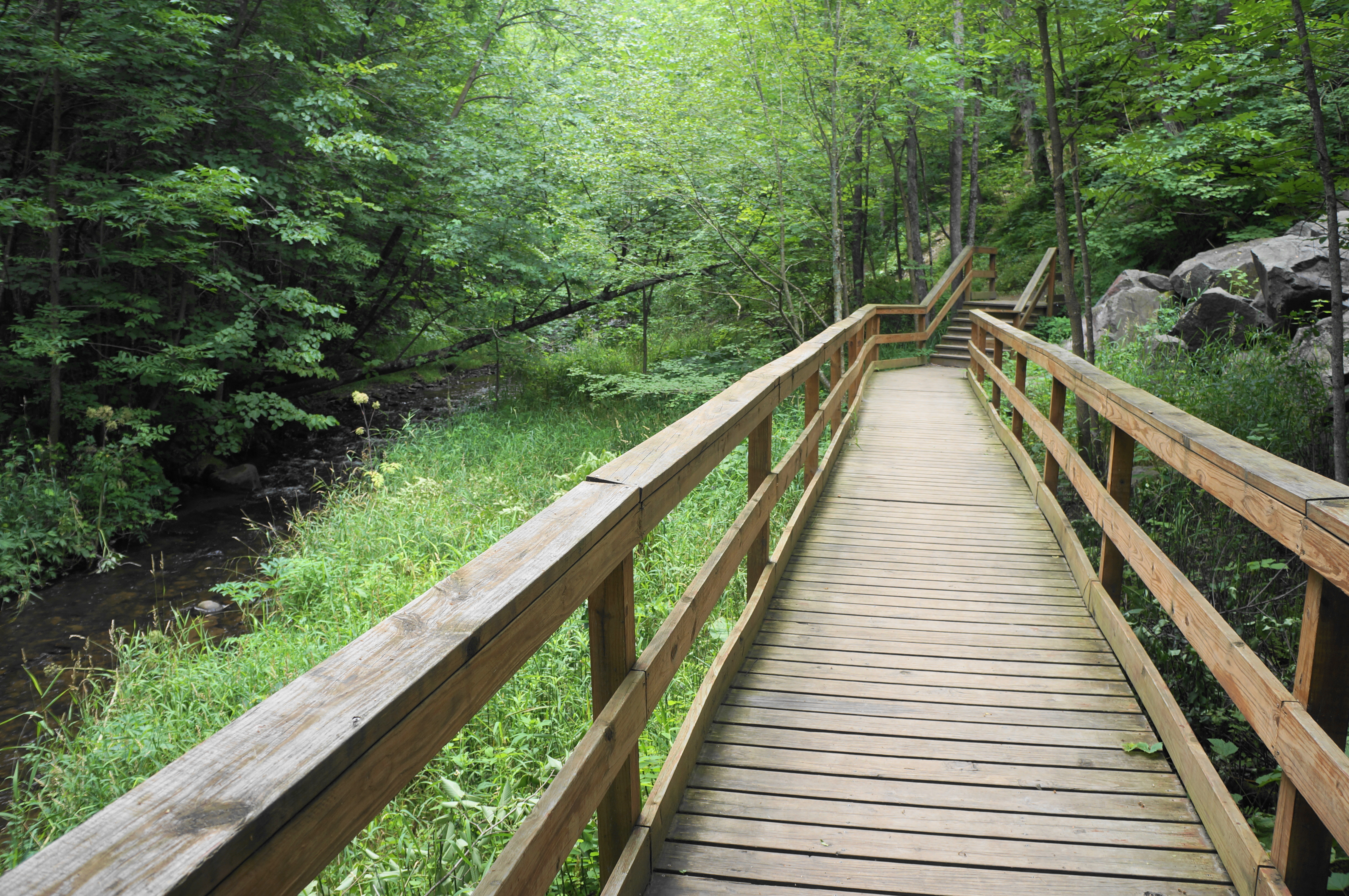
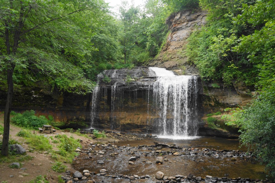
Here hikers will find another large trail map, and the Cascade Falls Trail begins, paralleling the Osceola Creek drainage upstream. Follow the pretty singletrack as it traverses two short bridges, then three more in quick succession, also skirting a rock slide on the right. The route culminates with a longer bridge and boardwalk, traversing the main creek and ending at a clearing just below the thundering falls.

Cascade Falls is an impressive sight, not least because of its considerable volume and multiple chutes. A picnic table offers a place to sit and take in the view, while brave visitors can walk up to the mist of the falls and the varnished alcove behind it. The St. Croix River area boasts a handful of waterfalls, mostly on the Wisconsin side, but there is arguably none better than this one. The roundabout route to get to the base of a waterfall that was visible from the city above is well worth the trip.


But the hike is not over yet; even though hikers have to retrace their steps, there is more to see in the area. Return to the mouth of the Osceola, bear left, and return to the Eagle Bluff Trail, climbing steeply back to the wooded upland. This time, however, after reaching the top, bear right on the Simenstad Trail, which forms a longer loop around the circumference of the bluffs.

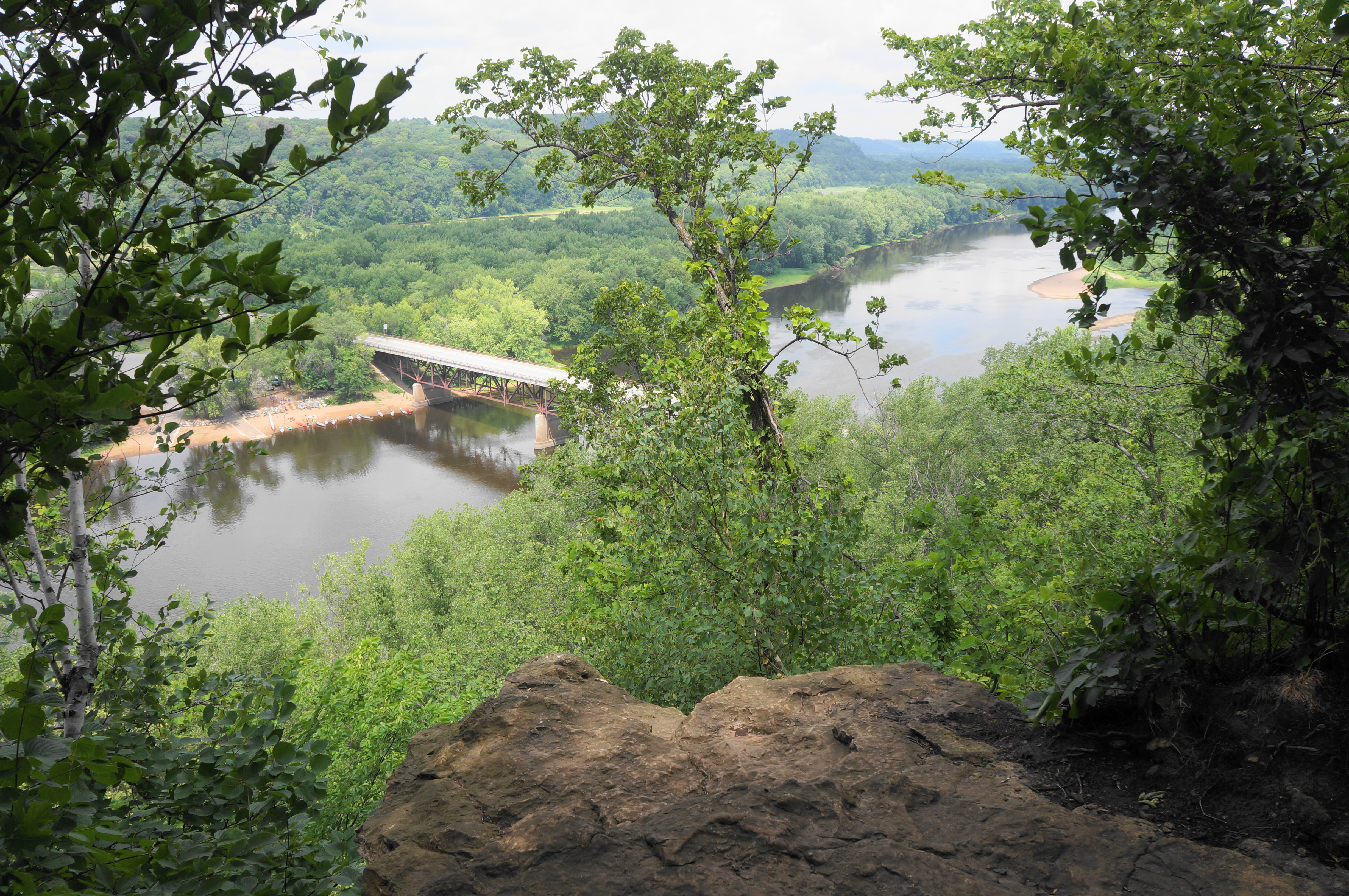
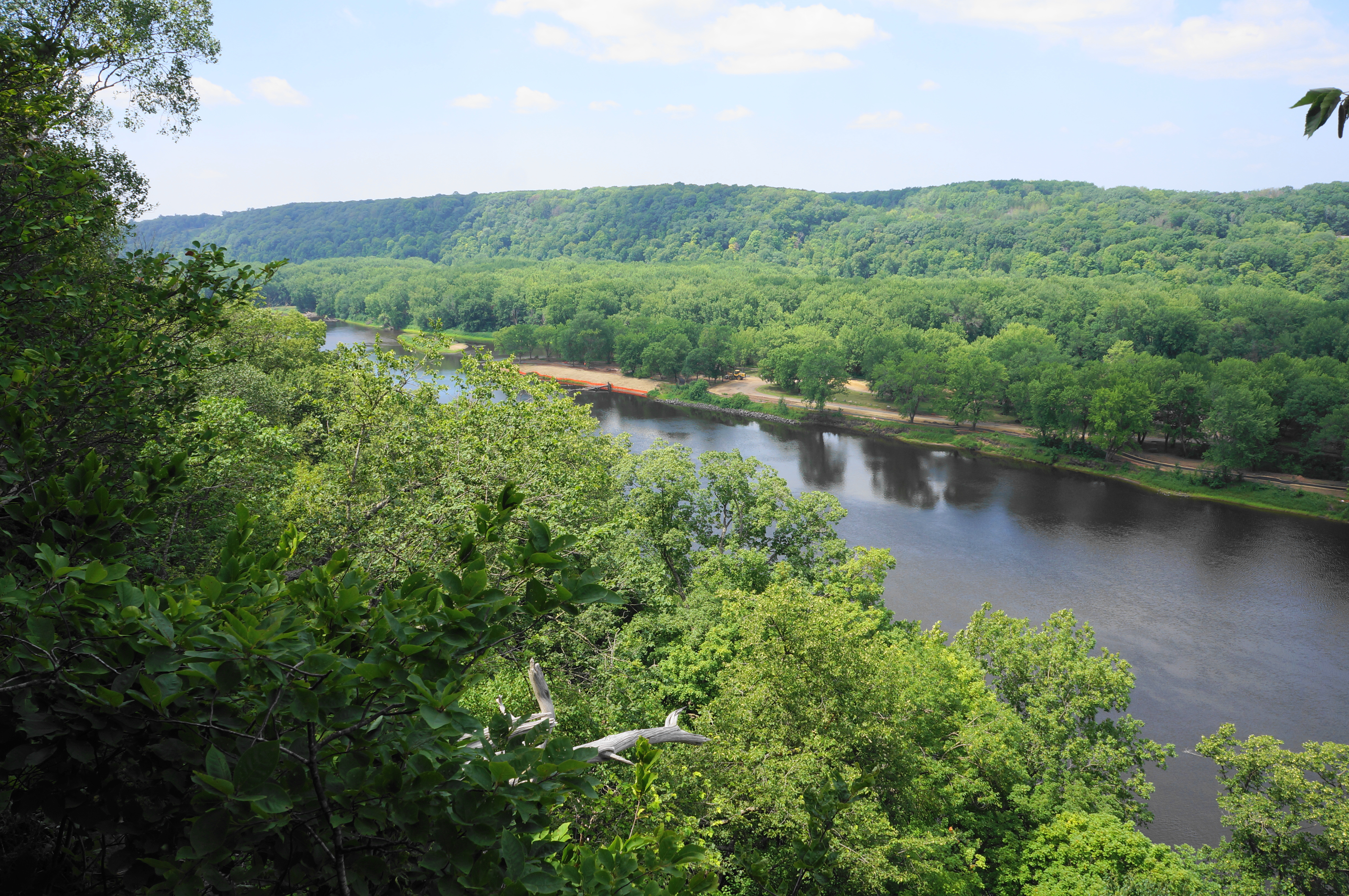
About 200 feet above the valley floor, hikers are quickly rewarded with a series of excellent viewpoints overlooking the St. Croix Riverway. Vistas extend well upstream, past the 243 Bridge and Osceola Boat Landing to the islands and woody uplands beyond. One can also see a little bit downstream, although views are more obstructed by the heavy forest thicket.

After enjoying several viewpoints in quick succession, bear left on the Simenstad Trail, ignoring the red blazes continuing straight along the cliff’s edge. The onward path moves away from the river, winding slowly southward and eastward, replacing the old views with a less-than-exciting new look down to a depot, warehouses, and the Osceola railway station.
The Simenstad Trail soon turns from a singletrack to a wide gravel road, the same encountered earlier in the hike. Head downhill on this path, with the incline picking up toward the end. After passing the start of the Eagle Bluff Trail on the left, retrace your steps from an hour previously, dropping down to the trailhead and garden area behind the BP station. From here one can cross Osceola Road and pass the Watershed Café to return to the start.
When the wooden staircase down to the falls is reopened, one can truncate this extended loop, making for a considerably shorter hike. But for now, the alternative route is still worthy of one’s time, featuring bluff views, riverside walks, and a beautiful waterfall all in less than a 2-mile span.

Pingback: Top 10 Hikes in 2022 | Live and Let Hike