
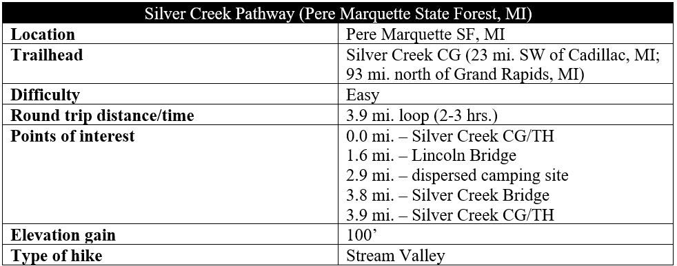
The 54-mile Pine River, a tributary of the Big Manistee River, undulates gently through the modest hillocks of northwest Michigan, making for a popular floating destination—but also a few decent hikes. The Silver Creek Pathway—a nearly four-mile loop that is a short drive from Cadillac, Michigan—is one of the better short walks, featuring high bluffs, nice flora diversity, and attractive rivulets. The pretty circuit connects two campgrounds in Pere Marquette State Forest, with much of the time spent paralleling the scenic river.

The hike
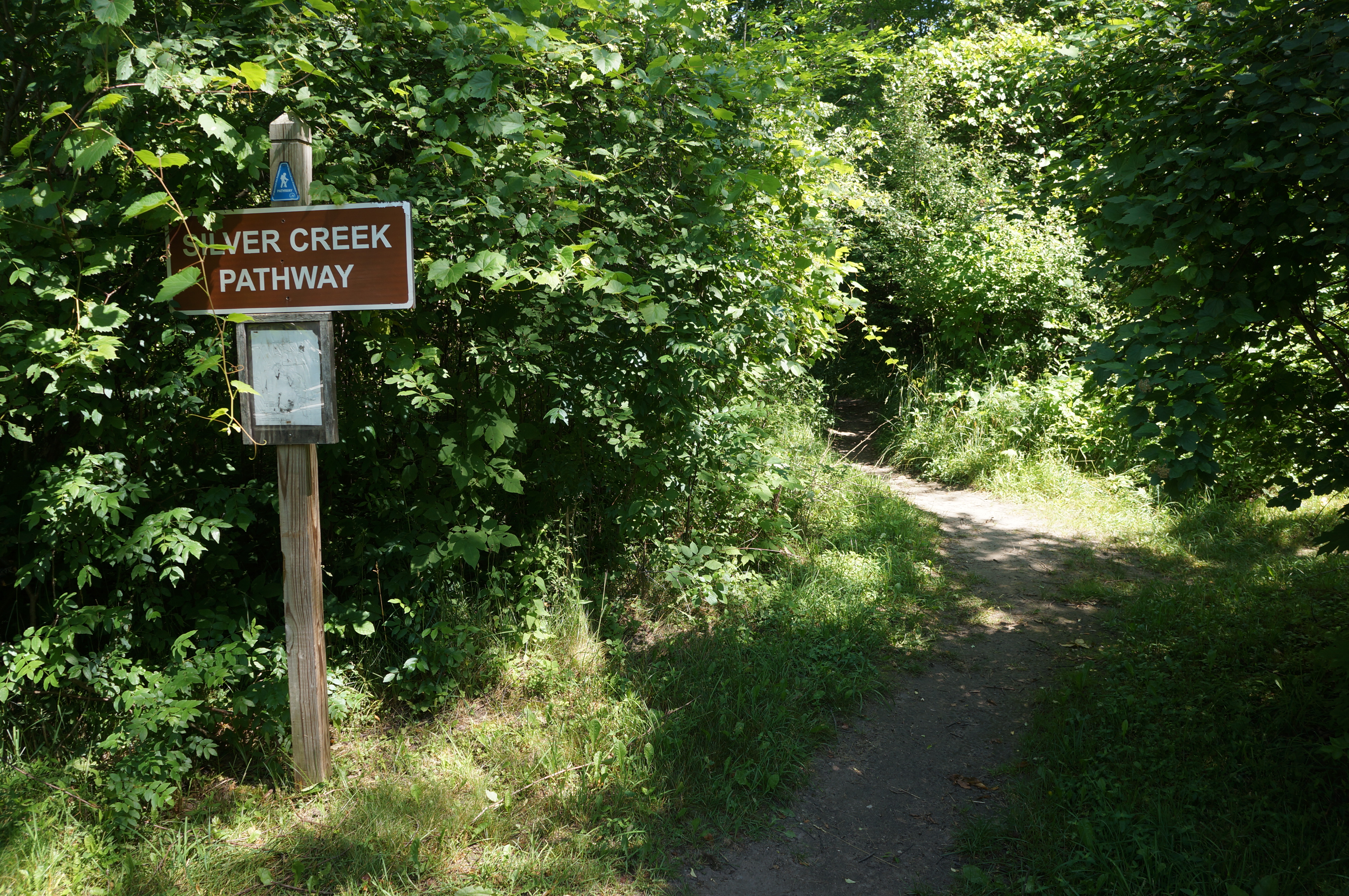
Easiest access to the Silver Creek Pathway is from the Silver Creek Campground, situated on a gravel track just off North State Road in Lake County. (Note: The nearest town in this heavily forested area is Luther, Michigan.) Make your way to the back of the campground, just as the road curves around a loop. Here there is a small parking area (near Site #10) with room for two vehicles; there is also a modest restroom, as well as a trail sign and small, tattered map.
The marked and well-trodden path bears north from the campground, almost immediately coming into view of the quickly-flowing Pine River off to the left. Given the trail traces both sides of the river and follows it north-south for nearly the entirety of the loop, it is a bit surprising that the hike is called the Silver Creek Pathway. But hikers soon cross the namesake stream—Silver Creek, a tributary of the Pine—on a short bridge, with dense thicket surrounding the drainage.

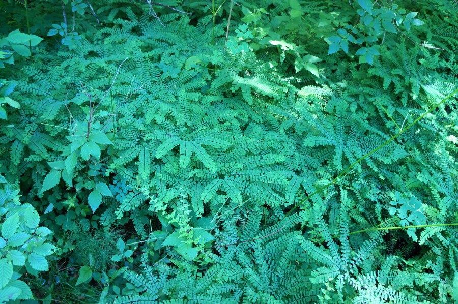
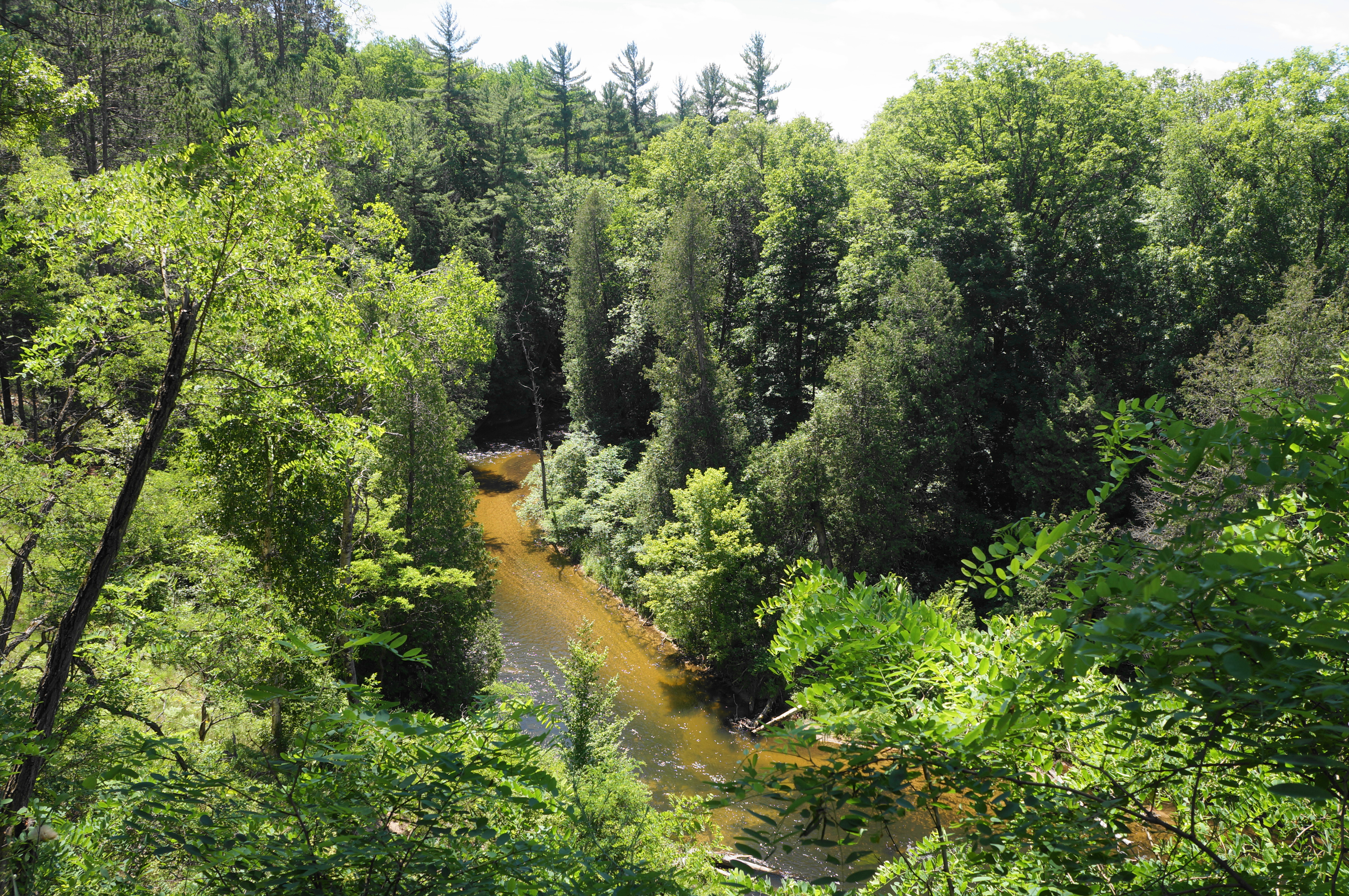
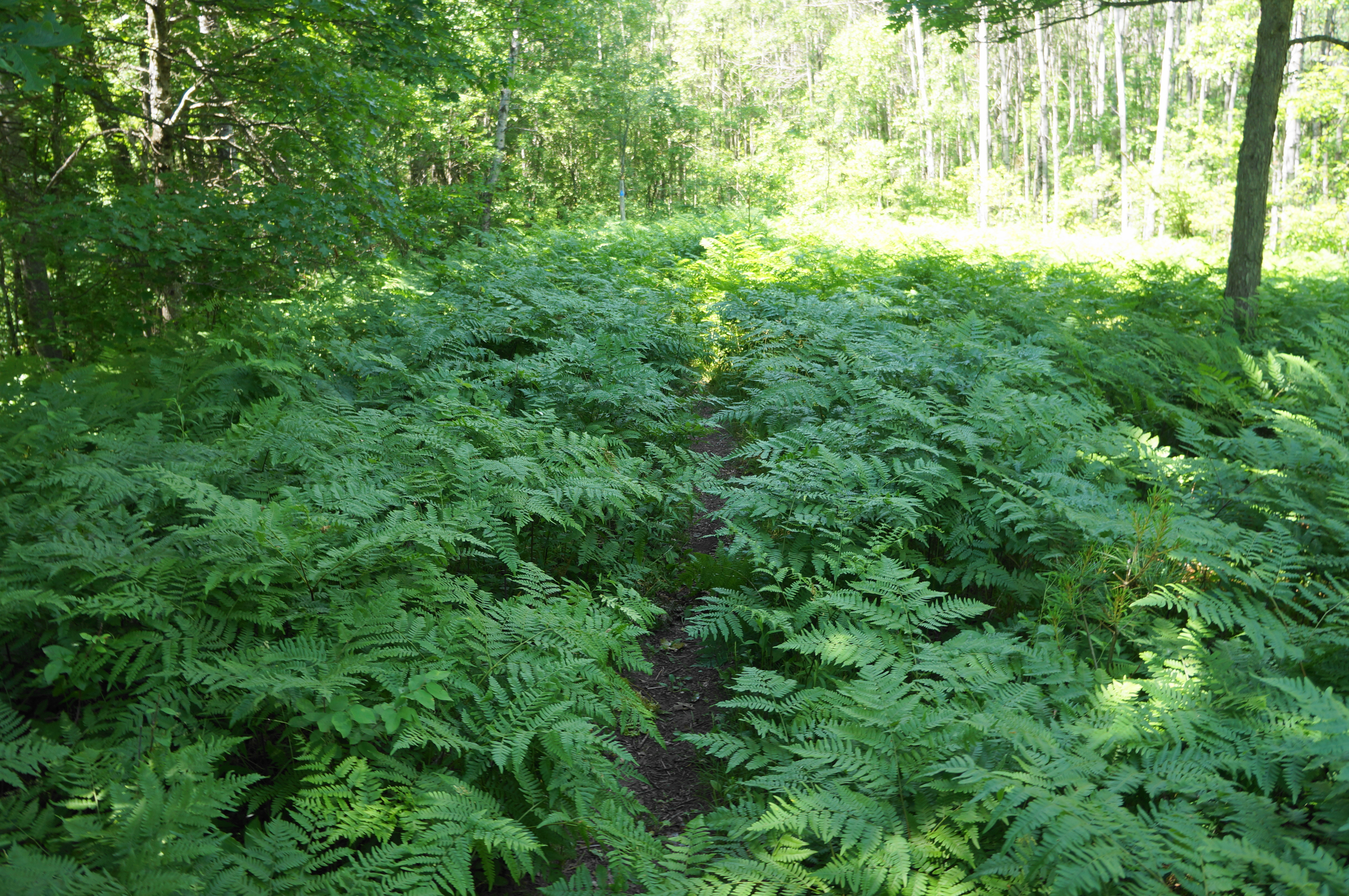
Following blue blazes, the path bobs up and down, traversing a second bridge, this time over a smaller tributary, at about 1/10 mile. Then the Silver Creek Pathway makes a steady ascent, rising amid ferns and beech trees to the top of some eroded bluffs about 50 feet above Pine River. At one point, hikers can peer down, through a break in the trees, at the wild bends of the river.

Soon the river disappears from view again, and the trail levels off at around 4/10 mile, the peaceful forest marred only by the occasional sound of passing cars on North State Road to the east. At 6/10 mile, the trail reaches a second overlook from atop a bluff above Pine River. Now well above the riverway, the onward route intersects with a wide double-track that acts as an ORV trail. Stay left, following the doubletrack north for a brief period, but pay close attention to the blue blazes, which eventually signal a continuation of the singletrack trail off to the left.


The trail then merges with the doubletrack twice, the second at a modest clearing with more, slightly obscured, views down the bluffs toward Pine River. Continue north on the ORV road for a brief period before the pathway again exits left. At 1.2 miles, the trail comes to a circle at the end of another dirt road, with a spur path leading left to another viewpoint. Thereafter, the main trail bears right and treads downhill, reaching a small meadow area on the right. Traversing the lowlands, the narrow path soon comes riverside at about 1.5 miles.
Here the route-finding gets a little difficult, with social trails crisscrossing the landscape. But generally, hikers should stay on the most well-established path—heading left, then right. Soon the trail emerges from the dense canopy and into a parking area for the Lincoln Bridge Canoe Landing. The river is accessible off to the left, but the onward route stays right, following the road around a corner and to the crossing of the 80-foot-long Lincoln Bridge. By now hikers have travelled around 1.6 miles, a little less than halfway.


Cross the bridge and come to the left bank of Pine River. On this side, the trail stays level with the river much of the time, offering regular access. But first, the onward trek requires following the muddy access road southward for a brief period before the singletrack departs again to the left, up about a 3-foot bank. Once back on the blue-blazed trail, the route levels off and traverses a floodplain stocked with beautiful, verdant ferns.
At 1.8 miles, the trail returns very briefly to the road but then cuts left again, reaching an upland well above the main waterway. Stay left again as the route intersects with a minor ORV road. Thereafter the Silver Creek Pathway settles into a steady downhill, crossing a trickling tributary at 2.25 miles. By 2.4 miles, the path is riverside again; from this point on, the path keeps the river close on the left.


Cutting along the Pine River, the singletrack trail comes to a shoreline opposite a 40-foot sandy bluff on the other bank. Staying largely streamside for the next 1/3 mile, the trail passes a lovely stand of pine trees that includes a nice dispersed camping site. This is a nice spot to stop for a snack or break before heading on.

At 3.1 miles, the Silver Creek Pathway continues over a short bridge. Within 2/10 mile, the path then splits, with a spur heading left. The main track takes a hard right, following a hairpin bend in the river. After about a tenth of a mile, the level, easygoing jaunt is suddenly interrupted by a steep but brief uphill slope. Soon the trail settles again into a flat tread, reaching an open field and track coming in from the right.

Stay straight here, continuing to keep the river on the left and coming to a bridge over another tributary at 3.7 miles. Hikers are now in the home stretch, passing a wily juniper on the left and crossing another short bridge.
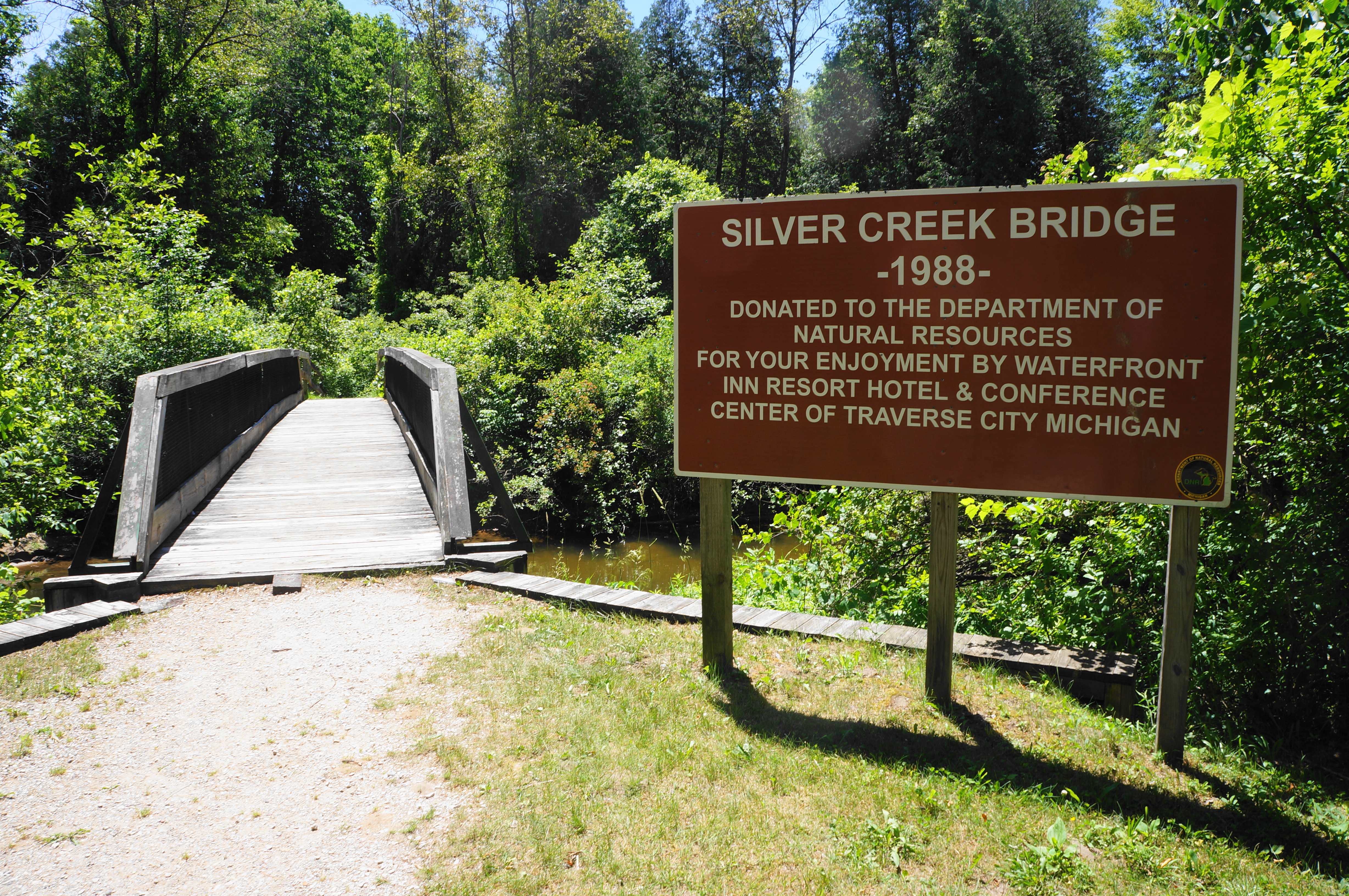
The hike terminates another 1/10 mile later, as hikers reach the Silver Creek Bridge, constructed in 1988. Now hikers are back in the campground, although not quite where they started, but it’s a short walk (left) to return to the trailhead. This concludes the 3.9-mile loop hike—not a stunner, but a varied and enjoyable walk in one of the most scenic watersheds of Michigan’s lower peninsula.
