

At 3,849 feet, Mount Diablo is one of the highest and most prominent peaks in the San Francisco Bay Area and perhaps the most well-known mountain in the East Bay. Taking its name from a linguistic accident in the early 19th century, this “Devil’s Mountain” makes for a very long and imposing climb for modern peak-baggers. Sure, most visitors reach the top with little effort, simply by following the winding Summit Road to its end. But that’s no fun…instead, ambitious hikers starting at Mitchell Canyon Staging Area in Mount Diablo State Park can reach the summit by way of an arduous but extremely scenic 13.2-mile loop. Along the way, ascend Eagle Peak (2,369’) and Bald Knob (2,645’) before looping around to the summit, where hikers can reward themselves with an ice cream sandwich at the summit store. On the way back down, traverse high ridgelines and descend the length of Mitchell Canyon to return to the trailhead. This is a very difficult hike with more than 3,200 feet in elevation gain; fit and experienced hikers only, and do not attempt in the summer heat!

The hike
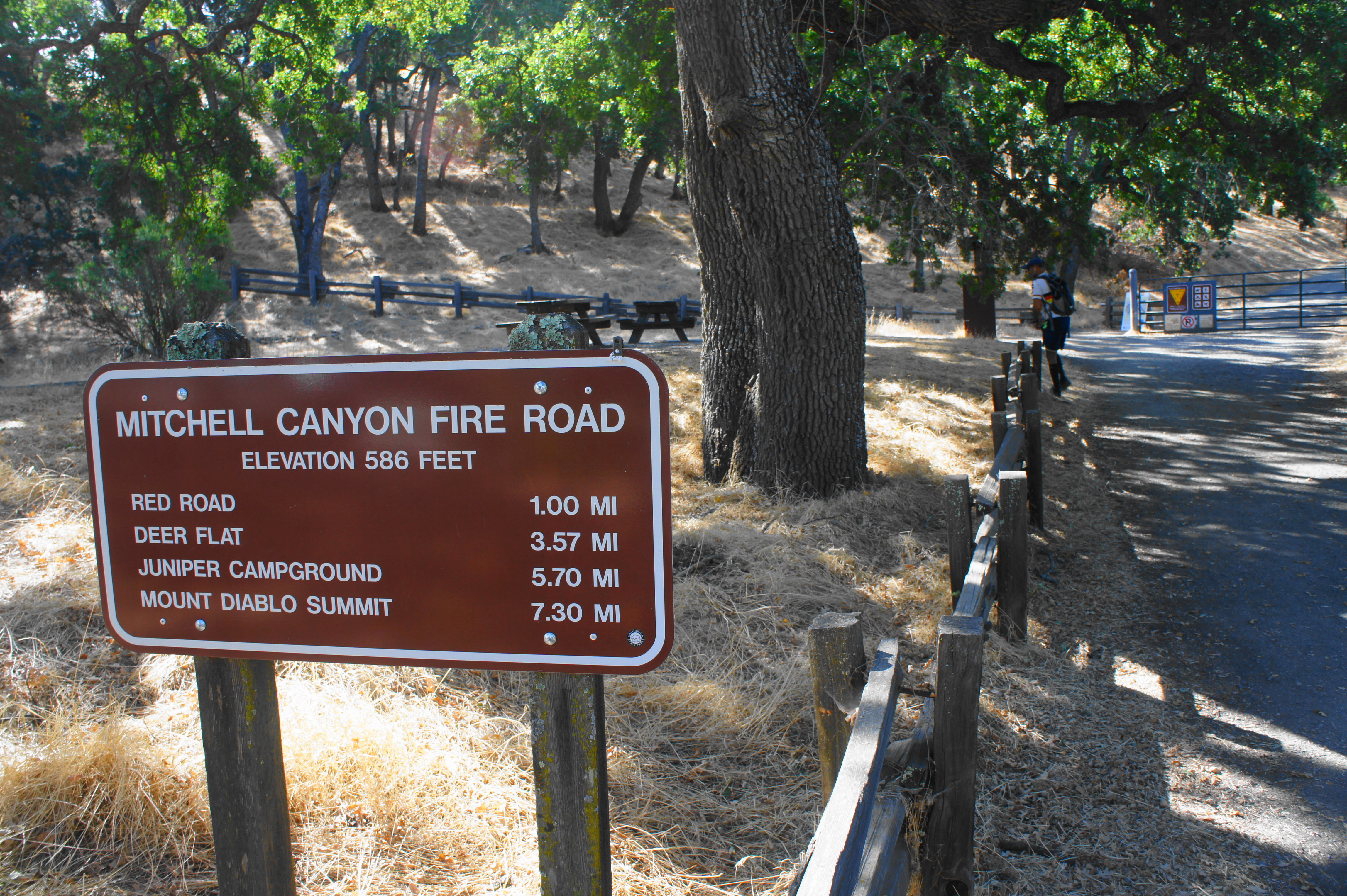
Mount Diablo State Park has an incredibly dense network of interconnecting trails, so there are of course multiple avenues for reaching the summit. However, perhaps the most commonly chosen option for climbing base-to-peak is to start at the Mitchell Canyon Staging Area in Clayton, California, a short drive from the nearby suburbs of Concord, Martinez, and Walnut Creek. Gates at the Mitchell Canyon area open at 8 am, and there is a $6 parking fee. The Mitchell Canyon Visitor Center is open weekends only (8-4 summer; 10-3 winter).
Mitchell Canyon Staging Area to Eagle Peak (2.8 miles)
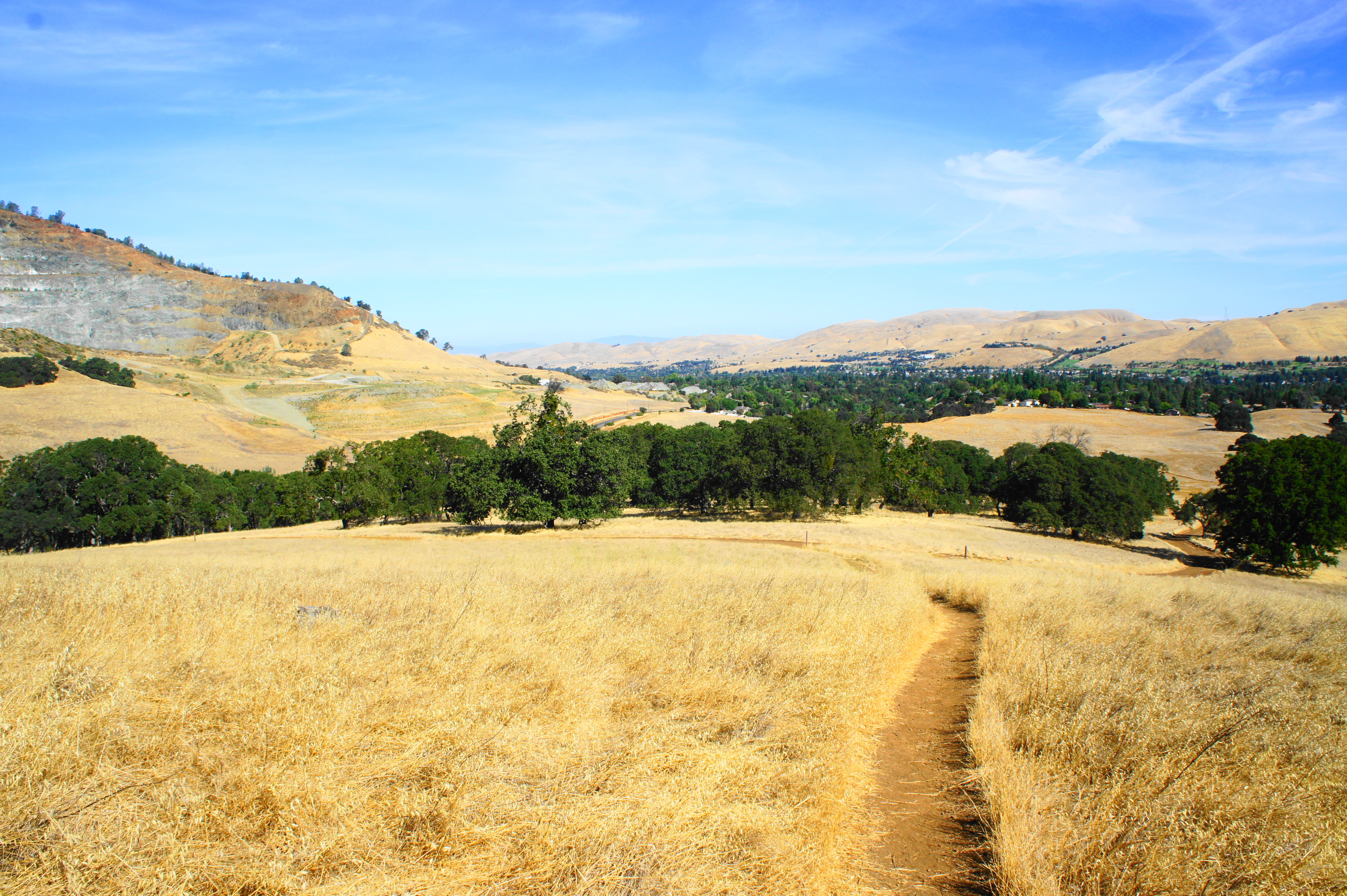
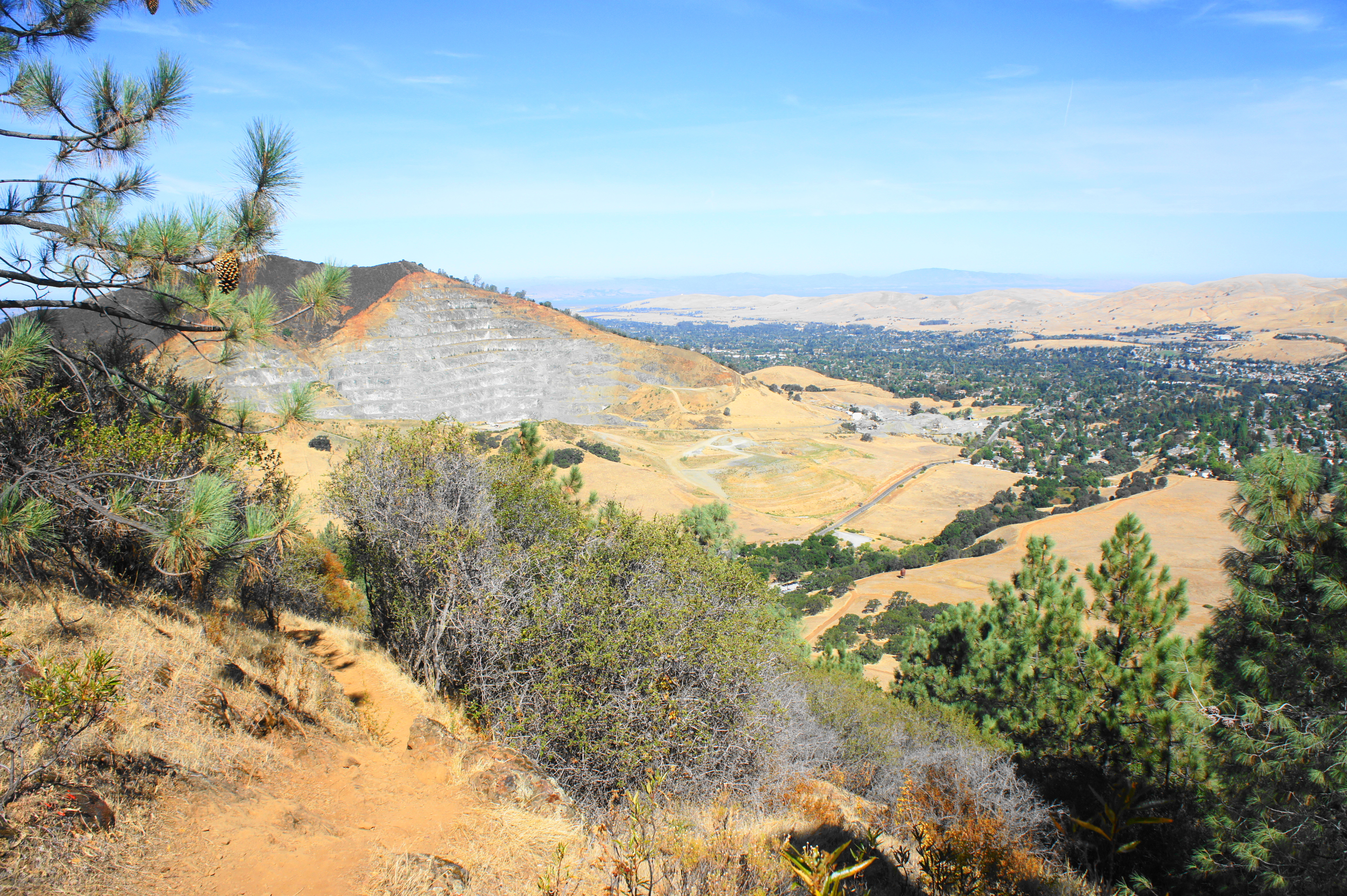
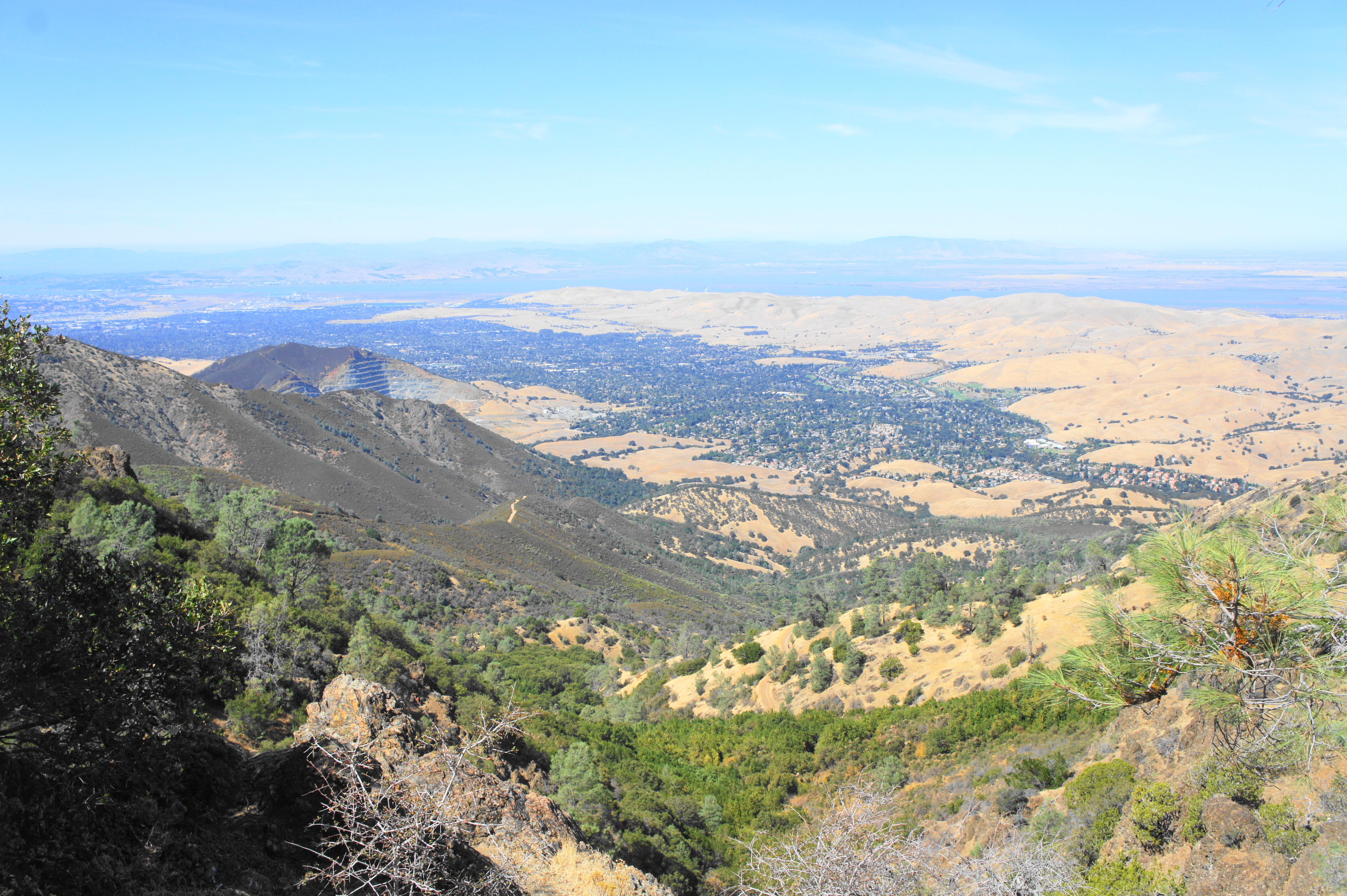
After stopping by the Visitor Center for maps and information, lace up your boots and get ready to embark on the start of a long and arduous journey to the summit and back. Begin by following the Mitchell Canyon Fire Road, passing picnic tables on the left, and head through the metal gate. After just 100 yards, bear left on a dirt track called Oak Road, which leaves Mitchell Canyon behind and climbs out onto a grassy hillside with views north toward the town of Clayton and the stairstep Clayton Quarry, carved into the slopes of Mount Zion (1,635’), situated just outside the park.
Stay straight on Oak Road as it passes a junction with Watertower Road at ¼ mile, then turn right around 80 yards later at the start of the Mitchell Rock Trail. Follow this single-track as it ascends through an open meadow, then follows a seasonal streambed through a brushy ravine. At about 0.45 miles, the trail abruptly rounds a right-hand bend, then edges to the west side of the slope to mount Mitchell Rock, the trail’s namesake and a fine viewpoint of Mitchell Canyon and Mount Zion.
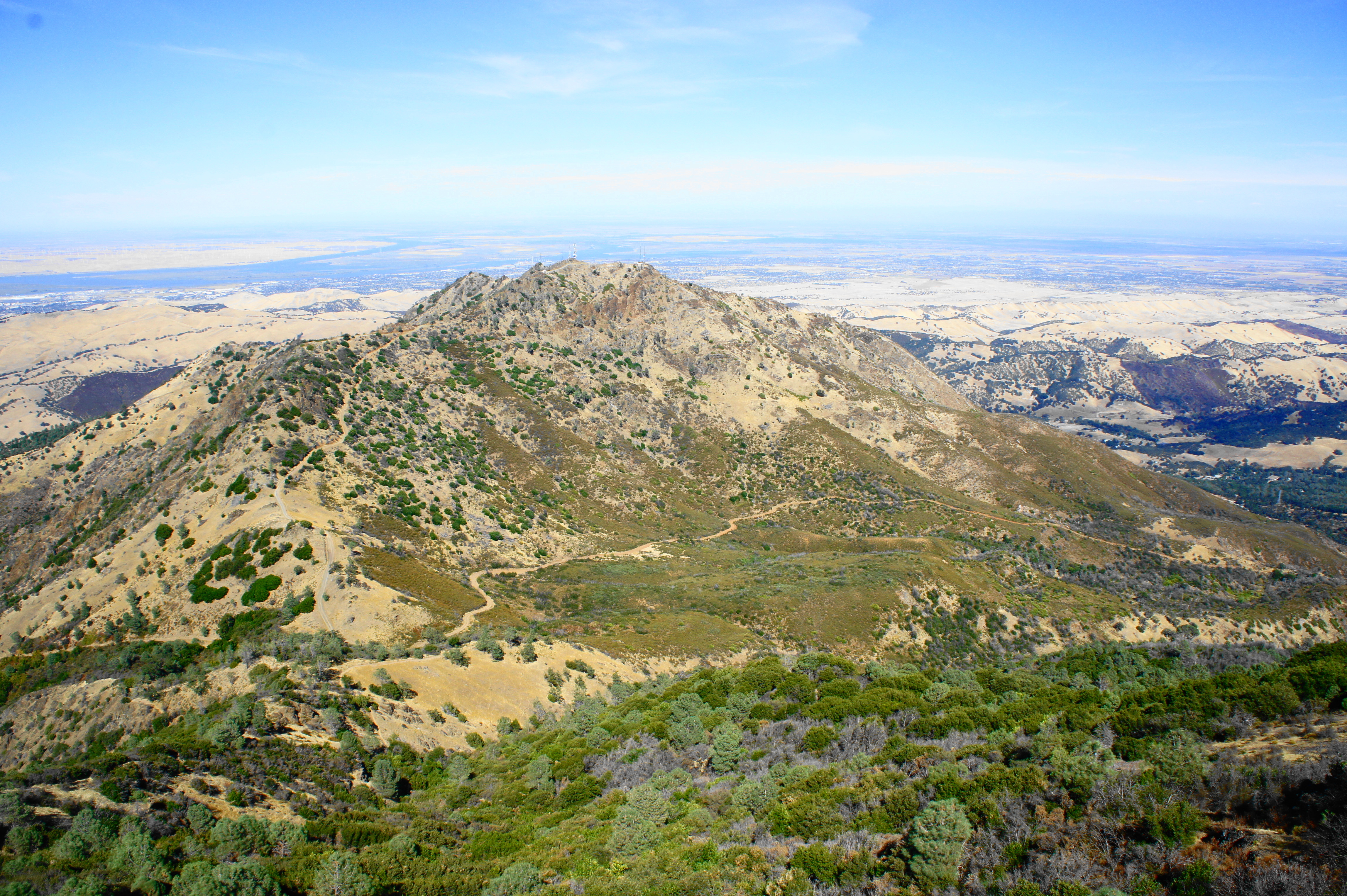
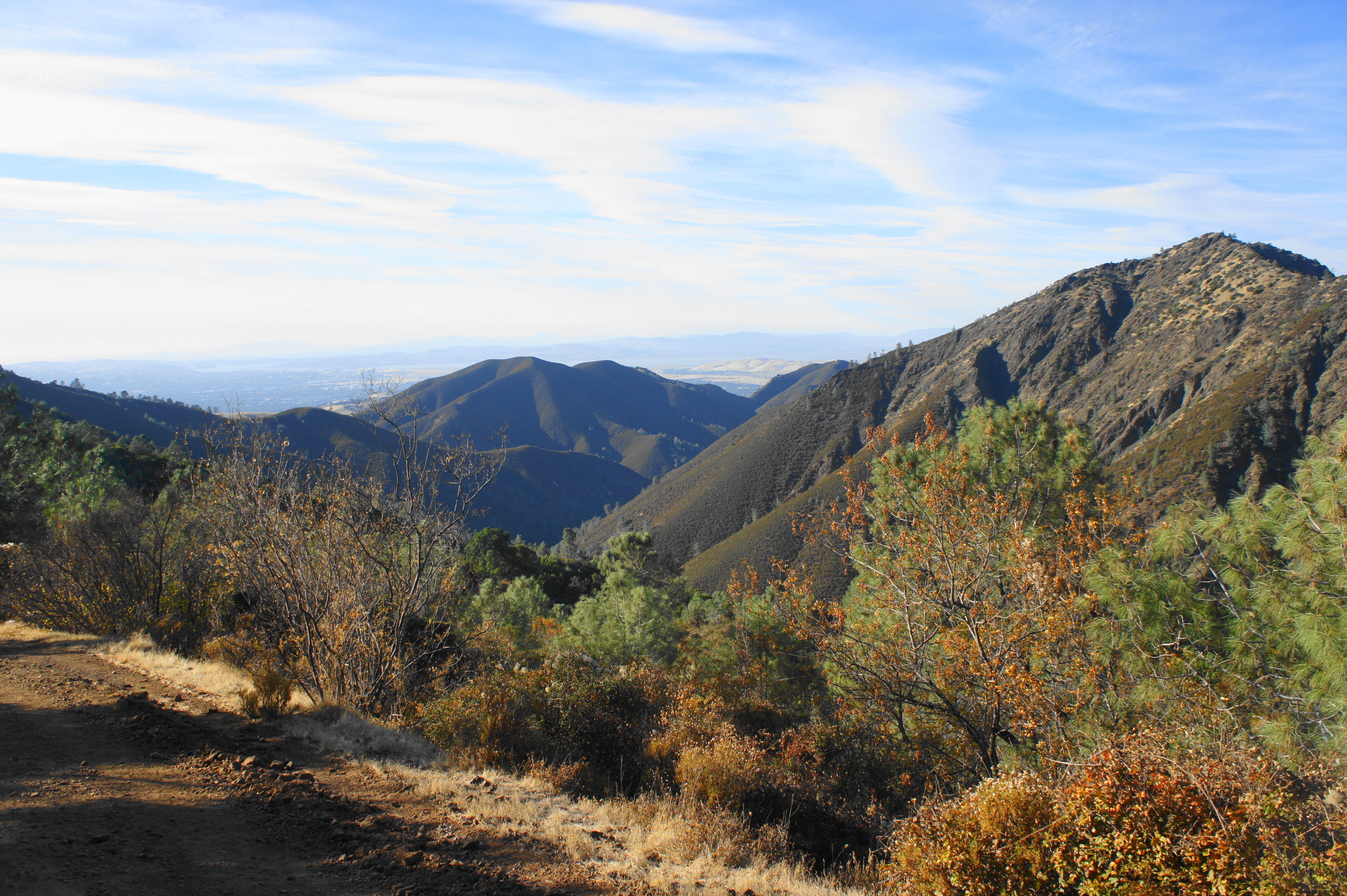
Beyond Mitchell Rock, the relatively level path skirts another pine-studded ravine, then cuts sharply left around a switchback at around the 1-mile mark. From here the trail ascends more steeply, briefly passing under a canopy of oaks. Open views to the north return at about 1.25 miles, followed by a wide bend to clear another gully. At about 1.5 miles, the Mitchell Rock Trail begins to climb sharply up to mount a ridgeline with the first views of Mount Diablo (3,849’) and North Peak (3,557’) to the southeast.
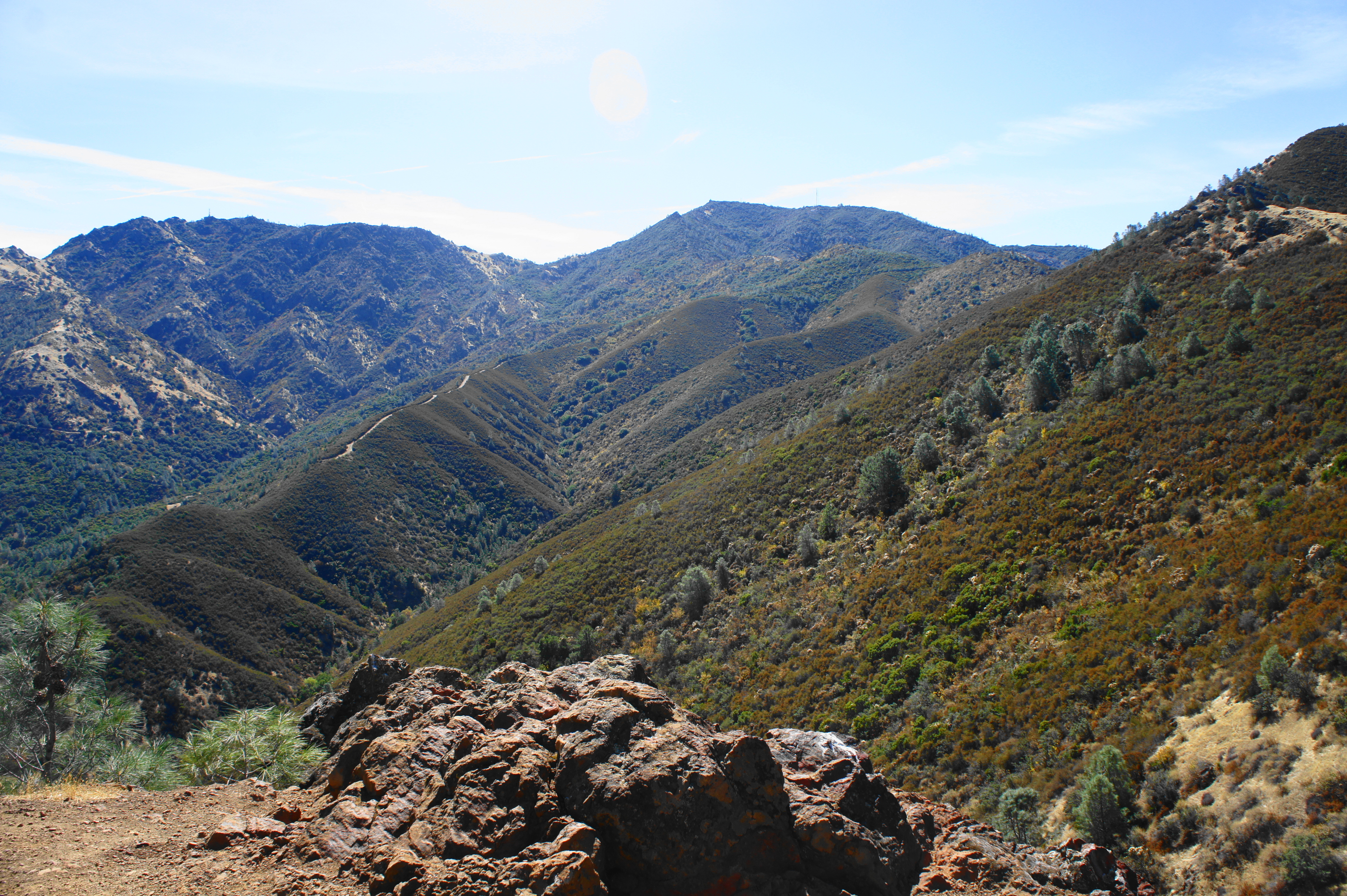
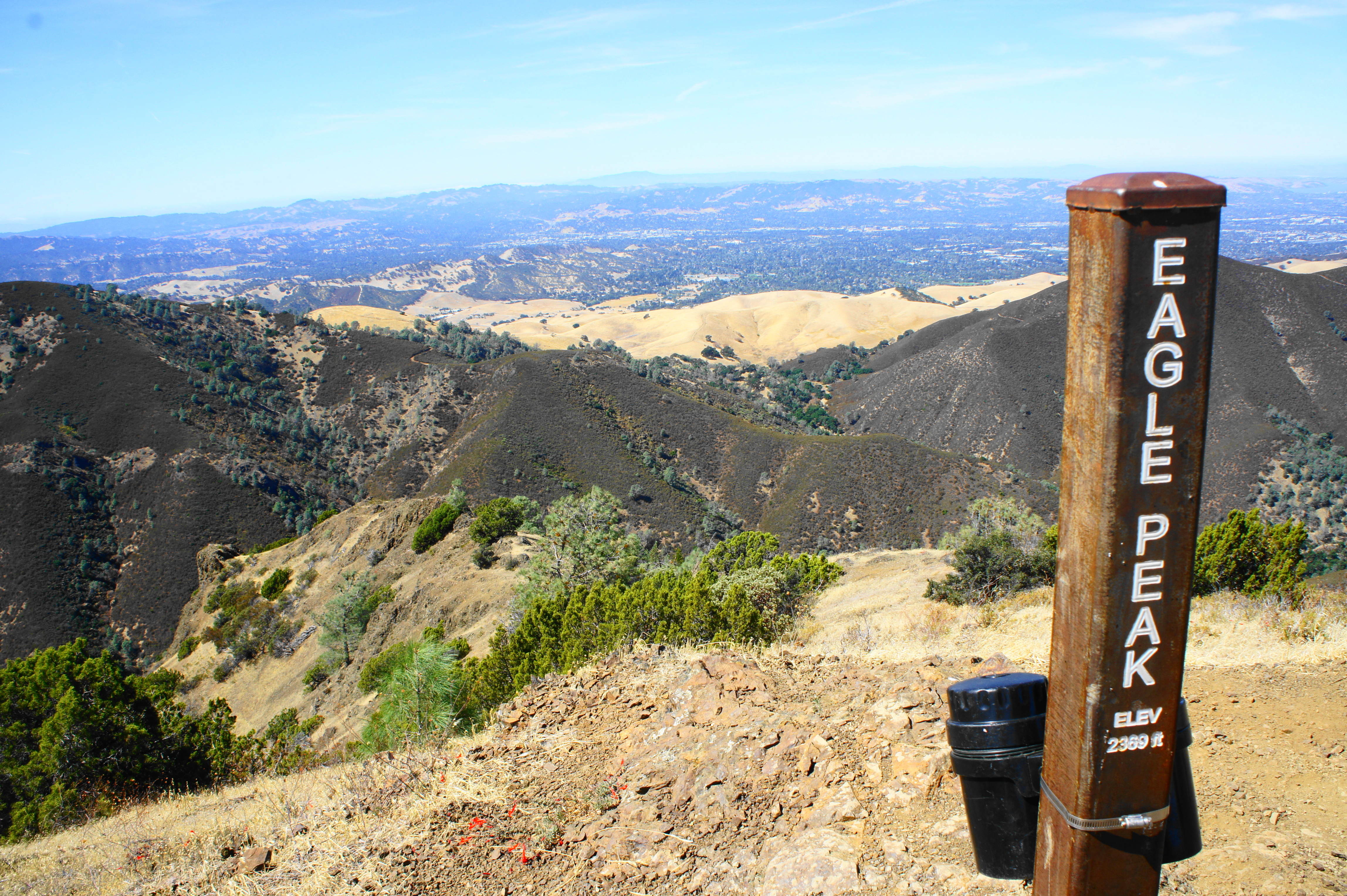
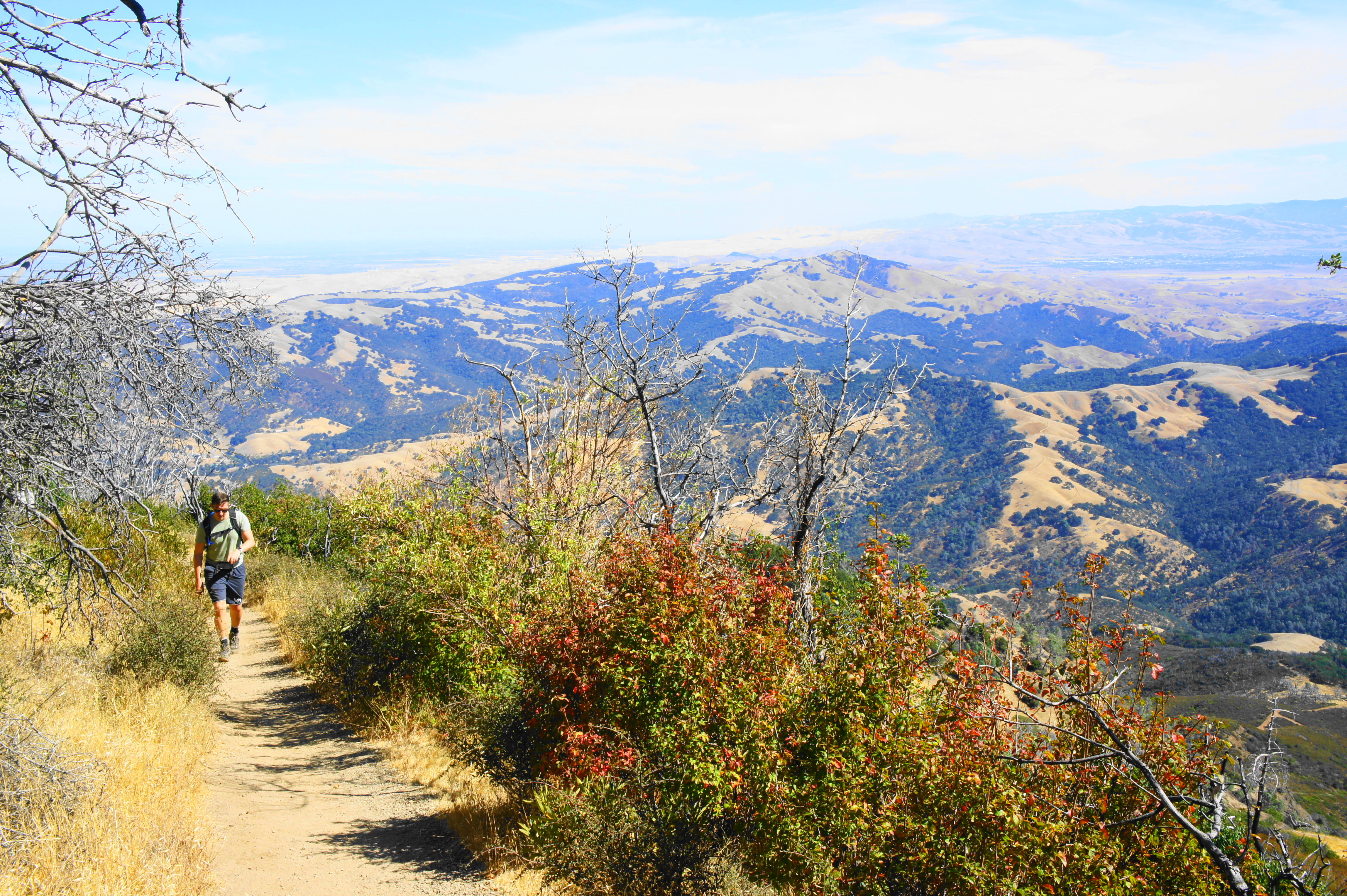
Bearing right, up the ridgeline, the trail passes a pair of stony outcrops called Twin Peaks (1,733’), each of which have fine views of the surrounding Diablo Range. Just beyond, the Mitchell Rock Trail merges with the Eagle Peak Trail; follow the trail to the right, continuing up the ridgeline. The next mile is extremely scenic, with views in all directions: west across Uncle Sam Canyon and Mitchell Canyon to Concord Valley and beyond; north to Clayton and the Carquinez Strait; east over Meridian Ridge and Donner Canyon; and south to the hulking mass of Mount Diablo. The trail is also increasingly rocky, requiring careful footing as hikers climb to the summit of Eagle Peak (2,369’).
Eagle Peak, at 2.8 miles, is a terrific place to stop for lunch or a break, taking in the panoramic views, some of the best of the hike. Although not as high, Eagle Peak is in some ways preferable to Mount Diablo: its summit is more remote and wild, free of roads and stores and parking lots.


Eagle Peak to Prospectors Gap (2.1 miles)
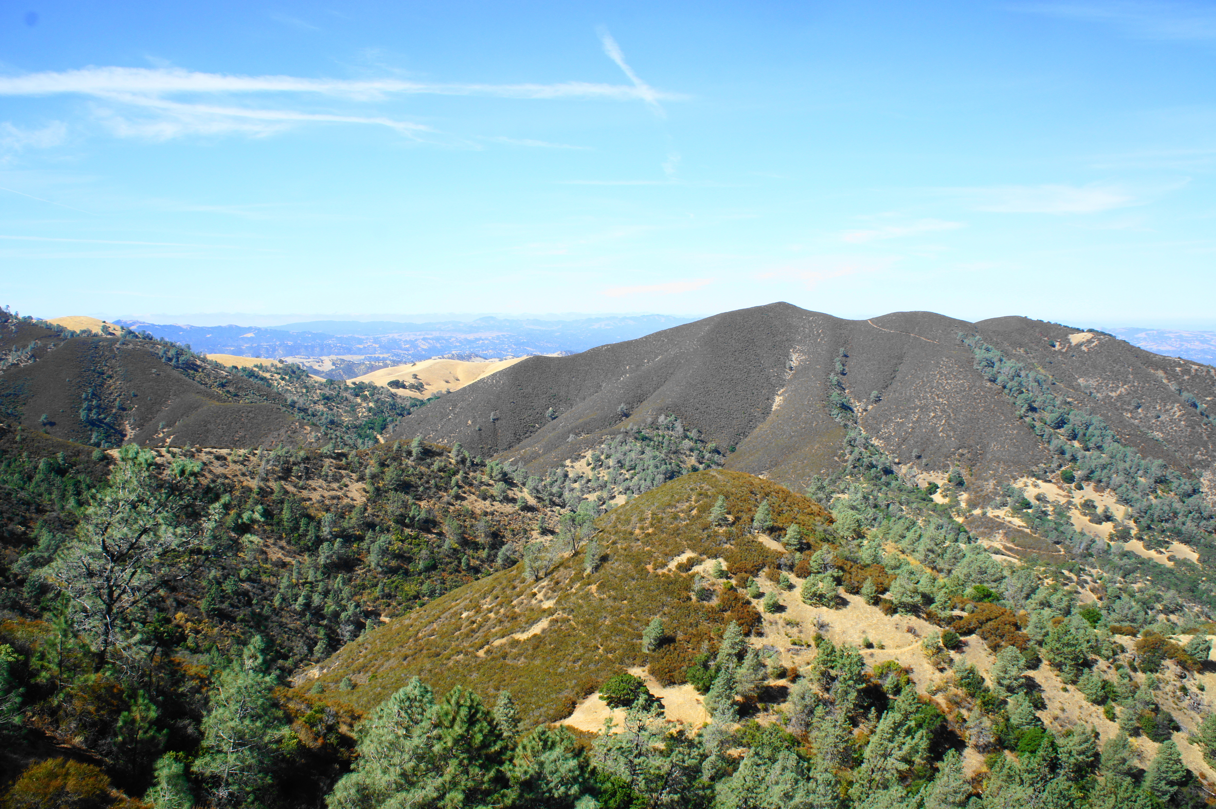
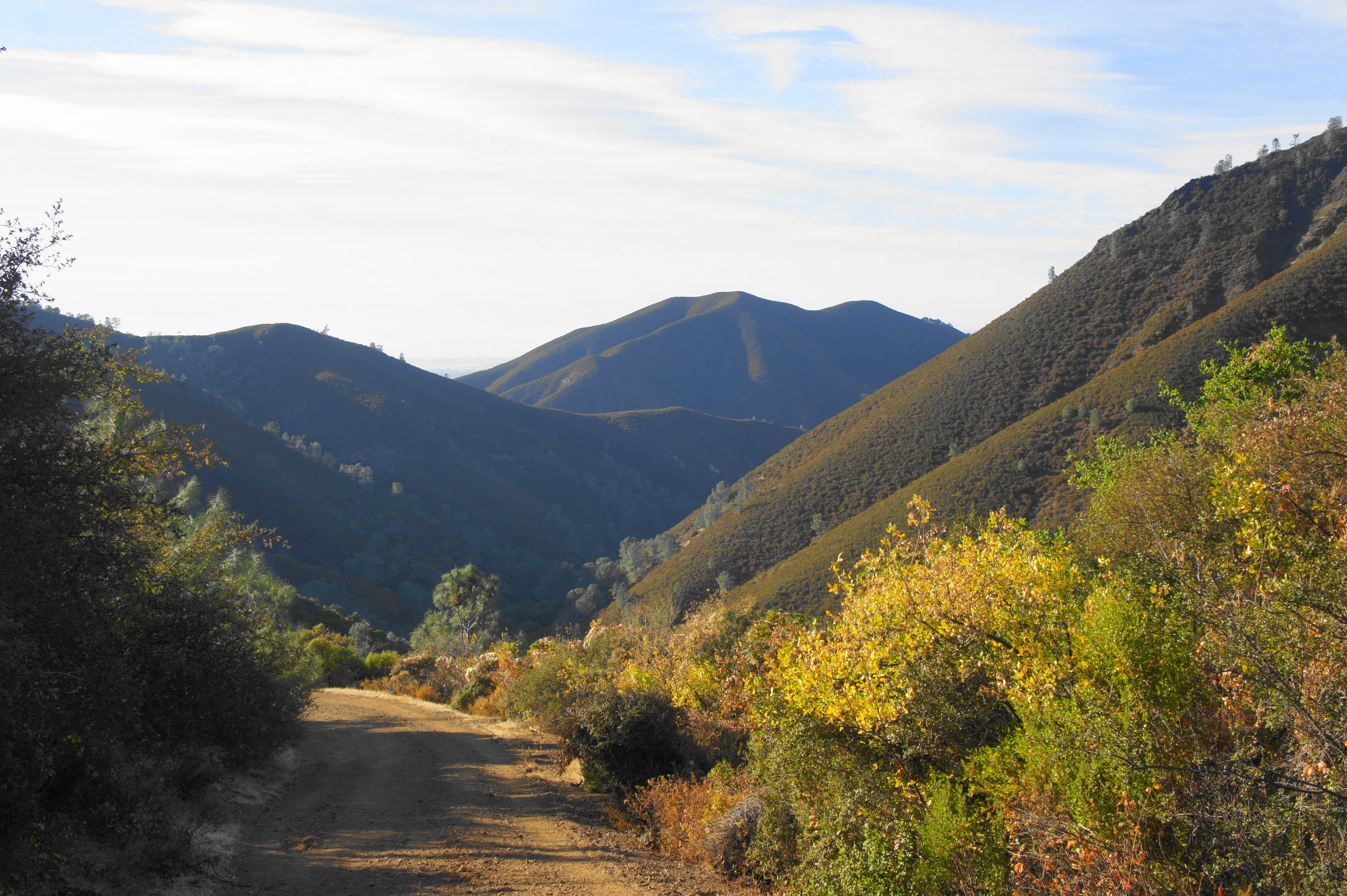
Beyond Eagle Peak, the trail begins a rocky descent to a low saddle. While the downhill is welcome after ascending more than 1,700 from Mitchell Canyon Staging Area, shedding 300 feet in elevation to reach the saddle means hikers will have to make it up again as they continue onward to Mount Diablo. After reaching the gap, the trail resumes its ascent amid thick sagebrush. At 3.6 miles, hikers cross Meridian Ridge Road at Murchio Gap (3,330’), where the Back Creek Trail comes in from the left. Continue straight on the Bald Ridge Trail, following the sign for Prospectors Gap Road.
The Bald Ridge Trail begins by ascending through a lovely grove of manzanitas, lush and green year-round. Soon enough, however, the thicket gives way to grasslands and rocky outcrops, and hikers clear Bald Knob (2,645’) at about 3.8 miles. As the trail bobs up and down, the landscape changes again, this time to a scorched area charred by a recent brush fire.
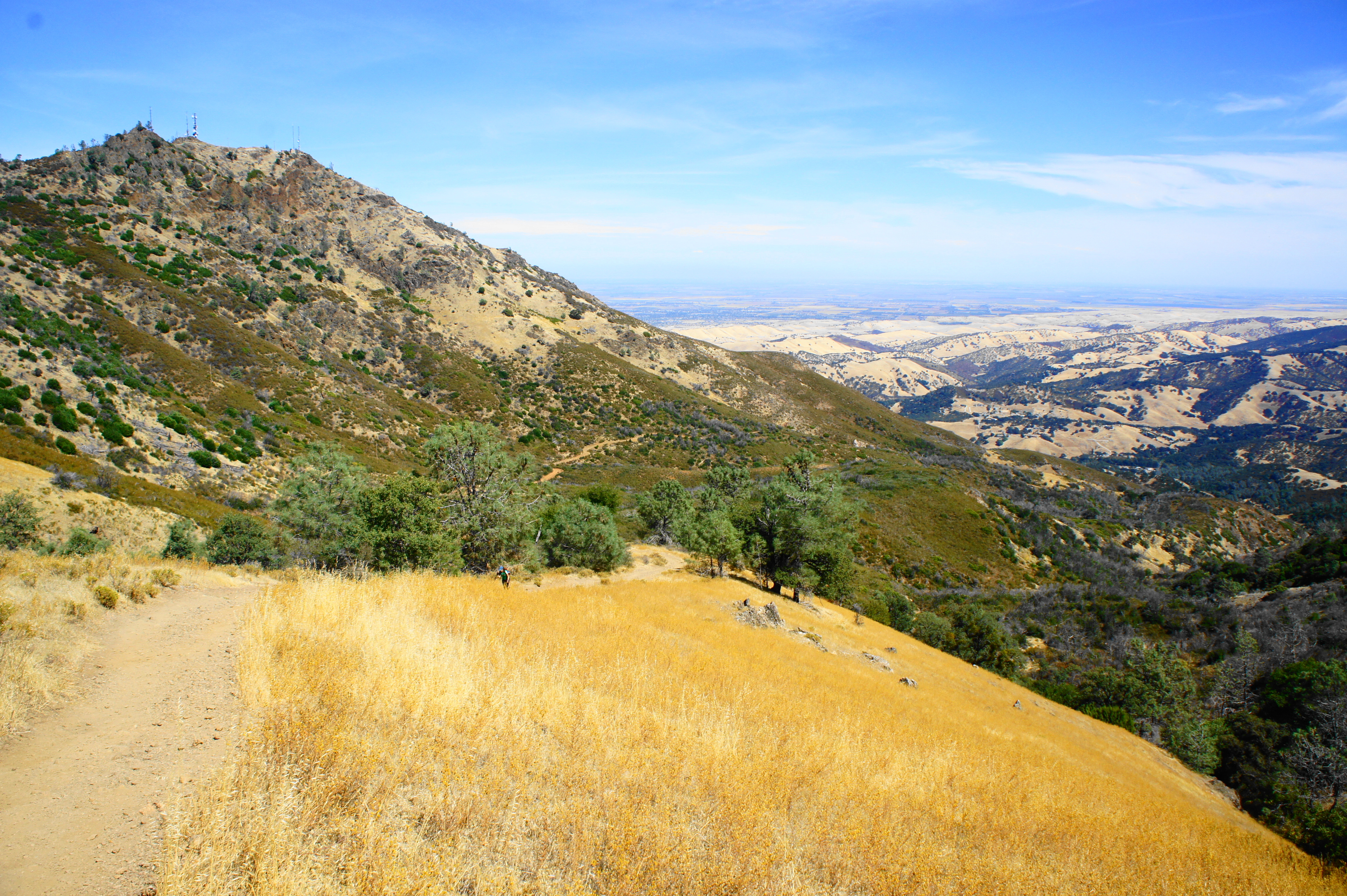
Beyond this point, the trail ascends in fits and starts through thick woods dotted with bay trees; the shade is welcome on a balmy summer day. At around 4.8 miles, the foliage clears, and the trail leads to an excellent view down Donner Canyon to the north. To the south, hikers get their first good glimpse at the observation tower at the summit of Mount Diablo, still nearly 900 feet in elevation above. Shortly after the viewpoint, the trail descends to Prospectors Gap (2,955’), another milestone on the journey.
Prospectors Gap to Mount Diablo Summit (1.5 miles)
The Bald Ridge Trail terminates at Prospectors Gap Road, situated between Mount Diablo and North Peak. Bear right on the dirt track, then a quick right again at the start of the North Peak Trail, which connects the gap with the Mount Diablo summit. Rather than ascending Diablo’s precipitous northern slopes, the trail slowly circles around the mountain to the south. Following a steep initial ascent, the grade lessens as views open up to the south and east: the Diablo Range and Black Hills continue for miles into the distance.
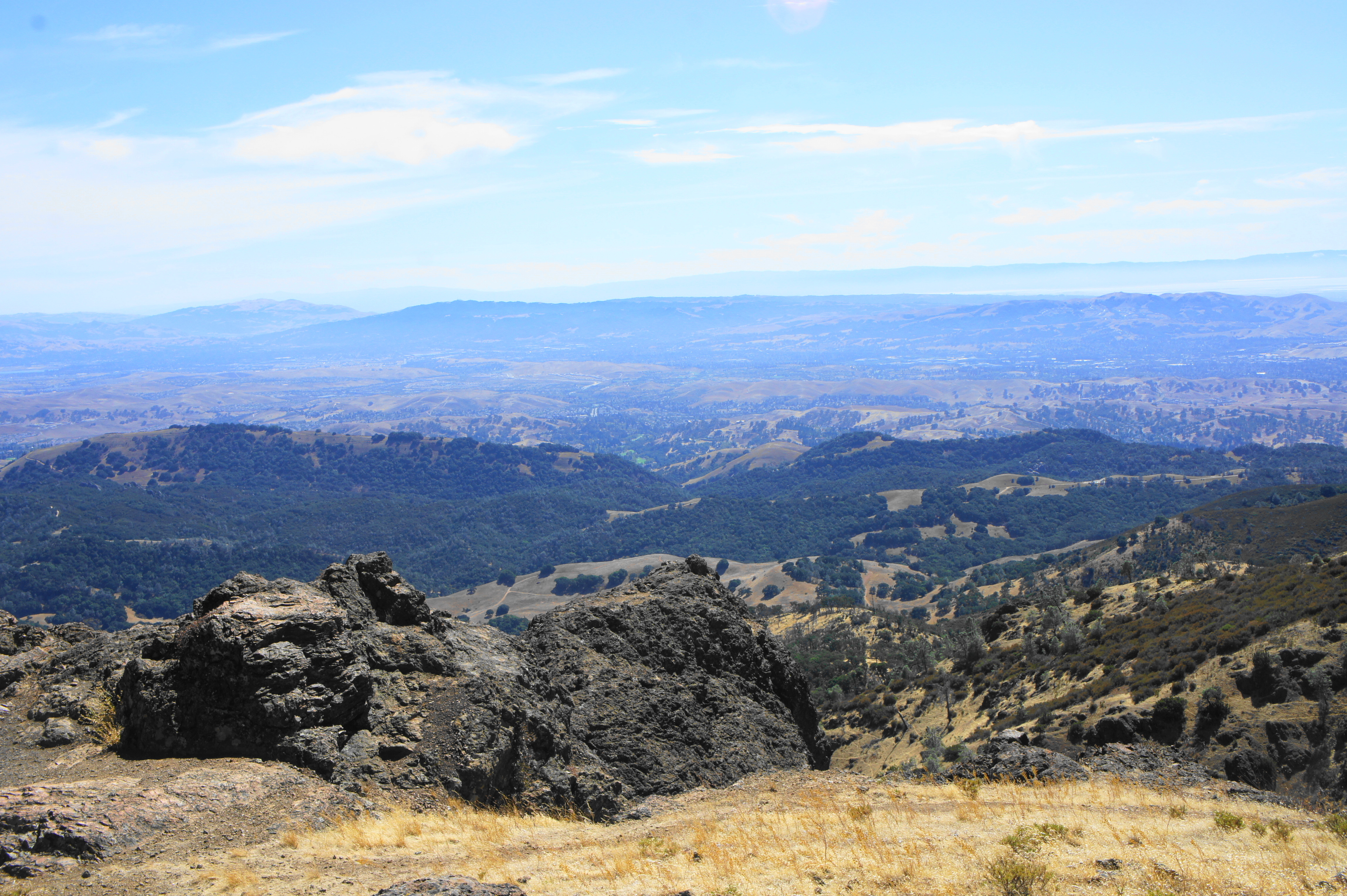
After rounding a corner to the south slope of Mount Diablo, below a rocky spire called Devil’s Pulpit (3,700’), hikers get their first views of San Francisco Bay and the Santa Cruz Mountains beyond. Continuing westward, the North Peak Trail ends with a sharp ascent for around 100 yards, terminating at Summit Road, the first paved road encountered since the trailhead. The sharp bend in Summit Road here is called Devil’s Elbow (3,480’).
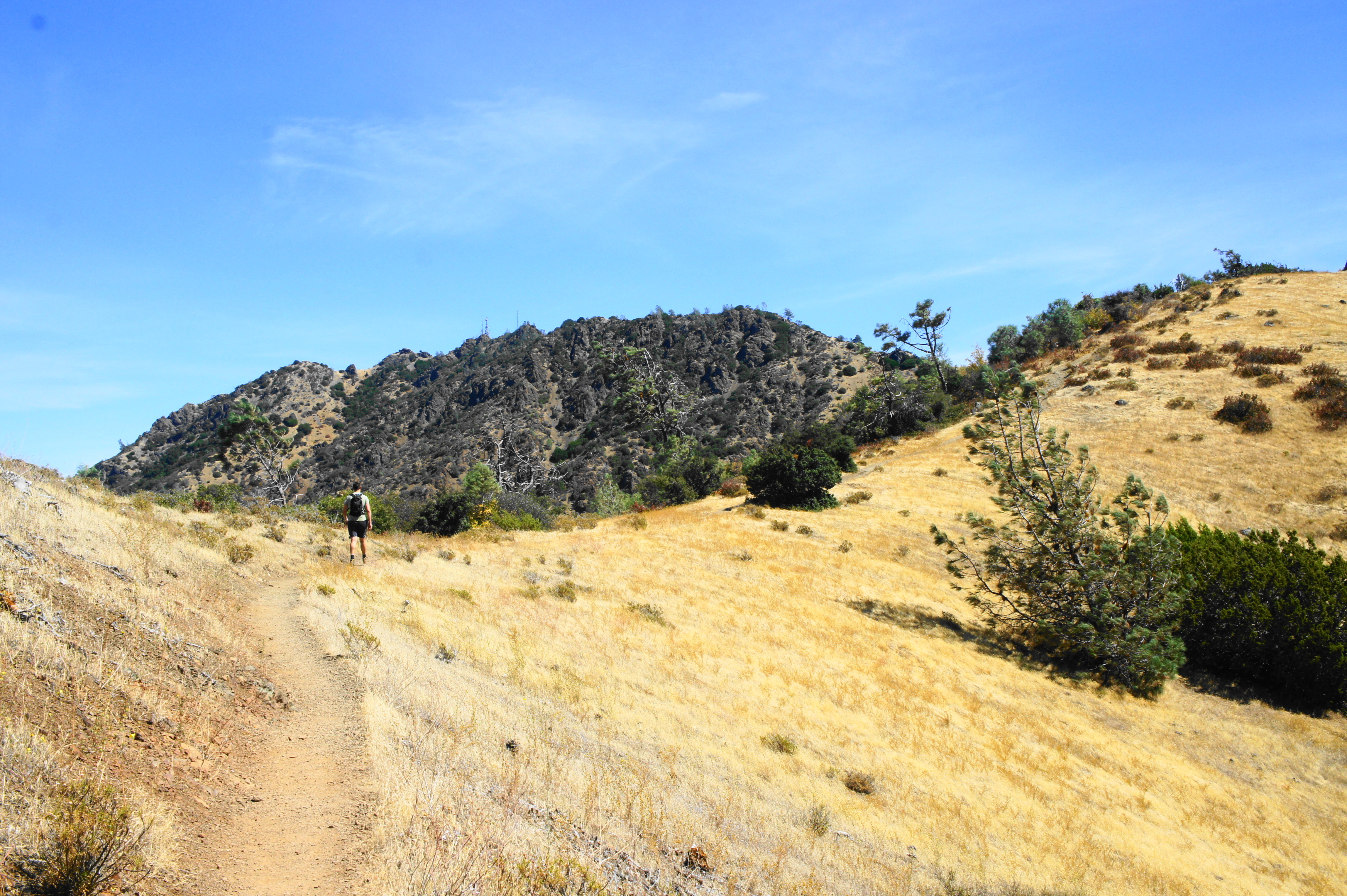
From here, bear right on the Summit Trail, which provides the final approach to the top of Mount Diablo. The trail climbs steeply at first before settling into a more modest grade as it parallels the road below on the left. The Mount Diablo antenna tower is visible ahead.
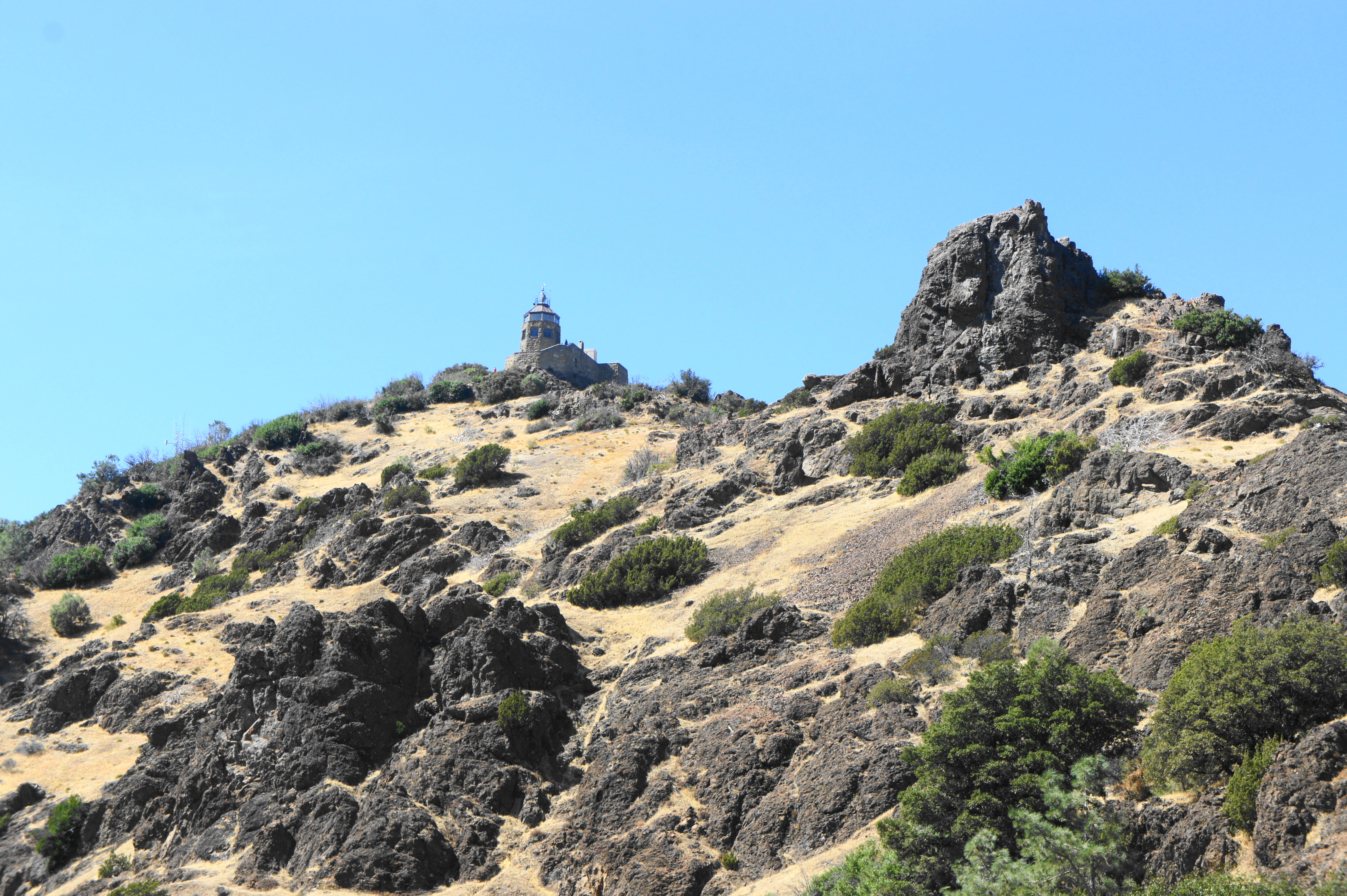
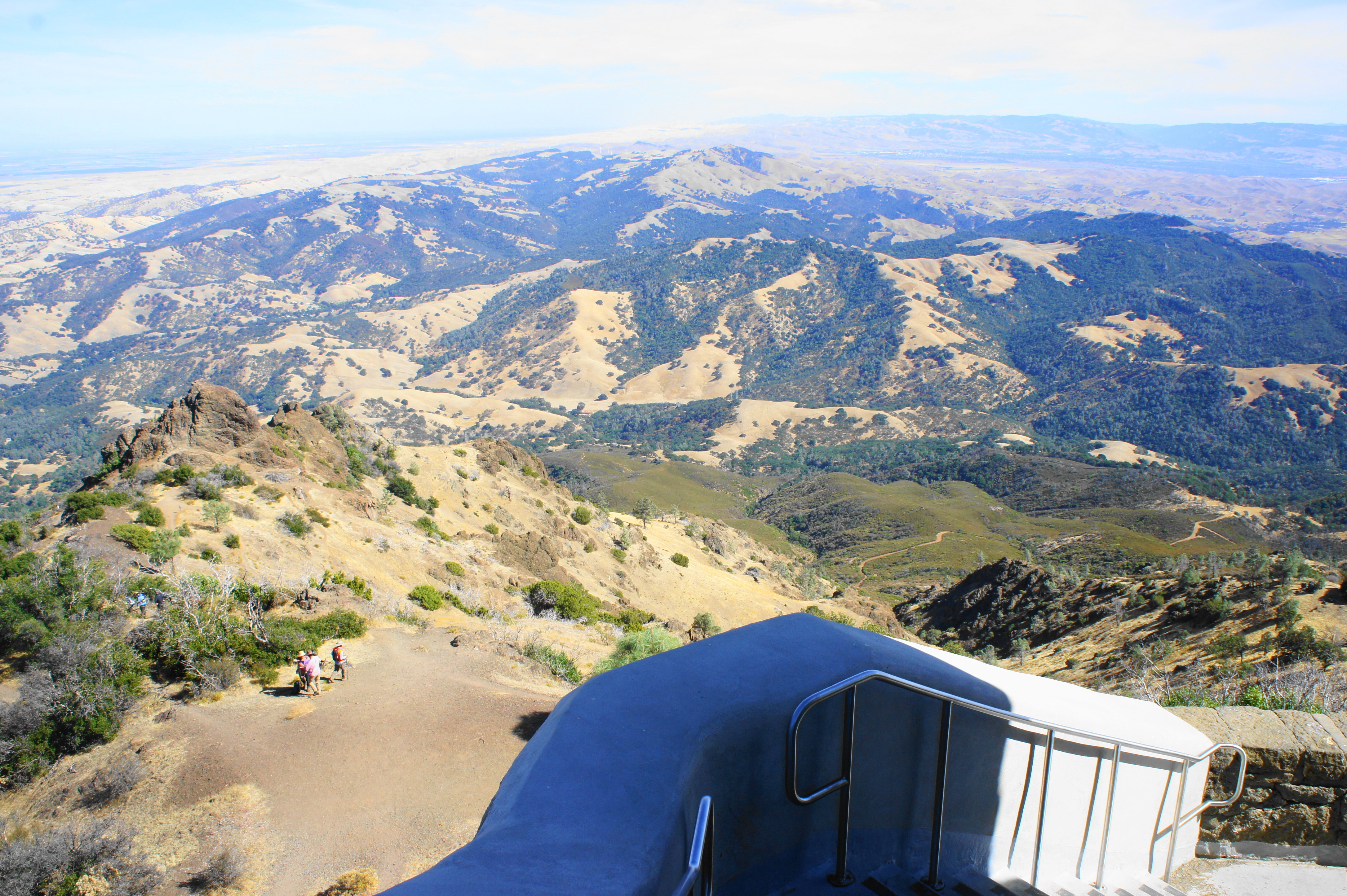
At 6.2 miles, the path crosses another paved road, which meets up with the main Summit Road just ahead to the right. Bear right on Summit Road, then, just as the road splits into a one-way loop, find the continuation of the Summit Trail, which traverses the shady ridge in the middle. Passing under a canopy of oaks, the trail climbs to pass a communications tower and then empties out into a parking lot: ahead is the Mount Diablo Summit Museum and Observatory.
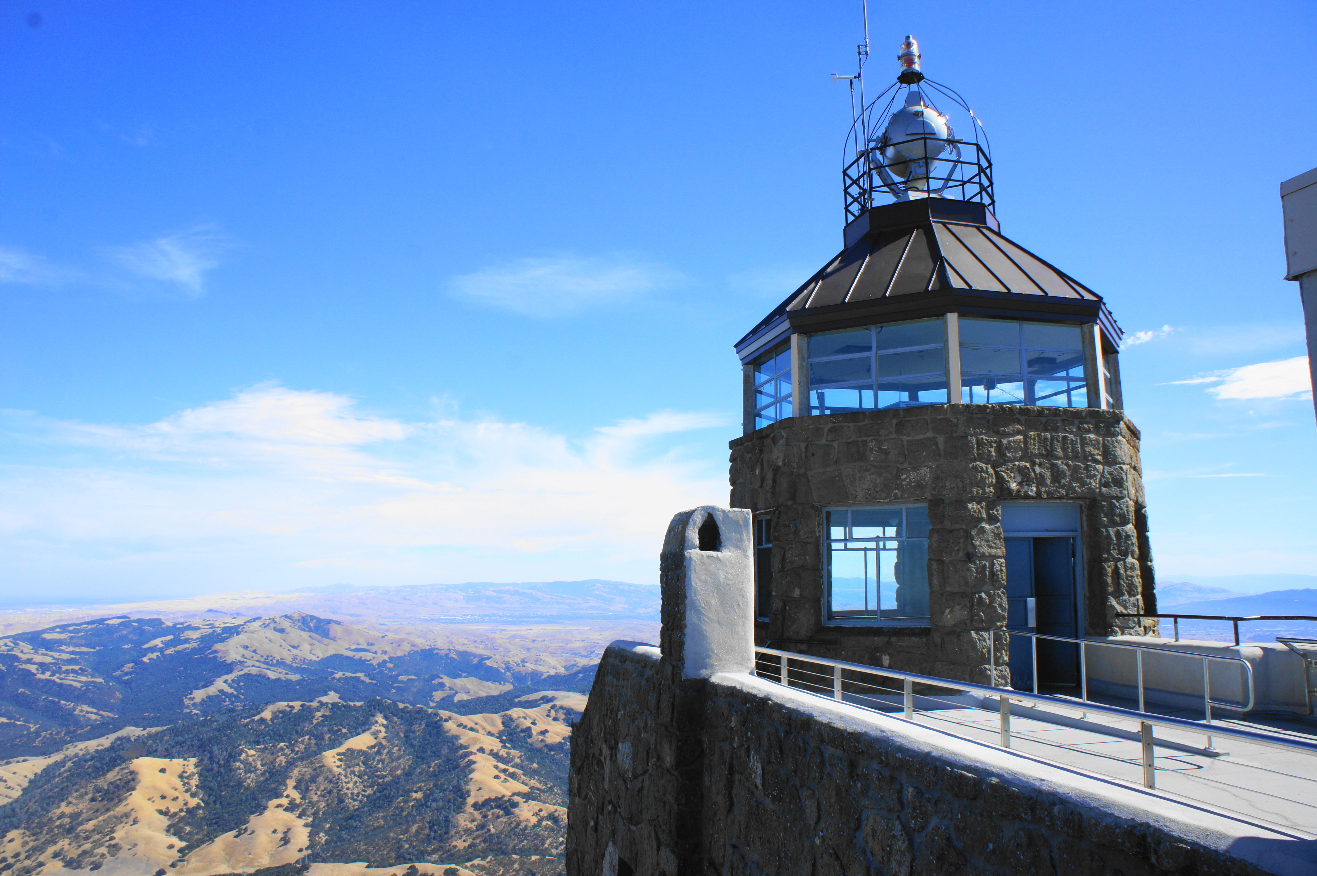
Reaching your destination—the summit of Mount Diablo—seems a little bittersweet. After several miles of natural and raw scenery, the summit feels a little like Disneyland: the observatory is swarming with visitors, the parking lot swamped, and the museum and Summit Visitor Center clamoring with people seeking snacks and knickknacks. (Then again, an ice cream sandwich at the gift shop is well-appreciated.)
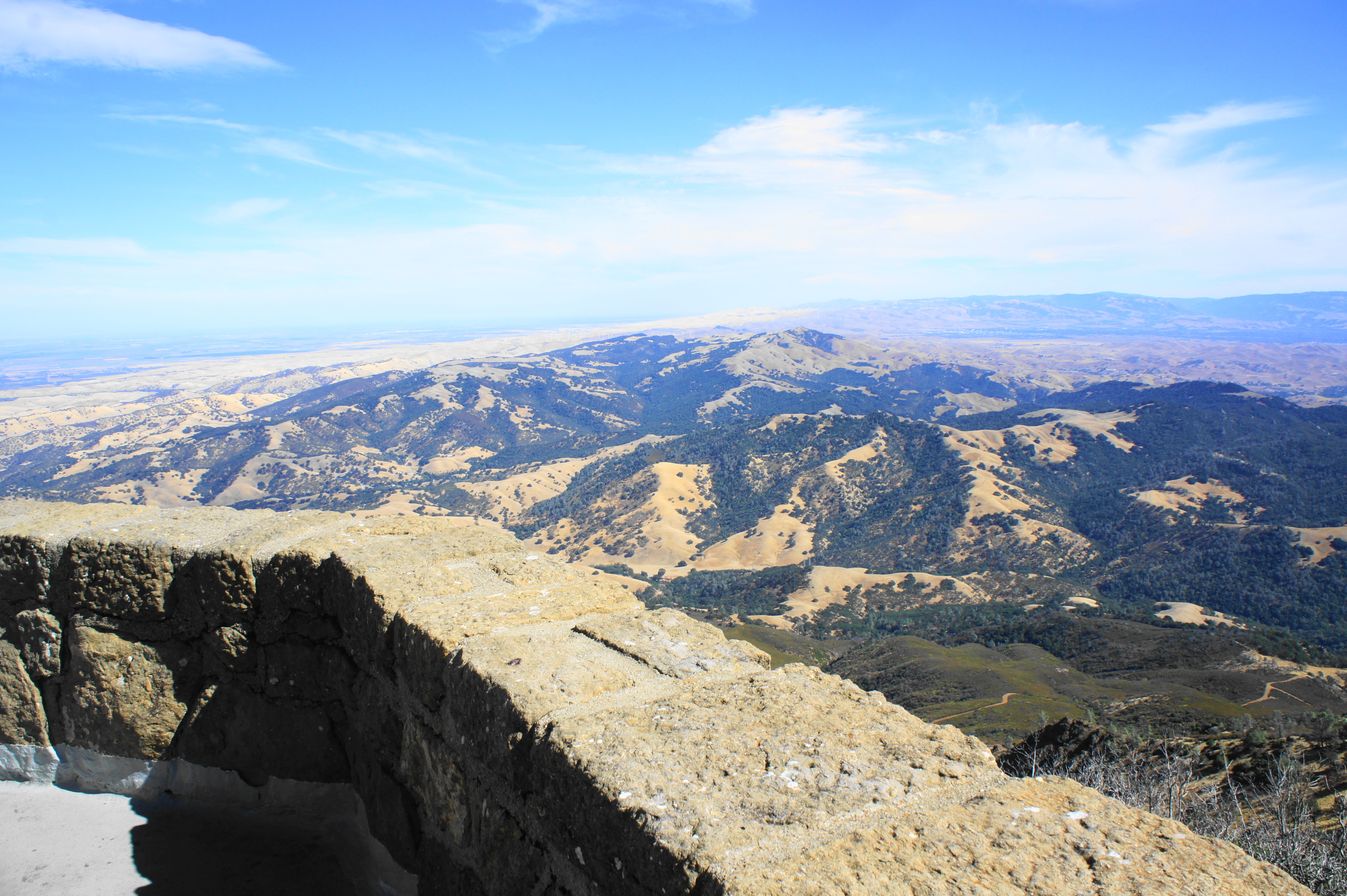
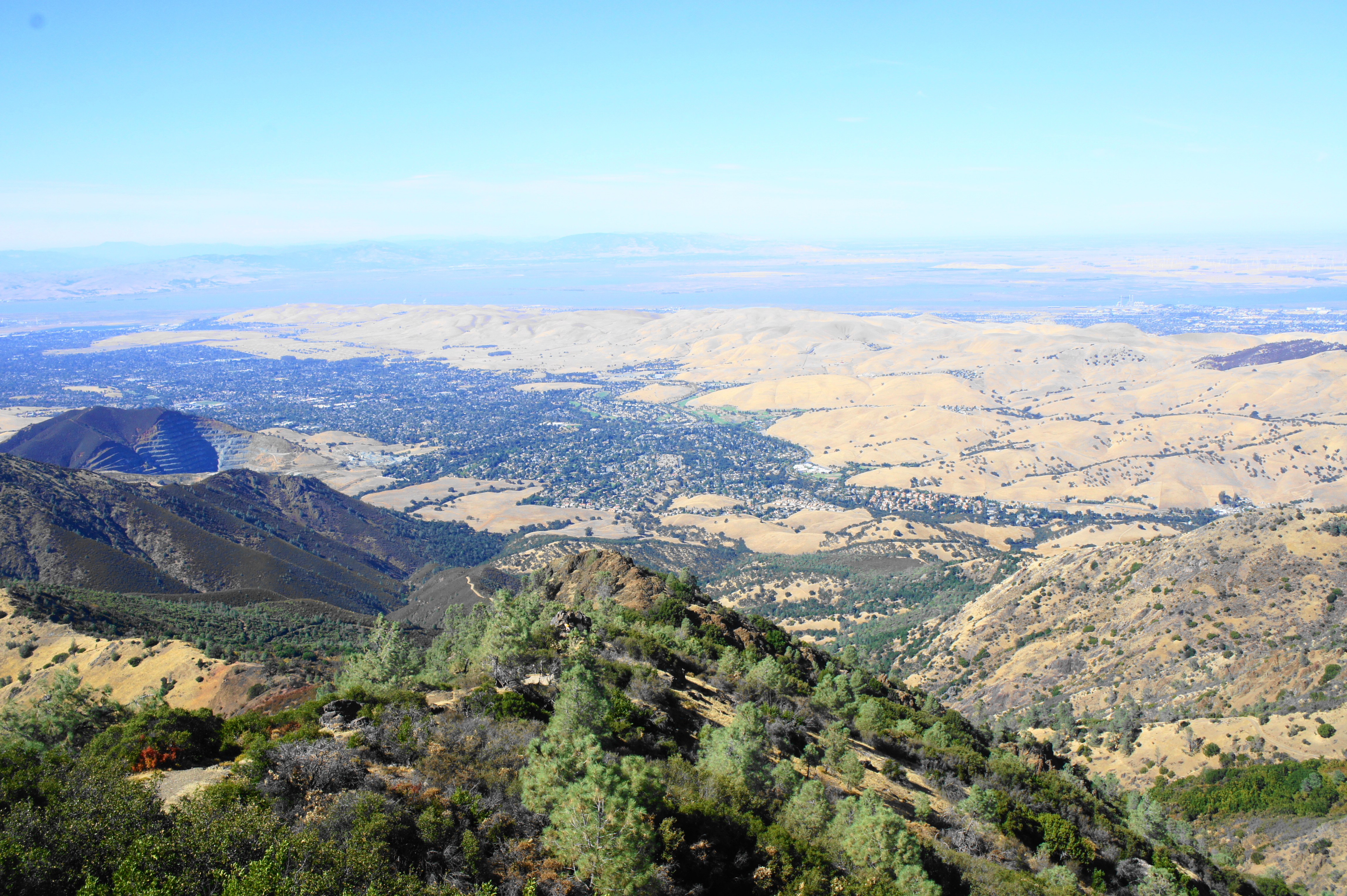
Yet despite the crowds, the 360-degree panorama from the top is one of the best in the Bay Area: on a clear day, one can see as far north as Lassen Peak and east to the Sierra Nevadas; barring haze or fog, the city of San Francisco, the South Bay, Mount Tamalpais, and the Santa Cruz Mountains can be seen on the horizon to the west. In between are a ragged mixture of peaks and valleys, including the Diablo Range, Briones Hills, and Oakland Hills.
Mount Diablo Summit to Deer Flat Picnic Area (3.3 miles)
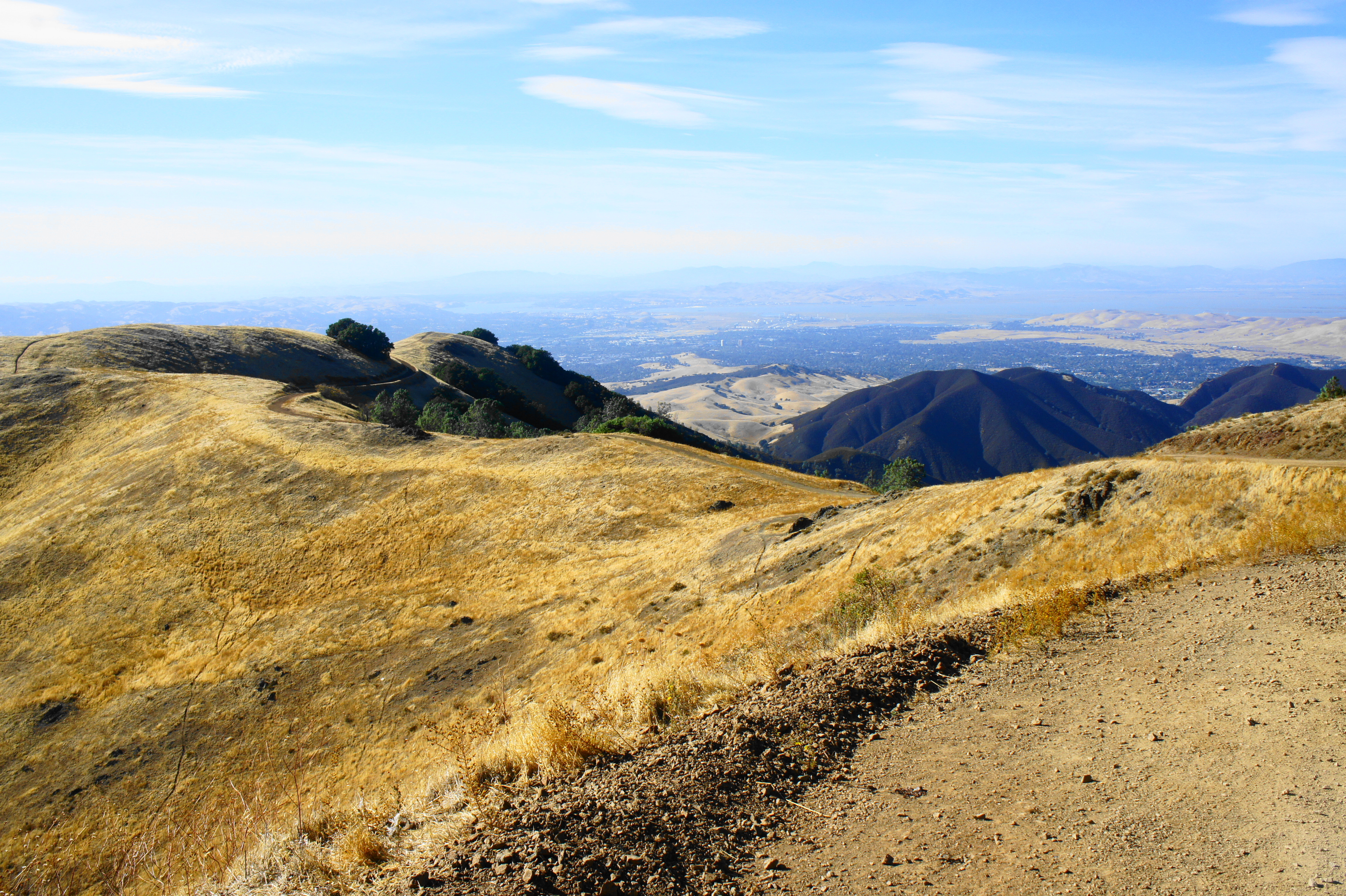
Of course, unless you have a pick-up waiting at the summit, the hike to this point is only half done—although the second half is considerably easier because it is almost entirely downhill back to Mitchell Canyon Staging Area. From the parking area, follow the Summit Trail back down through the oak grove to the split in the Summit Road, then bear left on the spur road leading to the Lower Summit Picnic Area. After passing the picnic area on the right, continue to the end of the road, which ends at a rough blacktop and fenced-off area surrounding an antenna tower. Look for a sign indicating the start of the Juniper Trail, which drops into the woods heading south.
Follow this single-track across Summit Road at 6.9 miles, then continue as the path follows a broad ridgeline westward. At 7.1 miles, hikers reach an informational wayside on greenstone, one of the two dominant rock types forming the south slopes of Mount Diablo (the other is chert). Stay left at the junction with the Moses Rock Ridge Trail at 7.6 miles, then descend sharply to Summit Road and the entrance to Juniper Campground. Bear right on the spur road leading into the campground, passing campsites on left and right.
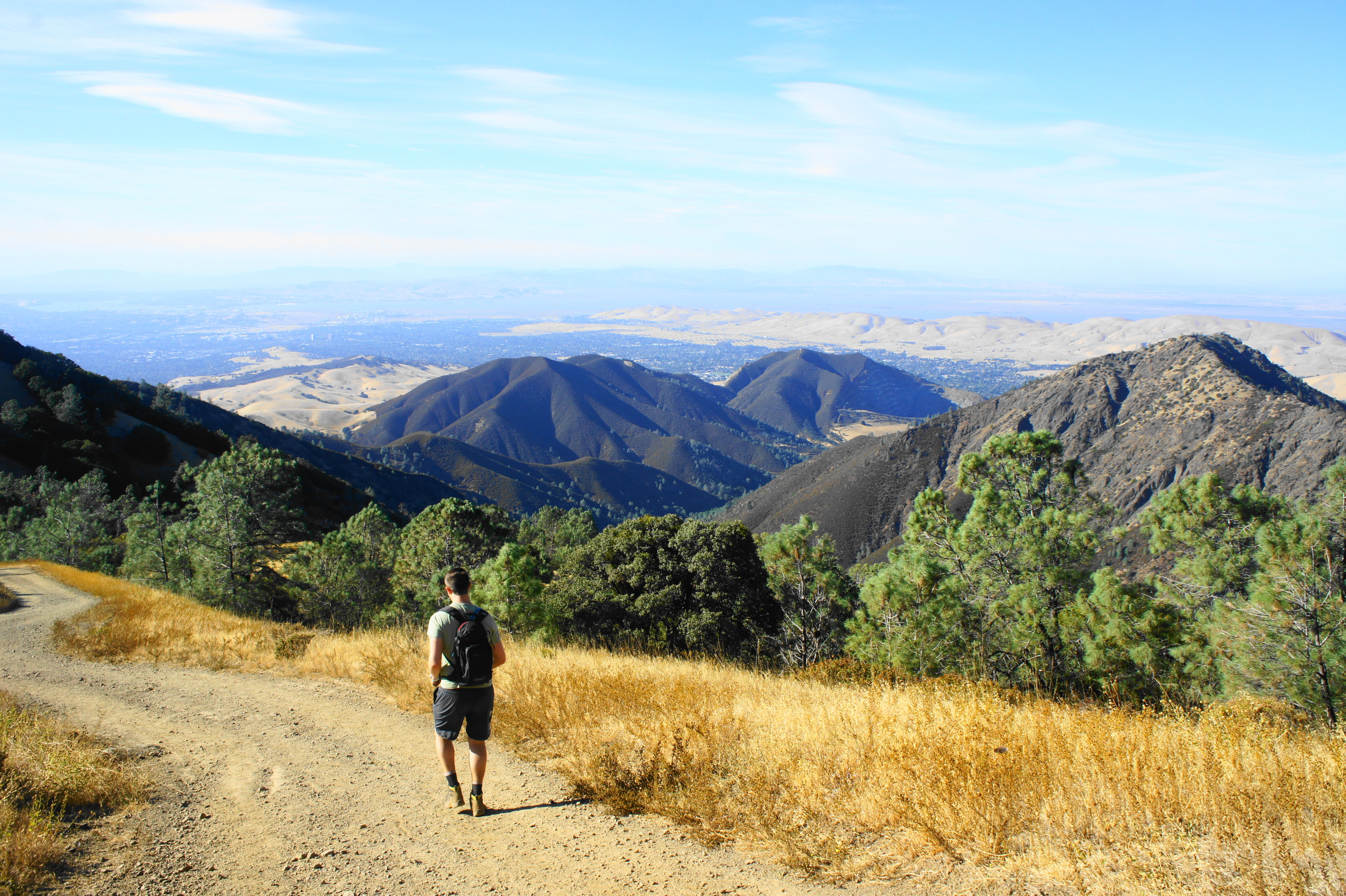
Follow Deer Flat Road as it passes a campground bathroom on the left, then continue straight as the road turns to dirt, passing through the gate. Stay straight at the junction with the Juniper Trail continuation at the 8-mile mark, following the wide grade as it skirts the west-facing hillside. The subsequent section is one of most scenic of the hike, as the grassy hillsides slope sharply down to the valley below.


At 8.4 miles, the trail crests a gap in Moses Rock Ridge, with Mitchell Canyon and Eagle Peak visible beyond. Stay left on Deer Flat Road at the trail junction, beginning the lengthy descent into Mitchell Canyon. As the trail sheds elevation, patchy meadows give way to dense thicket; after rounding a series of wide curves, the road reaches a trail junction at 9.6 miles (stay left on Mitchell Canyon Road) and a massive oak tree on the left. Just beyond is Deer Flat Picnic Area, a small but quiet and isolated meadow surrounded by a sea of oak woodlands.
Deer Flat Picnic Area to Mitchell Canyon Staging Area (3.5 miles)
By now, hikers are likely to have weary legs, with 3.5 miles remaining. The descent into Mitchell Canyon continues, gradually at first, then the drop in elevation accelerates significantly. Bald Ridge and Eagle Peak dominate the landscape to the east, while Olofson Ridge and Black Point (1,791’) form the western flank of Mitchell Canyon. After seemingly endless switchbacks, the trail levels out at about 11.25 miles; Mitchell Creek—a seasonal stream—is visible on the right.
The final two miles back to the parking area are largely flat and easy. Stay straight at the junction at 12.3 miles with Red Road, which bears left into White Canyon to the west. Remain on the main track again 0.4 miles later, when the Black Point Trail takes off to the left. Minutes later, Mitchell Canyon Road crosses the creek bed, and the remainder of the hike follows the right bank. Passing the initial turn to Oak Road on the right—taken many, many hours ago, back at the start of the walk—the hike finally ends back at Mitchell Canyon Staging Area.
The entire circuit, a hefty workout, clocks in at about 13.2 miles, with about 3,250 feet in absolute elevation gain/loss. This is a full-day hike for all but the fastest and fittest, yet one that—despite its challenges—is sure to be rewarding.

Pingback: Top 10 Hikes in 2019 | Live and Let Hike
Pingback: Fremont Peak Trail (Fremont Peak State Park, CA) | Live and Let Hike
Pingback: Bald Mountain Loop (Sugarloaf Ridge State Park, CA) | Live and Let Hike
Pingback: Falls Trail Loop (Mount Diablo State Park, CA) | Live and Let Hike
Pingback: Ohlone Wilderness Trail (Ohlone Regional Wilderness, CA) | Live and Let Hike
The total ascent is 3700 ft.
You can take the ‘Devil’s Pulpit’ trail right after prospectors gap if you want to save yourself about 0.75 miles of trail and don’t mind a steep scramble.
You need at least 2L of water, you can refill at the top. You should also bring a Gatorade, trail mix, or something to manage your blood sugar. Consume that at eagle peak and you won’t need to recover as much when you reach the top.
Good point. I didn’t include the extra 500 feet you have to make up after descending Eagle Peak
Pingback: Top 10 Hikes in 2020 | Live and Let Hike
Pingback: Lafayette Ridge Trail (Briones Regional Park, CA) | Live and Let Hike
Pingback: Mount Diablo via Macedo Ranch (Mount Diablo State Park, CA) | Live and Let Hike
Pingback: 12 Northern California hikes within driving distance of San Francisco - Family Vacations US