

Arguably the premier backpacking route in the East Bay, the 28-mile Ohlone Wilderness Trail connects Del Valle Regional Park in Livermore with Mission Peak Regional Preserve in Fremont. The punishing up-and-down of the hike is good practice for backpacking in the Sierras, and hikers are rewarded with terrific vistas of hidden valleys, rolling ridges, and scrubby peaks in the central Diablo Range. There are occasional reminders that one has not quite escaped the bustling metropolis of the Bay Area—distant views of suburban sprawl, planes buzzing above, the low hum of Interstate 680—but Ohlone offers perhaps the closest thing to remote wilderness in the East Bay.

Preparation and logistics
As with any backpacking trip, some advance planning is required to tackle the Ohlone Wilderness Trail. First and foremost, one should check the excellent East Bay Parks website for details on logistics: the two required items are (1) permits for all hikers ($2/person) and (2) camping reservations. Permits are easy to obtain online, by mail, or in person and come with an excellent map of the entire trail that is sufficient for navigation. Camping reservations should be made at least two days in advance of your trip (or significantly earlier if planning to hike on a busy weekend) and can be made by calling 1-888-327-2757, Option 2 (Monday-Friday). Camping is allowed at designated campsites only, more reason to plan ahead.
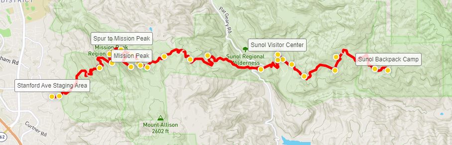
So, what to plan for? Since the hike is a one-way point-to-point with no good loop options, one needs to decide whether to start at Del Valle or Mission Peak and then plan for a pick-up or two-car shuttle. I highly recommend starting at Del Valle Regional Park, as ending at Mission Peak makes for a more rewarding end to the 2- to 3-day hike (although the trail permit/map describes the route starting at Mission Peak). Finishing at the quiet shores of Lake Del Valle, while nice, would be rather underwhelming. So park one car (or get dropped off) at the Rocky Ridge Visitor Center parking lot at Del Valle in Livermore and park a second vehicle (or schedule a pick-up) at the popular Stanford Avenue Staging Area at Mission Peak. (Note: The Stanford Avenue Staging Area is an extremely popular spot for day hikers heading to Mission Peak, receiving upwards of thousands of visitors on weekends. So if you plan to drop a car at Stanford Avenue, arrive very, very early.) Moreover, if planning to leave a car overnight at one of the parking areas, you also need a separate permit, which can be ordered when making camping reservations.
Next, hikers need to decide how long to take. For all but the heartiest hikers, the likely answer is three days. Yes, 28 miles can be completed in two long days—or even a brutal, one-day endurance run—but keep in mind that this is no walk in the park. The trail, which starts at 750 feet above sea level, climbs steeply to more than 3,800’ at Rose Peak, drops back to 390’ at Sunol, then ascends again to more than 2,000 feet at Mission Peak. Taking three days also allows for more side trips, including Murietta Falls or the summit of Mission Peak (2,517’).
If doing two days, plan to spend the night at Sunol Backpack Camp, about 16 miles from the trailhead at Del Valle. If taking three, there is more flexibility: most will camp at either Stewart’s Camp (7 miles from the start) or Maggie’s Half Acre (10 miles) in Ohlone on night one (both involve detours from the main trail), then stay at Sunol or Eagle Spring on night two. Yours truly aimed conservatively, staying at Stewart’s Camp and then Sunol, making for one 7-mile day, followed by 10- and 13-milers. (Note: Plan to bring a water filter, as water at the campsites is untreated. Check here for updates on seasonable water availability.)
All told, with detours to campsites and the summit of Mission Peak, the 3-day trip—staying at Stewart’s Camp and Sunol Backpack Camp—clocks in at about 30 miles.
Finally, a note on timing: the Ohlone Wilderness Trail is by far the prettiest in spring, when winter rains have turned the otherwise khaki-colored slopes into lush, green hillsides (especially in Sunol and Mission Peak Regional Preserves). However, it can still be chilly in spring, with a decent chance of clouds, fog, and storms, so hiking in springtime can be risky. Summer and fall offer more reliability—but the hills can be brutally hot (with temperatures exceeding 100 degrees F) and dry. Unlike the snow-socked Sierras, it’s possible to reasonably hike here in winter, but, like neighboring Mount Diablo, temperatures in the heights of Ohlone occasionally dip below freezing, producing sporadic snow showers.
The hike
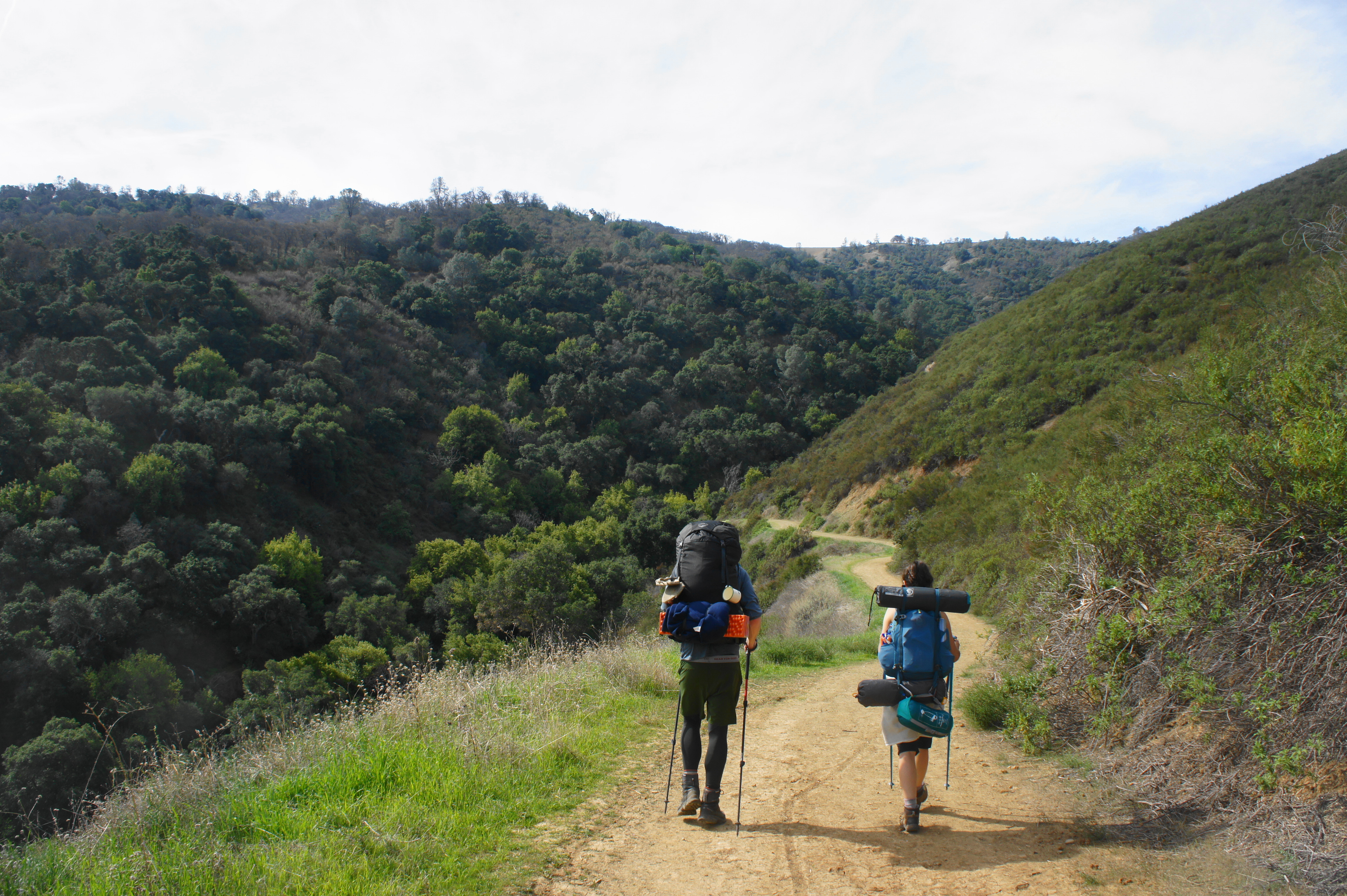
Having settled logistics, the following narrative describes the 30-mile route as I found it during a three-day backpack with two friends in late February/early March 2020. Starting on a Friday and ending on a Sunday, we saw very few people in the first day and a half—but crowds picked up as we passed Rose Peak—the highest point in the area—and dropped into Sunol Valley. After more quiet on the long slog to Mission Peak, we encountered the masses again at the final approach to the summit, then blended in with the runners, bikers, day hikers, and dog-walkers on the steady descent to Stanford Avenue Staging Area.
DAY 1: Del Valle Regional Park to Stewart’s Camp (7.1 mi.)

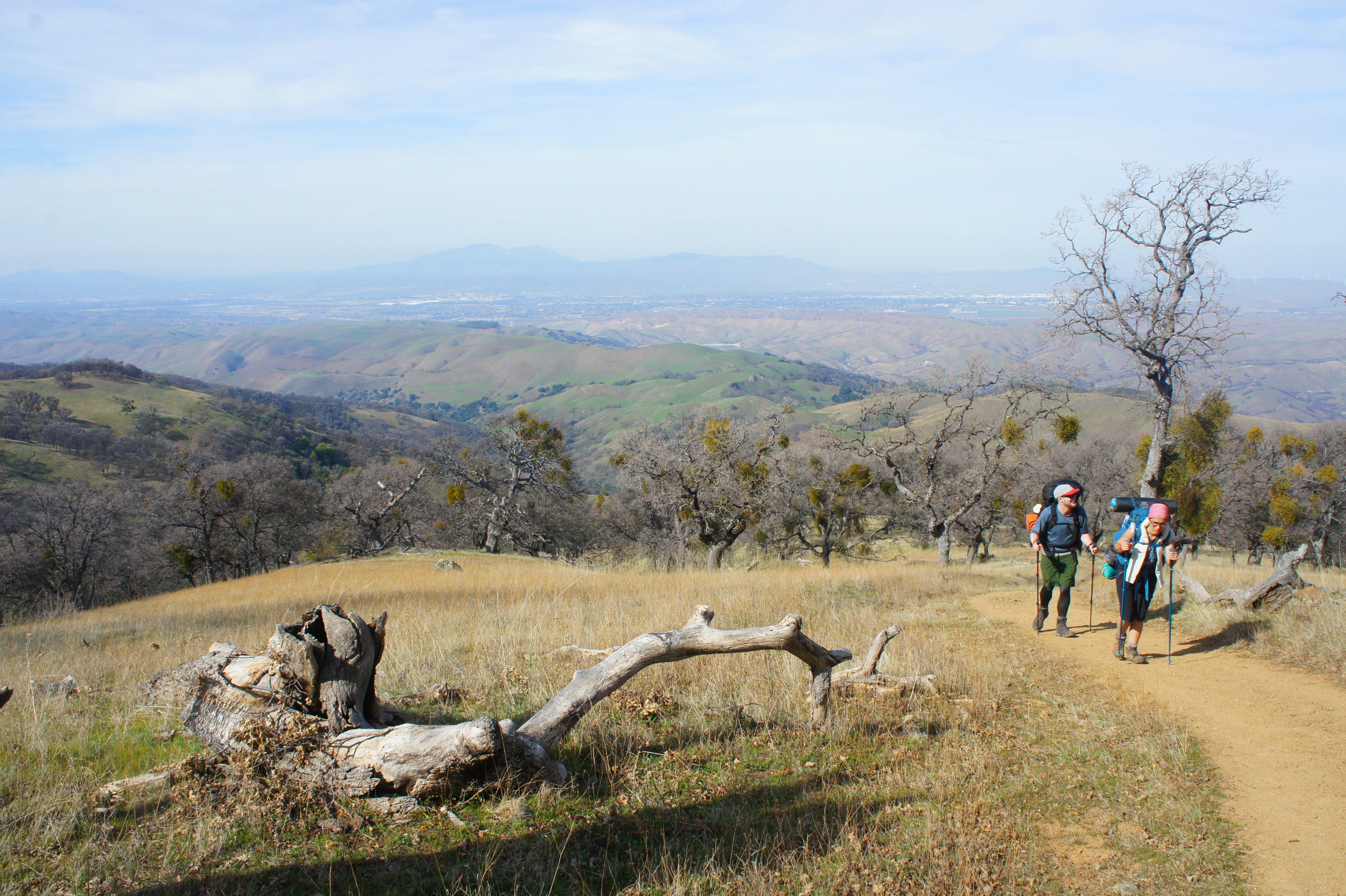
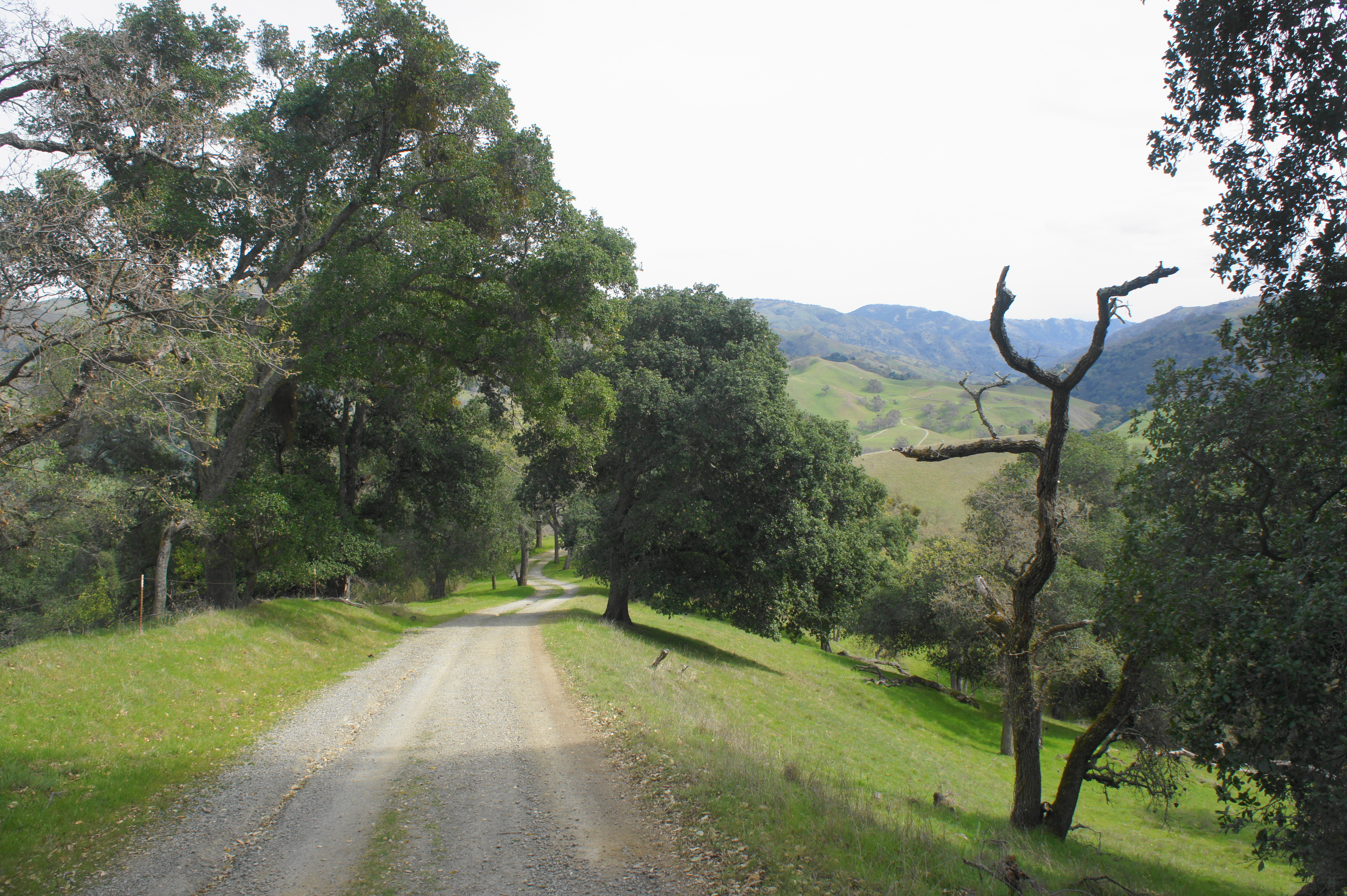
The three-day journey begins at Del Valle Regional Park, a 4,000+ acre preserve south of Livermore, California. The centerpiece of the park is Lake Del Valle, a pearly blue reservoir surrounded by oak-studded hills of the Diablo Range. While boating is a primary activity at Del Valle, there are also dozens of miles of trails, including, of course, the opening stretches of the Ohlone Wilderness Trail. To reach the trailhead, drive south from Livermore on Mines Road, then bear left on Del Valle Road, which snakes over a ridge then descends into the lake-filled valley. Follow the signs to the Rocky Ridge Visitor Center, which is situated on the southwest shores of Lake Del Valle. Park in the northernmost parking lot, near the Ardilla Group Camp and Lichen Bark Picnic Area.
The lake may be tempting, but the Ohlone Wilderness Trail begins by heading in the opposite direction, southward from the parking area, into the forest of oaks and bay. From the northwest corner of the parking lot (with your back to the lake and the restrooms and Ardilla Group Camp on the right), follow the grassy Ohlone Trail—which doubles here as the Sailor Camp Trail—as it enters a highly vegetated ravine. Stay straight at the first trail fork, heading into the hills.

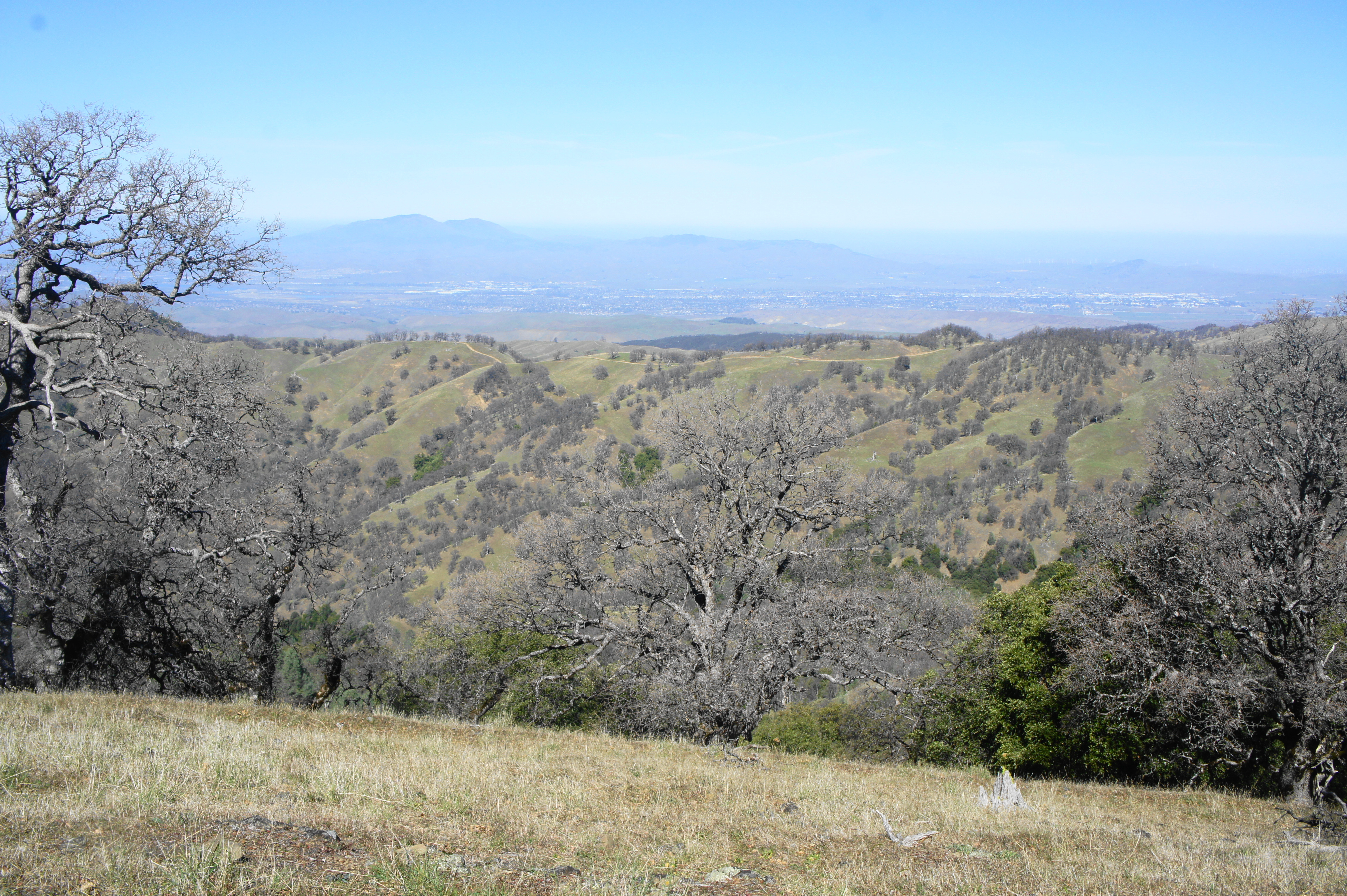
Starting at 750 feet in elevation, the Ohlone Wilderness Trail climbs to a height of 3,450 feet on the first day, and the ascent begins effectively right away. Most of the 29-mile hike follows dusty fire roads, former farm routes used today by hikers, park employees, and cattle-herders (who are still active in corralling the area’s many bovine grazers). The beginning is no exception: the partly graveled-track climbs up through the initial ravine, then bobs and weaves over two low ridges. The hike’s first views extend northward and eastward to Cedar Mountain Ridge (3,675’), the heights of which are located outside the park.
At about the one-mile mark, the trail descends to a junction with the Vallecitos Trail in a shady ravine. Here lies the Ohlone Trail Sign-In Panel, where hikers should register with their itinerary (signing out at Mission Peak two days later). Continuing straight on the ascending road, the trail rounds another bend and the incline begins to steepen, the first tough climb of the multi-day hike.
As the path gains elevation, the vegetation lessens, revealing wider vistas toward Lake Del Valle and Livermore Valley beyond. Even in spring, these hills do not grow as verdant as their cousins slightly farther west, suggesting a drier environment as one gets farther from San Francisco Bay. What vegetation remains, however, becomes more diverse, as pines, toyon, and manzanitas enter the mix.

As the trail approaches the heights of Rocky Ridge (2,426’), hikers pass through a metal gate, marking official passage into Ohlone Regional Wilderness, leaving Del Valle behind. By now hikers have gained 1,120 feet in about 1.7 miles.
Stay left at the junction with Stromer Spring Road, which leads westward to a water source, at 1.8 miles. Vistas improve greatly as the main track weaves out into the open: the town of Livermore, with Mount Diablo (3,848’) beyond, is visible to the north. A rocky outcrop at about the two-mile mark offers a nice place to stop for a snack and short rest. There’s no shame in taking more than an hour and a half to get to this point: the blistering ascent is one of the most demanding in the area, especially with a pack full of gear.

From the outcrop, the trail descends briefly to an open pasture; stay left at the fork. Now bearing southeast, the route passes signs of civilization: a pit toilet and the Boyd Camp (2,240’). Too early to camp for through-hikers, this spot is meant for those seeking a shorter overnight adventure from Del Valle.
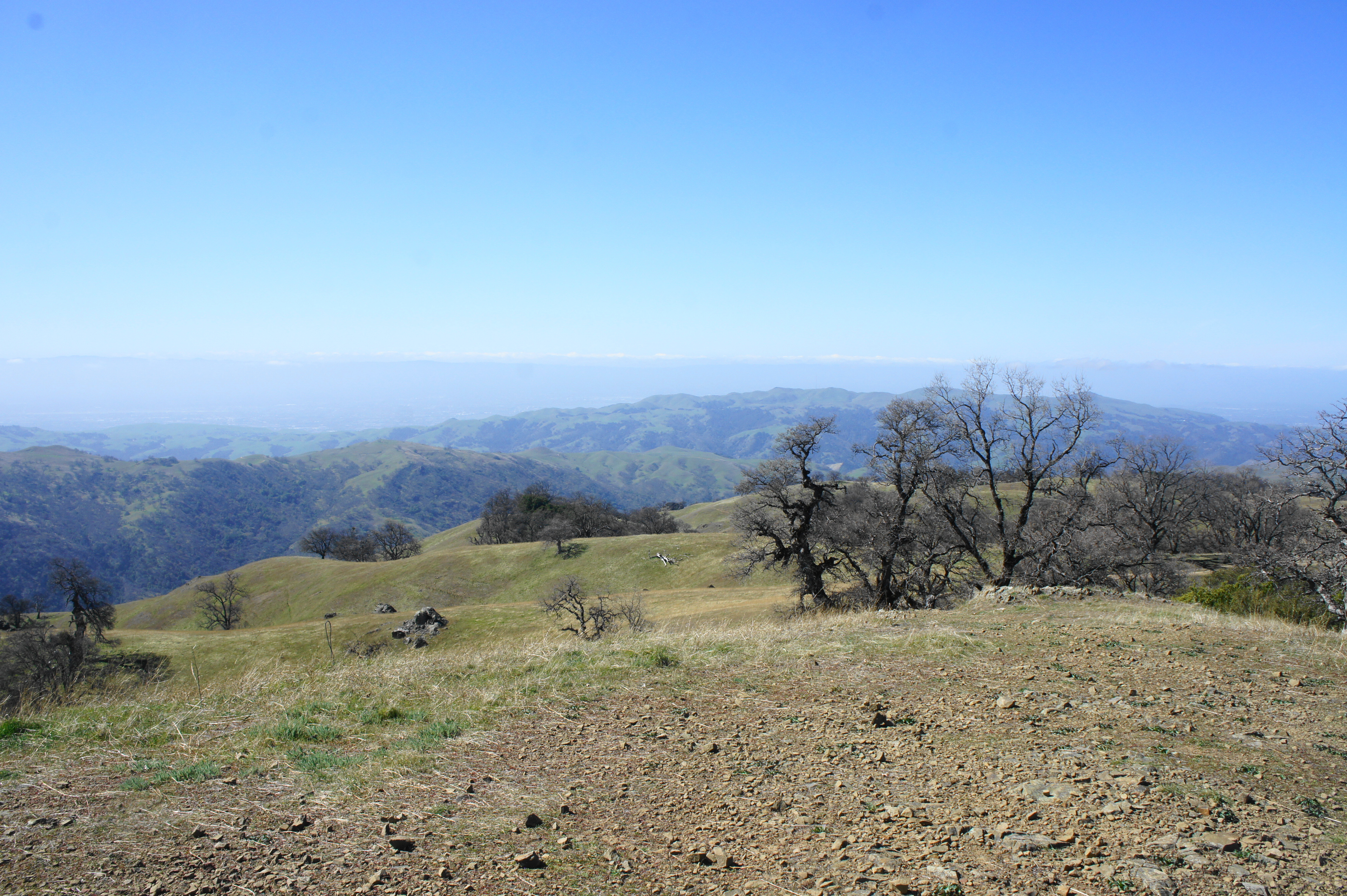
Beyond Boyd Camp, the trail ascends modestly to crest Rocky Ridge, revealing a new landscape to the south and west. The valley below is Williams Gulch, the next obstacle on the first day of the hike. Through the aperture to the east, one can see for miles down the Diablo Range, which extends for more than a hundred miles into central California.
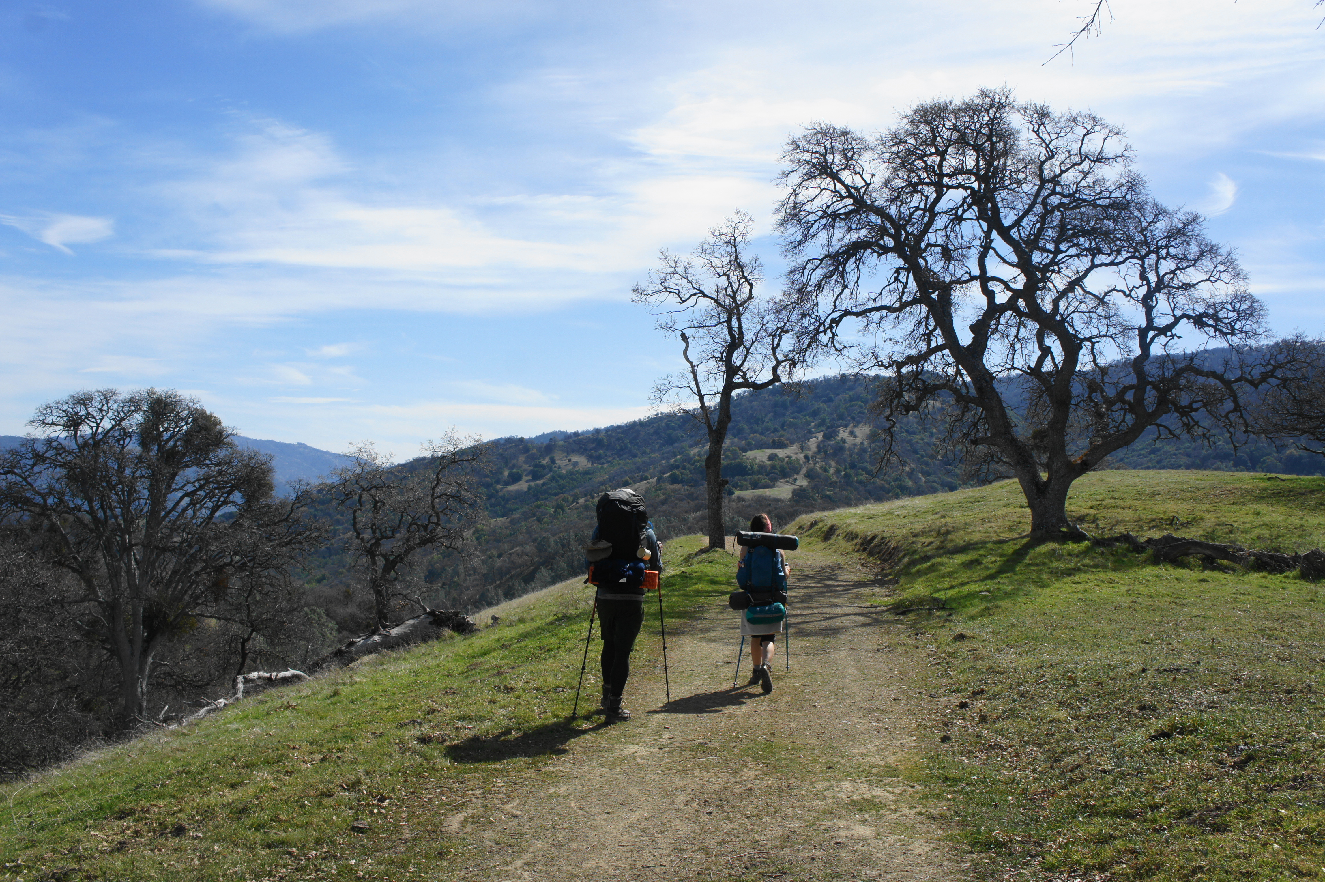
Atop the high pass, stay left at the junction with the Rocky Ridge Trail. Hikers are now at 2,380 feet but will descend to 1,890’ in the next half-mile to clear Williams Gulch. The descent begins gradually, following a grassy, sun-soaked finger to Sycamore Flat (2,000’). Stray oaks, which lose their leaves in winter, dot the landscape. Stay right at the junction with the Jackson Grade Trail at 2.75 miles. From here the Ohlone Wilderness Trail begins a steeper descent, eventually becoming a narrower single-track.

Dropping into Williams Gulch feels a world away from the dry, sunny hills above. The riparian landscape here is rich with lush vegetation and, in spring, a modest stream flow. The moss-covered bay trees bend sharply, dangling over the creek, while the high oaks provide much-appreciated shade. Cross the stream at around 3.25 miles.

Descending into Williams Gulch 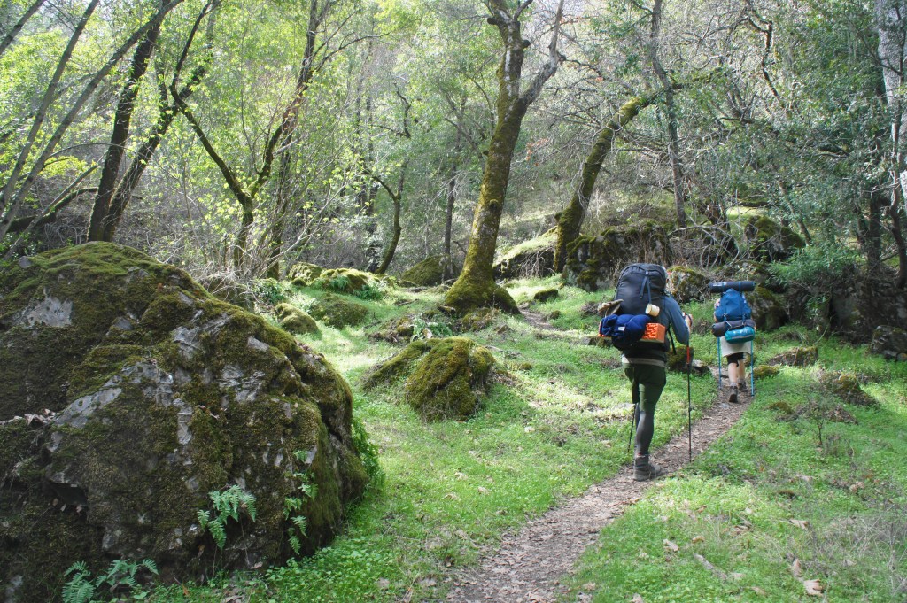
Williams Gulch before the Big Burn
Beyond, the trail begins the most gnarly ascent of the whole trip, gaining a crushing 1,400 feet in just over a mile and a half. The notoriously uphill section has a name—the Big Burn—as the feeling your lungs and legs will have when you’re steadily climbing the steep slope. One consolation is that the climb is almost entirely in partial shade, especially in late afternoon. The single-track switches back and forth up the hill more than a half-dozen times before skirting westward toward a side ravine with occasional views across Rocky Ridge to Mount Diablo.

Steady climb up the Big Burn 
Views across Rowell Ridge to Mount Diablo
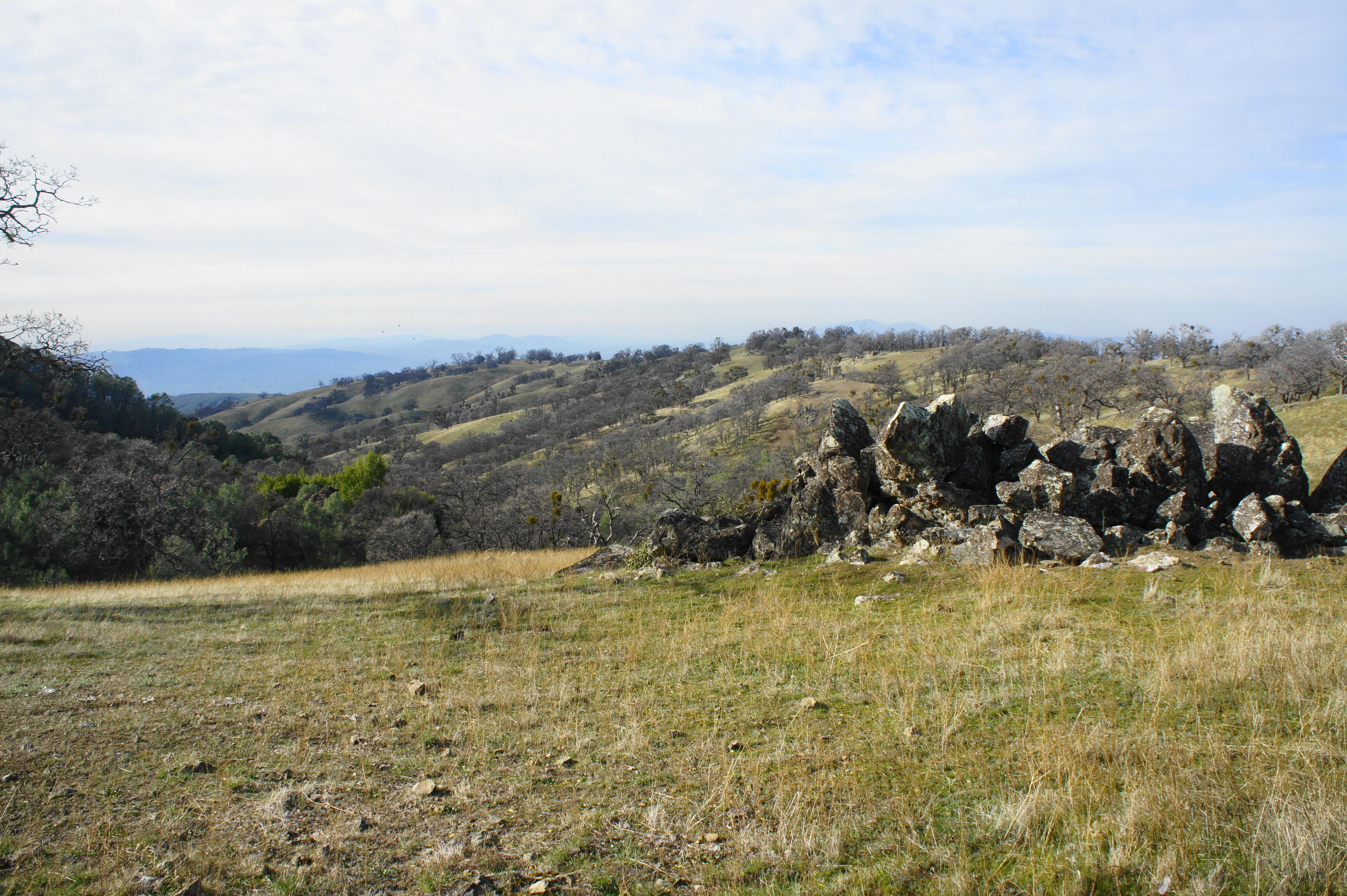
After a brief easement, the ascent continues in a steep scramble up to Schlieper Rock (3,080’), a nice viewpoint with northward and eastward vistas. Take a rest here (perhaps a late lunch?) before continuing. Alas, there is another quarter-mile of steep climbing to go before the next respite.
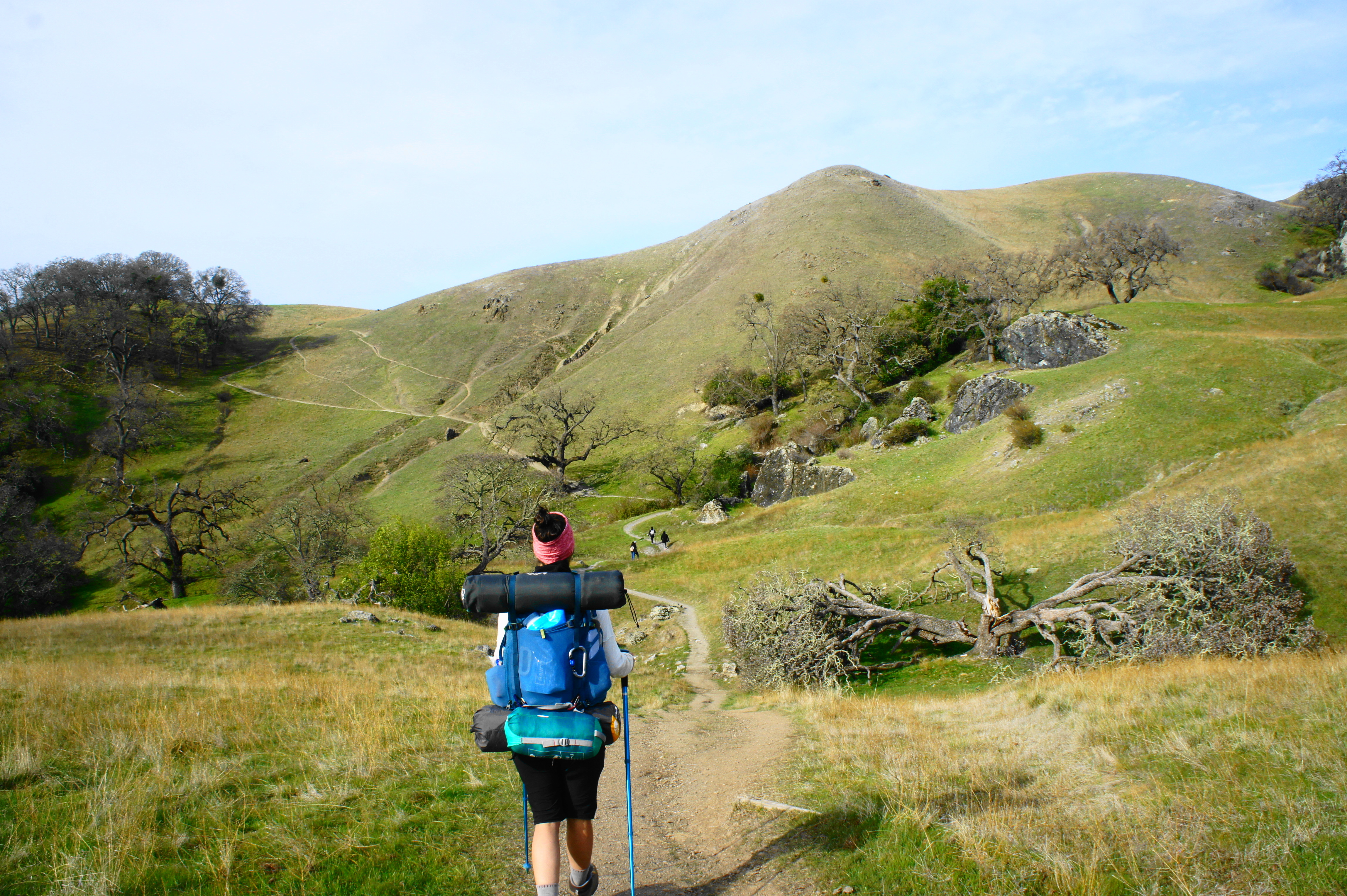
At last, at a junction with Springboard Road (4.9 miles from the start), the gradient levels off. A much more modest climb leads over a set of grassy peaks. This high ridgeline is called Rowell Ridge, named for Henry Rowell, the rancher who previously owned much of what is now the Ohlone Regional Wilderness. At 5.4 miles, the trail reaches a pair of junctions and Johnny’s Pond, a modest puddle frequented by cattle that was named for John Fernandes, who worked for Rowell. Stay left at the first fork, then hiker’s face a choice at the second: heading right leads down to Murietta Falls and is the quickest way to Stewart’s Camp (3,160’), the destination for the night. However, heading this way takes one away from Ohlone Wilderness Trail. Those determined to walk every inch of the Ohlone Trail should bear left, taking the slightly-longer route to Stewart’s Camp. (Note: Being the determined kind, we headed left. Day hikers headed for Murietta Falls, however, should bear right at the fork.)

The trail heading left marks the start of a four-mile stretch that is the most remote of the entire hike. Losing the day hikers headed for Murietta Falls, the Ohlone Wilderness Trail between here and Rose Peak is largely traversed only by determined backpackers. (Note: We saw only one solo hiker in this stretch.)
Heading southeast along the ridgetop, the trail passes through a cattle fence atop the first of a series of minor hills and then traverses open pastures for a half mile to the next junction at Shafer Flat. Hikers are now 6.2 miles from the trailhead, and—at 3,458 feet—this is the highest point on day one of the trek. In the bowl-shaped ravine below, one can spot Shafer Pond, a man-made reservoir and another watering hole for local cows.
Bear right at the junction, gradually descending and entering a curiously pine-studded forest. At 6.5 miles, head right on Greenside Road, leaving the Ohlone Wilderness Trail for the first time. This spur road provides access to Stewart’s Camp. Reaching the lone campsite requires dropping 330 feet, part way into the drainage for La Costa Creek. At last, 7.1 miles from the start, the shady campsite and pit toilet are found on the left.
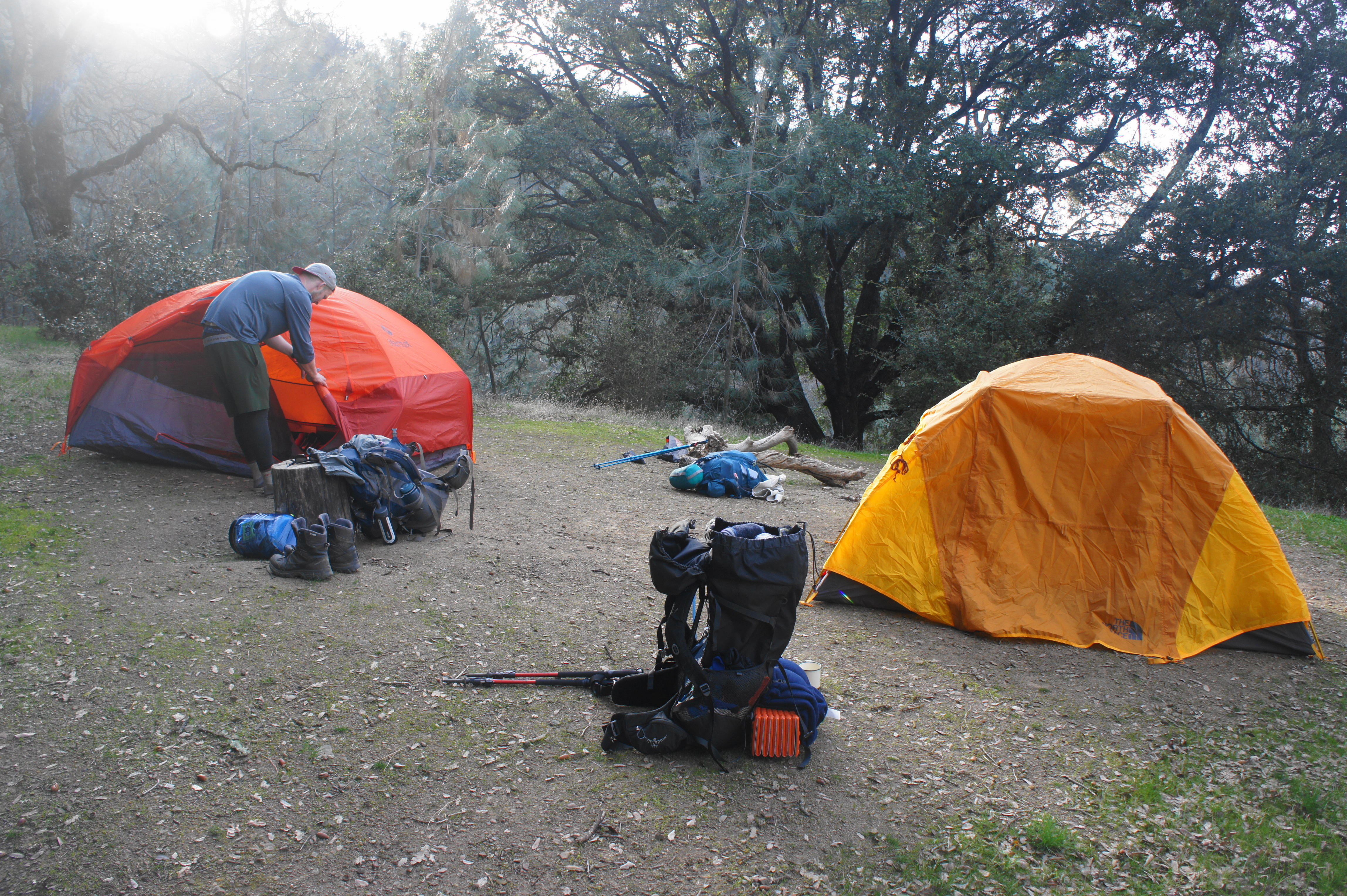
After setting up camp for the night, consider taking a walk back up the road about 1/10 mile to a rock outcrop on the left, which provides a nice spot to watch the sunset. Now out of sight of signs of civilization, one can truly experience the wilderness.

DAY 2: Stewart’s Camp to Sunol Backpack Camp via Rose Peak (10.2 mi.)

Rise and shine. The second day begins after what is hopefully a restful night at Stewart’s Camp, ushering in what is arguably the easiest and most beautiful of the three-day trek. After packing up camp, retread your way back up Greenside Road, gaining 330 feet in elevation, to return to the Ohlone Wilderness Trail. Bearing right (south), the trail traverses largely level terrain that is dotted with towering pines. Stay right at the junction at 1.1 miles (Mile 7 on the Ohlone Trail from Del Valle)—the route heading left leads into an East Bay Regional Park District land bank (off-limits).

Now bearing west, the trail descends into a shallow gully and then, after rounding a mucky pond, climbs steeply to clear a notch on Wauhab Ridge (3,547’). The next stretch, which traverses the ridgeline before dropping to the North Fork of Indian Creek drainage, is particularly scenic. The rolling hills of Apperson Ridge and Wauhab Ridge unfold to the west, while Valpe Ridge (which hosts Rose Peak, the local high point) dominates the scene to the south.
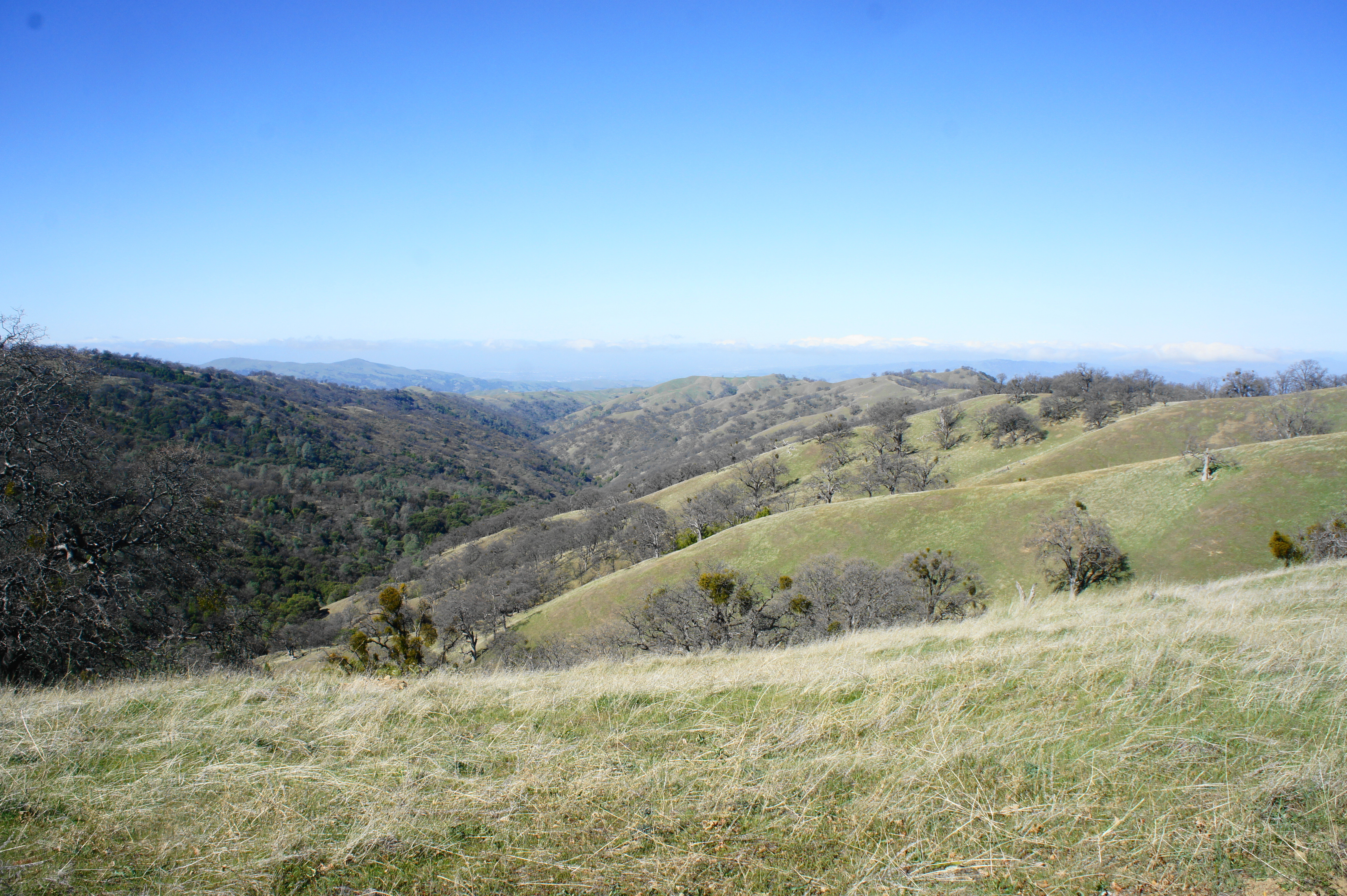
After proceeding northward along the ridge for ¼ mile, stay left at the junction, where the trail drops abruptly, beginning the 300-foot descent to the North Fork of Indian Creek. Hikers cross the stream at about mile 2.6 for the day then proceed on to an Ohlone favorite: a steep ascent up the road, gaining almost 400 feet in 1/3 mile. Stay right at trail post #30, continuing along Valpe Ridge en route to Rose Peak (3,817’), the highest mountaintop in the area.

The subsequent section climbs much more modestly, traversing high oak grasslands. At trail post #29 (mile 3.3 for the day), stay left. (Note: Heading right leads down to the Maggie’s Half Acre campsites, which some will use as their destination for Day 1.) By now one can spot the hulking mass of Rose Peak ahead; this remote mountain is the highest publicly accessible peak in Alameda County. After cresting a false summit, a spur trail leads off to the right, heading for the true peak, at about 3.6 miles. The short but steep ascent is a worthwhile diversion from the Ohlone Trail…after all, you came all this way.
Though 32 feet shorter than nearby Mount Diablo, Rose Peak offers views of comparable quality without the crowds and noisy parking lots that mar the summit of Diablo. Like before, one can see north across Wauhab Ridge and Livermore Valley to Mount Diablo, but now additional vistas to the south and west are added to the mix: backpackers can spot Sunol Valley, Mission Peak (2,517’), and San Francisco Bay for the first time. (Note: On the Saturday morning that we reached Rose Peak, we also spotted a curious sight: day hikers. Yes, some hearty hikers make the nearly 20-mile round-trip hike to Rose Peak from Sunol Valley (or, in some cases, from Del Valle).)

Rose Peak summit 
Descending the Buckboard Trail from Rose Peak
While the summit makes for a nice rest spot, even better scenery lies ahead as the Ohlone Wilderness Trail begins its lengthy, 10-mile descent to Sunol Valley. From the peak, return to the main track, which heads west along Valpe Ridge. The mostly-descending trail bobs and weaves amid oak grasslands and passes another spur to Maggie’s Half Acre campsite at 4.1 miles. Now doubling as the Buckboard Trail, the fire road bears right at another fork minutes later.
At 4.6 miles, the most absurdly sloping trail bears off to the right, providing access to the Doe Canyon Horse Camp (poor horses). While most hikers can skip this detour, those in need of hydration can get untreated water at the spigot at the horse camp.

Eventually the Buckboard Trail settles on the left flank of the ridge, providing scintillating views down the next drainage—South Fork of Indian Creek—toward Mission Peak and Pleasanton Ridge on the horizon. After descending to the creek, the trail climbs steeply out the other side of the valley, cresting another hill.

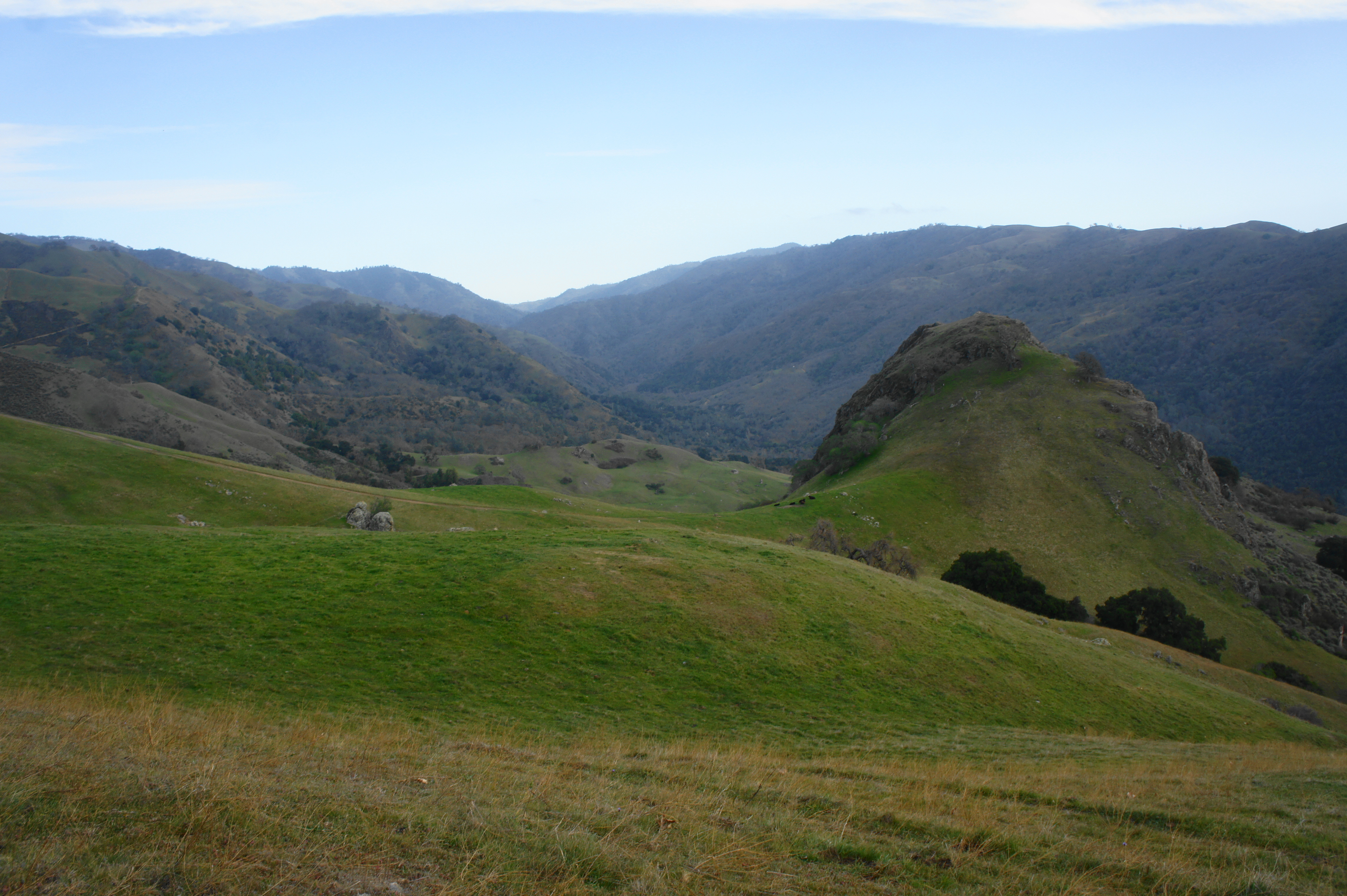
The large canyon ahead is the deep Jacob’s Valley, which feeds into broader Sunol Valley. The Ohlone Trail will skirt the hillsides above this drainage for the rest of the day. And what a sight it is! Oak Ridge (outside the park) rises more than 1,500 feet from the valley floor, while the Mission Peak complex is visible off to the west. Hikers soon become acquainted with Goat Rock (2,038’), a protruding butte amid otherwise smooth-sloping hillsides, visible to the southwest. As the fire road weaves in and out of side ravines, it gradually draws closer to the massive rock.


At trail post 22 (now 7.7 miles from Stewart’s Camp), hikers encounter another junction. Stay straight on the main path and continue through the gate separating park jurisdictions: you have now passed beyond the reaches of Ohlone Regional Wilderness and into a small bloc of land owned by the San Francisco Water Department. Hikers are required during the next two miles to stay on the trail.

Goat Rock from the far western edge of Ohlone Regional Wilderness 
Ohlone Wilderness Trail as it descends through San Francisco Water Department lands
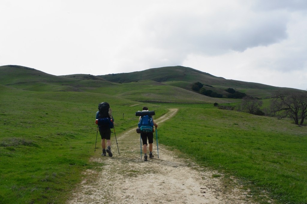
The rolling green hillsides (at least in spring) appear like a scene straight of out of Scotland or Ireland (a feeling that is strengthened by the cool breeze and chilling clouds we encountered on our hike in late February). Again the trail stays relatively high, at over 2,000 feet, although it does drop more than 200 feet along a grassy ridge encountered within a half-mile of entering the Water Department territory.
By now, despite the excellent scenery, hikers will likely be ready to call it a day, so the entry gate for Sunol Regional Wilderness at 10.2 miles is a welcome sight. Just beyond, the trail crests a windswept ridge and enters the Sunol Backpack Camp area. There are seven campsites, each well spread out and (mostly) off the trail. Most have excellent views of Mission Peak and Jacob’s Valley, especially those at the highest elevations (e.g., Hawk’s Nest, Eagle’s Eyrie, and Sky Camp). It’s no wonder then that one of these spots—Eagle’s Eyrie—is the most popular backcountry campsite in the East Bay. There is also water (untreated) and a decent pit toilet at the camping area.

Camping at the Hawk’s Nest site at Sunol Backpack Camp 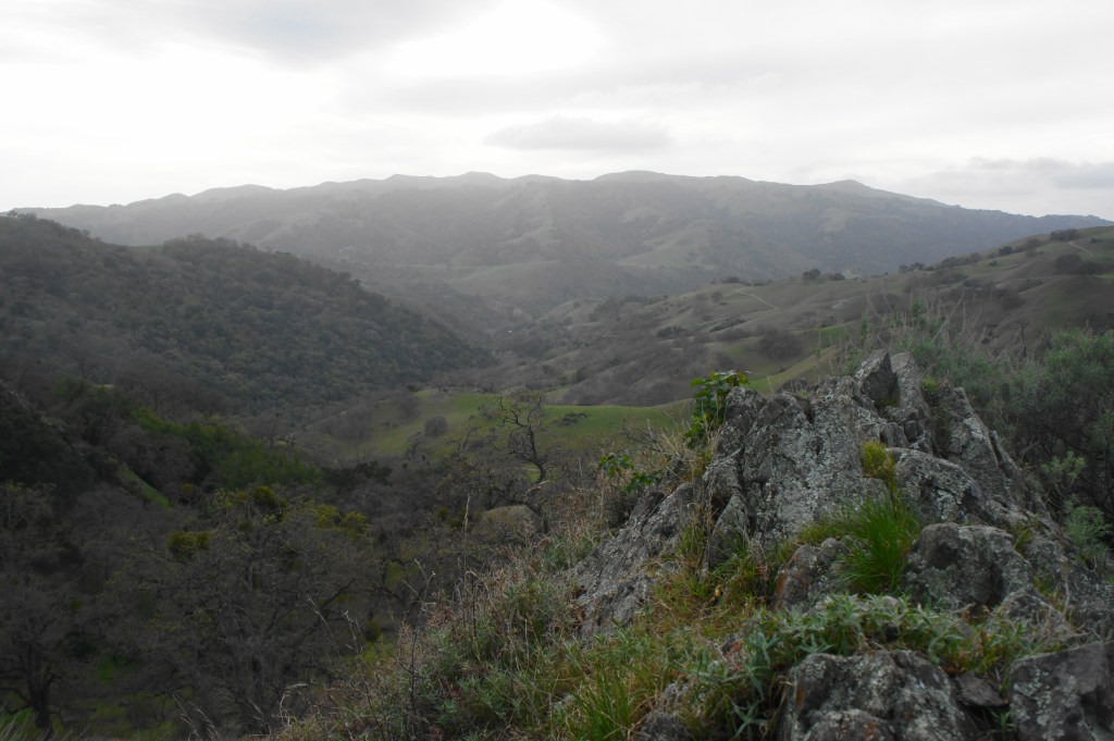
Sunset view from Hawk’s Nest
DAY 3: Sunol Backpack Camp to Stanford Avenue Staging Area via Mission Peak (12.8 mi.)
Day 3 is the final but longest day of hiking and begins with sunrise over Jacob’s Valley. The first few miles of the day complete the lengthy descent into Sunol Valley by way of the McCorkle and Canyon View Trails. From the upper tier of tent sites (Star’s Rest, Hawk’s Nest, Eagle’s Eyrie, Sky Camp) at the campground, the fire road drops precipitously to the lower tier (Cathedral, Oak View, Sycamore) then passes through a gate. Though the more obvious path appears to continue downhill to the left on Backpack Road, hikers should continue right on the McCorkle Trail, which doubles as the Ohlone Trail in this section.
The McCorkle Trail is highly scenic, weaving in and out of rocky ravines and staying relatively high above the valley floor. After about ¾ of hiking on the day (from the center of the backpack camp at Hawk’s Nest), the route crosses a drainage curiously dubbed the “W” Tree Rock Scramble. Then the route climbs steeply to clear a grassy hilltop, in the shadow of higher peaks to the north. Traversing elevations at about 1,400 feet, hikers get their first views of Calaveras Reservoir, situated just south of the park.

At about 1.6 miles, the trail merges with Cerro Este Road, which climbs steeply to an overlook to the right, but the Ohlone Trail continuation bears left, descending an open slope. A little over a third of a mile later, the trail forks again and the Ohlone/McCorkle Trail leaves Cerro Este Road to the right. After descending into an oak-studded ravine, the trail splits without explanation; this is an easy place to get lost: be sure to stay right, staying on the path that ascends back up to another scrubby hillside. Stay left at the junction at post #16, then crest a bushy ridge with fine views down Sunol Valley.

At last, the McCorkle Trail descends into Sunol Valley, with the Visitor Center area now visible to the northwest. At the foot of a rolling hillside, the Ohlone track splits off to the right, following the Canyon View Trail, at about 2.9 miles on the day. (Note: There are actually a pair of junctions in quick succession; stay right at both.)
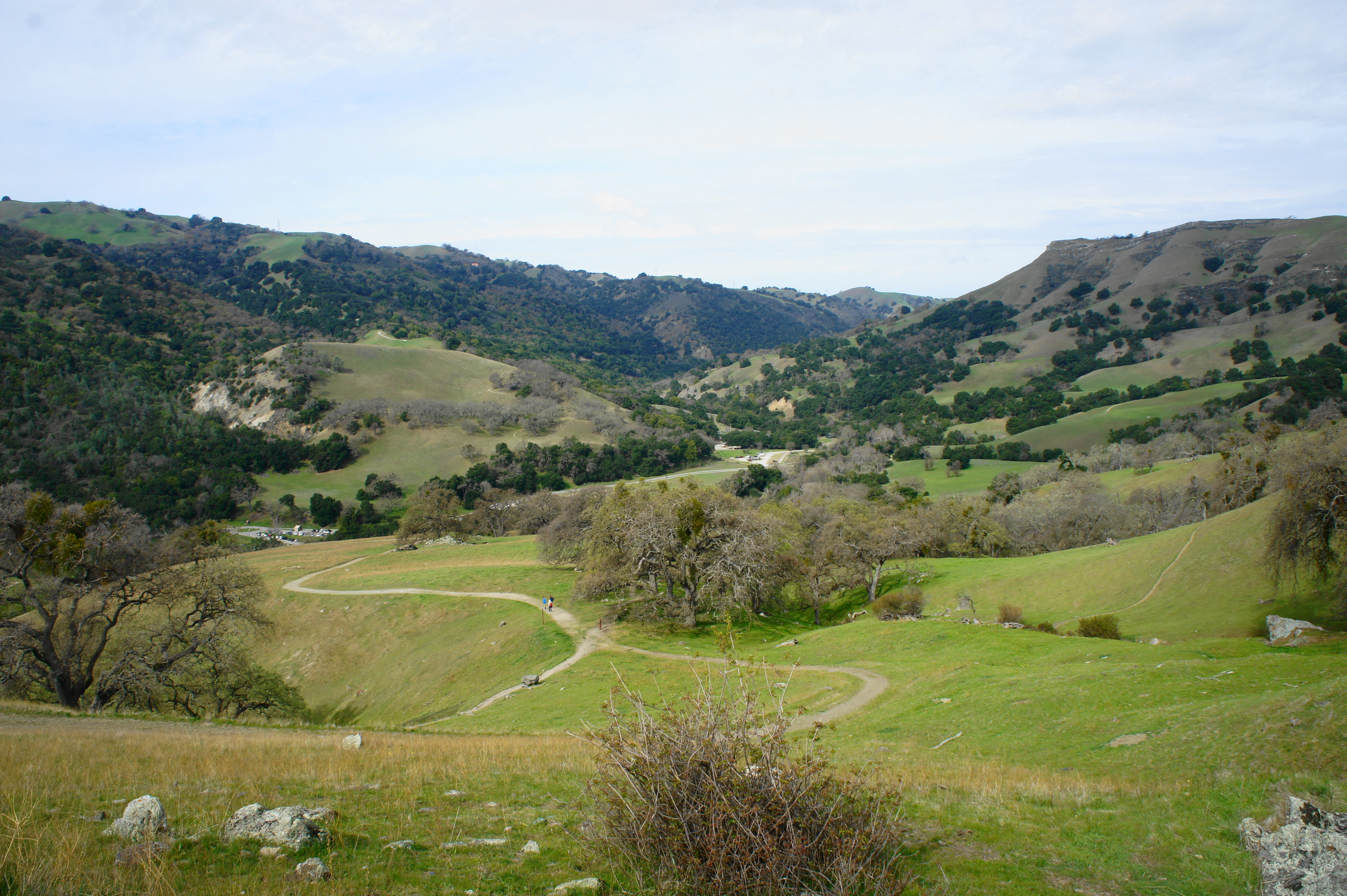
From here the route descends through a pleasant oak grove, passing the turnoff for the Indian Joe Creek Trail on the right. As you approach the Sunol Visitor Center, Alameda Creek—the highest-volume stream encountered on the hike—appears on the left, and the trail levels off. Follow streamside for about 250 yards, and then bear left on the wide bridge across Alameda Creek. Here the trail spills out into a parking lot, the first since Del Valle. Off to the right, across a grassy meadow surrounded by trees, is the Sunol Visitor Center. There are also decent restrooms, quite the luxury after 2 ½ days in the backcountry. Picnic tables offer a chance to sit down for a snack or an early lunch after about 3.5 miles of hiking in the morning. Enjoy the break while you can, as there is plenty of climbing still ahead.
Sunol Valley marks the lowest elevation on the hike—a mere 390 feet above sea level—roughly 2,100 feet lower than Mission Peak (2,517’) and 3,400 feet below Rose Peak (3,817’). The rest of the day involves a climb up and over the former, one of the iconic mountains of the East Bay. (Note: In fact, tackling Mission Peak from Sunol makes for a pleasant day hike, much less crowded than the route from Stanford Avenue.)

The trek to Mission Peak begins at the parking area just down the road from the Visitor Center, next to a small horse pen. Follow the track around the left side of the pen, then pass through the gate, following the single-track Ohlone Trail. The path begins to ascend immediately, traversing a series of long bends, gaining nearly 300 feet in about ¾ mile. At trail marker #11, the path crosses paved but quiet Calaveras Road.

On the other side, pass through the gate and enter more San Francisco Water Department land, leaving Sunol Regional Wilderness behind. The route returns to wide double-track as it rounds a bend and bears westward, ascending an oak-spotted ridge. Compared to the rest of the route, the tree cover in this section is relatively dense—maples and buckeyes are added to the bay and oak mix—although there are occasional views to the north, down Sunol Valley toward Pleasanton and Interstate 680.

Looking down Sunol Valley toward Pleasanton 
Maguire Peak and Sunol
The ascent is relatively gradual but relentless, gaining more than 1,100 feet over the course of three miles. About two miles from Sunol, the trail rounds an old stone ruin known as the Old Homestead, which is much upstaged by the lovely, more modern home in the distance off to the right (on private property). After rounding a hairpin bend, the trail ascends out into the open for a brief moment, offering excellent views eastward across Sunol Valley to Maguire Peaks, Cerro Este, and Apperson Ridge.
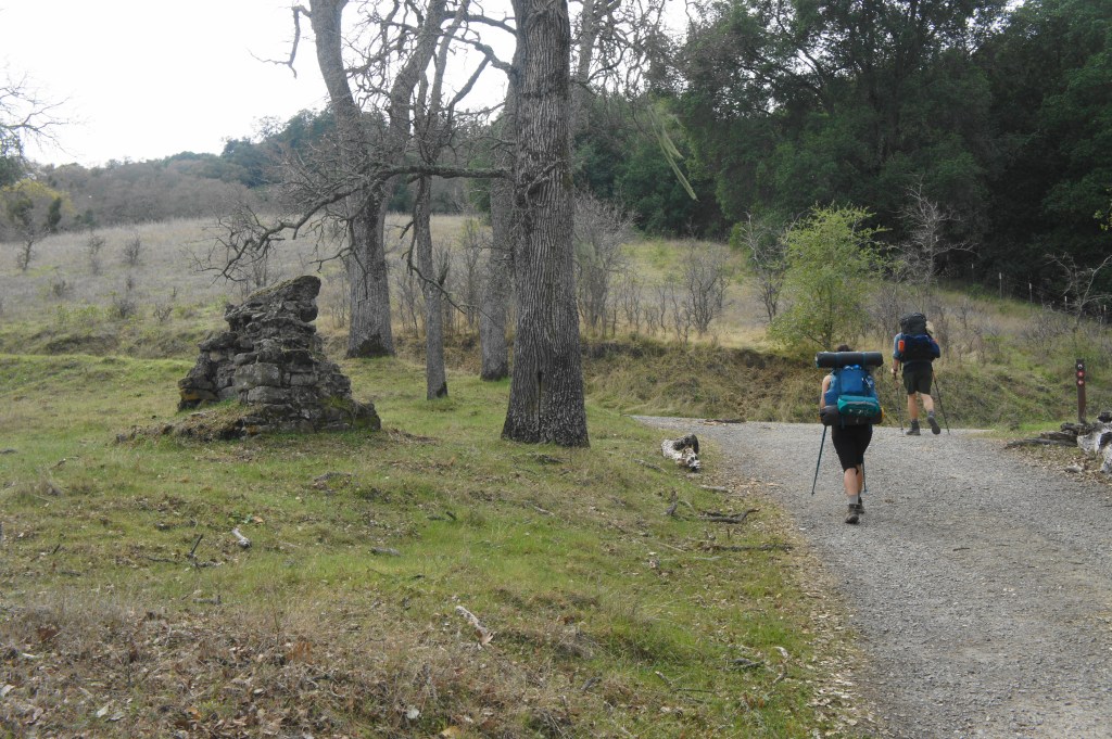
Old Homestead on the left 
Sunol Wilderness Trail in San Francisco Water Department district
It is roughly 1.5 miles of steady climbing from here to the entry gate for Mission Peak Regional Preserve, situated about 3.75 miles from Sunol Valley and 7.4 miles from Sunol Backpack Camp. Sign out at the trail kiosk here. While the official “recorded” hike is over, there is still several miles of trekking to cover. Fortunately, the views from the remote eastern flanks of the Mission Peak area are excellent, some of the best of the hike. As the route ascends past the entry gate, one can look back at much of the territory traversed to this point: Sunol Valley, Valpe Ridge, and Rose Peak in the distance. Mount Diablo still dominates the horizon to the northeast, but Pleasanton Ridge comes into the foreground.
Mission Peak ahead! 
Looking back across the rolling hillsides
After cresting a pair of grassy ridges, the trail drops into lovely Laurel Canyon, a small but lush ravine that is inviting to explore. Stay left at the junction with the Laurel Canyon Trail, however, continuing toward Mission Peak. At trail marker #7, the Eagle Trail continues left to Eagle Spring Backpack Camp, an option for another overnight but most likely skipped in favor of completing the traverse of Mission Peak by the end of the day.

Instead, bear right, heading north. (Note: There is both a single-track and the main fire road that heads right; both are fine as they end up in the same place.) One can begin to spot day hikers climbing Mission Peak, tiny dots huffing and puffing through the grueling final ascent to the summit. For now, the Ohlone Trail stays relatively level, and vast views open up on the right: Pleasanton Ridge, Livermore Valley, Mount Diablo, and beyond. One also gets the hike’s first views of Oakland and the Bay Bridge to the northwest.

At trail marker 5, all the sense of remoteness enjoyed during the past three days evaporates as one encounters the sea of masses, day hikers ascending Mission Peak. Yet the crowds should not deter hikers from taking the brief detour to the summit.

Covering 400 feet in elevation gain in about ½ mile, this final ascent to Mission Peak is steep, rocky, and—on many days—extremely windy, making for an interesting adventure. Fortunately, the wind dissipates a bit near the summit, and hikers can spread out to enjoy the aerial views of San Francisco Bay, the Santa Cruz Mountains, and the Peninsula.
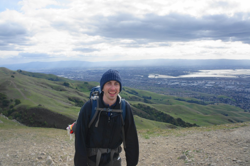
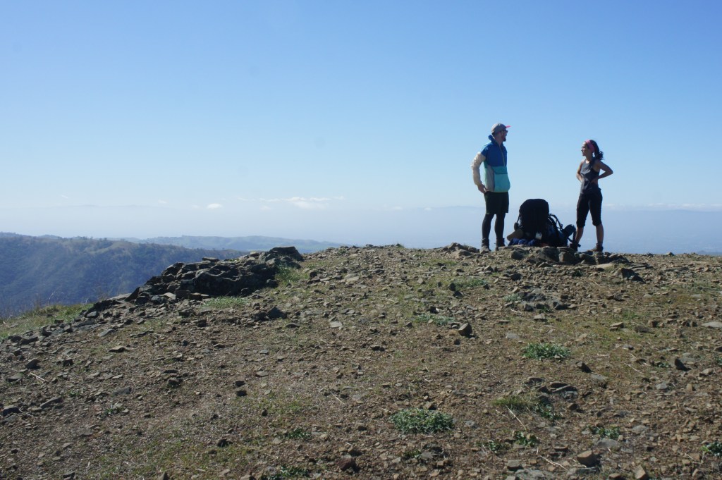
The author at the top of Mission Peak 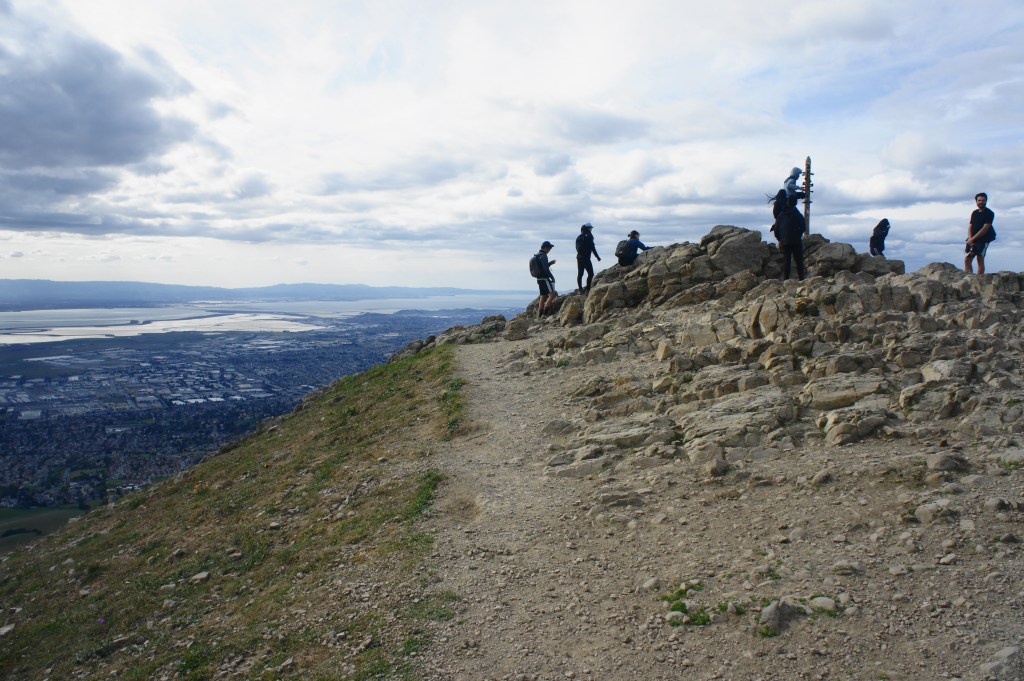
Mission Peak summit


Mission Peak is a perfect capstone for a lengthy, three-day trip. But don’t pop the champagne yet: it’s still another three miles from the summit to the end of the trek. From the summit, retrace your steps, back down the half-mile descent to marker #5. Then bear left on the Peak Trail, rounding to the west side of Mission Peak. From here, follow the crowds: the masses will largely be following the Hidden Valley Trail, a wide and gravel track that cuts past a pit toilet, then drops down the western face of Mission Peak.
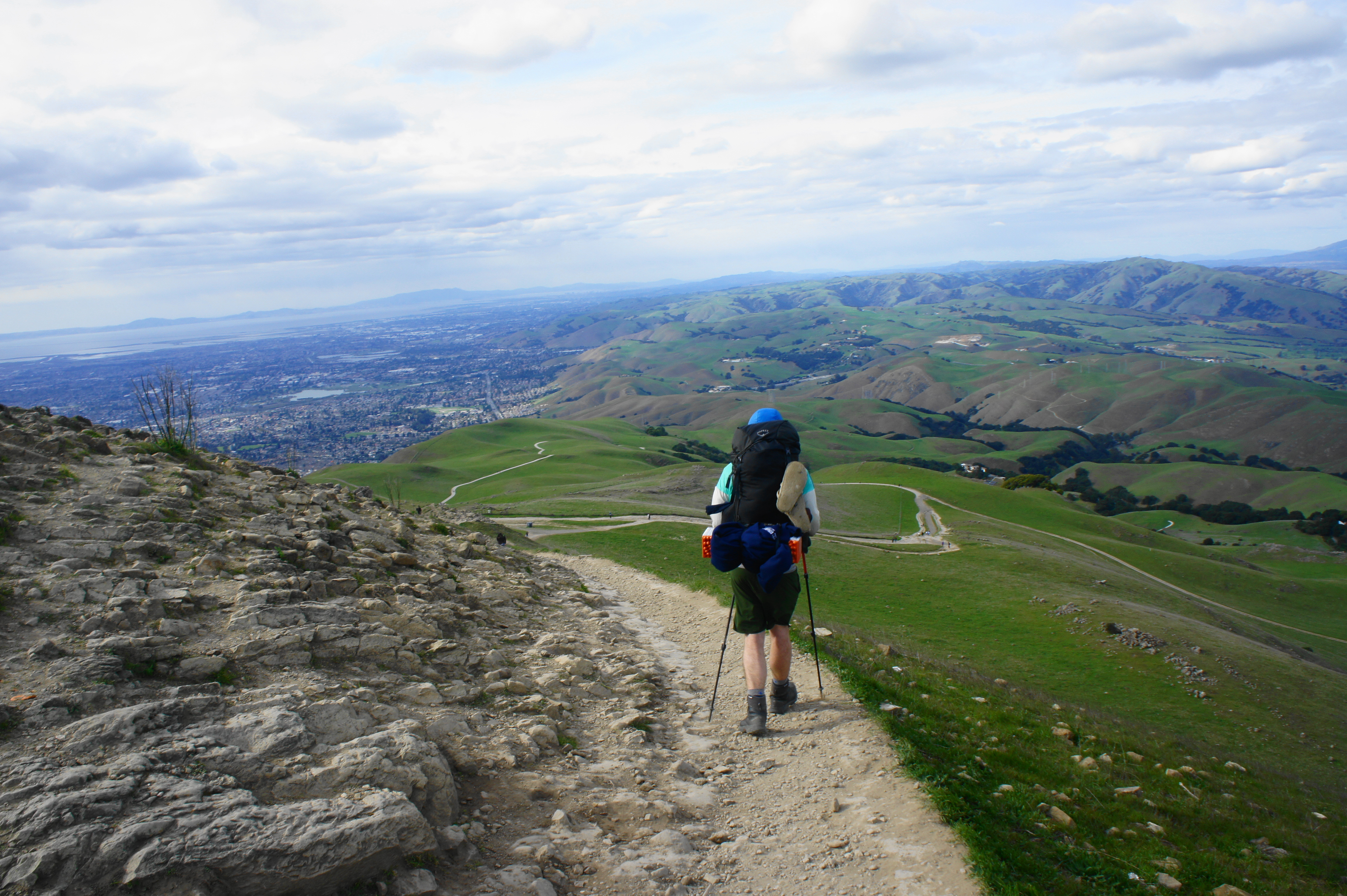

Descending the Hidden Valley Trail toward Stanford Avenue Staging Area 
Green hillsides, with San Jose beyond
Stay left at post #3, and left again at post #2 about 2/3 mile later. There are open views all the way down, across Fremont and Hayward to the Bay and beyond. Yet the descent seems to never end: despite spotting the staging area from above, it is still 1.5 miles away from the junction with the Peak Meadow Trail.

After seemingly endless tread, the Ohlone Trail drops into Hidden Valley and levels off, spitting out at Stanford Avenue Staging Area. The end, at last!

Mission Peak from near the end of the Ohlone Trail 
The end at Stanford Avenue!
All told, the entire, three-day hike, including diversions to Stewart’s Camp and Mission Peak, covers roughly 30 miles, with more than 2,000 feet in elevation gain/loss each of the three days.

Pingback: Top 10 Hikes in 2020 | Live and Let Hike
Pingback: Cerro Este & Little Yosemite Loop (Sunol Regional Wilderness, CA) | Live and Let Hike