
Despite being located on the Ring of Fire, it is easy to forget California’s volcanic past. Beginning roughly 8-10 million years ago, what are now the Berkeley Hills of the East Bay were the epicenter of a series of volcanic eruptions that flooded the area with lava and eventually hardened into basaltic formations visible today. Perhaps the best place to discover this violent geological past in the East Bay is Sibley Volcanic Regional Preserve, situated high above Oakland, a half-hour’s drive from San Francisco. The below loop hike covers the highlights of the preserve, following the self-guided tour of the Round Top Volcanoes at Sibley, a relatively easy, four-mile jaunt around the park.

The hike
Around 10 million years ago, when California was mostly submerged in a shallow sea, two centers of volcanic activity emerged in what is now known as the East Bay: one of the large volcanoes blew its top, leaving a massive caldera on which parts of the city of Berkeley now sit. The second, at Round Top, eventually became dormant, but new volcanic vents emerged about 8.5 million years ago. Tectonic movements led to the formation of the surrounding hills as we know them today, and Round Top volcano was partly eroded and literally pushed by the compressing faults on its side. The result of all this activity is the rugged milieu of basaltic knobs, bluffs, and crags that occupy Robert Sibley Regional Preserve in Oakland today.
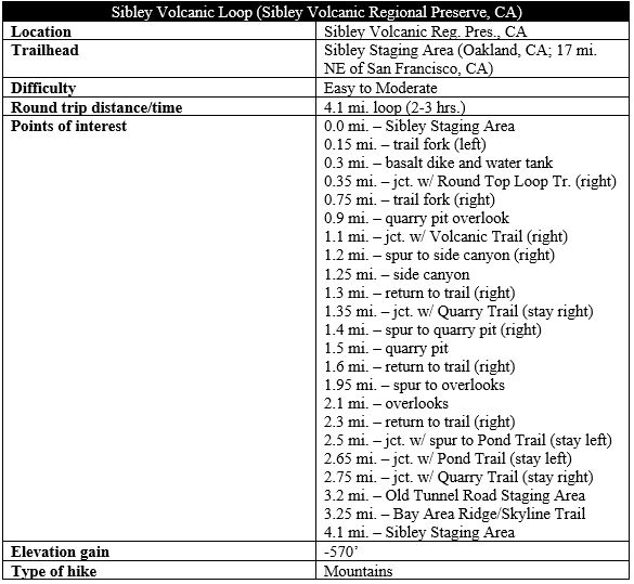
Named for the founding director of the East Bay Regional Park District, Sibley Preserve covers more than 900 acres in the Berkeley Hills and has become a popular destination for hikers, bicyclists, and dog-walkers. There are two primary staging areas: the main trailhead begins along Skyline Drive near the crest of the Oakland hillsides, while the second—Old Tunnel Road Staging Area—is situated off Fish Ranch Road in Orinda.
The hike featured here begins and ends at the former—labeled on maps as Sibley Staging Area—and forms a roughly four-mile loop, including several short spurs.
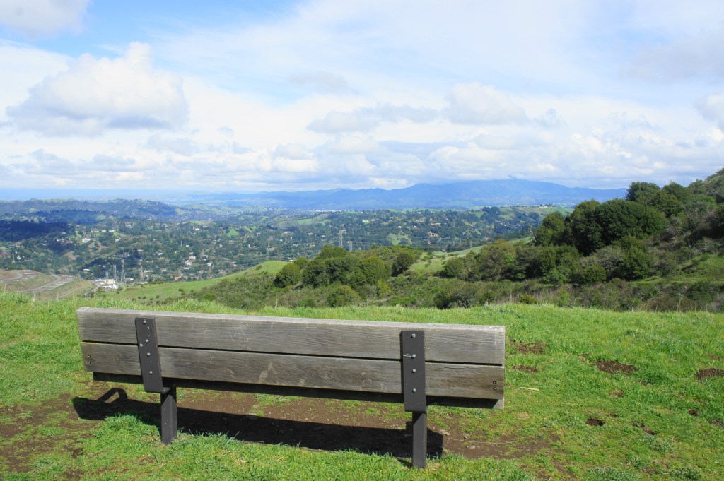
Begin by parking at Sibley Staging Area and checking out the many interpretive panels at the visitor center for a short lesson in the geological and natural history of the area. Also pick up a park brochure, which includes a map and description of 11 sites that form a self-guided tour. The loop hike hits each of these sites in turn, then drops into the Round Top Creek drainage before returning to the start.
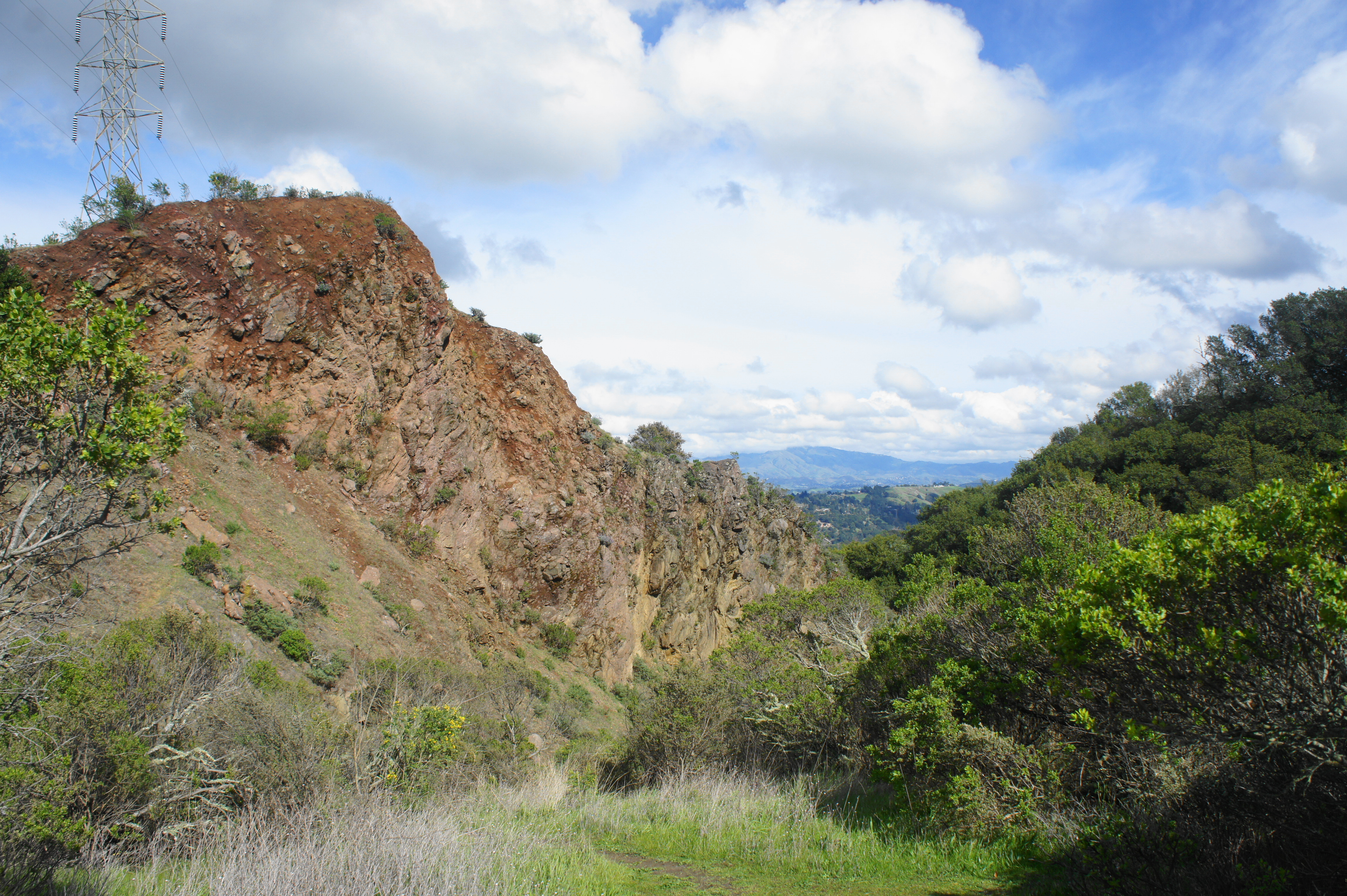
Begin by following the paved path—Round Top Road—leading eastward from the staging area (to the right of the visitor center). This is a very popular spot for casual dog walkers, but the crowds will gradually dissipate as one continues onward. After 250 yards, the road forks: bear left and then pull right, climbing a steep slope to the first of the 11 sites, a viewpoint and a dark basaltic dike, the latter hidden behind a massive EBMUD water tank. This dike, mixed in with grayish brown breccia, is a clear marker of Round Top’s (1,763’) volcanic past.
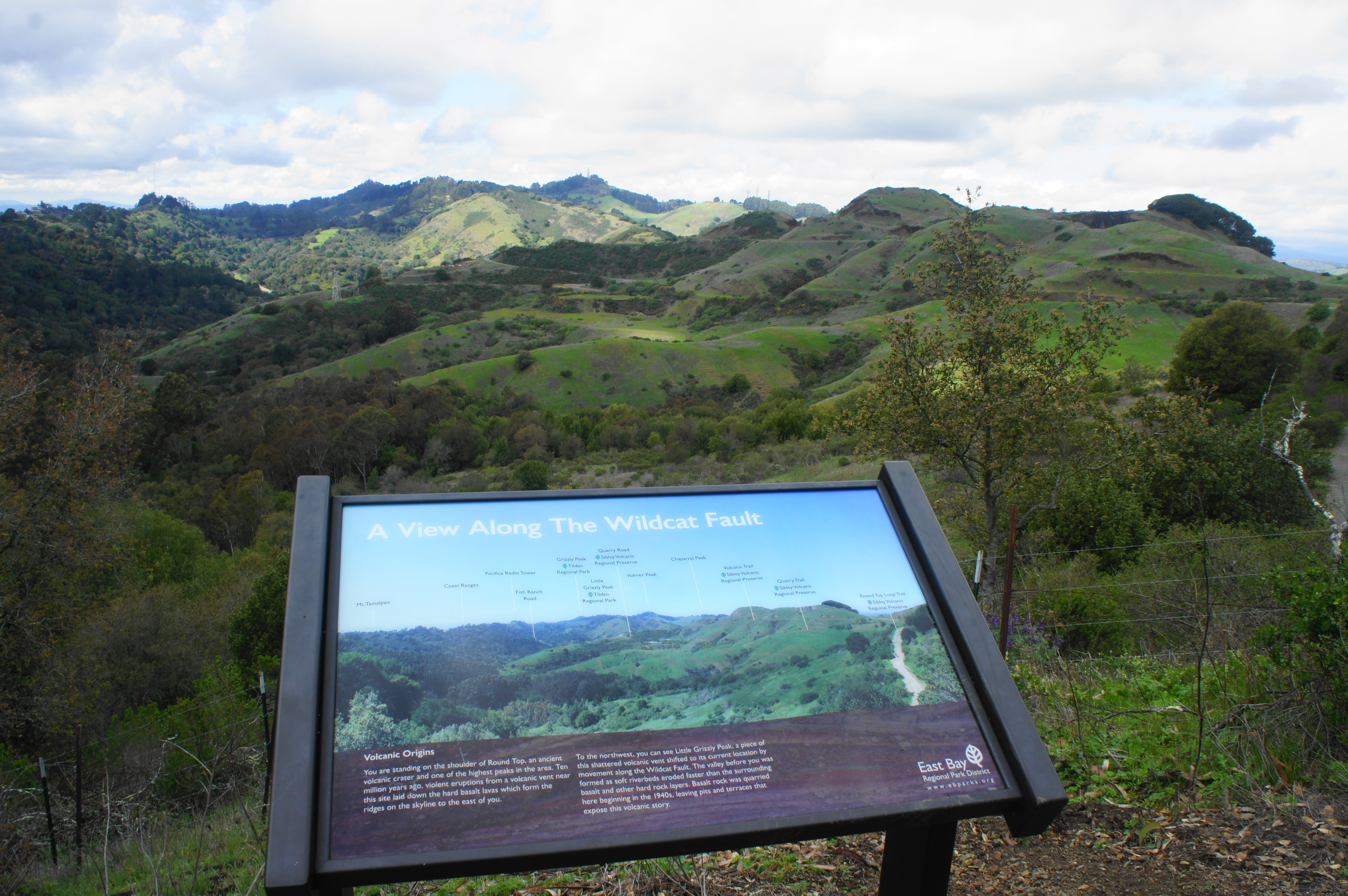
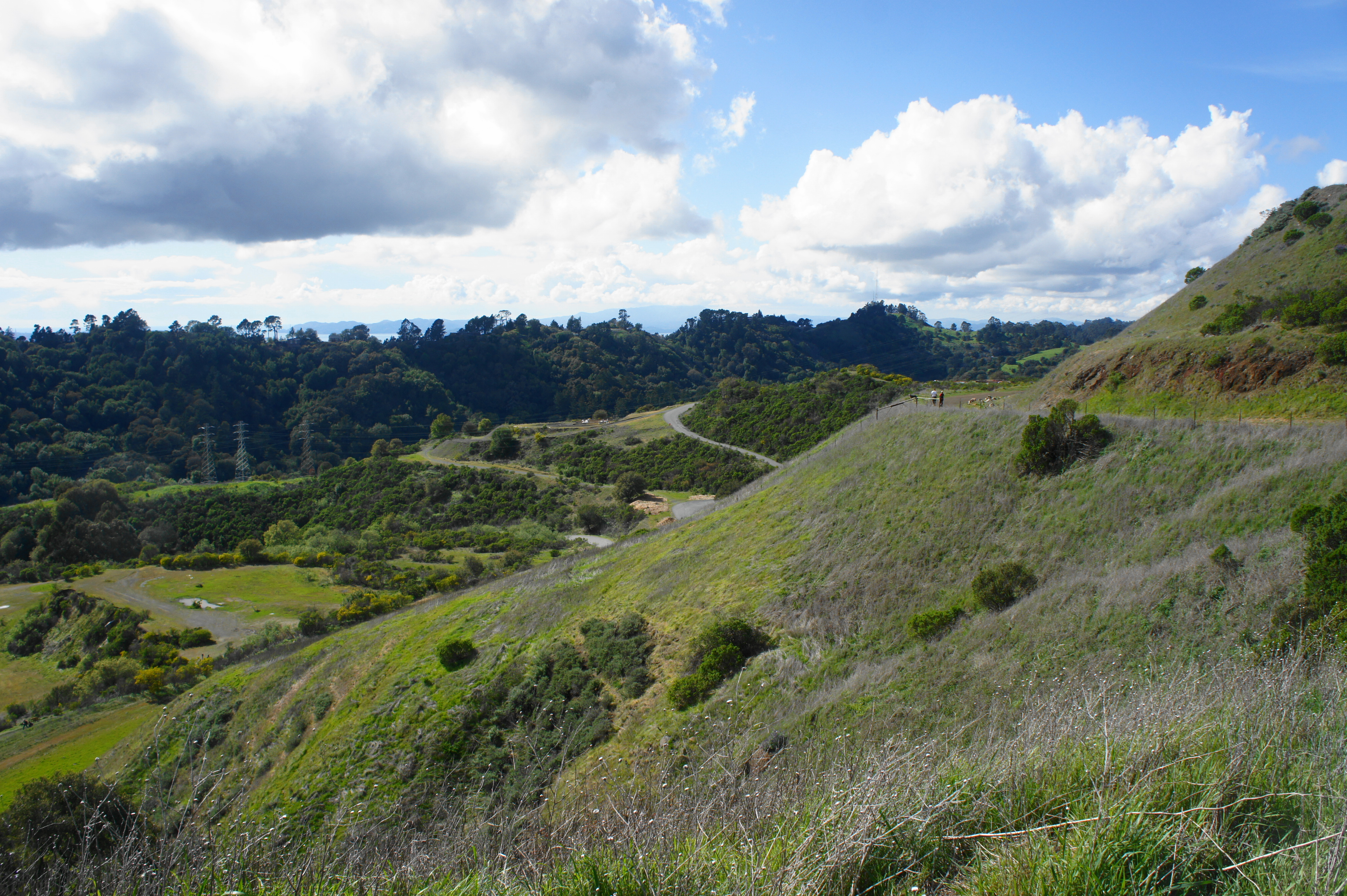
Better than the dike is the view from the water tank. An interpretive wayside points out the peaks of interest: Mount Tamalpais (2,456’) off to the west, and—on this side of the Bay—Grizzly Peak (1,759’) and Vollmer Peak (1,905’), the most prominent summits in nearby Tilden Regional Park. (Note: The high peak with the radio towers is Vollmer.) In the foreground, the Round Top Creek drainage unfolds below, with the volcanic ridges of Sibley off to the right.
From here, return back down the steep hill to the main road and this time bear right on the mulched, then graveled, Round Top Loop Trail. This wide track skirts the western flank of Round Top and climbs mildly through chaparral scrub to a north-south ridgeline. At ¾ mile, bear right at the junction, then follow the track for 200 yards to the second site: an overlook that peers down on a hillside quarry pit. From the 1940s onward, this area was heavily quarried, leaving a ridge that remains scarred and barren-looking today. At the overlook, there is a picnic table and a steep cliff; as is common in northern California, there is a man-made labyrinth in the hole of the former quarry. A window through the hills reveals distant views of Mount Diablo (3,848’) and Mulholland Ridge (1,157’).
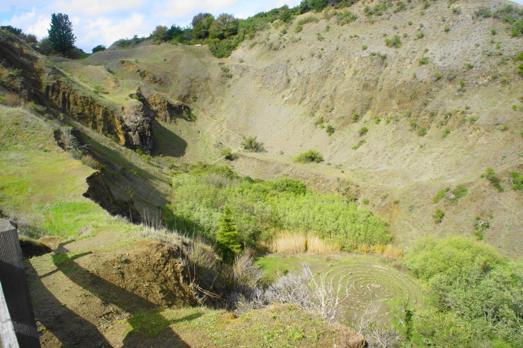
Quarry pit and labyrinth from above 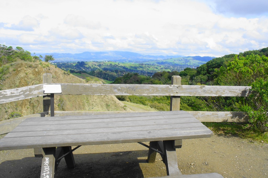
Picnic table at the overlook
Ambitious hikers can continue onward, down a steep slope to the foot of the quarry (and the labyrinth). But most will move on to the next site by retracing their steps back to the junction and continuing straight on the Volcanic Trail.
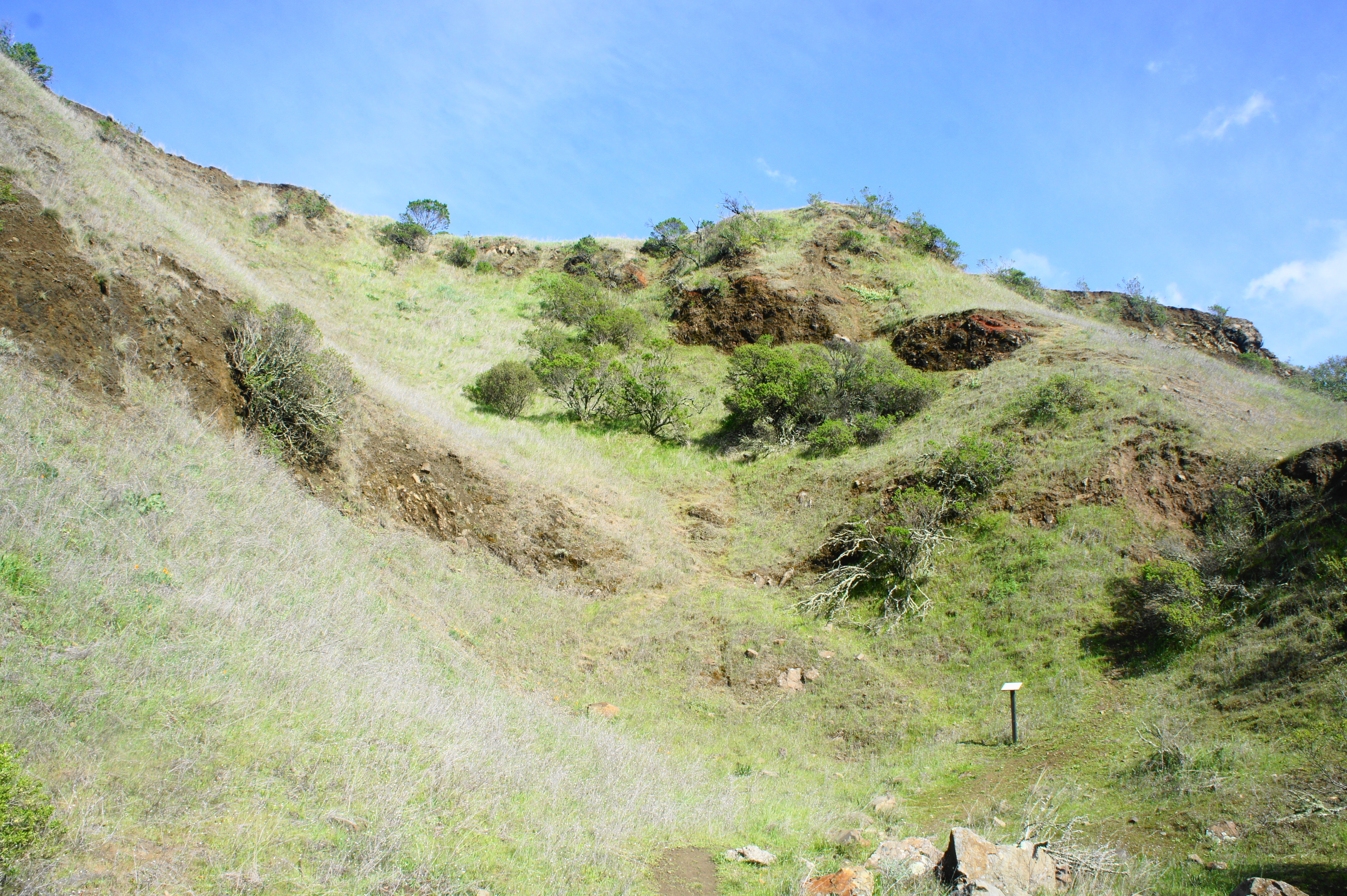
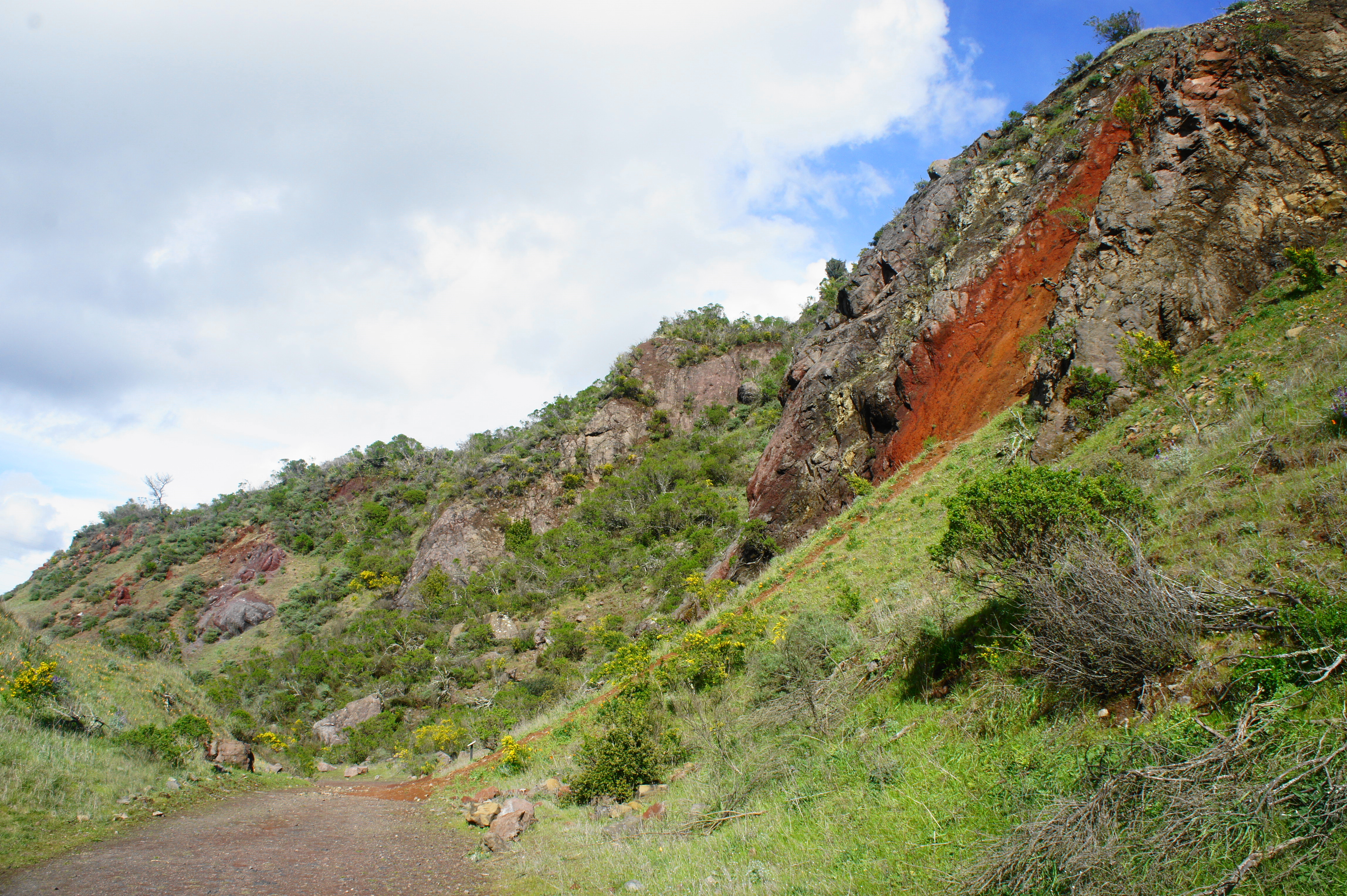
This scenic track follows the high, scruffy ridges of Sibley. Sign 3 on the right points out the exposure of the Orinda Formation, a bed of alluvial deposits laid in the Pliocene epoch. The rocks are splotched with pangs of red, signs of iron oxidation. At 1.15 miles, bear right to explore a minor side ravine, where (as sign 4 indicates) there is a wall of basalt and Orinda mudstones.
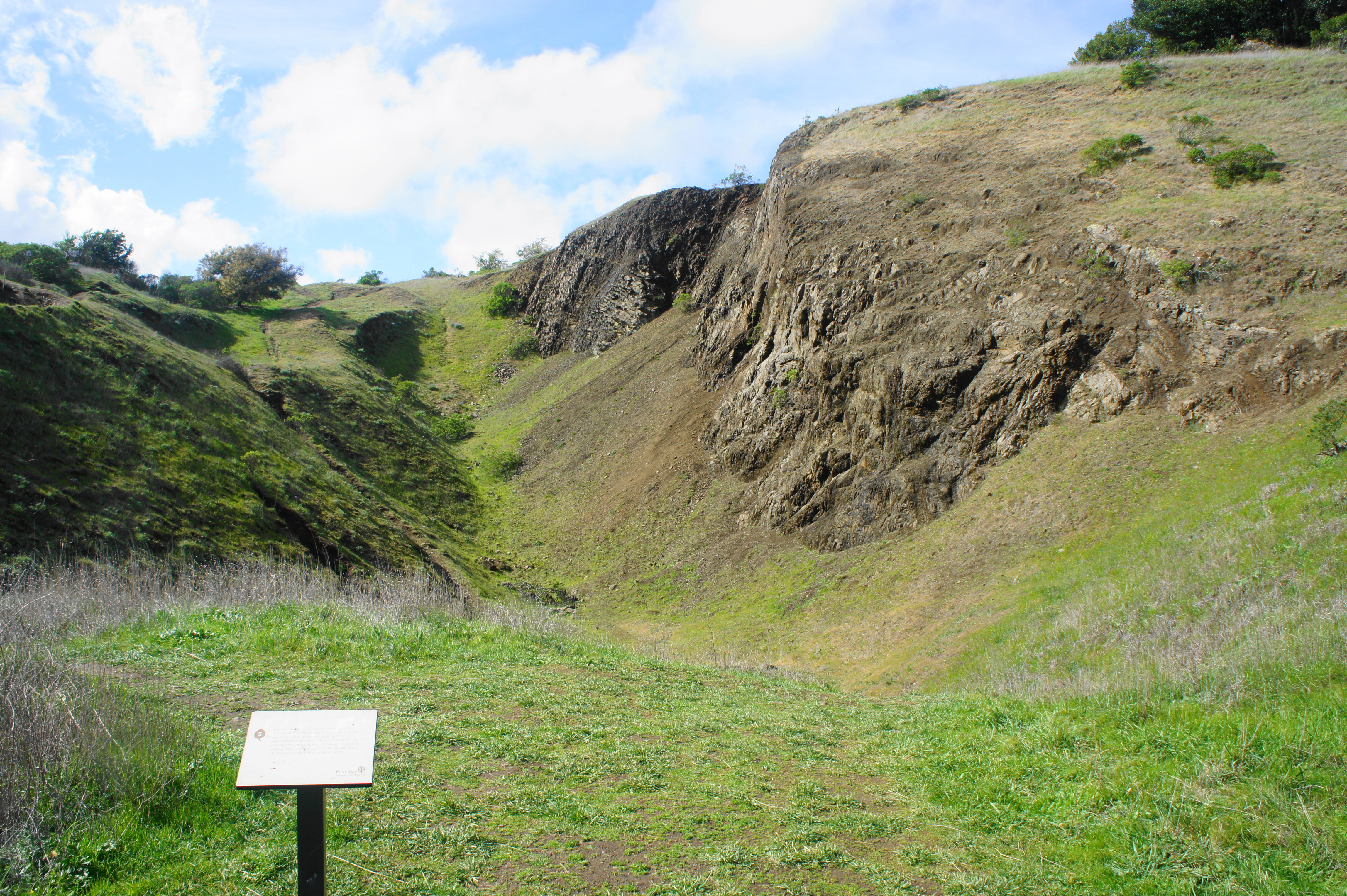
Back on the main trail, stay right at the junction with the Quarry Trail, then bear straight at the subsequent fork, following a short spur to sign 5 and another basalt quarry pit. Here the charcoal-colored rock almost forms neat vertical pillars, analogous to Devil’s Postpile in the Sierra Nevada. Return the way you came, then head right at the four-way junction.
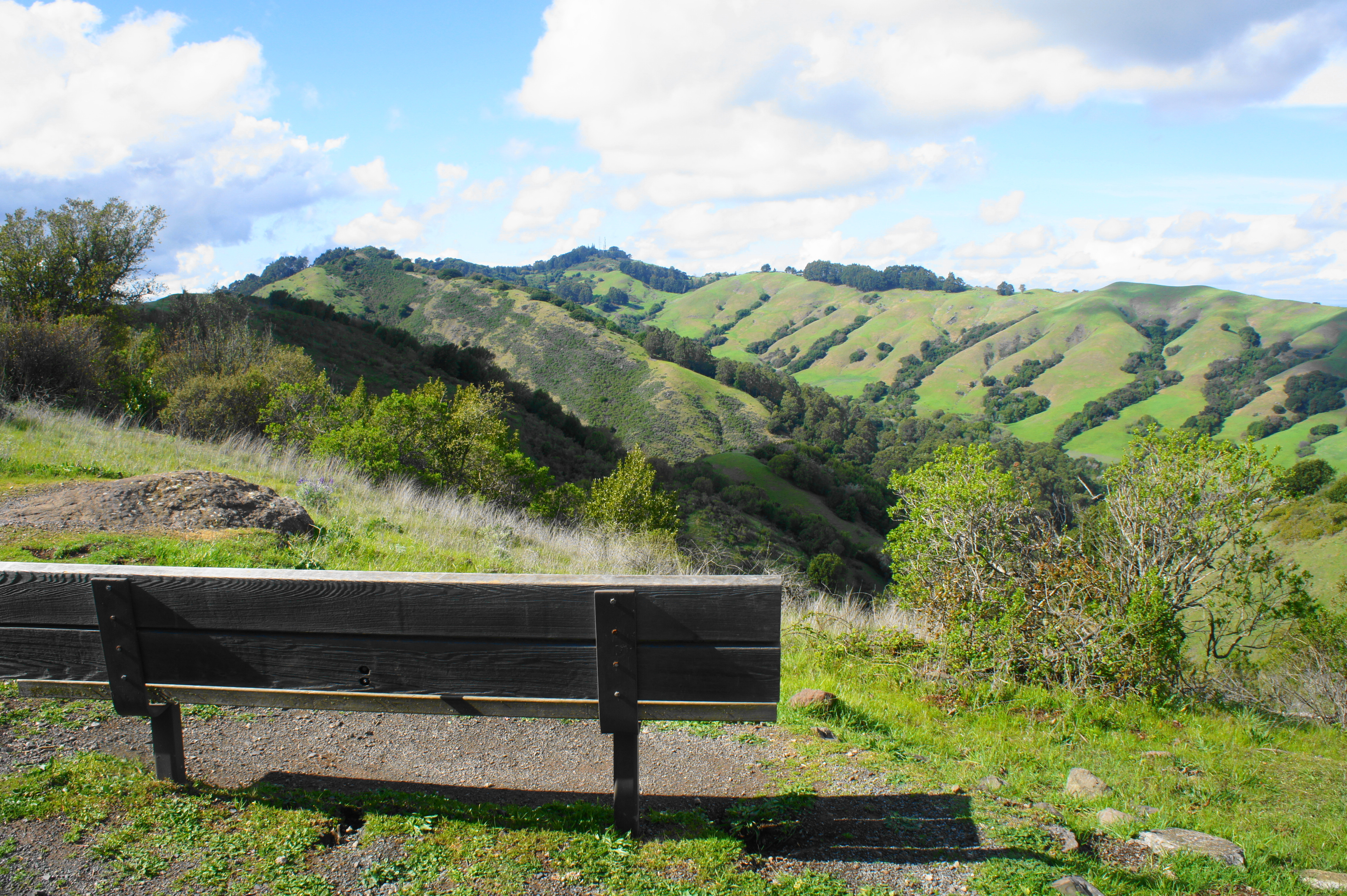
Bench view from the Volcanic Trail, looking east 
Looking back at Round Top
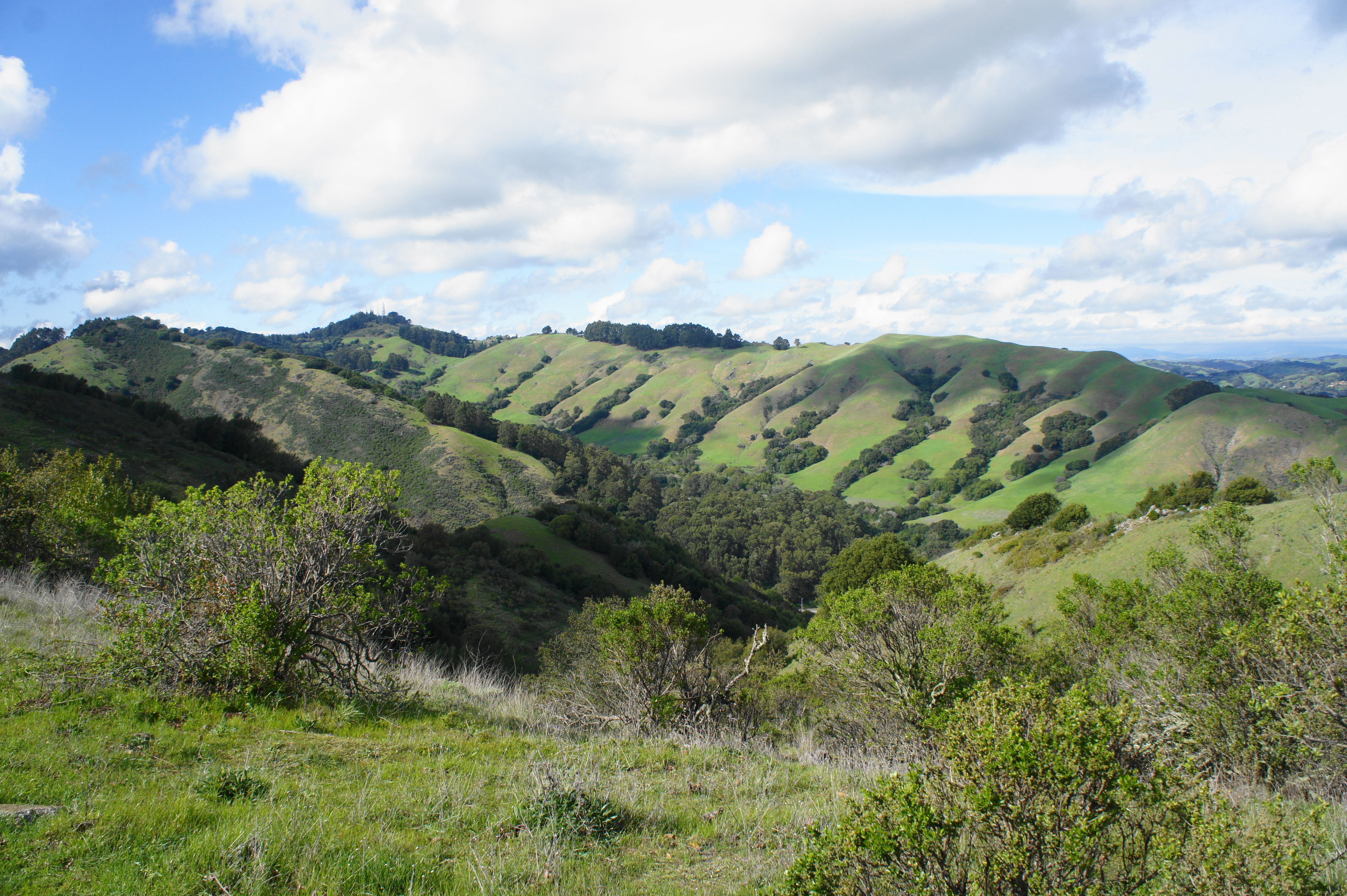
As the Volcanic Trail gradually climbs, the path offers excellent views of the densely vegetated drainage to the left, a stark contrast with the windswept and relatively sparse hillsides on the right. The trail passes signs 6 and 7 in quick succession—more on the basalt formations visible at the park. At 1.8 miles, the path passes through a gate and skirts a scenic amphitheater of reddish-brown rock with a single picnic table.

By now, on the left, one can see the paved Quarry Road below. Loop hikers will be there soon, but first one should take the final spur at 1.95 miles to a series of nice overlooks. The route to the overlooks passes through a narrow cut in the hillside, revealing high walls of basaltic breccia and eroded tuff.
The spur, which covers signs 8-11, ends with a split into two forks: heading left leads to a pair of overlooks to the west, peering across Highway 24 to Siesta Valley, Vollmer Peak, and Tilden Park. To the right, one can peer through a window eastward to Mount Diablo. Benches offer an opportunity to stop for a snack and contemplate the volcanic awesomeness of this place.
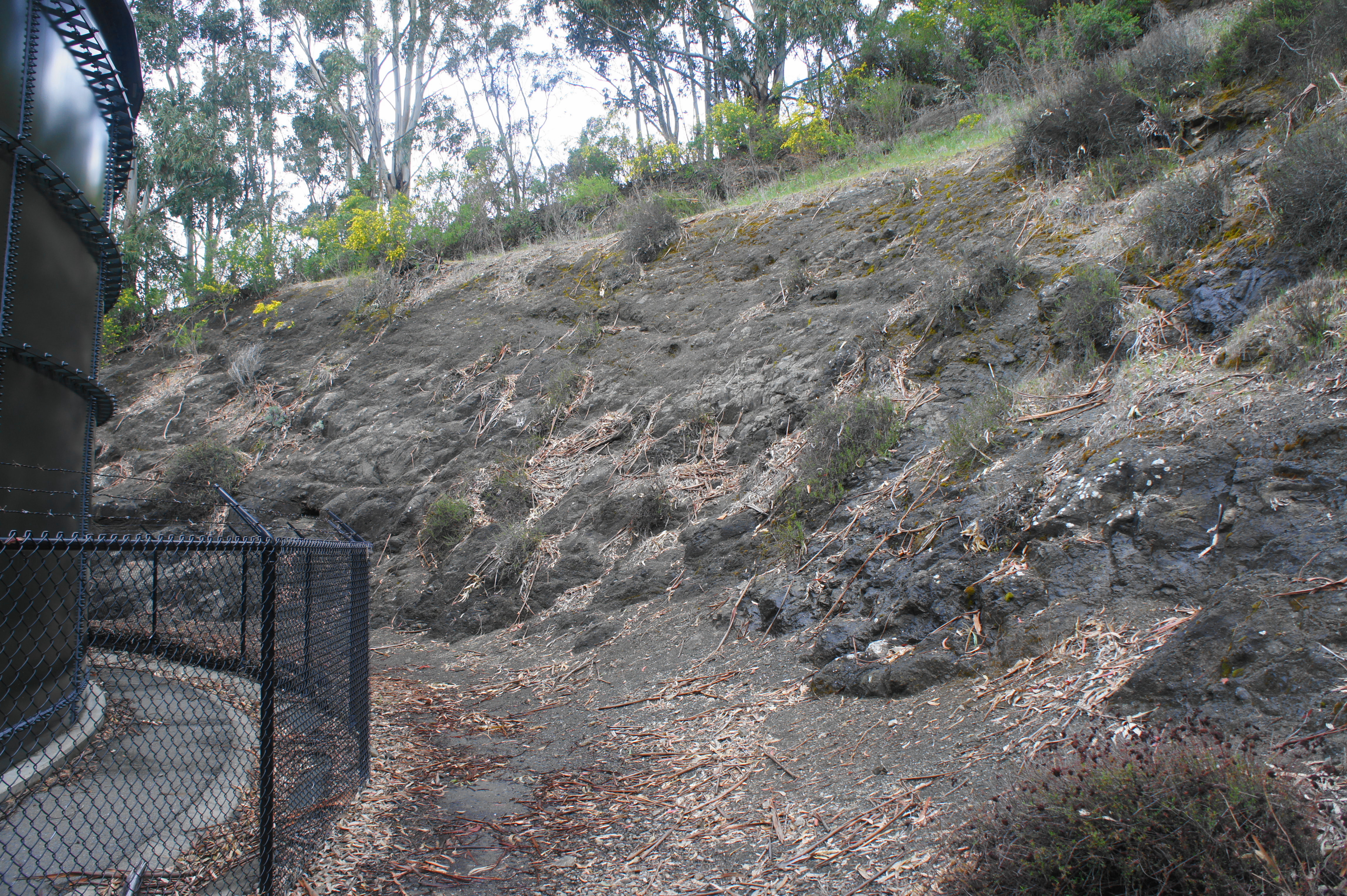
Finally, return back to the Volcanic Trail and bear right. The stops on the scenic tour are done, but technically the loop is only half complete. After following the Volcanic Trail to its end, hikers will spend about ¾ mile descending the wide and paved Quarry Road. (Note: At one point, a chunk of the road curiously vanishes, crumbling with the eroded hillside—it will be awhile until this is fixed.) Stay on the winding road as it passes another junction with the Quarry Trail then bends south and westward, reaching the Old Tunnel Road Staging Area at 3.25 miles. This small parking lot is enormously popular (again, dog-walkers).

Road issues… 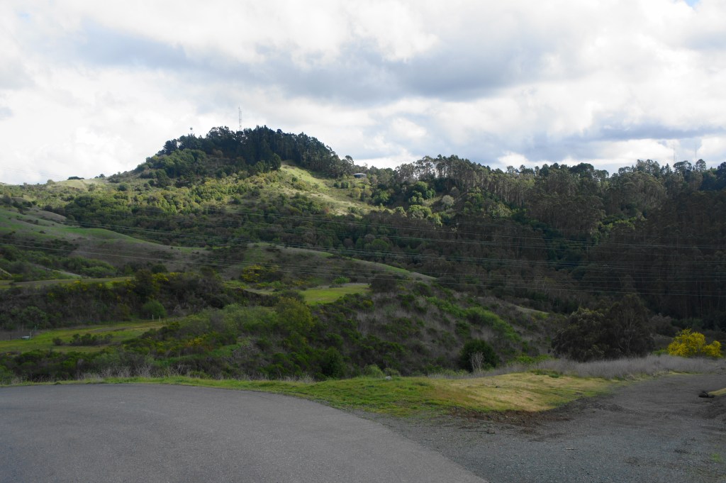
Looking back at Round Top from Quarry Road
Once clear of the parking lot, bear left on Old Tunnel Road and follow it across Round Top Creek to connect to the Skyline/Bay Area Ridge Trail. This woody single-track will be your thoroughfare for the rest of the hike.
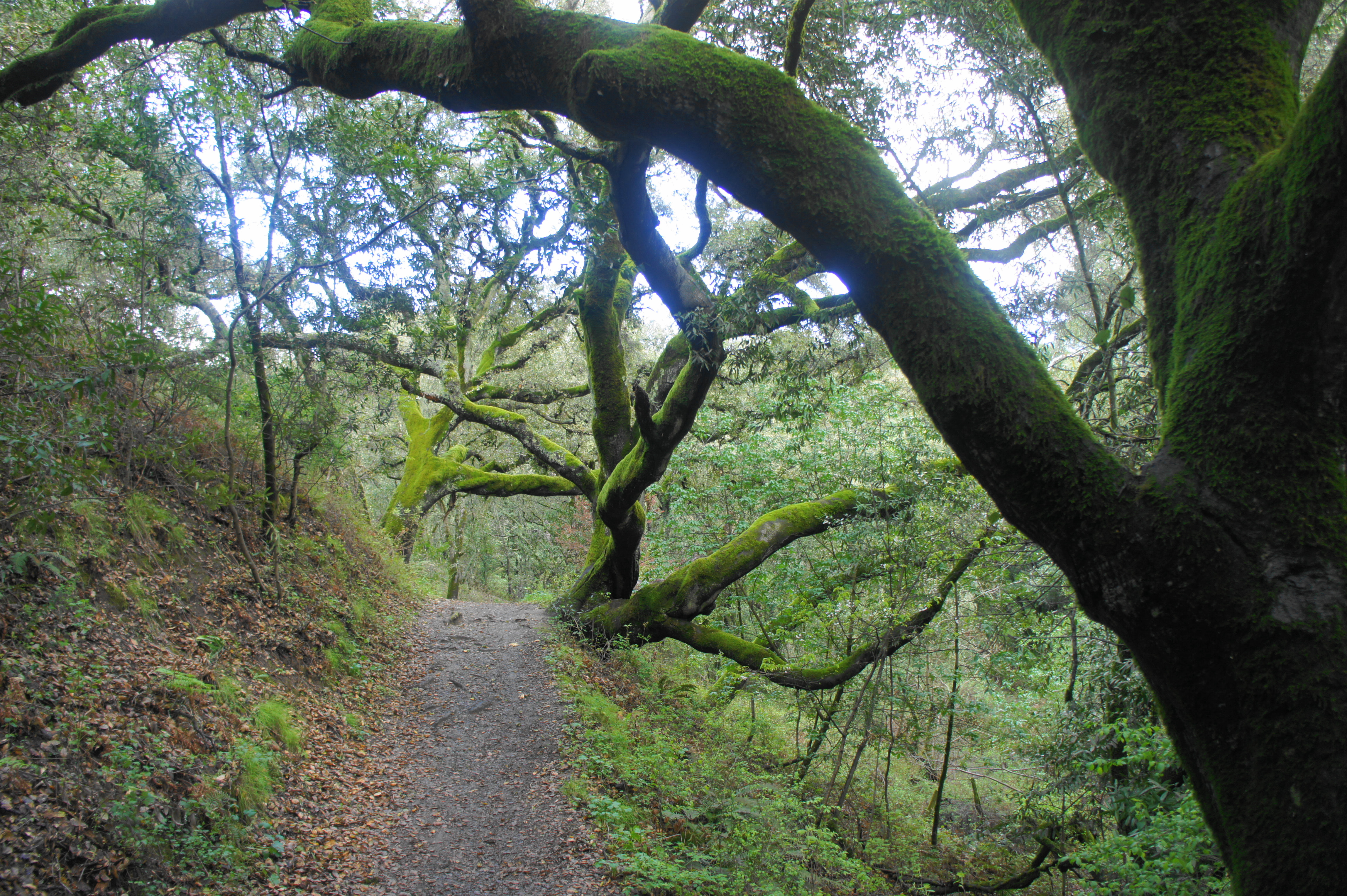
After roughly following the Round Top Creek drainage for 2/10 mile, the trail crosses the stream at 3.4 miles begins to gradually climb. Passing over a wooden bridge at 3.6 miles, the incline steepens, gaining more than 300 feet in the next half-mile. The ascent does not feel overwhelming, however, and it is entirely in the shade of the oak-bay woodlands. At 4.1 miles, the Skyline Trail reaches a familiar spot: Sibley Staging Area and the end of the loop hike.
All told, this 2- to 3-hour loop is mostly easy, save for the relatively steady ascent at the very end. It’s a must-see for geology lovers—if one can contend with the regulars who frequent the place with their canine friends…

Pingback: Top 10 Hikes in 2020 | Live and Let Hike