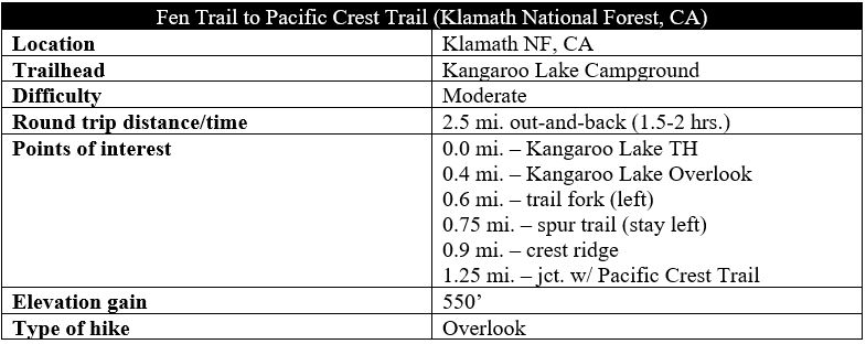
While Kangaroo Lake is a fairly popular spot in northern California’s Klamath National Forest, the trails that take off from this camping and fishing destination see far less traffic than the lake itself. The switchbacking Fen Trail provides access from Kangaroo Lake with the Pacific Crest Trail (PCT), but the 1.25-mile path is more than a mere connector trail: along the way, hikers enjoy excellent views across the various ranges of the Klamath Mountains, as well as a bird’s eye view of the lake and close encounters with Darlingtonia californica—the California pitcher plant—a carnivorous plant shaped like a cobra. Onward hikers can follow the PCT to nearby destinations, such as Scott Mountain, Cory Peak, and Bull Lake.
The hike
Kangaroo Lake is nestled amid the northern slopes of the Scott Mountains, a more than 20-mile stretch of the Klamaths that runs east-west through north-central California. Though remote, the lake is relatively easily accessible—one can take paved roads all the way (a stark contrast with the nearby Trinity Alps). About halfway along the Gazelle-Callahan Road, which connects Highway 3 with Old Highway 99, look for a signed turnoff to Kangaroo Lake Campground in Klamath National Forest. From here, the spur road winds seven miles up into the mountains, topping off at a large parking area with access to the shores of the lake.
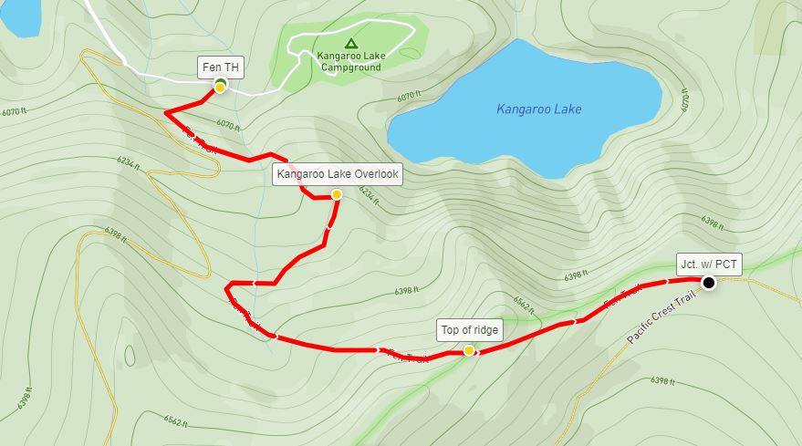
While the Kangaroo Lake Trail is partly paved and takes off right from the parking area, reaching the Fen Trail requires backtracking down the access road about 400-500 feet and crossing Rail Creek. (Note: There is also a gravel pull-off here that provides access specifically for the Fen Trail.) A prominent trail sign on the south side of the road signals the start of the Fen Trail (alternatively known as Kangaroo Fen Trail or Fen Nature Trail).
The short but steep trail begins to ascend from the start, albeit at a mild incline. Pines, firs, and hemlocks blanket the craggy slopes, and the trail quickly passes clear indicators that one has entered the trail’s namesake environment: grassy wetlands fed by mineral-rich stream water. Unlike bogs, characterized by the presence of standing water, fens tend to be located on slopes and are fed by flowing streams.
Minutes into the hike, the easily-discernable path crosses an old road bed, then bears left up a switchback, the first of many on the hike. An interpretive sign on the left direct hikers to look down the hill toward a sea of Darlingtonia californica, or California pitcher plants. These cobra-shaped bulbs are carnivorous, using smelly secretions and their bright-colored spots to attract and trap insects, which are later digested. This is the best spot on the trail to spot the pitcher plants, although they are scattered in patches elsewhere in the area.
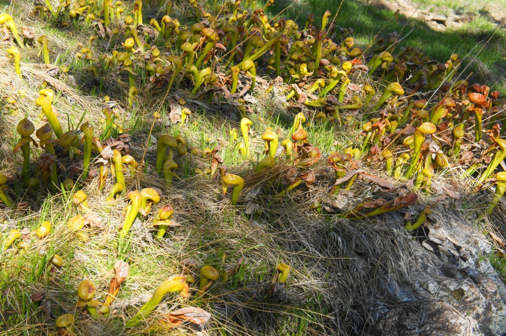
California pitcher plants 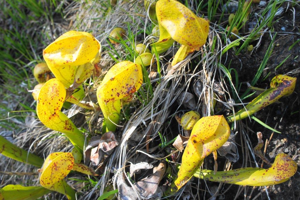
Up-close with the carnivorous Darlingtonia californica
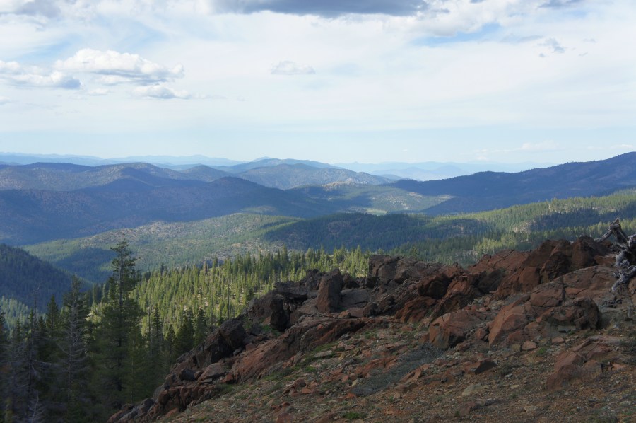
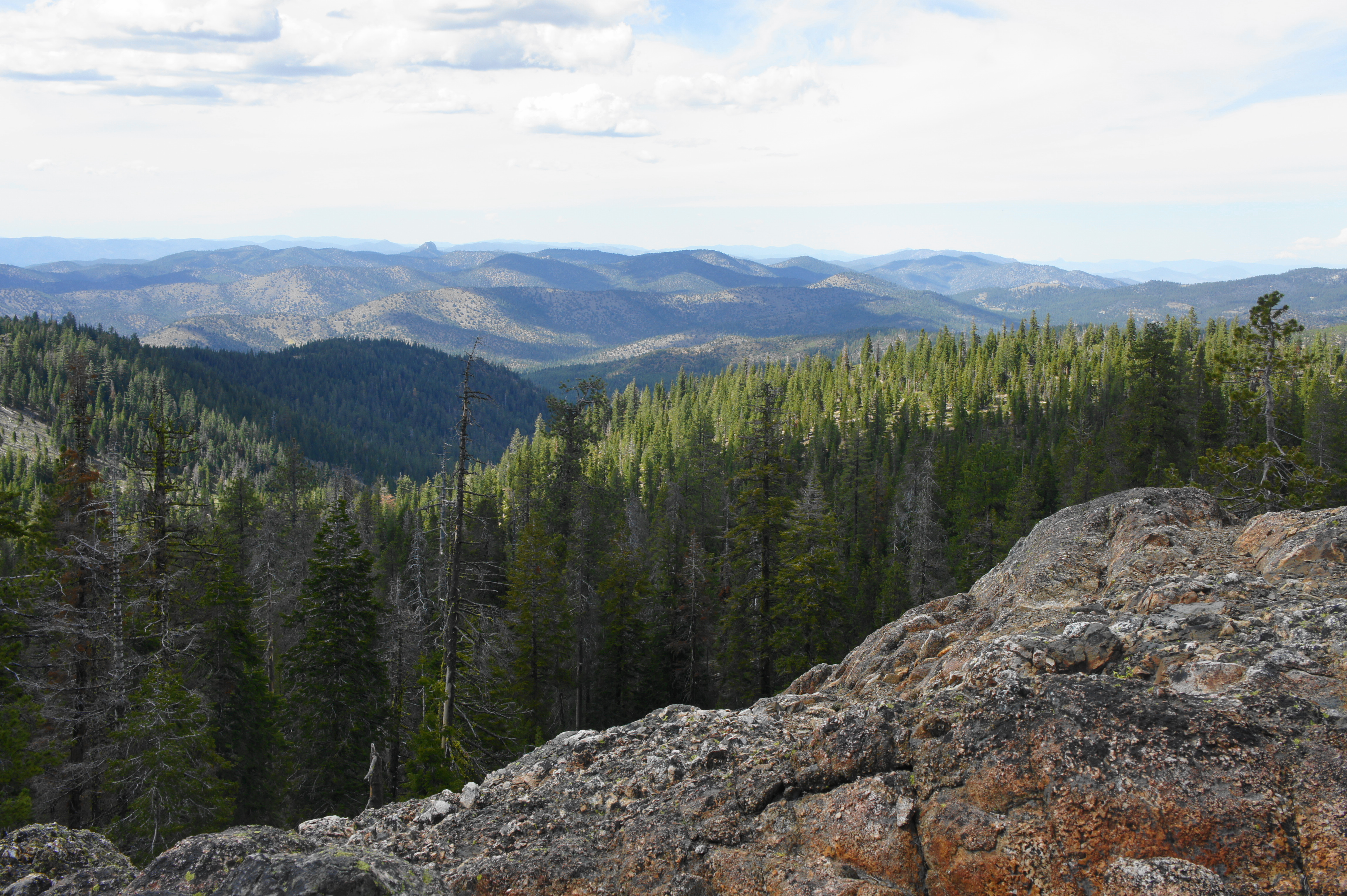
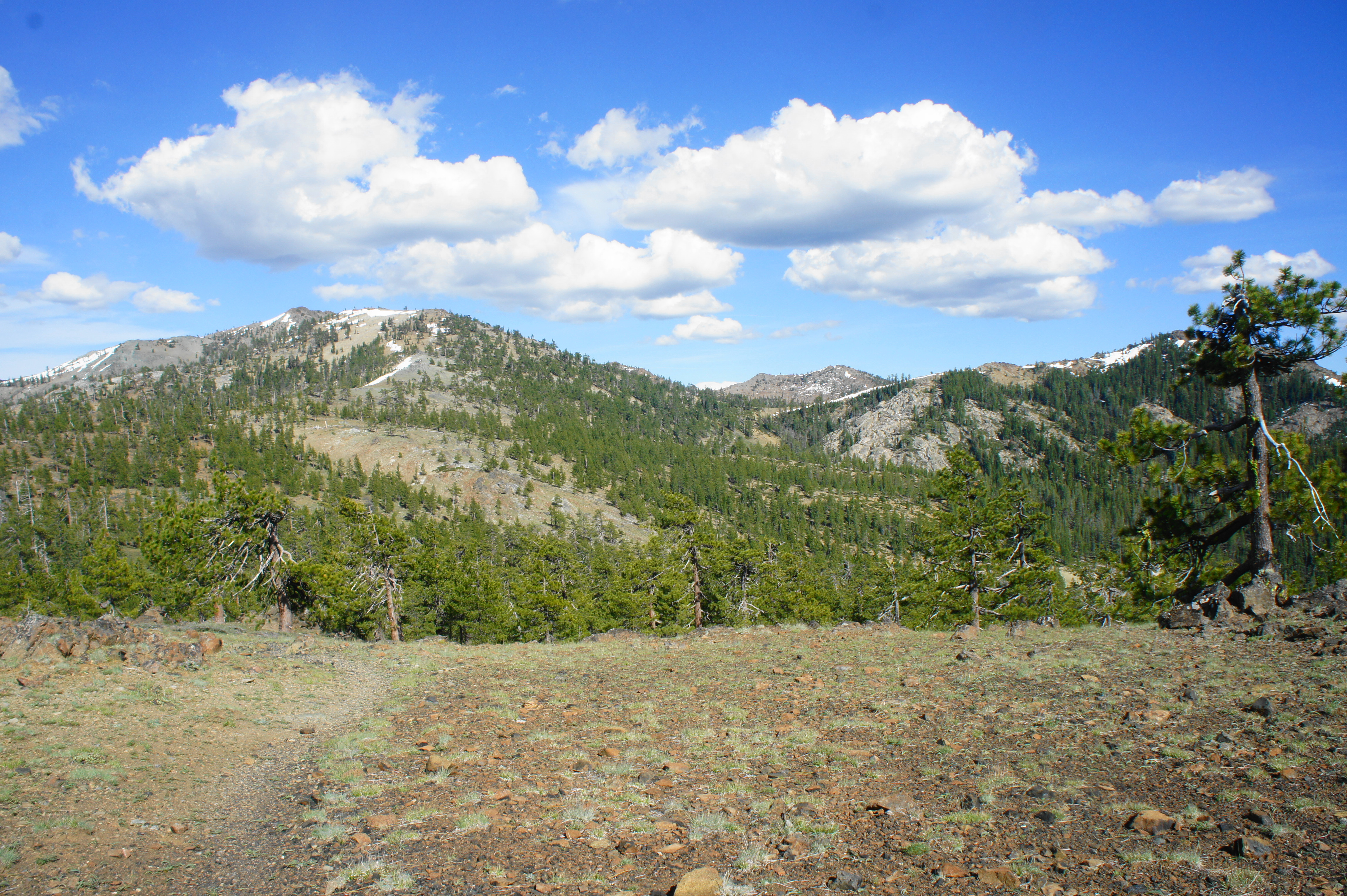
After rock-hopping across Rail Creek, hikers will reach an attractive rock outcrop on the left, offering the hike’s first unobstructed views of the surrounding landscape. To the north, one can see across the Little Scott Mountains and the Mineral Range to the Siskiyou Range, which crosses into Oregon. On clear days, one can spot Oregon’s Mount McLoughlin (9,493’), an impressive volcanic peak in the Cascade Range to the northeast. Off to the west are the Salmon Mountains, Marble Mountains, and Russian Wilderness, also sub-ranges of the Klamath Mountains. The highest peak in the foreground, off to the right, is nearby China Mountain (8,551’), the tallest of the Scott Mountains.
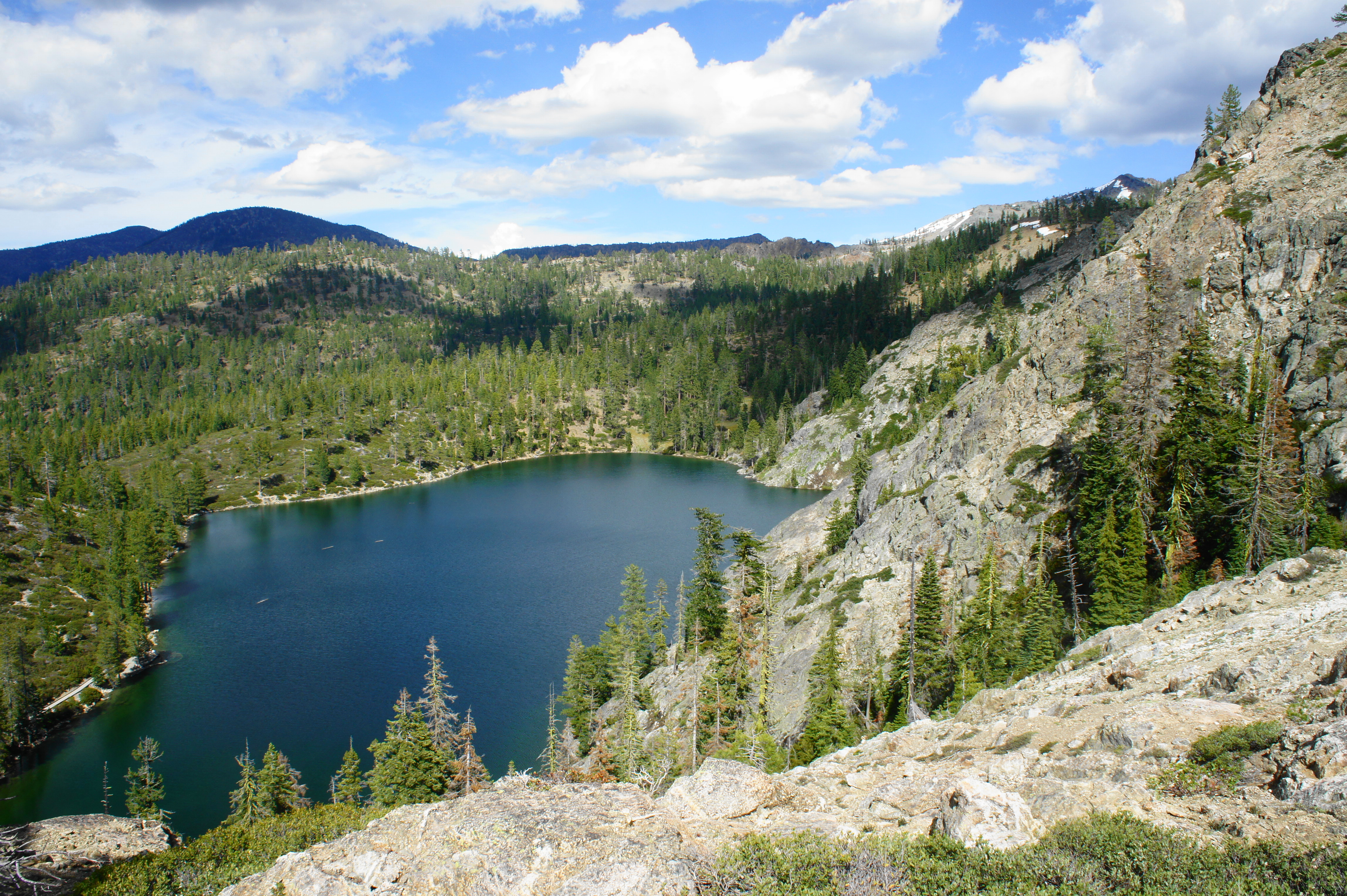
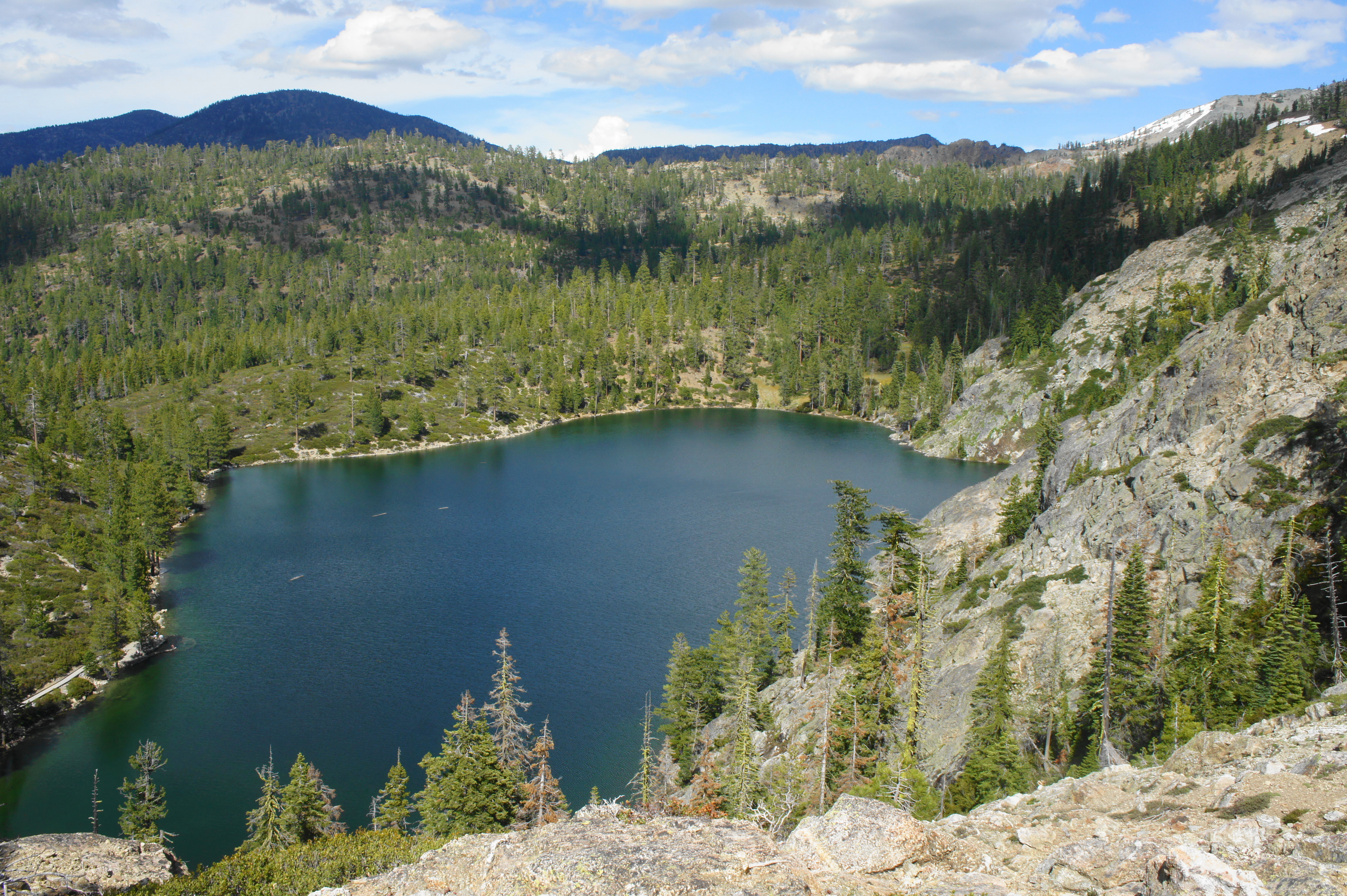
While it is tempting to stay at the outcrop, the views get even better as one continues up the Fen Trail. At 4/10 mile, a short detour to the left leads to the Kangaroo Lake Overlook, situated above 200 feet above its namesake waters. The lake sits in a glacial cirque, bounded to the east by towering Cory Peak (7,737’), which comes into view for the first time.
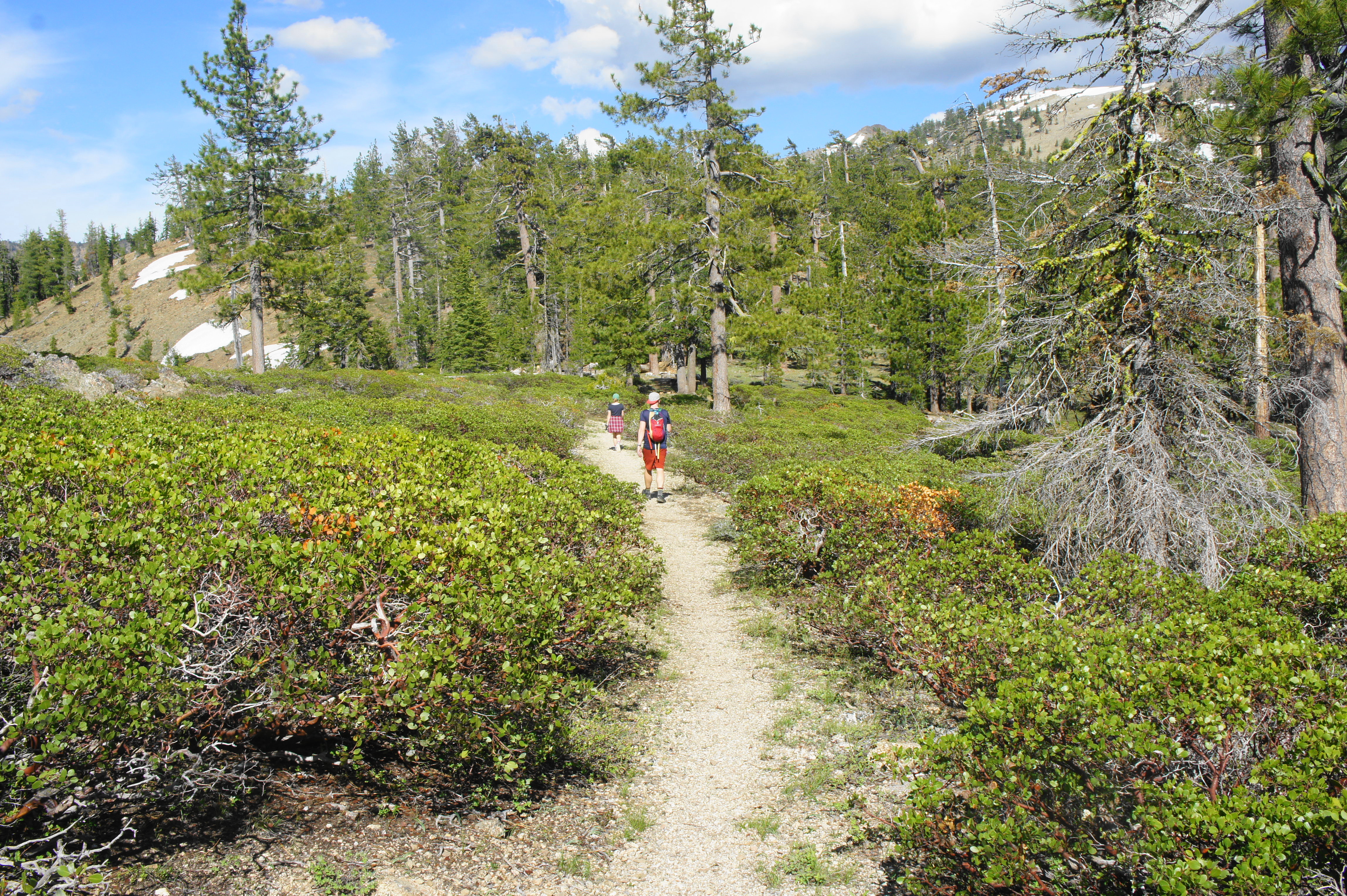
Beyond the viewpoint, the Fen Trail continues upward amid scrub of manzanita, mountain mahogany, and huckleberry oak and crosses Rail Creek again at about ½ mile. Stay left at the trail junction minutes later. (Note: Heading right leads to Forest Road 40N62 and Cooper Meadow.) Cross the stream a third time at 0.65 miles, then climb to a well-worn wooden trail sign (barely readable) on the left. A short spur trail heads right to an old-growth forest, featuring Shasta red fir, Jeffrey pine, mountain hemlock, and white fir. The main track continues straight, toward the reddish ridgeline ahead.

Climbing to the ridge is the steepest part of the hike and, in late spring or early summer, the slopes may have patches of snow. The views from the ultramafic ridge, however, are worth it. (Note: High concentrations of iron give the periodite rock here its reddish color.) In addition to sweeping northward vistas, views open up to Cory Peak and the Scott Mountains to the east. (Note: Heading down the trail on the other side of the ridge, one can eventually see southward to the Trinity Divide and Trinity Alps.)
Some may be content to turn around here, but hikers bound for the Pacific Crest Trail (PCT) can continue onward as the Fen Trail descends a rocky slope, then passes again through a conifer forest with manzanita undergrowth. It is about 1/3 mile from the top of the ridge down the junction with the PCT, the end of the Fen Trail. (Note: Beyond the ridge, hikers pass into Shasta-Trinity National Forest.)
Hikers can continue left for a nice day hike to Robbers Meadow, Bull Lake and/or Cory Peak. Otherwise, trekkers should turn around here, retracing your steps back to Kangaroo Lake. Allot about 1.5-2 hours for the 2.5-mile round-trip walk to the PCT and back.
