
The windswept shoreline of Lands End forms the northwest tip of the San Francisco Peninsula and is easily accessible from northern California’s iconic cultural capital. For those looking for a brief urban escape, the Land’s End section of the Coastal Trail offers a surprisingly rugged hike through cypress groves and along rocky cliffs, with excellent (weather-permitting) views of the Golden Gate Bridge. A short detour to Mile Rock Beach offers access to the ocean and the idiosyncratic “Labyrinth,” an artistic rock maze. Combine with a walk along the El Camino del Mar Trail to form a loop, or catch public transportation to take you anywhere in the city.

The hike
Many visitors to the Lands End section of the Golden Gate National Recreation Area begin their day at the Lands End Lookout Visitor Center, situated just up Point Lobos Avenue from the Cliff House in San Francisco. It’s a short walk west from the Visitor Center to the Sutro Baths, once a massive bathhouse built by millionaire Adolph Sutro in 1894. Decaying and declining in popularity, the baths were bought by real estate developers in 1964 who planned to construct high-rise apartments; perhaps fortuitously, however, a fire destroyed the site in 1966, persuading the developers to abandon the project and preserving the stellar views of the Pacific Ocean. Visitors can explore the ruins of the bathhouse today.
The Visitor Center and parking area are on the grounds of the short-lived Sutro Pleasure Grounds at Merrie Way, another of Adolph Sutro’s enterprises. The amusement park, which included a crude roller coaster and early version of a Ferris wheel, lasted only four years, closing its doors in 1900 following Sutro’s death. Today, there are no traces left of the Sutro Pleasure Grounds.
What has remained is the natural beauty of Lands End, and the 1.4-mile Coastal Trail section from Lands End Lookout to Eagle’s Point covers the best of it. From the Visitor Center parking area, the Coastal Trail bears north through shrubby chaparral to the edge of the cypress forest. The trail begins as a paved, wheelchair-accessible track; stay right at the first trail junction, where a dirt track bears off to the left toward Sutro Baths. Seconds later, stay left on a wide dirt path that cuts off a paved switchback. Here another paved path merges from the right; stay left again, continuing north.

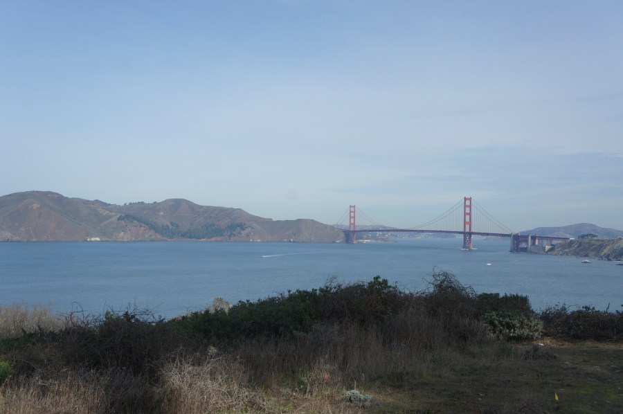
Passing under a cypress canopy, the Coastal Trail winds eastward to the Coastal Trail Overlook, first of several viewpoints of the Golden Gate Bridge. The iconic structure, constructed in 1937, connects San Francisco to the hilly Marin Peninsula and serves as the divider between San Francisco Bay to the east and the Pacific Ocean to the west. On a clear day, one can see as far west as Point Reyes and the Farallon Islands. (Note: The staircase that comes in from the right offers access to the USS San Francisco Memorial, which commemorates the 106 Americans killed in the WWII Battle of Guadalcanal.)
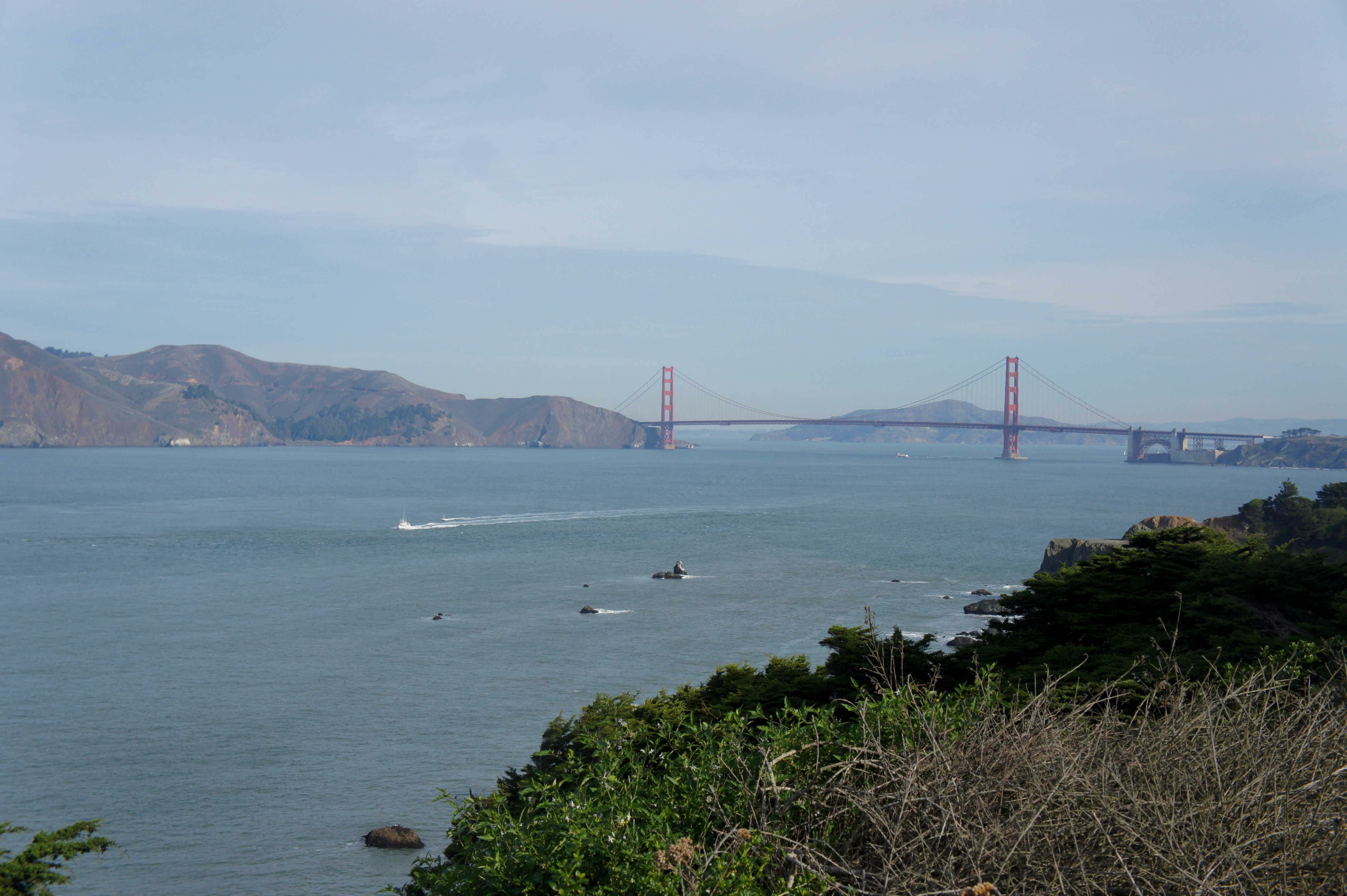
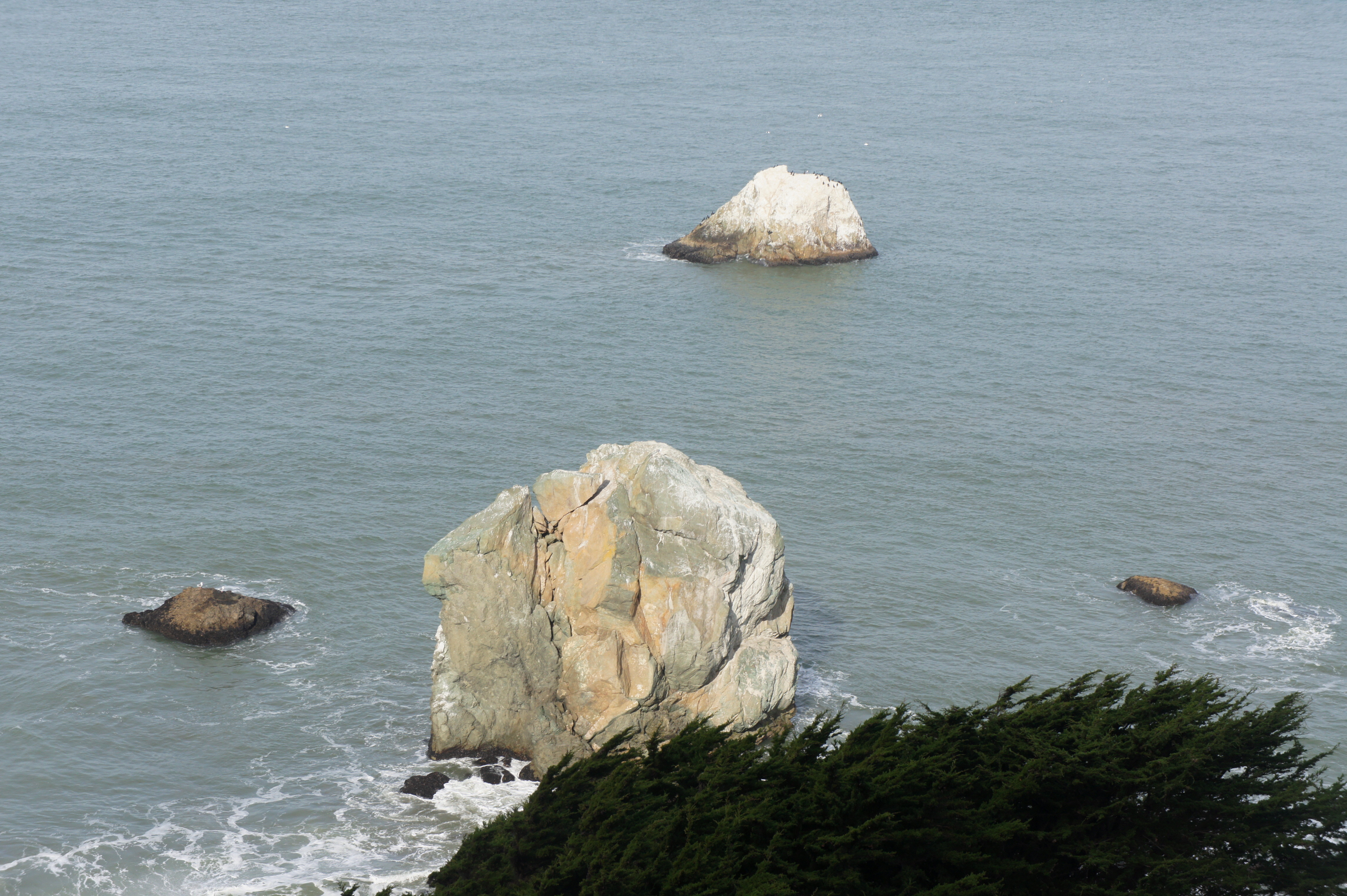
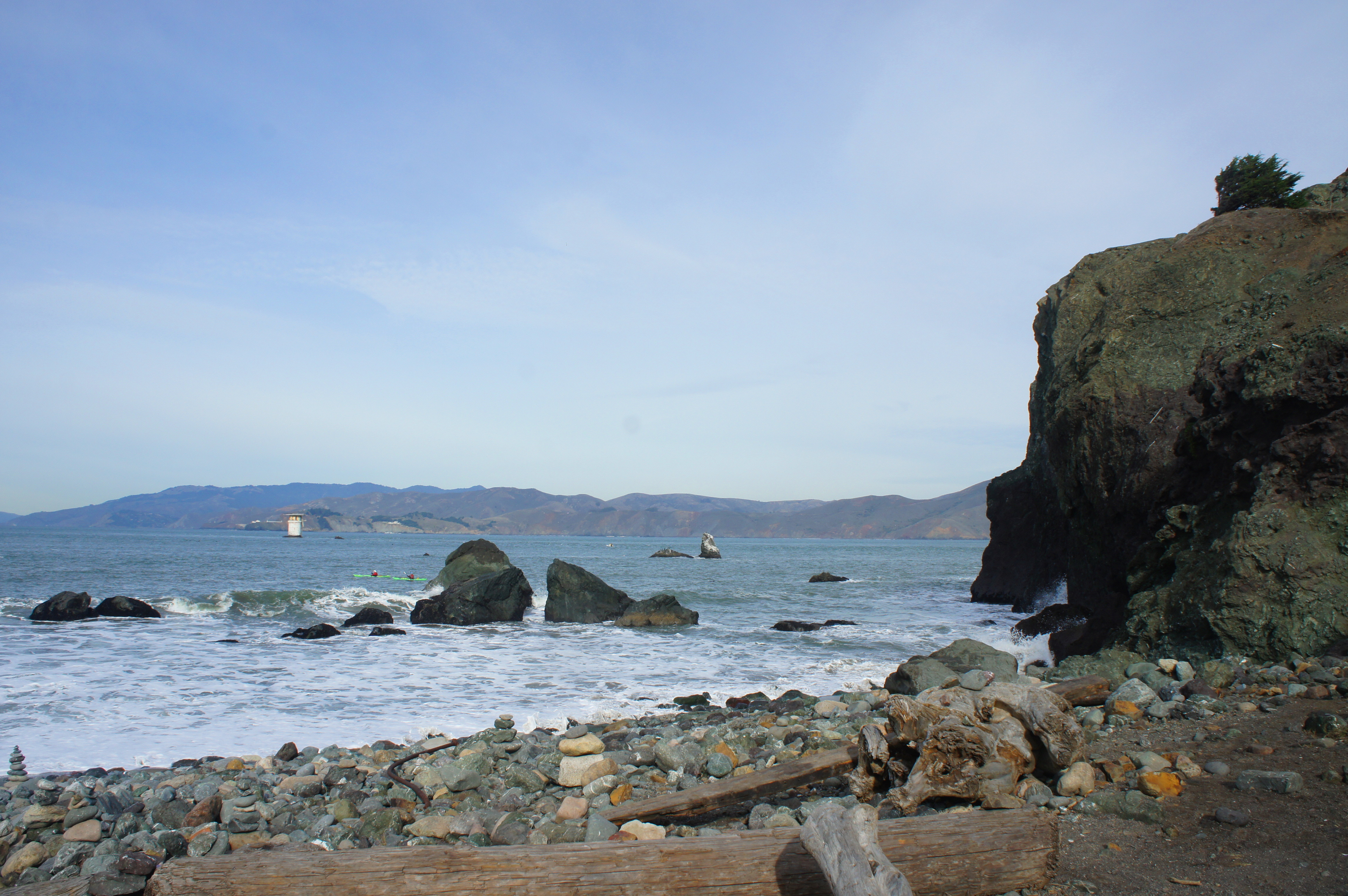
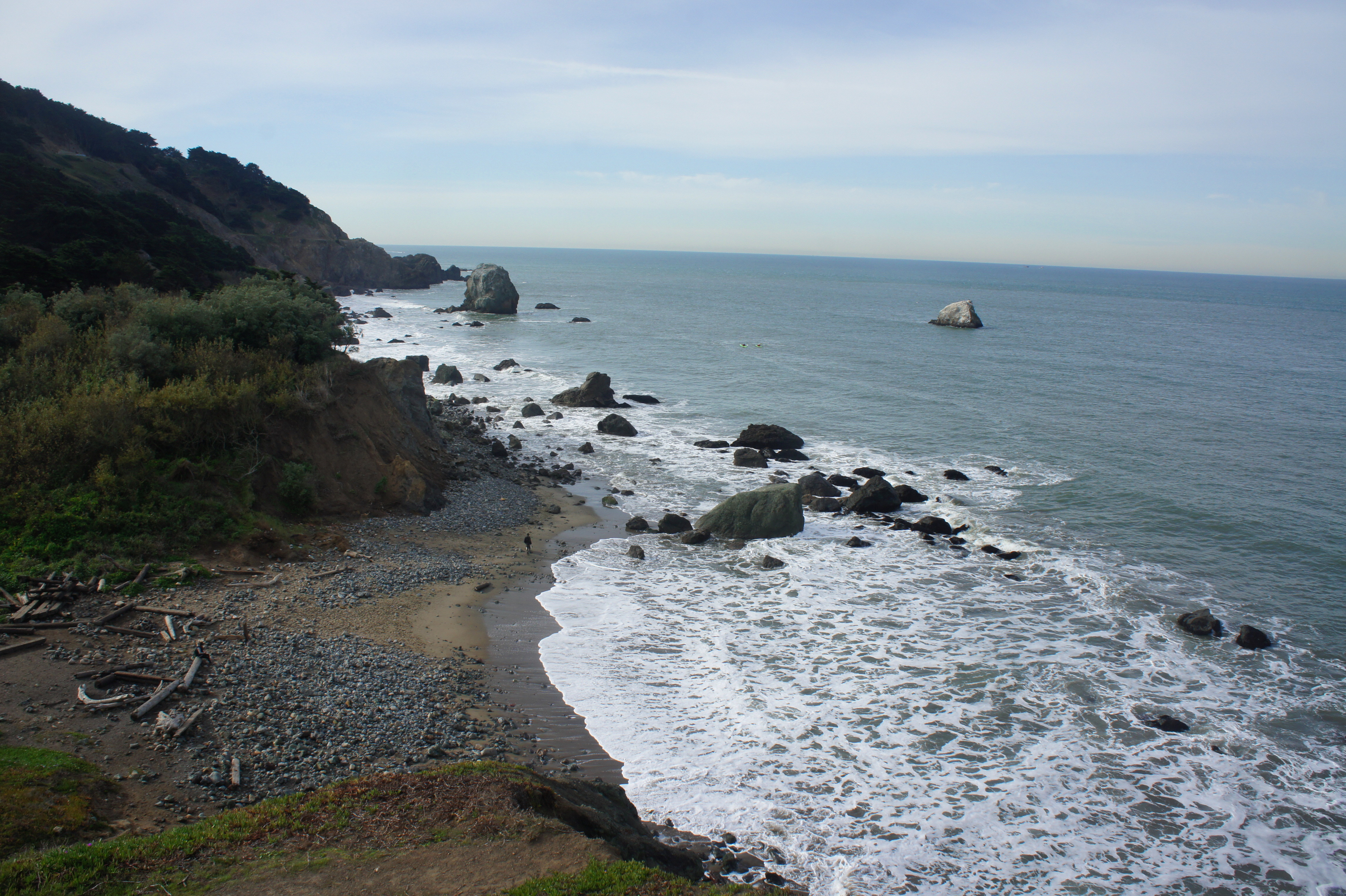
Continuing east along the wide and hard-packed path, visitors will reach Mile Rock Overlook at about the 1/3-mile mark. Here the vistas are even broader and more spectacular than before. The large outcrop just off the coast looks suspiciously like a sleeping man, while the smaller Lobos Rock—further out to sea—is sure to be covered with sea-loving birds. Off to the northeast, the small peninsula sticking out into the ocean hosts the Labyrinth (and will be visited later in the journey).
From Mile Rock Overlook the trail narrows and reenters the forest, dominated by willow and cypress trees. At about ½ mile, an unmarked trail heads up the hillside to the right; stay left along the cliff’s edge. Just beyond, the trail dips suddenly into a brushy ravine and forks at a signed junction. Stay left again, then climb out of the ravine and back into the shady woods.
At about the 2/3-mile mark, the Coastal Trail splits. Most will want to bear left, hewing closer to the coast. Steps later, bear left on the Mile Rock Lookout Trail, a short but steep detour that drops about 175 feet to the sea. The ubiquitous stairs end at Mile Rock Beach, a small but peaceful shore at the foot of the Lands End Cliffs.

From the beach, hike a short loop by bearing left on the trail winding northeast to the Labyrinth, a small rock maze originally constructed by artist Eduardo Aguilera in 2004. A popular destination for meditation, the maze mimics the design of the 13th century Chartres labyrinth in France. It also boasts yet another great view of the Golden Gate Bridge.

From the Labyrinth, climb the winding trail as it hugs the cliffside then returns to the main Mile Rock Lookout Trail. From here it is roughly 70 yards back up to the Coastal Trail, marking the end of the 1/3-mile detour.
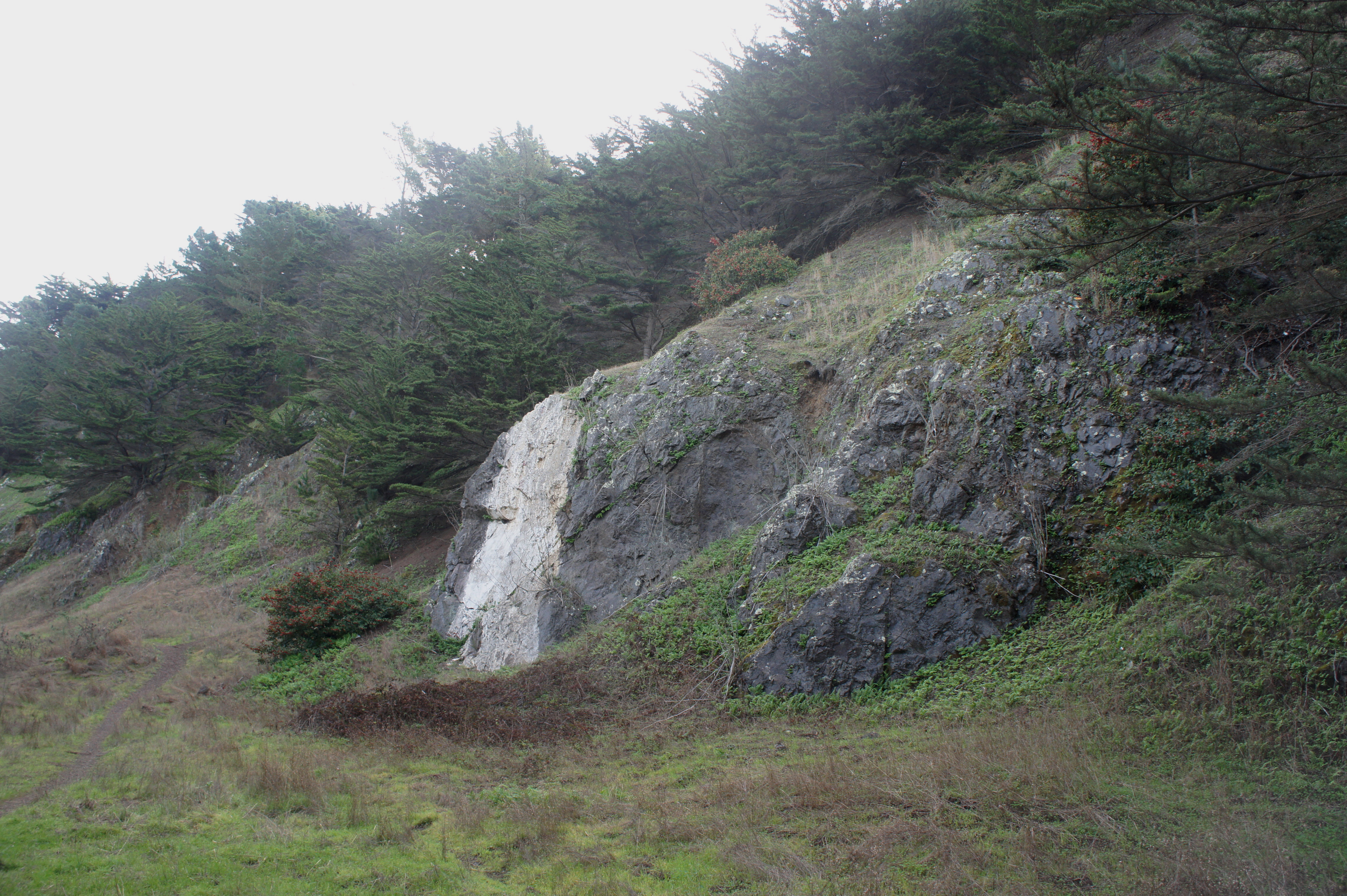
As the Coastal Trail continues east, it passes the chalky-hued Painted Rock, which was once used by passing sailors as a navigational aide. At about 1.2 miles, the path begins to climb sharply up a set of stairs, coming within earshot of the Lincoln Park Golf Course to the south. (Note: The trail heading left at the foot of the climb is off-limits because of risk of rock slides.) The trail crests a ridge at 1.25 miles, then drops down a winding path with open views of the Golden Gate Bridge and Presidio area to the northeast.

After clearing a grassy ravine, the Coastal Trail levels out and hugs the coastline for 4/10 miles before approaching Eagle’s Point Overlook, a windswept viewpoint overlooking the Golden Gate waters and headlands. This is a crowded spot, by virtue of its relative proximity to a parking area, situated around 50 yards past the overlook.

The Eagle’s Point parking area marks the end of this one-way hike. Soak in the views, then return the way you came, link up with the El Camino del Mar Trail heading west, or continue on the Coastal Trail as it hugs the roadside heading east toward China Beach and the Presidio. Allot 1-2 hours for the one-way hike, including the detour to Mile Rock Beach and the Labyrinth.

Pingback: Top 10 Hikes in 2017 | Live and Let Hike
We’ll have to take the whole thing next time…we missed that twisty tree over the trail
1
Pingback: Sibley Volcanic Loop (Sibley Volcanic Regional Preserve, CA) | Live and Let Hike