
Spanning 6,859 acres of the northern Diablo Range, Sunol Regional Wilderness is a hiker’s paradise close to home in the East Bay, wedged between the massif of Mission Peak (2,517’) to the west and Ohlone Wilderness and Rose Peak (3,817’) to the east. This terrific loop hike rises to tremendous heights above Sunol Valley, visiting the highest point in the park (2,210’) before descending Cerro Este to the depths of Jacob’s Valley and the thrilling cascades of the so-called “Little Yosemite” area. Best done in winter or springtime when Alameda Creek is flowing and the hillsides are brilliantly verdant, this 7.6-mile circuit is a demanding, sort of Ohlone Wilderness Trail-in-miniature and one of the finest half-day hikes in the East Bay.


The hike
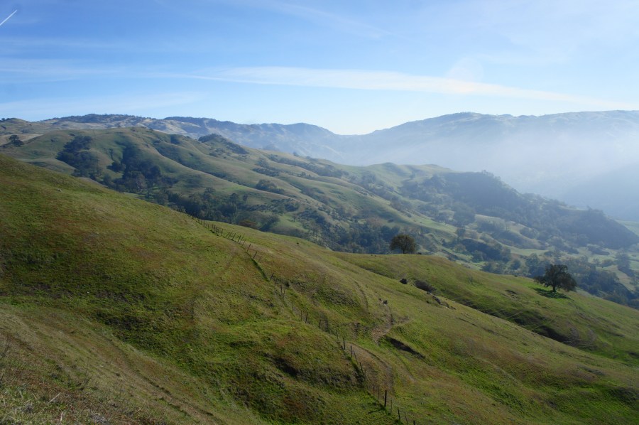
The mainstay of Sunol Regional Wilderness is Sunol Valley, which cuts north-south through this scenic section of the Diablo Range, south of Pleasanton, California. Here visitors can enter the park via Geary Road, which parallels the Calaveras Road thoroughfare before culminating at a large, one-way loop with several parking areas. Park near the Visitor Center to start the hike. (Note: If spots are unavailable at the Visitor Center, there are plenty of overflow lots further south along the road.) From the parking area just south of the lawn at the Visitor Center, take the wide trail, and cross the footbridge to the east side of Alameda Creek, the main carving agent of this deep valley. Passing a pretty collection of oaks, bear right on the Canyon View Trail, then stay right again at the junction with the Hayfield Trail. The 3-foot-wide track parallels the creek for another 300 yards, reaching a junction with the Indian Joe Creek Trail after about a quarter-mile of walking.
Bear left on the Indian Joe Creek Trail, a peaceful and mostly-shaded route that serves as the access trail for the climb to Cerro Este. Follow the narrow track for about a quarter-mile, then cross the Indian Joe Creek drainage and bear left at the junction. Pass through a cattle gate, then follow the trail as it crisscrosses the streambed six times (including three in quick succession).


After the sixth crossing, the Indian Joe Creek Trail leaves behind its namesake and climbs sharply and steadily up a woody hillslope between two drainages. The imposing ridgetop of Cerro Este peeks through the trees above, still a good distance from here. After returning streamside and passing a junction at 1.3 miles, climb for another minute or two to reach Cave Rocks, a massive jumble of basalt boulders, perched on a slope overlooking Sunol Valley, with Mission Ridge visible beyond. A short spur trail leads to the rocks, which can be explored but requires some careful scrambling.

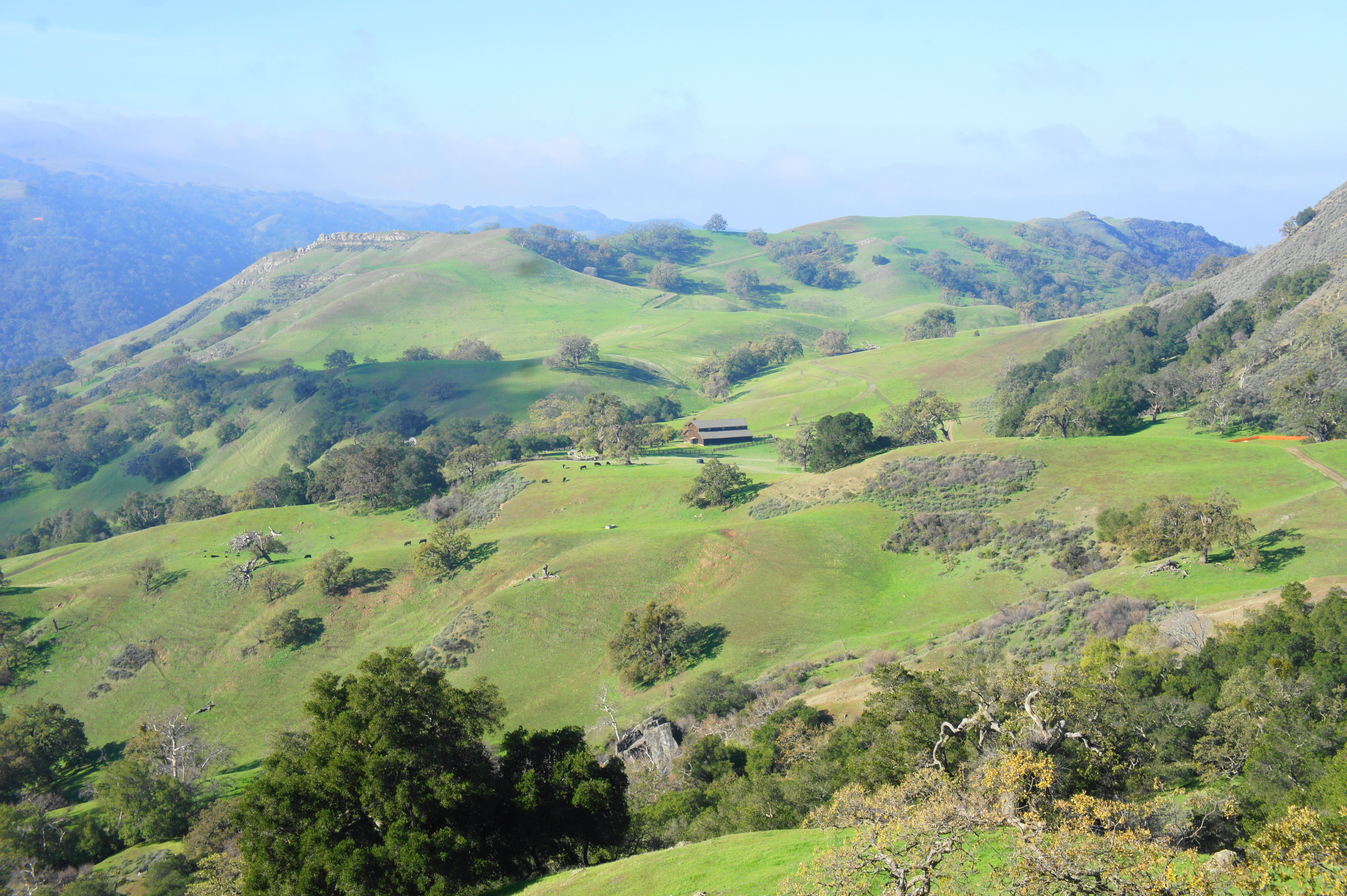
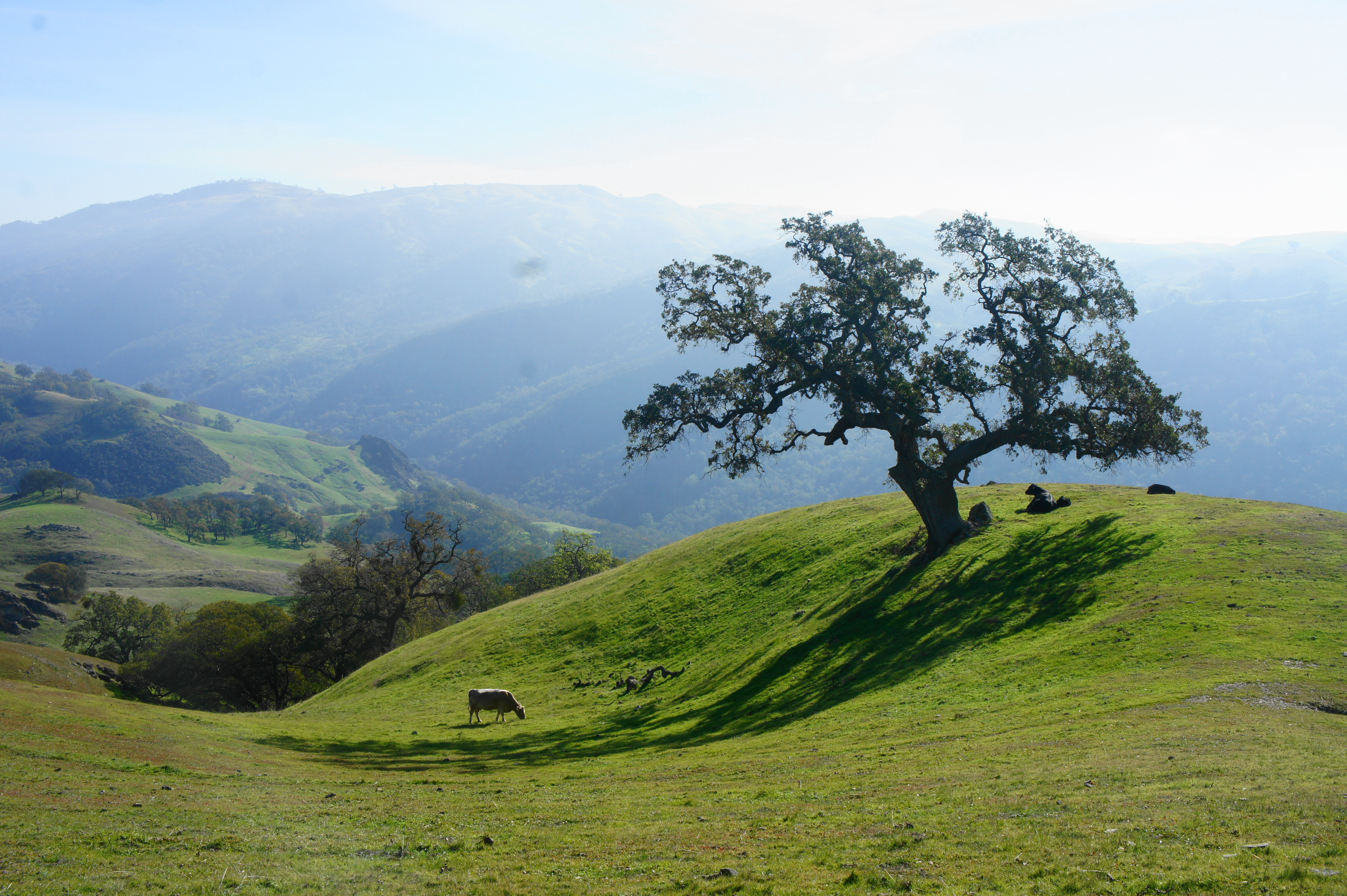
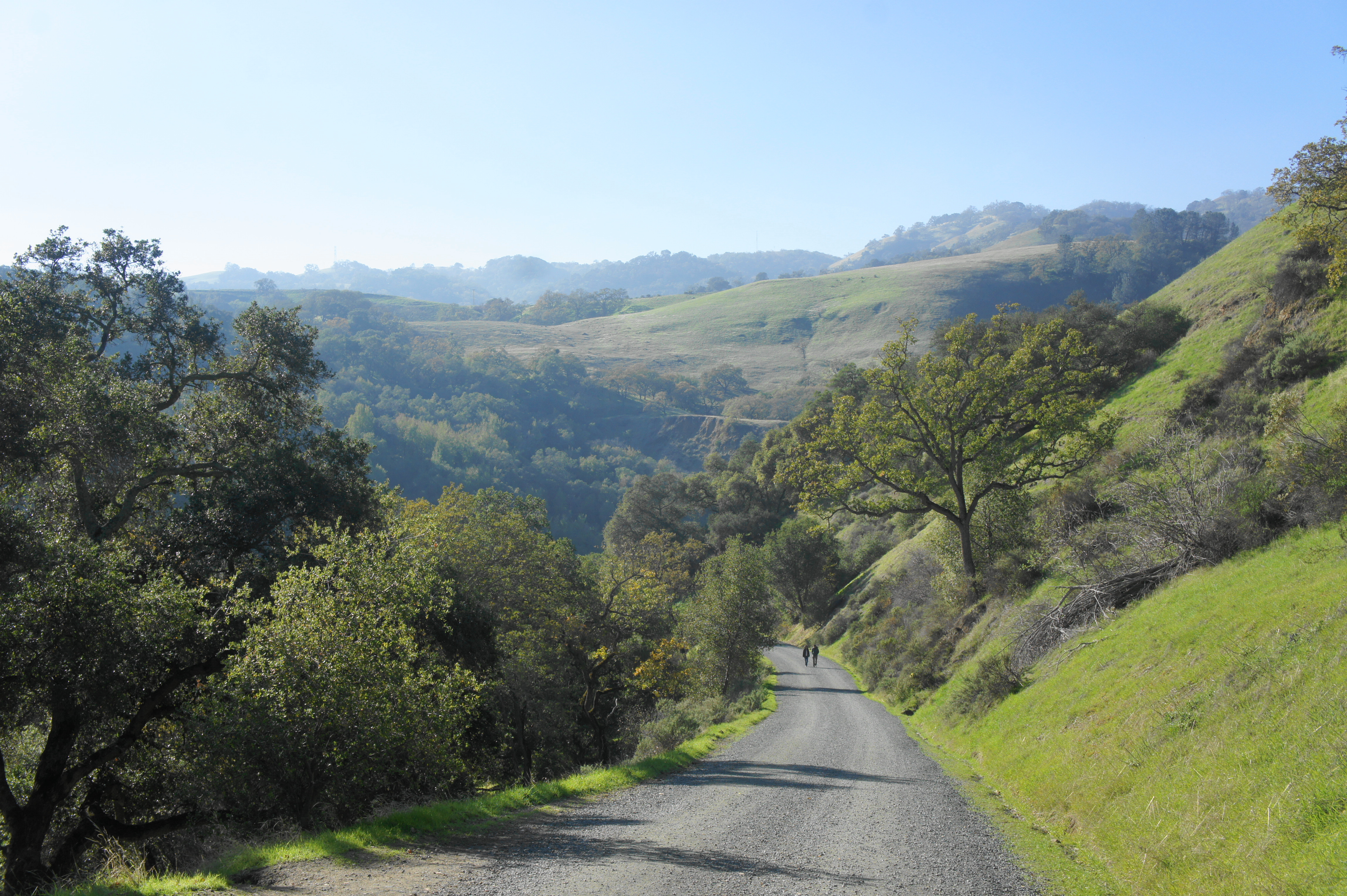
Continue to follow the Indian Joe Creek Trail as it gradually rises out of tree cover to the merger with Cave Rocks Road. Bear right on this wide gravel track, which ascends steadily amid excellent views across Sunol Valley to the southwest. By now hikers have come level with the height of Flag Hill (1,360’), the bluff-lined feature to the west, but the route remains below the chapparal scrub of the Vista Grande ridge to the north. Looking back west, one can see the large barn at High Valley Camp, situated on a verdant shelf in the foreground.
Climb to another junction with a bench at 1.9 miles, then a second fork about 200 yards later (stay right both times). From here the trail briefly descends to clear a side drainage nestled in the hillside of Cerro Este; there is sometimes a small, muddy pool off to the right.

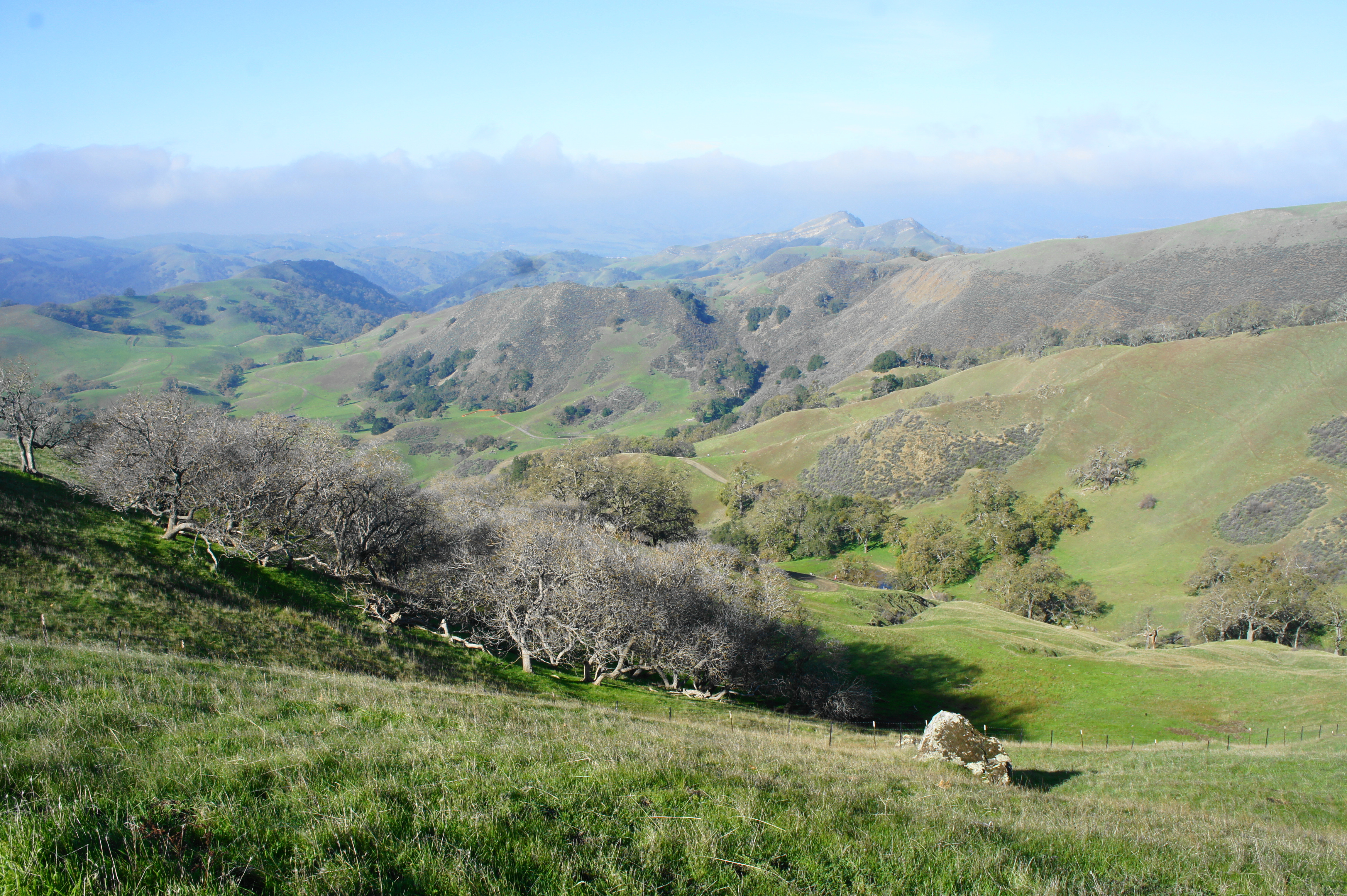
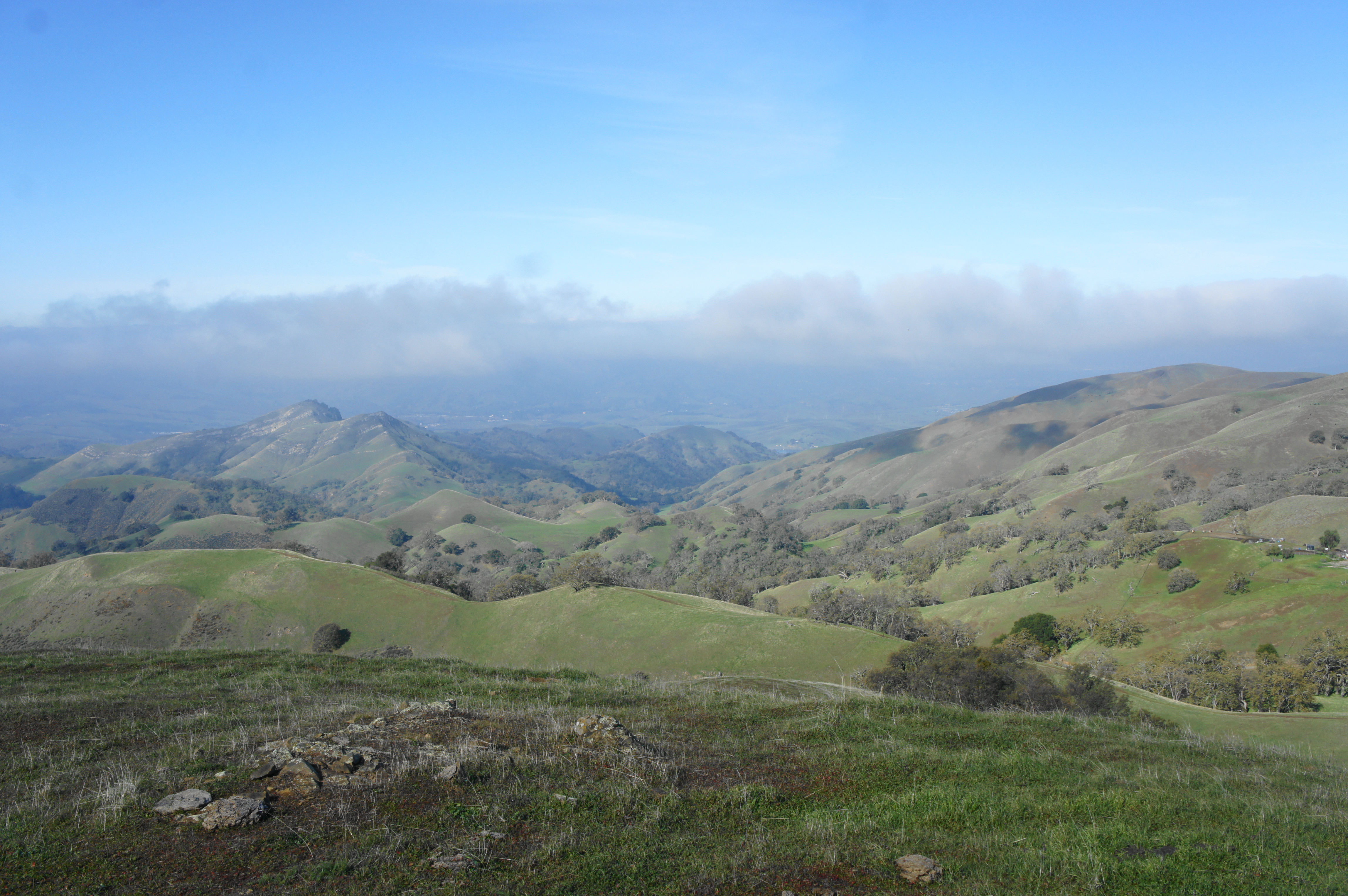
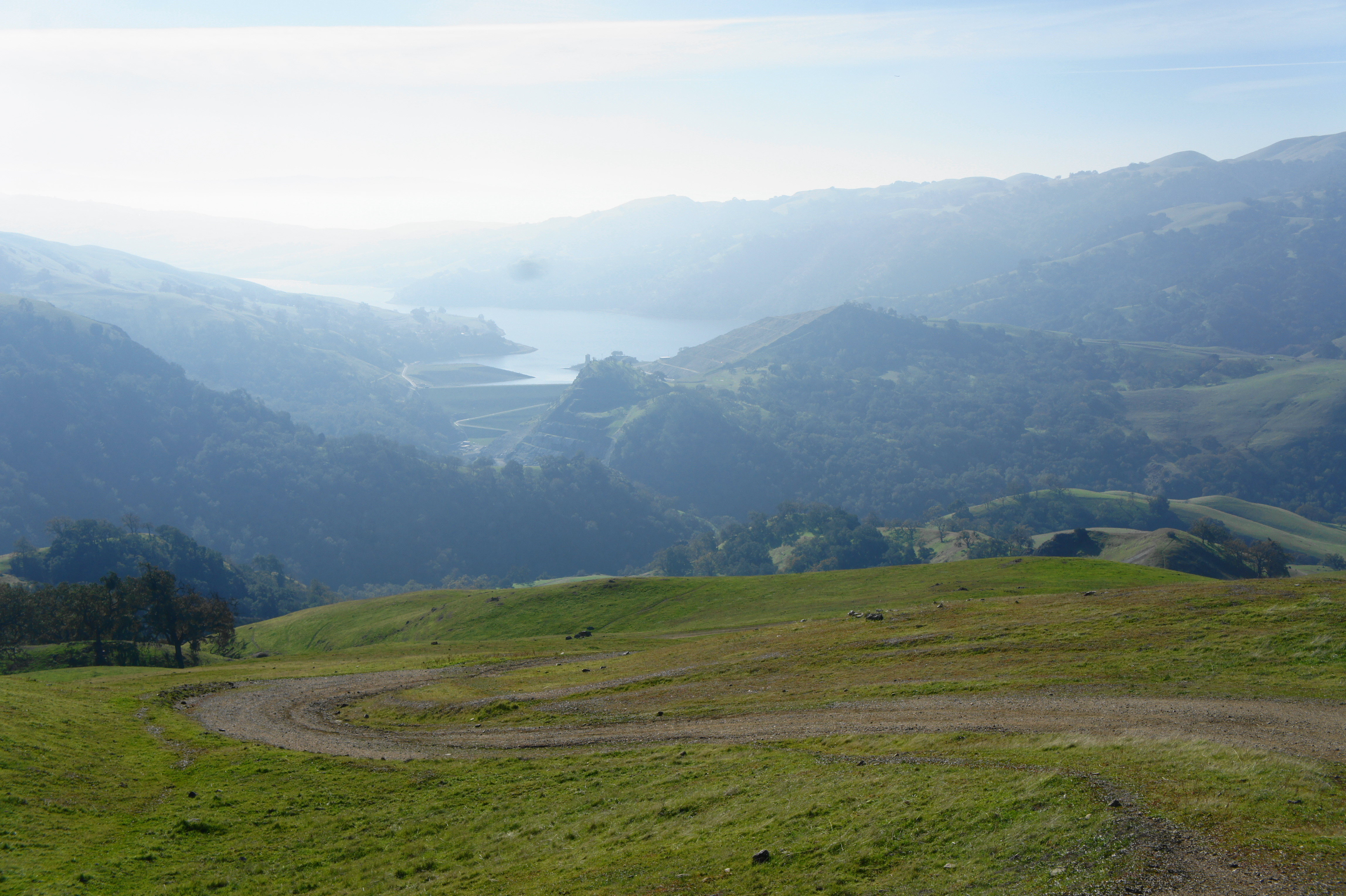
Beyond the pool, Cave Rocks Road rises steeply, covering two switchbacks before levelling off a bit as the road bears southward. Then, at about 2.6 miles, the trail crests a slope and reaches Cerro Este Overlook, a popular vantage point marked by a large, stone trail sign and monument. The vista from the overlook is terrific, with hikers viewing Calaveras Reservoir to the south for the first time, as well as Jacob’s Valley, the deep canyon that skirts the southern boundary of the park. Looking back to the north, one can see the rugged Maguire Peaks (1,688’), with Pleasanton Valley beyond.
Many hikers will be satisfied enough with this vista and proceed down the southern slope toward Little Yosemite. However, those with some extra energy and in search of solitude can bear left, climbing for about ¾ mile to the official summit of Cerro Este and highest point in Sunol Regional Wilderness.

Follow the grassy track—fainter but easily discernable—as it rises to a brief flat with a cattle gate, then ascend steeply to clear a point marked 2,038 feet, with increasingly expansive views eastward into Jacob’s Valley.

Thereafter, the route passes a high gap, which frames Flag Hill and Mission Peak in the distance, and then rises to another small gate and junction. The official trail bears right and ends at a larger, locked gate, with private property beyond. Staying straight, however, one can pass through the small gate and quickly reach the summit of Cerro Este (2,210’).
Here the views are sublime and the crowds thin, with the best vistas opening up to the north toward Maguire Peaks. Stop here for a snack or lunch, having travelled around 3.5 miles to this point.
Once ready, return the way you came until reaching Cerro Este Overlook. Bear left at the junction, beginning a steady descent that will shed 1,100 feet in the next 1.75 miles. Following Cerro Este Road, the route weaves down a series of bends, passing a handful of small watering holes frequented by the resident cattle population. At the junction with the McCorkle Trail at 4.7 miles, stay right, dropping another 200 feet to a subsequent fork. Stay left at this junction, passing a bench with a picturesque view of Jacob’s Valley. (Note: It is technically shorter to head right on the McCorkle Trail/Ohlone Wilderness Trail, but this would skip the worthy detour to Little Yosemite.)
In the next section, the trail descends for ¾ mile into ever-denser brush and then oak/bay woodlands, interrupted by patches of green grass. Protrusions of metamorphic rock with quartz crystals can be seen at one point on the right. At 5.8 miles, the trail passes a four-way junction (stay straight on Cerro Este Road), then drops another 2/10 mile to meet Camp Ohlone Road, where there are two picnic tables and pit toilet.

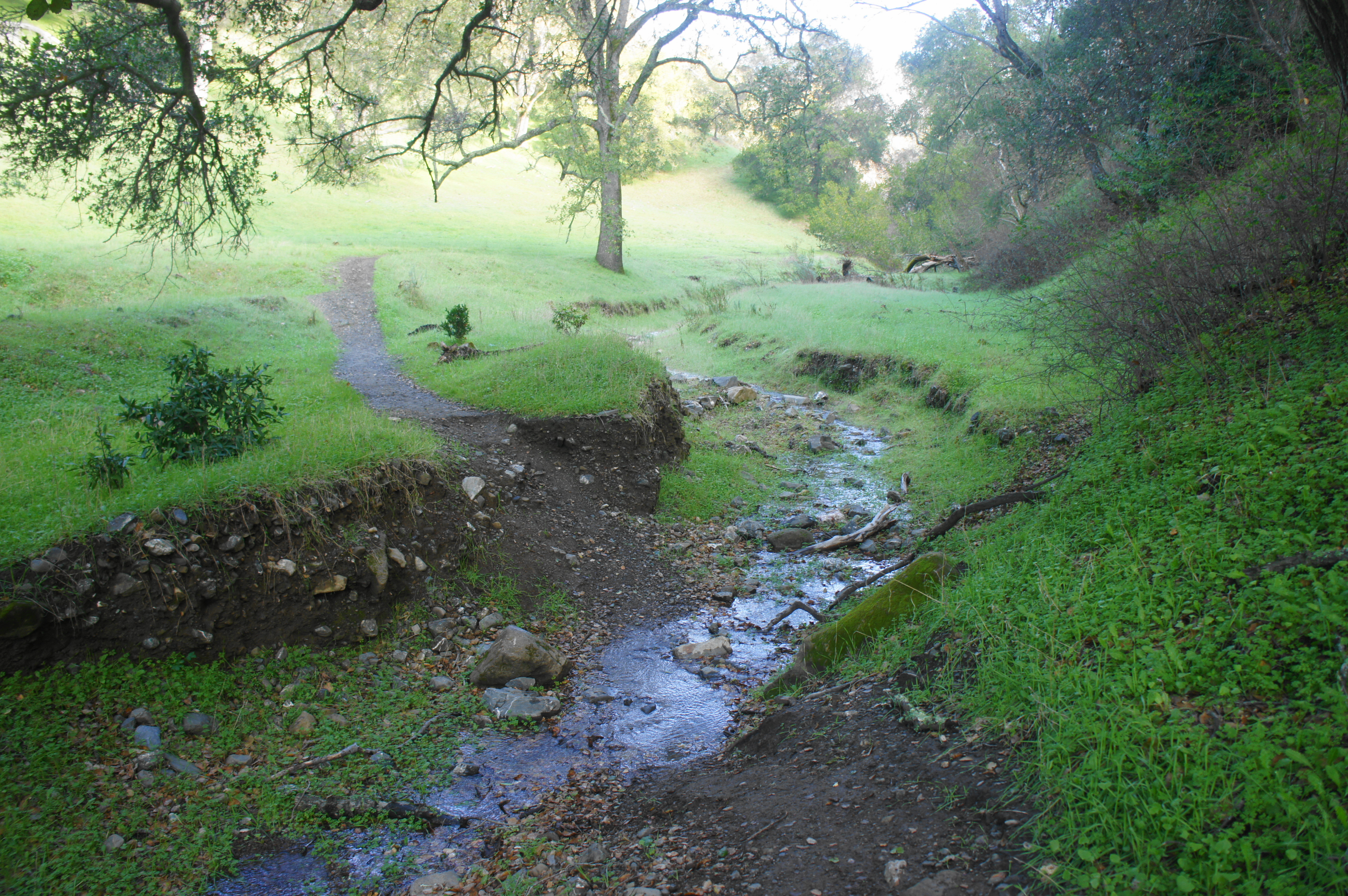
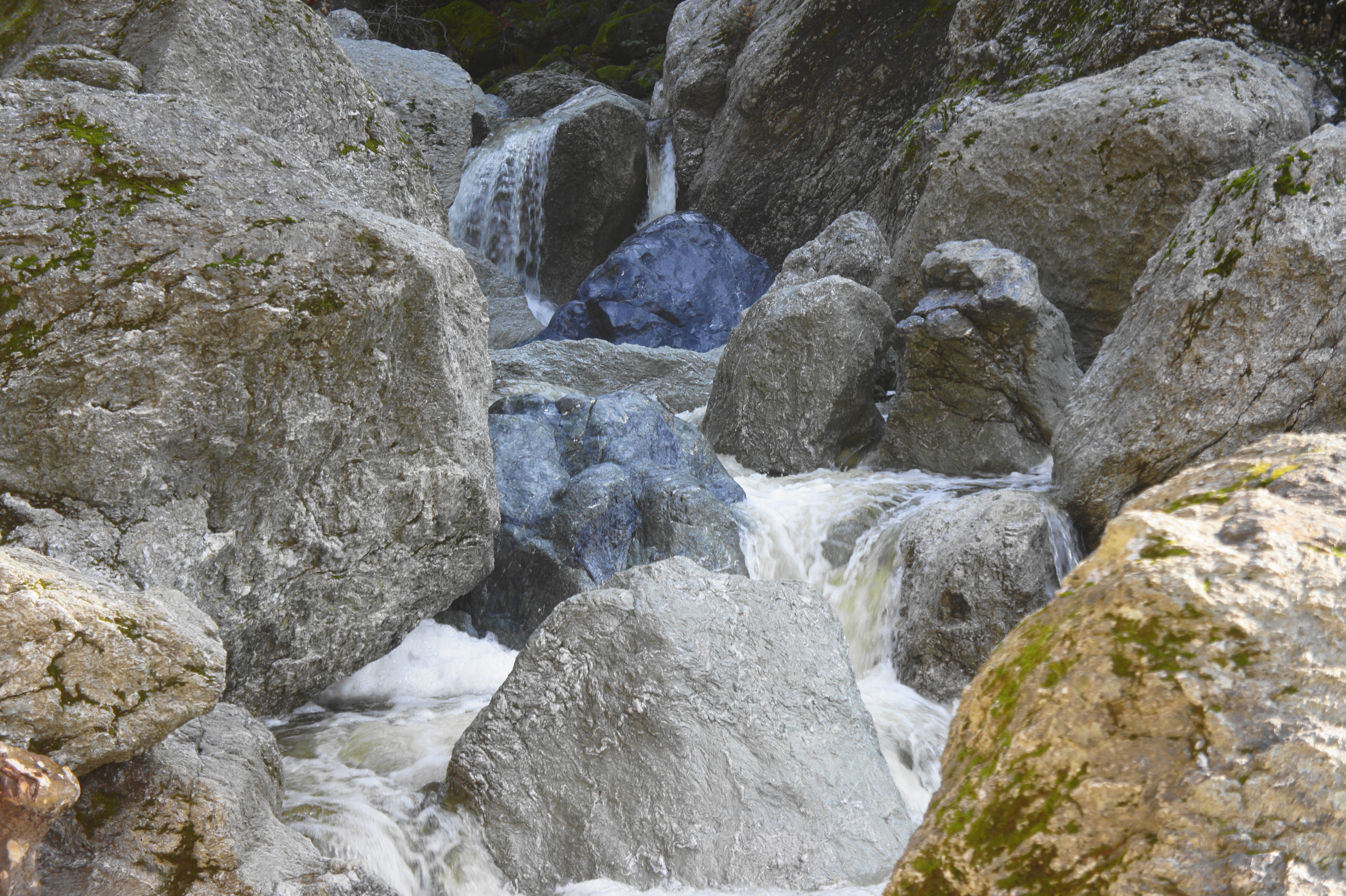
By now, one can hear the rushing cascades of the Little Yosemite Area (at least in winter/early spring), a very popular destination and one of the main draws of Sunol. Here Alameda Creek squeezes through a tight canyon, producing a series of stairstep cascades—none entailing more than 10 feet of freefall—that can be quite pretty but sort of difficult to reach. Immediately across from the end of Cerro Este Road, there is one signed area where hikers can scramble down the sharp banks to the creek’s edge. Unfortunately, some of the taller drops upstream are marred by the presence of rock graffiti.


A second approach to the Little Yosemite Area, situated 100 yards west down Camp Ohlone Road, is more popular and comes out at the base of a modest waterfall. This is perhaps no Yosemite, but it’s a nice spot to enjoy a snack and explore.
After returning to the main track, head west on Camp Ohlone Road, passing a cattle guard and then descending mildly down-valley. One can still hear and see the rushing waters of Alameda Creek, but the stream is now effectively out of reach, situated down a steep slope of perhaps 100 feet. Eventually the waters calm and the valley broadens, and hikers round a right-hand bend that brings one closer to the road and parking areas.
At around seven miles, stay left at another junction with the McCorkle Trail, then follow the wide bridge over Alameda Creek. Once on the far side, hikers are greeted by a fleet of cars and parking lots, which line seemingly the entire loop south of the Visitor Center. Follow the hiker’s trail along the left side of the road; soon enough, it crosses to the right side and eventually returns to the Visitor Center, capping off a 7.6-mile scenic hike.


Pingback: Top 10 Hikes in 2021 | Live and Let Hike
Andrew I would love to come down and do a hike with you but ee are locked down because of omicron. Suffering the results of too many holiday trips. I can hike and ski, but no restaurants, flights or hotels.
I will use you posts as my hiking guide if we can ever get rid of this virus.
LJ