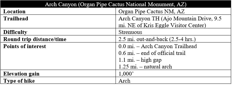
Stenocereus thurberi, or organ pipe cactus, is the primary draw of the park bearing its name. But visitors to Organ Pipe Cactus National Monument in southwestern Arizona are also rewarded with sweeping views of rugged mountain landscapes, broad valleys, and a Sonoran desert ecosystem with plants and animals that are well-adapted to the hot, dry conditions. In addition to the peculiar-looking organ pipe—found only in southern Arizona and northern Mexico—a number of other catci species abound, including the famous saguaro, prickly pear, and several types of cholla. The cacti mix with interesting geological formations on the Arch Canyon Trail, a route in the Ajo Mountains that ranges from an easy, modest walk to a strenuous scramble, depending how far one is willing to go. While the namesake arch is visible right from the start, reaching the aperture requires a steep, 1,000-foot climb over the course of 1.4 miles, with most of the elevation tackled in the final ¾ mile. While the arch itself is modest compared to, say, those found in Utah, the views westward from the arch to the Puerto Blanco Mountains, Diablo Mountains, and the Valley of the Ajo are outstanding and worth the rigorous ascent.
The hike
Even for non-hikers, driving the 21-mile Ajo Mountain Drive is a must-do for visitors to Organ Pipe National Monument. The mostly gravel, one-way loop track starts just across Highway 85 from the Kris Eggle Visitor Center, where most first-time visitors will stop to get a map and information. Quickly the drive enters a dense cactus forest and rises up and over a gap in the Diablo Mountains, revealing the even higher and more impressive Ajo Range beyond. This north-south range is the tallest in Organ Pipe and forms the park’s eastern boundary.

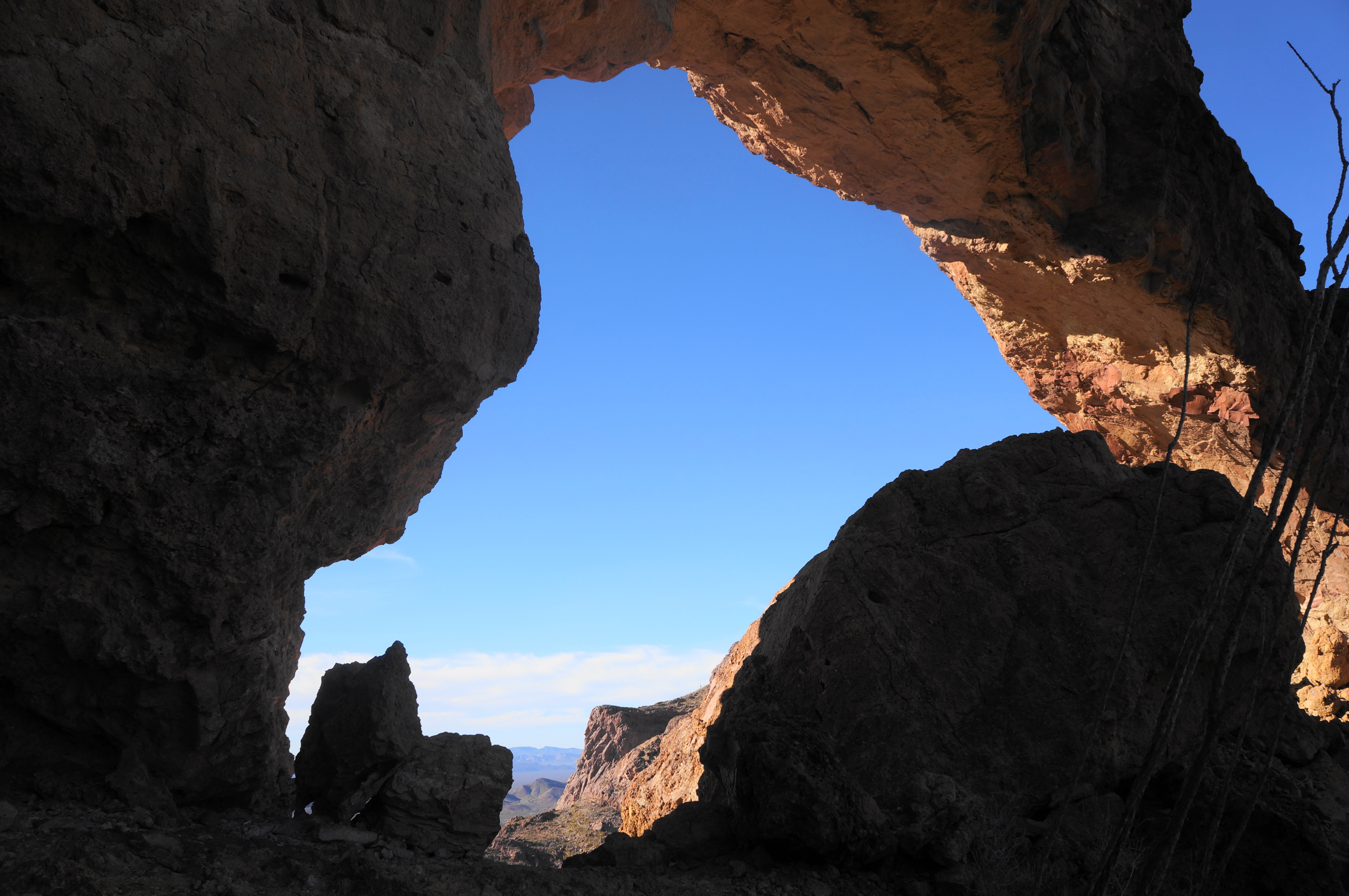
At a point about 9.5 miles from the Visitor Center, just as the road abuts the Ajo Range, pull off (left) into a small parking area with three interpretive signs and a picnic table. This is the Arch Canyon Trailhead. Immediately from the start, one can see the natural arch high up in the cliffs above. The archway is made of volcanic rhyolite, as well as breccia, a sedimentary mixture of fragments of many different rock types. Like all natural arches, it was formed through weathering that gradually ate away at the weaker rock below the arch; eventually the arch itself will topple, but for now, it is the endpoint and objective of the hike to come.
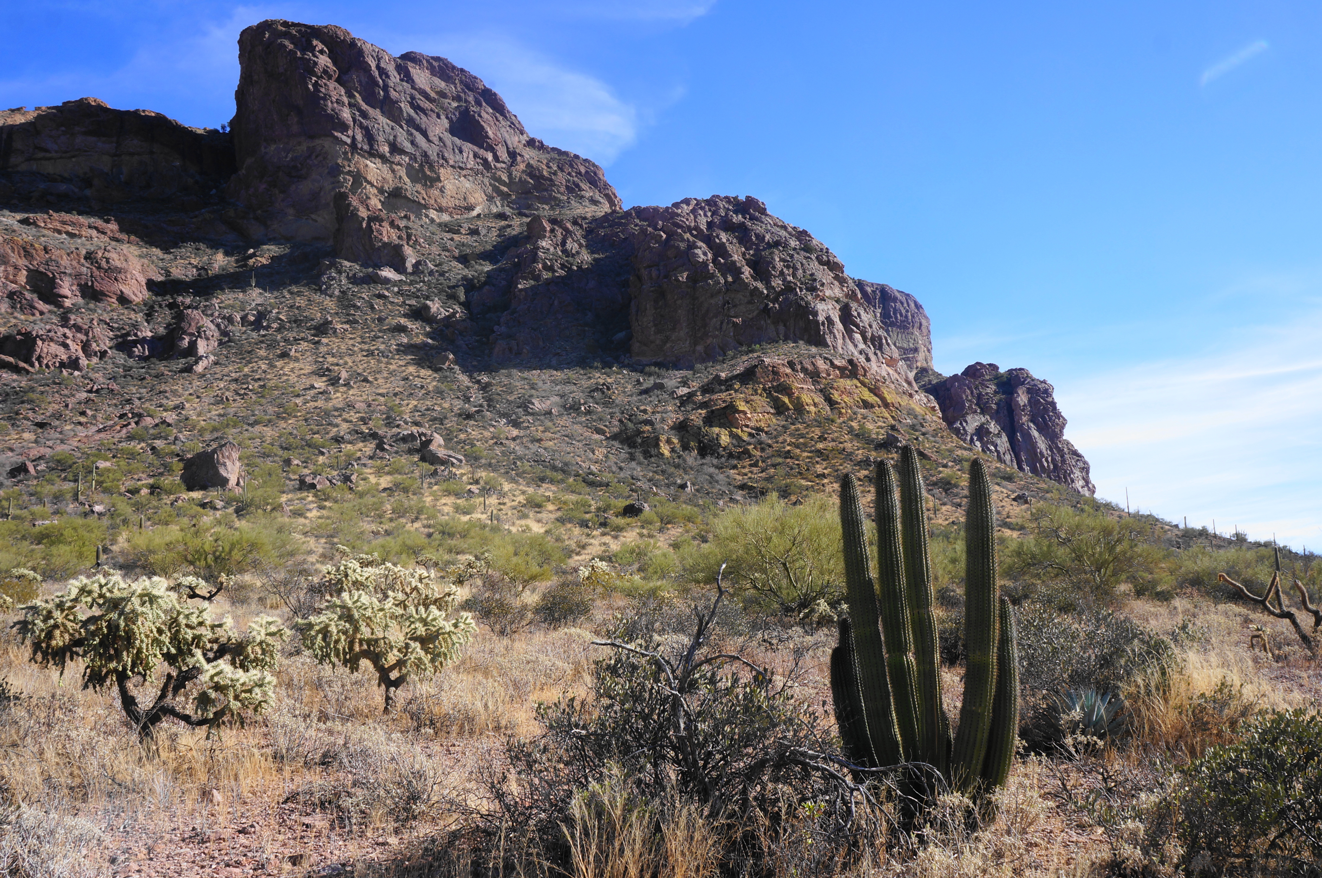
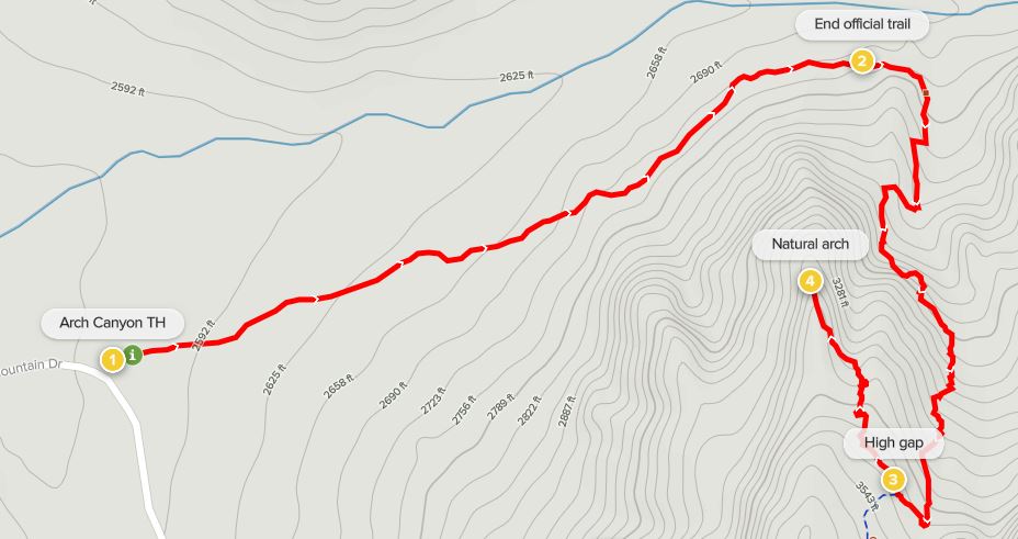
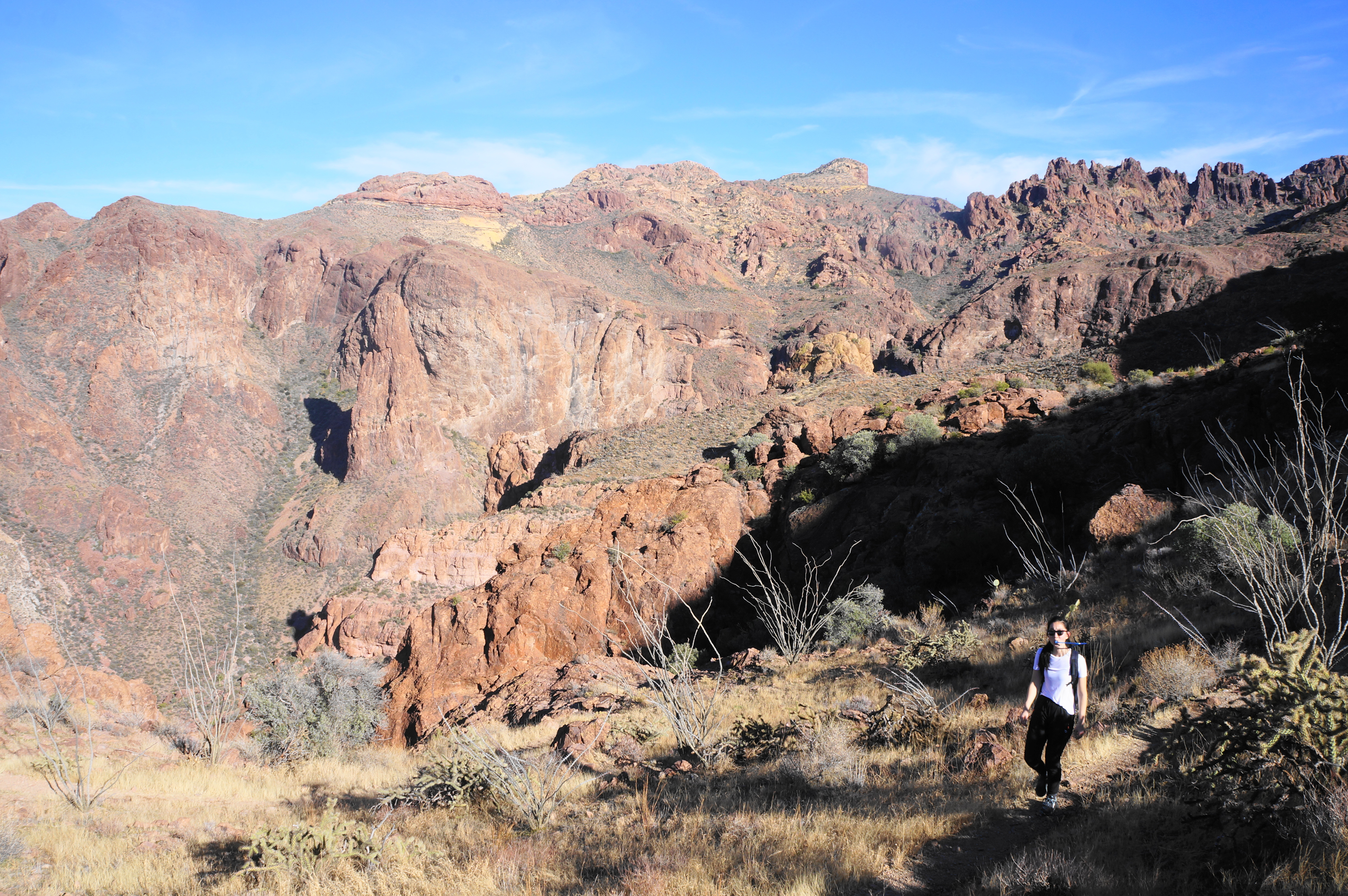
The Arch Canyon Trail begins as a wide, level, and sandy track, passing well below the arch on the right. Creosote bush, jojoba, ocotillo, and various cousins of sagebrush dot the landscape, as do occasional jumping cholla, saguaro, and, of course, organ pipe cacti. The trail keeps the (usually dry) arroyo of Arch Canyon down to the right as the trail rises at a moderate clip, narrowing and ascending sporadic steps as it works deeper into the Ajo Mountains.
Having now fully passed the buttress bearing the natural arch, the formal trail ends at a pair of signs around 6/10 mile from the start. The first sign warns about illegal immigration and trafficking (which is somewhat common in the park), while the second is marked “Arch Canyon Trail” and points right.

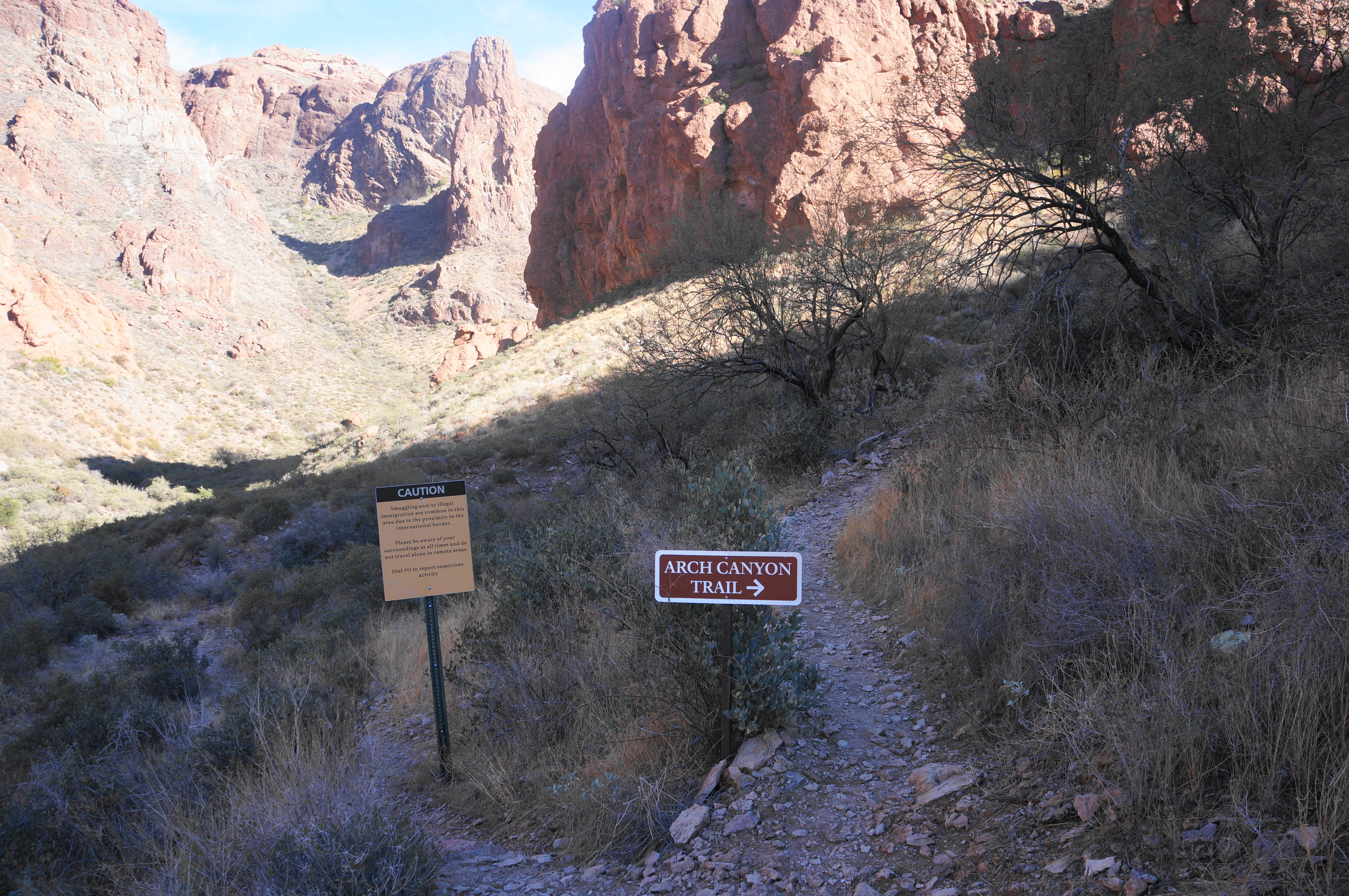
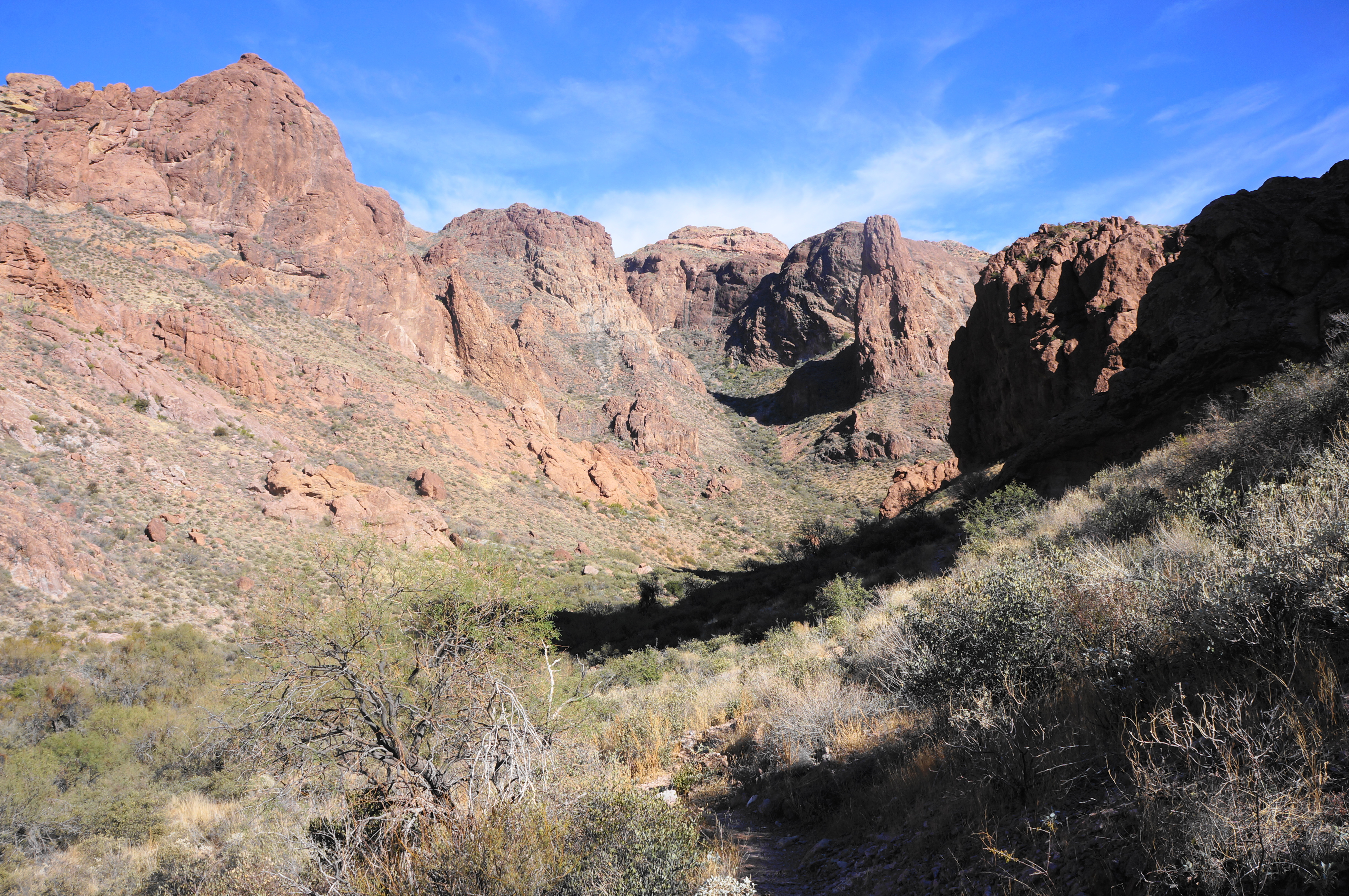
Take this cue to bear right on the unmaintained—but well-used—path, which will take hikers up to the natural arch. Follow this path for a few dozen yards, as it follows a side drainage, until it forks again; bear right and follow the route that ascends the gritty slickrock, a pitch that can be dangerous if littered with fine sand and loose rock. Slowly and carefully ascend, then follow the onward trail cutting right, and then left, soon reaching a rocky notch between stony walls.
From here the path cuts back toward the wash, then bears north again to clear a knob with nice views looking back at Arch Canyon. Thereafter, the trail returns to its southward climb and ascends very sharply up a pitch that will require the use of hands and some minor scrambling to mount. This strenuous ascent continues for some time as the trail puts Arch Canyon further and further in the rear-view mirror.

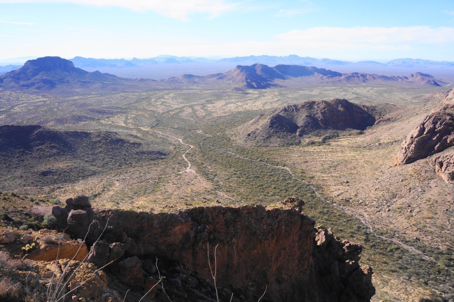
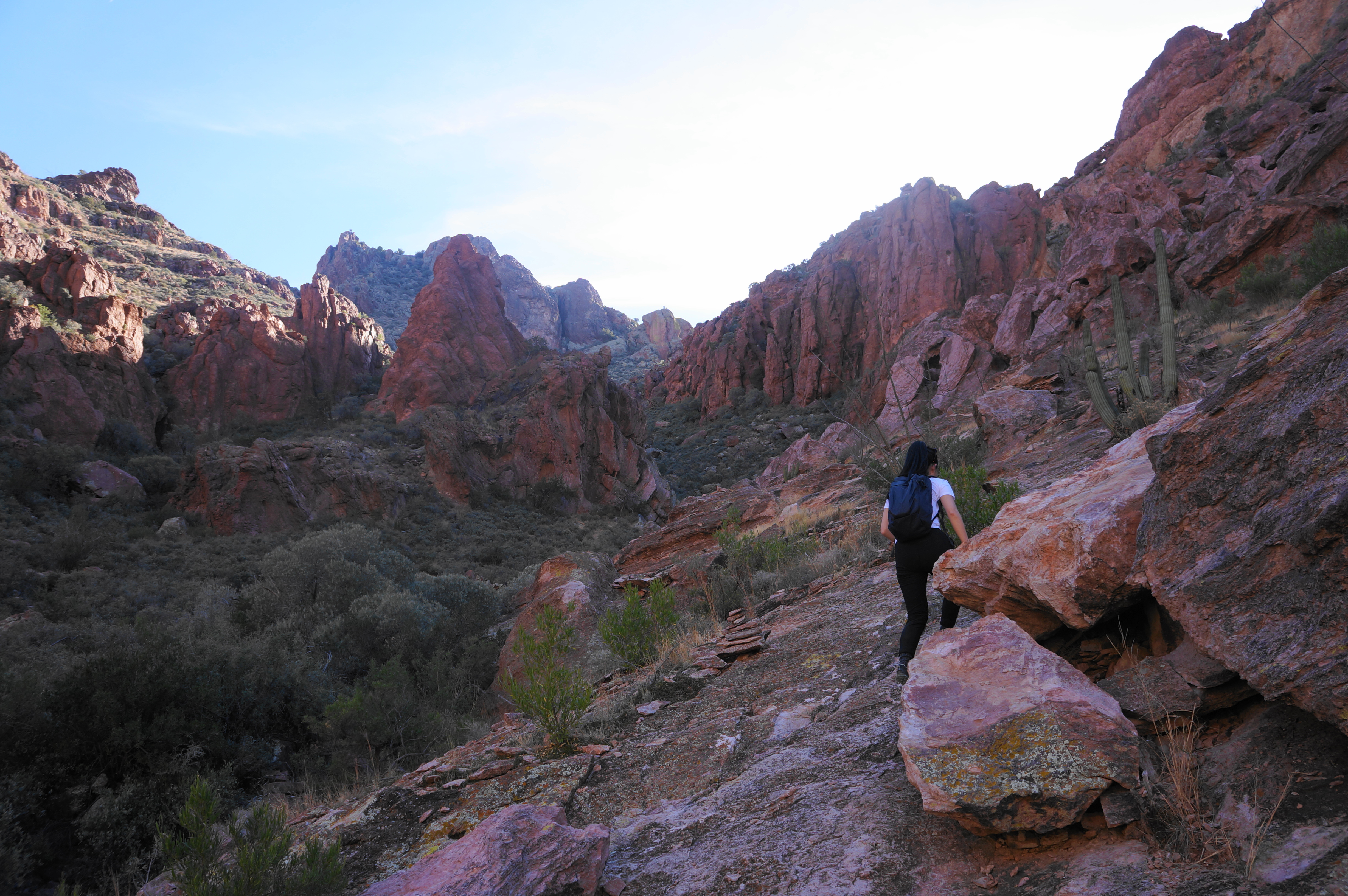
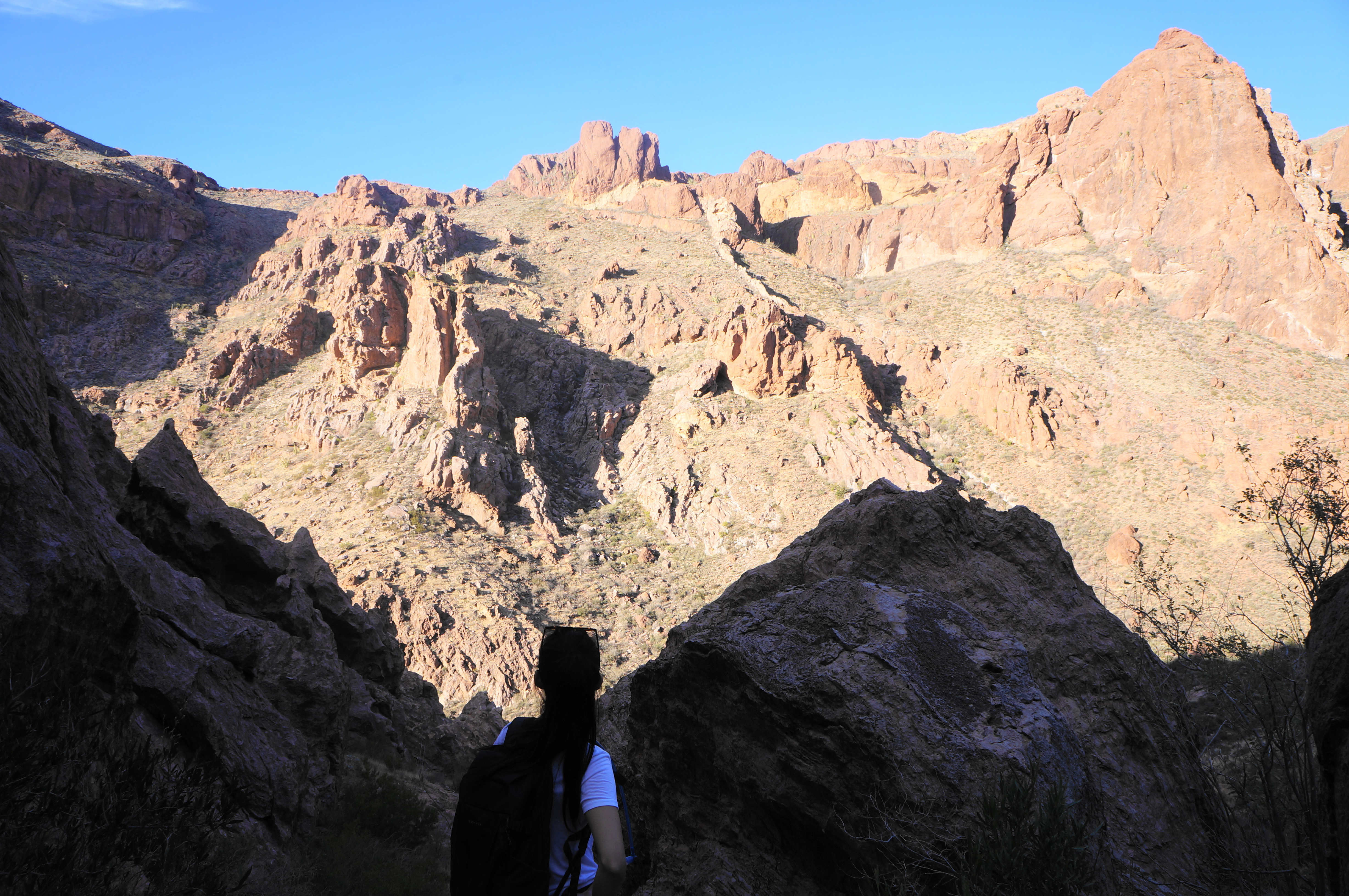
At last, the trail levels off after reaching a flattop and even a descent at about 1.1 miles. Follow the rock cairns as the route edges northwest to a high gap with excellent views westward across the valley. Here one can see west to Tillotson Peak (3,374’), the Puerto Blanco Mountains, and the Bates Mountains—a series of mountain streaks contained within the park’s boundaries.

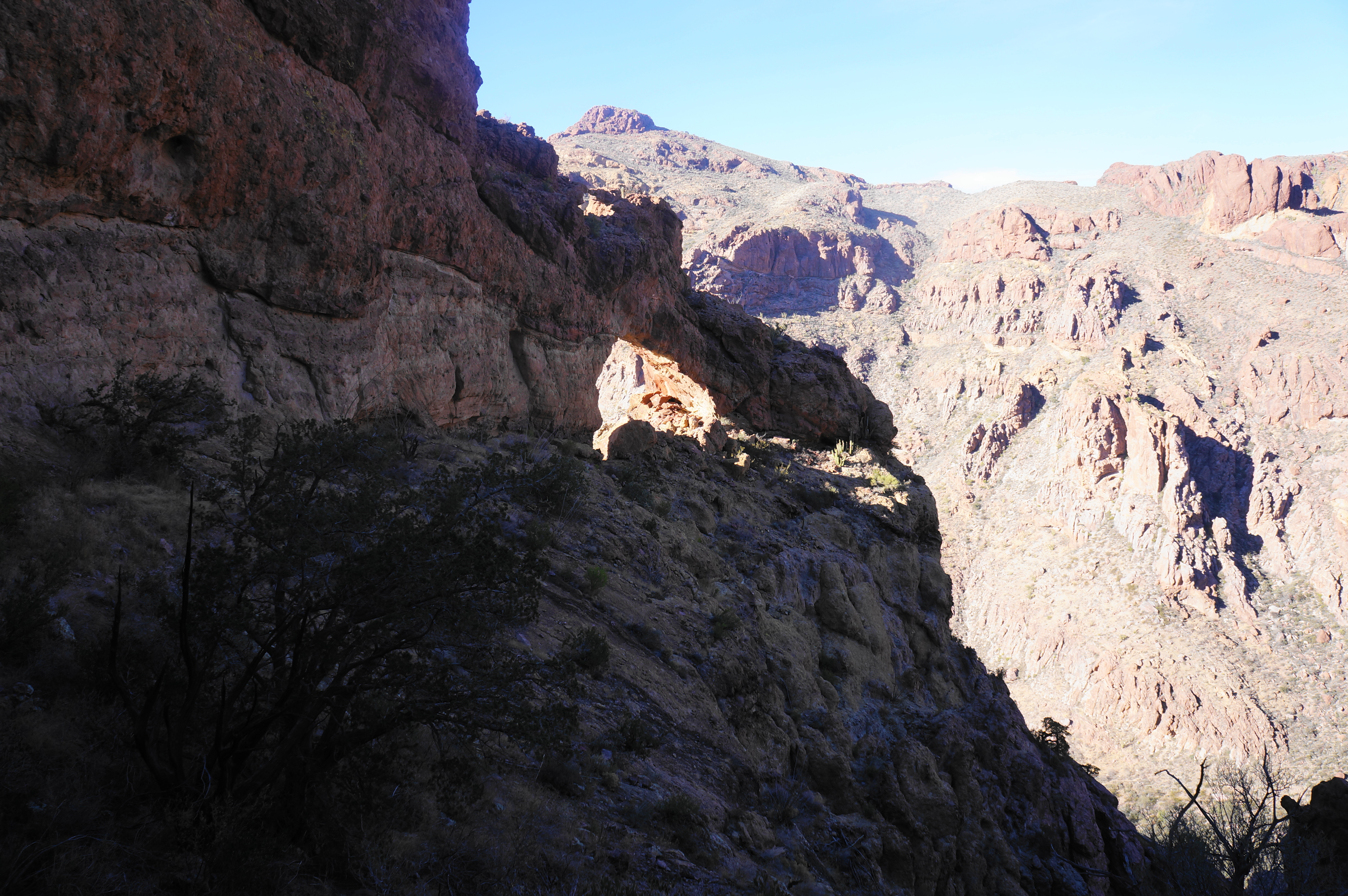
Just beyond, there is another small arch, this one with views east to Arch Canyon and into the Ajo Range. This is not the main arch but a fun detour nonetheless.

From here the trail to the natural arch gets a little more confusing. The track descends, reaching the edge of a drainage where the trail appears to end abruptly. Hikers can see the natural arch down below, but a seemingly dicey pitch dropping some 50 feet lies between here and there. Instead of trying this risky downclimb, follow the path straight, skirting a short rocky section before crossing the drainage to the other side. Here a large rock cairn indicates that hikers have gone the right way.

From here, it is a much more manageable downhill, although small, loose rock can make it a little slippery. After shedding about 50 feet, the final stretch follows a reasonably wide bench below high walls to the archway.
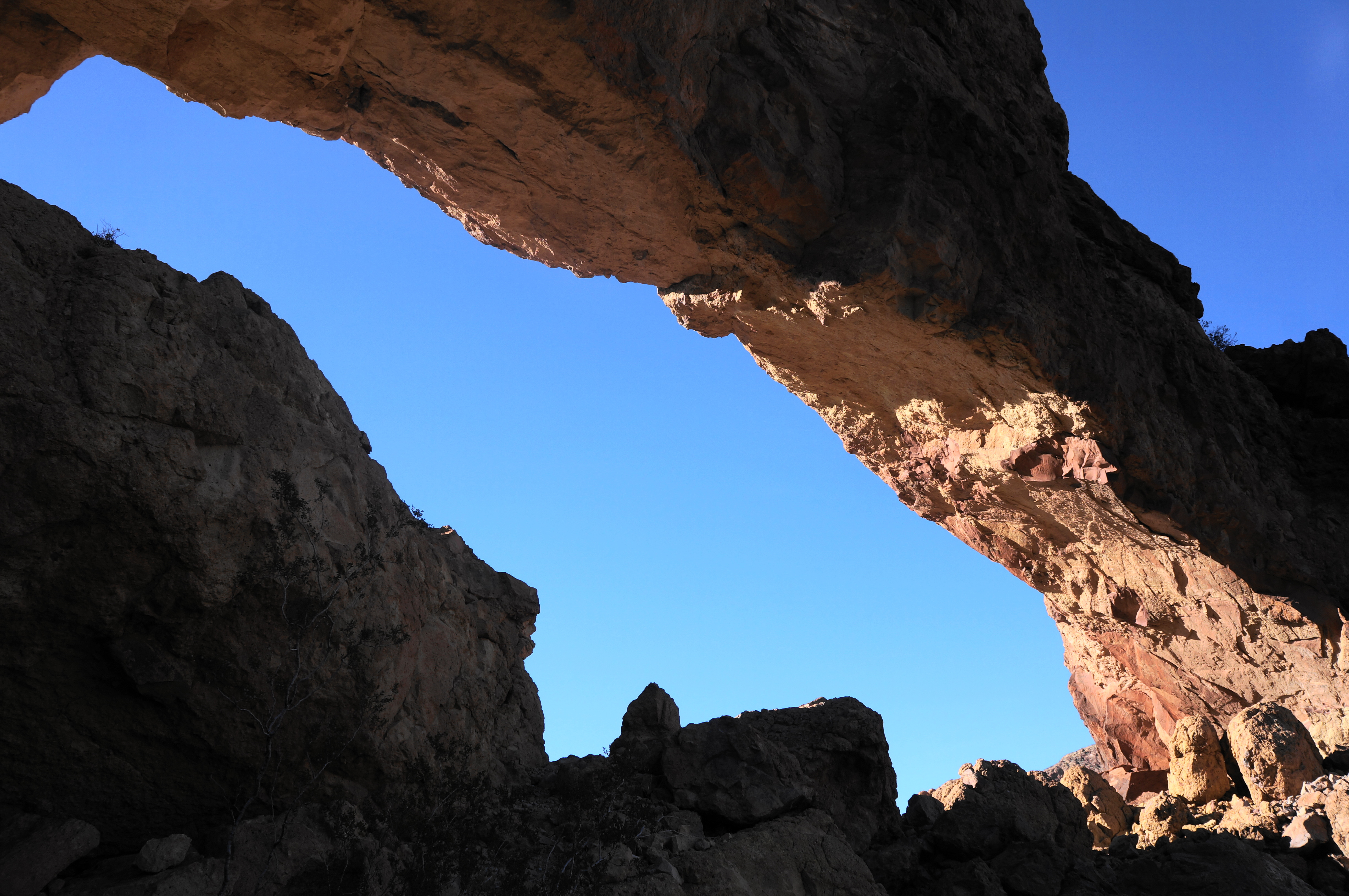
It is hard to get a good picture that captures the entirety of the arch, but the views are terrific nonetheless. Here one can look down at Ajo Mountain Drive and the trailhead, some 1,000 feet below. The views of the valley are especially great as the sun is setting, producing beautiful red and purple hues as the day approaches dusk.


However, it is not wise to wait too long before the sun sets, as hikers must still retrace their steps down the steep incline to return to the start. Make your way back up to the high gap, then edge over to the start of the steady and relentless descent. After down-climbing slowly and carefully to the end of the official trail, bear left and follow the path for 6/10 mile back to the trailhead.
This strenuous out-and-back is only a mere 2.5 miles round-trip, but hikers should allot at least 2.5-4 hours due to its trying difficulty.


I love the views from the top! I studied geology and thishike and landscape is a dream hike. One day I hope to get a chance to do some hiking in Colorado 🇺🇸
Pingback: Top 10 Hikes in 2022 | Live and Let Hike