
Wasson Peak (4,687′) is the highest point in the Tucson Mountains, a small range of cactus-dotted heights situated just west of Arizona’s second largest city. Reaching the summit is one of the more popular hikes in Saguaro National Park’s Tucson Mountain District, but the nearly 8-mile loop requires a bit of stamina and endurance as it climbs 1,800 feet through dry gullies and atop high ridgelines. The panoramic views are fantastic—some of the best in the area—but it is the impressive saguaro cacti that steal the show. These slow-growing titans are found naturally only in the Sonoran Desert of Arizona/California and northern Mexico, and the hike to Wasson Peak offers up-close views of some excellent specimens. Better yet, do the hike in the late afternoon as the setting sun casts beautiful light on the west-facing slopes of the Tucson Mountains. The following description details a clockwise loop to/from Wasson Peak that begins and ends at King Canyon Trailhead to the south.

The hike
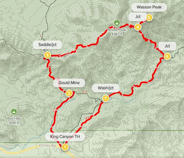
Although 99% of the hike is within Saguaro National Park, the 7.7-mile circuit begins at the King Canyon Trailhead in neighboring Tucson Mountain Park. This Pima County park is perhaps most famous for the nearby Arizona-Sonora Desert Museum and Old Tucson Studies, but miles of hiking trails abound in this 20,000-acre tract. (Note: There is also a large campground—Gilbert Ray—that is a short drive from the trailhead.) The King Canyon Trailhead is one of the most popular starting points in the park, and the reasonably small parking lot can fill up quickly, even on weekdays. (Note: There is overflow parking across the street at the Arizona-Sonora Desert Museum.)
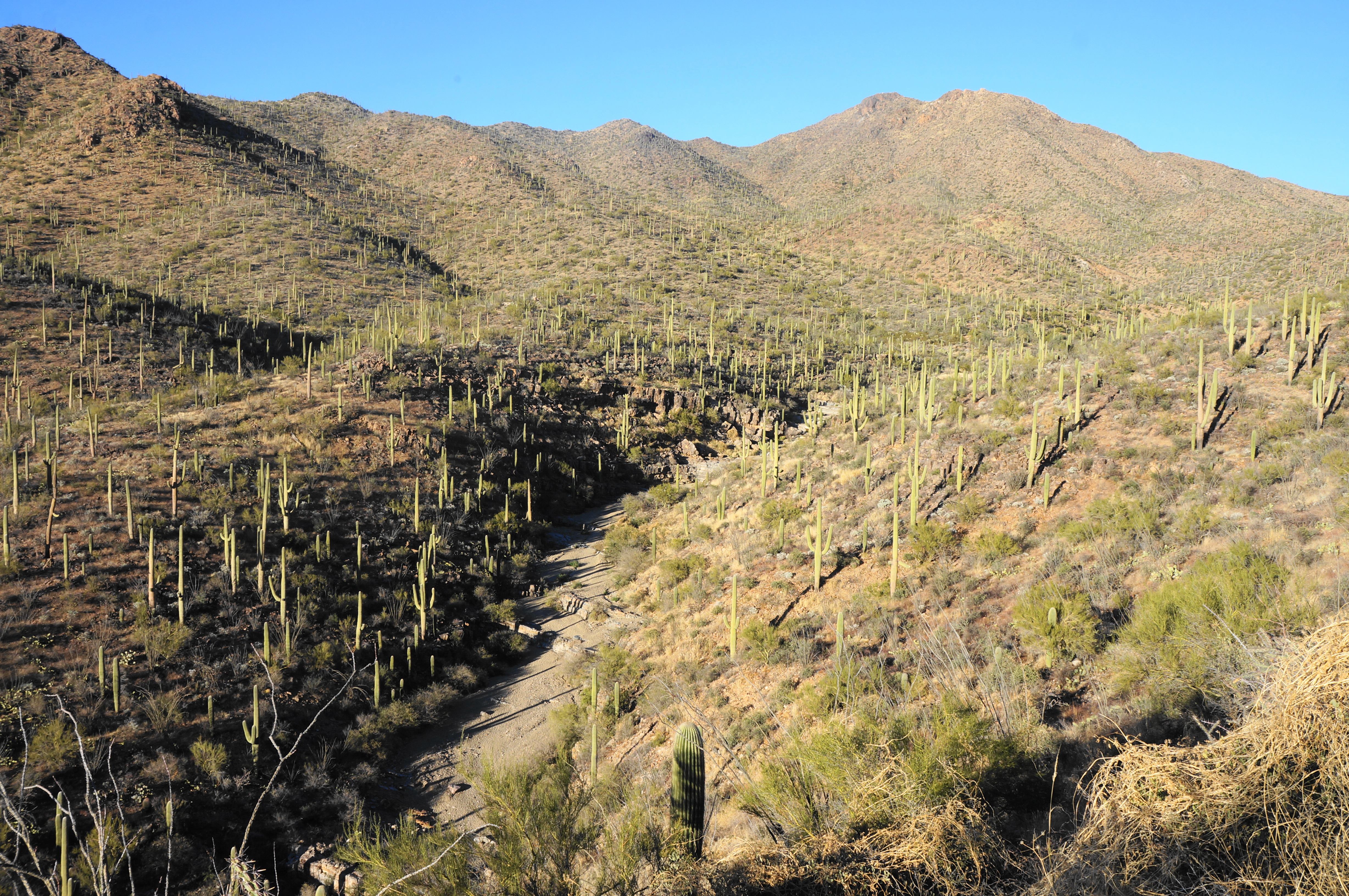
At first glance, there appears to be only one route—the King Canyon Trail—leaving from the trailhead, but the path quickly splits into two. Head left on the Gould Mine Trail, dropping down to a sandy wash, the main drainage through King Canyon. Once down in the wash, take a left, heading downstream toward Kinney Road, then follow the singletrack path as it abruptly climbs up and out of the drainage to the west. Here hikers are at about 2,900 feet in elevation, with around 1,800 feet in climbing ahead.

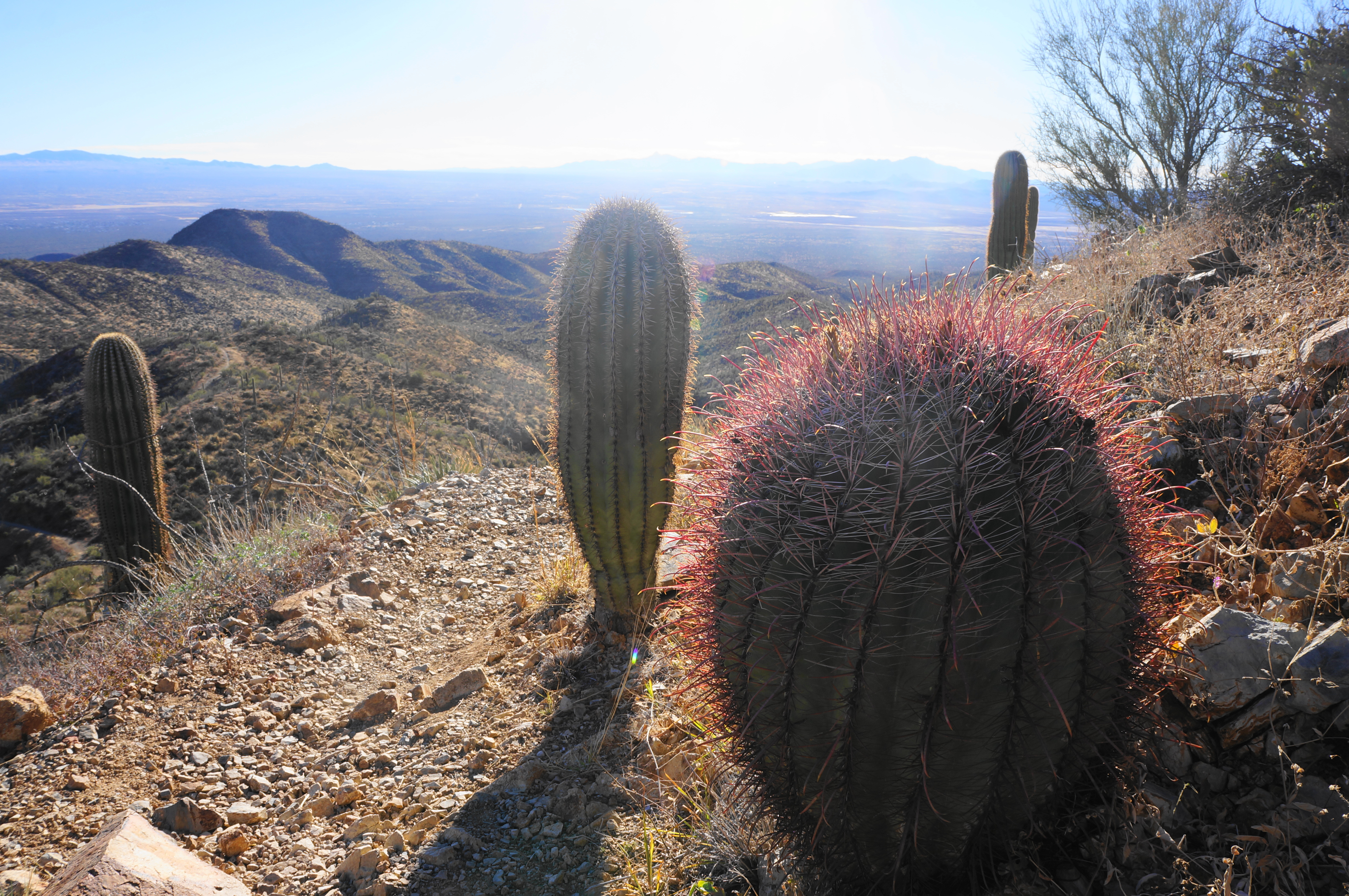
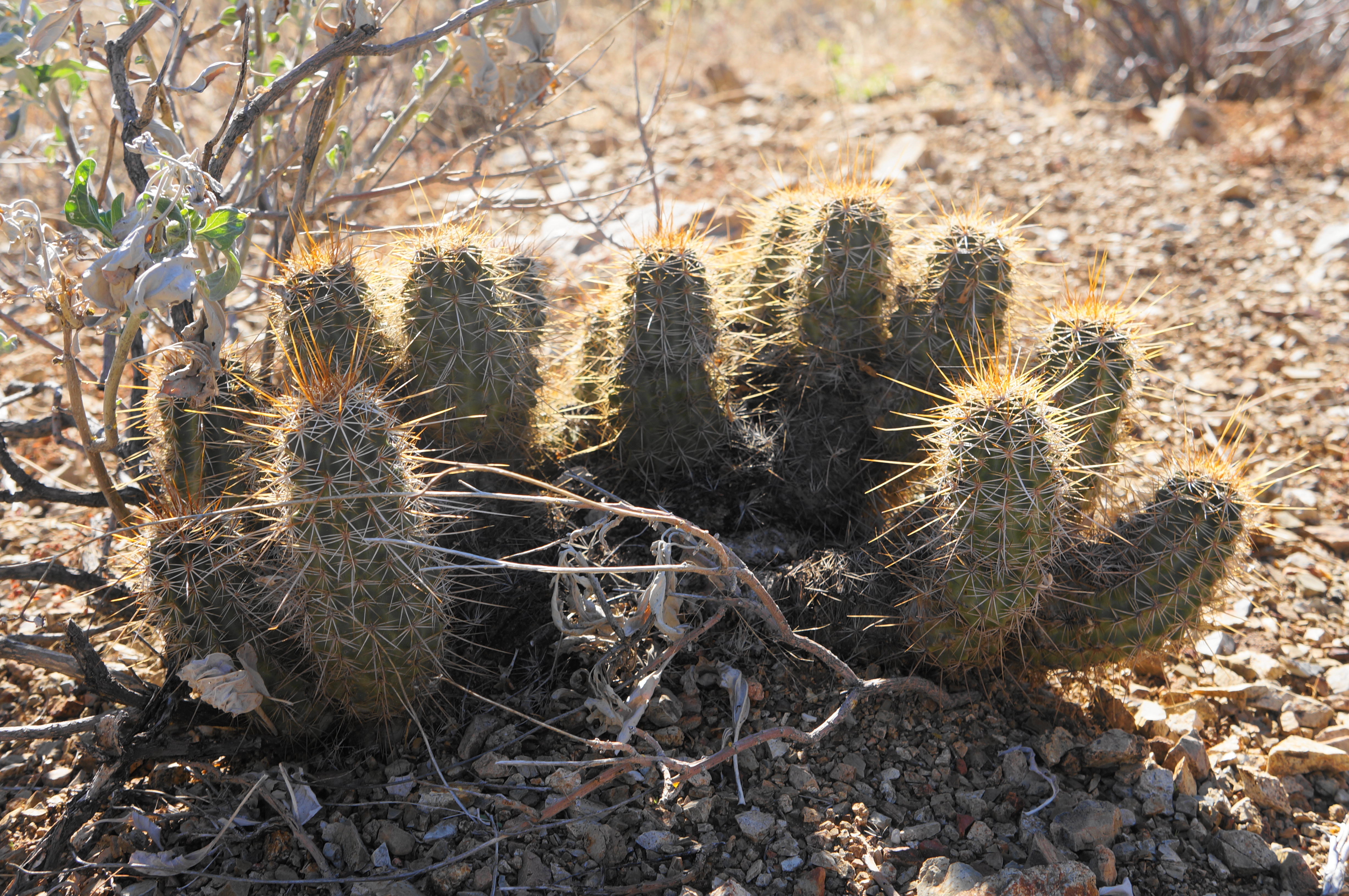
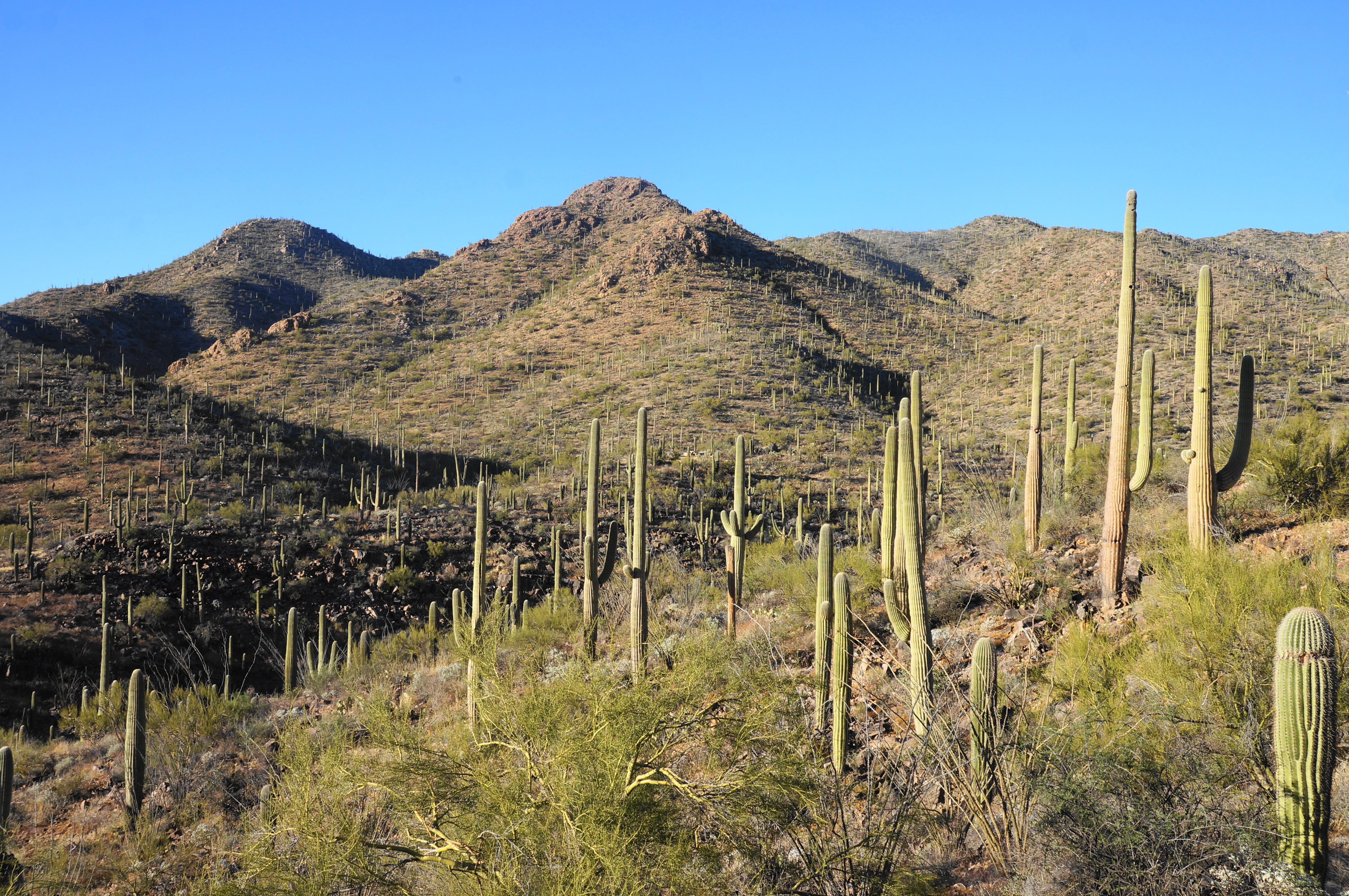
The Gould Mine Trail quickly rises to a low shelf that immediately boasts a diversity of plant life, including creosote bush, jumping cholla, prickly pear cactus, ocotillos, palo verde, and, of course, saguaros. Follow the dusty path as it cuts through a wire fence—officially entering Saguaro National Park—then ascends mildly and intermittently as the route edges northward, skirting another drainage that forms a modest canyon.

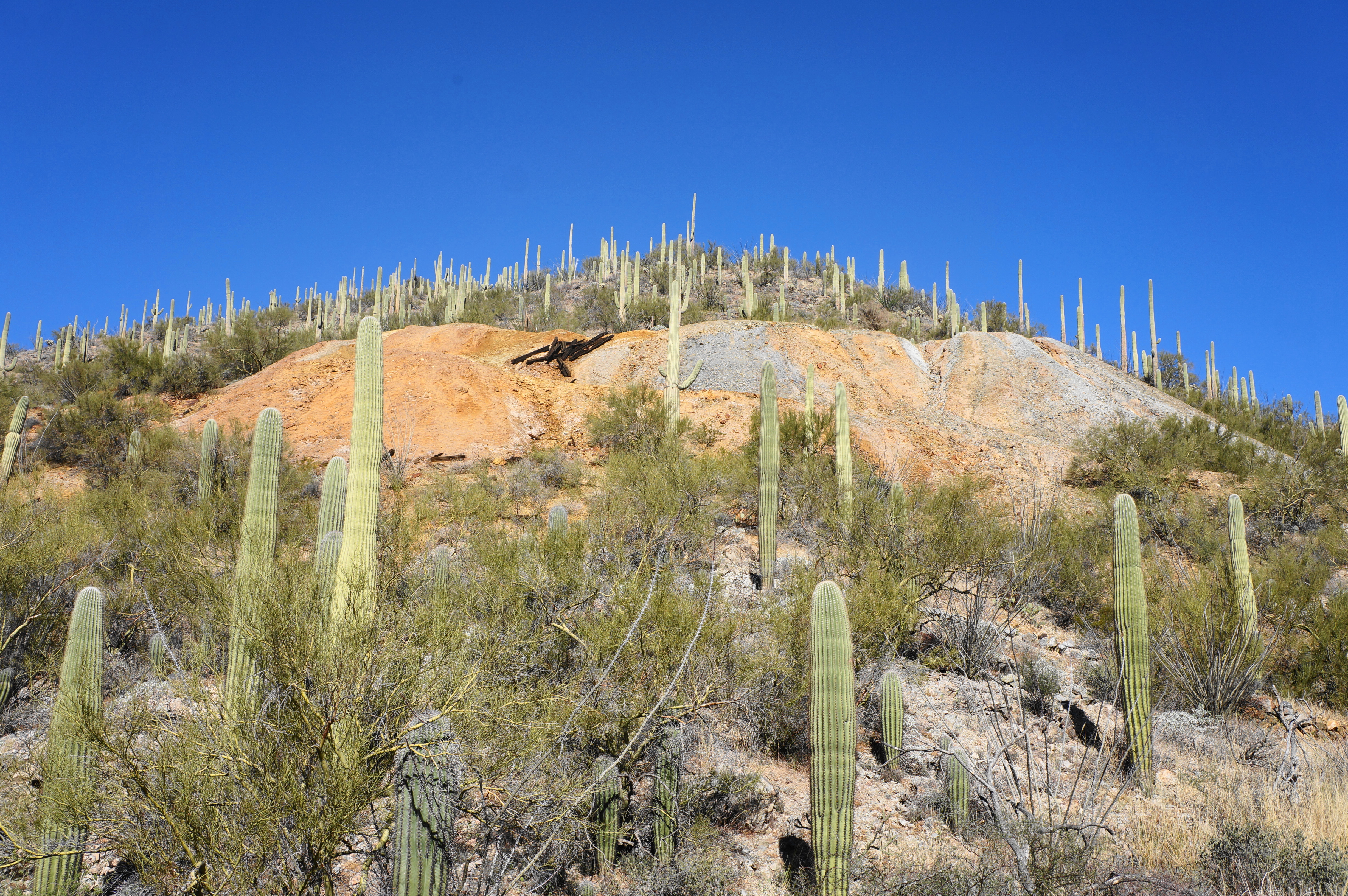
Passing the so-called Red Hills off to the west, the Gould Mine Trail drops to clear the wash at about 2/3 mile but then continues to parallel it on the left. The incline steepens as hikers come within eyesight of what is left of Gould Mine, which was in operation from 1906 to 1954. Here the mine tailings have left the hillside streaked with bright, Martian-like hues of pink, orange, and silver, perched above a slope of mesquite, saguaros, and ocotillos.
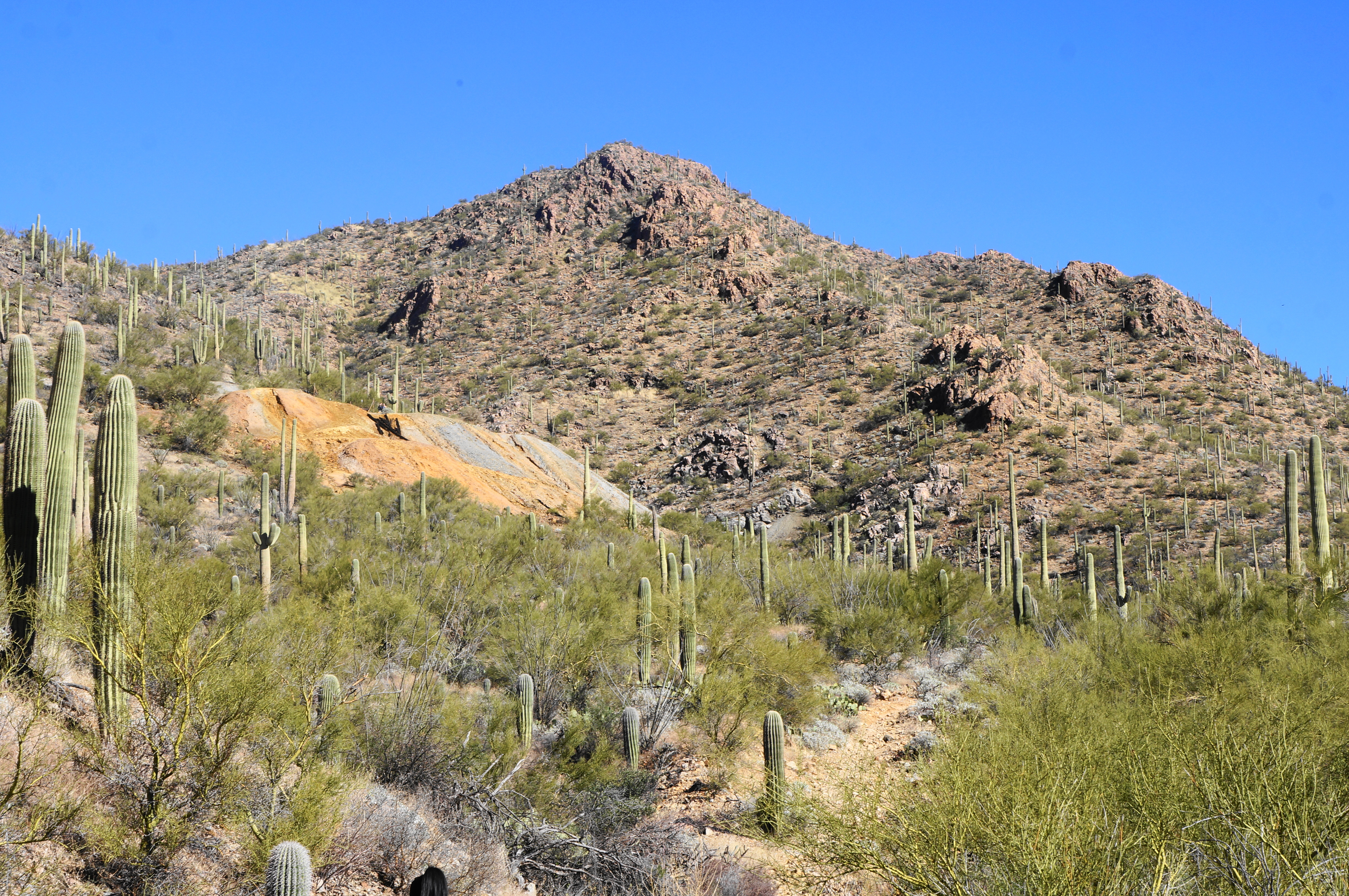

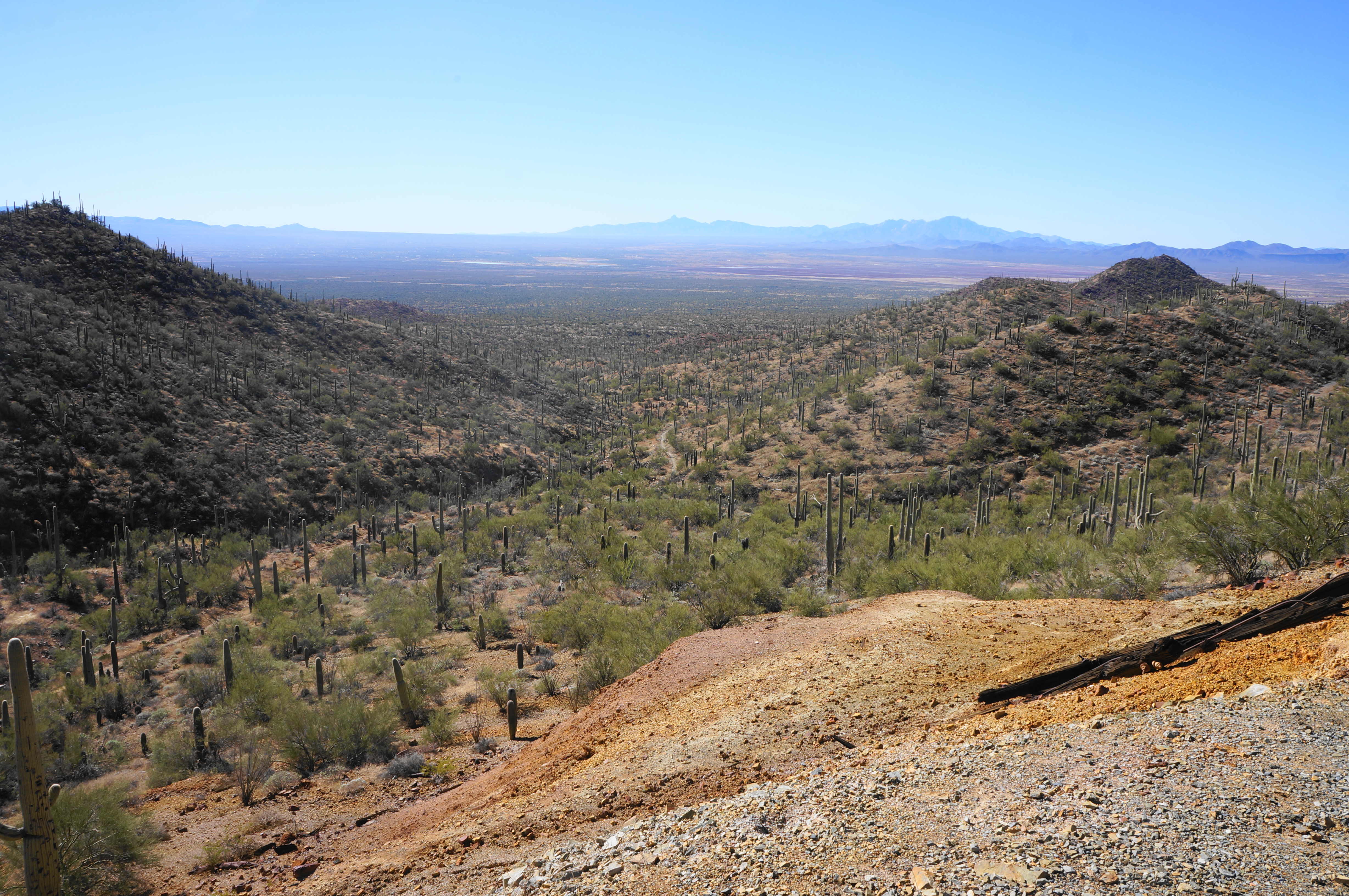
After passing the mine on the left, the single-track merges with the Sendero Esperanza Trail, which effectively the bisects the ridgeline between Wasson Peak to the east and the Red Hills area and Hohokam Road to the west. Bear left and climb the path as it rises to the top of the mine, where hikers pass a stone structure and can peer down the barred-off shaft.
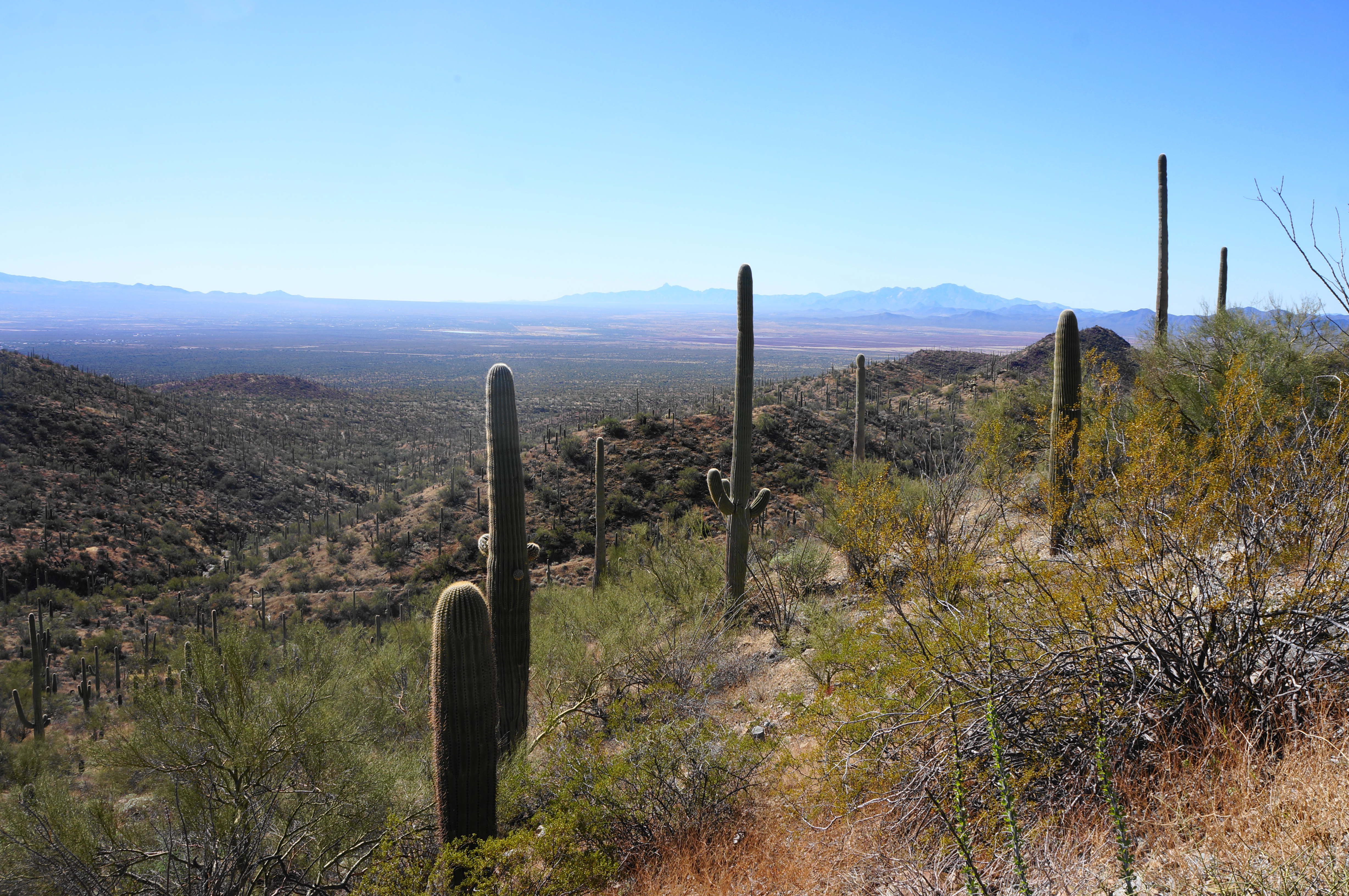
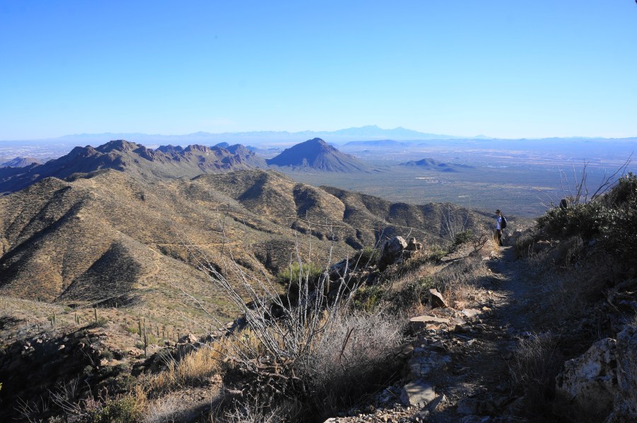
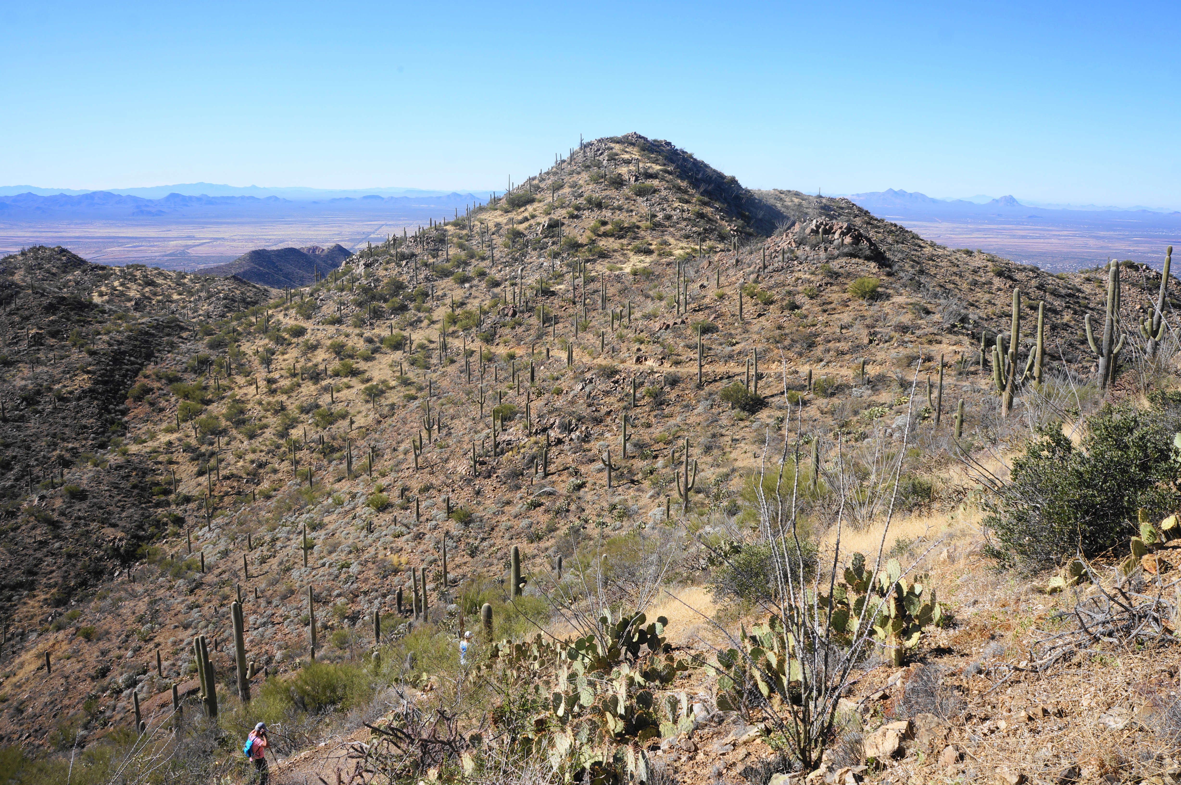
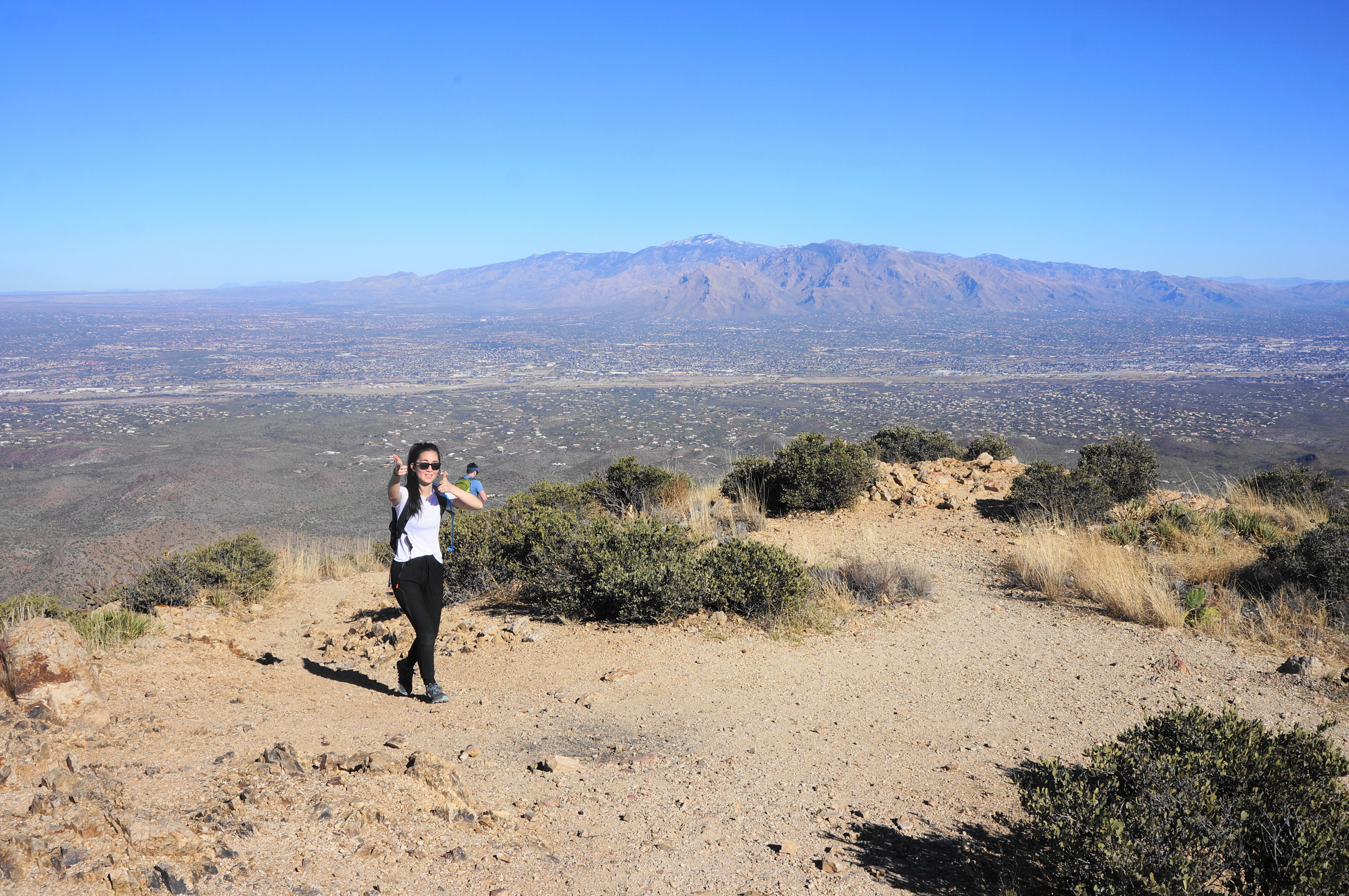
Notice the teddy bear chollas as you continue up the Sendero Esperanza Trail, which gradually edges around two steep drainages with open views south and west across Avra Valley, with the Sierrita, Coyote, and Roskruge Mountains in the distance. Continue uphill as the trail passes an outcrop of deep brown, volcanic rock on the left and then rises to a high saddle at 2.1 miles. By now, hikers have gained about 650 feet, less than half of the total gain.
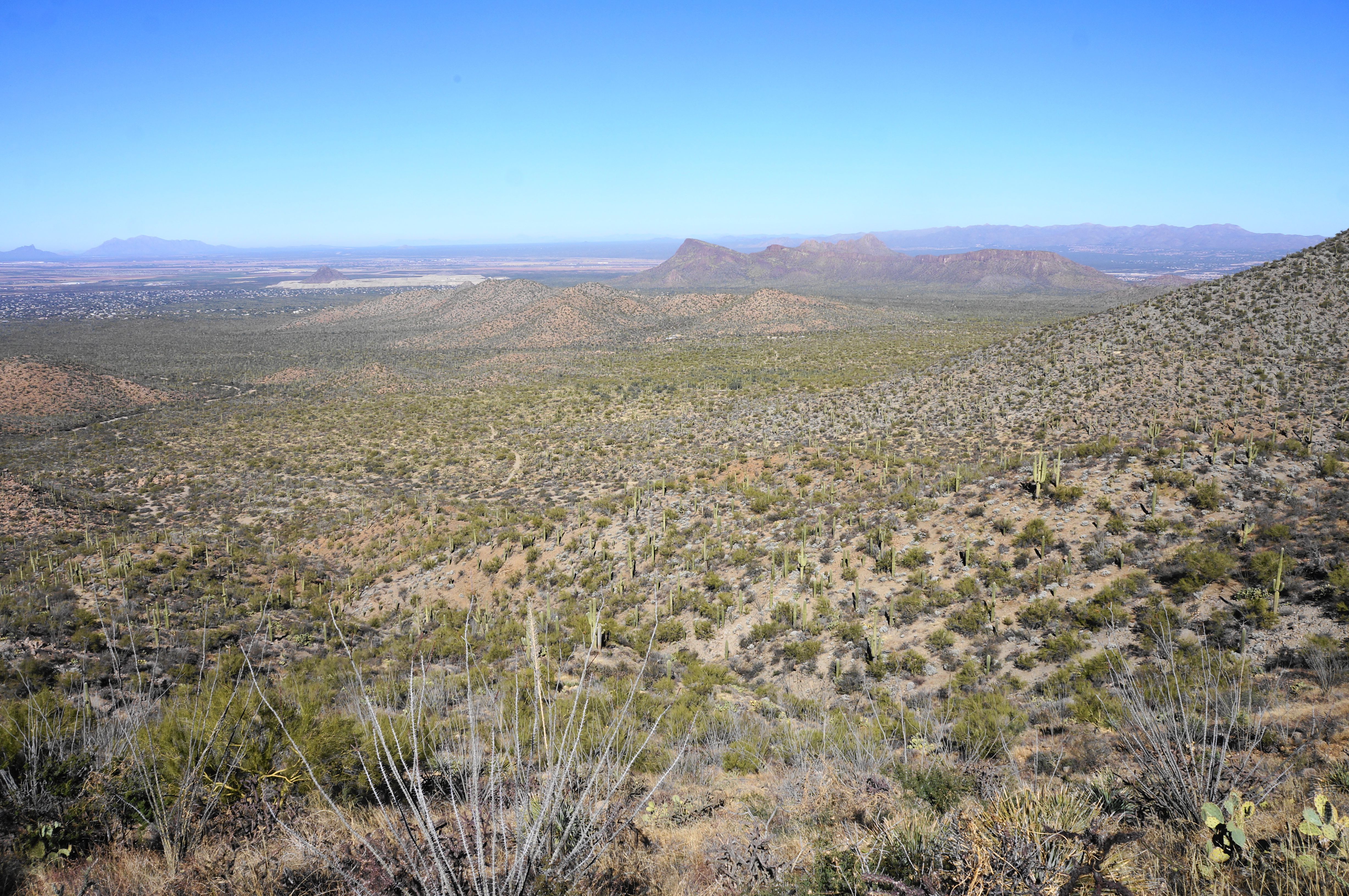
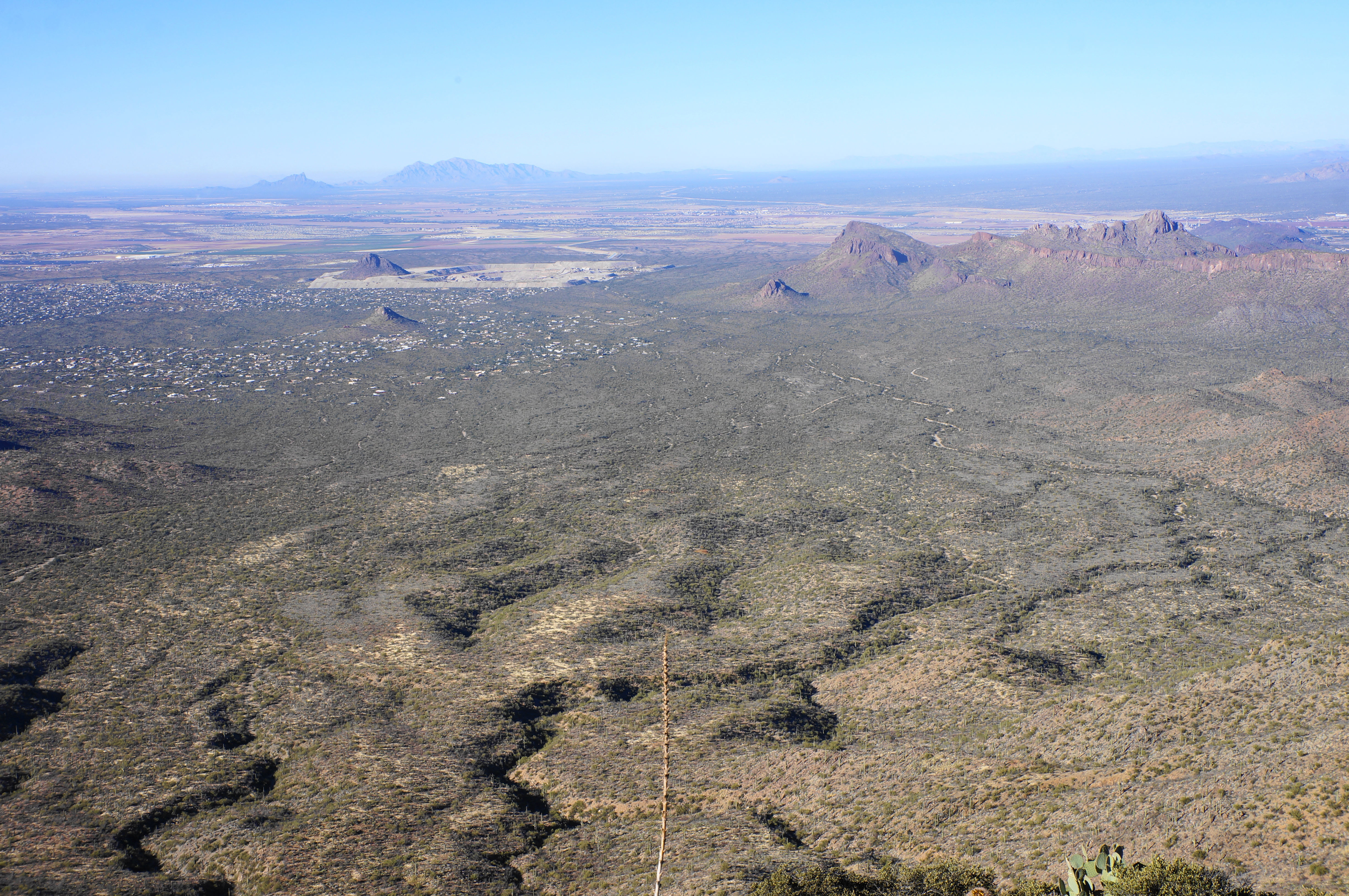
The views from the ridgeline are terrific, with new vistas to the north offering a look across modest hills to imposing Panther Peak (3,435’) and Safford Peak (3,663’) in the northern reaches of the park. Beyond that is broad valley, serviced by the seasonal Santa Cruz River, that stretches northwest toward Phoenix. Off to the northwest, just outside the park boundaries, is the community of Picture Rocks.


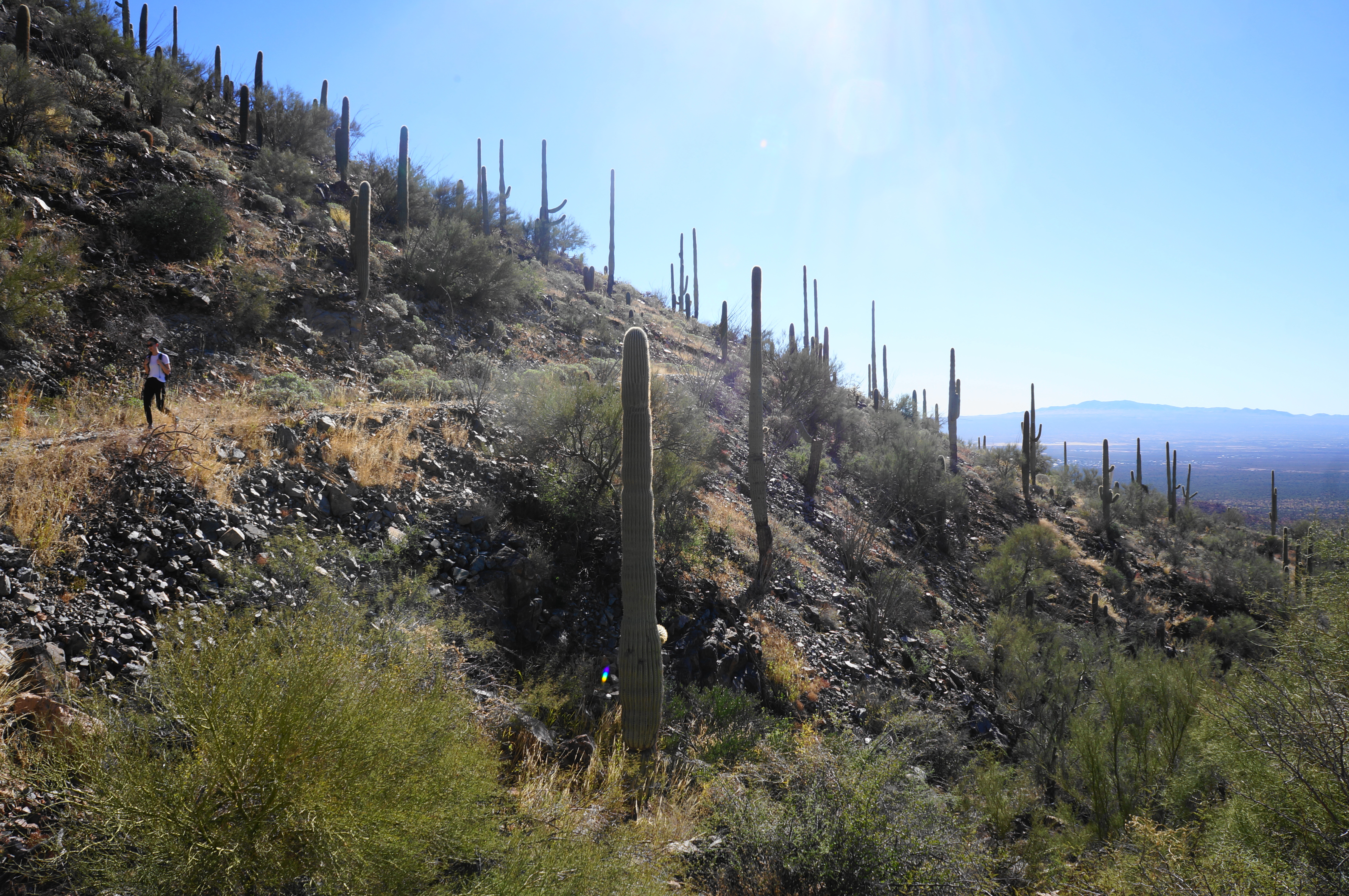
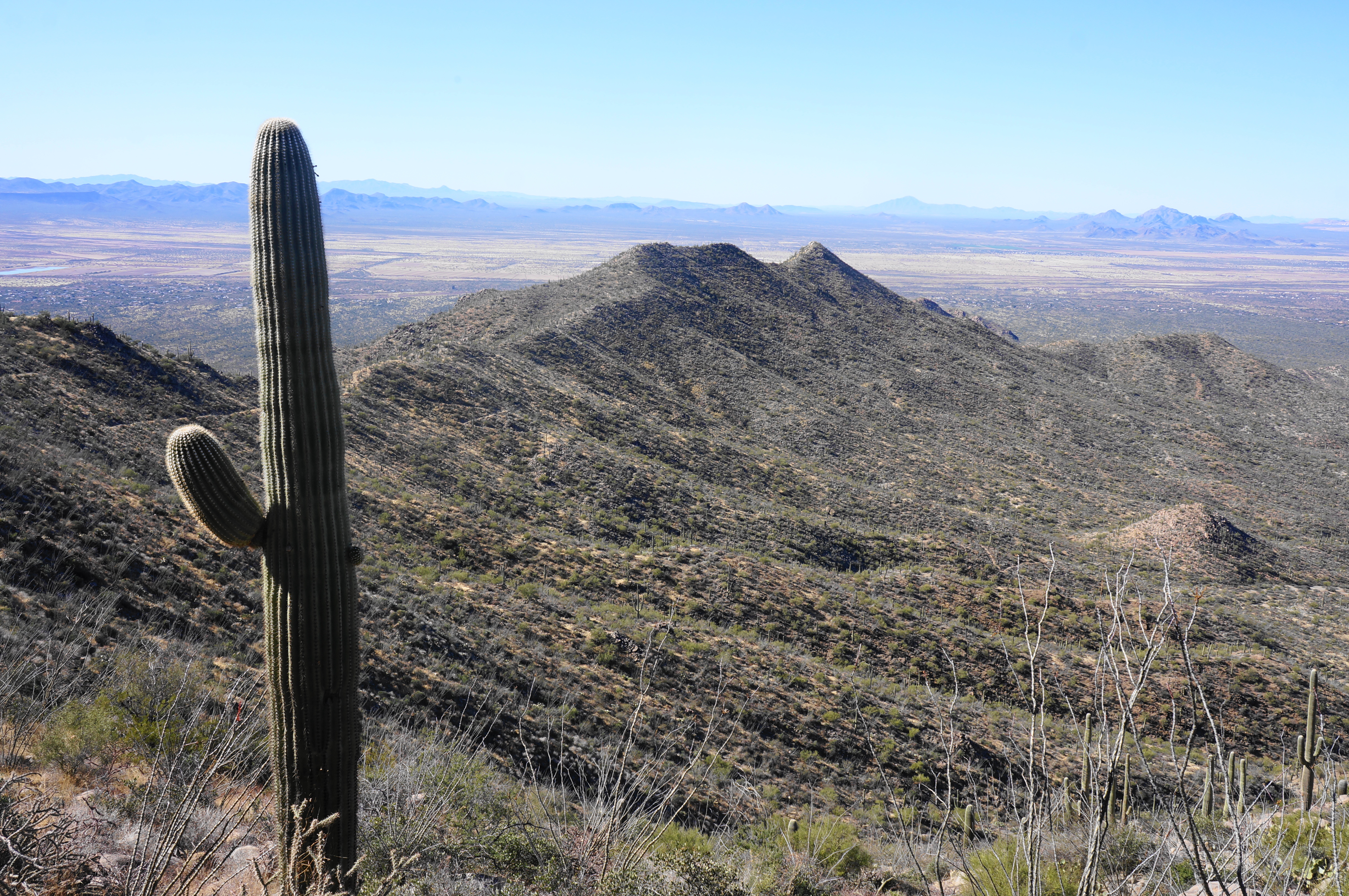
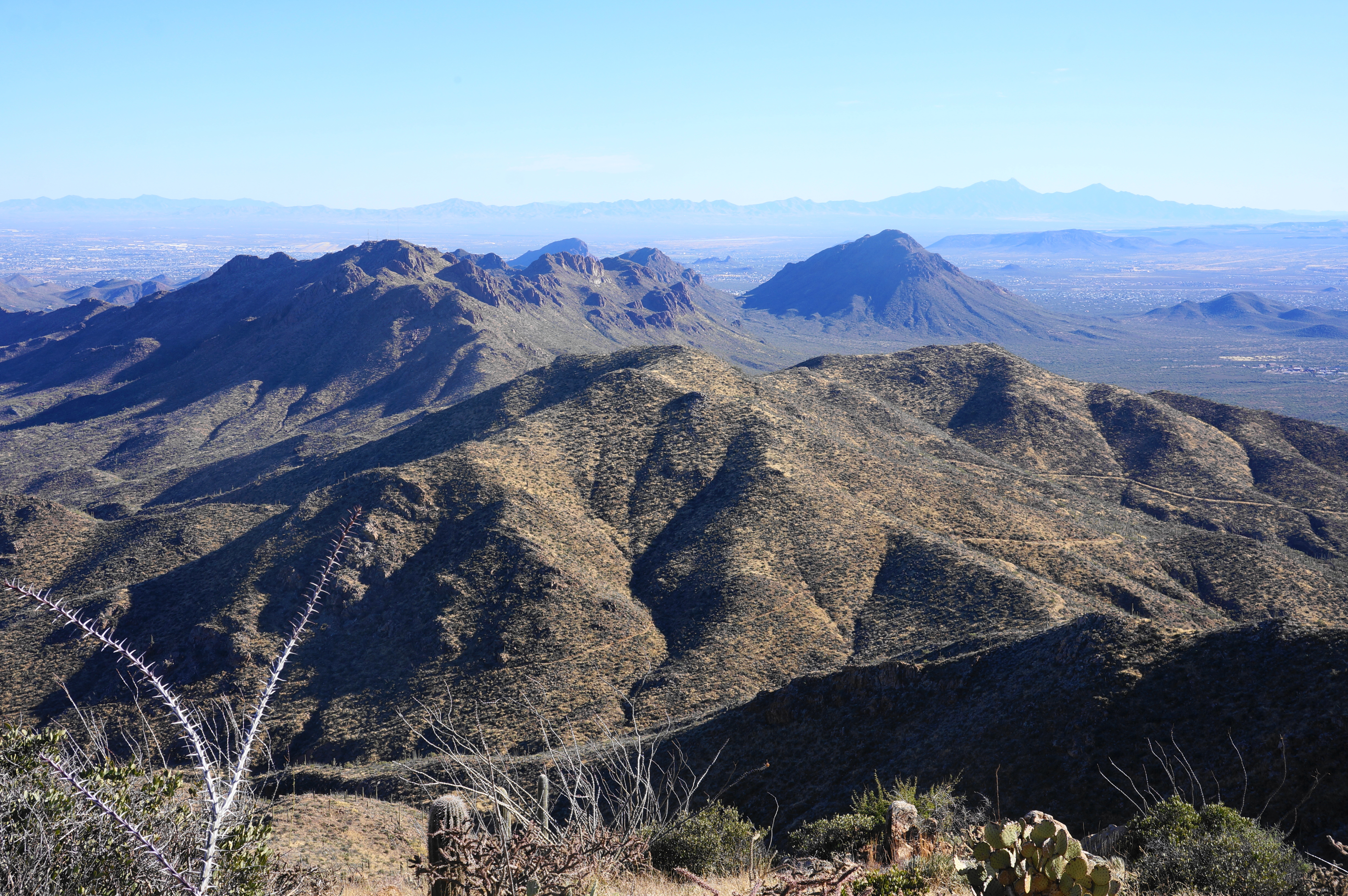
One can also see east from here toward Wasson Peak, although the actual summit for now remains obscured. Bear right at the junction with the Hugh Norris Trail, following the path eastward as it climbs steadily, leveraging stone steps and occasional switchbacks to gain height. Yuccas become more prominent as the trail goes on, and a spur at around 2.6 miles leads to a nice overlook with views to the southeast—toward Gates Pass, Tower Peak (4,161’), Bushmaster Peak (4,140’), and the long tail of the Tucson Mountains.
Soon enough the trail crests the ridge and switches to hugging the south-facing flank, with more exquisite views. After returning to the north side again briefly, the trail skirts Amole Peak (4,422’) on the left, briefly descends, and then rises to a high gap at about 3.6 miles.
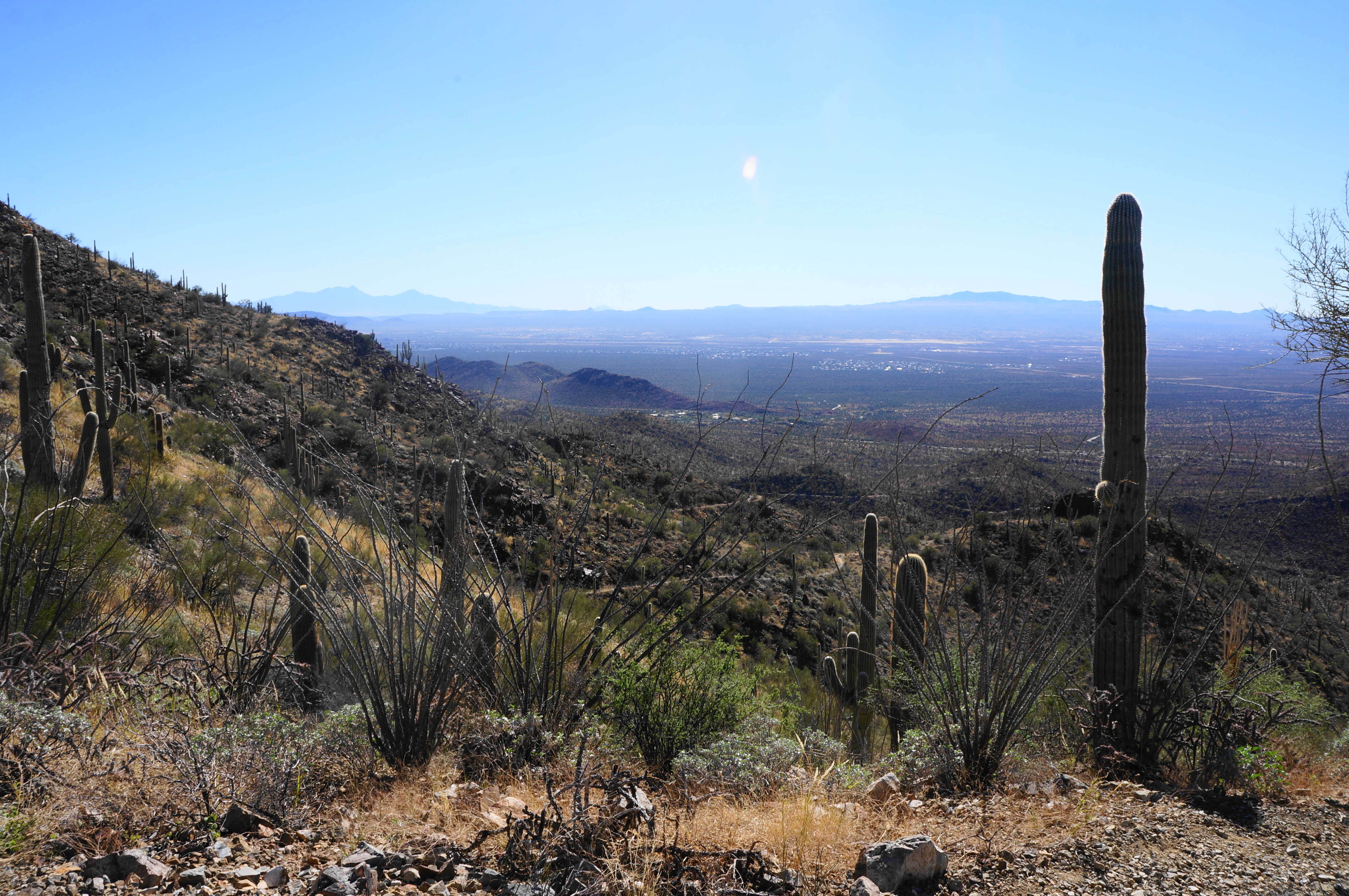
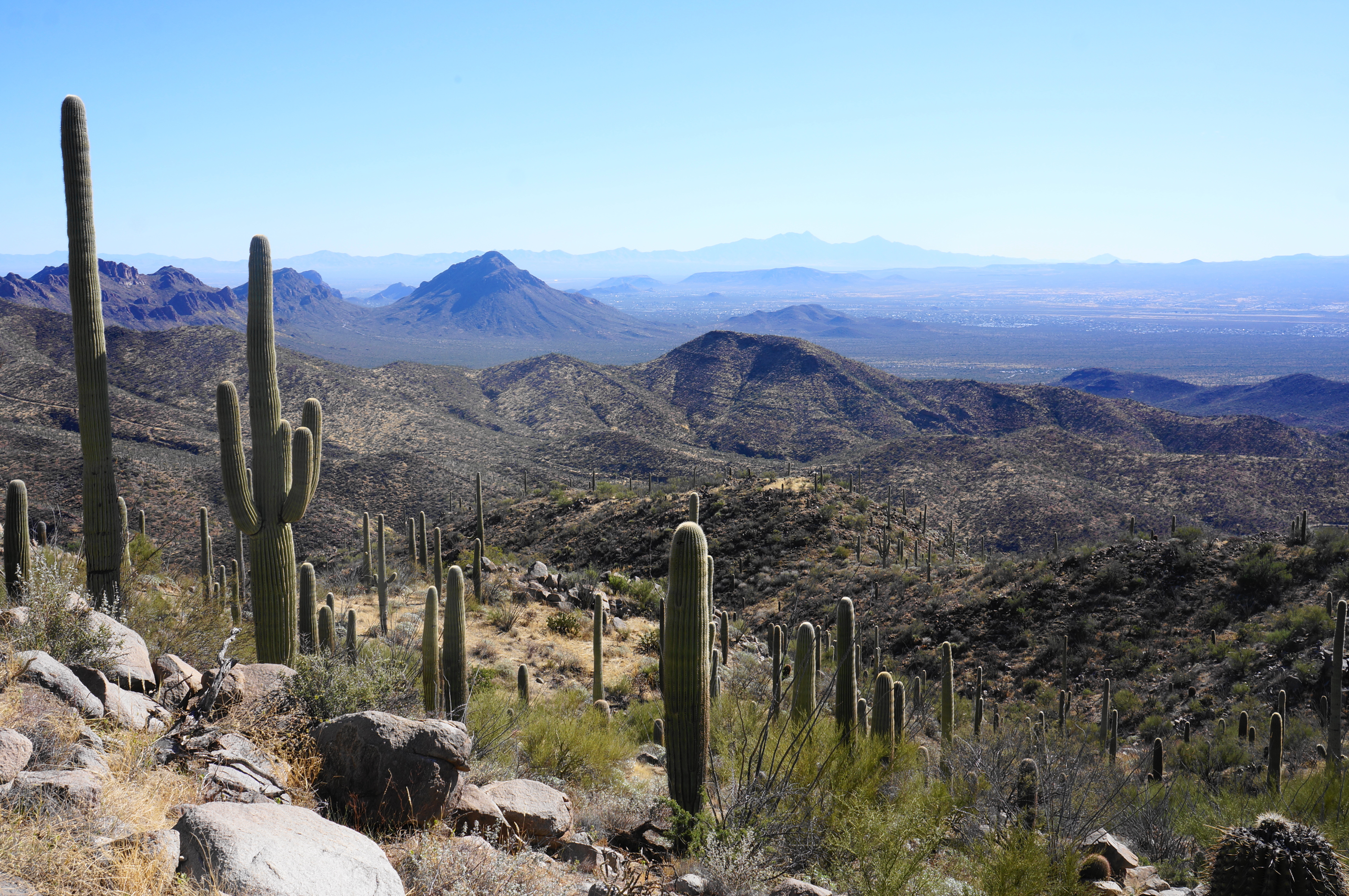
Thereafter, hikers launch into arguably the toughest part of the hike, a 300-foot climb that comprises ten sun-soaked switchbacks, culminating at an even higher saddle with the first unobstructed views of downtown Tucson. Here one can see across the heavily-populated valley to the snow-capped Santa Catalina and Rincon Mountains. Also visible ahead is the hulking mass that is Wasson Peak, the main objective of the loop hike.


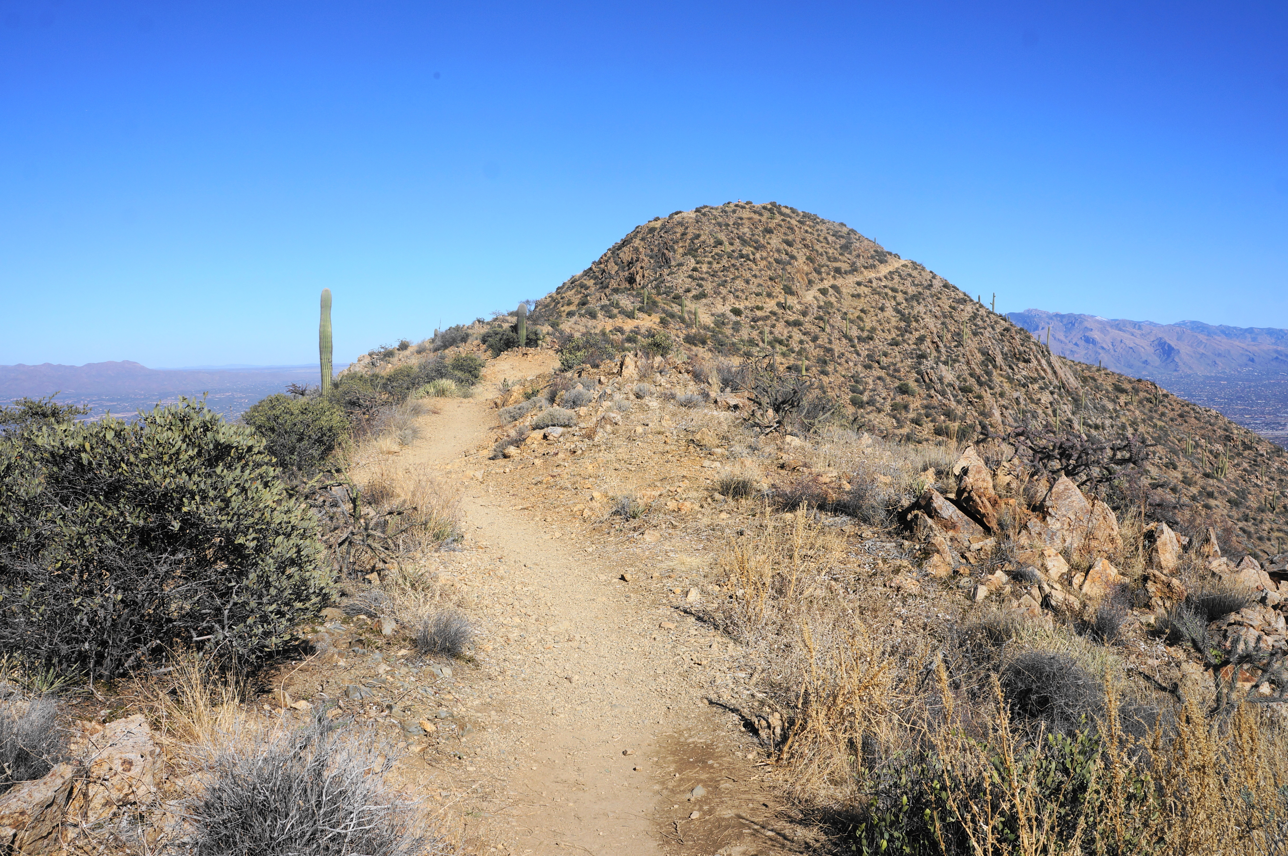
From the high pass, drop to a junction where the King Canyon Trail descends down to the right; the spur path to the summit continues left, briefly descending before rising a final time to a narrow ridgeline and then the protruding summit.
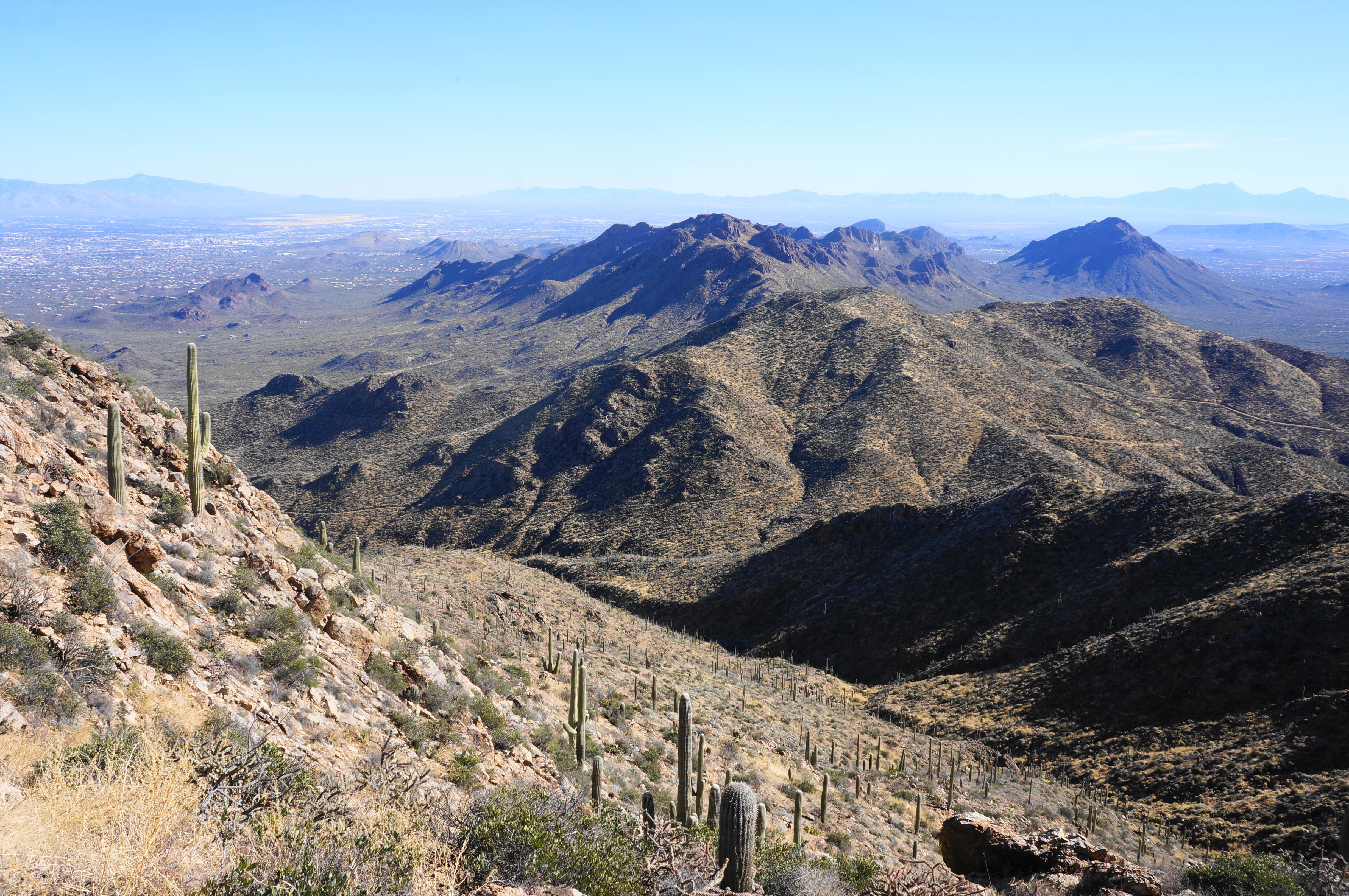
The path wraps all the way around to the east side of the peak before doubling back to the west and reaching the top. Shade is at a premium on this scrubby summit, but the views are panoramic, stretching in the direction of Phoenix to the northwest and south toward the Mexico border.

The peak was named for John Wasson, who was once the editor of the Tucson Citizen and Surveyor General of the Arizona Territory in the 1870s-80s. He has been described as a “very capable journalist” but also a “stern opponent” of the Apache Indians.

Once ready, make your way back down the spur trail, returning to the signed junction with the King Canyon Trail. Take a left here, dropping down two short switchbacks before settling into a longer straightaway that bears southwest, away from Wasson Peak. Descend another five switchbacks, with views due south returning at the left-hand bends.


Drop to a stony ridgeline and descend another set of switchbacks, flirting with the lip of the ridge before the trail finally commits to descending down the south face toward King Canyon. At about 5.5 miles, the King Canyon Trail reaches an intersection with the Sweetwater Trail and an unnamed road that was visible during the descent from Wasson Peak. Bear right, continuing on the King Canyon Trail as it cuts to the southwest, roughly following an elevated hill between two arroyos. The steady descent is made less fun by the abundance of loose, crumbly rock.
At around 6.2 miles, cross a minor wash and then climb briefly to clear another cactus-lined knoll. Soon the King Canyon Trail drops to another, wider wash, where the onward route can be a little confusing. In general, follow the wash down-canyon for about a minute, then look for a wide, ascending path that rises up on the left. This leads to a wide and broad road that stays well above the canyon floor and offers the quickest access back to the trailhead.
Follow this path for more than ¾ mile, shedding the remaining elevation before the trail finally reaches the initial fork with the Gould Mine Trail. From here it is a very short walk back to the parking area. All told, the round-trip loop clocks in at about 7.7 miles; hikers should budget about 4-6 hours for the moderately strenuous walk.

Been there, done that! A good days outing with trails that aren’t very difficult I recommend sturdy footwear and plenty of H2O!
I hiked this beautiful peak, via 3 different trails in February. The Hugh Norris was the most challenging, but all 3 offered incredible views.
The park’s visitors center was closed, but there were rangers on the outside with maps and invaluable information.
Pingback: Top 10 Hikes in 2022 | Live and Let Hike