
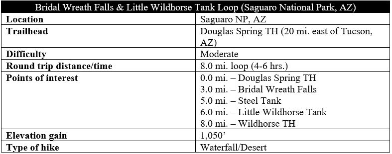
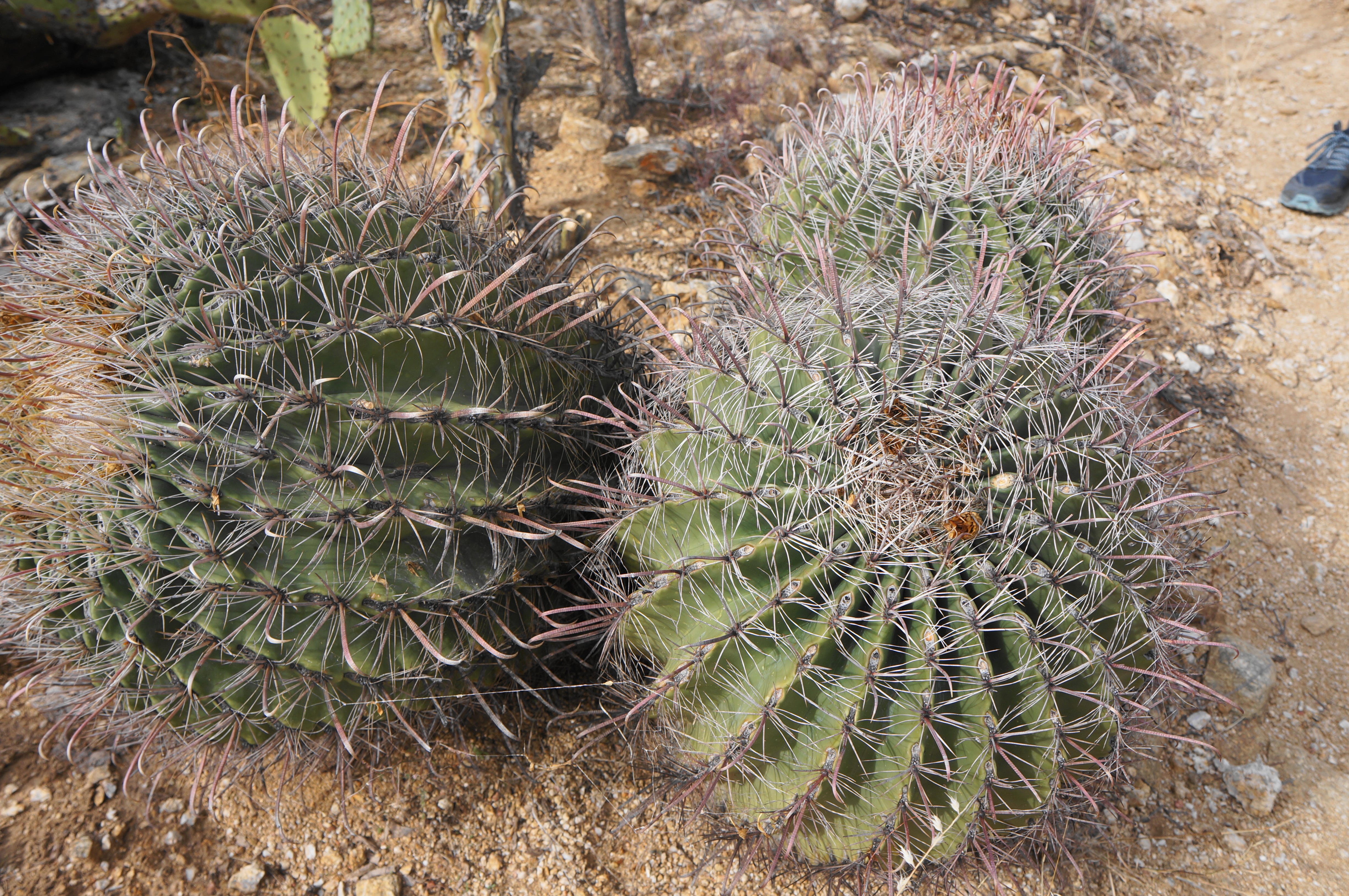
Abutting the northwestern fringes of the Rincon Mountains, the Cactus Forest in Saguaro National Park’s eastern district boasts a rich diversity of plant life, including prickly pear, red barrel, and saguaro cacti and various cholla species. A network of hiking trails crisscrosses the desert ecosystem, while a subset of them climb partway up into the foothills, where visitors can encounter, at least in springtime, a surprising sight: flowing water. A modest stream tumbles around 25 feet into a lovely pool at Bridal Wreath Falls—a popular spot among Tucson locals—while a slight detour south leads to the even nicer Little Wildhorse Tank, where a seasonal flow spills in and out of a series of potholes etched in the metamorphic bedrock. Combining the two destinations, hikers can complete a satisfying 8-mile circuit that is moderately difficult with about 1,050 feet of elevation gain.
The hike
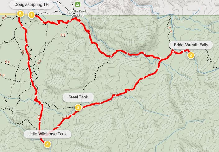
The circuit begins at the end of East Speedway Boulevard, a straightaway that leads eastward to the Rincon Mountain District from downtown Tucson, Arizona. There is no fee for entry to this part of Saguaro National Park, and the Douglas Spring Trailhead has a small parking lot that is nearly always full after mid-morning. Extra parking can be had along the shoulder to the west of the trailhead, which actually works out well given that the loop hike ends at the Wildhorse Trailhead, about 2/10 mile west of the Douglas Spring parking area.
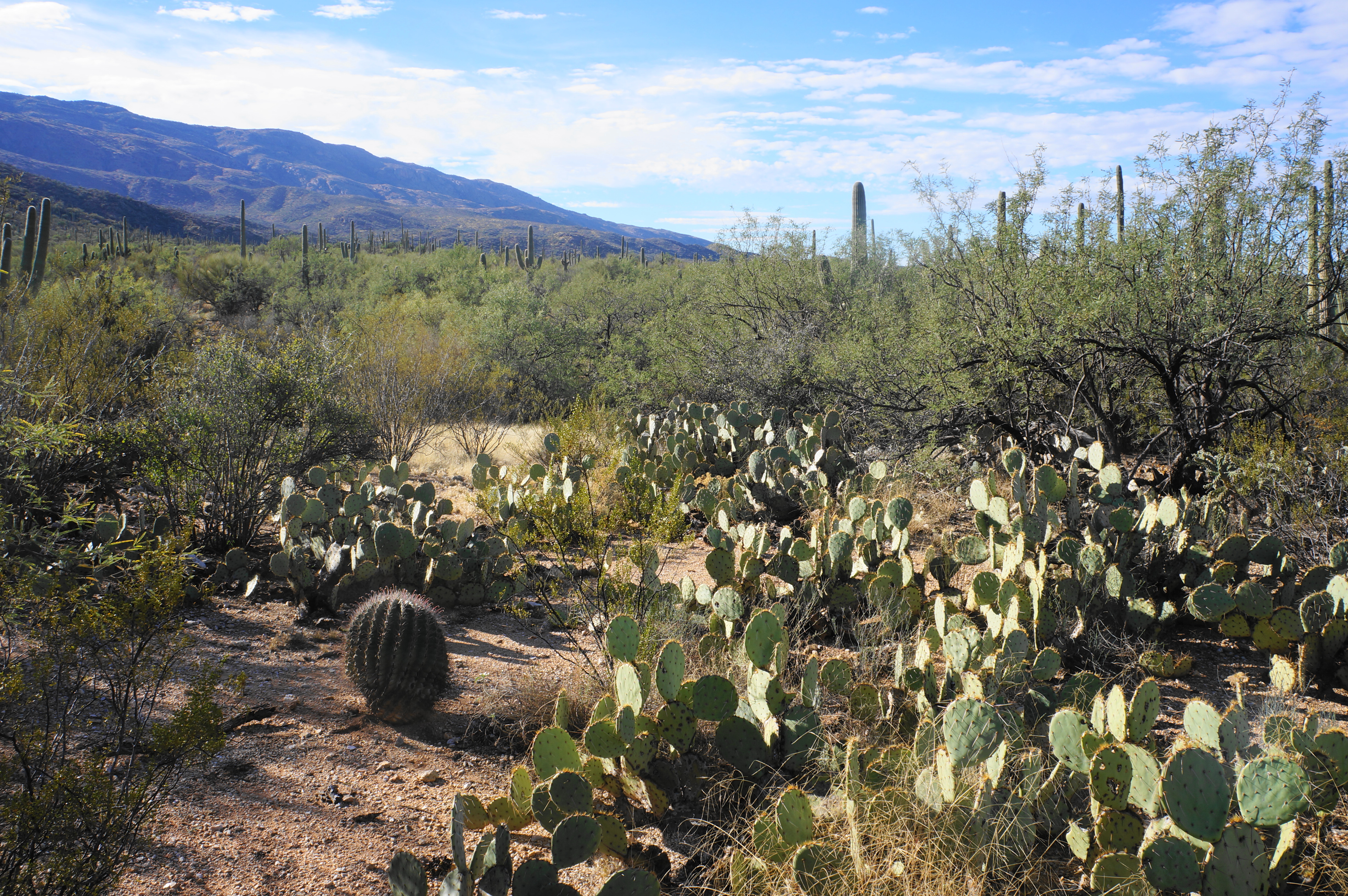
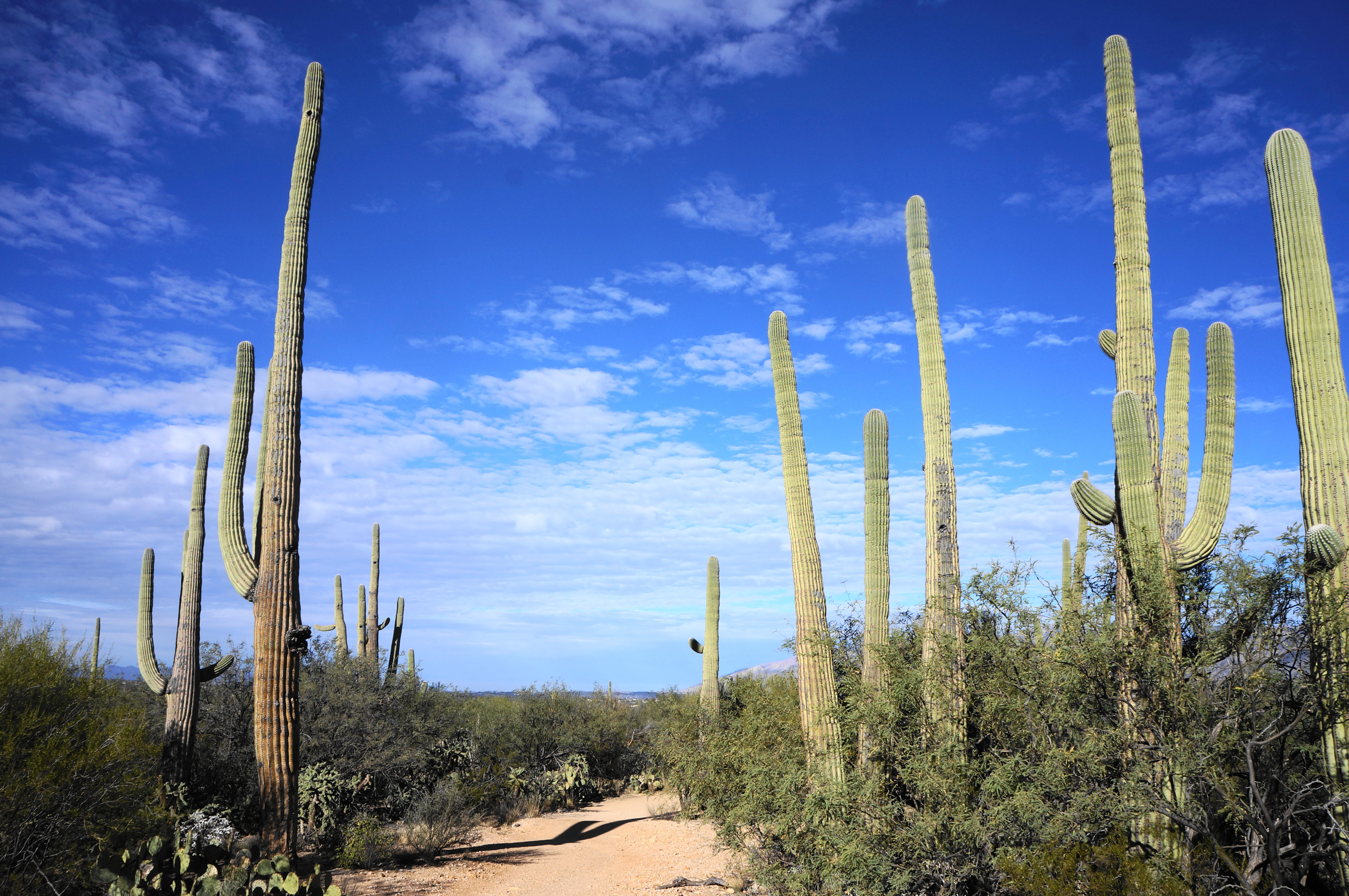
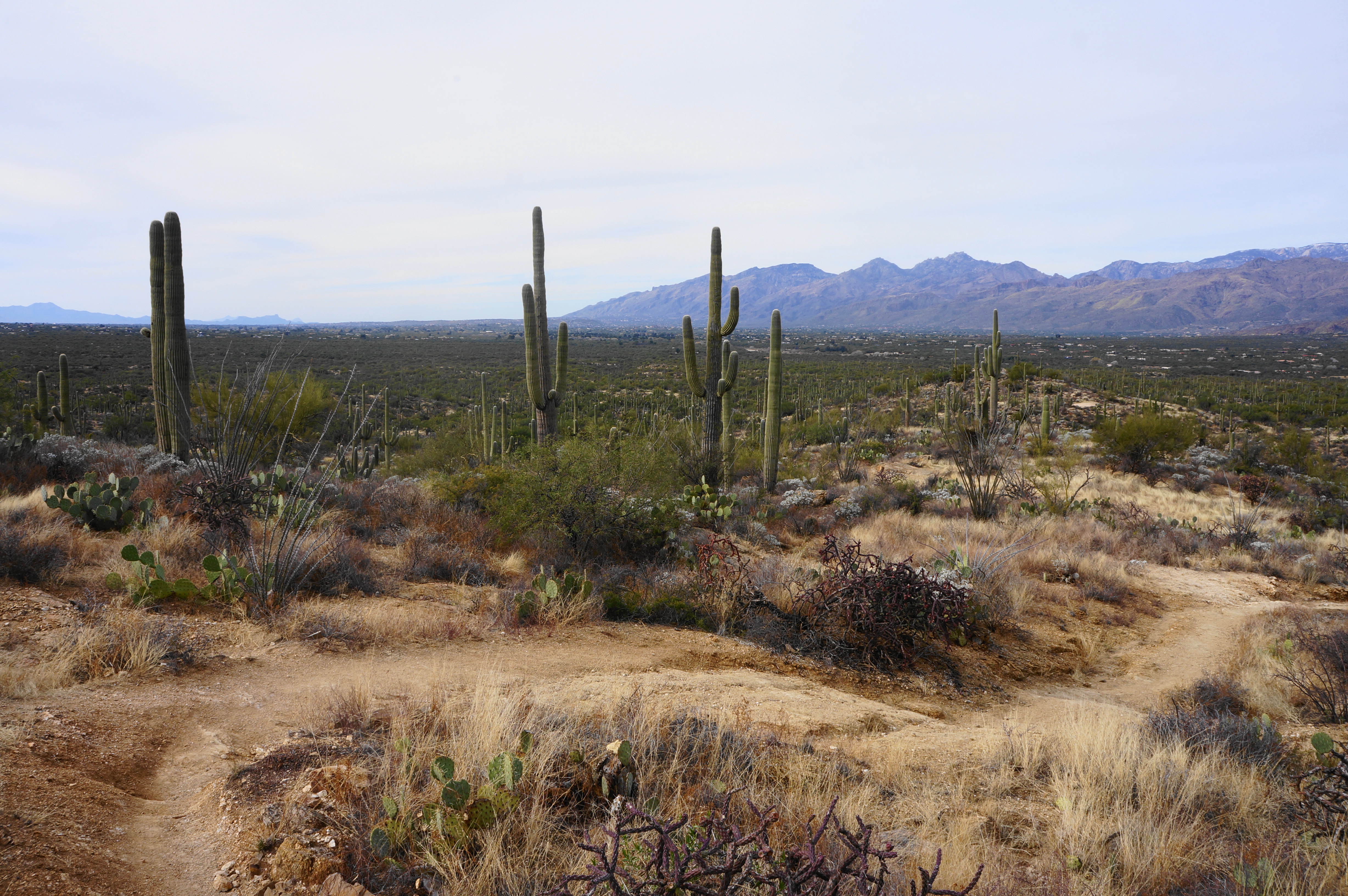
Make your way to the start of the Douglas Spring Trail, which leaves from the crowded parking lot and enters the spectacular Cactus Forest, which is particularly dense in this area. In addition to lots of the park’s namesake saguaros, there are ribbons of prickly pear, mesquite, cholla, barrel cactus, and creosote. Follow the easy, level path for ¼ mile to the first junction, where the Garwood Trail bears south. Stay left, continuing east, down and up some brief sets of stone stairs, then descend to clear a sandy wash, crossing to the north side.
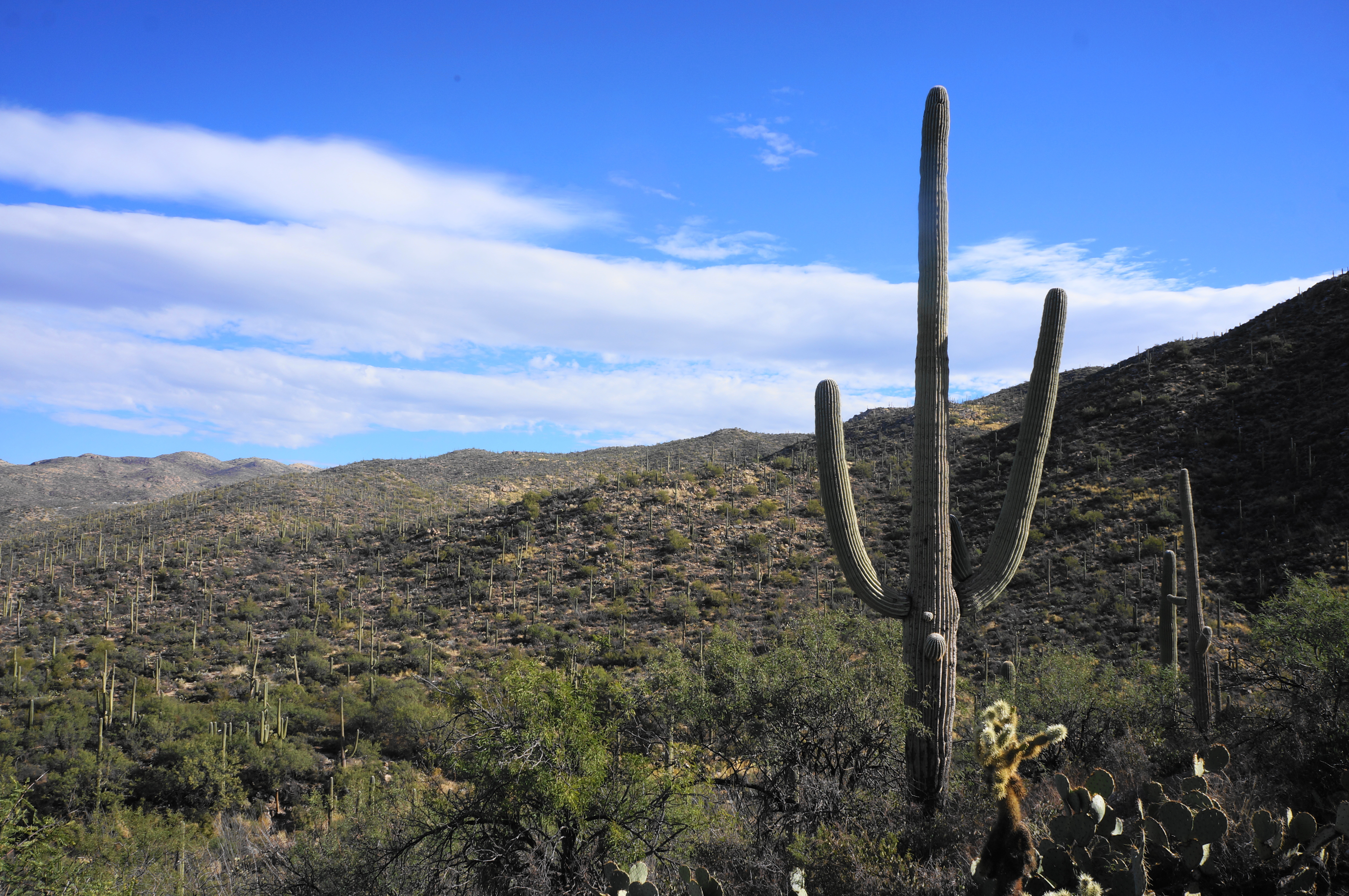
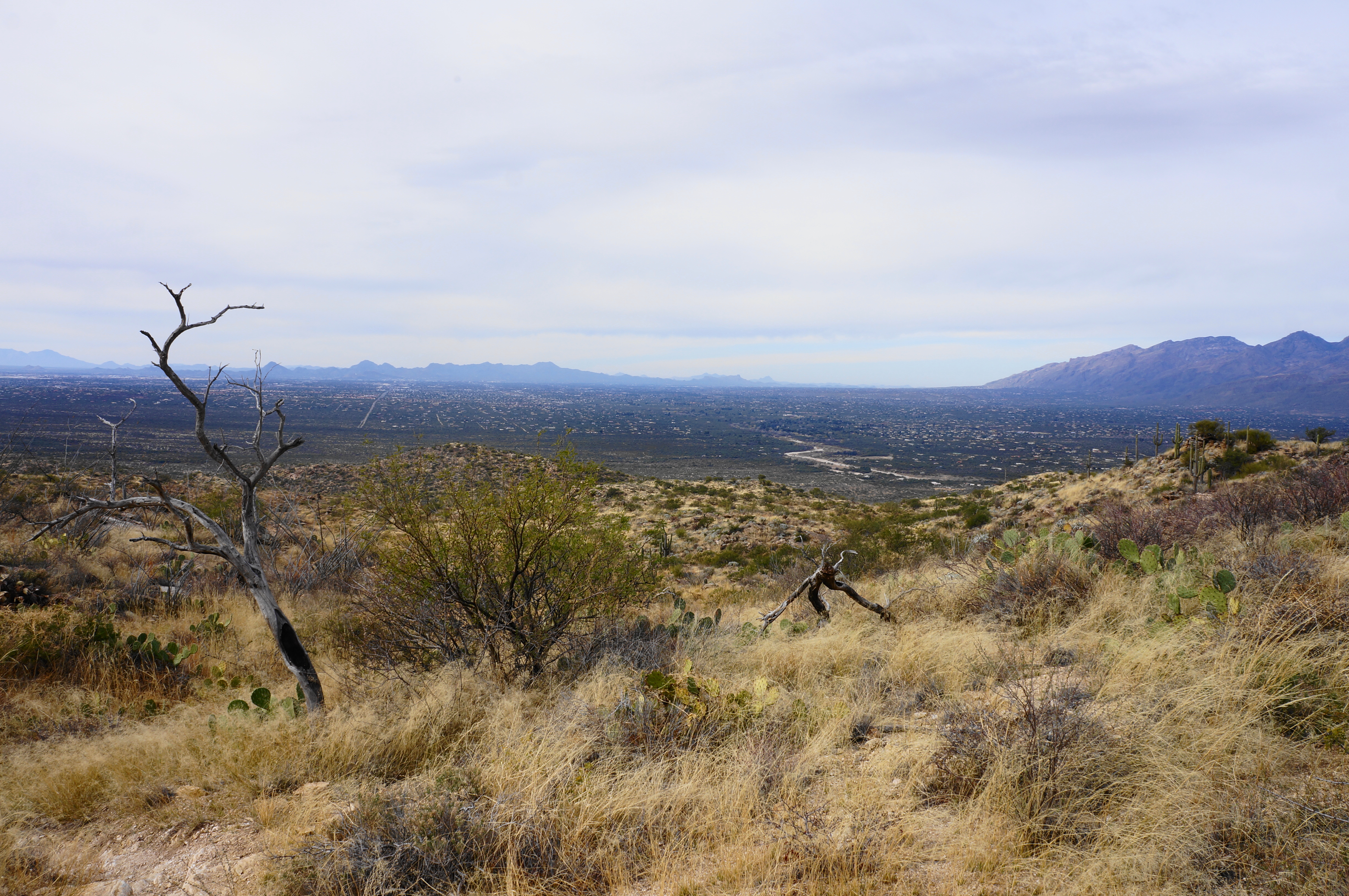
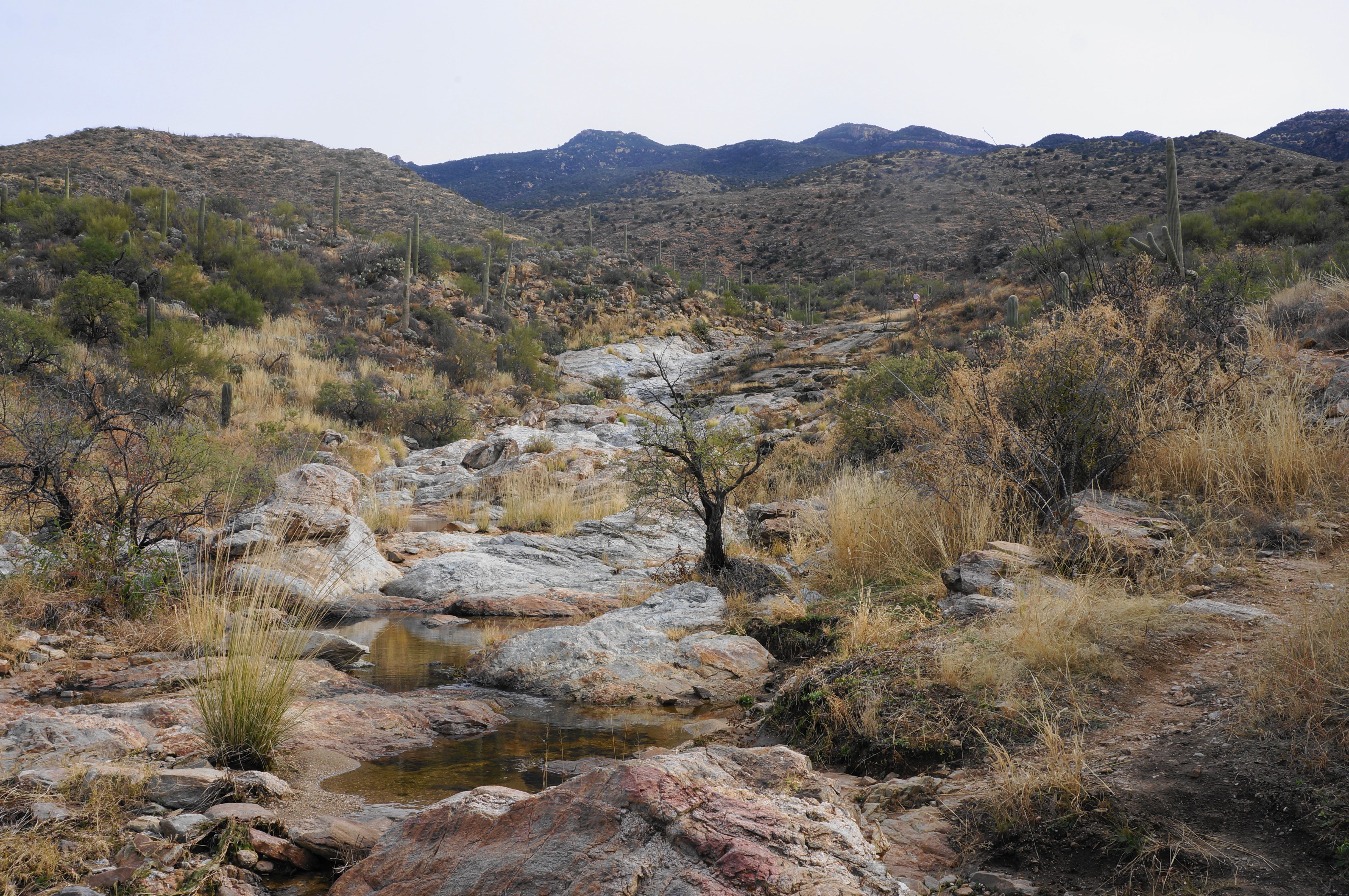
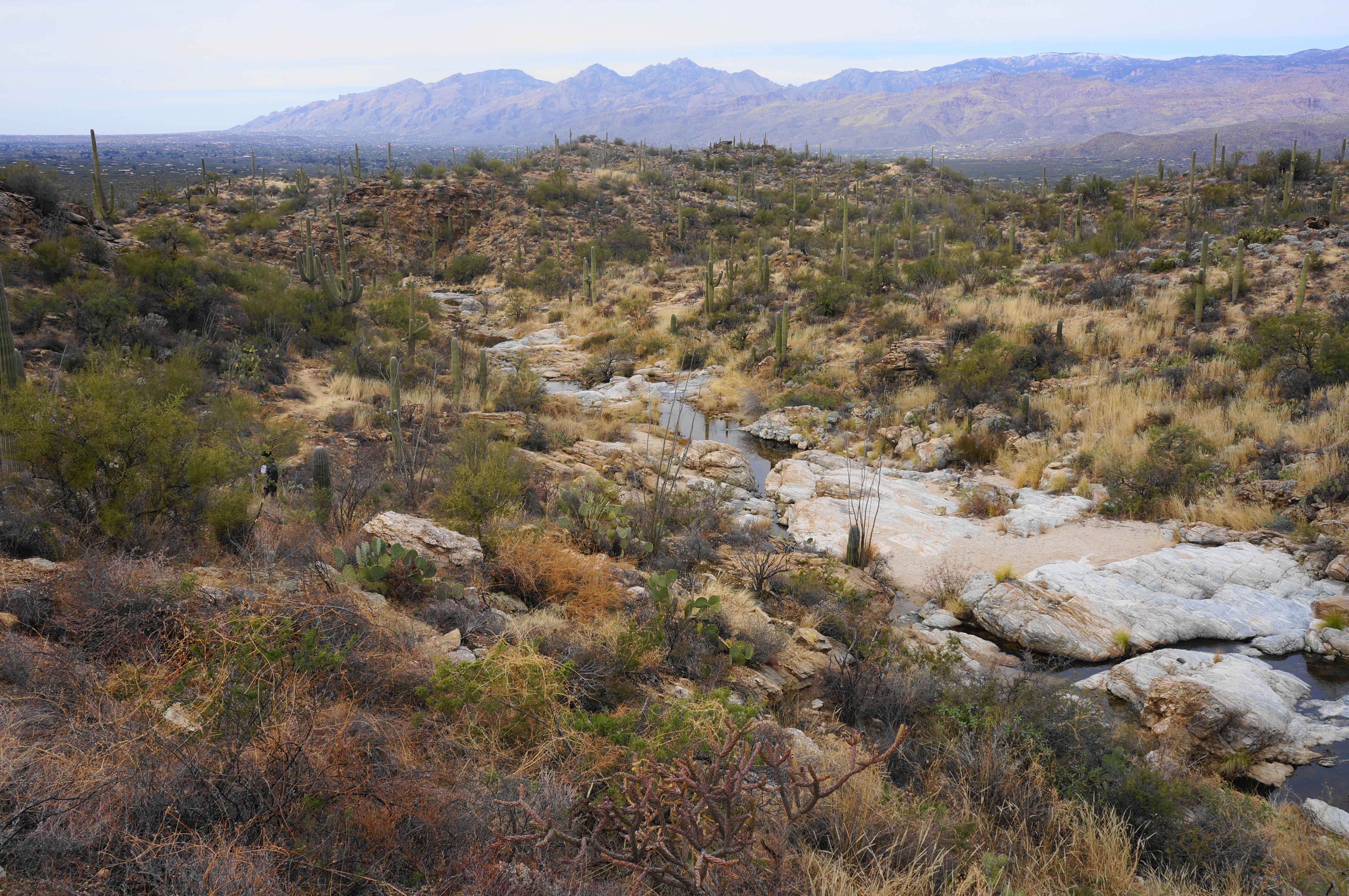
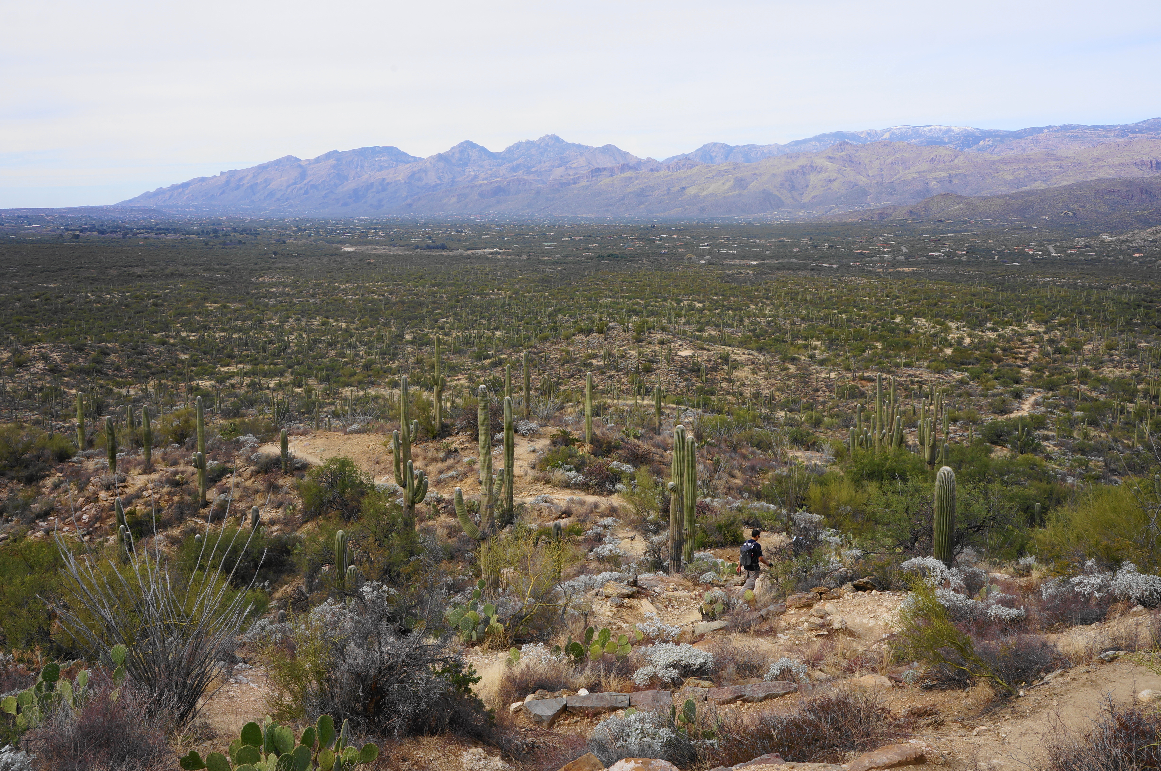
From here the path rises mildly to a second junction, this time with the Converse Trail. Stay left again, entering a section that rises into the foothills of the Rincon Mountains. A steady uphill incline brings hikers up to around 3,100 feet. After a brief flat, the ascent continues, climbing steeper stone steps, with expansive views across the broad valley to Tucson and the Santa Catalina Mountains. Ahead, the landscape is dominated by Tanque Verde Ridge, a long hogback that eventually connects with Mica Mountain (8,666’), the highest point in Saguaro National Park. (Note: Reaching Mica Mountain requires at least a 2-3 backcountry trip.)
Yuccas and ocotillos become more ubiquitous—and saguaros sparser—as the Douglas Spring Trail rises higher, reaching about 3,400 feet before a third junction. Although hikers will eventually find themselves on the Carrillo Trail en route to Little Wildhorse Tank, for now stay left on the Douglas Spring Trail toward Bridal Wreath Falls.
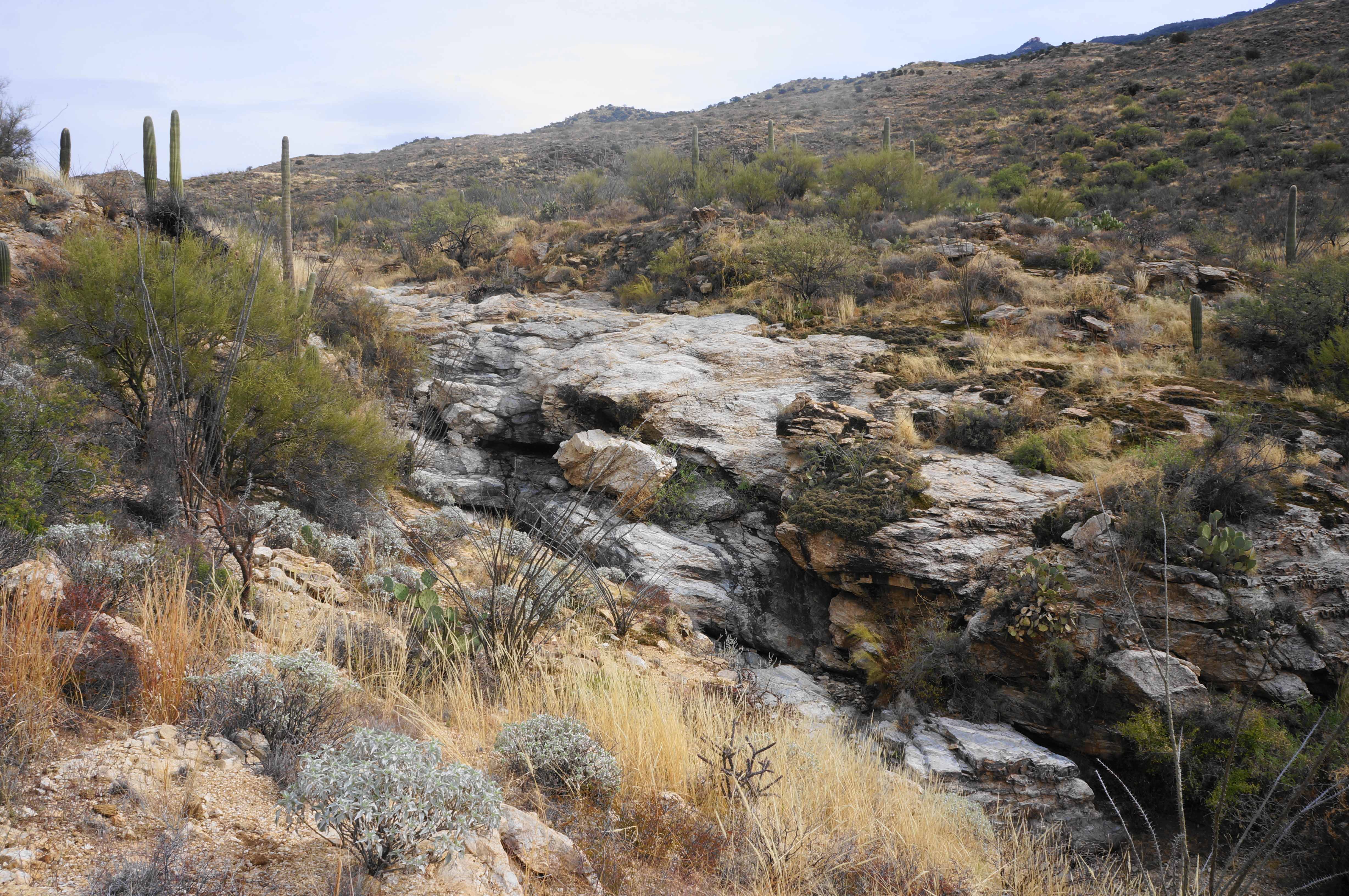
From the fork, drop down a grassy pitch to a blocky drainage that may hold water after recent rains. This nameless wash is nonetheless one of the most prominent in the area, and the trail will continue to follow it for another ¾ mile.
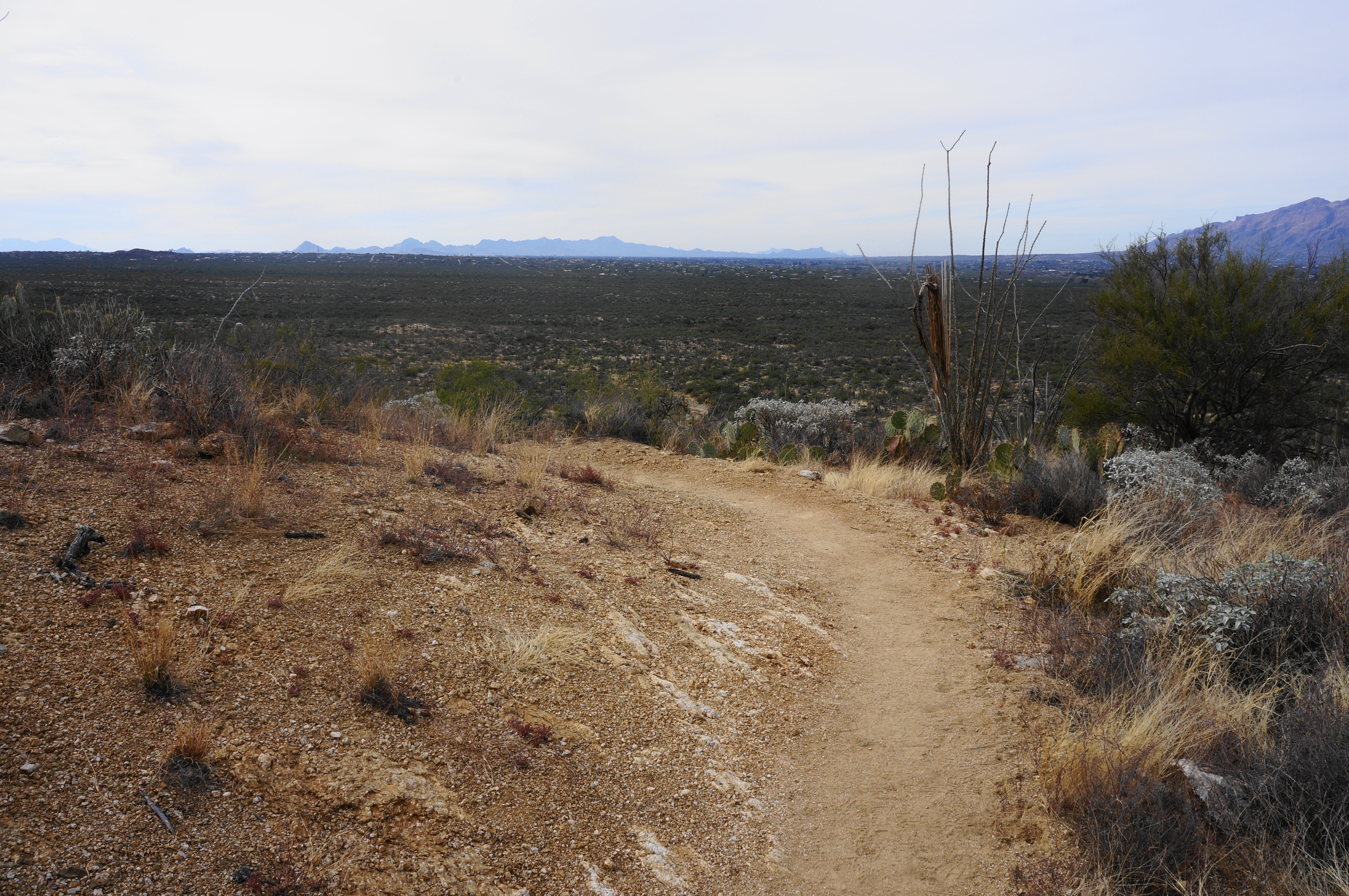
Once across the wash, ascend a staircase and parallel the drainage from high above, looking back across the valley to Tucson and beyond. The trail soon levels off and then crosses a side drainage flanked with brush. Continue to climb up to a sun-soaked plain. This area was once charred by the 1989 Chiva Fire, although it is hard to tell today as tufty grasses and brush have overtaken the flat once again.
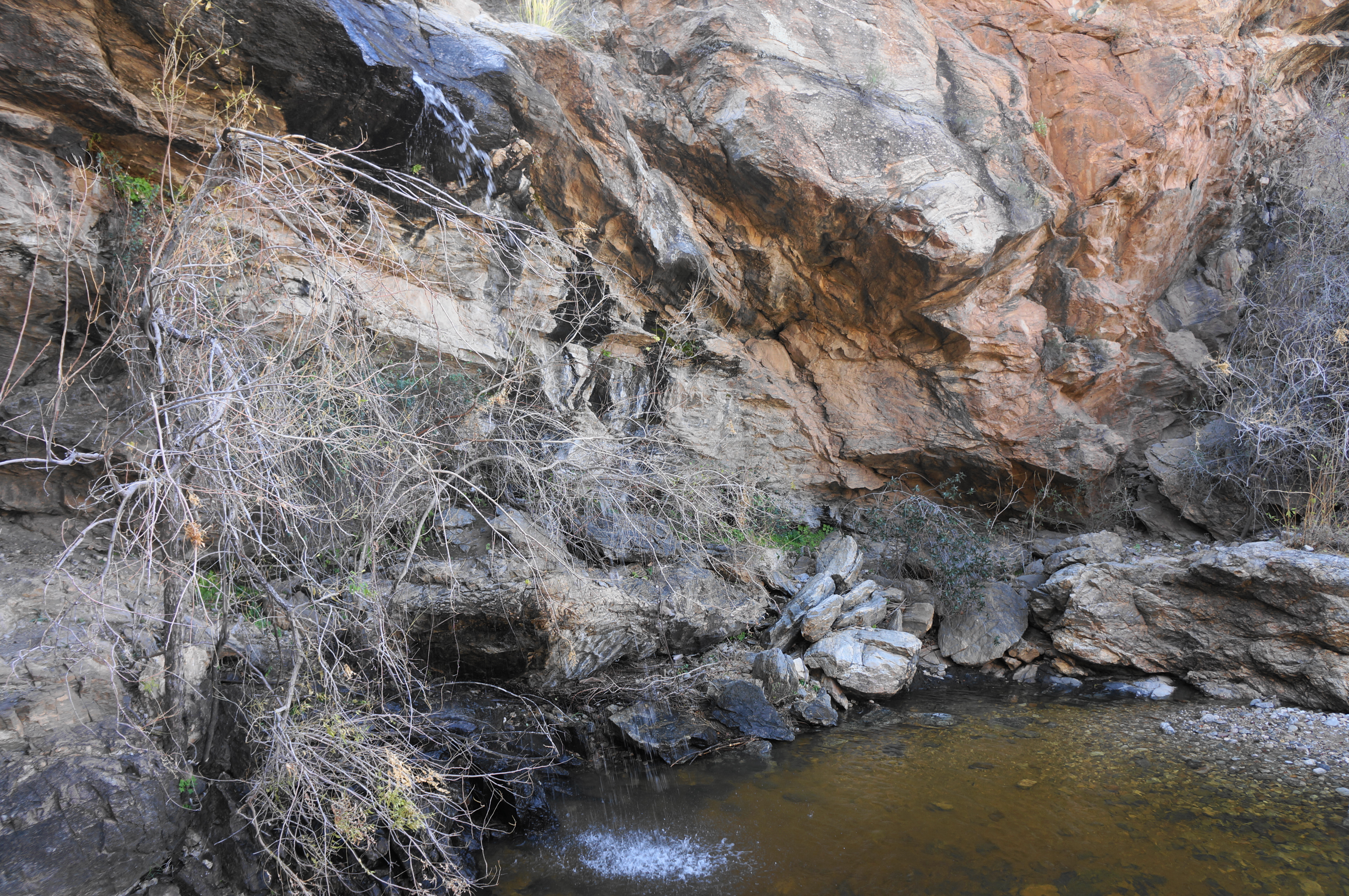
At about 2.4 miles, stay left at the junction with the Three Tank Trail, which hikers will take later to reach Little Wildhorse Tank. Continuing on the Douglas Spring Trail, crisscross a minor drainage and then come to another fork around ¼ mile later. Here hikers should bear right at the four-way junction, taking the short Bridal Wreath Falls Trail as it descends through thicker brush. Cross the rocky drainage, fed by the waterfall, then climb along the north banks for a bit before the trail drops again, this time ending in the drainage itself. Use careful footing as you make your way upstream, quickly arriving at Bridal Wreath Falls.

Given that it usually has only a faint or nonexistent flow, the waterfall is no Niagara Falls, but the multihued cliff and clear pool makes the area a pleasant enough sight. A small beach and adjacent rocks offer places to stop for a snack and enjoy the shady glen, a relatively rare sight in the sun-soaked desert.
Most day hikers will turn around at this point and return the way they came to Douglas Spring Trail, which makes for about a 5.9-mile out-and-back. But why stop here? It is relatively easy to combine Bridal Wreath Falls with a visit to Little Wildhorse Tank, another popular attraction, in a loop hike that adds about two miles to the round-trip. To continue on this circuit, work your way back to the four-way junction, turn left, and then walk to the start of the Three Tank Trail. This pleasant and lesser-used path cuts southwest along the base of the Rincons, passing three seasonal tanks—two natural and one man-made—along the way.
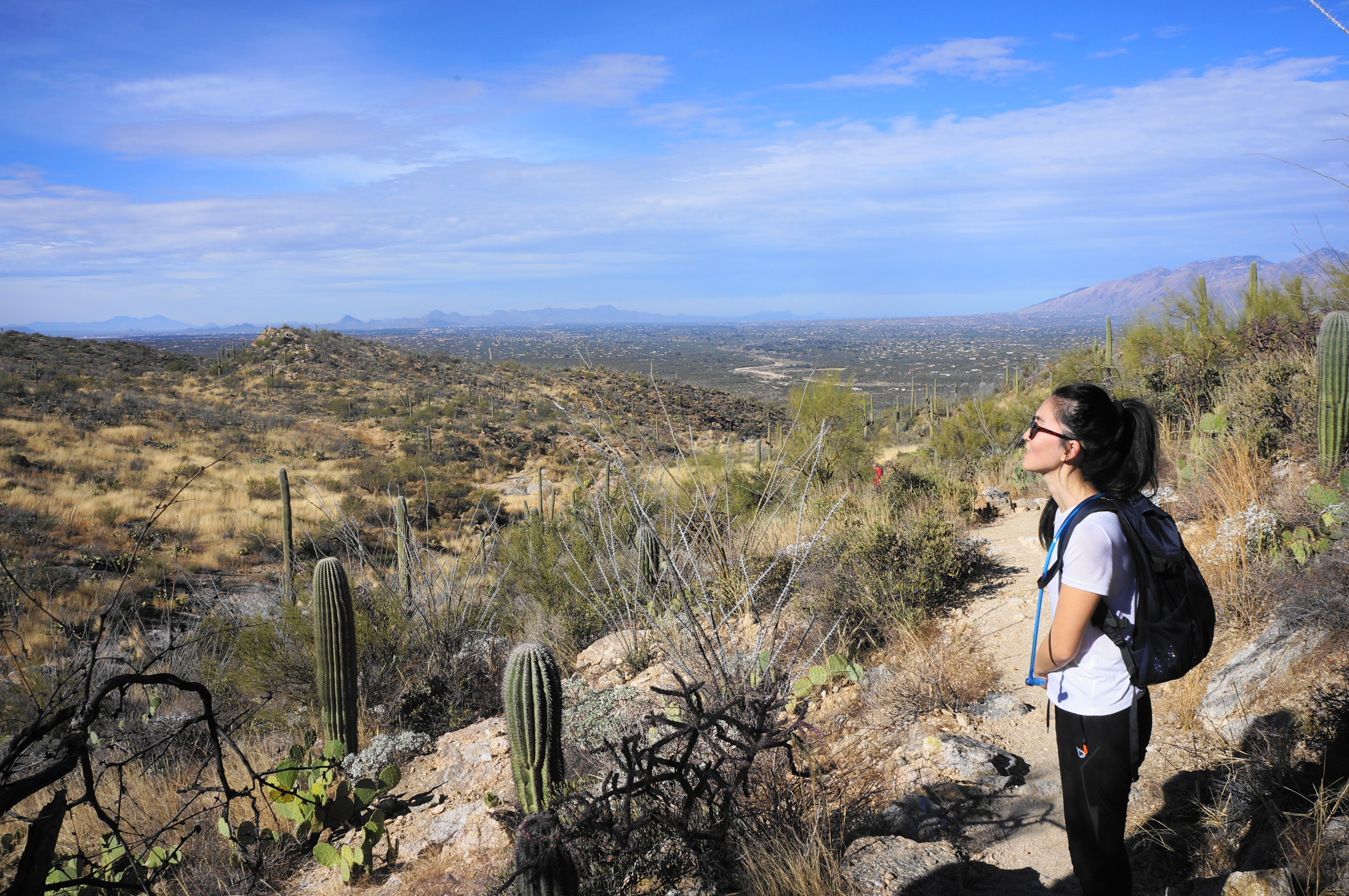
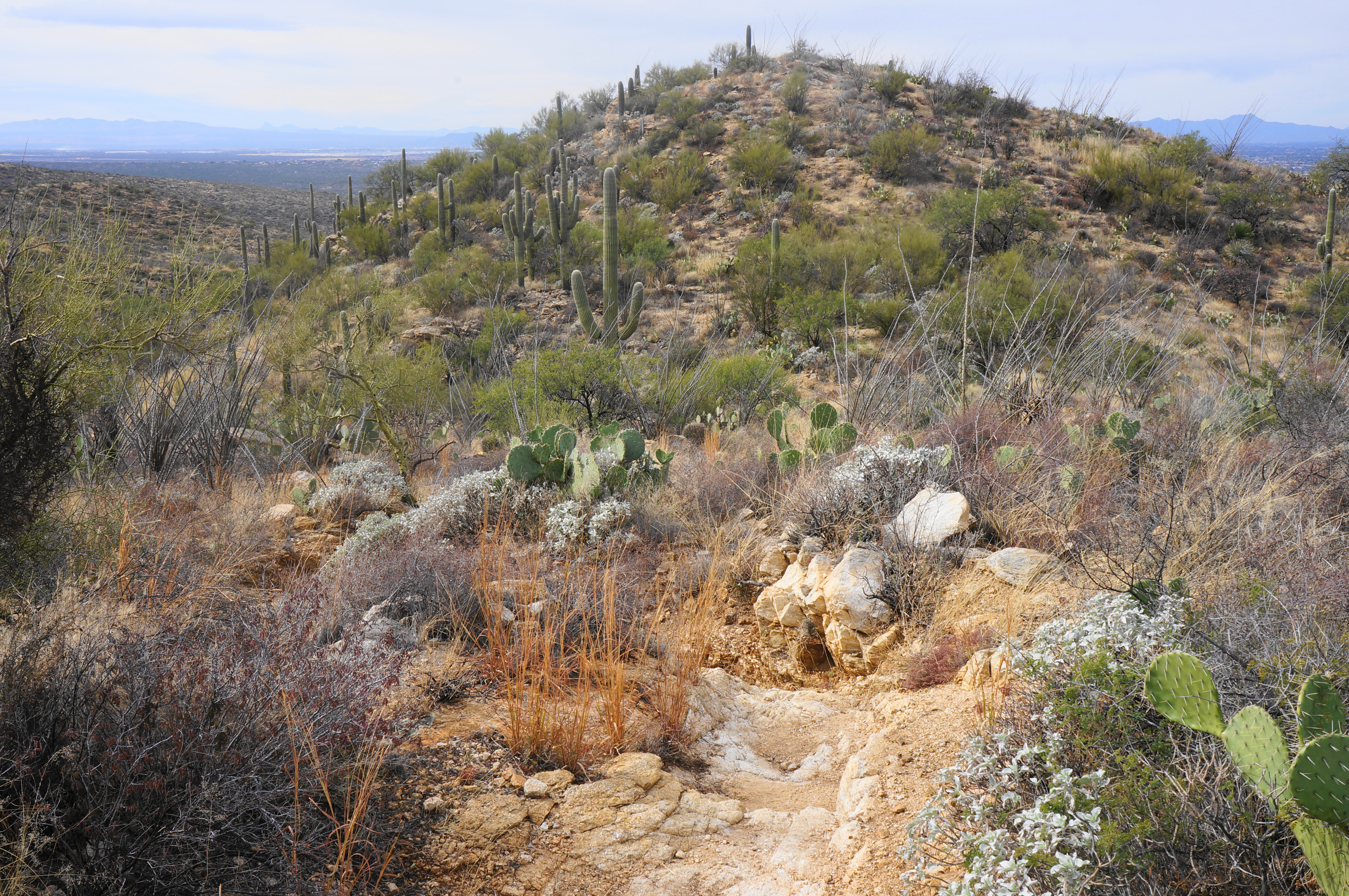
Follow the Three Tank Trail as it drops to clear a drainage and then rises steadily toward a low ridge, passing the usually dry Aguila Tank on the right. At 3.9 miles, the trail rises to the hike’s highest point (about 3,800’), a saddle with fine views across the Santa Cruz Valley. In the distance, one can spot the Tucson Mountains, partly encompassed by the west unit of Saguaro National Park.
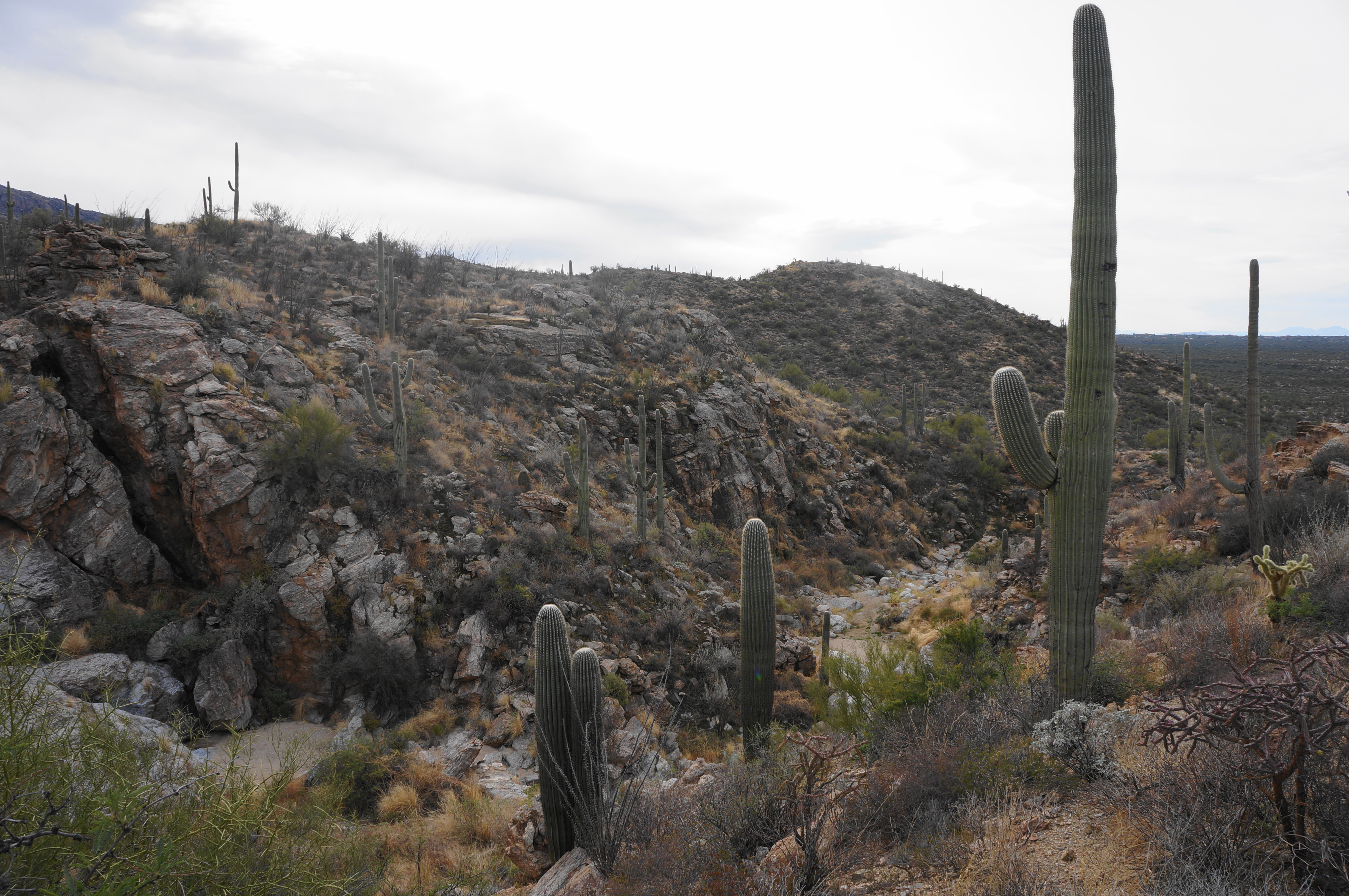
From here the Three Tank Trail begins a lengthy descent, with nice views much of the way. Cross a minor drainage at around 4.25 miles, then descend to a larger one, which forms an interesting canyon flanked in some area by relatively high, craggy walls. Hidden amid the brush is Mica Tank, down in the wash on your left; below the tank, the trail briefly enters the wash but then quickly exits off to the right. Now paralleling the wash below, the Three Tank Trail edges westward amid another large stand of saguaros, bypassing a series of pouroffs on the left.

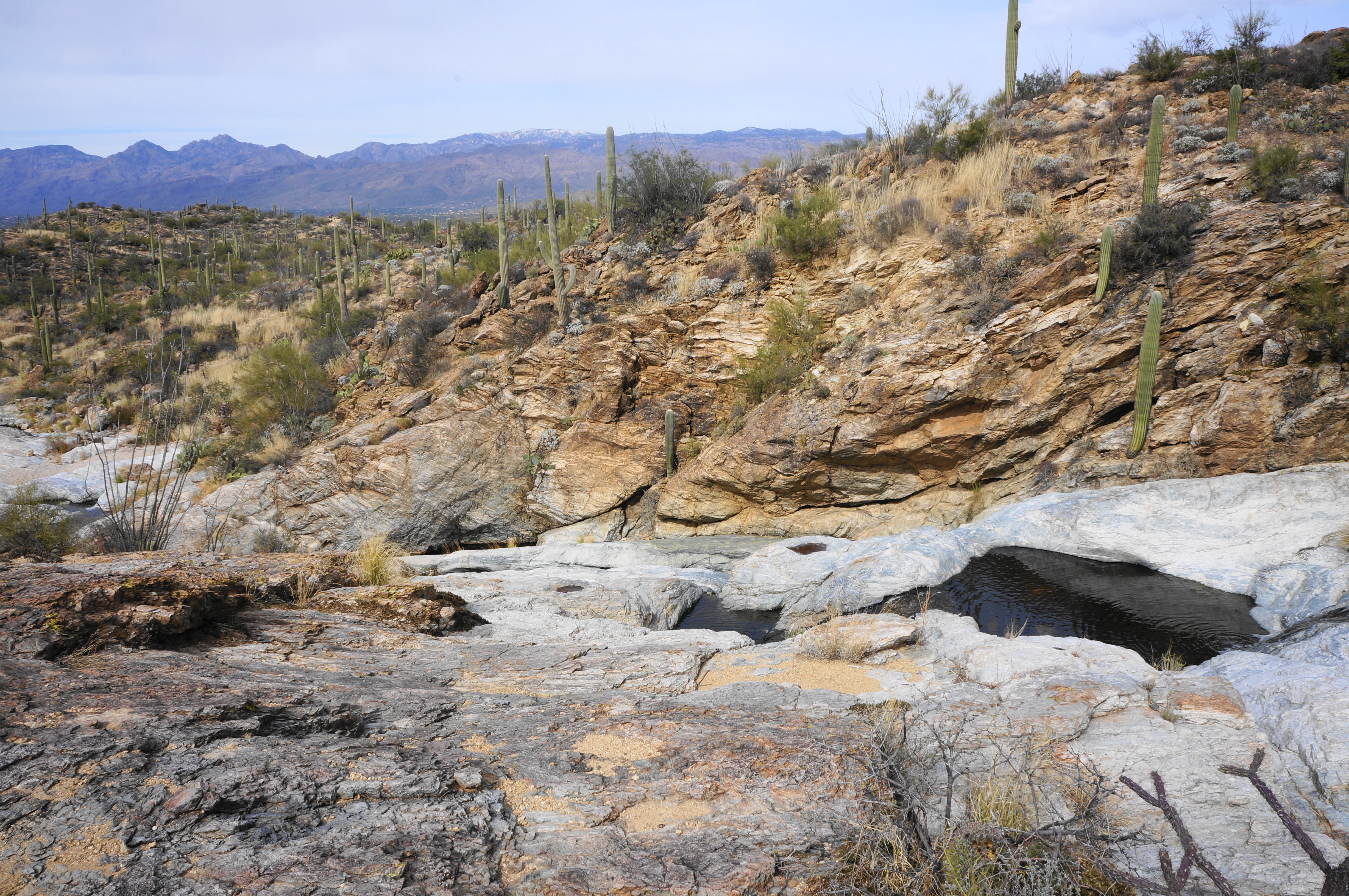
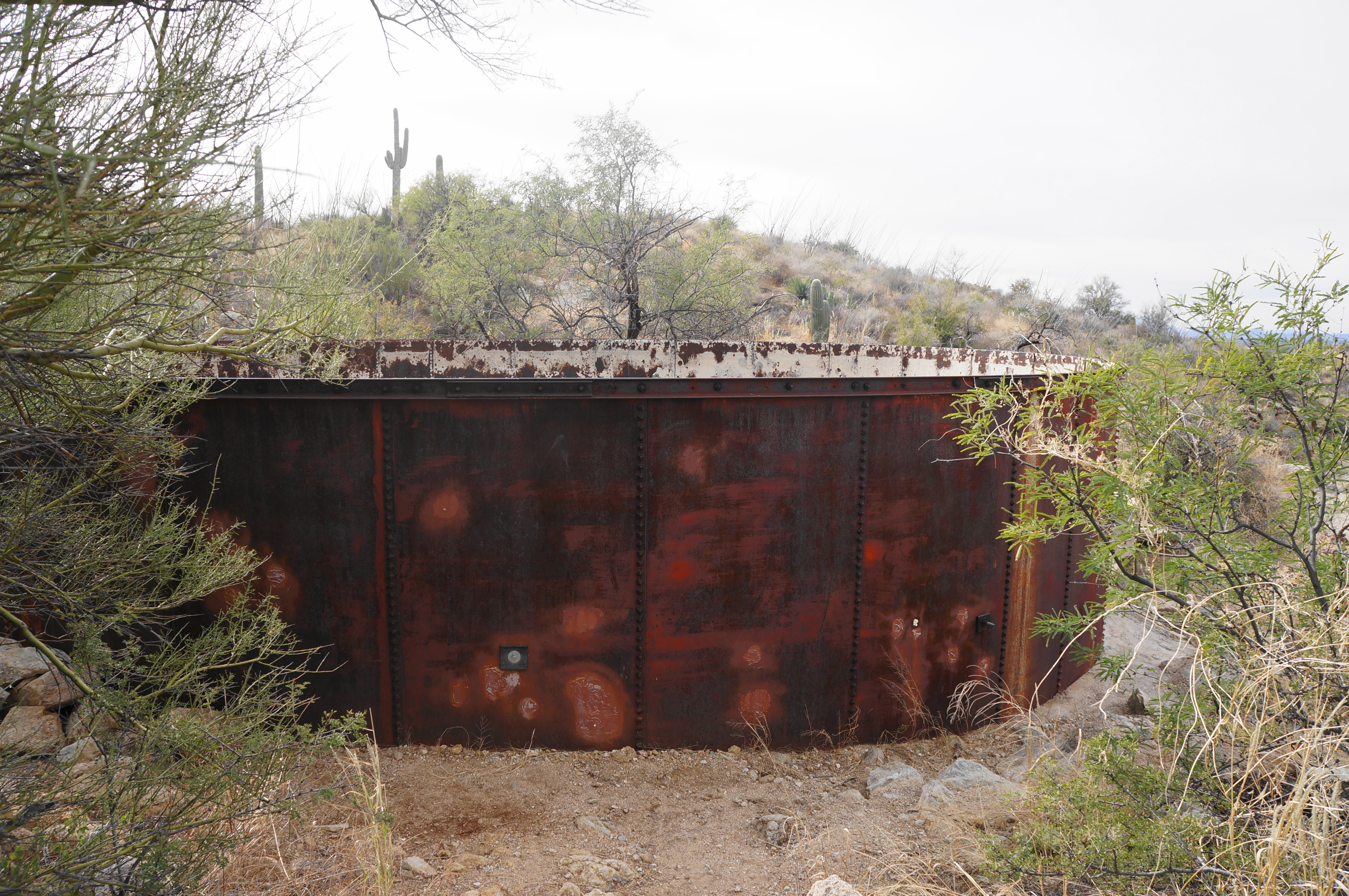
Soon the Three Tanks Trail drops precipitously to a confluence of two drainages and a somewhat confusing intersection of hiking trails. Visible ahead is the large Steel Tank, a manmade water basin that is now deeply rusted, with several holes in the base. Here hikers heading for Little Wildhorse Tank will want to take a hard left, skirting around to the west side of the tank. Briefly follow the lesser drainage eastward, then follow the Carrillo Trail as it exits right. (Note: You should not have to descend to the main wash.)
Take the Carrillo Trail as it ascends to another low escarpment with views of the valley, then descend through the cactus forest to cross another wash and reach a four-way junction, this one about 5.7 miles into the hike. Here hikers will want to take a hard left on the Wildhorse Trail, a narrow track that leads to a beautiful set of tinajas.
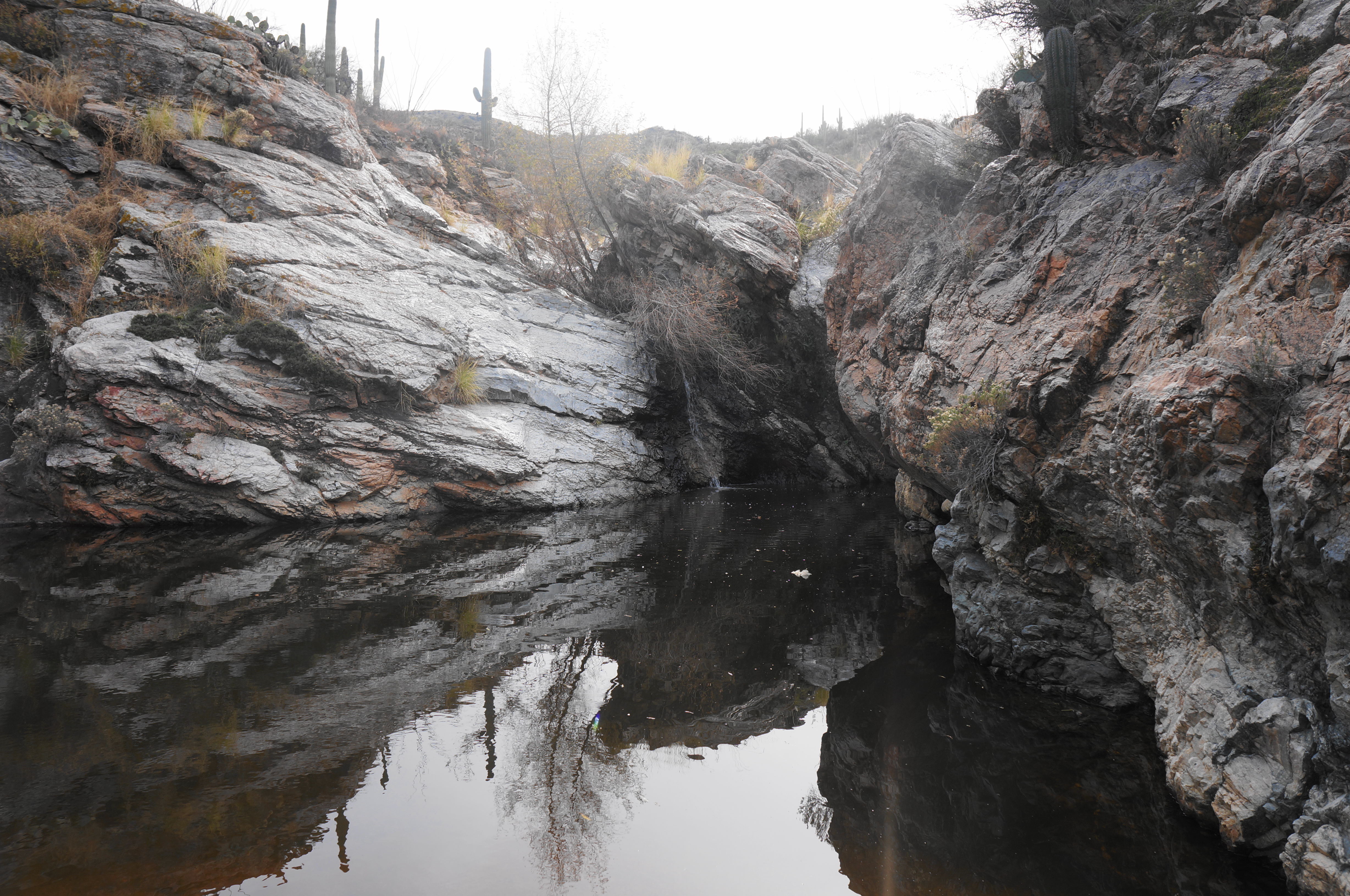
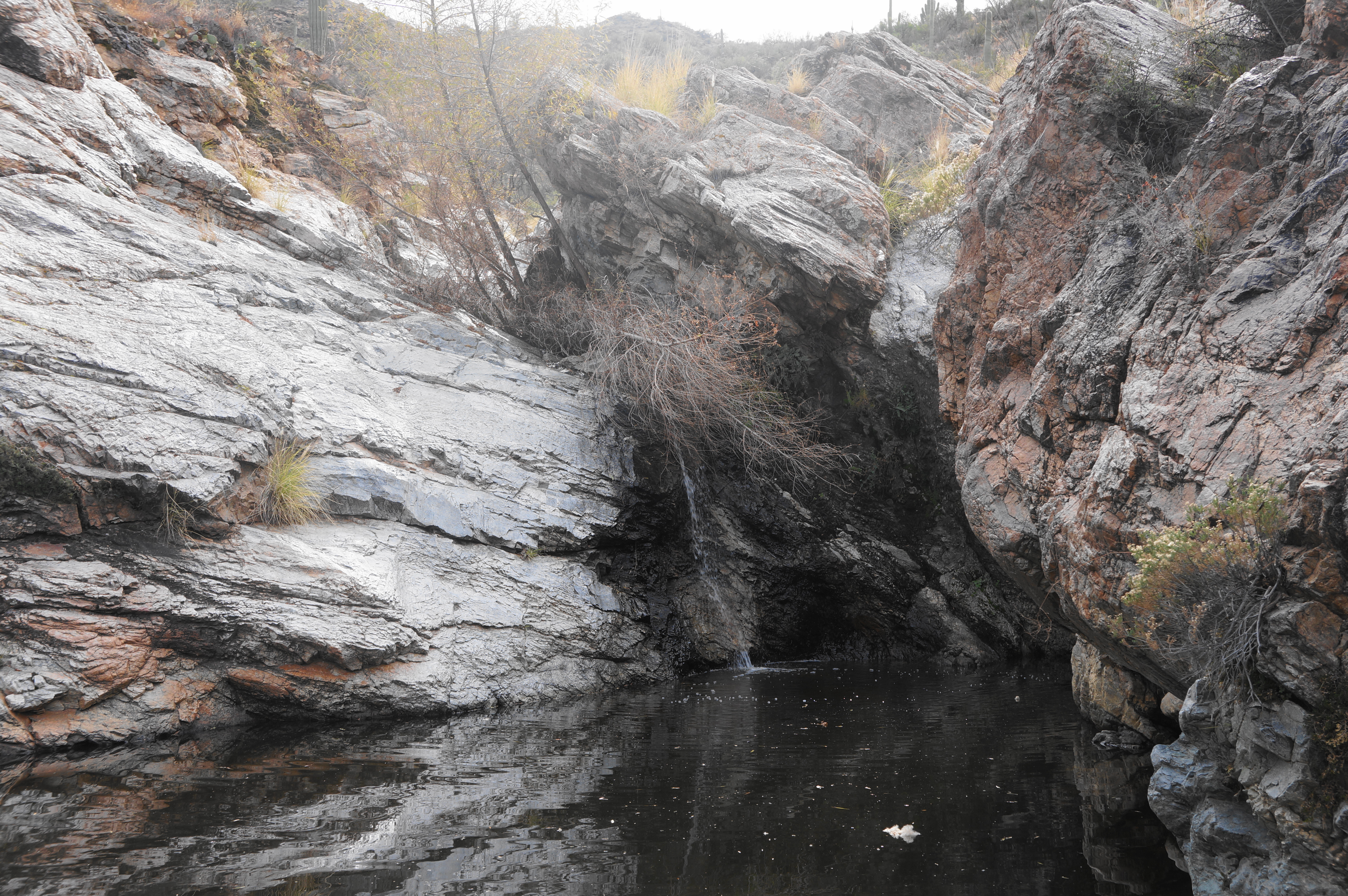
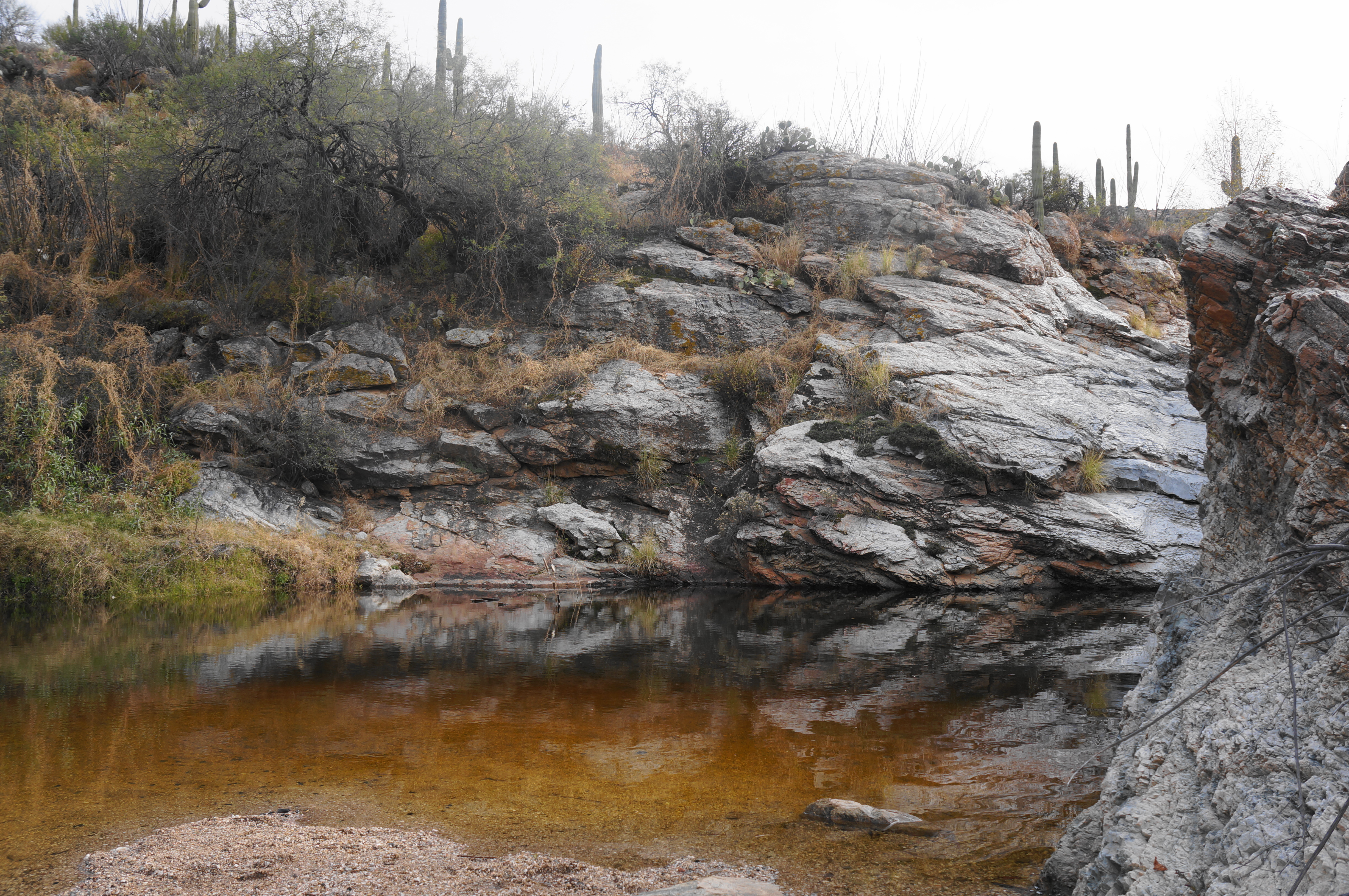
Follow the trail as it approaches a grey- and red-hued wash, where puddles of water may be present. Cross the drainage and climb steeply up the other side as the trail narrows further. From here the undulating path passes high above some pretty pools, sometimes connected by thin streams of water. In the heat of summer, many of these pools will dry completely—but after recent rains they are filled with water and play host to desert frogs, turtles, and other species.
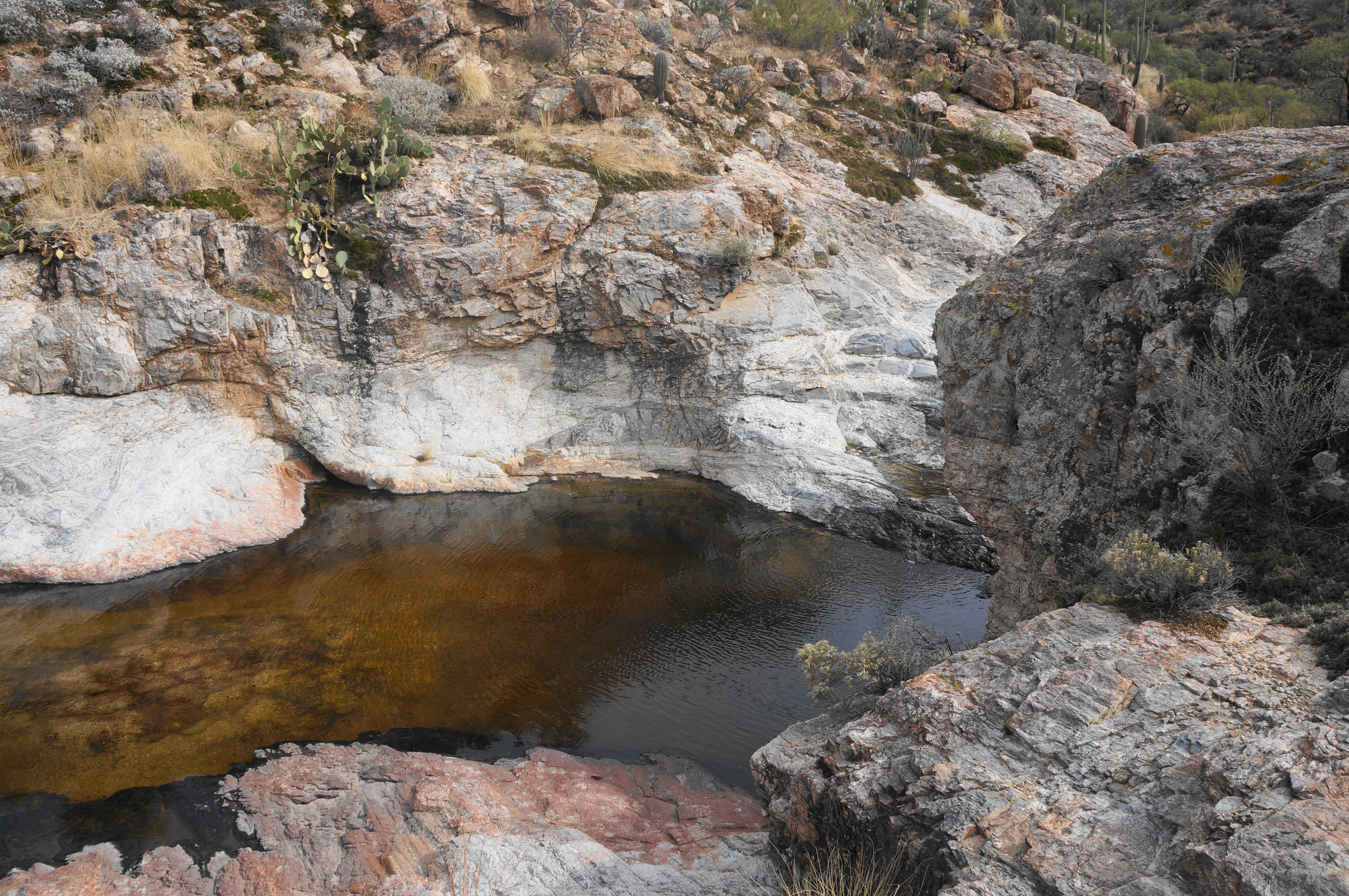
At last, the trail descends to a gravelly beach and Little Wildhorse Tank, a shady pool fed by rains and snowmelt from the seasonal stream. This pretty spot boasts a full-fledged riparian environment, a mini-oasis in the Sonoran Desert. Hikers can stop here for a snack and rest before continuing on to finish the loop.
Once ready, retrace your steps for 4/10 mile, returning to the four-way intersection. This time continue straight on the Wildhorse Trail, which hikers will follow all the way back to East Speedway Boulevard.
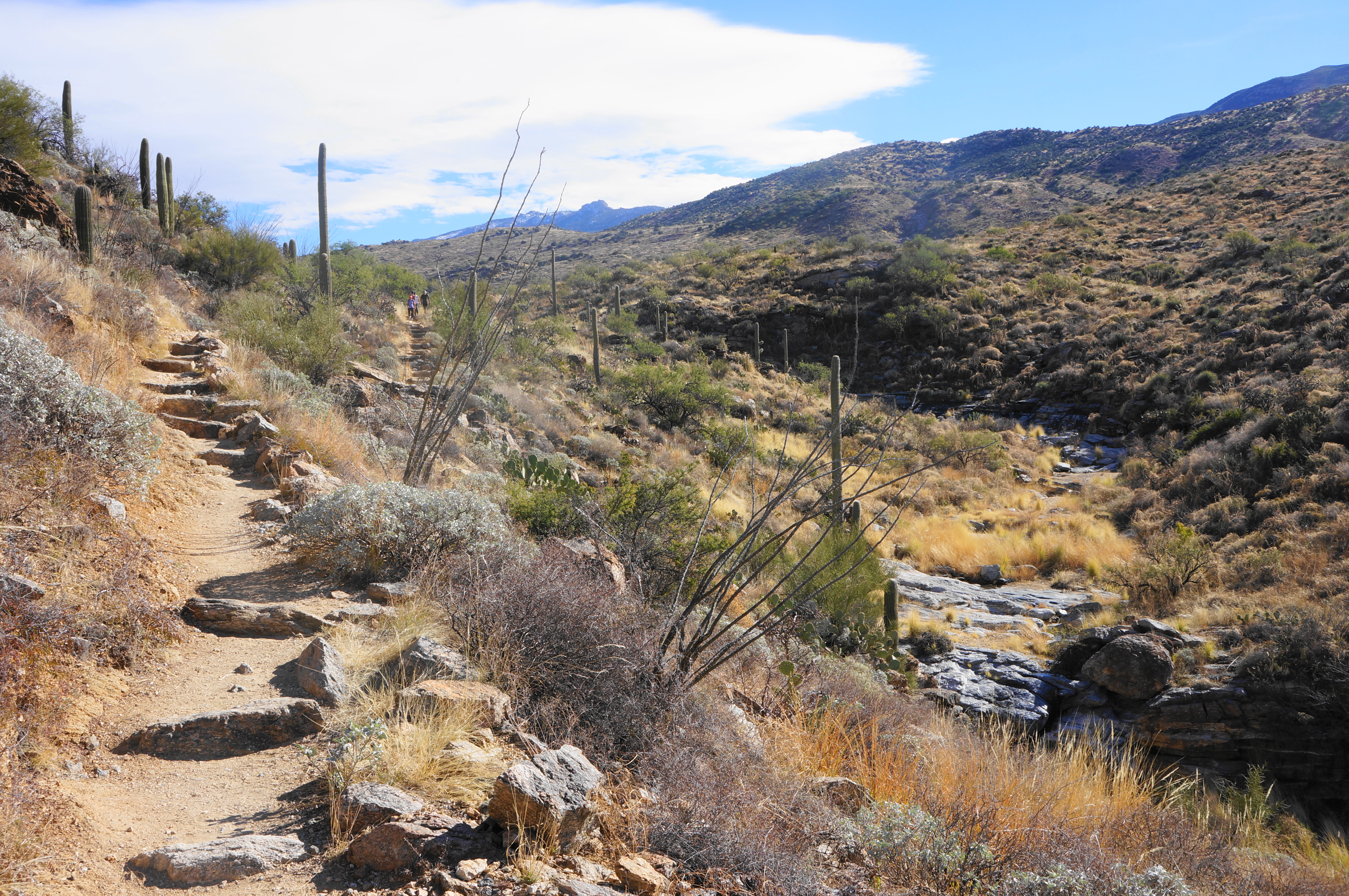
At first, the path follows a drainage on the right, crosses it, rises for a brief period, then drops to clear a second small wash. Thereafter, ascend a stone staircase to a ridge overlooking the broad valley floor, then descend again, reaching the drainage followed earlier that contains the Mica and Steel Tanks.
Just after crossing this wash again, there is another junction. Stay left as the Three Tank Trail comes in from the right, then follow the winding switchbacks, with views of the suddenly deep drainage on the left. The incline gradually eases as the Wildhorse Trail edges northward, reaching a junction with the Garwood Trail at about the 7-mile mark. Stay straight, then right at the subsequent fork with the Bajada View Trail.
From here the widening track descends gradually to the broad, sandy, and confusing Bajada Wash. It is easy here to lose the onward trail amid the brushy islands, but general sense leads one to head down-stream (north) for about 1/10 mile, then up a well-worn path leading out of the wash to the right just as the arroyo enters a dogleg left.
Back out in the open basin, the Wildhorse Trail meanders through the Cactus Forest, passing junctions with the Creosote Trail (stay right) and Stock Bypass Trail (stay left). A final junction is reached just before the road, where hikers will want to bear right and walk the remaining steps back to the Wildhorse Trailhead and East Speedway Boulevard. It is a short walk from here to the Douglas Spring Trailhead, finishing off the 8-mile loop.
This moderately challenging hike will take most at least a half-day (between about 4-6 hours).

Pingback: Bridal Wreath Falls & Little Wildhorse Tank Loop (Parc national de Saguaro, AZ) - justaglobe.com