
Described as “one of the state’s top ten hikes to experience” and one of the “best hikes near Phoenix,” Flatiron in Arizona’s Superstition Wilderness offers an exceptionally scenic vista, but most hikers will remember it for its challenging and unique ascent: a seemingly endless scramble, including one 12-foot pitch that resembles true rock climbing. The very strenuous hike, gaining about 2,500 feet in just three miles, is certainly not for beginners and casual hikers. Nonetheless, Flatiron is a rather popular day hike, with visitors flocking to the colorful, striated knob that has become one of the most recognizable natural landmarks of the Phoenix area. The hike begins at Lost Dutchman State Park ($7-10 entrance fee) but ends deep in the Superstition Wilderness high above the sprawling metropolis.

The hike
The out-and-back to Flatiron begins and ends in Lost Dutchman State Park, a popular destination spanning 320 acres of the Sonoran Desert at the base of the Superstition Mountains, around 40 miles east of downtown Phoenix, Arizona. The Superstitions comprise an alluring range composed largely of rhyolitic tuff and breccia, with many sheer vertical faces that take on a beautiful reddish hue. The imposing mountains appear from Lost Dutchman to be a seemingly indomitable mass, towering high above the saguaro cactus forest below. Yet there is indeed at least one traversable route: a drainage called Siphon Draw, a (usually) dry arroyo, accessible from the northwest.
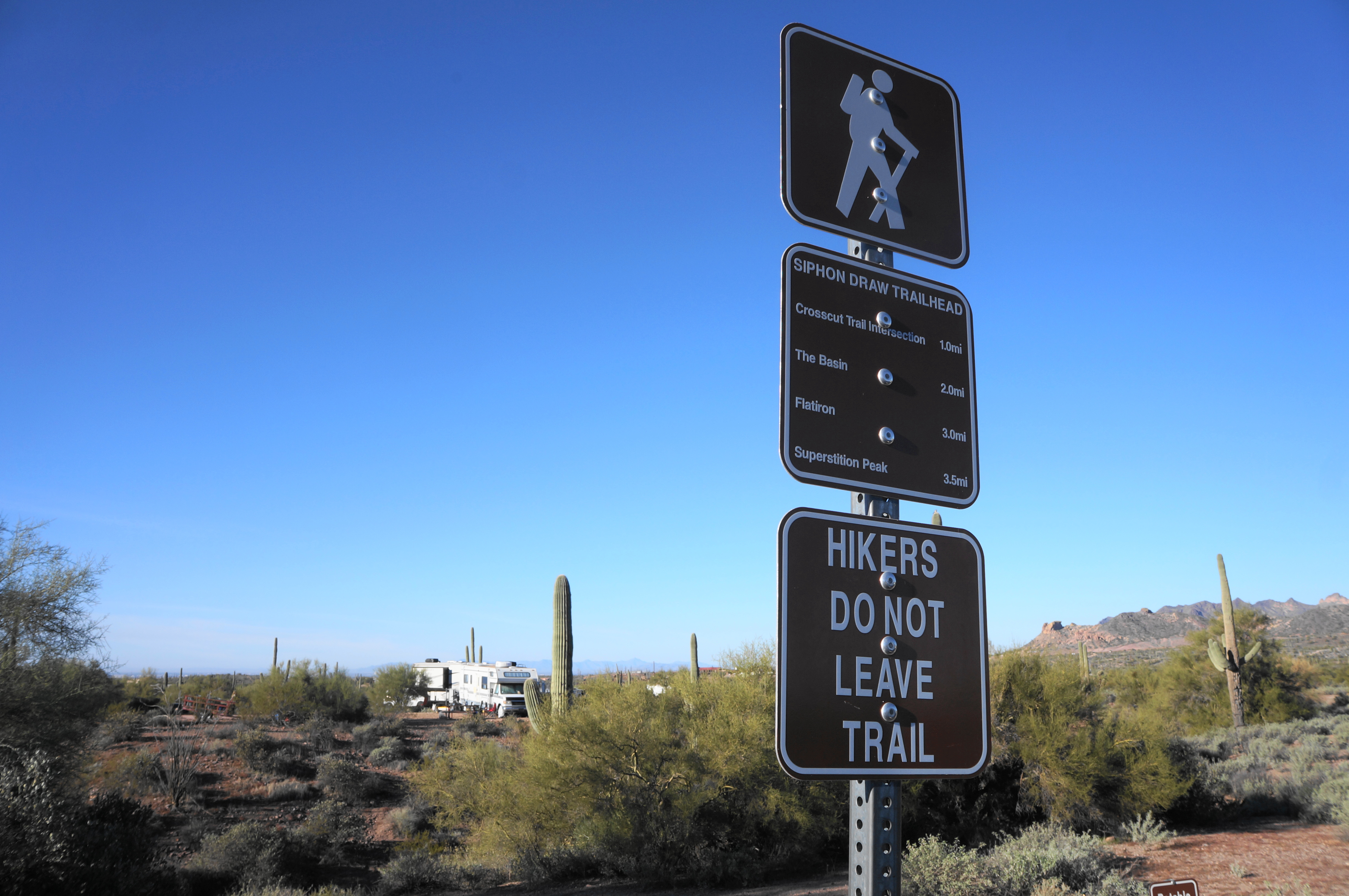
To reach Siphon Draw, first drive into Lost Dutchman State Park, bear left at the first intersection past the entrance station, and follow the road to its end, where there is a moderately-sized parking lot at the Siphon Draw Trailhead. (Note: If this lot is full, park at the Saguaro Day Use Area, about 1/10 mile back toward the entrance.) Look for the modest sign on the south side of the lot for the start of the trail.
The first half mile of the walk is an easy stroll, beginning with a short stairstep descent to clear a wash, followed by another less than a minute later. Stay straight at the various junctions, dipping in and out of several more creek beds and passing a group of picnic tables and a coyote-shaped sundial on the left. All around, the ruddy soil is dotted with brush, palo verde, and several types of cacti, including prickly pear and the famous saguaro. At a point about 0.22 miles from the start, bear left as the Siphon Draw Trail edges around the large Main Campground at Lost Dutchman. Following the signs, the route weaves southeast and then abruptly crosses a paved track below the cabins at the camping area.
Stay on the track as it gradually leads away from the campground, reaching another junction at about ½ mile. Stay left, settling into a wide but rocky trail that heads to the eastern boundary of the park. After remaining straight at the junction at 6/10 mile, pass through a cattle guard, officially leaving Lost Dutchman State Park and entering Tonto National Forest.
The Siphon Draw Trail quickly passes a sign for the Superstition Wilderness (although hikers have not technically entered it yet) and then rises to a pair of junctions at around 8/10 mile. Stay right at the first and straight at the second, then begin a long, gravelly climb toward Siphon Draw. By now, the saguaros have largely given way to stubbly brush and grasses, and hikers can clearly make out the contours of Flatiron, the imposing, striated peak ahead.

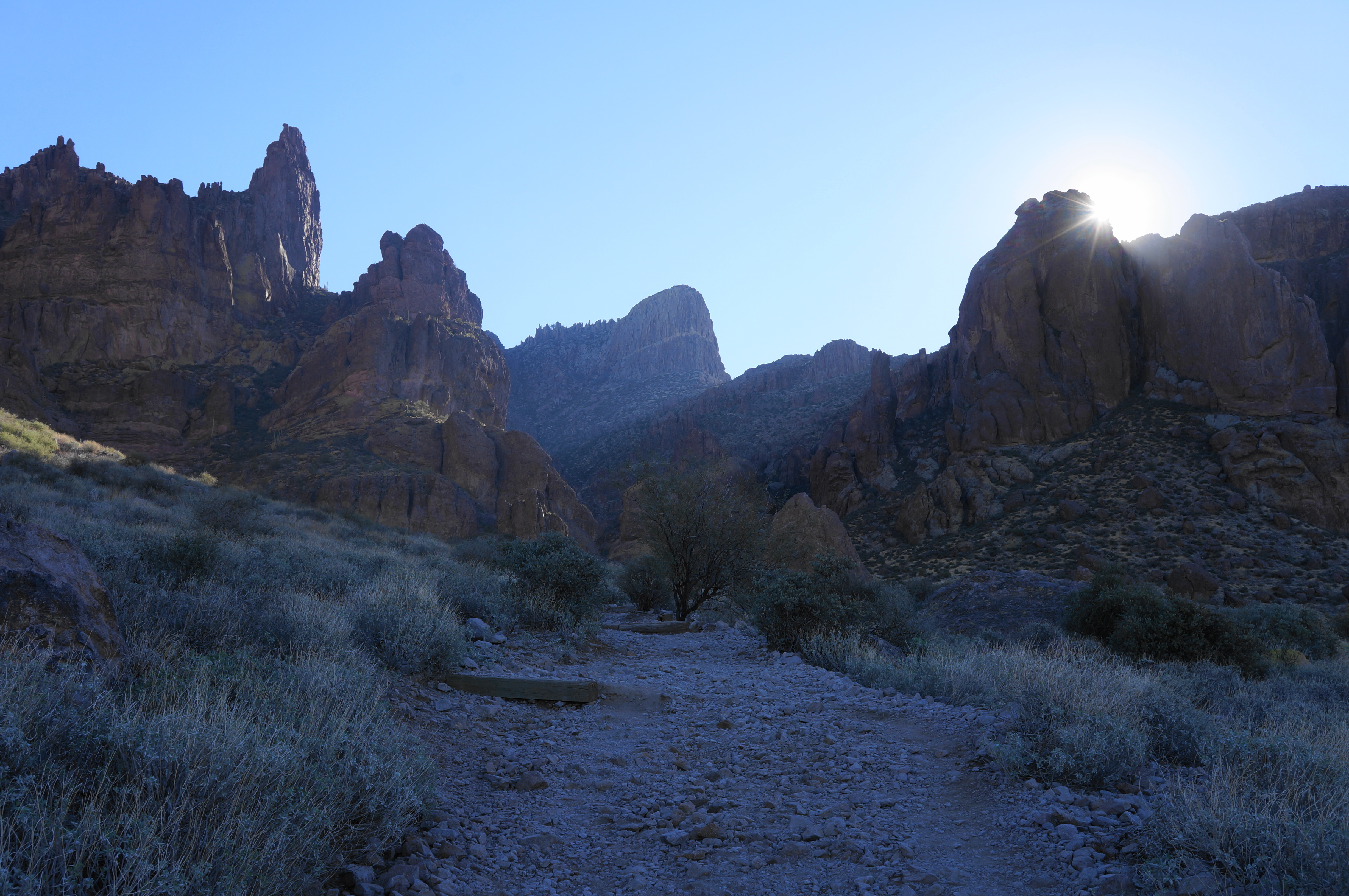
After the relatively easy tread to this point, it is easy to get lulled into a false sense of security: at the one-mile mark, hikers are technically already one third of the way there. But the remaining distance is exponentially harder, and the incline picks up steadily as hikers approach the official boundary of the Superstition Wilderness at around 1.4 miles. By now the trail has narrowed a bit and weaves in and out of some rock jumbles, with far-reaching vistas looking back to the west across the Phoenix area.

Generally staying to the left flank of Siphon Draw, the onward trail begins to scale sloping slickrock, awash with loose rock. Be careful when ascending this section. At about 1.75 miles, the route appears to split into several different paths, although all seemingly lead to the same place, continuing to stay on the left side of the draw. At 1.9 miles, the trail drops to clear the sandy drainage, flanked by acacia trees. Quickly thereafter, the onward path leads to a scenic, bowl-shaped pitch called The Basin.
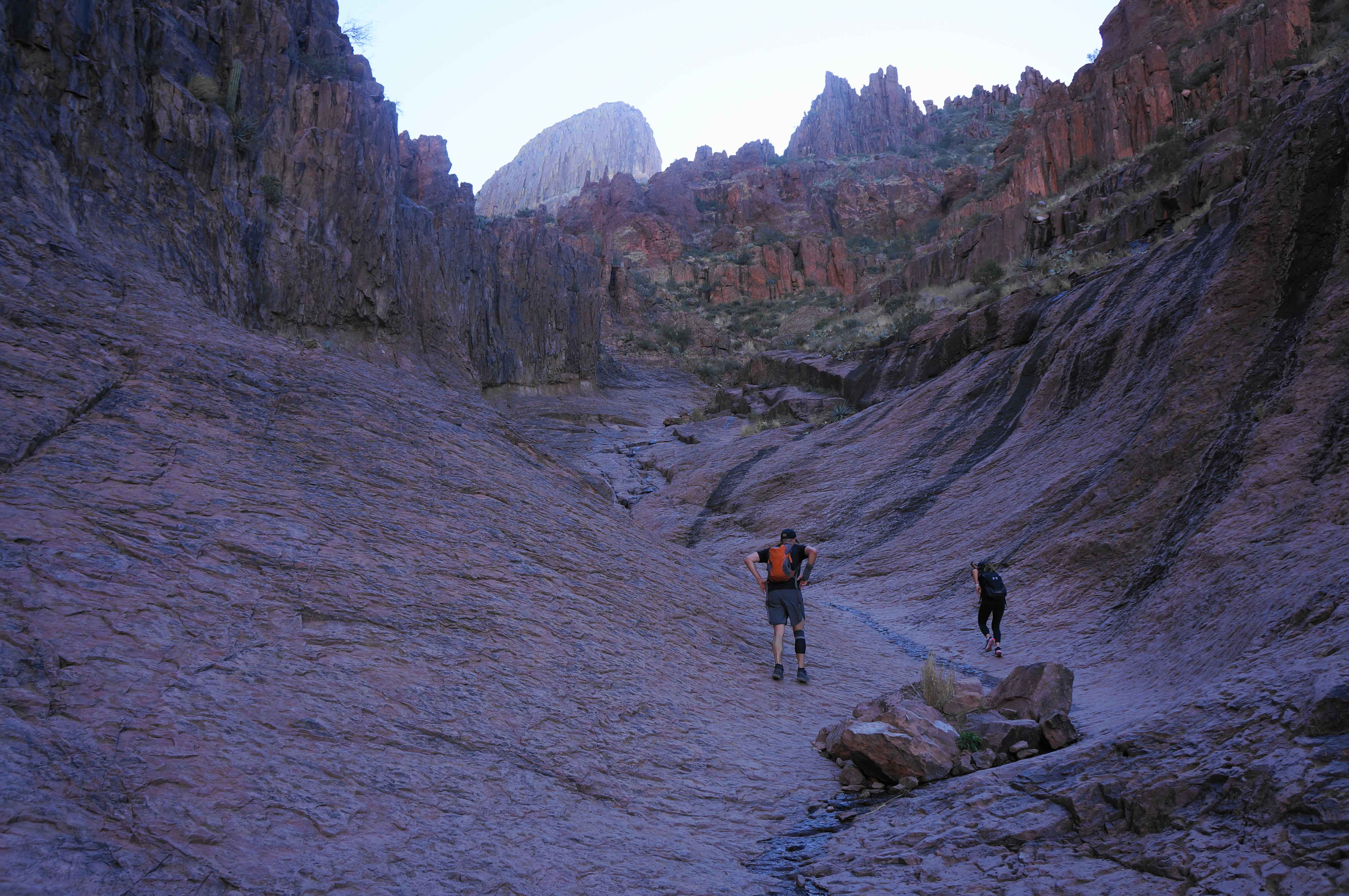
This picturesque spot, composed of slickrock and streaked with desert varnish on the right side. Having already gained 1,100 feet from the trailhead, many visitors will turn around at this point. But determined hikers can press on – bounding up the drainage, rounding a slight left-hand turn, and then rising to an even steeper pitch composed of natural stairsteps. Climb up to a set of two notches, each offering onward passage, with an onward look at Upper Siphon Draw and Flatiron.
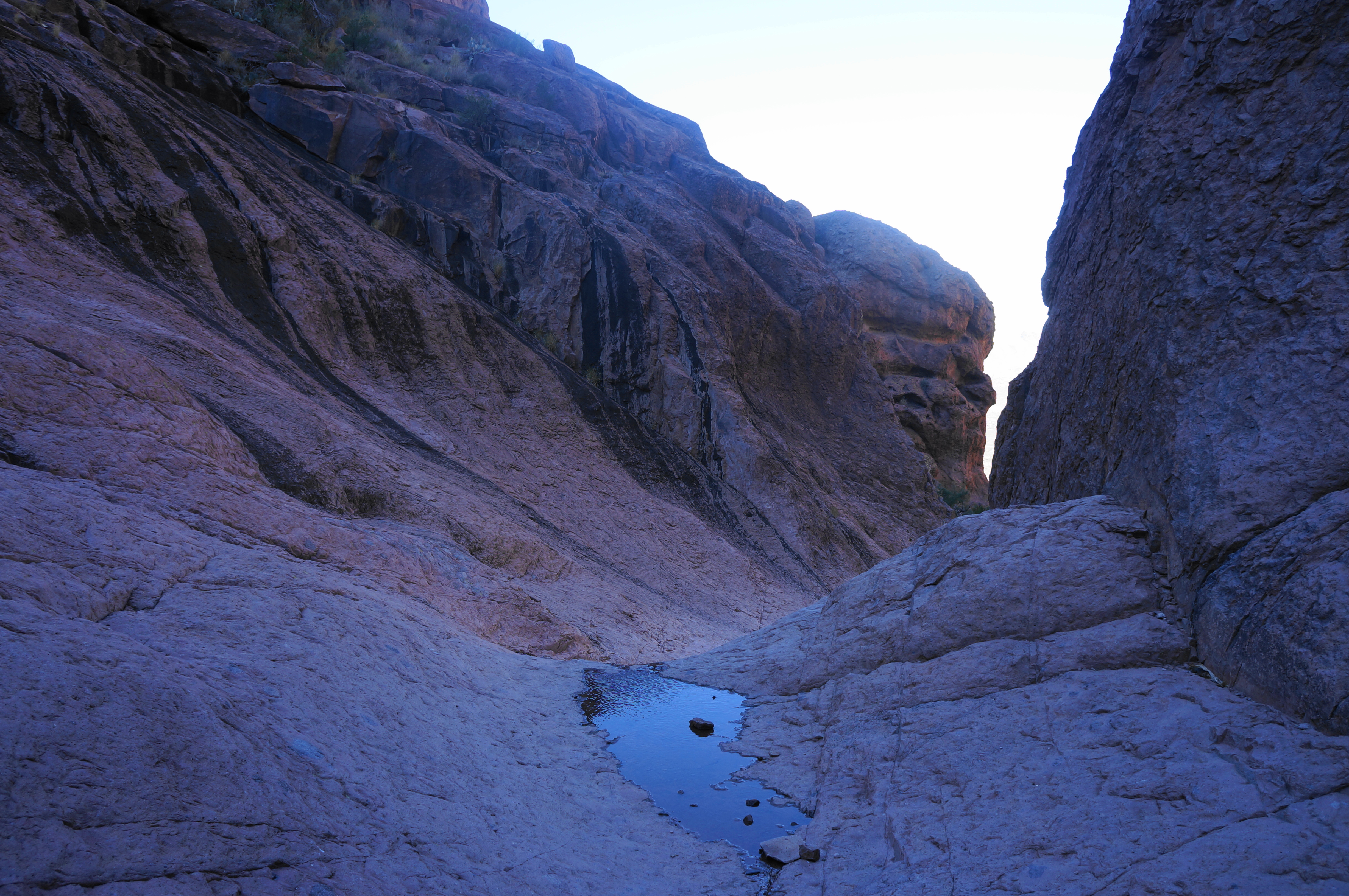
From here, the Siphon Draw Trail does something not yet seen on the hike—it descends steeply and quickly, dropping to a point where the route empties into the drainage itself. Once down in the drainage again, about 9/10 mile of hiking remains—but the next section mounts more than 1,200 feet in elevation gain.

The trail itself dissolves, giving way to a series of social paths. But don’t overthink it: the best option for the next 2/3 mile is to follow the drainage straight up the gut; many hikers make the mistake of following paths leading up the right side of the drainage—only to find themselves ledged out and having to backtrack. Heading upstream requires patience and careful footing, with the sandy drainage quickly turning to a seemingly endless rock scramble: up, over, and around chunk boulders and between thick brush. At one point about halfway up this section, there is temptation again to take one of the social trails leading right. Resist this temptation, instead cutting back and staying in the main drainage. For more than a half mile, it is a slow and methodical climb, with ever-widening views looking back toward the Phoenix suburbs.

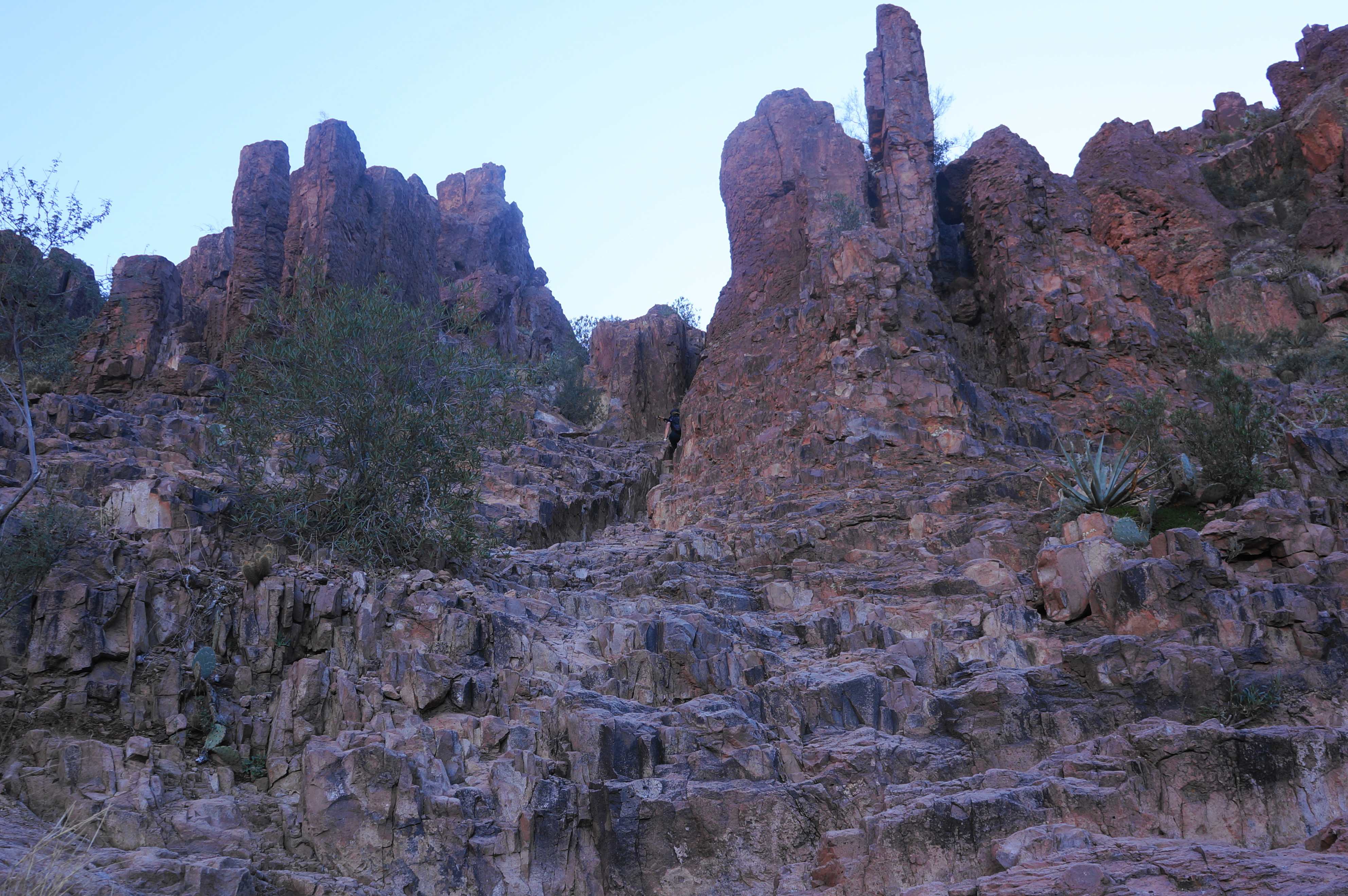
At a point around 2.7 miles from the trailhead, the drainage narrows to a thin notch, and onward passage requires ascending a 12-foot, Class 3 pitch. This is easily the most challenging obstacle of the hike, and, it first glance, it can appear intimidating. But careful decision-making, use of handholds (and perhaps the tree on the left), and a little bit of arm strength lift hikers over the top.

Suddenly, after this pitch, the difficulty eases up significantly. Hikers can take a deep breath and enjoy the wide views, eyeing the surprisingly flat top to Flatiron off to the west. Ahead to the east is the pinnacle-studded Ironview Peak (5,024’), with Superstition Peak (5,057’)—not visible—beyond.
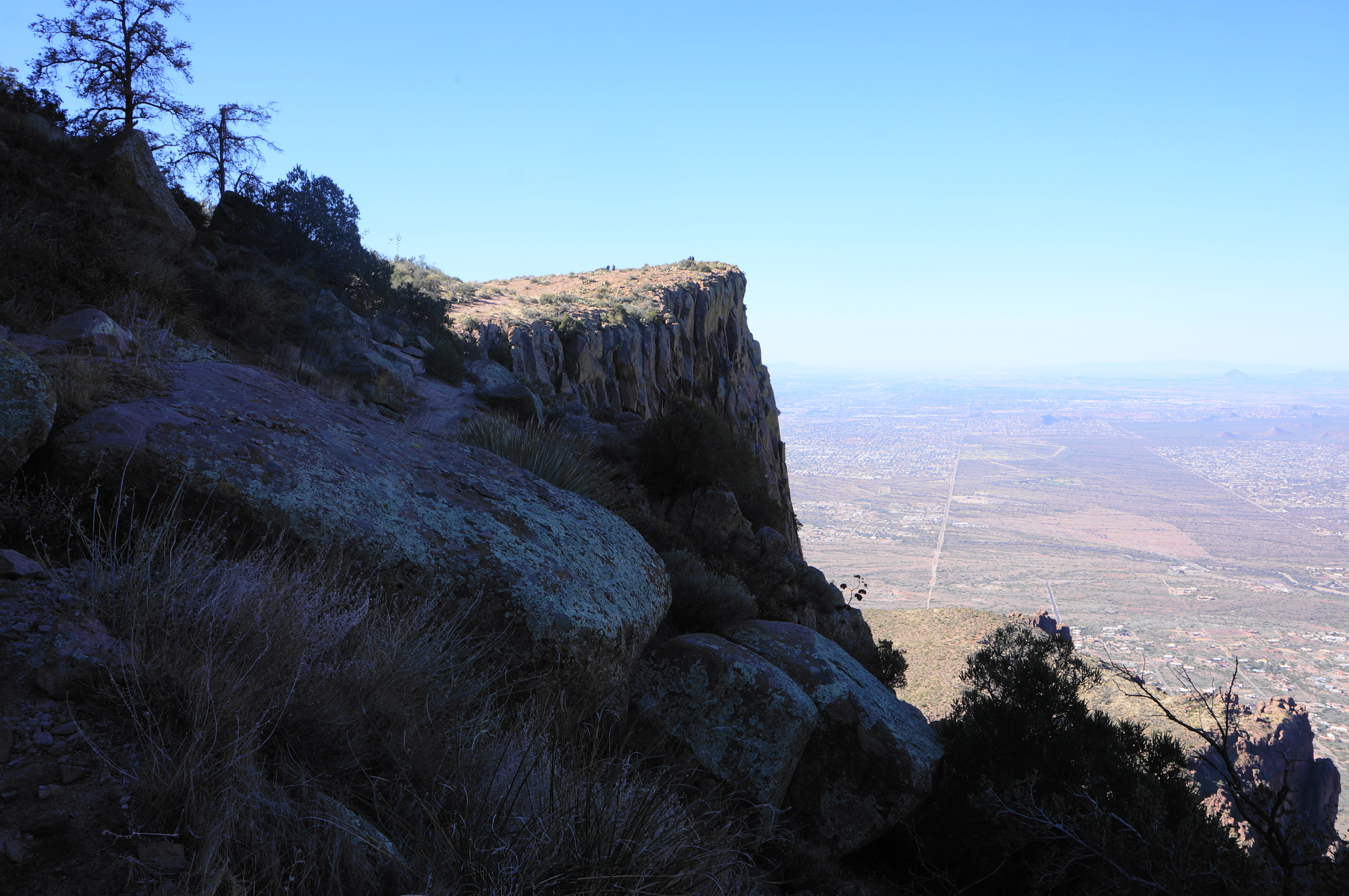
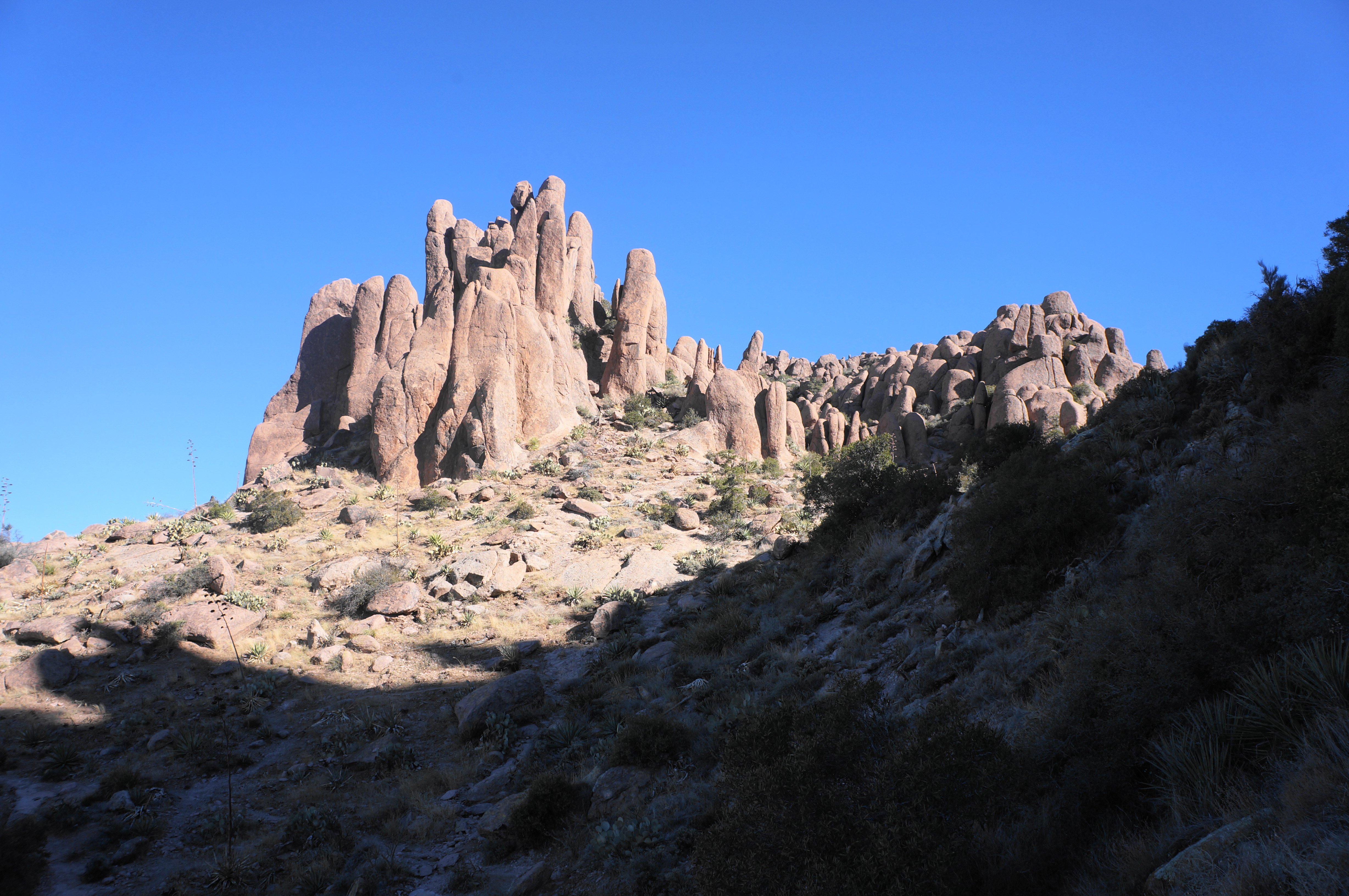
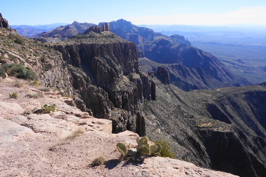
The final leg requires edging southwest, leading toward the scaly head of Flatiron, dotted with prickly pear cacti, agaves, yuccas, and chollas. Follow the main tread to the edge of the cliff, where the dropoff extends more than 1,000 feet to the vast valley below. Most hikers will huddle around the edge here, peering off west across the Phoenix metropolis, with the Goldfield and Usery Mountains off to the north and South Mountain, the Estrella Mountains, and White Tank Mountains in the distance to the west.

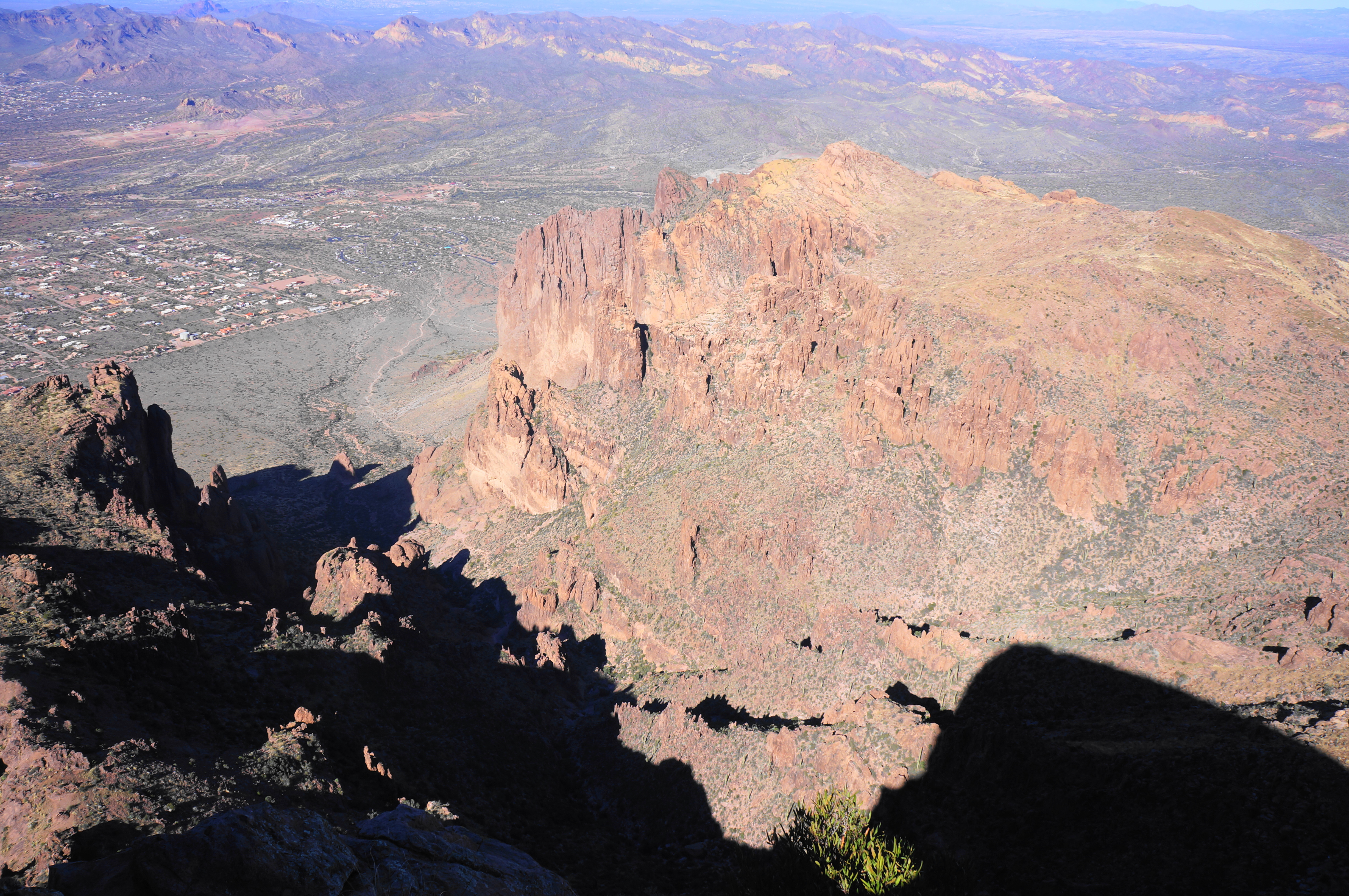


But the best views are arguably to the southwest. Here the Superstition Mountains unfold in their full glory, with steep, imposing cliffs dropping to a tiered desert escarpment. The high ranges extend southward toward Tucson, headlined by the imposing Santa Catalina Mountains. Backtracking from the summit, hikers can find a nice spot overlooking this area that is virtually free of crowds; a sublime spot to stop for lunch and catch your breath after the brutal, 2,500-foot climb.


When ready, return the way you came, descending Siphon Draw back to The Basin and Lost Dutchman State Park. The return route, with fatigue setting in, can be just as difficult as the ascent; take your time and use careful footing to descend the 12-foot pitch and the lengthy declivity back to the desert floor. The final mile through the cactus forest can feel hot and seemingly endless, but when the entire 6-mile round-trip is complete, hikers are rewarded with the bragging rights of having finished one of the toughest summit hikes in the Phoenix area.


Thanks for sharing. I always wondered if there was a hiking trail to the flat iron. My Daughter Priscilla does many running hikes.and 50 miles hikes and she is well fit. I know my daughter will be intrested in Doing this hike.
Pingback: Flatiron via Siphon Draw Trail (Superstition Wilderness, AZ) - justaglobe.com
Pingback: Top 10 Hikes in 2022 | Live and Let Hike