
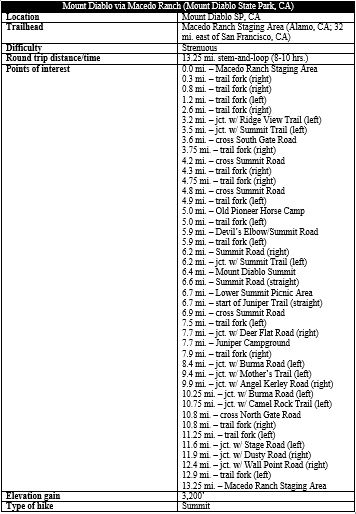
Rising more than 3,000 feet above the valley floor, Mount Diablo (3,849’) is perhaps the most iconic peak in the East Bay, a behemoth for which the broader Diablo Range—which extends around 200 miles south into central California—is named. Most visitors reach the peak by way of the winding Summit Road, but the adventure-minded can instead conquer the summit by hiking from the base. The most popular base-to-summit route starts from Mitchell Canyon Staging Area to the north, gaining and losing 3,250 feet (net) on a 13-mile trek. A less-travelled alternative, however, leaves from the Macedo Ranch Staging Area, covering a nearly identical length with slightly less gain (3,200 feet). This option allows hikers to explore the mountain’s grassy south-facing slopes, complete with panoramic vistas of Concord Valley, San Francisco Bay, the Berkeley Hills, and beyond. This is a challenging hike that, like most long hikes in Mount Diablo State Park, should be avoided in the brutal summer months; in fact, the hike is most beautiful in spring, when the rolling hillsides are verdant and teeming with wildflowers.
The hike
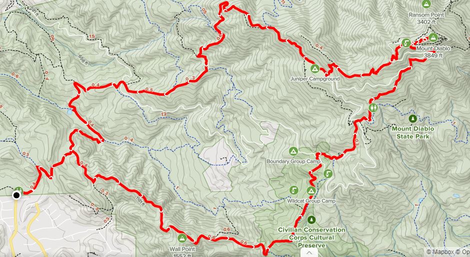
Macedo Ranch Staging Area in Alamo, California offers entrée into Mount Diablo State Park and is situated at the end of neatly-manicured Green Valley Road. The parking lot is graveled and spacious, with a $6 day use fee enforced. Pay the entry rate and lace up your boots before starting out on the long and difficult trek, 13.25 miles to and from the summit via a wide-ranging loop.
Macedo Ranch to Summit Trail via Wall Point Road (3.6 miles)
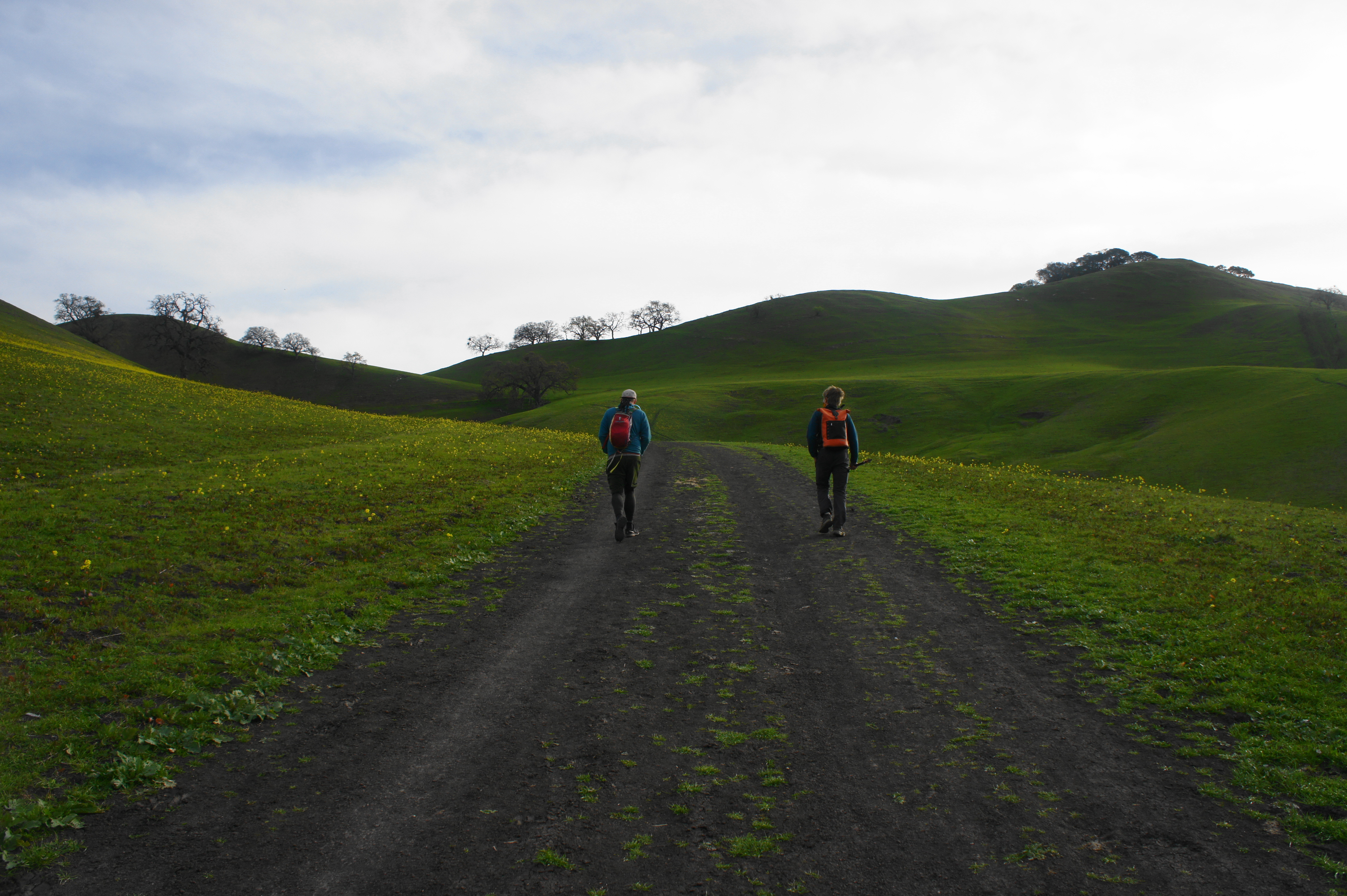
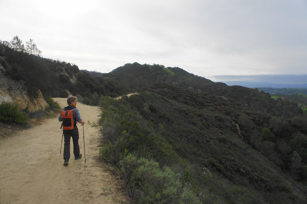
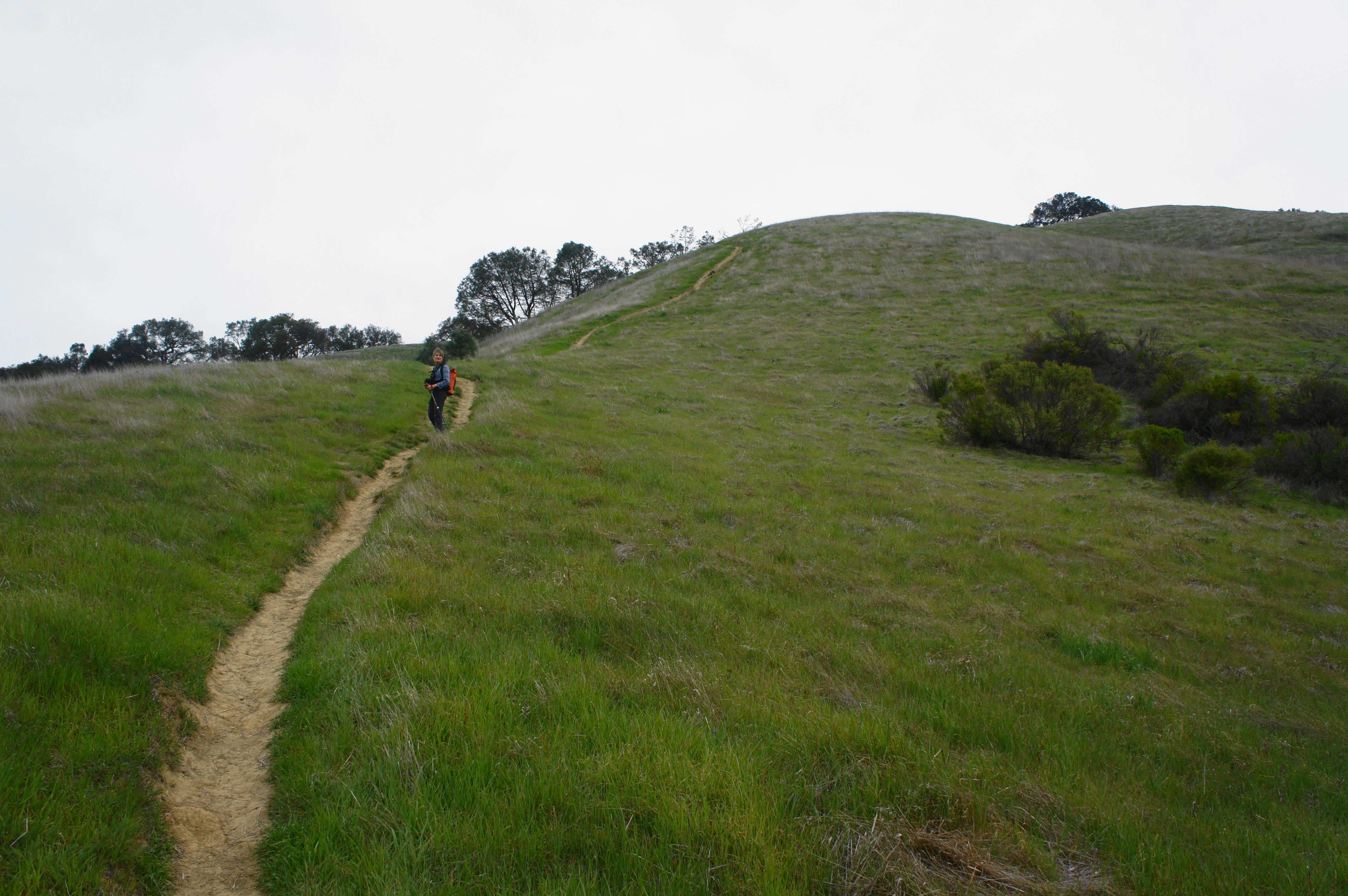
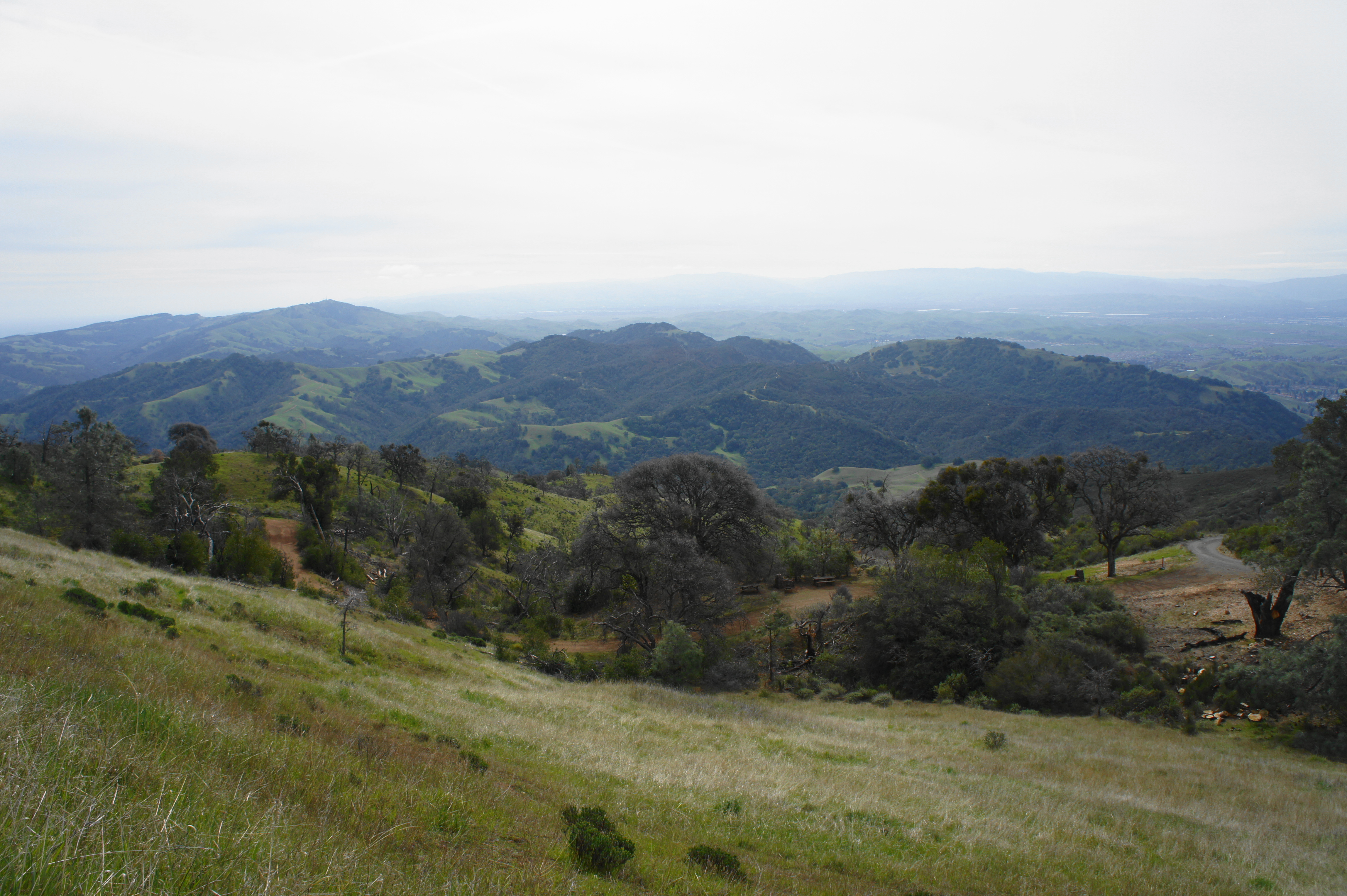
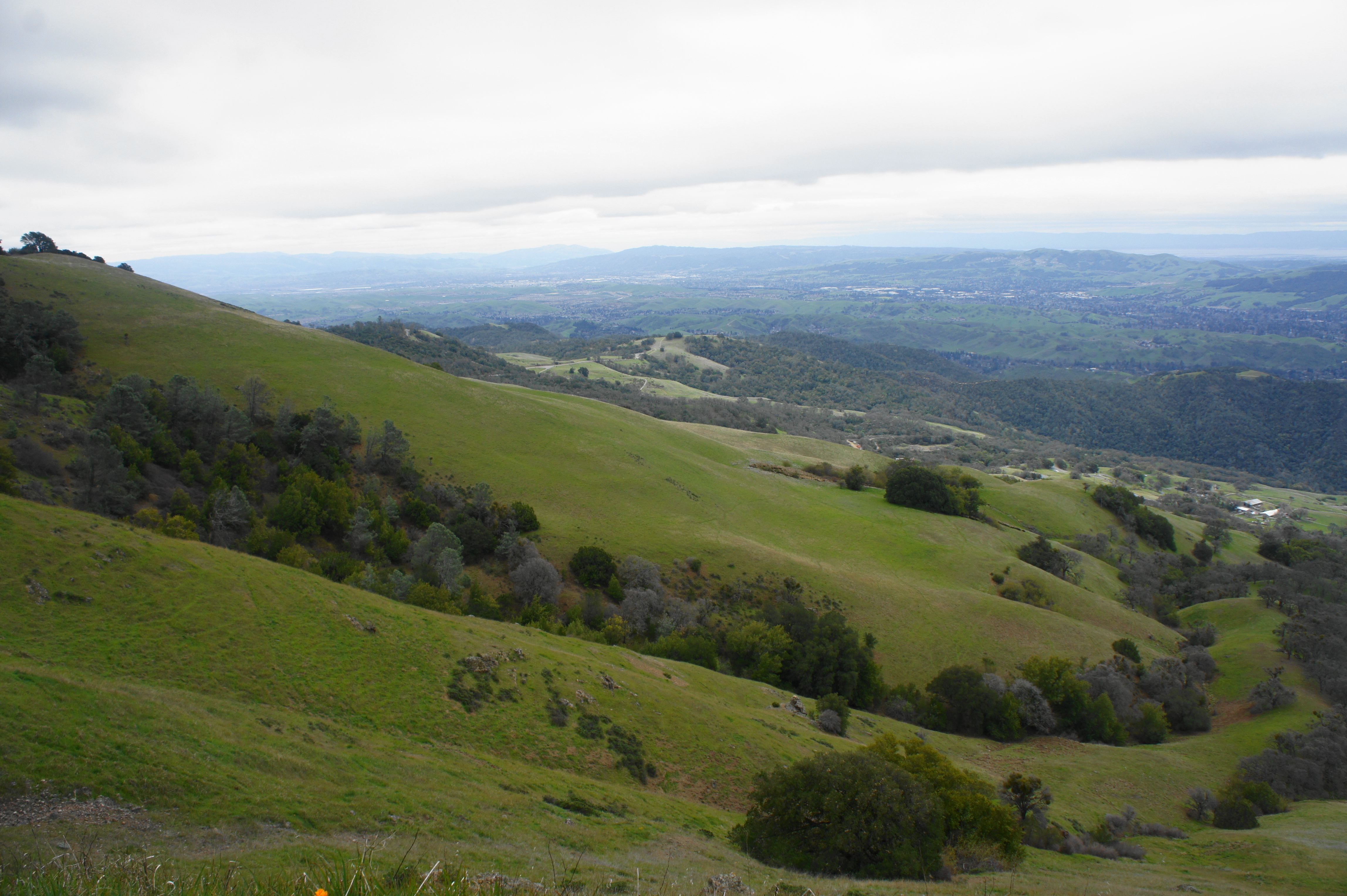
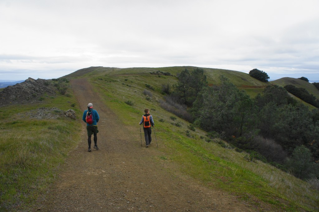
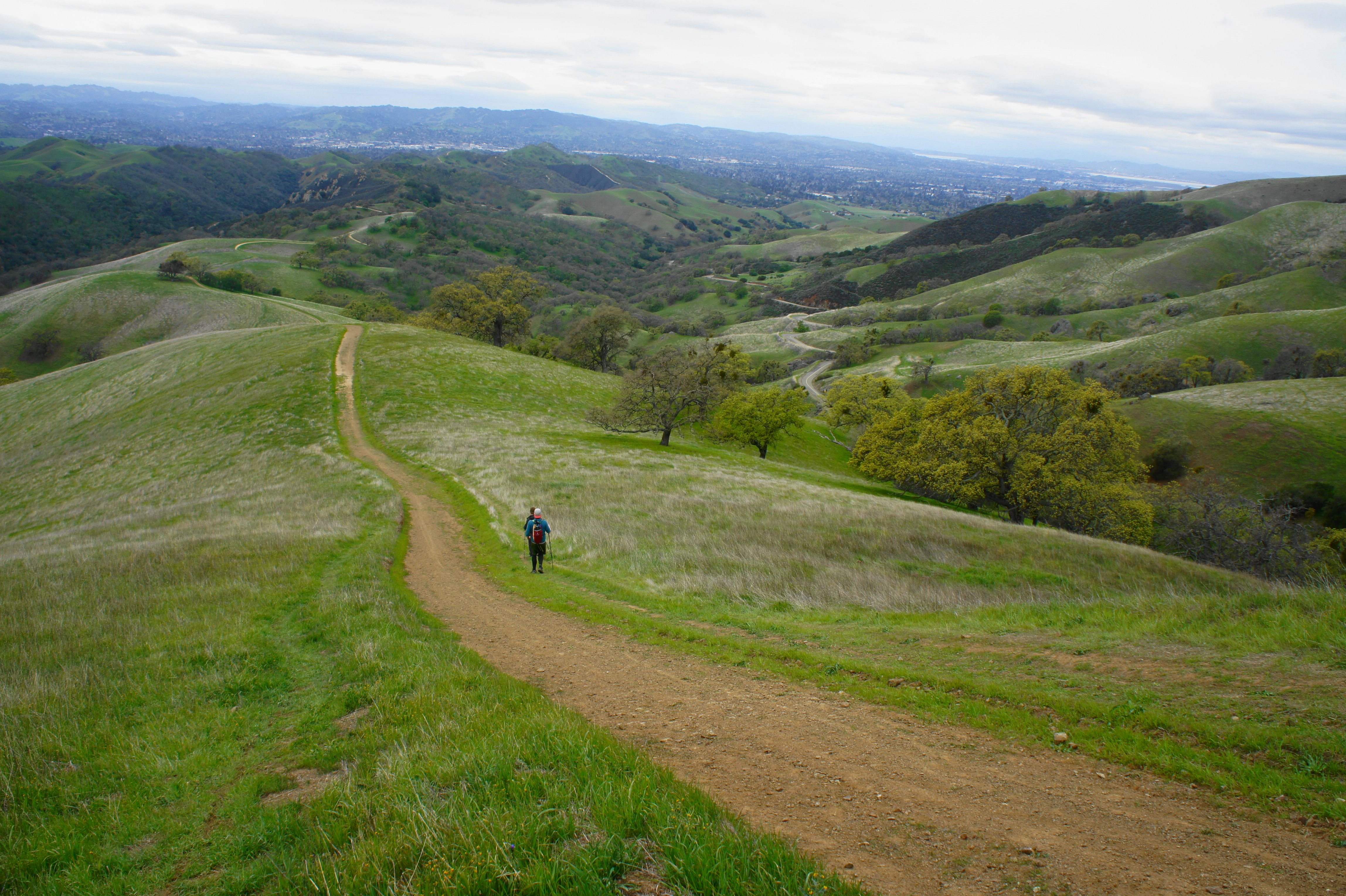
Setting off on the wide, dirt track heading east, follow the hiker/biker Wall Point Road as it snakes between gently rolling knolls, brilliantly green in winter and early spring. Gradually rounding a left-hand bend, the path ascends to a junction at 1/3 mile. Bear right, crossing to the other side of a minor ravine. Here Wall Point Road continues to ascend, rounding a sharp right-hand turn before cresting a saddle at 6/10 mile. The subsequent descent to clear an unnamed drainage is pleasant and offers the hike’s first views of Mount Diablo, still a distant summit at this point.
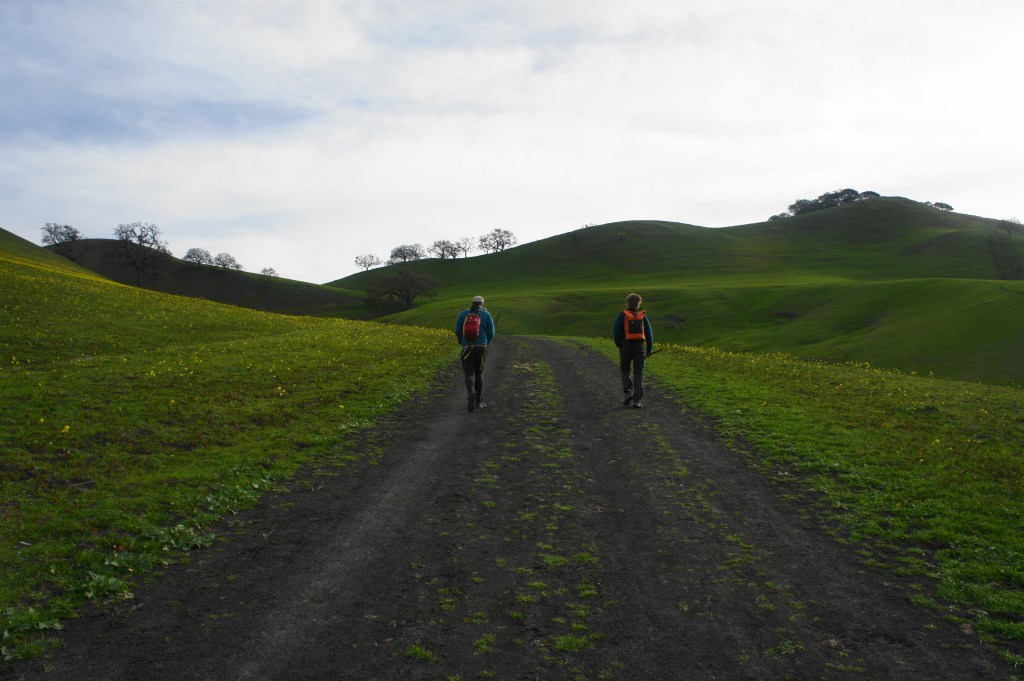
Setting off 
Wall Point Road with Mount Diablo ahead
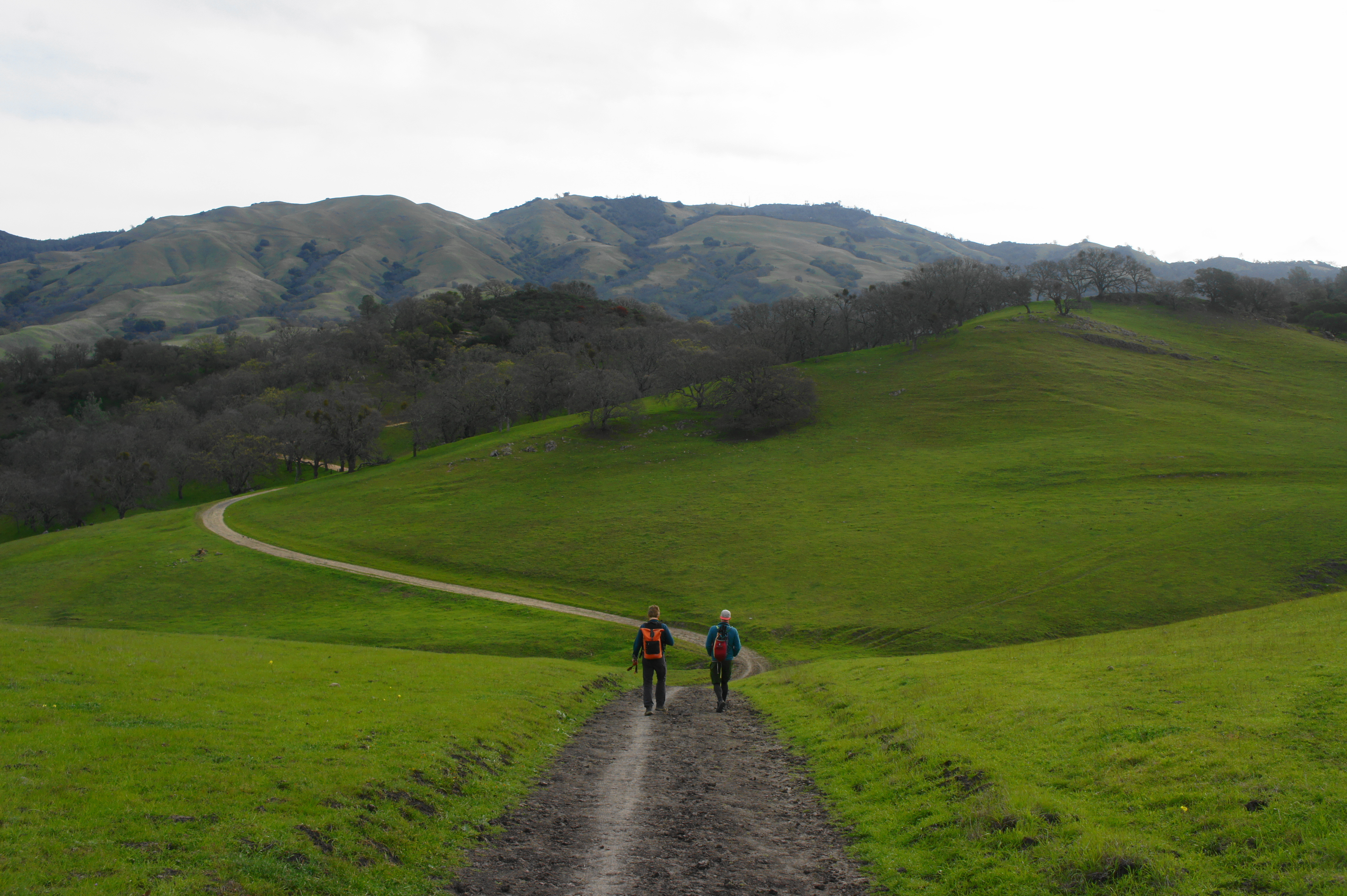
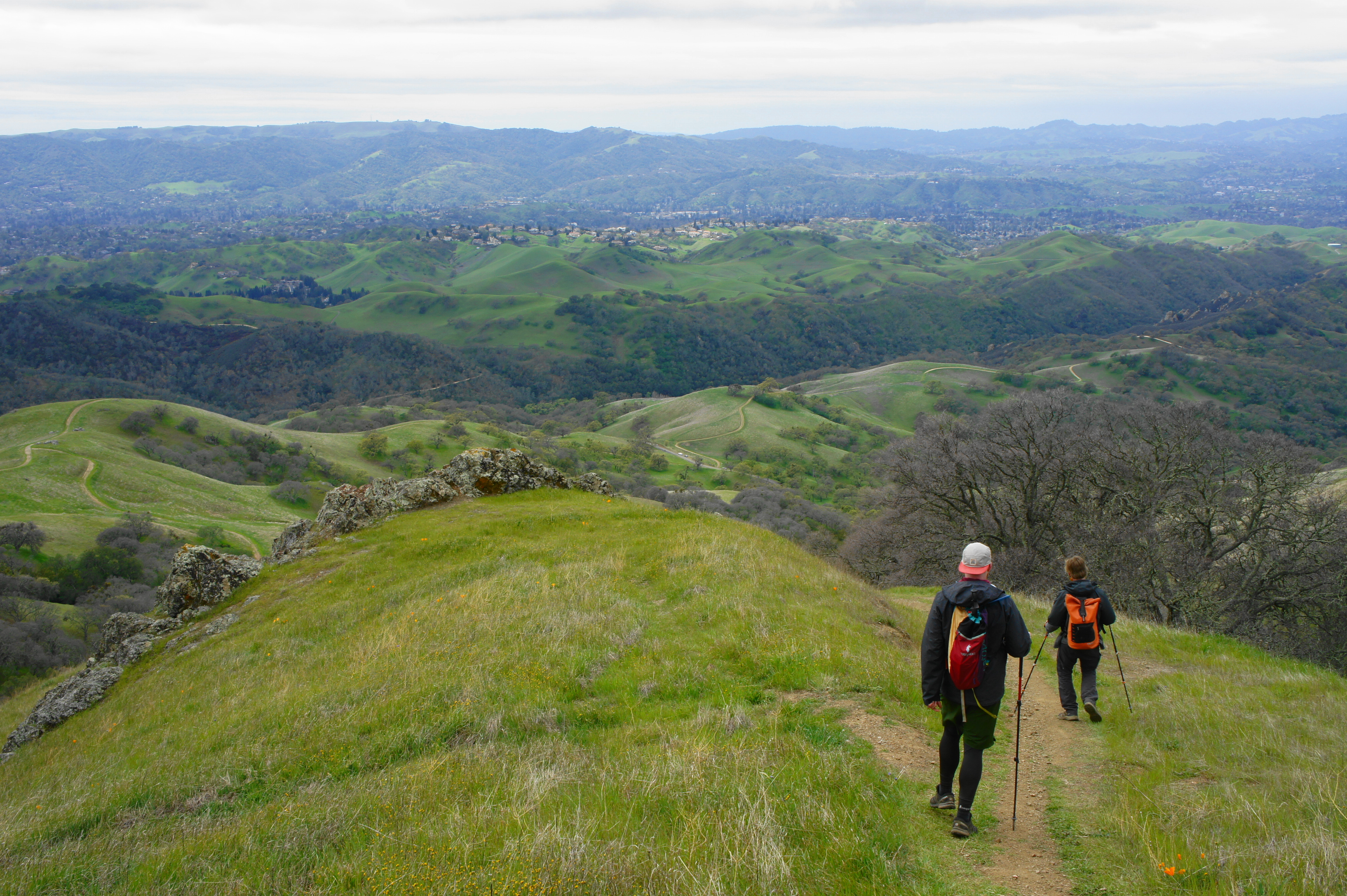
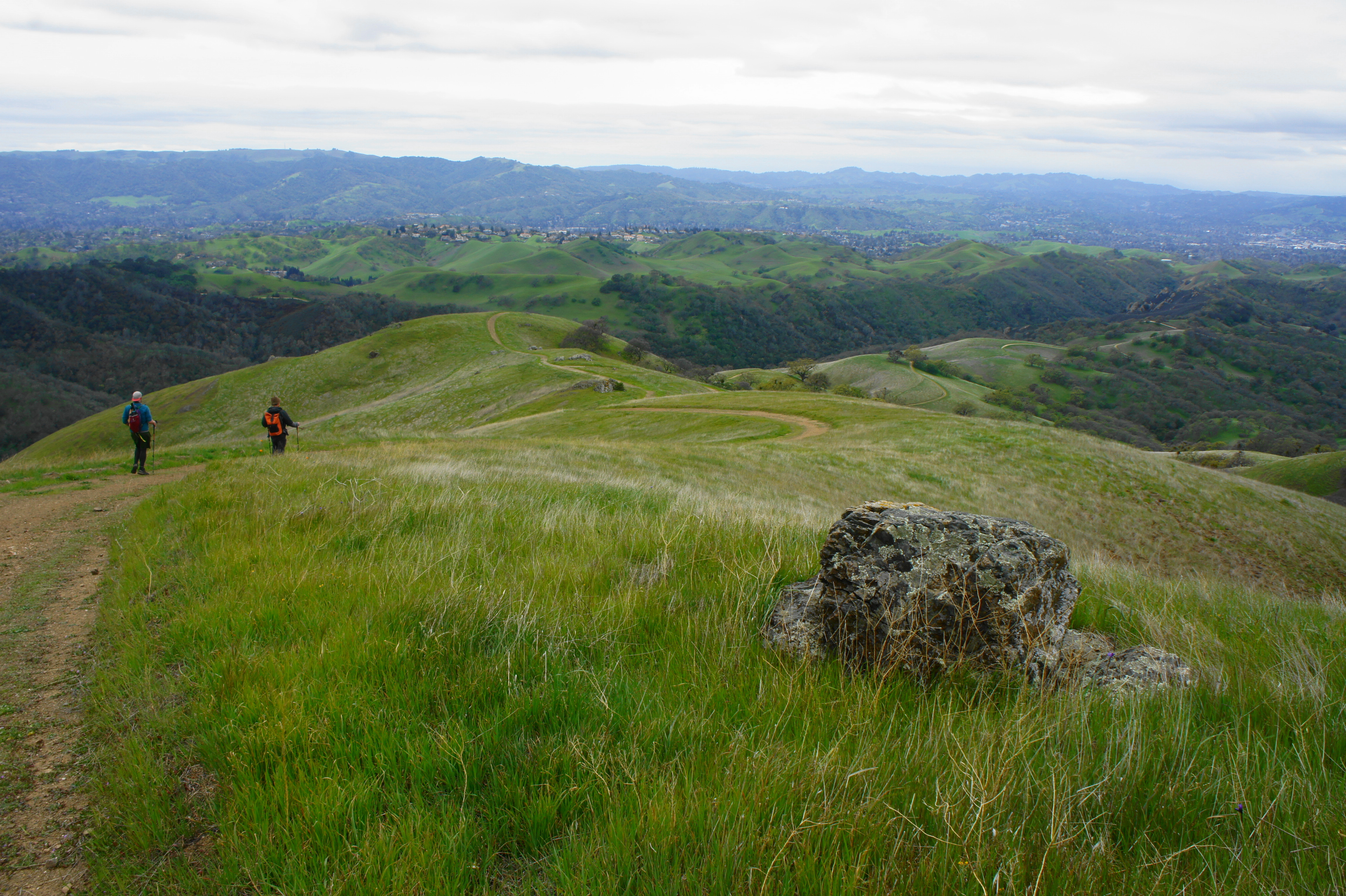
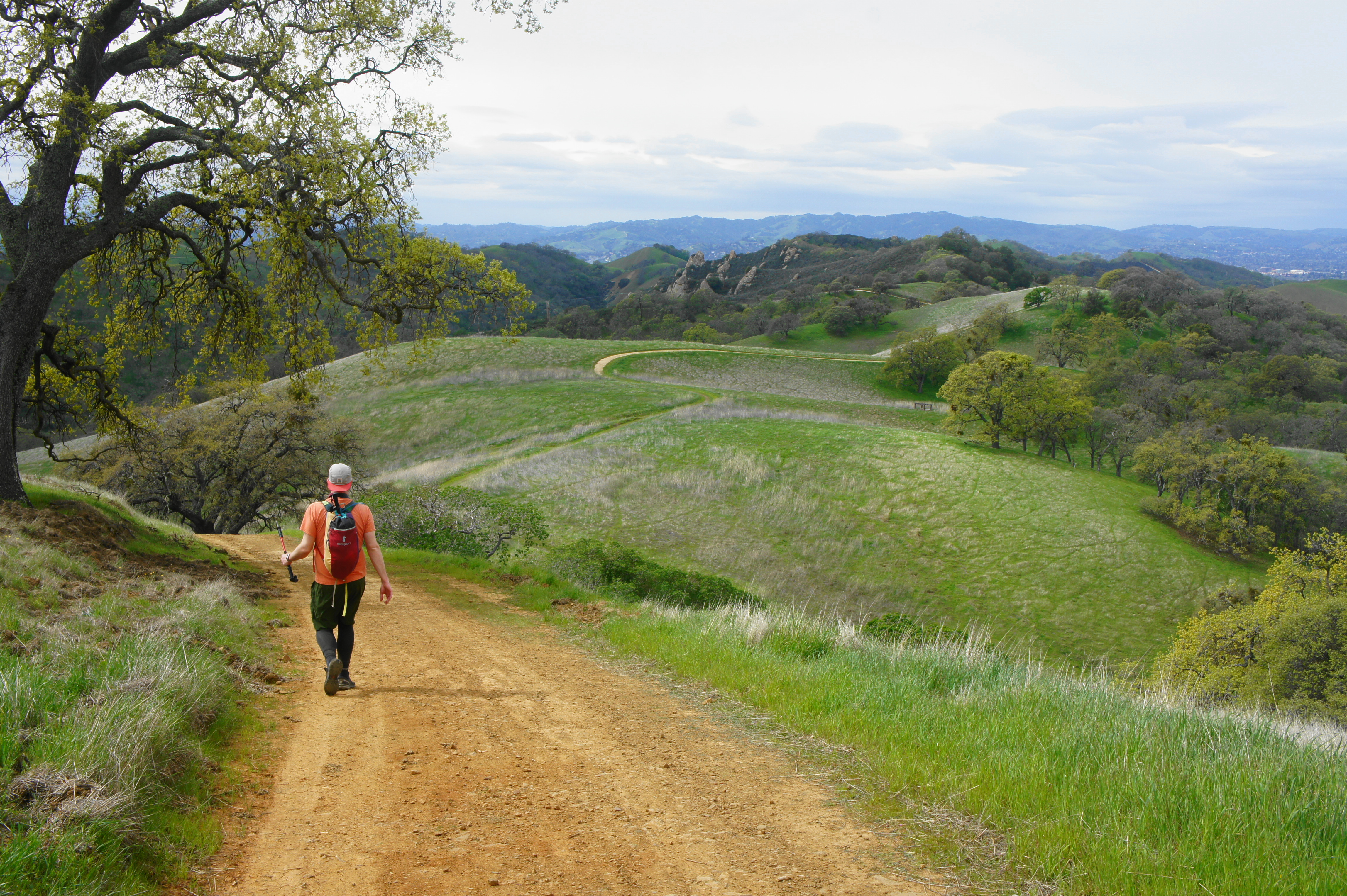
Eventually entering a forest of wild oaks, the route forks again at 8/10 mile. Stay right on Wall Point Road, beginning the long loop portion of the hike. For the next two miles, hikers will be roughly following the length of Pine Ridge, a rocky and rugged striation that dominates the landscape between the southern trunk of Mount Diablo to the east and Diablo Foothills area to the west. Rising from the initial junction, the wide path reaches a crest and another fork at 1.2 miles. Stay left, traversing the scrubby, south-facing flank of Pine Ridge. As hikers gain another 500 feet in elevation en route to Wall Point (1,600’), they are rewarded with excellent views across the broad valley toward Las Trampas Ridge and the Dublin Hills.
Hiking along Pine Ridge 
Brief descent on Wall Point Road

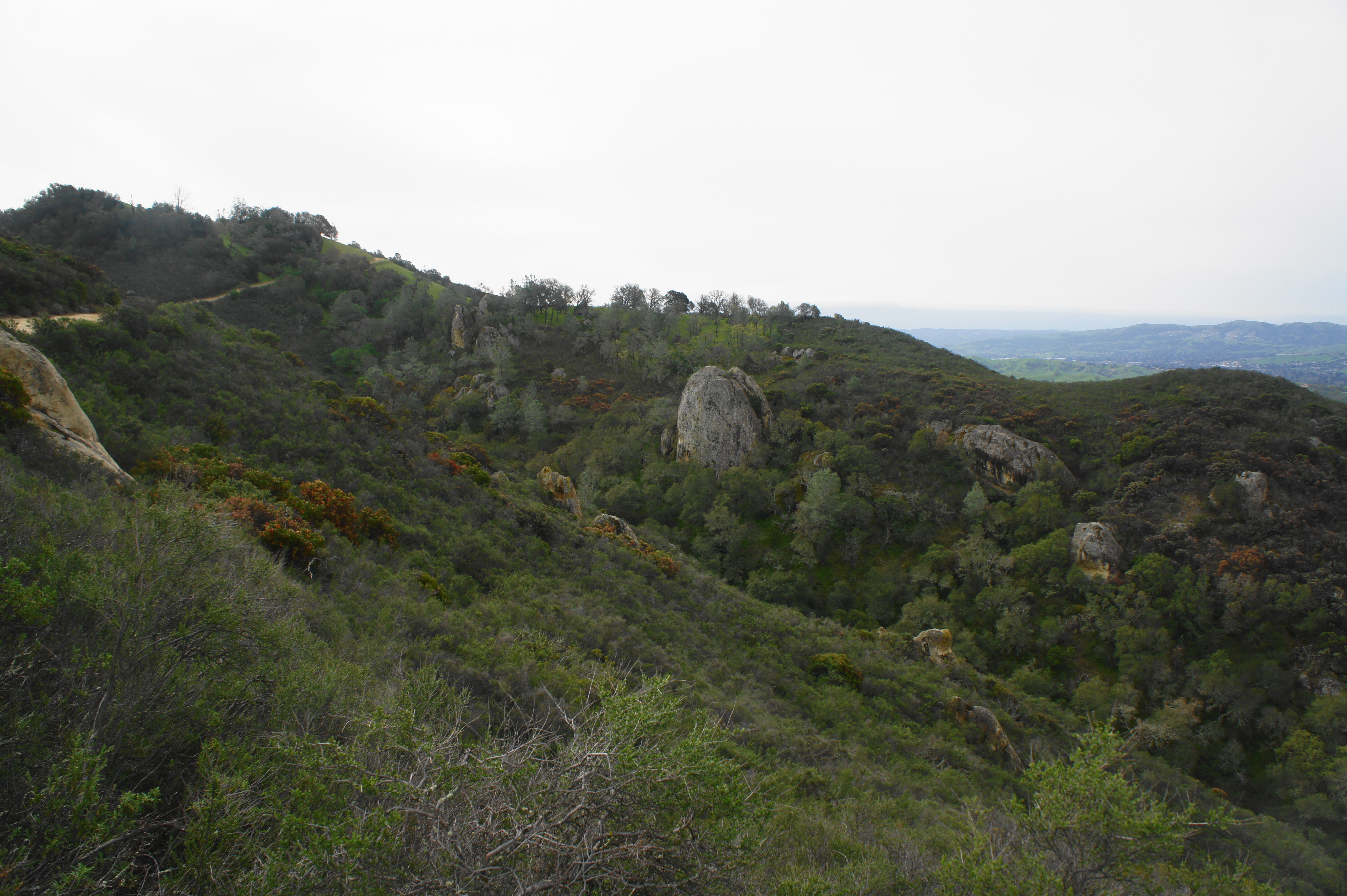
Following the windswept ridge for over a mile, the route briefly descends to a junction with the curiously-named Secret Trail; stay right, resuming the climb toward the southern spine of Mount Diablo. At 3.2 miles, look for a (signed) singletrack on the left; this is the Ridge View Trail, a steep cutoff route that connects Wall Point Road with the northbound Summit Trail. This rutted path climbs, sans switchbacks, an exposed slope, making this probably the steepest uphill of the entire loop.
Up the Ridge View Trail 
Rock outcrop on Ridge View Trail
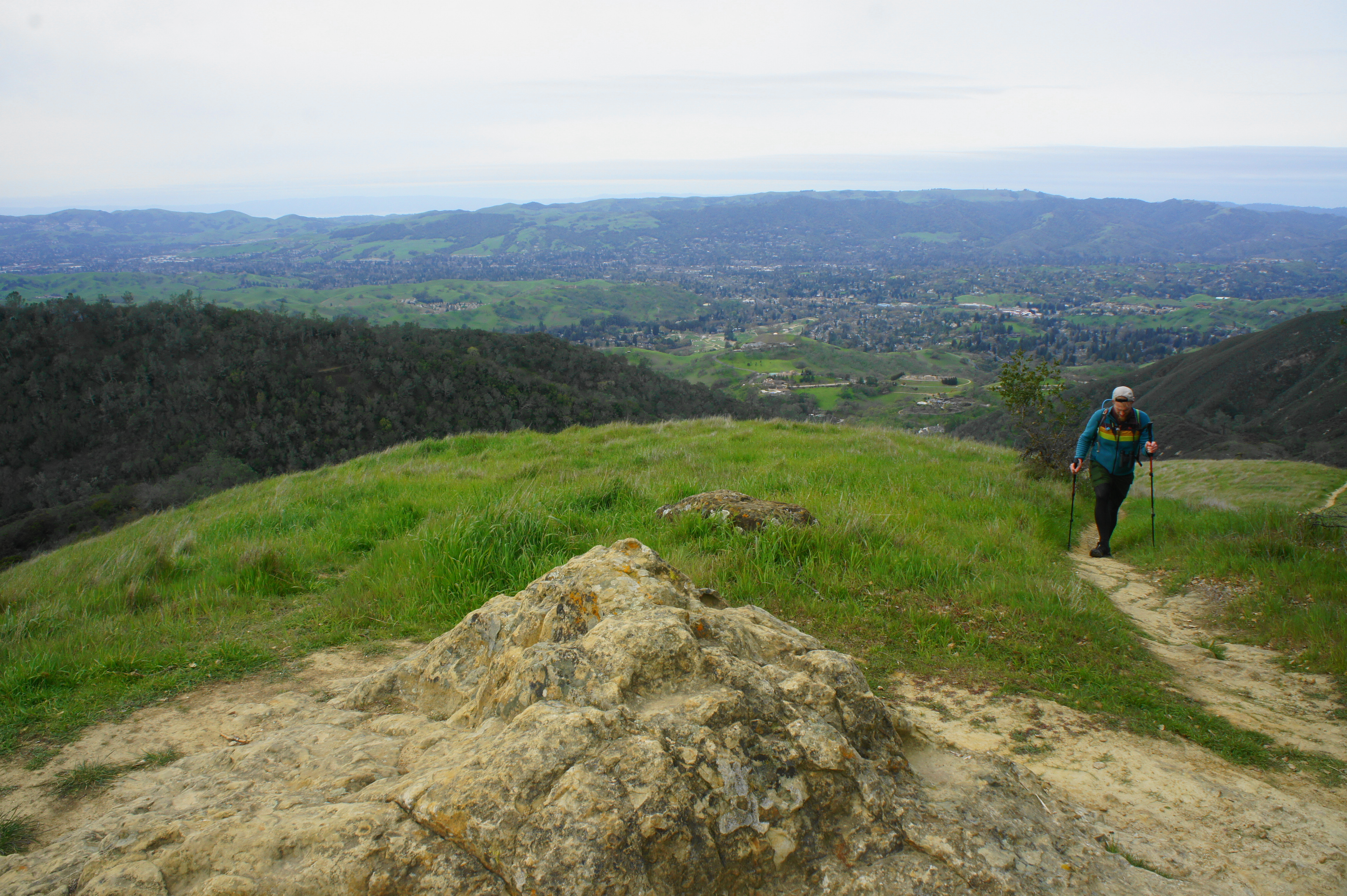
After gaining around 300 feet, the path briefly levels off at a nice rock outcrop with expansive vistas, a nice place to stop for a snack break. Beyond the outcrop, the trail descends to a junction with the Summit Trail, where hikers should bear left and cross South Gate Road. By now hikers have gained around 1,300 feet but are more than halfway, distance-wise, to the summit.
Summit Trail to Mount Diablo Summit (2.8 miles)
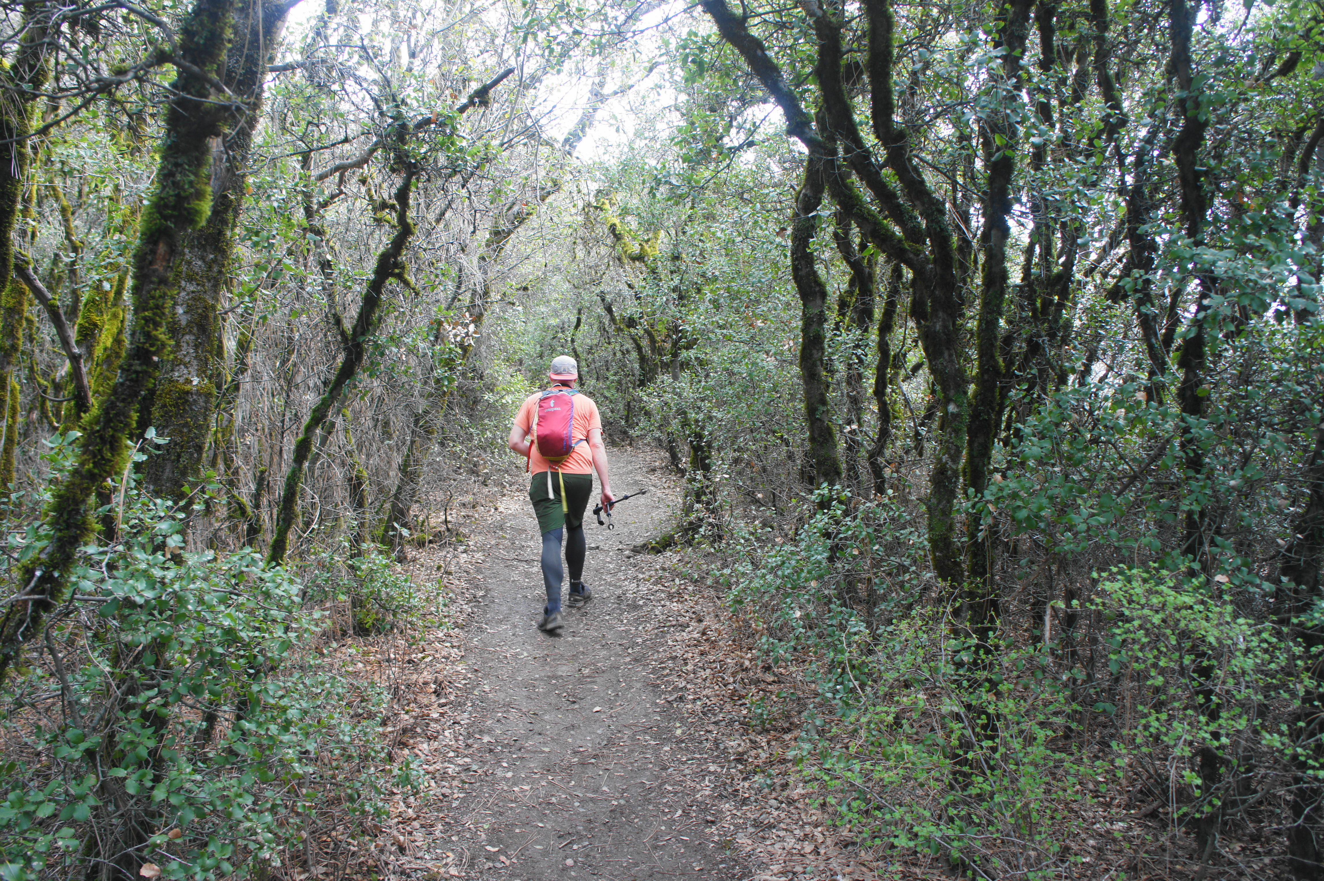
With more than 1,800 feet in elevation gain remaining, the Summit Trail proceeds northward, briefly paralleling South Gate Road. Climbing amid brushy chapparal and oak/bay woodlands, the Summit Trail passes the Sunset Picnic Area (where there is a restroom) on the left and crosses Summit Road. Follow the onward path, beginning as a paved track but quickly returning to gravel and dirt. Just past an intersection with the Junction Trail (stay right), hikers will pass the historic Mountain Home Site on the left. This was the site of a former, 19th century hotel that was situated along a tourist toll road constructed by Joseph Seavey Hall in the 1870s.
Soon the onward trail passes back into the sun, and a sign on the left indicates the presence of chert, a reddish rock layer commonly found on Mount Diablo. Steps further is a similar sign for greywacke, a sandstone variety. Stay right at the junction at 4.75 miles, then cross Summit Road again, after which the landscape turns to largely short shrubs (taller trees struggle on this windswept slope).
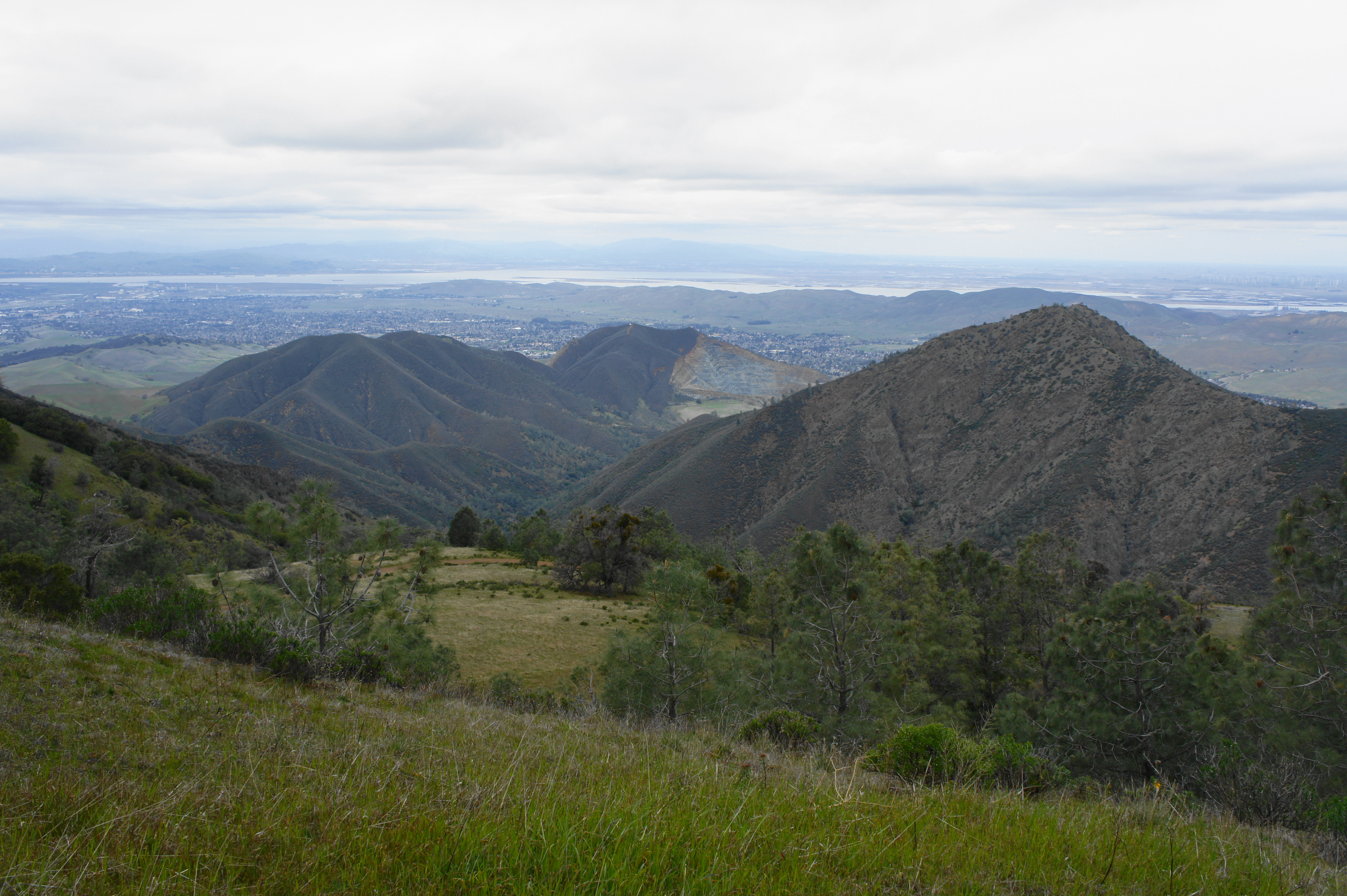
Stay on the Summit Trail, now a singletrack, as it quickly parts with the wider Green Ranch Road and continues its relentless climb. At the Old Pioneer Horse Camp—which sports a water tank, picnic tables, and restrooms—continue left on the Summit Trail. The subsequent climb is steep but offers the best views yet as the patchy Black Hills come into focus to the south and east.
Stay right on the trail as it briefly intersects with the Summit Road again, then climb to Devil’s Elbow, a hairpin turn on the road situated at 3,480 feet. Here the Summit Trail joins with the North Peak Trail, which comes in from the right. With the summit observatory now in sight, the trail makes its final push up to the peak. First the route cuts west in the direction of a set of antenna towers, then meets the Summit Road again at 6.2 miles. Briefly follow the road east; as it splits into a one-way loop, look for the continuation of the Summit Trail. The rocky path cuts through a dense canopy of oaks, then passes a communications tower and ends, finally, at the parking area for the Mount Diablo Summit and Observatory.

Summit Trail 
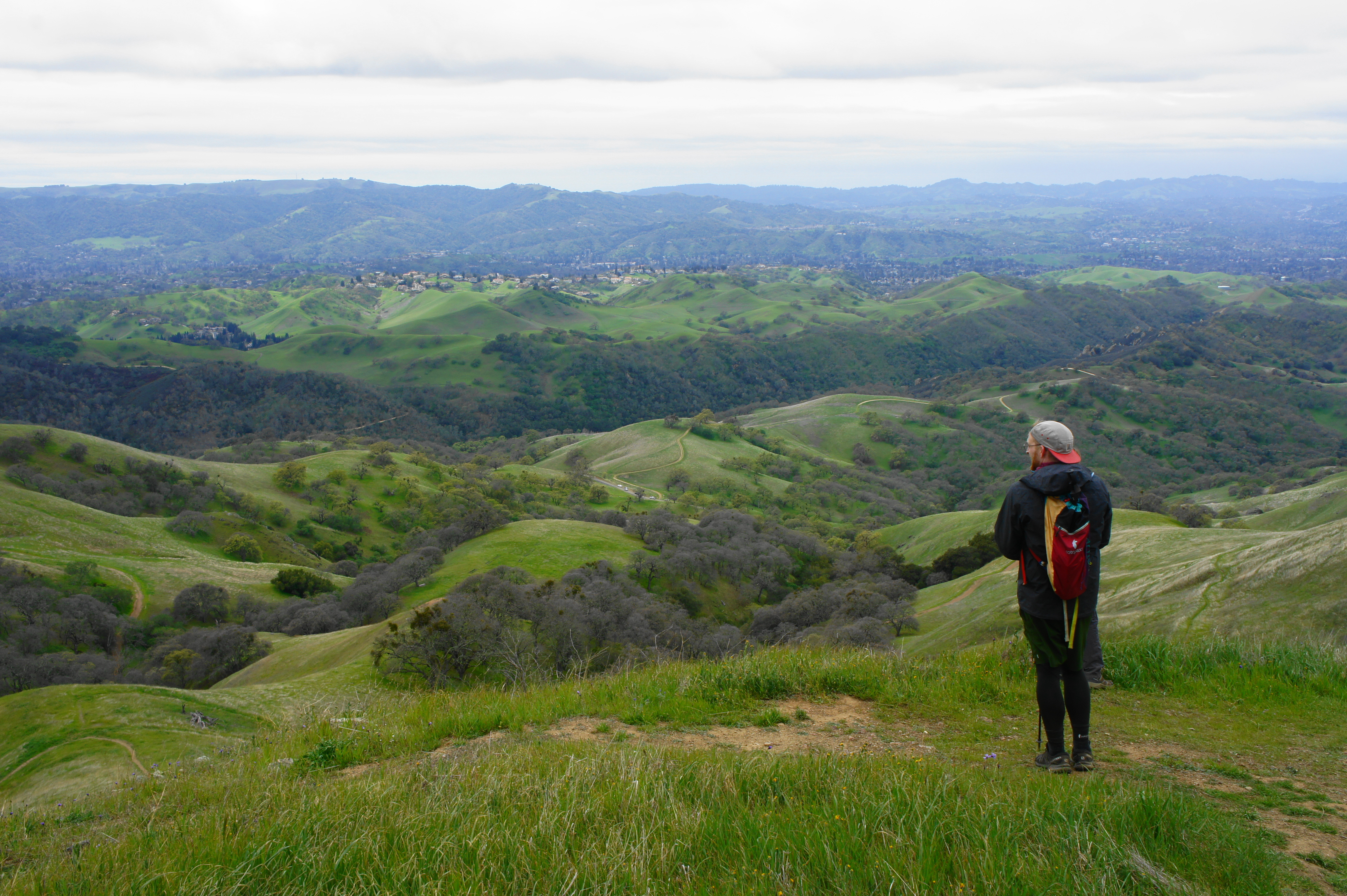
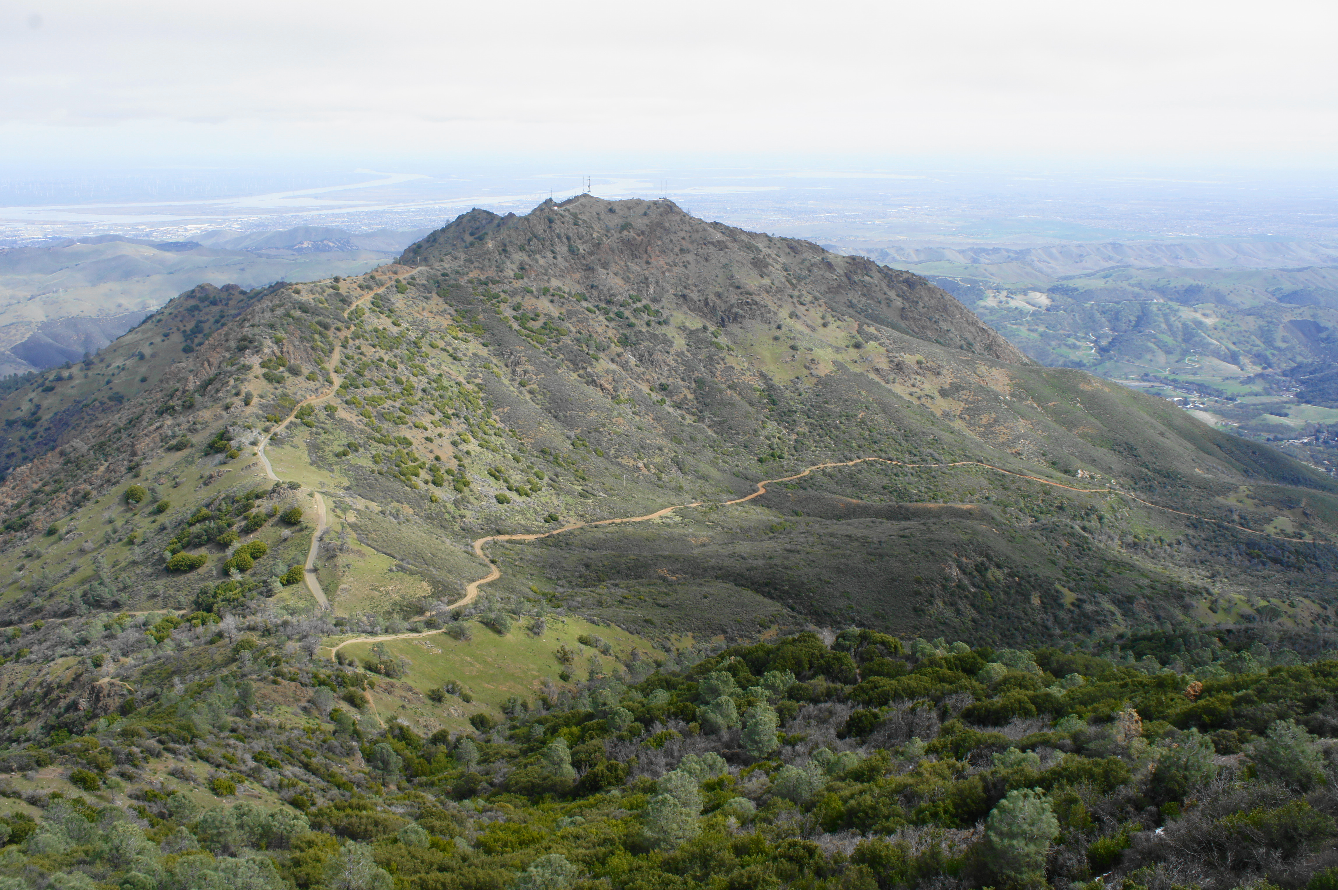
Mitchell Canyon, Eagle Peak, and Sacramento River Delta from Mount Diablo summit
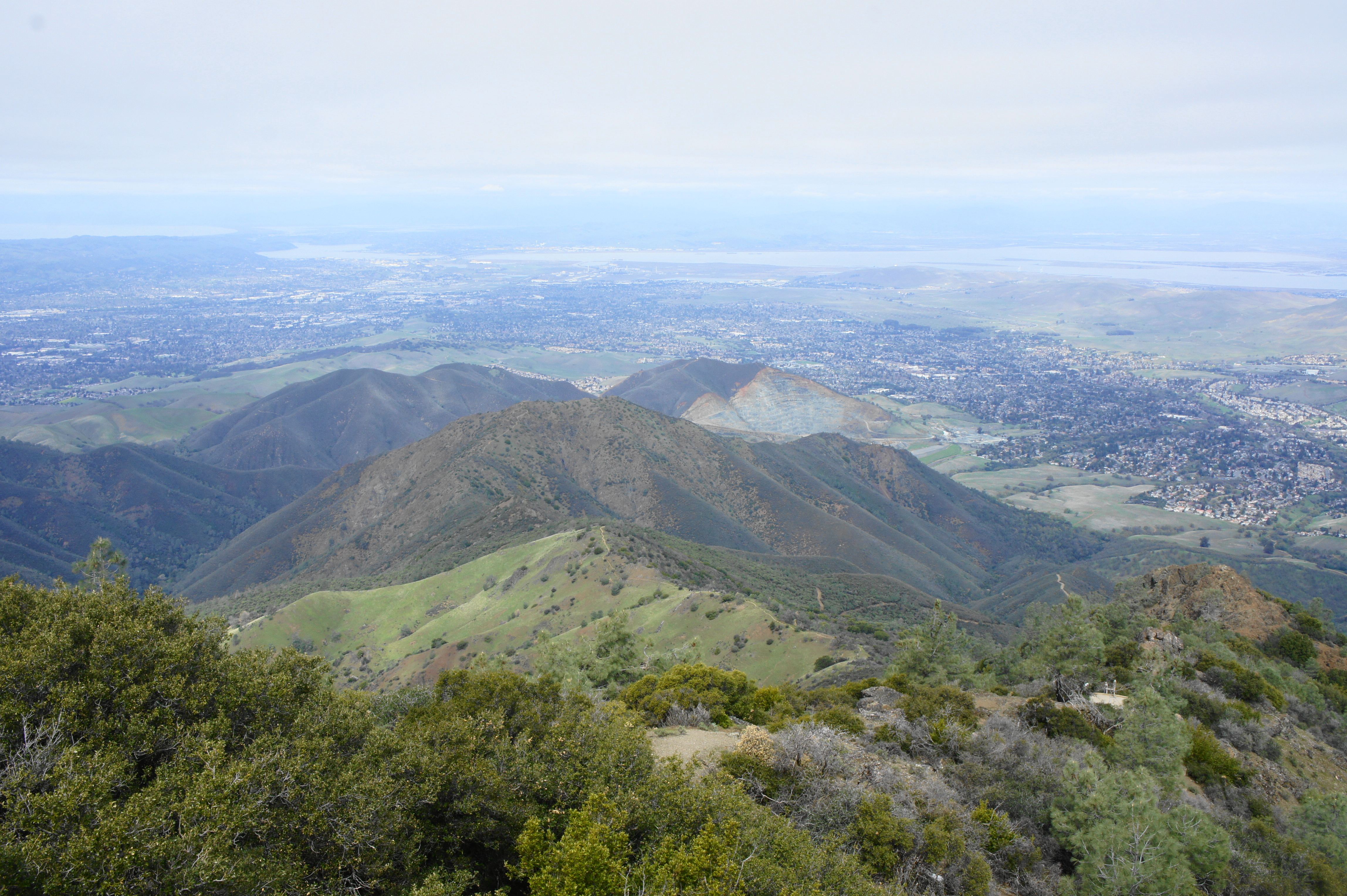
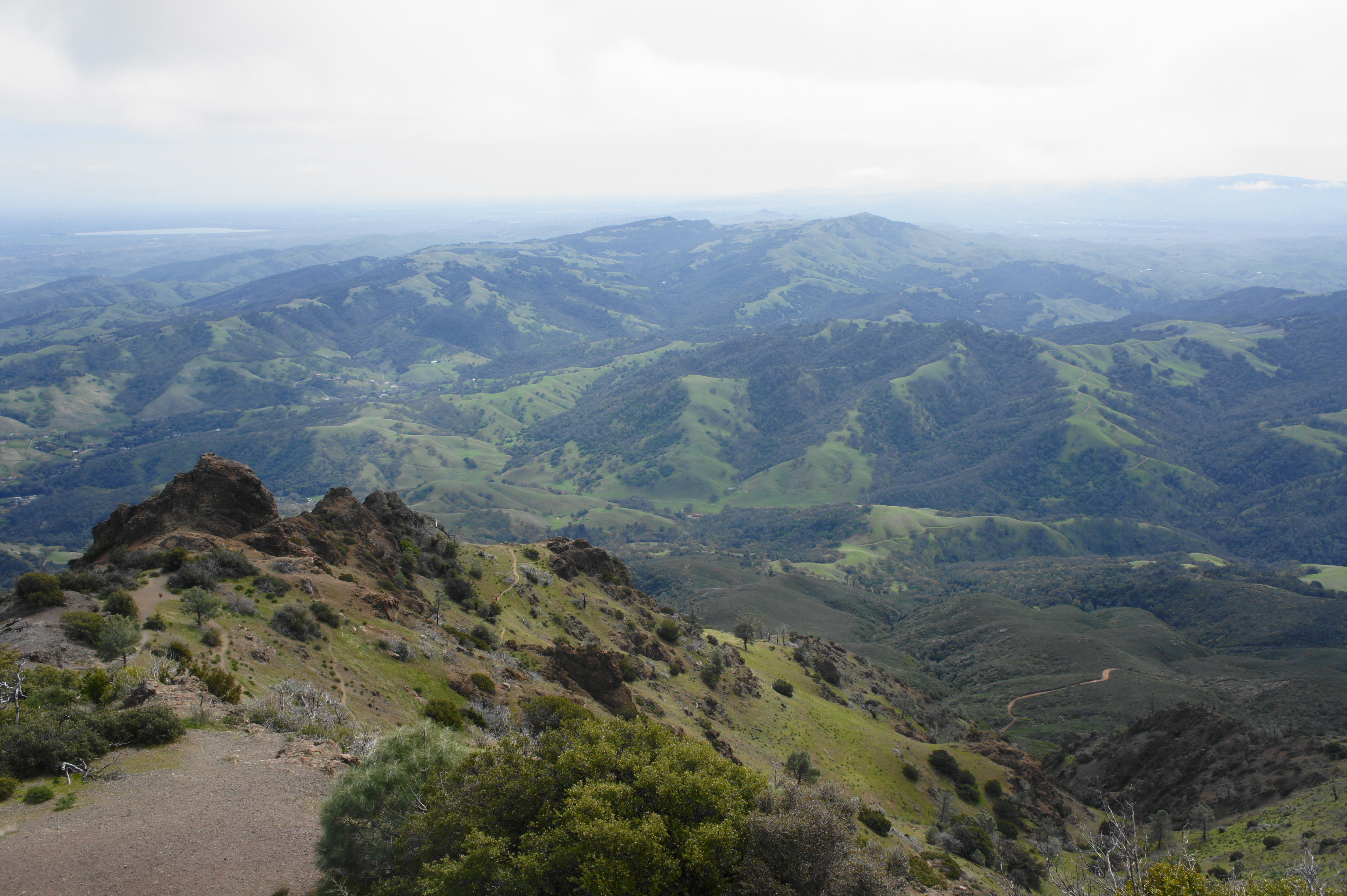
Even as you fight through the crowds of people who, psshh, drove to the top, it is worth climbing the steps of the observatory to a viewing platform with panoramic vistas. On a clear day, hikers can see across much of California, including the Central Valley and Sierra Nevada to the east. To the south are the Black Hills, as well as the rest of the Diablo Range. A northward look is partly blocked by North Peak (3,557’), but hikers can see the Sacramento River Delta, as well as the Mitchell Canyon portion of the park—where a more heavily-trafficked base-to-summit route begins. To the west, of course, one can make out the San Francisco Bay, Mount Tamalpais, and Santa Cruz Mountains, with the Pacific Ocean beyond.
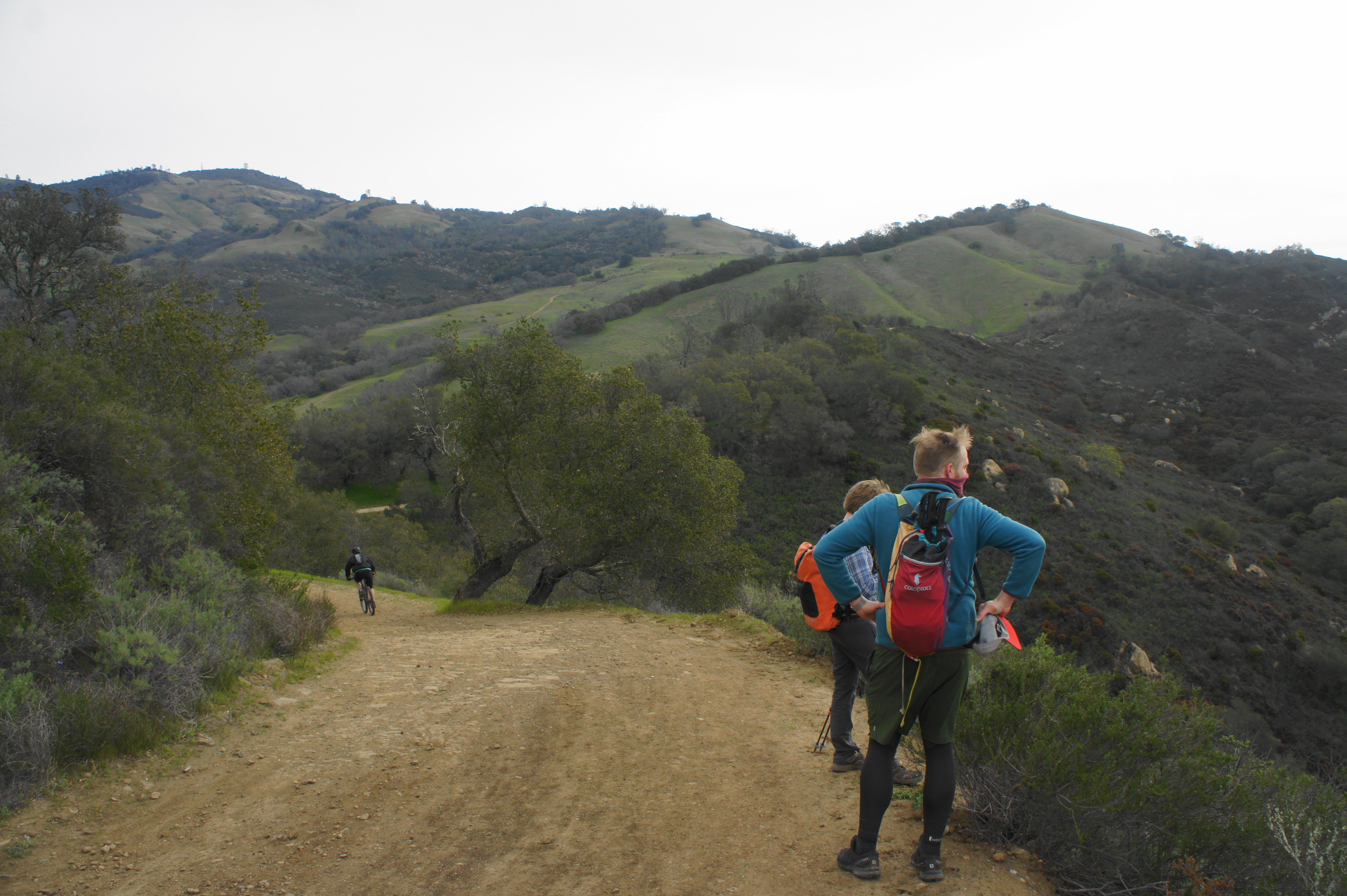
Mount Diablo Summit to North Gate Road via Burma Road (4.4 miles)
Of course, given this a loop back to Macedo Ranch, the hike is only halfway done. Fortunately, the downhill route traces a different section of the park and is strikingly beautiful and relatively rarely travelled. Begin by making your way back across the summit parking area, down the Summit Trail, and across the length of the crowded Lower Summit Picnic Area. Continue to the end of the parking lot and look for a sign indicating the start of the Juniper Trail.
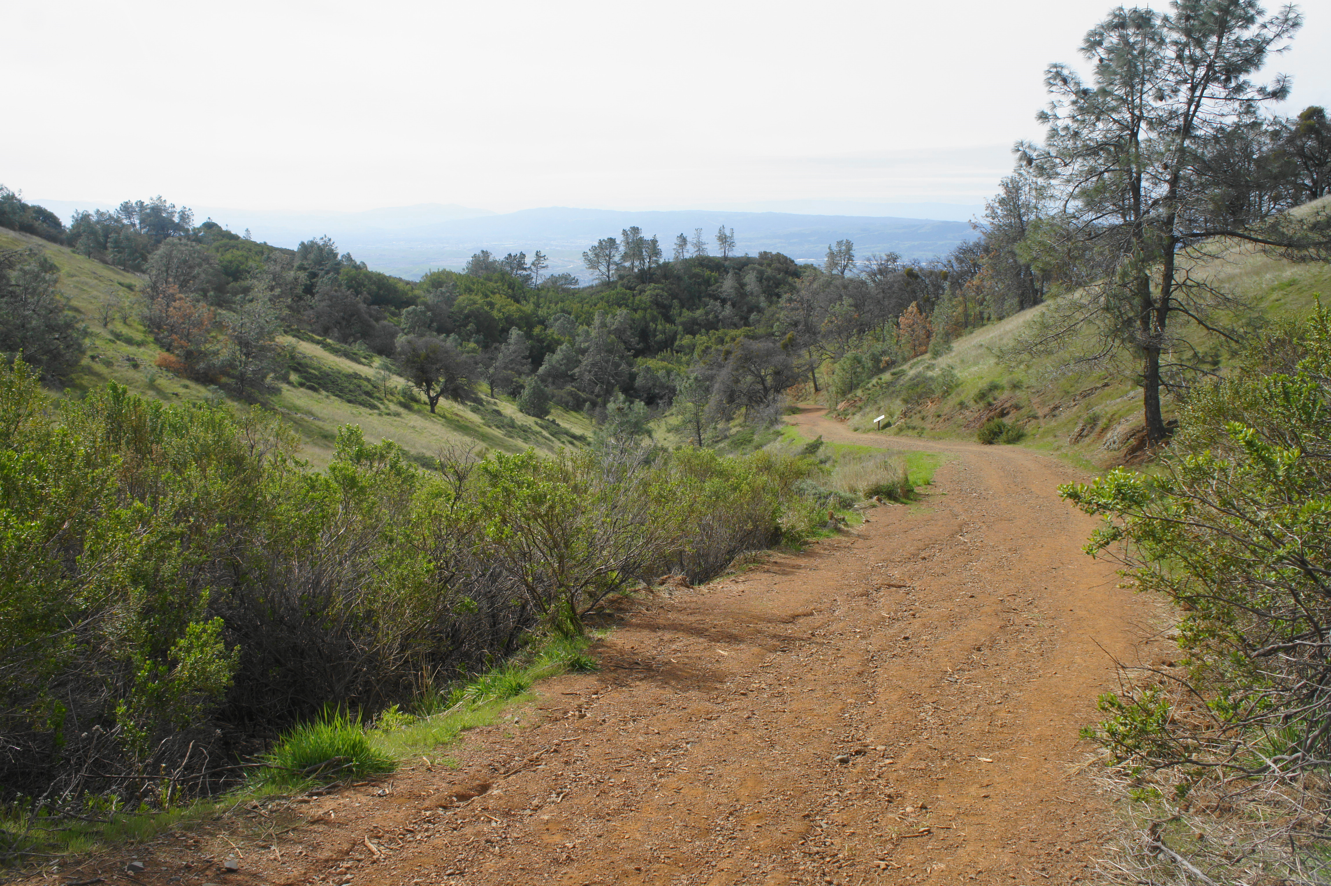
Once on the trail, the crowds disappear again, and the path plunges down a scrubby slope. Cross Summit Road again, then continue eastward as the Juniper Trail descends the upper reaches of Moses Rock Ridge. At around mile 8, stay left at the junction with the Moses Rock Ridge Trail, then descend sharply to Summit Road and the entrance to Juniper Campground. Bear right on the spur road leading into the campground, passing campsites on left and right.
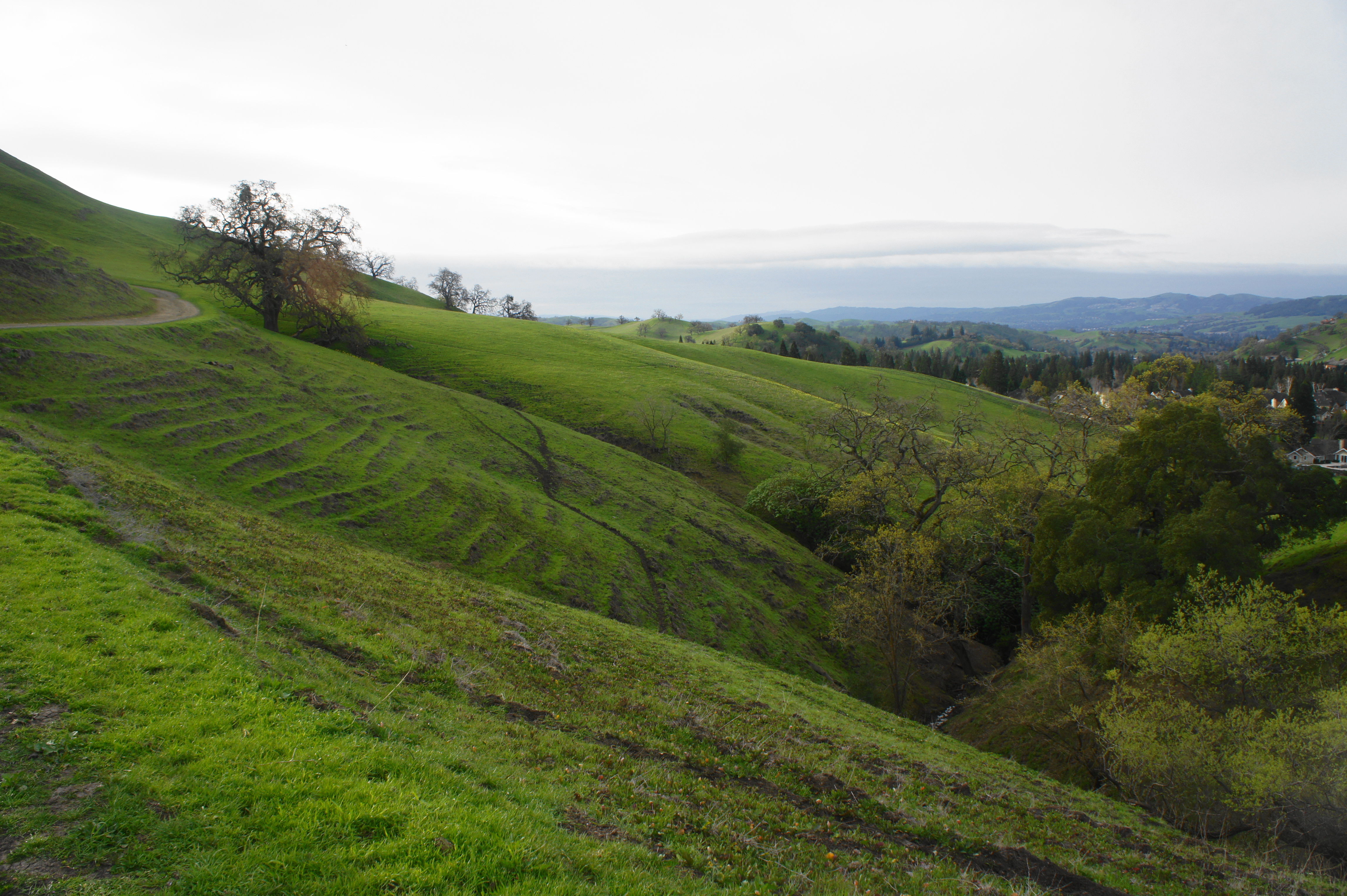
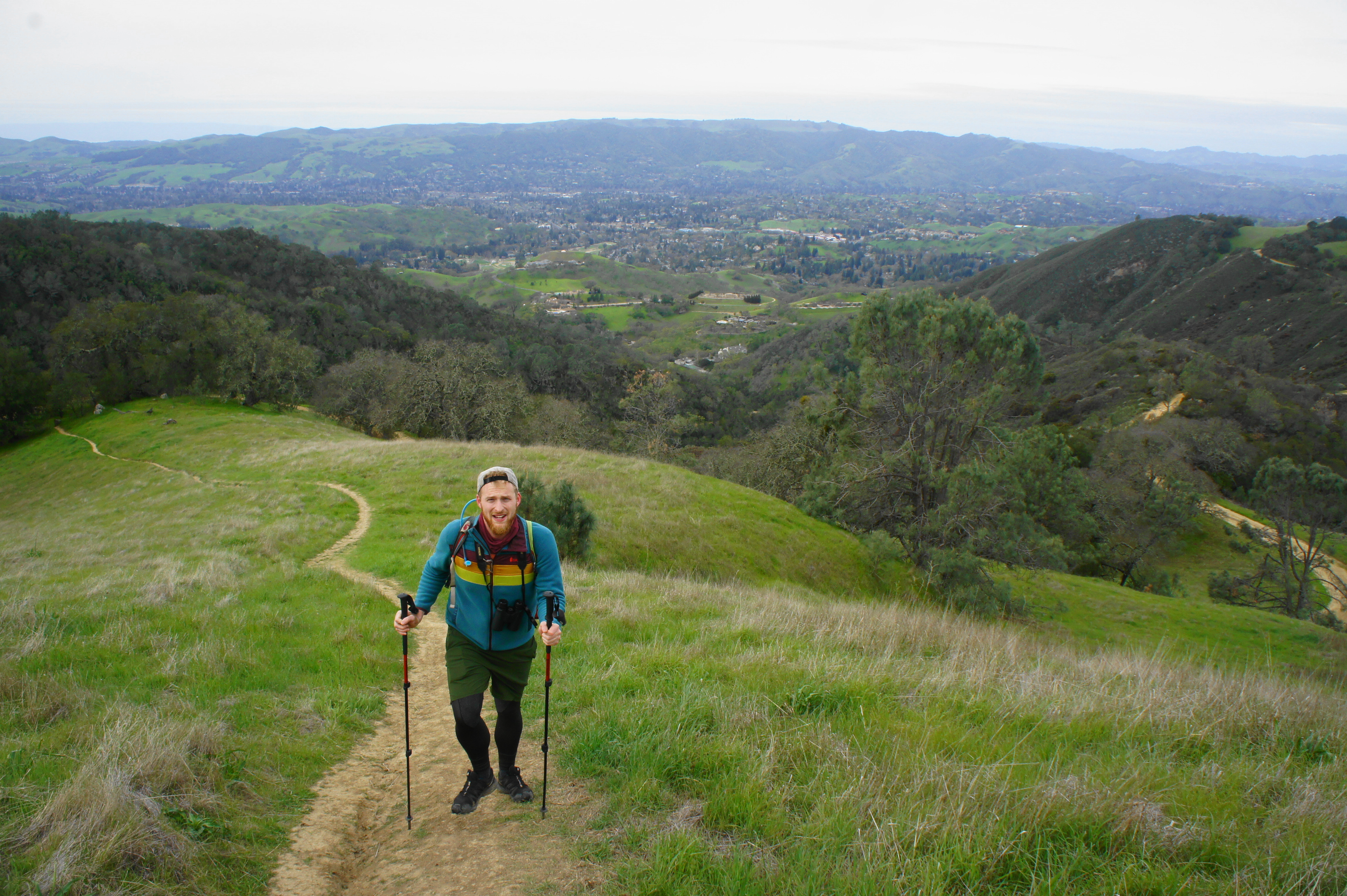
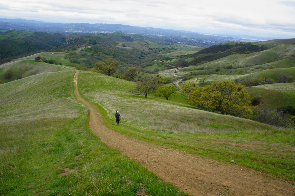
Continue on Deer Flat Road as it passes a campground bathroom on the left and then returns to dirt, passing through a gate. Stay straight at the junction with the Juniper Trail continuation, following the wide grade as it skirts the west-facing hillside. As the various pines gradually dissipate, hikers are rewarded with excellent southward views.
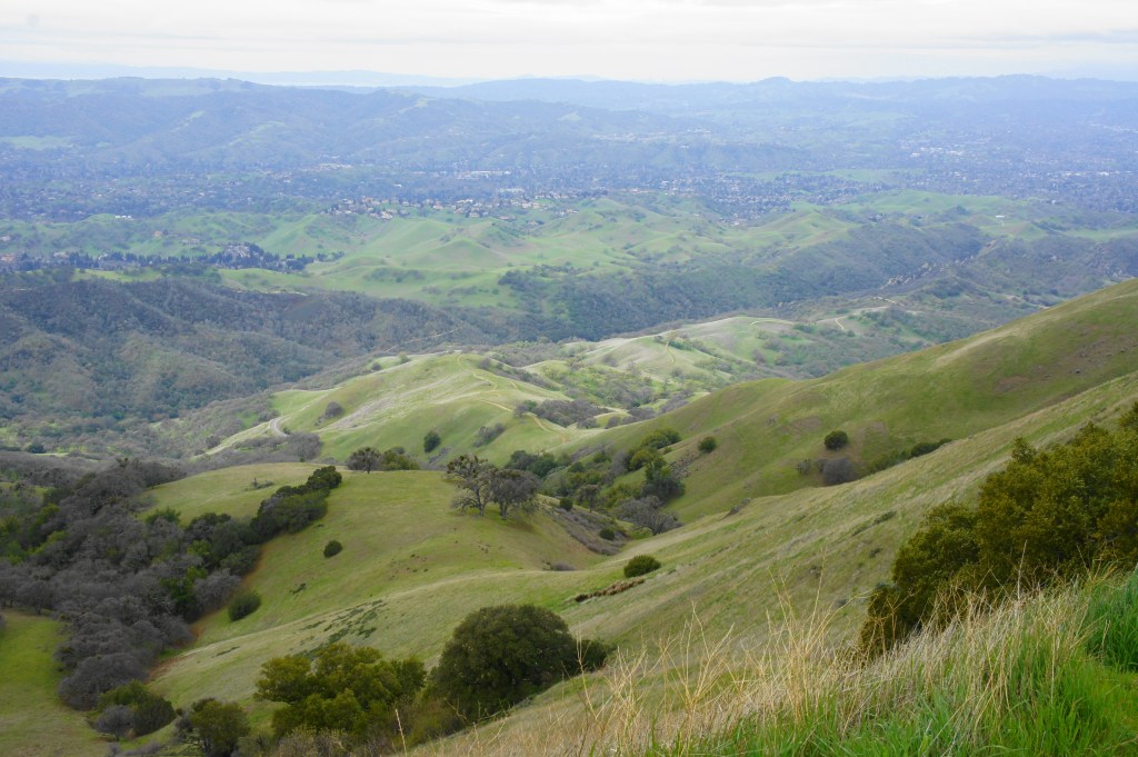
Sweeping views 
Views from along Deer Flat Road

At a saddle at around 8.4 miles, stay left on Burma Road, which snakes the north flank of Moses Rock Ridge before returning to the south. After peering north down Mitchell Canyon, the route begins a sharp and winding descent down the west face of the Mount Diablo complex. In the next two miles, hikers will shed nearly 1,800 feet in elevation.
Burma Road 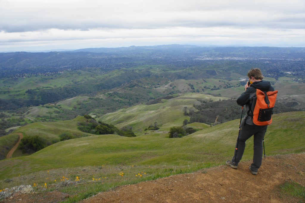
Descending Burma Road


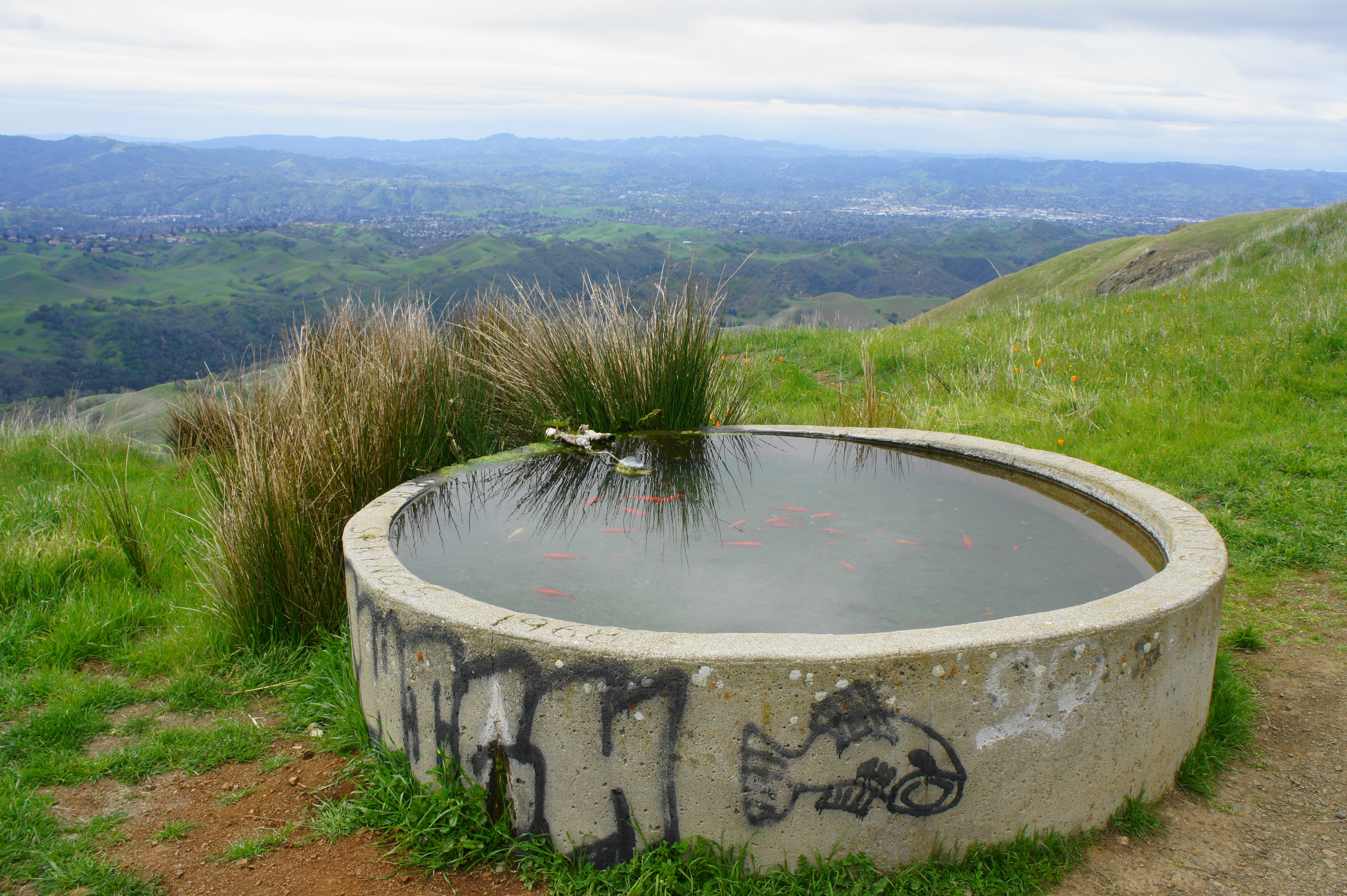
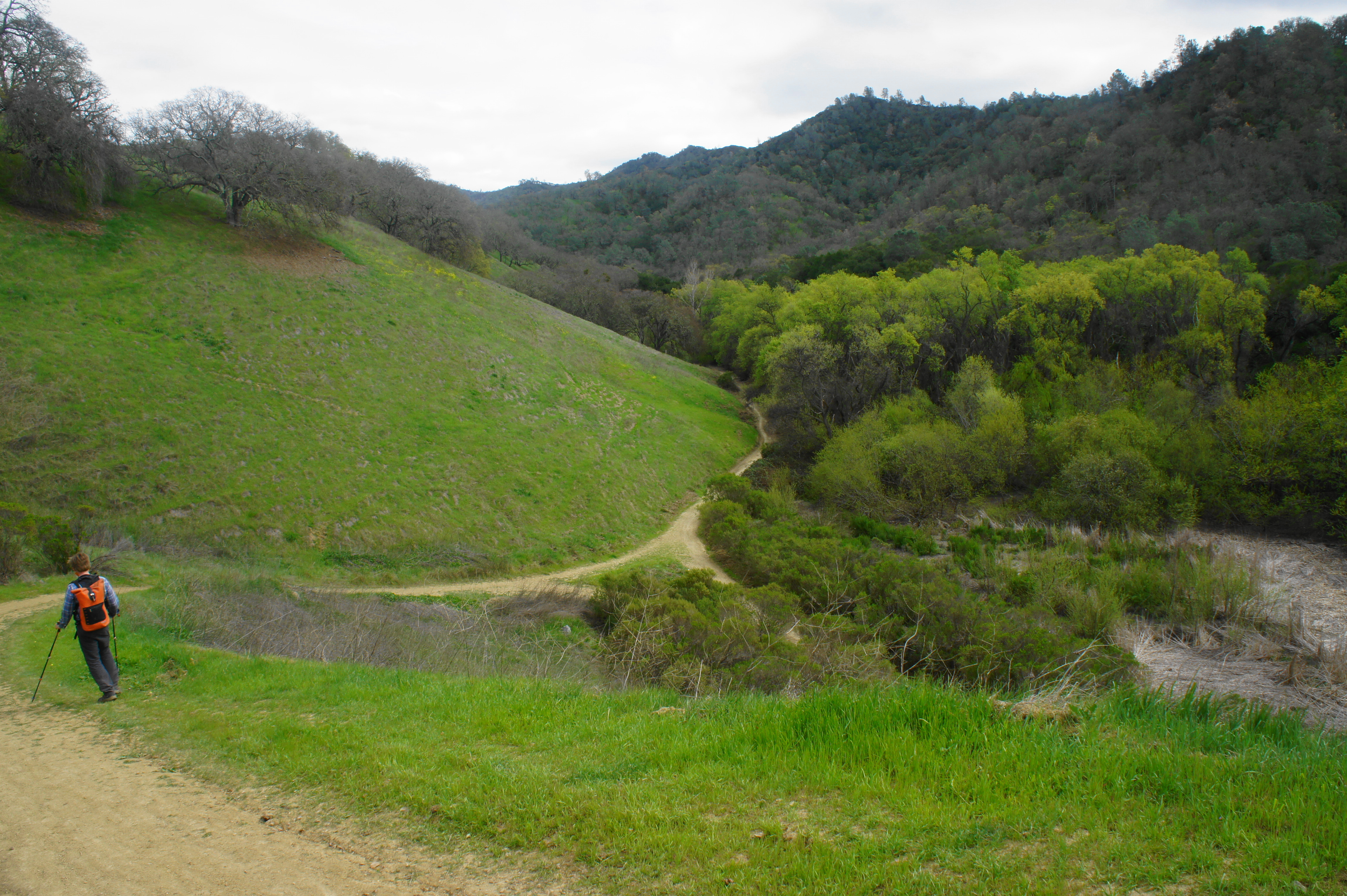
Burma Road drops steadily for a half-mile before reaching a junction with the Mother’s Trail at around 9.4 miles. Bear left on this single-track, one of the steepest trails in the park. Just past its start, the trail passes a coy pond (a curious sight!) on the right and then proceeds with its relentless descent. The route is very steep until around 9.75 miles, when it briefly levels off; minutes later, the Mother’s Trail ends at a junction with Angel Kerley Road. Bear right and continue descending, merging again with Burma Road at 10.25 miles (stay left).

Coy pond 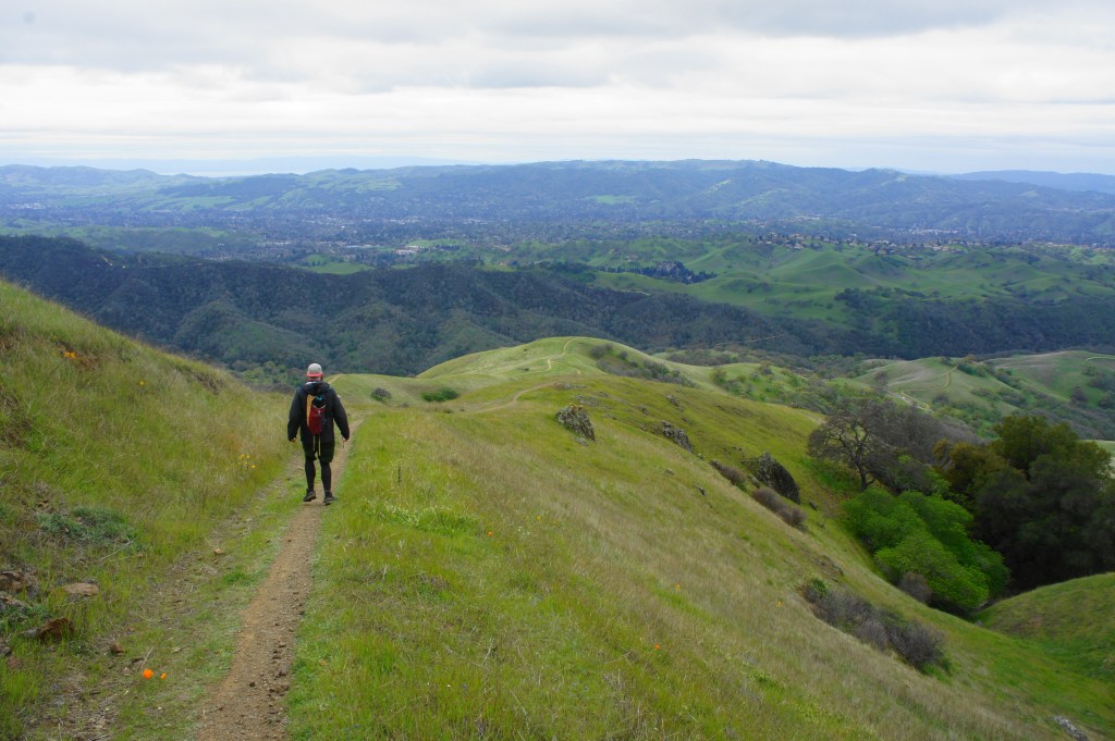
Descending Mother’s Trail

The subsequent section involves some of the most absurd downhills in the East Bay—devoid of any switchbacks, the dusty road drops at a near 45-degree angle down the hillside, requiring hikers to very slowly maneuver to avoid slips on the loose gravel. After two monster hills, the trail enters the Camel Rock area and crosses North Gate Road, nearly 11 miles into the hike.
Slow descent to North Gate Road 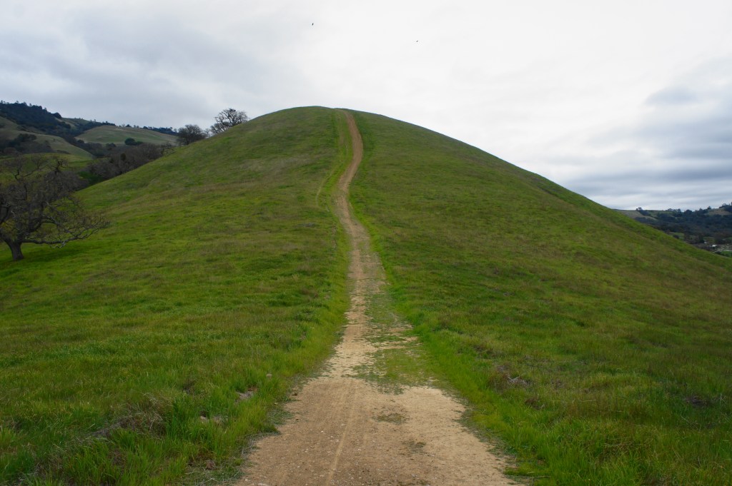
The crazy hill

North Gate Road to Macedo Ranch (2.4 miles)
By now, weary legs will be ready to be done, but it’s still another 2.4 miles back to Macedo Ranch. It perhaps does not help that Pine Canyon stands in the way, requiring hikers to descend Burma Road for more than a half-mile to the valley floor. At the junction with Stage Road, bear left, passing a (usually dry) pond on the right. Follow this wide and easy track for 4/10 mile, then bear right on Dusty Road, which climbs steadily through a shady oak woodland.
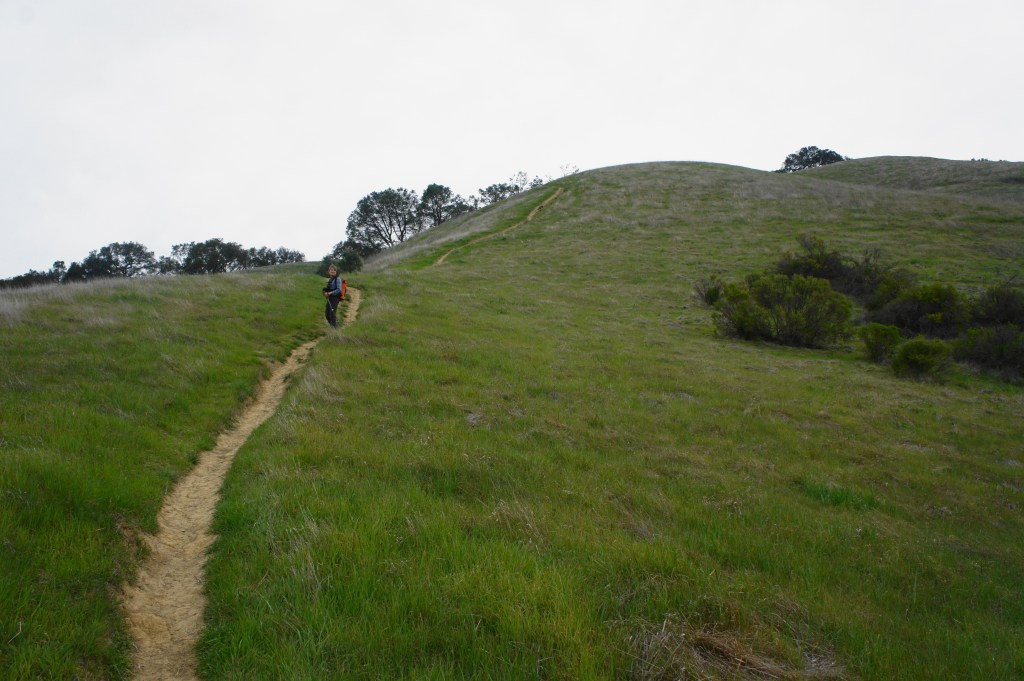
At last, after nearly 12 miles of hiking, the road returns to the intersection where the loop portion began (left leads up Wall Point Road and Pine Ridge). Bear right at the fork, following the wide path down and then up over the opening saddle. From here the path drops to the initial junction, where hikers should bear left and follow the route back to the Macedo Ranch Staging Area.
All told, this strenuous hike clocks in at around 13.25 miles. For most hikers, it will take most of a day to complete.

Wow, it is incredible to see the hills around Diablo so green! Thanks for providing the detailed descriptions and pictures of the gorgeous views!
Looks like a very nice hike and so much green in that area!
Also, North Peak, looks very interesting peak to hike/climb.
Pingback: Top 10 Hikes in 2021 | Live and Let Hike