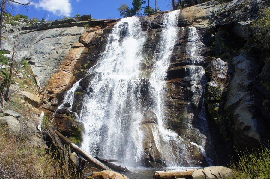
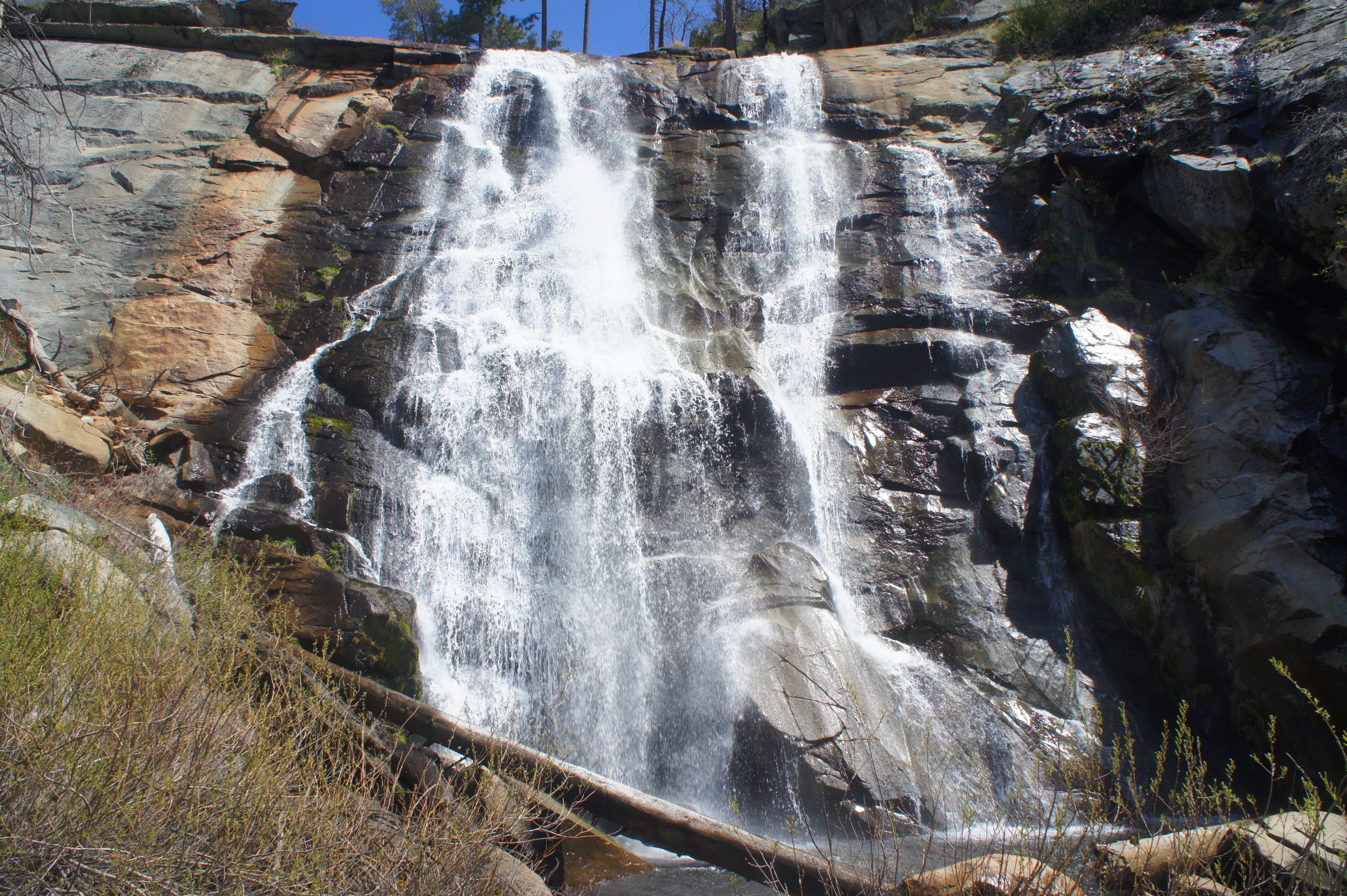
It is a testament to the spectacular bounty of waterfalls in California’s Yosemite National Park that terrific Foresta Falls is routinely neglected by visitors in favor of even taller and higher-volume waterfalls nearby. In perhaps any other park, the 60-foot Foresta Falls would be a centerpiece, yet the hike to this voluminous plunge lacks even a trail sign or description on the list of walks on Yosemite’s website. Starting from the small village of Foresta, one of three enclaves of private property in Yosemite, the short and easy walk to the base of Foresta Falls offers distant views of Merced Canyon and the foothills west of the park and ends at a bridge below the splendid waterfall.


The hike
Foresta is effectively a small collection of cabins and vacation rentals in the western reaches of California’s Yosemite National Park, a short drive from the ever-popular Yosemite Valley. The small town was established in the late 19th century by squatters, who used the Big Meadow area for ranching and agriculture. Plans to establish a large summer resort at Foresta in the early 1900s failed, and the town remains a largely sleepy place with a few vacation rentals but no other commercial properties.
There is a turnoff for Foresta located about 6 miles southeast of the Crane Flat junction along Big Oak Flat Road, or 3.4 miles up Big Oak Flat Road from El Portal Road in Yosemite Valley. Follow the Foresta Road for about 2.5 miles, where the pavement ends. (Note: Set your GPS for “Lyell Way” to get closest to the trailhead.) Here, as the road turns to dirt, it ends abruptly at a sign reading “Road Closed Ahead Bridge Out.” There is a pull-off on the right, with space for perhaps 2-3 cars—likely not to be problem at this rarely-visited place. (Note: If the spots are full, simply park farther back along Foresta Road and walk to this point.)
Beyond the parking area, begin walking along the wide, dirt track, cutting through a burned area with many dead pines. The road roughly parallels the bustling drainage of Crane Creek, which one can hear—and then eventually see—off to the left.
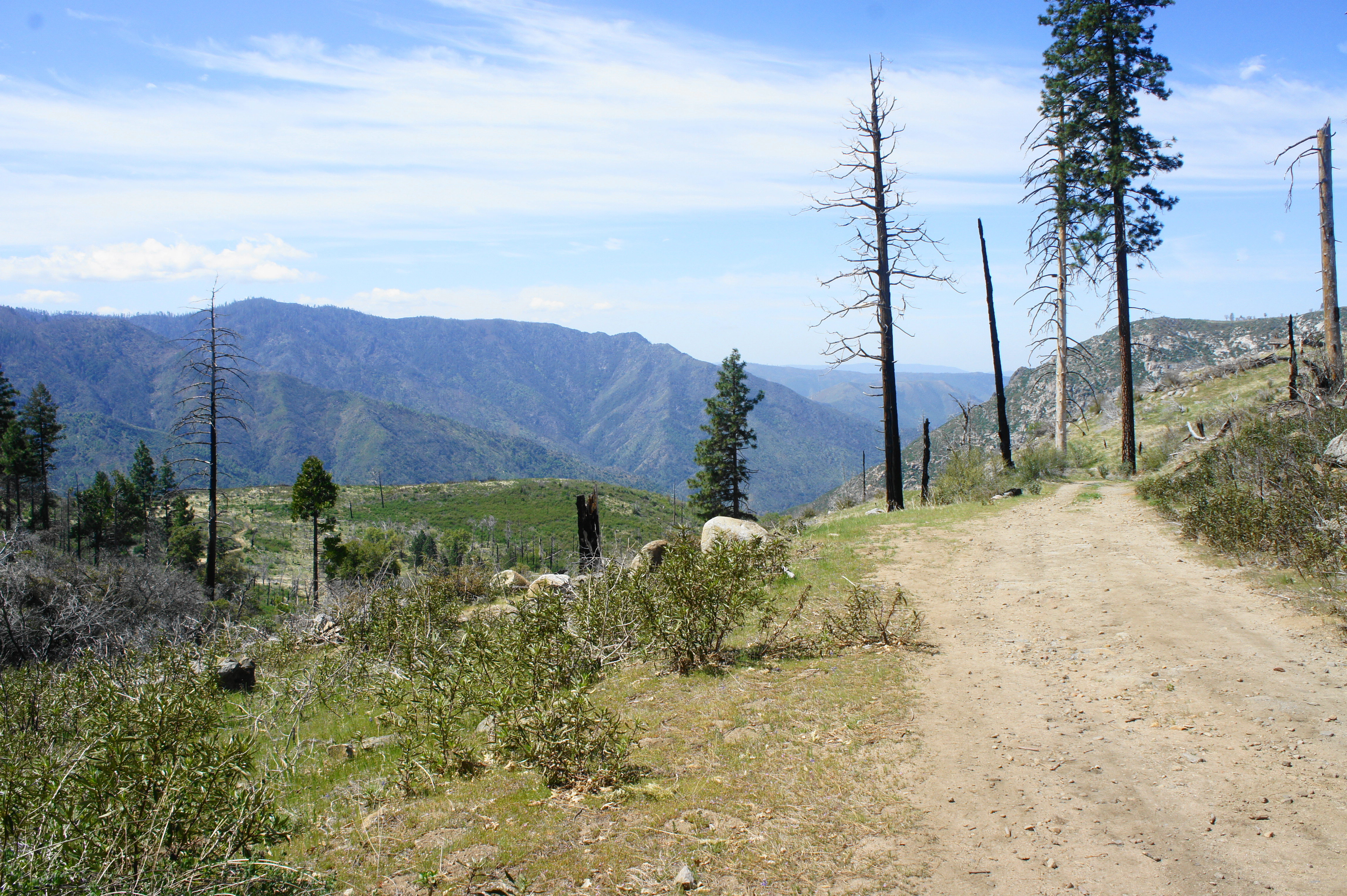
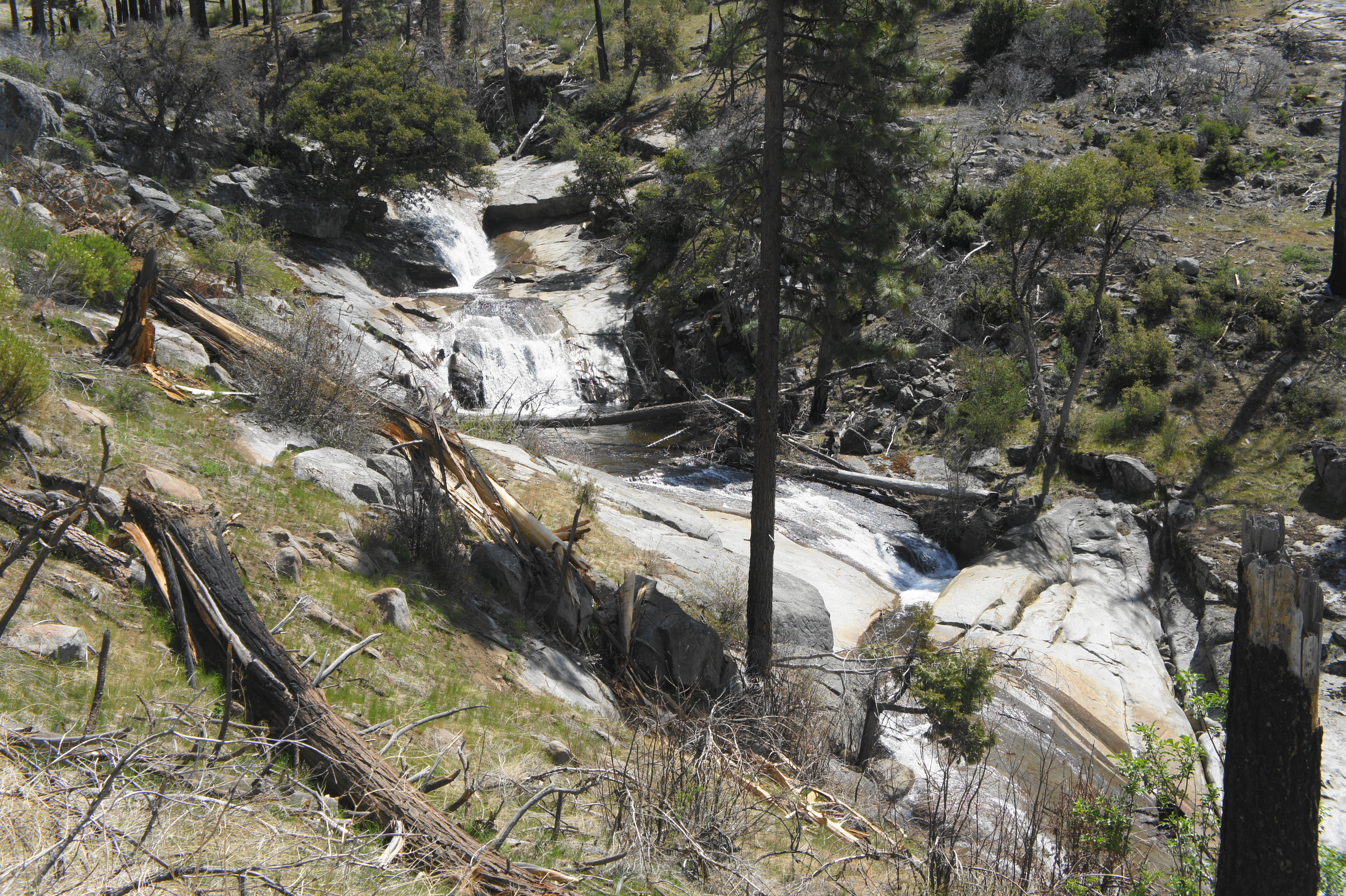
After about ¼ mile of relatively level walking, hikers get their first open views of the meadows and Merced Canyon beyond, as well as a lovely set of cascades on the left. Here Crane Creek tumbles in quick succession through a group of pools and minor slides, a preview for the main waterfall to come.
Just beyond the cascades, hikers encounter a sign on the right denoting that hikers are entering the “McCauley Ranch Addition.” This property was previously owned by James McCauley, an Irish refugee who became an early pioneer of tourism in Yosemite, possibly the first person responsible for generating the famous Yosemite “firefall” at nearby Glacier Point. Beyond the sign, one gets a more open view of the scrubby plateau below, and an early but partly obscured peek at the main waterfall off to the left.

To reach the base of the falls, hikers will need to follow the road as it cuts northwest, descending gradually to a left-hand switchback at ½ mile. After this bend, the road continues southeast, down a straightaway, returning to Crane Creek. The trail is marred in part by the desolation of the forest burns, as well as telephone wires and a fence dating to the McCauley period. Finally, at about 0.85 miles, the road drops to a concrete bridge over the creek, with mighty Foresta Falls on the left.

The waterfall may not be Yosemite’s tallest or most spectacular, but the relative solitude and up-close view of Foresta Falls makes this one of the park’s most underrated destinations. When ready, hikers can continue farther down the road if they’d like (it eventually connects with Highway 140 in Merced Canyon) or return the way they came to complete a roughly 1.7-mile out-and-back hike.


Crane Creek looks very nice, and of course Foresta Falls very impressive!
I also like the way you display the map, in PDF and interactive format.
A great discovery, Andrew. I am not doing well in Issaquah.Have unexplained dizziness. Going to have series of tests this week. Keep your posts coming.
LJ
Pingback: Top 10 Hikes in 2021 | Live and Let Hike
Pingback: Chilnualna Falls Trail (Yosemite National Park, CA) | Live and Let Hike