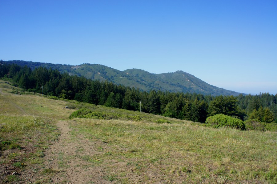

At 2,571 feet above sea level, California’s Mount Tamalpais (known affectionately by locals as “Mt. Tam”) offers splendid vistas of Marin Peninsula and the San Francisco Bay area, as well as Bolinas Bay and the Pacific Ocean to the west. Mount Tamalpais State Park—comprising far more than just the mountain’s three peaks—also boasts more than 60 miles of hiking trails. Among the best options for a half-day hike is the 4.2-mile circuit connecting the Dipsea and Steep Ravine Trails. This moderately strenuous loop traverses a wide diversity of terrain, from sloping grasslands to dense redwood groves, offering a great introduction to the area.

The hike
With an abundance of interconnecting trails, Mount Tamalpais State Park presents several options for loop hikes. At 4.2 miles with 900 feet in elevation change, the Dipsea-Steep Ravine circuit is a good choice for those satisfied with moderate length and difficulty (for a more strenuous, 7-mile loop, try the Matt Davis-Steep Ravine loop).
Two trailheads provide access to the hike described here. The first is the Pantoll campground/ranger station, situated along the Panoramic Highway roughly midway between Stinson Beach and the park’s east entrance (see map here). The parking area at Pantoll often fills up quickly, so arrive early to evade crowds. The alternative trailhead at White Gate, situated approximately two miles west of Pantoll—near the base of Mt. Tam’s westernmost slopes—is usually less congested. As an added bonus, there is also no parking fee.
For these reasons and others (including a personal preference for hiking uphill first), starting and finishing at White Gate is the more agreeable choice. The trailhead is unmarked, but it is relatively easy to find when equipped with a Mount Tamalpais map. The gravel parking area supports up to 10-15 vehicles.
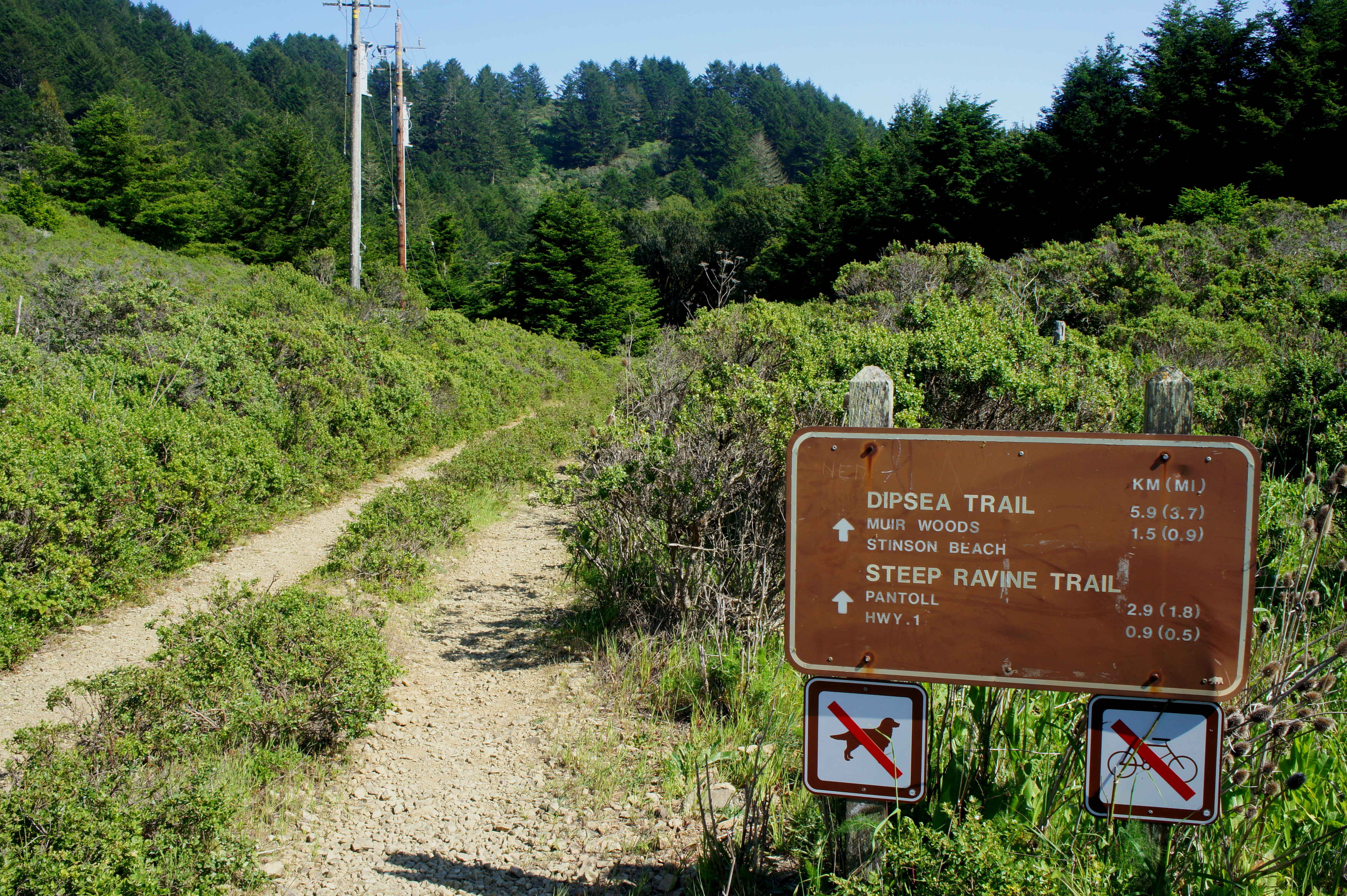
Two gravel roads, both closed to vehicles, bear south from the parking area. The easternmost of the two is signed—Dipsea Trail and Steep Ravine Trail straight ahead. Hikers should follow the bushy track for around 1/10 mile until a well-graded footpath bears off to the left. Take this trail, which soon passes under a set of power lines before entering a shady woodland of Douglas firs, tanoaks, and canyon/coast live oaks. A route junction is reached within a minute or two; bear left at the fork.
Assisted by man-made steps, the trail beyond descends steeply to the banks of Webb Creek, which at this point is dammed, forming a still reflecting pool. The creek just upstream is free-flowing and forms gently-trickling cascades.
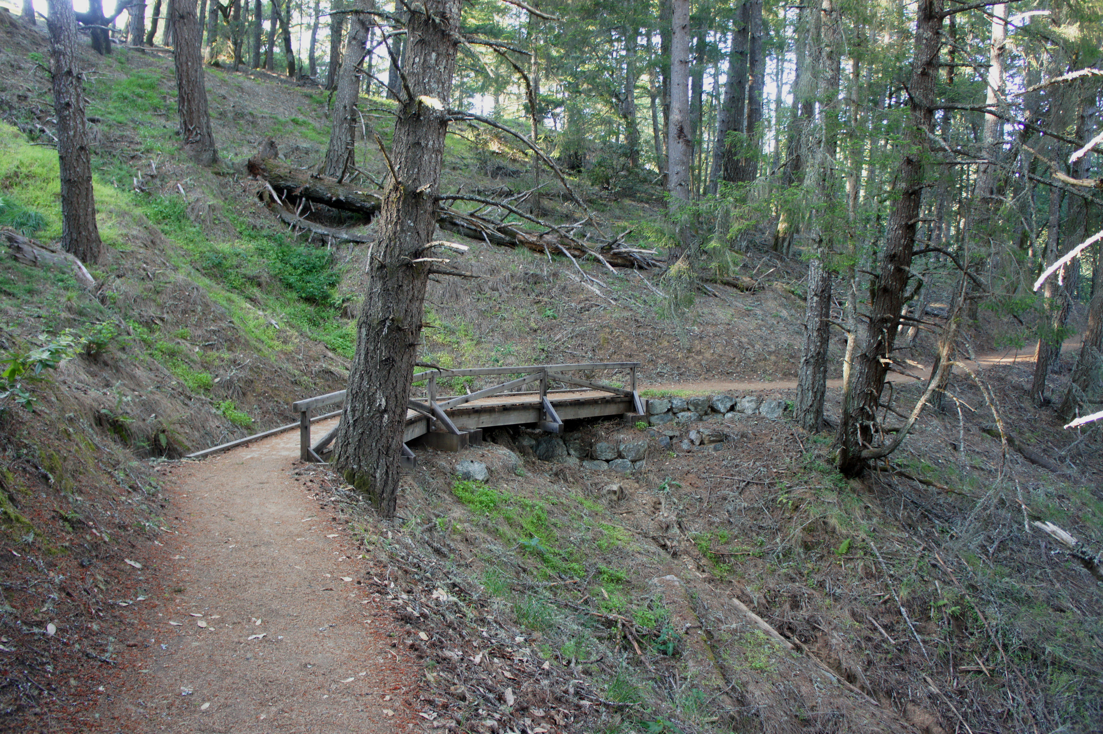
About ten minutes from the White Gate, a sturdy wooden bridge appears, and the trail forks. The Steep Ravine Trail continues straight, hugging the creek’s western bank without crossing. The Dipsea Trail traverses the bridge to the opposite side. Here hikers face a choice: which trail to tackle first? In terms of elevation gain, it is perhaps a matter of preference. The Steep Ravine Trail climbs at a relatively persistent clip, while the Dipsea covers more than half of the 900-foot elevation gain in the first mile before flattening out for the remainder.

(Note: Sarah and I started up the Dipsea by mistake, but were later glad to have done so for two reasons. For one, we reached the scenic vistas of Dipsea just before the afternoon fog rolled in. Second, we judged Steep Ravine to be slightly more appealing and therefore were happy to keep the best for last.)
Dipsea Trail and Lower Old Mine Trail
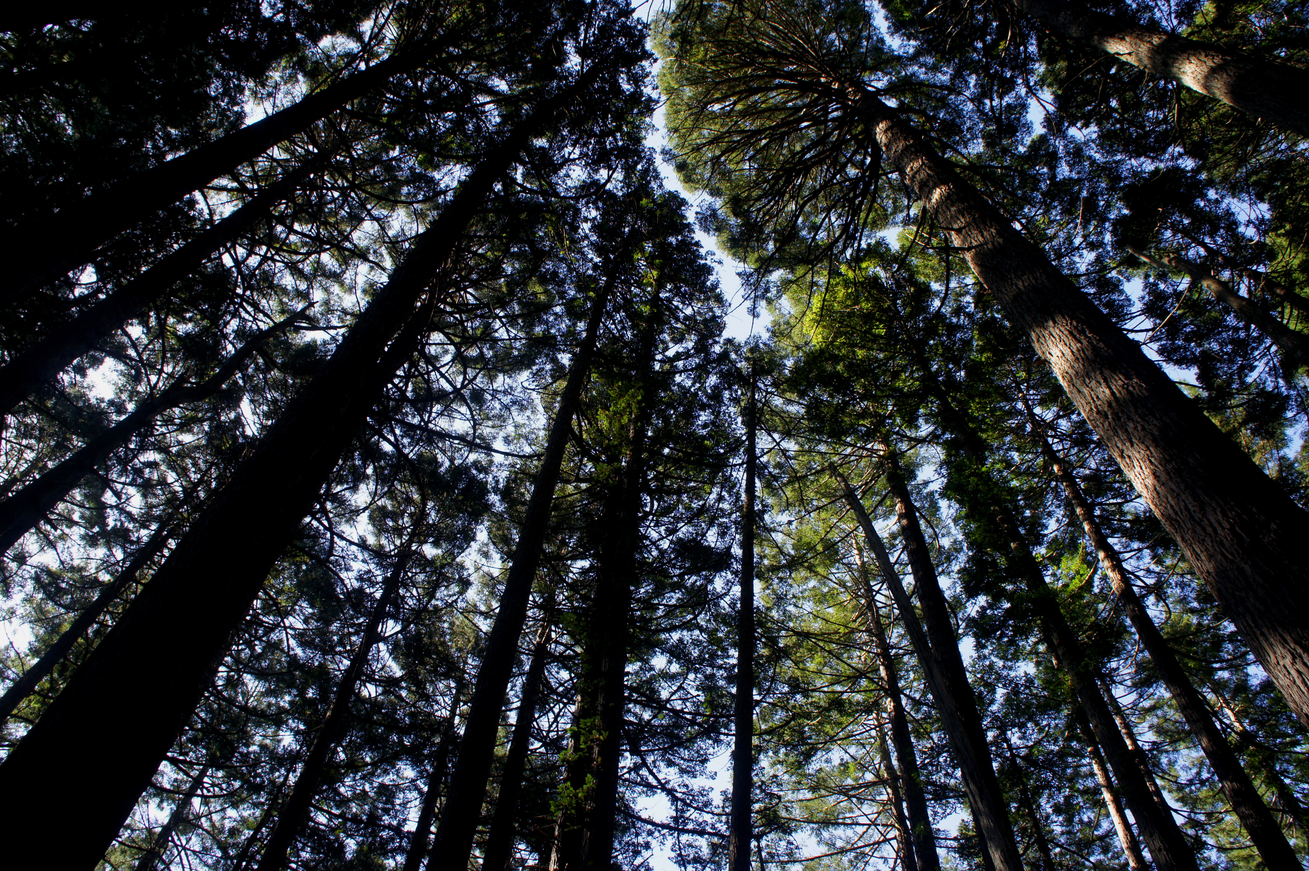
Immediately after traversing Webb Creek, the Dipsea Trail begins a sharp climb up a side drainage, the beginning of a 600-foot ascent over the course of approximately one mile. Wooden stairs account for much of the initial gain, after which the gradient lessens as the trail snakes eastward around two more ravines. Bay, redwood, and a variety of oak trees predominate, while ferns and lime green grasses blanket the rolling slopes.

About 20-30 minutes from the start of the ascent, the trail passes a minor clearing on the right. 10-15 minutes farther, the thick tree cover finally recedes; a 150-foot spur on the right leads up to a tremendous vantage point (assuming a lack of fog) of the Pacific Ocean to the south.
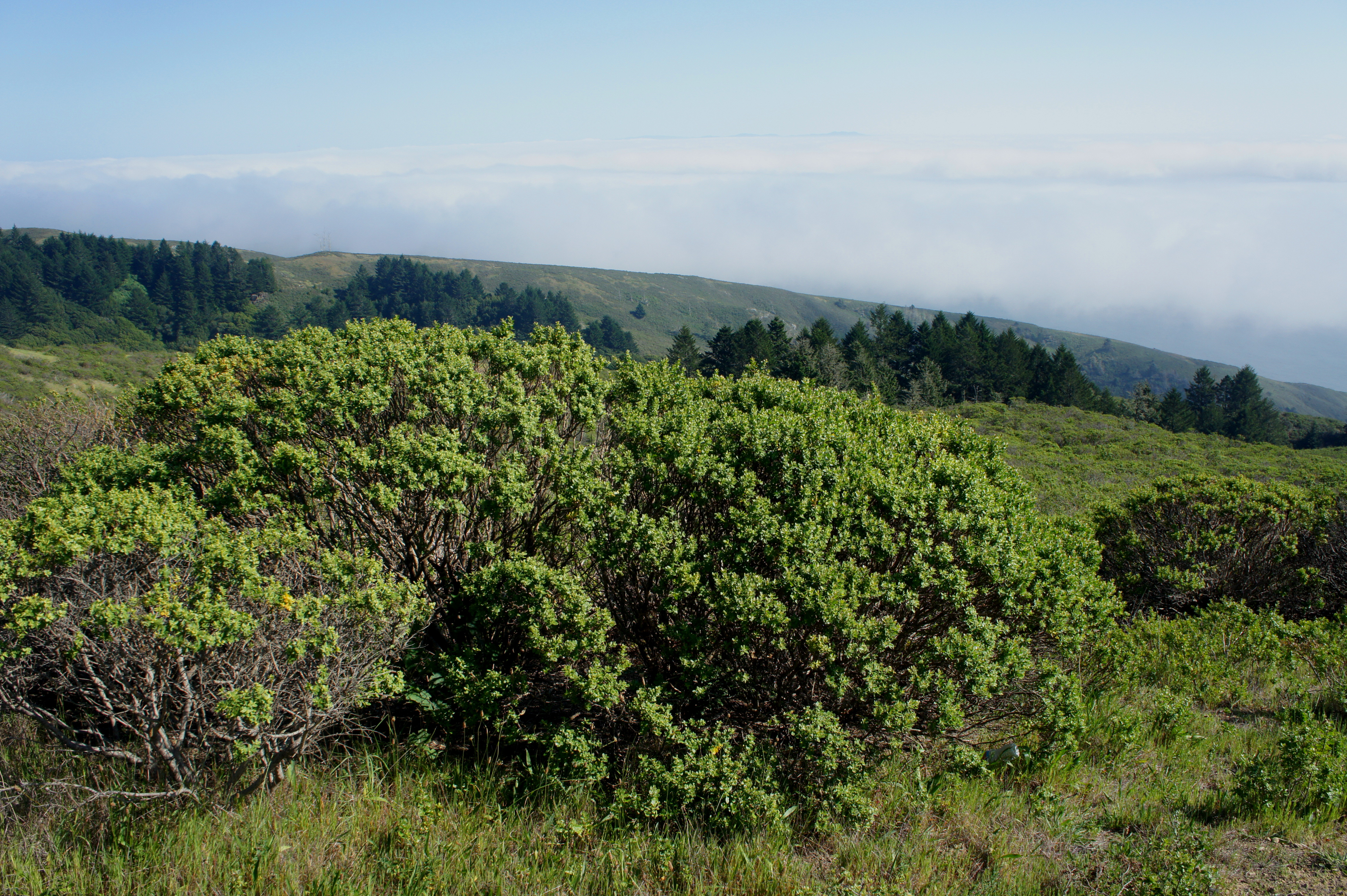
The Dipsea Trail spends most of the next 8/10 mile above the trees (and, hopefully, the fog) in the brushy chaparral. Tracing the vestiges of an old fire road, the footpath edges northeast around a series of ravines, the last of which is cut by Lone Tree Creek.
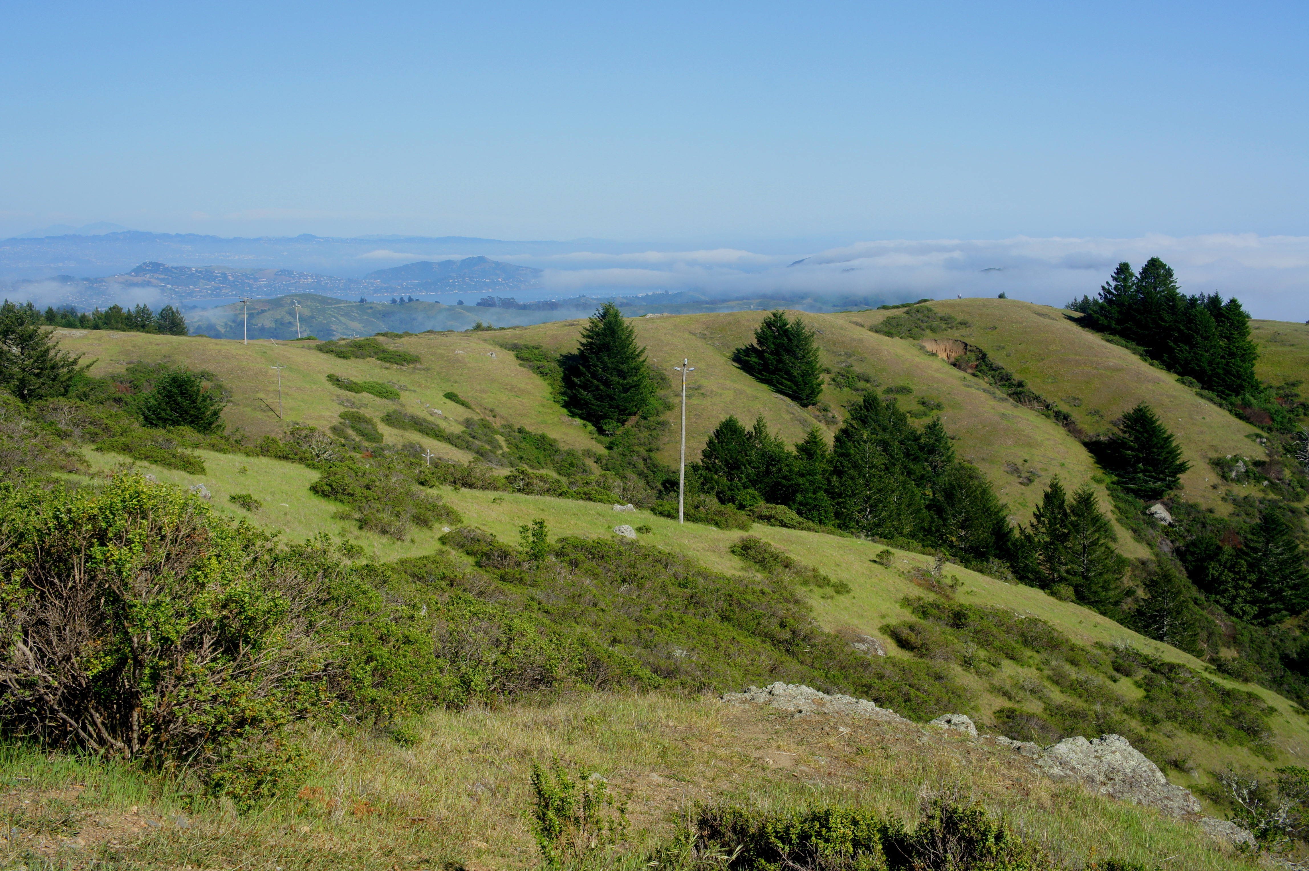
Following a brief foray back into the woods, the trail reemerges again just before a sunny route junction, affording views (on a clear day, of course) of Tiburon, San Francisco Bay, and bits of the Golden Gate City itself.
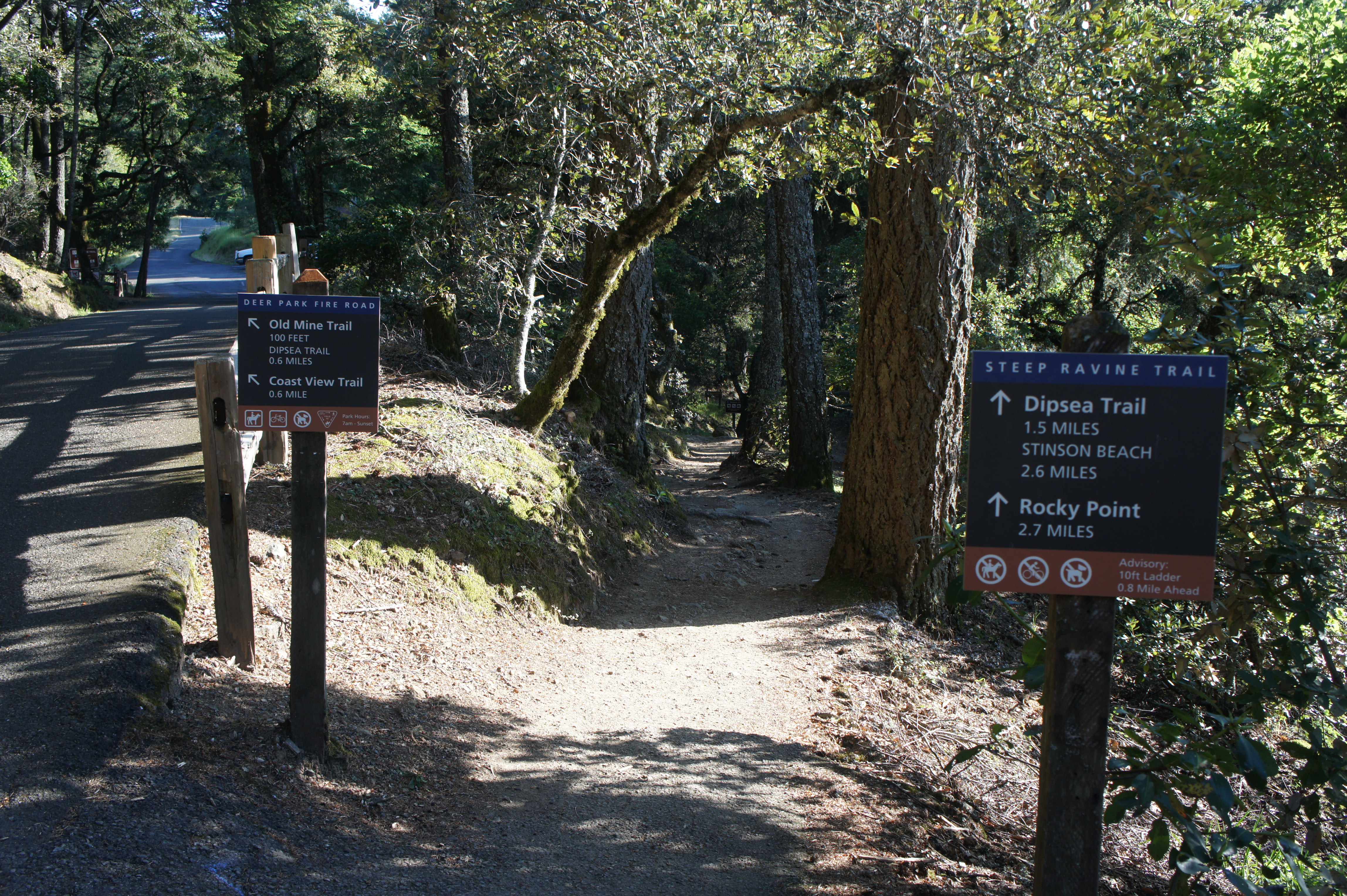
A gaggle of hiking and biking trails come together in this spot. Continuing east on the Dipsea Trail provides access to Muir Woods National Monument and the Ben Johnson Trail. Following the wide Deer Park Fire Road to a scenic overlook to the south (the start of the Coastal View Trail) is a worthy detour. But to complete the loop, hikers will want to bear left on the Deer Park Fire Road, heading north for 1/10 mile to the start of the Lower Old Mine Trail.
The Old Mine Trail is composed of hard-packed dirt, making it (within reason) wheelchair-accessible. The smoothed path travels north—crossing five minor, wooden bridges—for ½ mile to the Pantoll Campground/Ranger Station, passing an unsuccessful 1863 mining claim (a minor marker tells the story of the “Denos Claim”) along the way. A final, gently-sloping switchback leads up to the paved road through Pantoll. The Pantoll parking area is reached after about 2.5 total miles of hiking.
Steep Ravine Trail
After a break at Pantoll (where there are restrooms and drinking water), head back south down (the paved portion of) the Deer Park Fire Road to begin the Steep Ravine Trail section, which bears off to the right. It is 1.7 miles from here, nearly all downhill, back to the White Gate Trailhead.
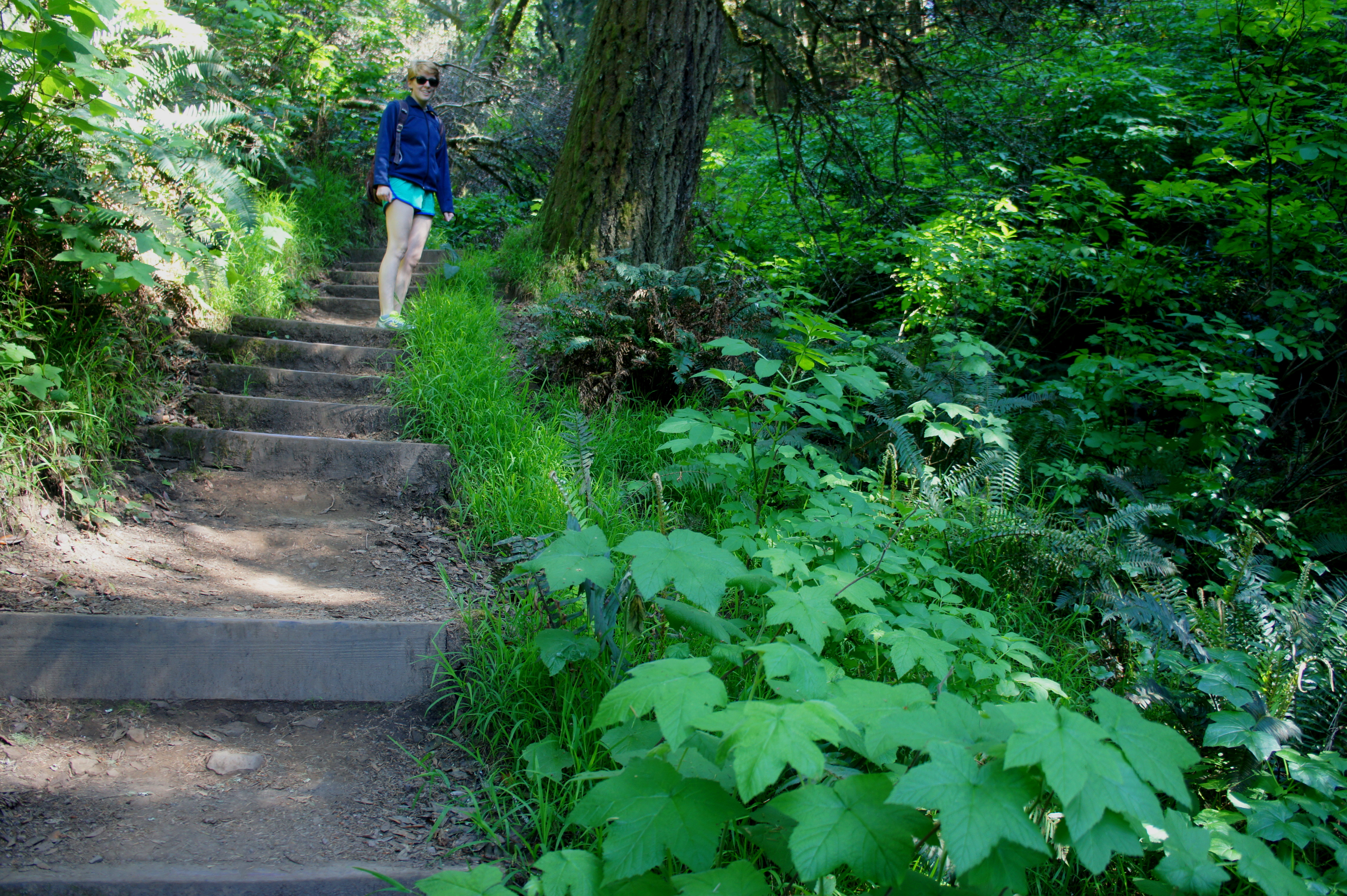
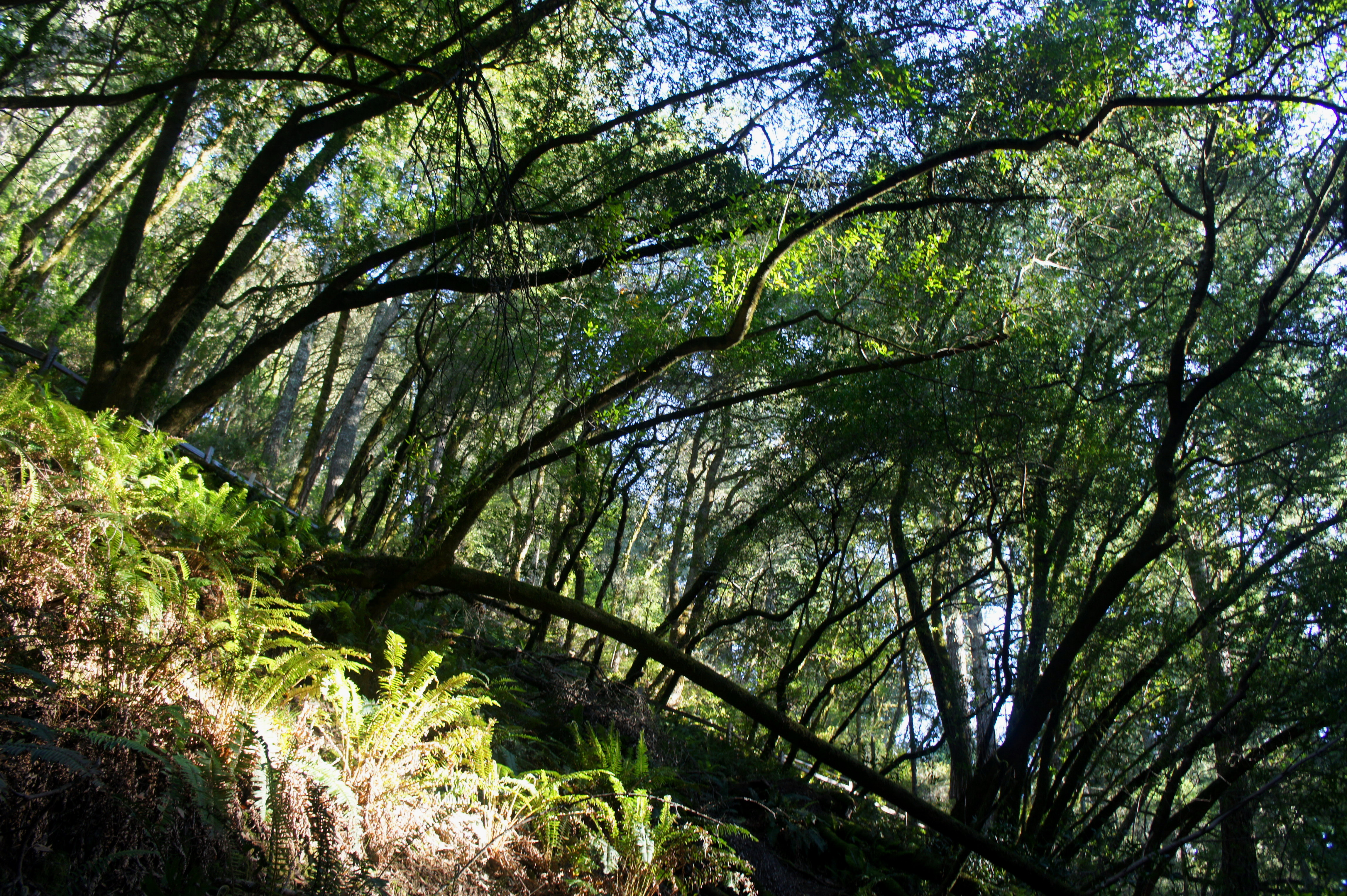
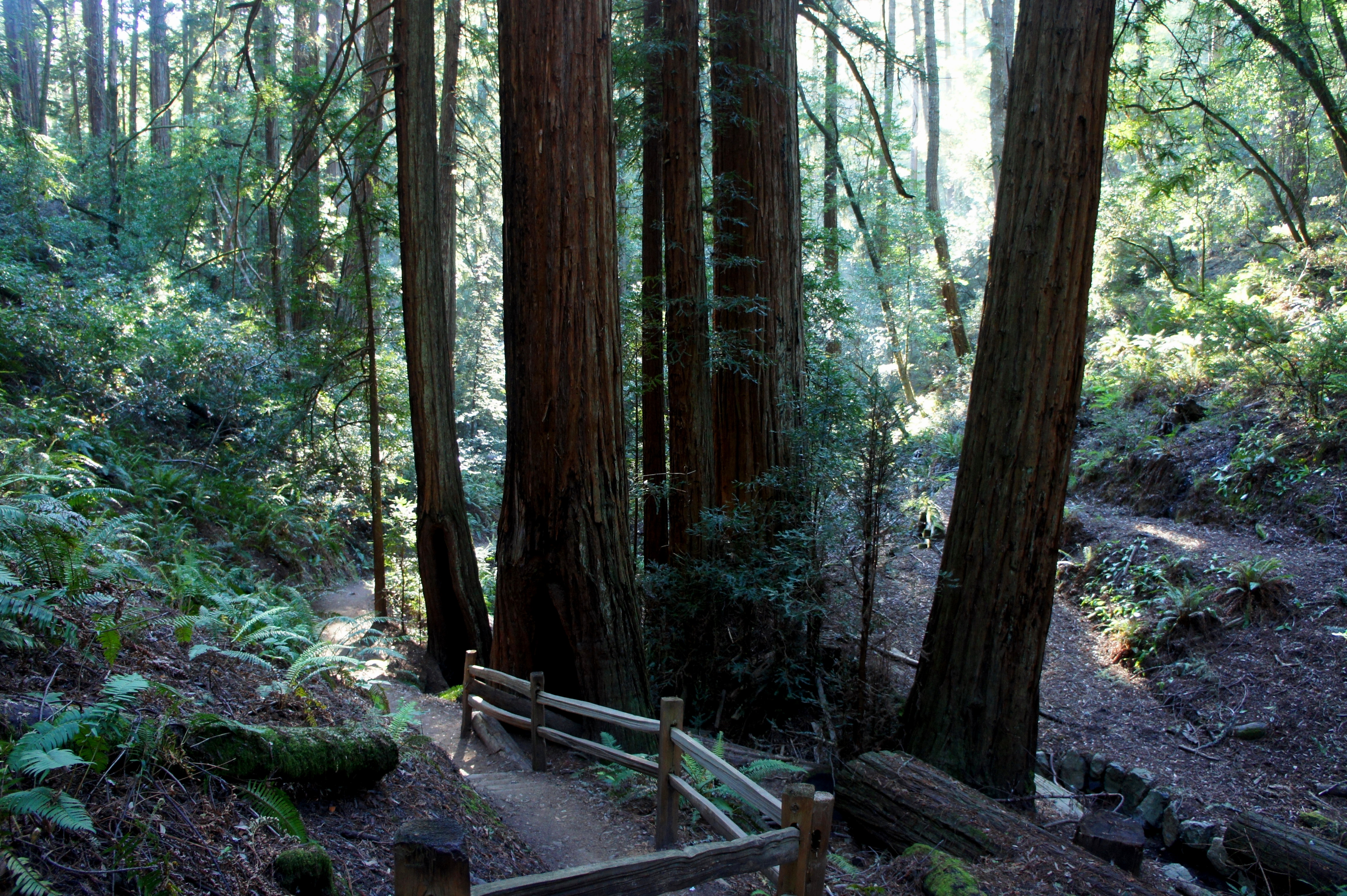
Steep Ravine is a majestic canyon, lush with ferns and a wide array of lofty trees. Following a steep, initial descent down a series of switchbacks to Webb Creek, sky-high redwoods abound. The trail, skirting the stream’s left bank, passes several spectacular groves in a matter of minutes. The perennial flow of Webb Creek adds to the allure of this absolutely serene place.
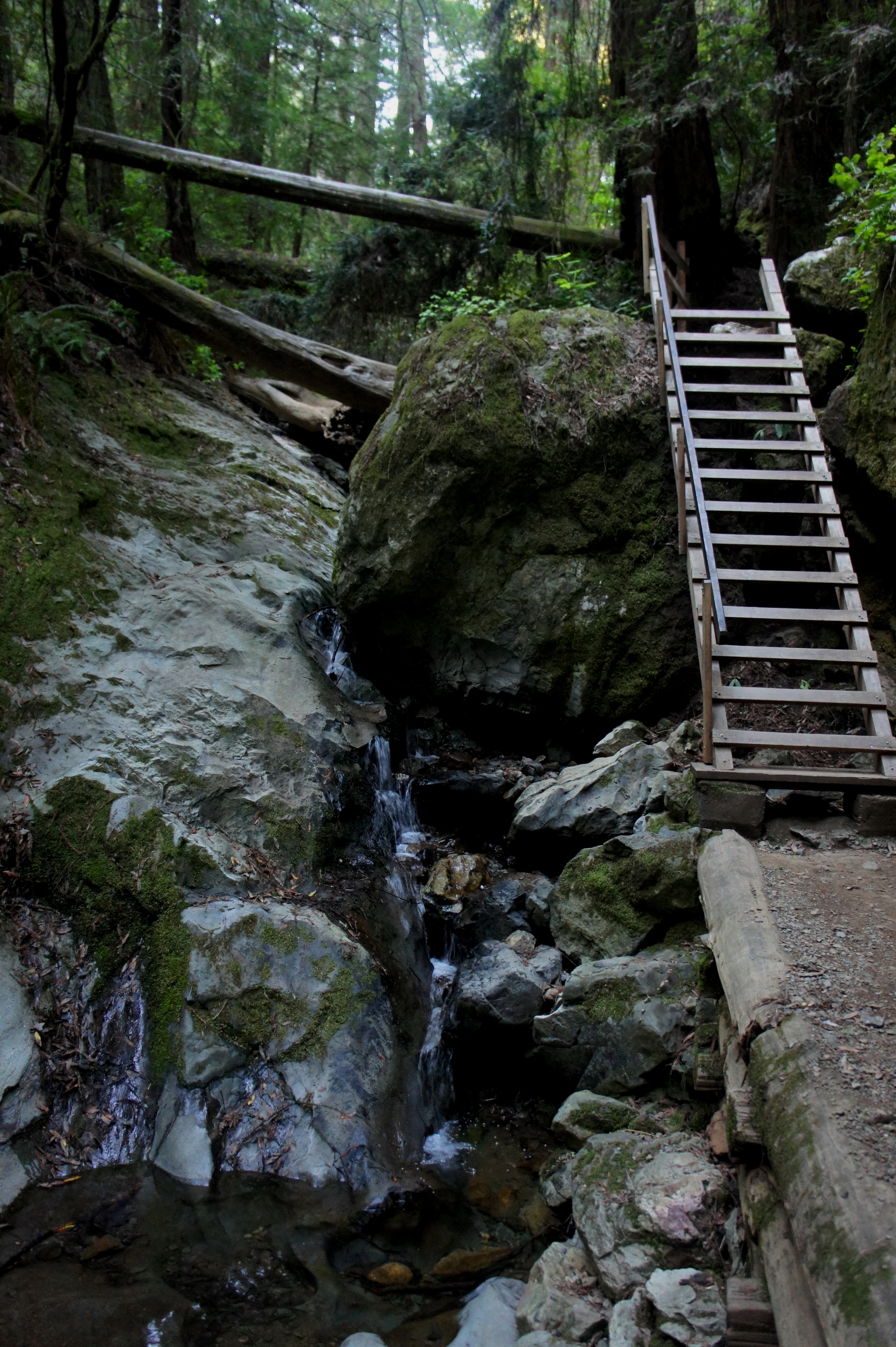
Around ¾ mile from the top of Steep Ravine, a 14-rung wooden ladder must be descended (carefully) to clear a protruding chunk of greywacke, a type of sandstone commonly found in the area. To the right of the ladder is a picturesque cascade tumbling 10-15 feet.
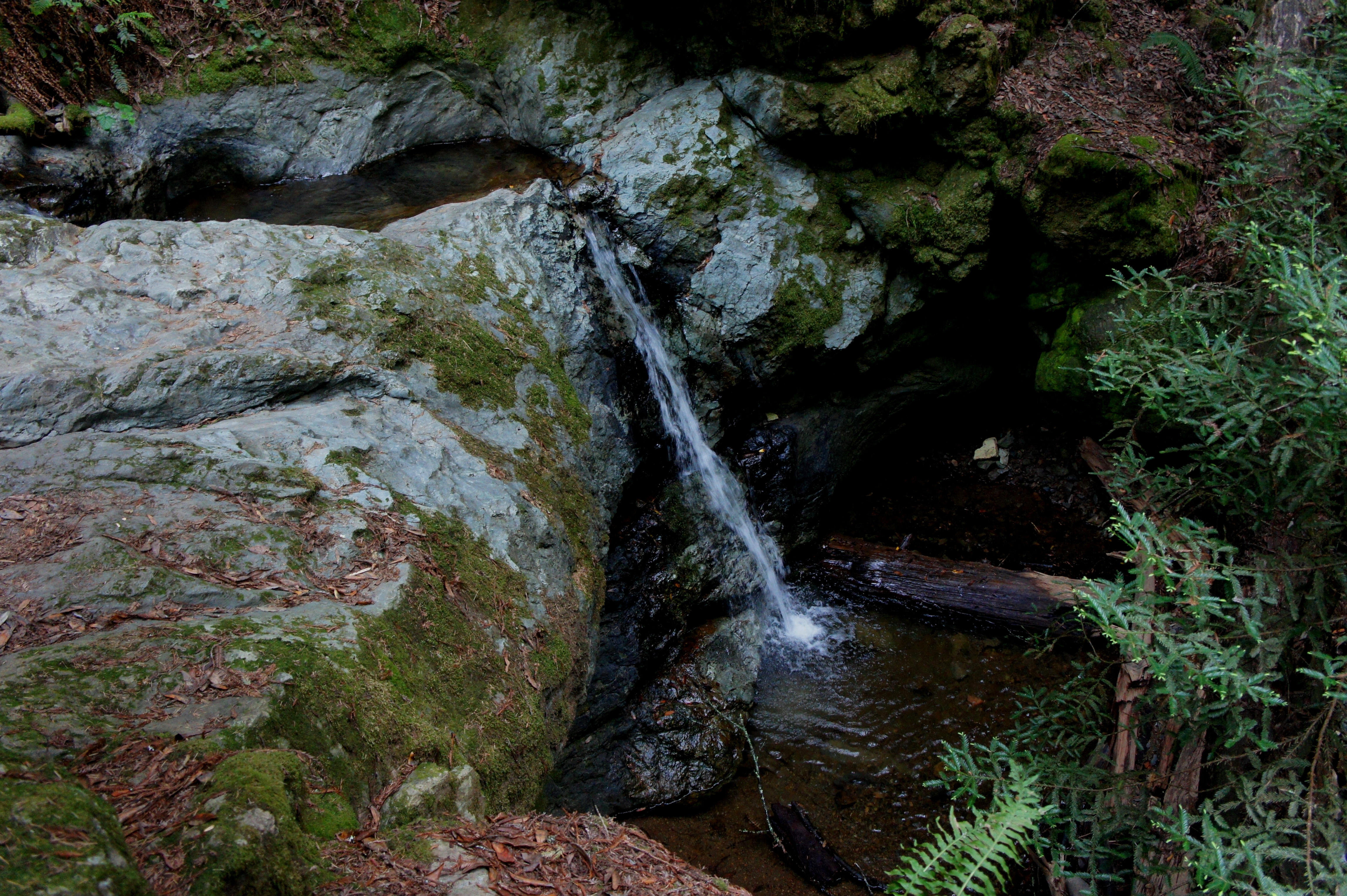
Ten minutes down-canyon, Webb Creek plunges over another series of cascades, briefly interrupted by small, standing pools. (Note: This is, in my opinion, the most enthralling section of the entire hike.)
Creek crossings become increasingly frequent beyond the waterfalls; hikers will encounter at least five bridges between the ladder and the original junction of the Dipsea and Steep Ravine Trails. The final bridge is avoided by staying to the right—this is the original crossing at the base of the Dipsea stairs encountered hours earlier. From this point, it is a familiar ¼ mile back to the White Gate Trailhead. Bear right at each trail junction.
The circuit hike can be completed in as little as two hours at a relatively quick pace. More leisurely hikers can comfortably do so in three or four.

Beautiful!
Pingback: Steep Ravine – Matt Davis Trail Loop (Mount Tamalpais State Park, CA) | Live and Let Hike
Pingback: Fern Creek – Dipsea – Sun Trail Loop (Muir Woods National Monument, CA) | Live and Let Hike
Pingback: Fern Creek – Dipsea – Sun Trail Loop (Muir Woods National Monument, CA) | Book-JC - Book-JC Blog