
In early spring, even as much of the Sierra Nevada remains blanketed in snow, the Hetch Hetchy area of Yosemite National Park is often snow-free, making it an attractive spot for early-season hiking and backpacking. One of the more popular routes is the 5-mile out-and-back to Wapama Falls, one of the highest waterfalls in California. Adventurous hikers can follow Hetch Hetchy Reservoir farther east to multi-tiered Rancheria Falls—a worthy destination for a long day hike or overnight backpack. The sun-soaked trail to Wapama and Rancheria Falls is mostly mild, with relatively limited elevation gain, but should probably be avoided in full summer, when temperatures at Hetch Hetchy regularly top 90 or 100 degrees. (Note: Hetch Hetchy is open daily from 8-5; backpackers must obtain a wilderness permit and park in the backpackers’ lot.)


The hike
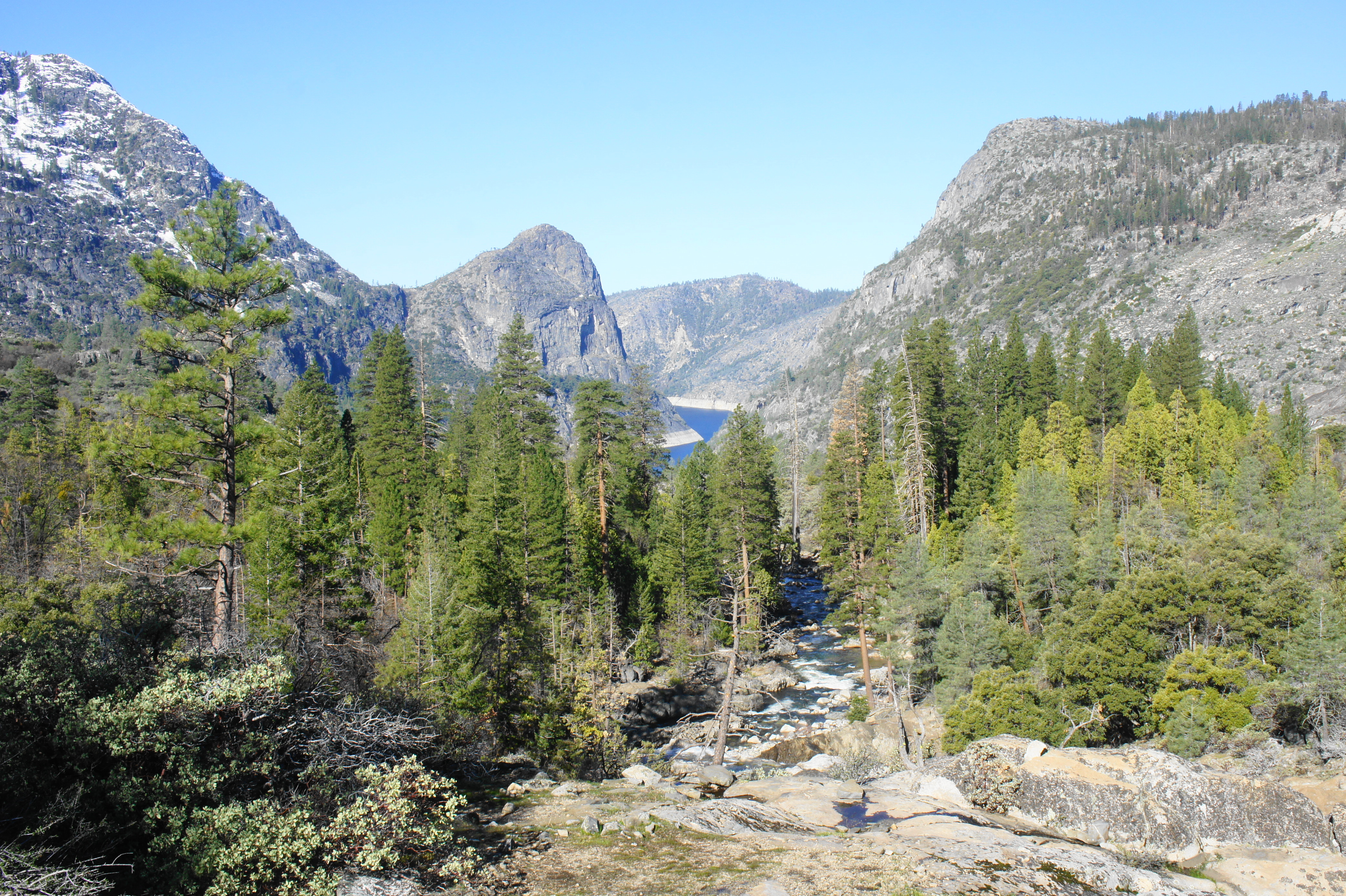
Hetch Hetchy Valley in California’s Yosemite National Park is of course most famous for a controversy in the early 20th century: after a fierce debate between preservationists (led by John Muir) and residents of San Francisco, Congress pass a law in 1913 that allowed for the damming of the Tuolumne River in Hetch Hetchy Valley. The result was the 430-foot O’Shaughnessy Dam and the 1,200-acre Hetch Hetchy Reservoir, which continues to provide drinking water for the city of San Francisco today. Even as the river was dammed, the controversy over Hetch Hetchy helped propel support for the modern environmental movement.
Reaching Hetch Hetchy today requires a winding but entirely paved drive along the Hetch Hetchy Road, entering Yosemite National Park just north of the town of Mather, California. Backpackers should check in and acquire their permits at the Hetch Hetchy Entrance. (Note: While walk-up backpacking permits are free and easy to acquire during the winter season, advance reservations are recommended for trips from May-September. No permit is required for day hiking.) From the entrance, the road gradually descends into the Poopenaut Valley, ending in a one-mile loop that forms a circuit around the main entry area for Hetch Hetchy. Overnight backpackers should park in the lot at the start, while day hikers should continue clockwise around the one-way loop to the parking area overlooking O’Shaughnessy Dam. This is perhaps inconveniently named the Beehive Meadows/Rancheria Falls/Miguel Meadows Trailhead.
From the parking area, make your way across the concrete rim of O’Shaughnessy Dam to begin the hike to Wapama and Rancheria Falls. Off to your left, a look over the curvature of the dam offers an excellent view downstream, where the Tuolumne River continues its winding path down toward the Central Valley (where it is dammed again and eventually flows into the San Joaquin River).

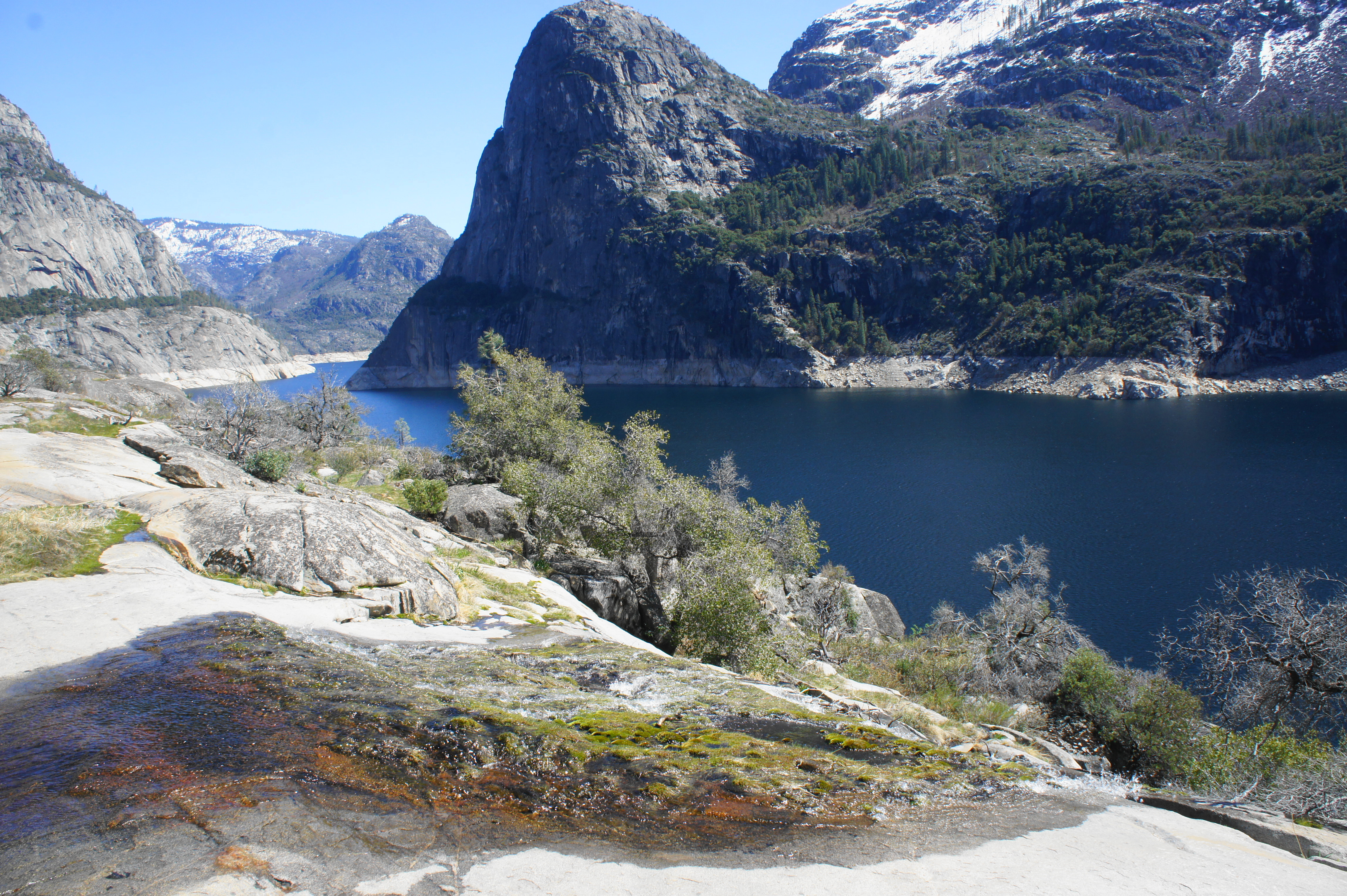
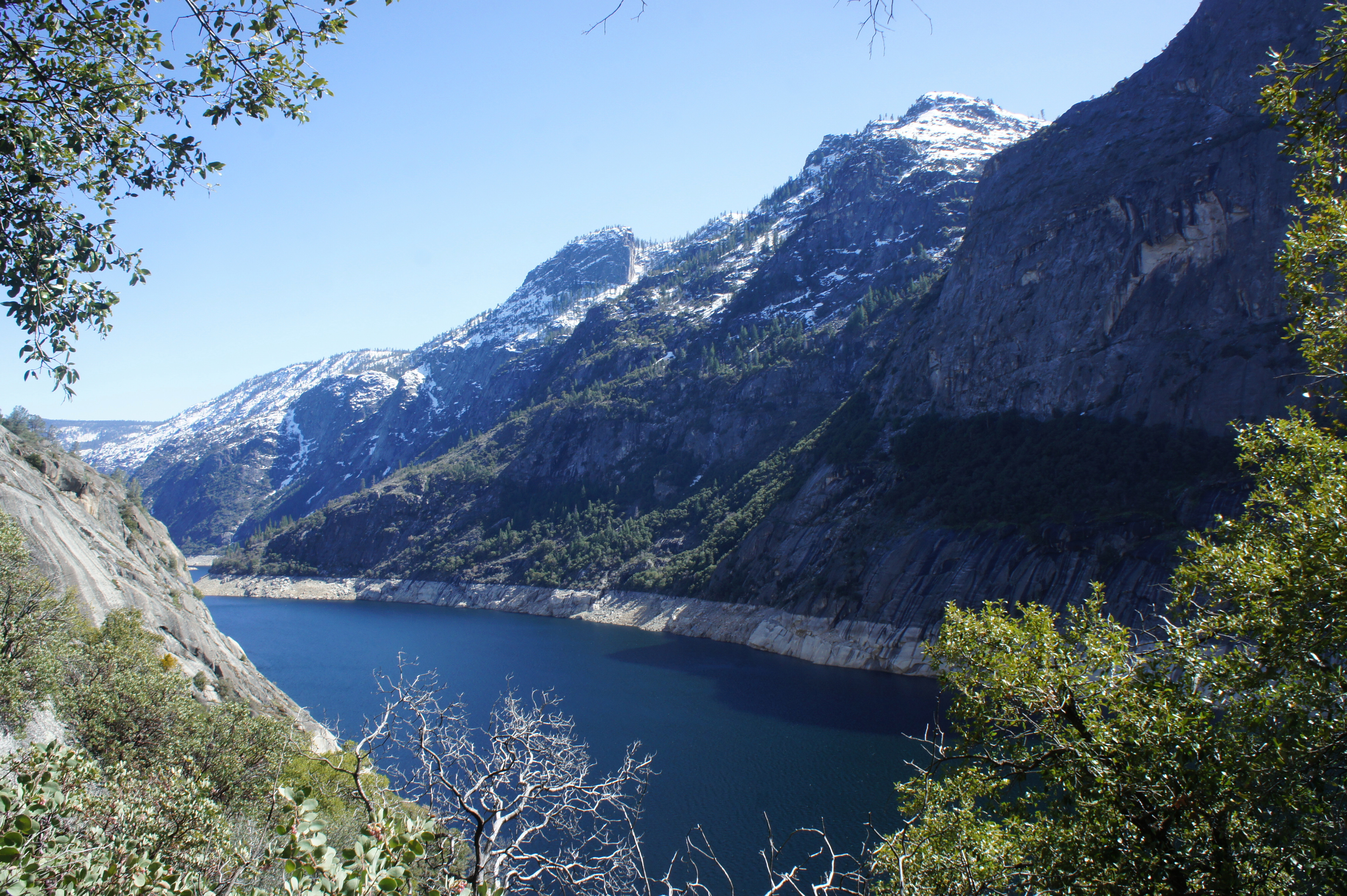
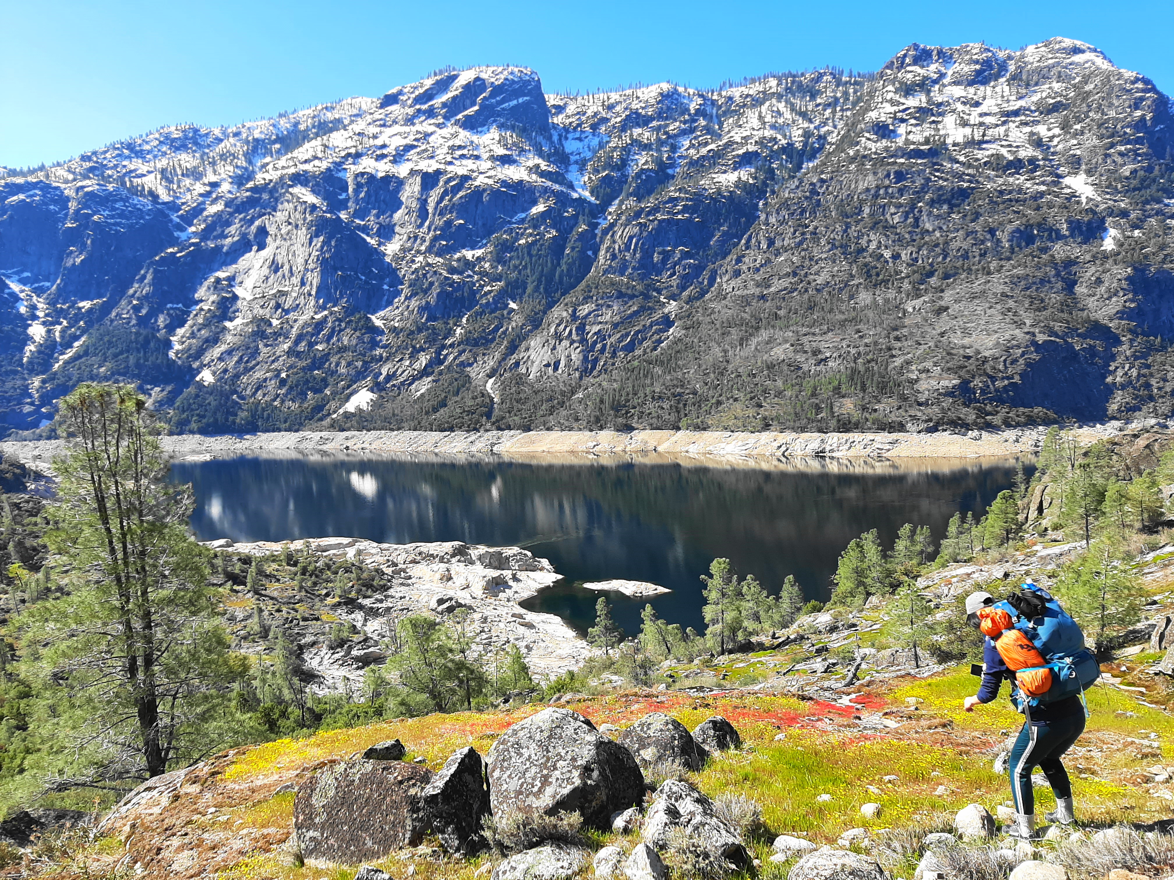
Off to the right, however, is the real show: a deep blue reservoir bounded on either side by towering granite cliffs. The prominent summit on the right is Kolana Rock (5,772’), situated across the reservoir from Hetch Hetchy Dome (6,197’). At least through spring and early summer, one can also spot Wapama Falls, cutting through a cleft to the west of Hetch Hetchy Dome. Next to Wapama is the much thinner Tueeulala Falls, which is only seasonal. It’s hard to argue, even with the controversy over the manmade reservoir, that this valley isn’t beautiful—and the vistas only improve as the trail continues north and west toward the waterfalls.

Tunnel after the dam 
Seasonal falls


After crossing the dam, the wide route enters a dark and muddy tunnel; it is not long enough to require a headlamp, but watch your footing as the tunnel often sports small pools of water. Once out the other side, the graveled path passes an informational sign on the left with a map of the area. Most hikers will be heading to Wapama Falls, with anything beyond considerably less-trafficked. After first hugging the banks of the reservoir (supported by clusters of boulders below), the trail begins to climb mildly, in and out of scrubby pines and other vegetation.

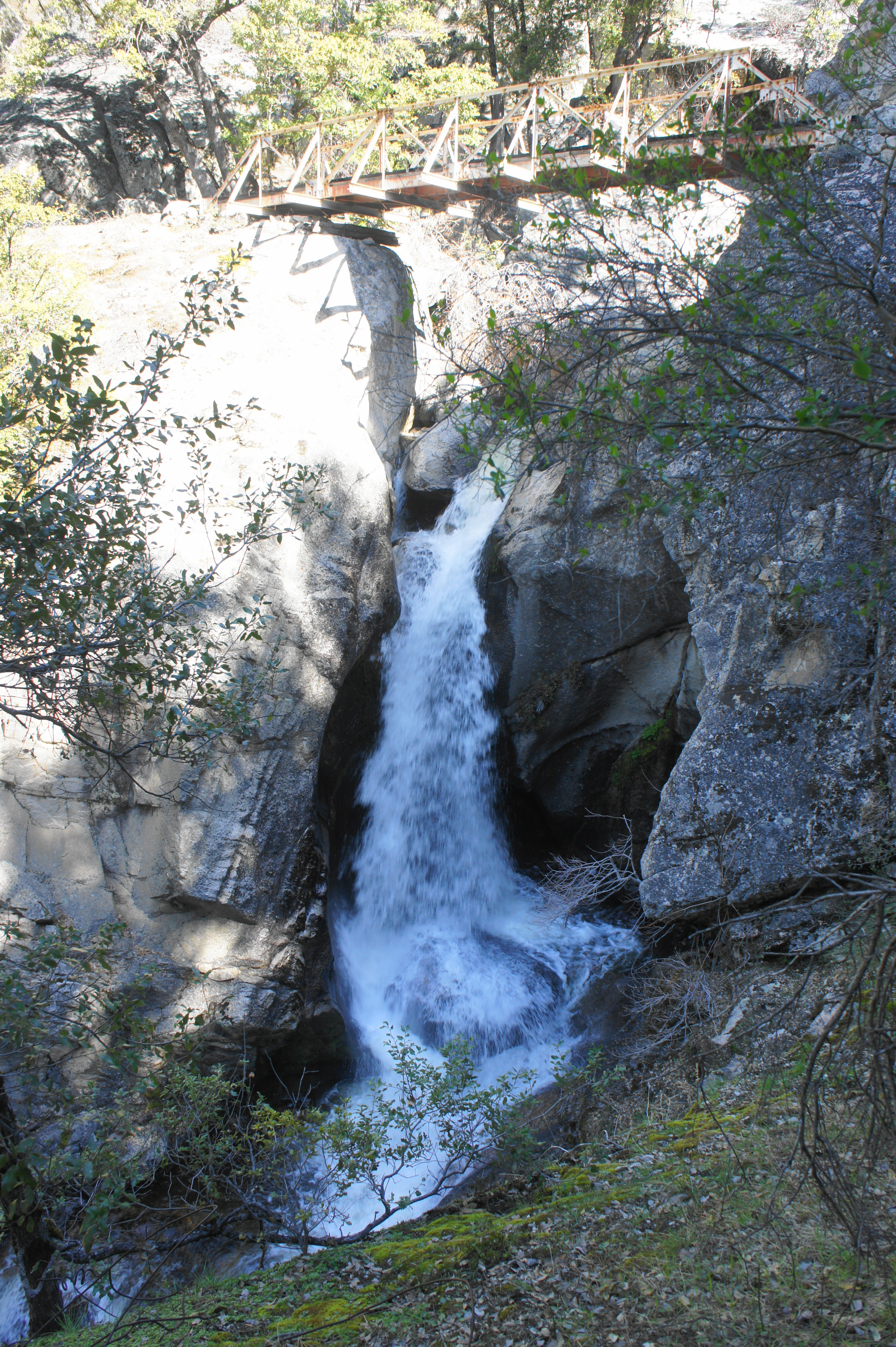
The first notable uphill at ¾ miles has some stone steps and leads to a wooden bridge, with a seasonally-flowing cascade on the left. The small falls are close enough to the trail to dip your head (refreshing on a hot day). Soon another, the trail to Wapama Falls reaches a fork, with the strenuous route to Beehive and Miguel Meadows leading left. Stay right as the route skirts several flat, open slabs of granite—quite popular with amateur photographers hoping to trend on Instagram. It is undoubtedly beautiful, of course, with hikers now able to see farther up the reservoir toward the Grand Canyon of the Tuolumne.
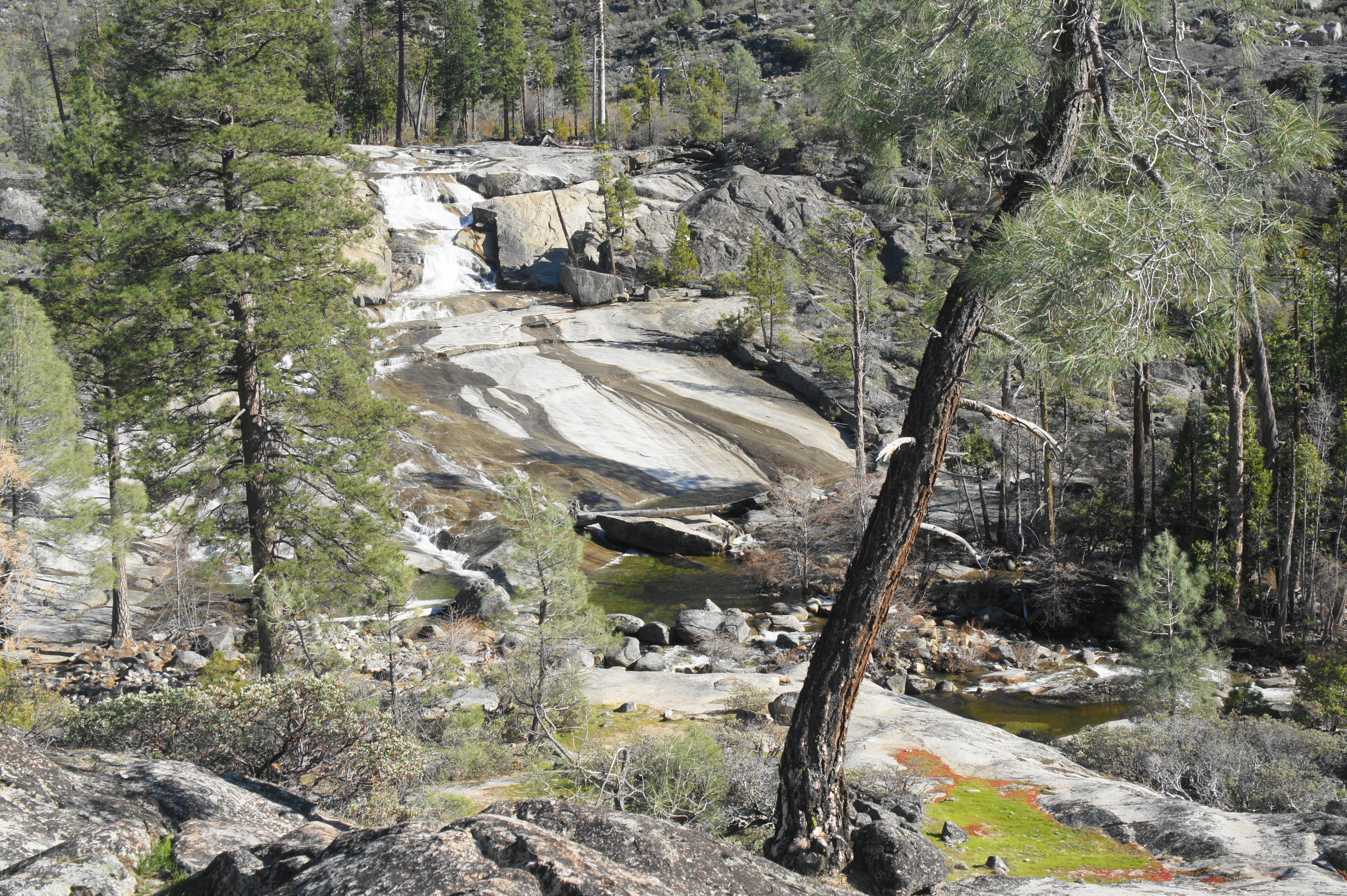
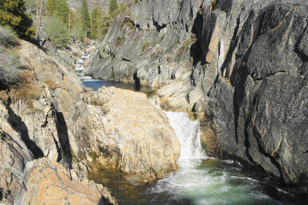
After weaving in and out of several brushy areas, the now-narrow and rocky trail traverses a second seasonal stream at about 1.5 miles, with a multi-tiered waterfall above to the left (Note: The waterfall here is often confused from Tueeulala Falls—even on topo maps—but the real Tueeulala Falls is farther on. Some have called this “Hetch Hetchy Falls.”) The crossing is made easier by a few well-placed stone blocks. The trail thereafter, however, temporarily disappears, with few to no markers of onward travel. Keep heading roughly straight (along the flat granite), however, and eventually the well-manicured path will reemerge.
Hetch Hetchy Falls 
Reservoir and Kolana Rock from Hetch Hetchy Falls


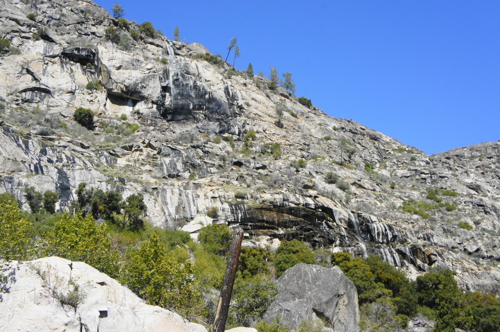
After nearly two miles in mostly open sun, a shady stretch at 1.8 miles is a welcome sight. From here the trail drops a level down via a set of switchbacks. At about this time, Tueeulala Falls is visible up on the cliff to the left, although mysteriously it is unclear where the flowing water comes out (seeps into the rock? subterranean channels?).

Tueeulala Falls 
On the trail to Wapama Falls


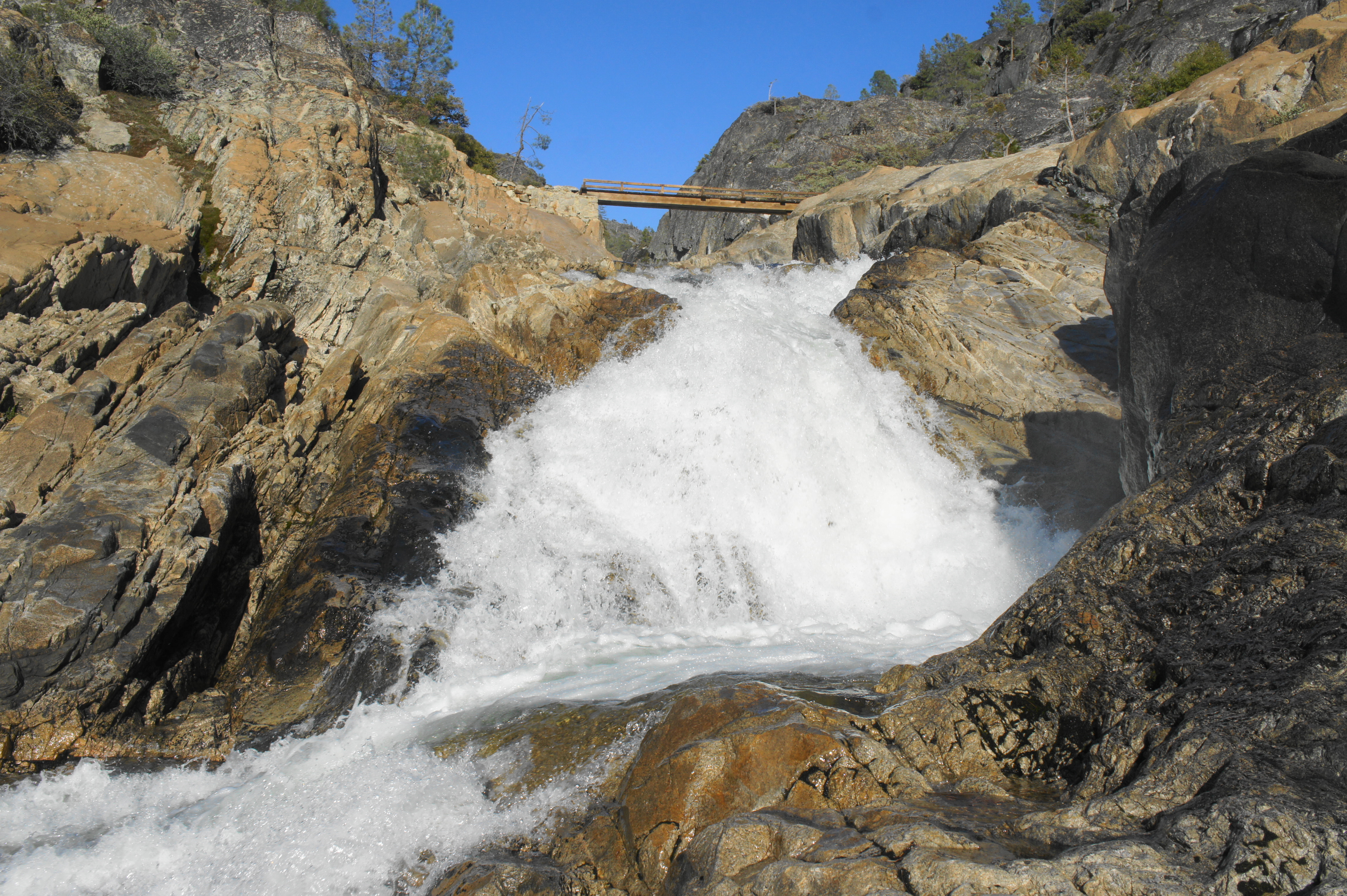
Of course, these minor waterfalls are merely teasers for the main event—Wapama Falls—the roar of which becomes more and more audible as the trail approaches. After a rather steep and rocky descent at 2.3 miles, the trail reaches the first of a set of bridges at the base of Wapama Falls, where Falls Creek fans out into a minor delta. At the height of its flow (typically in May or early June), the volume of water at Wapama Falls is sometimes so high that onward passage is impossible. (Note: Don’t do it—several people have died trying.) Most of the year, however, the bridges are open, offering an up-close view of the various chutes at the base of the towering falls.

Wapama Falls 
Wapama Falls from another angle

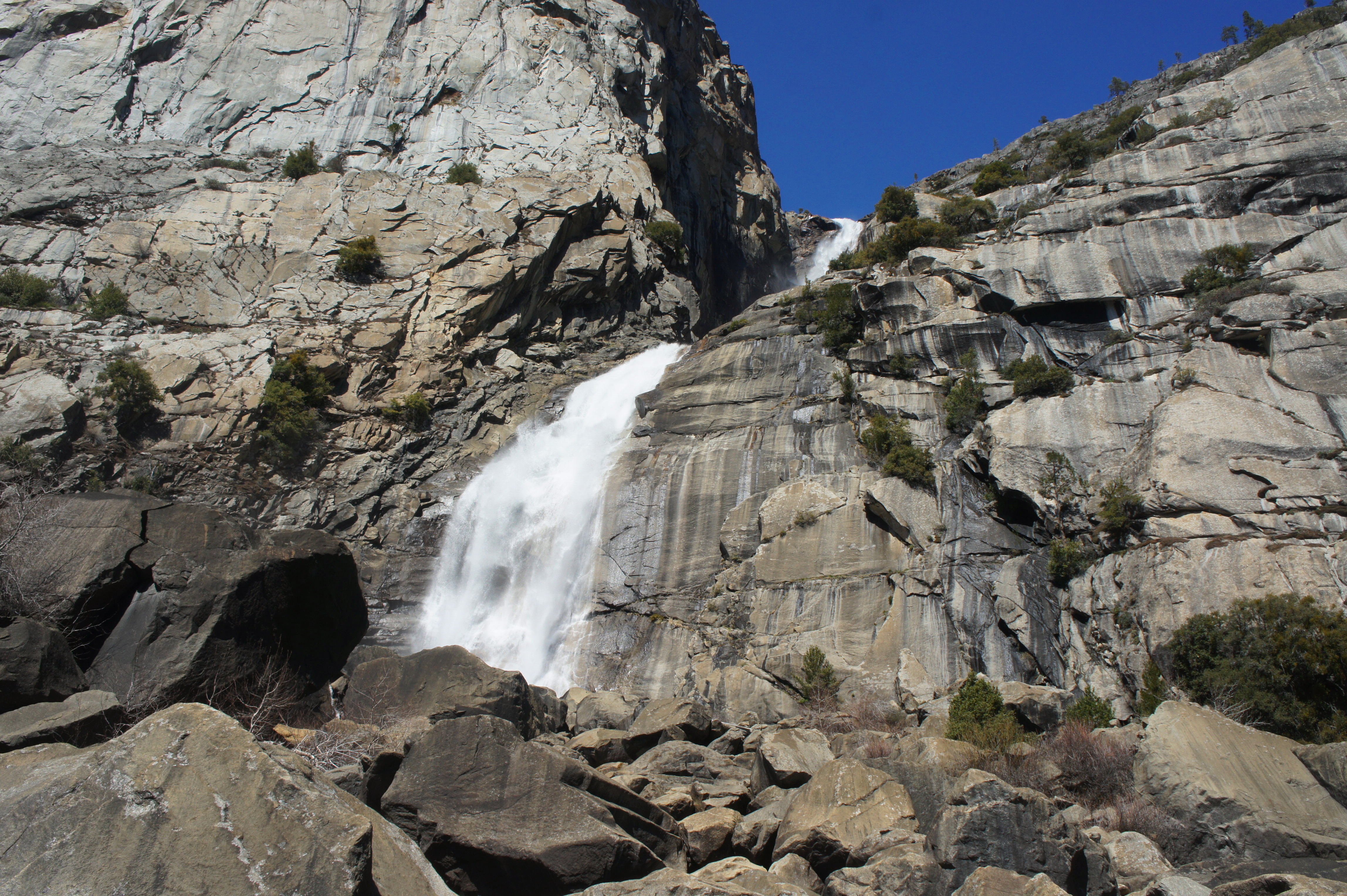
More than 1,000 feet, Wapama Falls is one of the top ten tallest waterfalls in California, and its high volume makes considerably more impressive than some nearby chutes that are taller but weaker. The main drop comprises a set of two powerful inundations cutting through a cleft high up along the granite cliffs, after which the water fans out in several directions. A set of five different bridges is required to traverse all the various branches; each offers an opportunity to get near to the falls’ cool spray. Down below, the falls end by pouring into the deep blue reservoir.

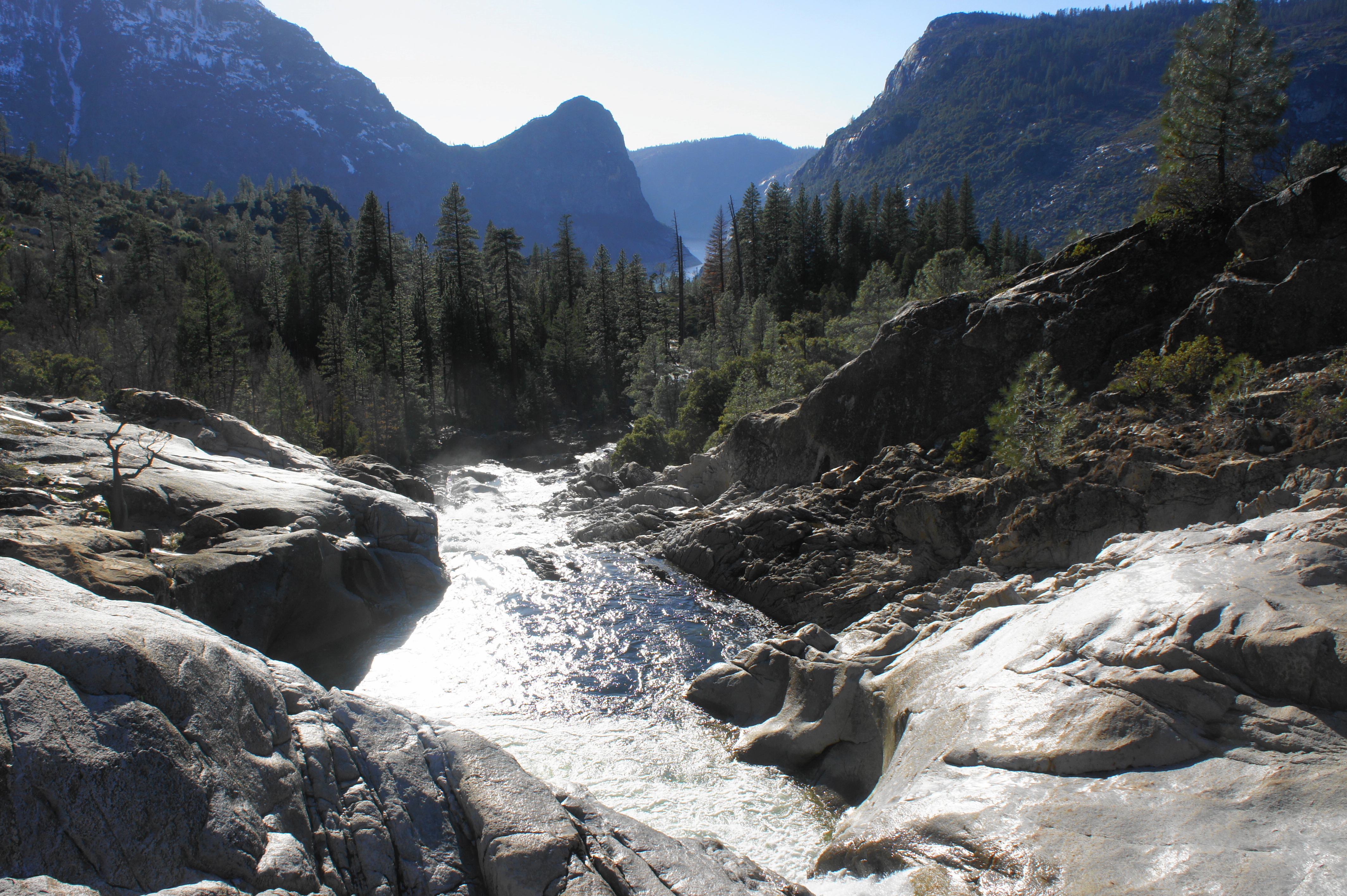
Being the primary hiking destination in the area, Wapama Falls is likely to be crowded, especially in summer or on nice weekends. But the crowds thin out considerably as the trail continues past the waterfall, narrowing and traversing a rock field before tracking in and out of more welcome shade. During the subsequent stretch, the entry route and dam gradually fade from view, and the path rounds a corner with better views up the Tuolumne drainage to the southeast.
At 2.9 miles, the path ascends a set of switchbacks and then spends the next quarter-mile or so traverses a beautiful grassy shelf with excellent views of the reservoir and Kolana Rock. Ahead, one can begin to make out the drainages of Tiltill Creek and Rancheria Creek.


Another uphill at 3.75 miles leads up another level, but the trail soon reverses course by dropping down a set of switchbacks at about 4.1 miles, followed by two more about 350 yards later. At 4.5 miles, the path crosses another seasonal stream with some minor falls.

Switchbacks mark the start of a steady descent to Tiltill Creek at 4.9 miles. At 5.1 miles, the trail traverses a set of bridges over the relatively high-volume stream. The creek sports its own rather impressive waterfall, though it is hard to see without a potentially sketchy scramble through the brush to the cliff’s edge.
From Tiltill Creek, the trail to Rancheria Falls climbs steadily, emerging out of the shady woods and back to a manzanita-lined knob between the two drainages. Just after cresting the ridge, a short spur on the right leads to the first views of Rancheria Falls—or at least a small part of it. Many call it quits at this spot, where the rushing water of Rancheria Creek spills rather gently over an apron of granite. Camping is also relatively popular in this area as well.
However, there is much more of the falls to see if one continues onward, following the trail as it bears east and then north. After passing a wooded area leading to other camping spots on the right, hikers briefly turn away from the sound of the stream, but then continue on an eastward path that is relatively level. (Note: As of March 2021, a large tree had fallen on the path here, requiring hikers to detour through the dense manzanita thicket to get around the obstacle.)

Fallen tree across the path 
Footbridge above Rancheria Falls

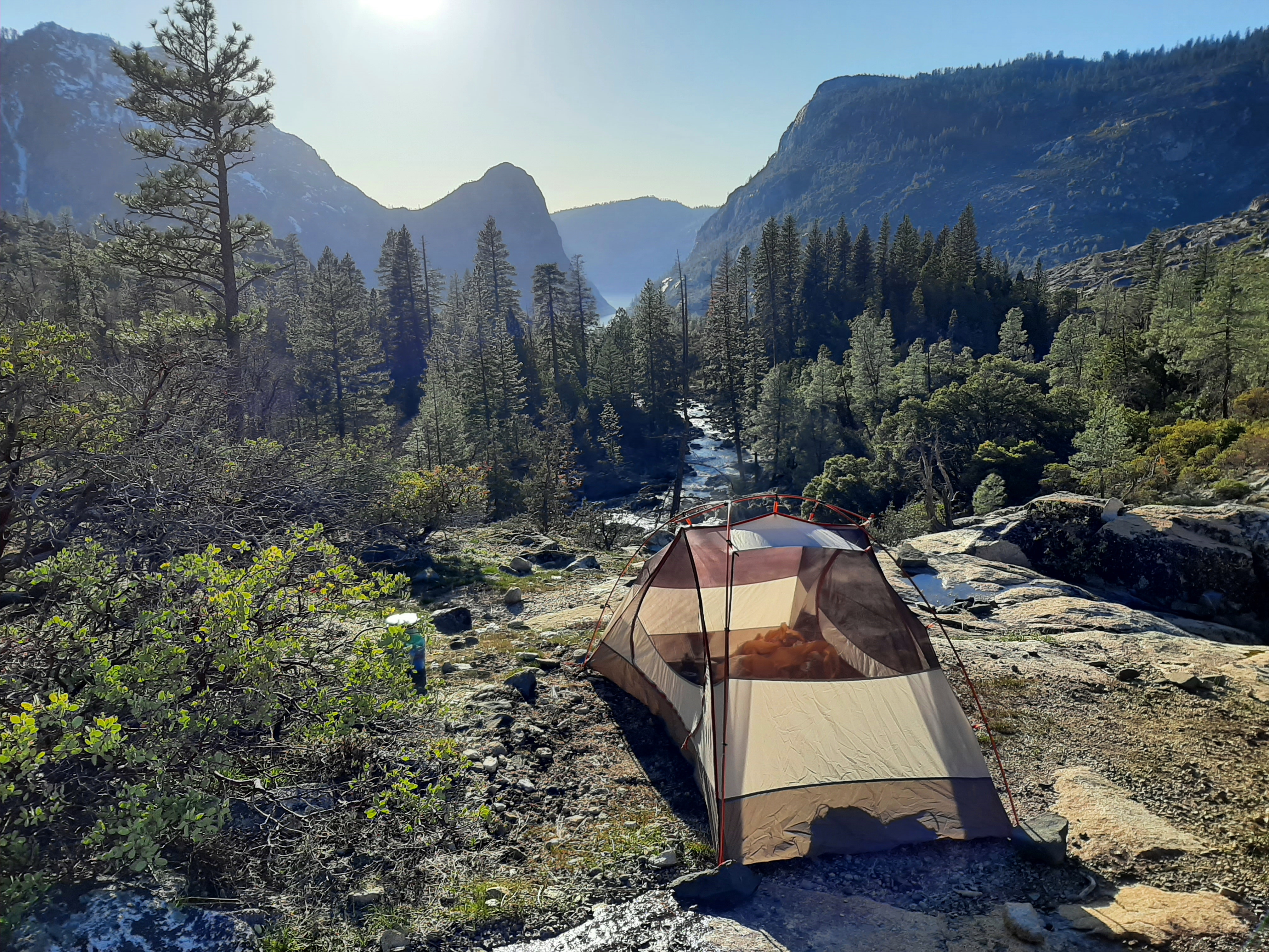
At about 6.2 miles, hikers reach another trail junction: the path left leads up a sharp slope toward Tiltill Valley, Lake Vernon, and beyond; the rightward path bears east toward Pleasant Valley (and eventually Tuolumne Meadows). Stay right, climbing to cross another seasonal stream and then reaching a footbridge over Rancheria Creek, the suggested turn-around point for the hike.
Upstream from the footbridge 
Downstream from the footbridge

From the footbridge, hikers get an excellent view down the rushing waters of Upper Rancheria Falls, tumbling down a series of ledges to the forest below. With Kolana Rock and Hetch Hetchy Reservoir visible in the distance, the area around the footbridge is an excellent place to camp for the night.

All told, it is about 6.4 miles to this point from the trailhead; heading back would make for a nearly 13-mile day hike or relatively leisurely two-day trip.

It’s funny that I should stumble across this post today… my fiancé and I have been watching the Ken Burns National Park series and we just finished the episode about the Hetch Hetchy controversy. It’s so sad to learn what happened. But I’m glad to see there are still some beautiful sights to see there.
The Ken Burns documentary is incredible!
We’re absolutely loving it so far!
Nice post and the campsite for the night is indeed splendid!
Snowy Smith Peak and Rancheria Falls are my personal favourites from this post of you. Thanks for sharing.
Thanks for the trail description! Do you expect that the falls would continue to run into July, or would these dry out like falls in the valley?
Yes, in July it should be okay, although this is a drought year, so the volume will not be as large as usual.
Love YOSEMITE
Pingback: Top 10 Hikes in 2021 | Live and Let Hike
Pingback: Washburn Trail (Yosemite National Park, CA) | Live and Let Hike
Do you think that end of April is too risky for snow?
You never know, but we went in mid-March and it was clear. HH tends to be the warmest part of the park so likely the first for snowmelt, and the trail hugs a south-facing slope where snow is likely to stick.