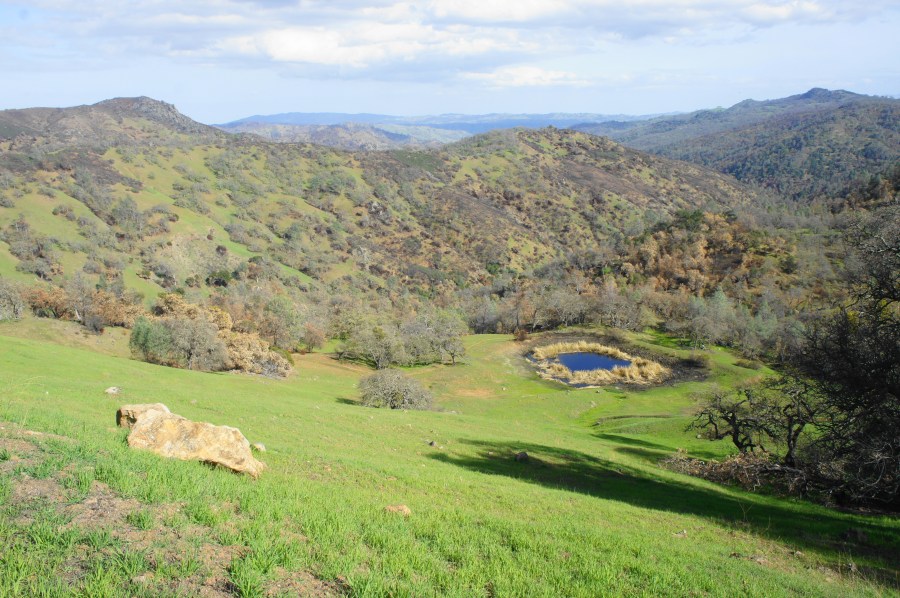

Central California’s Henry W. Coe State Park is a popular destination for Bay Area backpackers seeking to condition during the winter/spring season for trips to the Sierra Nevada later in the year. In fact, the terrain at Henry Coe is so rugged and challenging that it has often been quipped that backpackers do not go to Henry Coe to train for the Sierras; rather, they go to the Sierras to train for Henry Coe. Multi-day loop options abound in this 87,000-acre tract, the second-largest state park in California. The tough, two-day (or a more comfortable three-day) journey outlined below leads up and over several high ridgetops, with sweeping views of the central Diablo Range, and visits pleasant Kelly Lake, Coit Lake, and Pacheco Falls before looping back to Hunting Hollow. Tackle this 20-mile trek in spring when the temperatures are mild, wildflowers are in bloom, hillsides are verdant, and streams (including beautiful Pacheco Falls) are flowing. (Note: Obtain a walk-up backpacking permit at the trailhead; it costs $5 per person per night, plus a $6 parking fee. Bear canisters are not required, but a free California campfire permit is needed if you plan to operate a camping stove.)

The hike
The following description covers the 20.1-mile circuit (including the worthy out-and-back spur to Pacheco Falls) in two full days, with a night spent at Wood Duck Pond, situated on a grassy shelf just above the Pacheco Creek drainage. The trek starts and ends at the Hunting Hollow Entrance, accessed by way of the Gilroy Hot Springs Road heading east from Gilroy, California. Turn right at the entrance sign and park in the large, gravel lot, which has some pit toilets and several interpretive waysides offering information on Henry Coe State Park. While considerably less crowded than the headquarters area at Coe Ranch, Hunting Hollow still sees a steady stream of mountain bikers and intrepid backpackers looking for a more rugged alternative to the more popular camping spots in Henry Coe (e.g., China Hole, Poverty Flat) to the north.
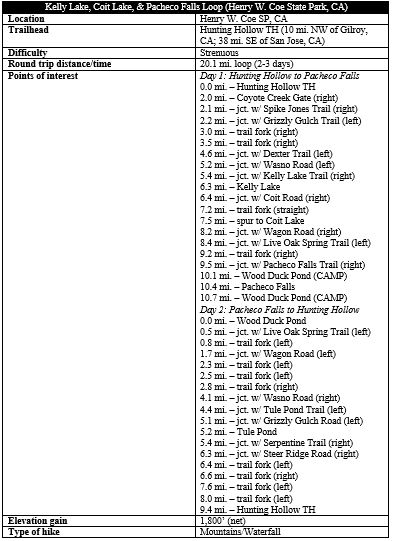
DAY 1: Hunting Hollow to Pacheco Falls via Kelly Lake and Coit Lake (10.7 miles)
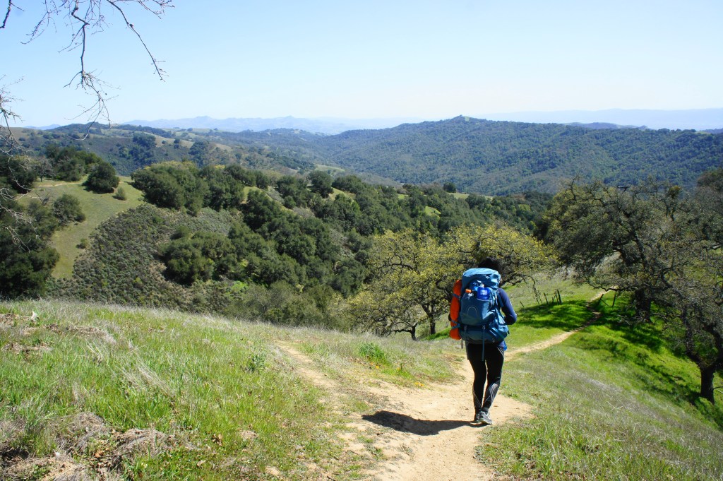
Once you have paid your camping fees and readied your backpack, hikers should begin hiking clockwise around the loop, which stitches together several fire roads and single-track trails over the course of the two days. Heading clockwise prioritizes easier ascents on the first day—although of course easy is all relative in this difficult terrain, where ups and downs are a continual challenge for even the fittest hikers.
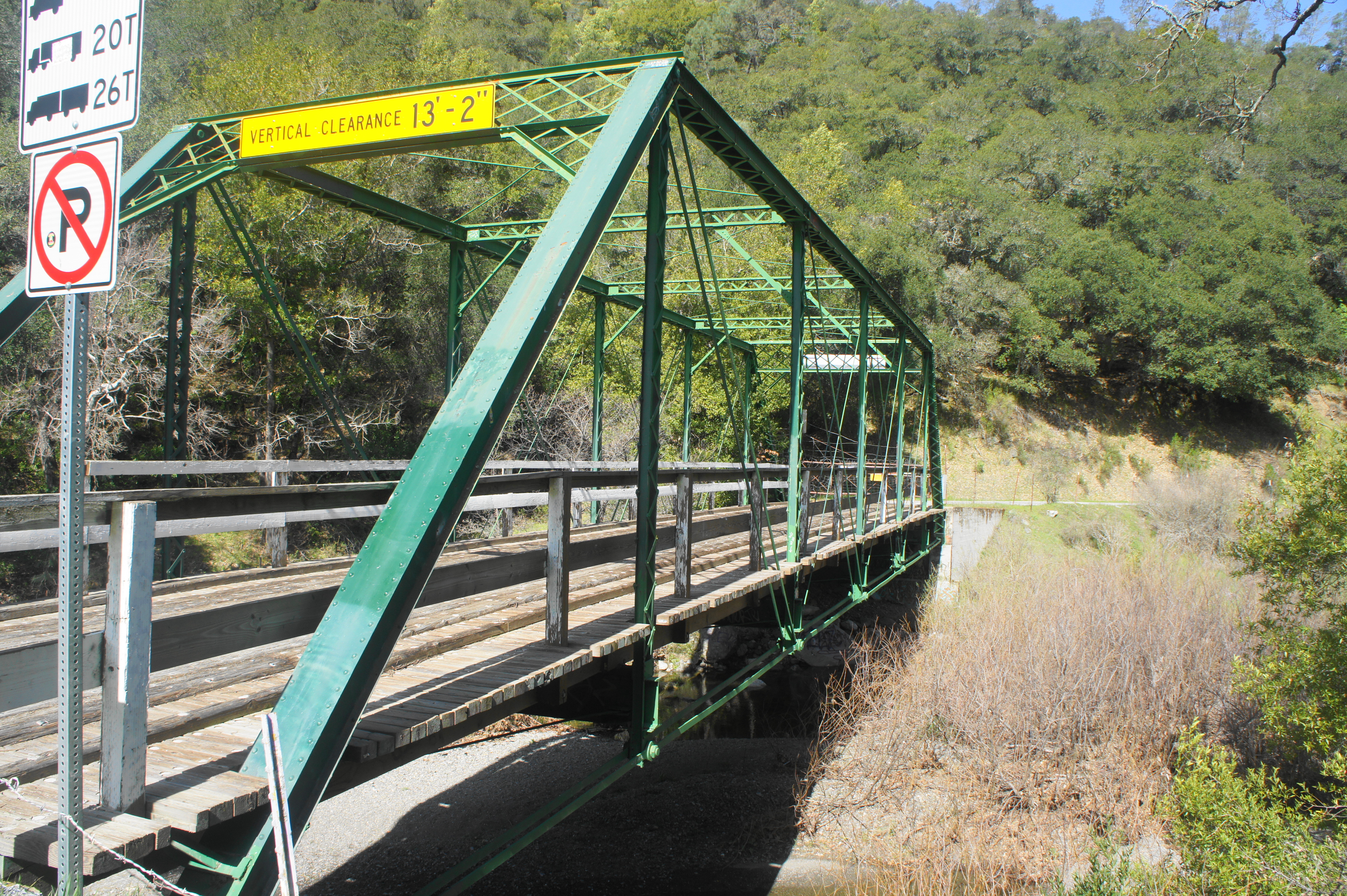
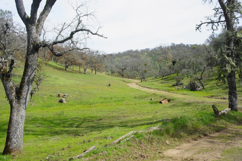
Counterintuitively, heading clockwise actually means leaving the parking lot and returning to the paved Gilroy Hot Springs Road, following it north into the park for two miles. This initial, mild stretch is relatively dull but made more interesting by the flowing waters of Coyote Creek, which gives life to various sycamore trees that dot the drainage. At the two-mile mark, the road continues across a low-clearance bridge toward Gilroy Hot Springs; however, hikers should bear right without crossing the creek, following instead a dirt track where a sign officially welcomes one into Henry Coe State Park. (Note: This is the “Coyote Creek Gate,” an official trailhead but where the absence of parking requires visitors to effectively visit only on foot.)
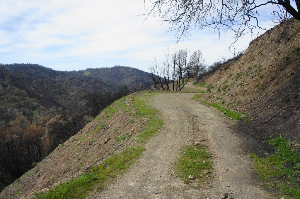
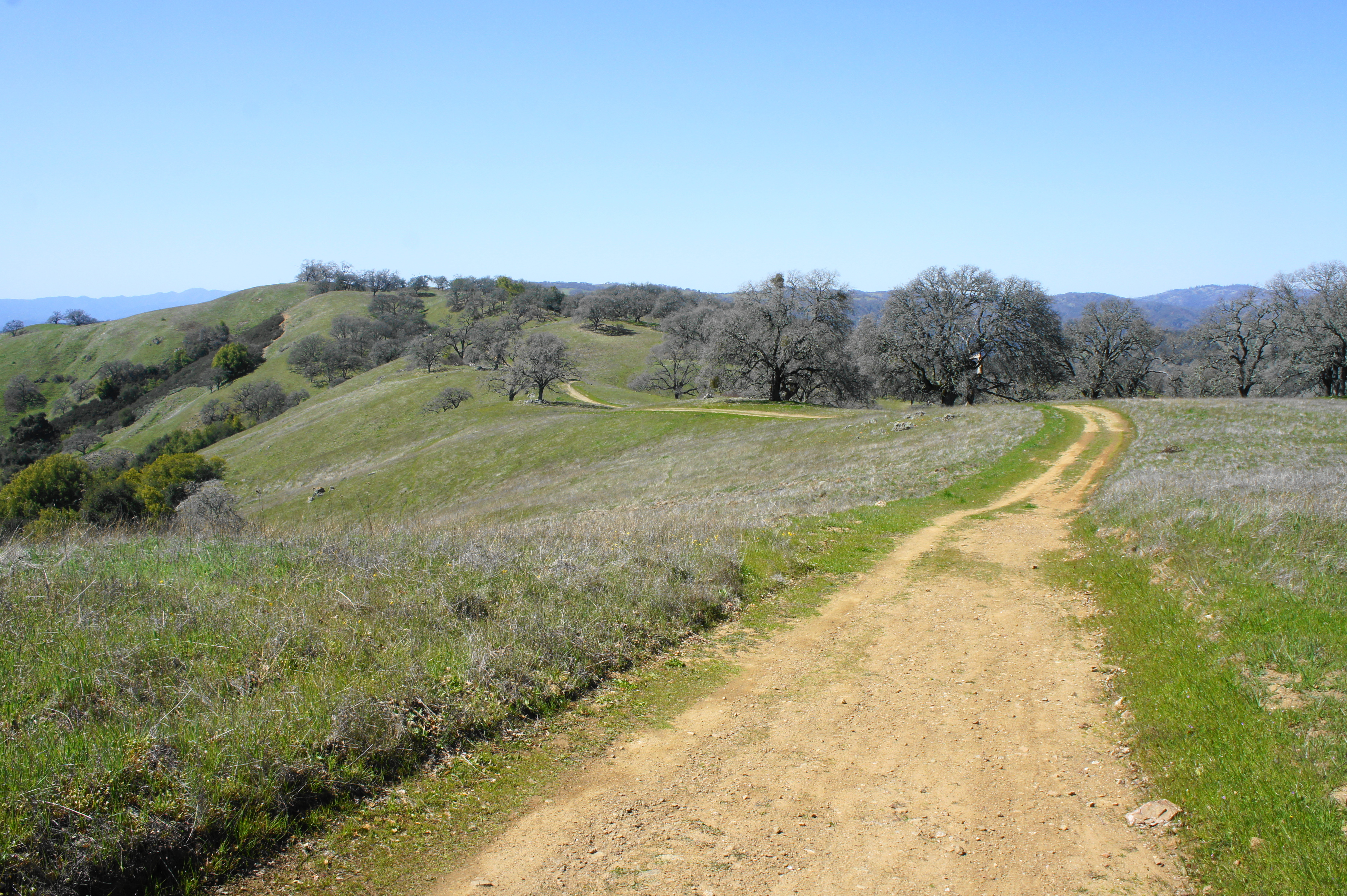
Now on the wide and graveled Coit Road, hikers skirt the brushy drainage of Coyote Creek on the right, then approach a trail fork at 2.1 miles. Bear right on the Spike Jones Trail, which begins as another wide double-track, climbing to a clearing with a pit toilet; here the road suddenly ends, with the onward trail doubling back to the south as a single-track. Rounding back to the north again, the trail climbs steeply and forks again. Bear left this time on the Grizzly Gulch Trail, which will serve as your primary route up Wasno Ridge for the next 2.5 miles.
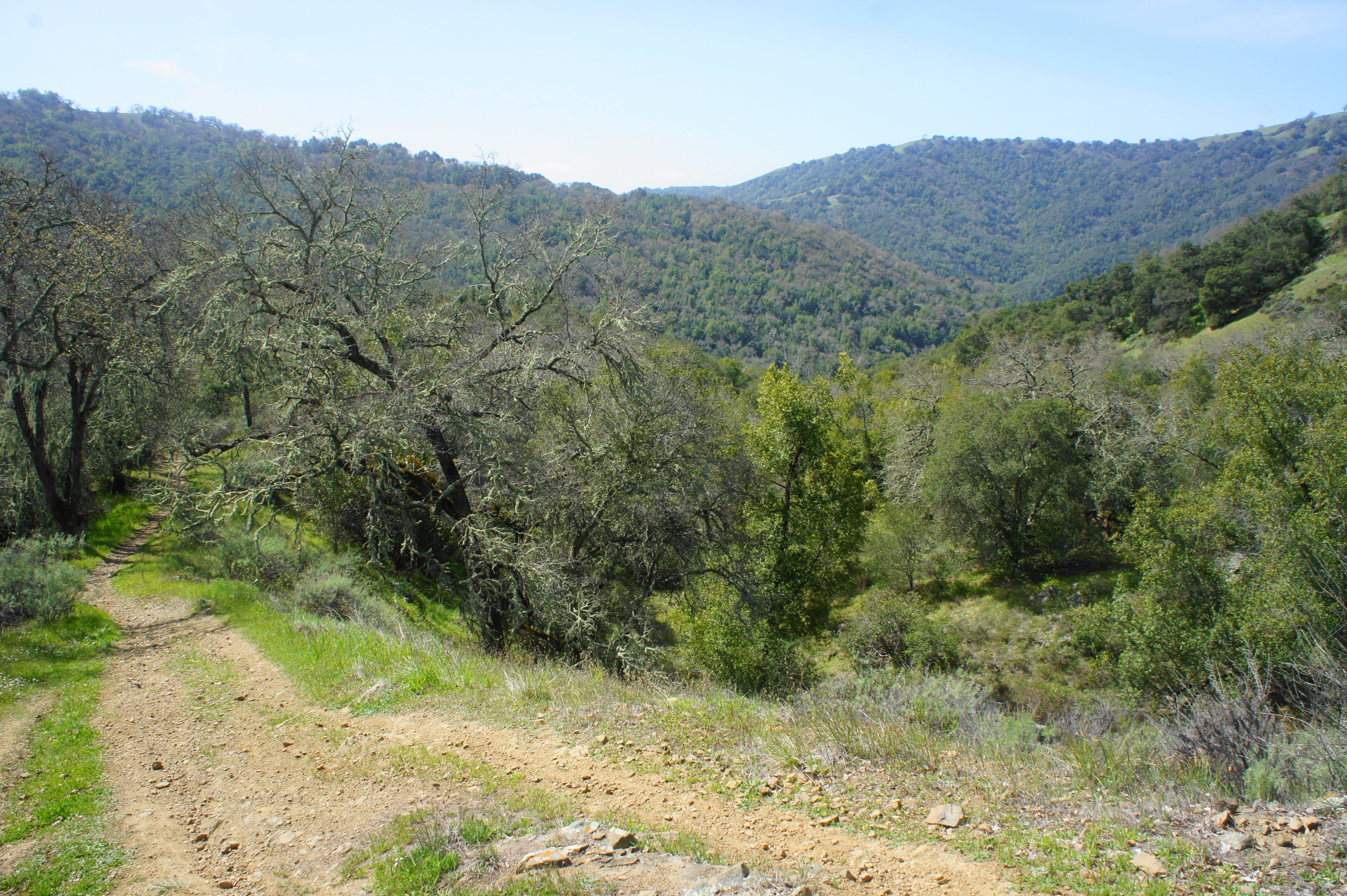
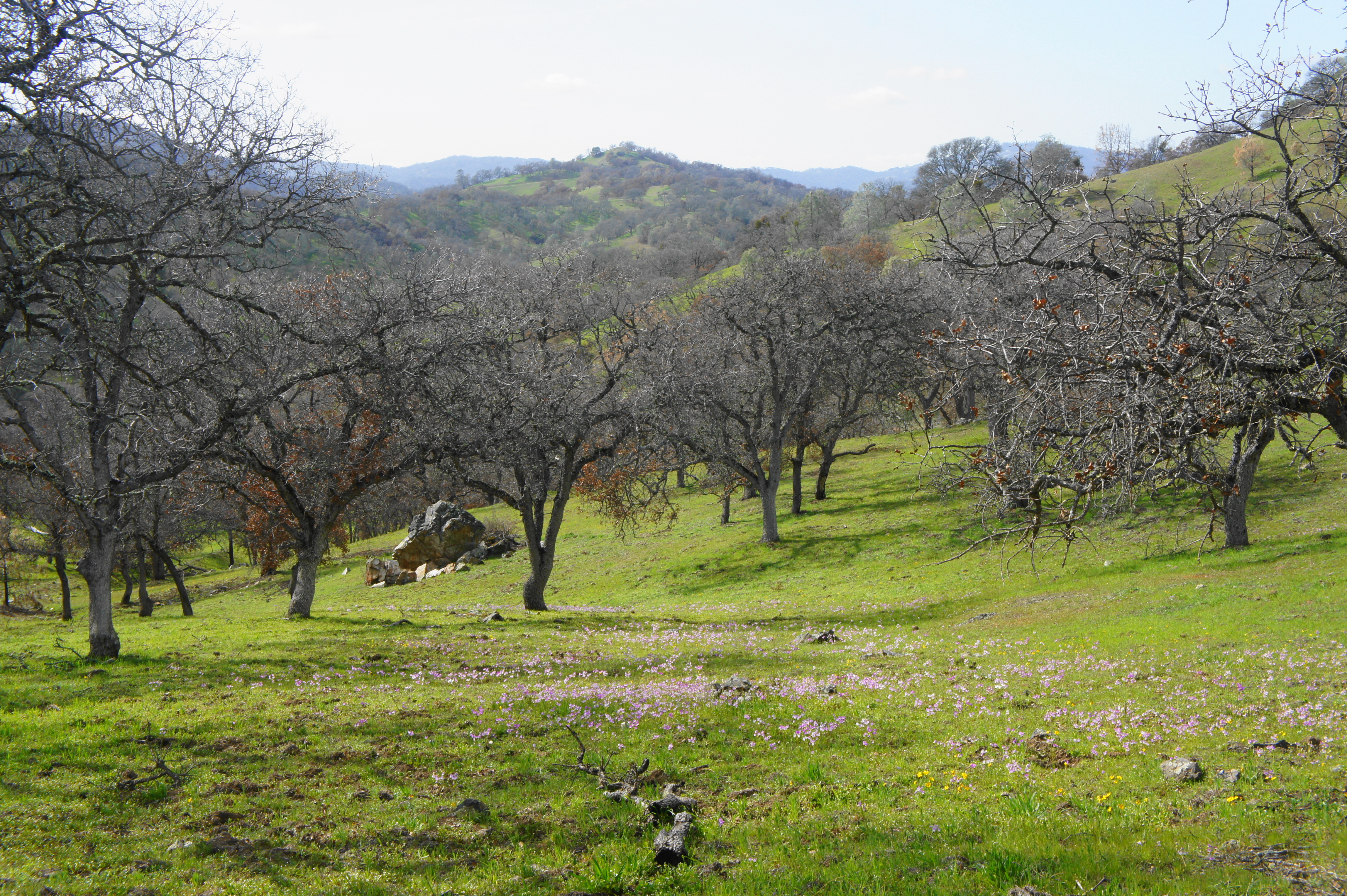
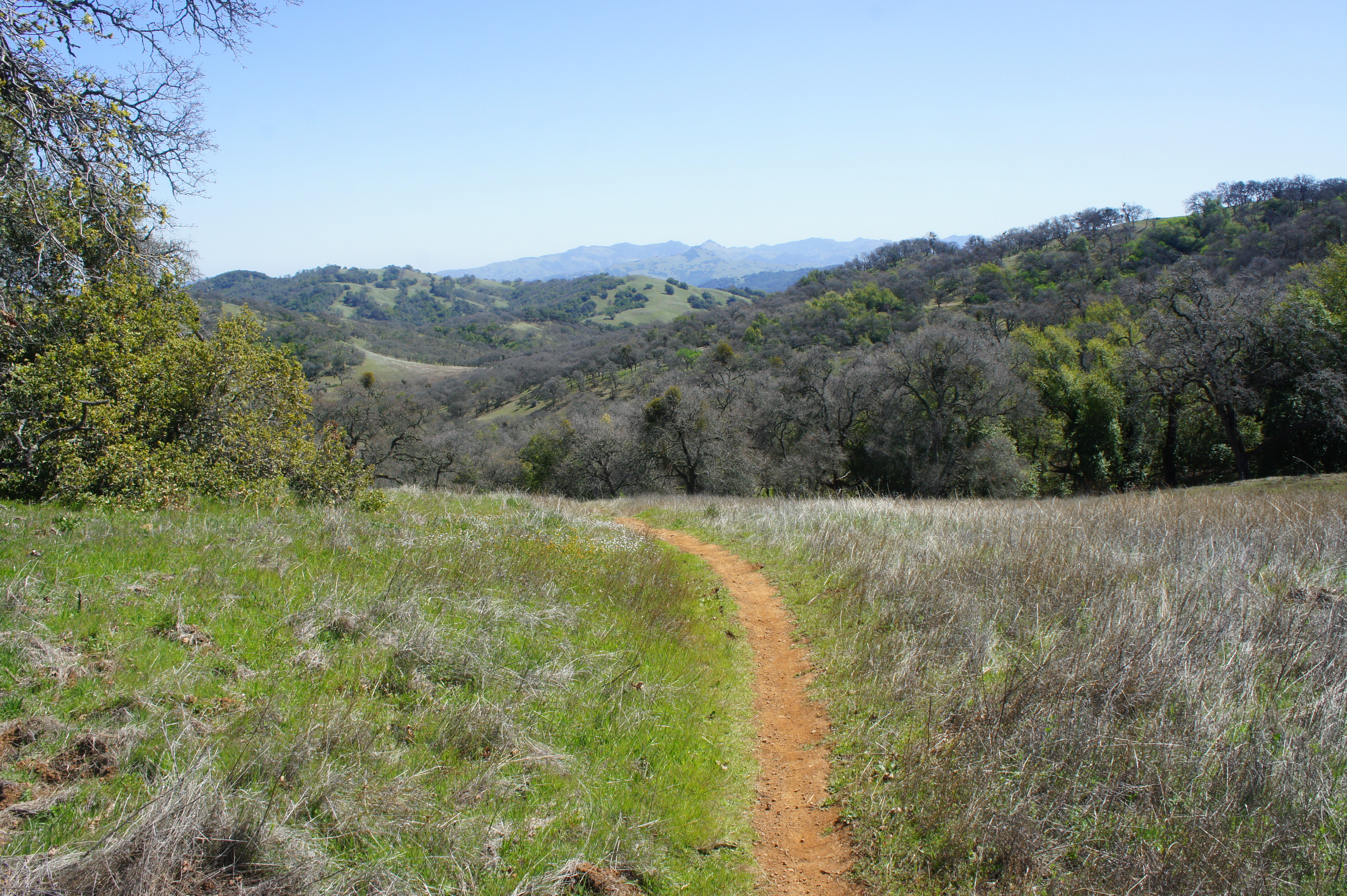
Enjoy the densely wooded stretch that follows, as consistent shade will be at a premium for much of the rest of the loop. After 1/3 mile of pleasant, largely level hiking along north-facing slopes, the trail drops to clear the Grizzly Creek drainage, which holds water in the spring but may dry up completely during the hot summer months.

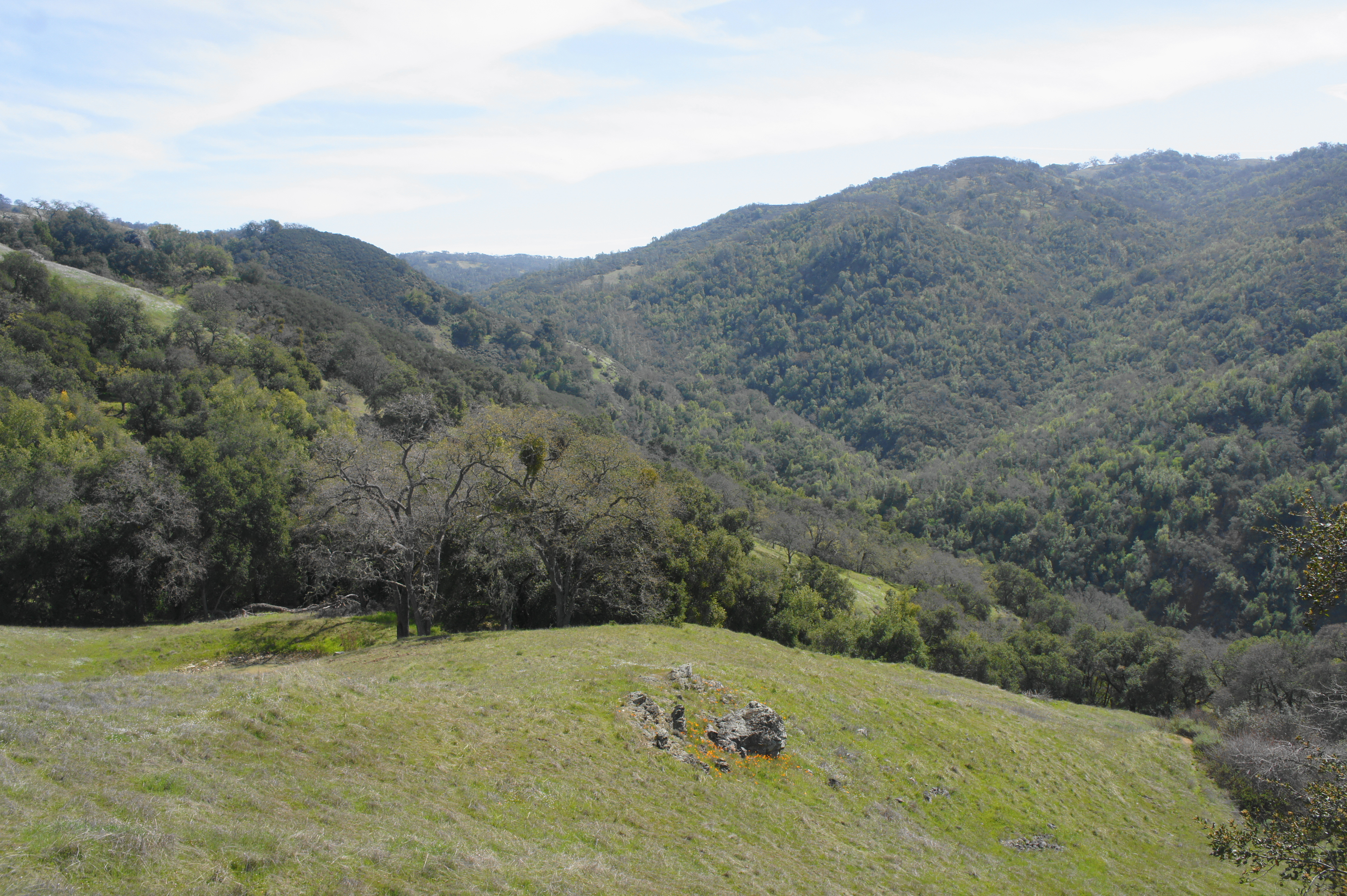
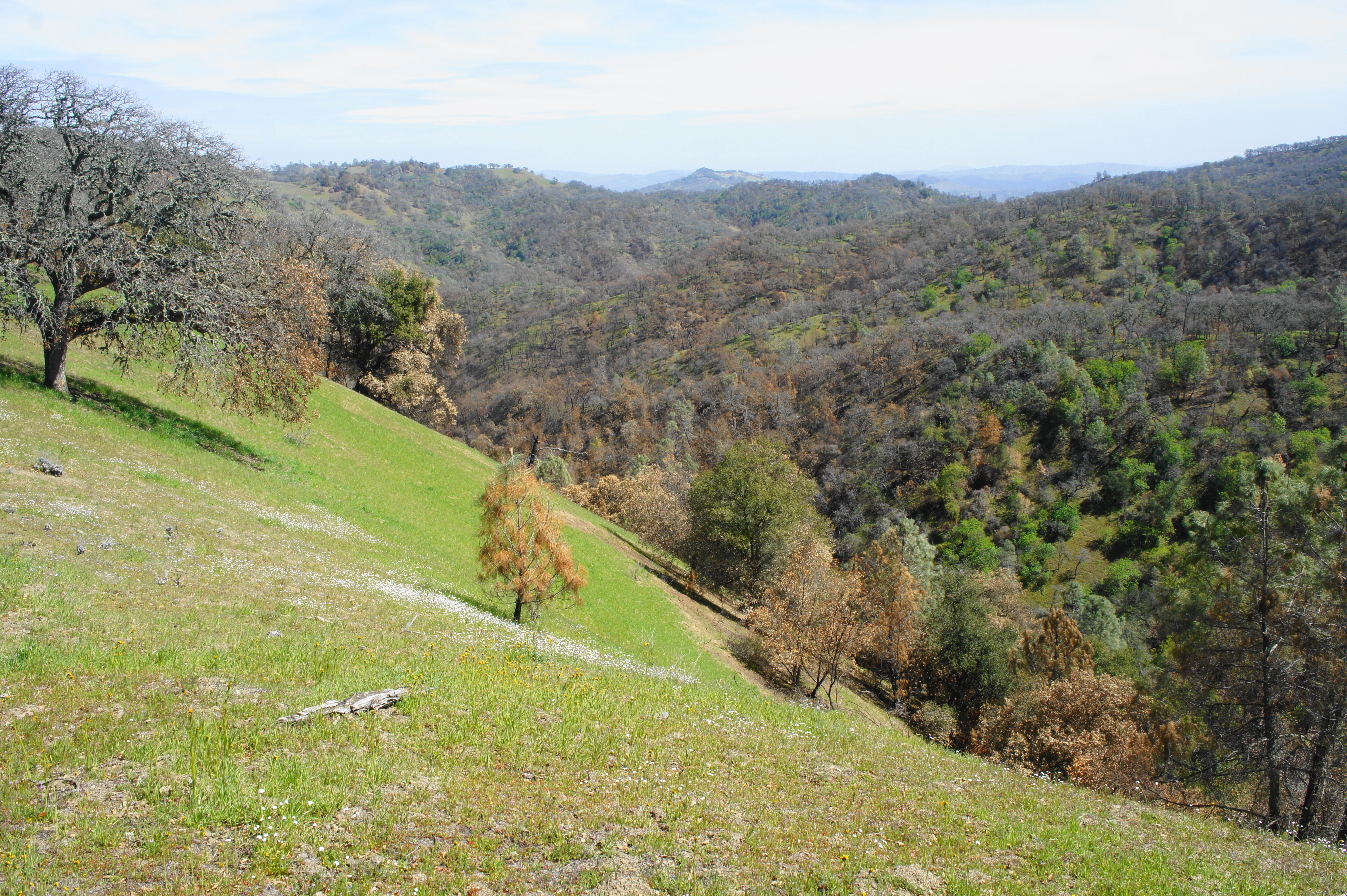
Just beyond, about 2.7 miles from the start, the longest climb of the up-and-down circuit begins. Starting as a gently winding path amid side drainages of Grizzly Gulch, the ever-climbing path quickly steepens and passes in and out of patches of oak/bay woodlands. Looking back as the track ascends a sharp ridgeline, one can begin to see above the trees and down Grizzly Gulch and the Coyote Creek watershed, with heavily-vegetated Palassou Ridge off to the west.
The terrain in these southern reaches of Henry Coe is noticeably different from the more-visited area around Coe Ranch, where there tends to be thicker vegetation, more ponds and streams, and a richer diversity of plant life. By contrast, Grizzly Gulch is largely rimmed by sunny fields and patchy oaks and bays, offering more consistent open views of the surrounding hills.

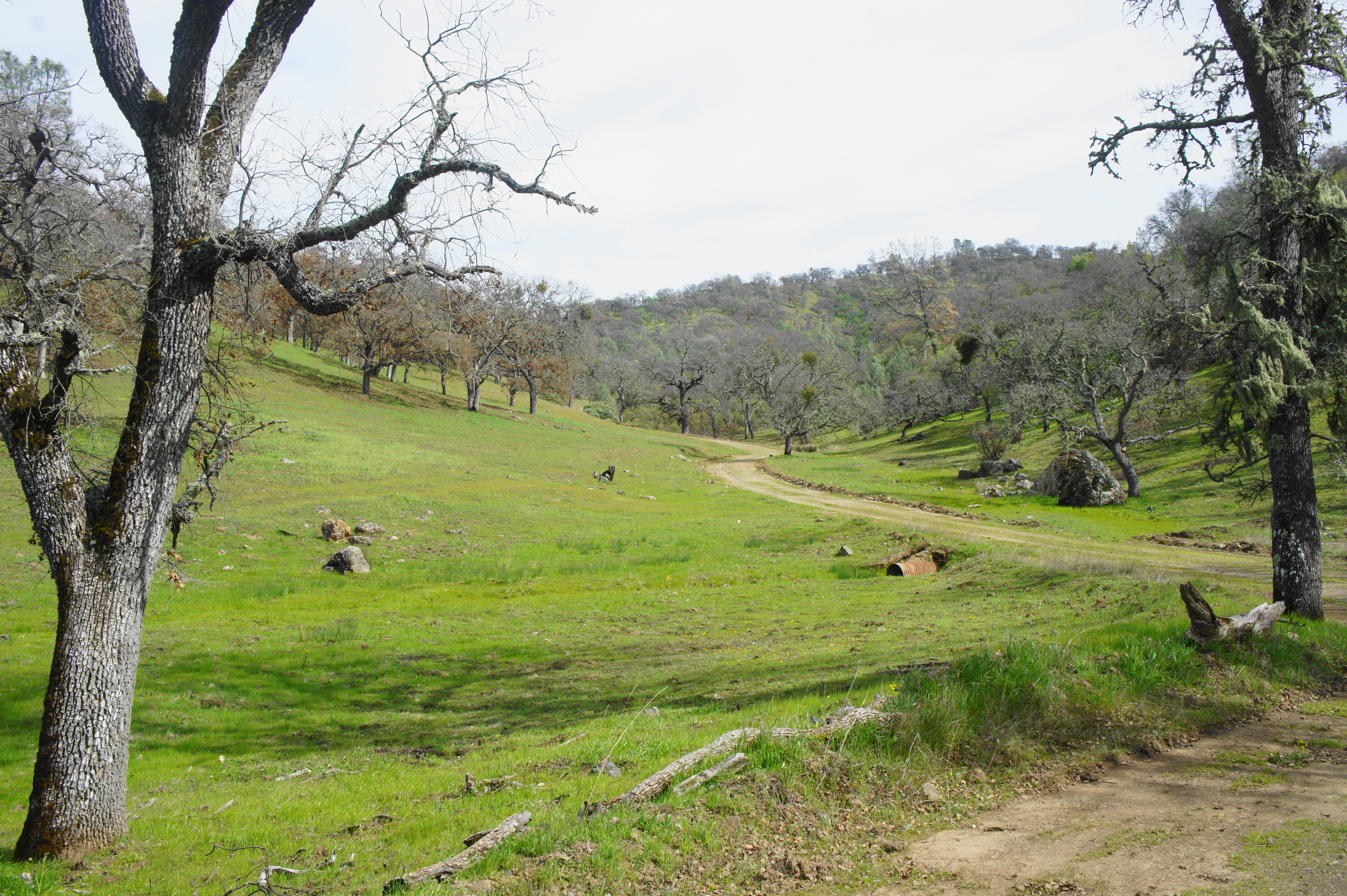
Grizzly Gulch drainage 
Grizzly Gulch Trail
At the 3-mile mark, the trail splits again, with the lesser-travelled Cullen Trail heading left. Stay right on the Grizzly Gulch Trail, which continues its relentless climb up another protruding crumple in the steeply-sloping hillside. In another half-mile, another junction ushers in a brief respite; staying right at the fork with the Tower Trail, the Grizzly Gulch Trail briefly levels off, even descending at times to clear minor ravines.
The subsequent section is particularly beautiful as views across much of Grizzly Gulch open up and the trail skirts hills of brimming wildflowers and multi-hued rock outcrops. At 4.6 miles, the trail crests a windswept saddle, and hikers should bear left on the Dexter Trail, which marks the final climb to the top of Wasno Ridge.
The narrow Dexter Trail gains 400 feet in about 4/10 mile before briefly descending and intersecting with Wasno Road at 5.2 miles. By now, hikers have climbed more than 1,500 feet—no joke with full backpacks—and are rewarded with the hike’s first look over the crest of Wasno Ridge to the north.
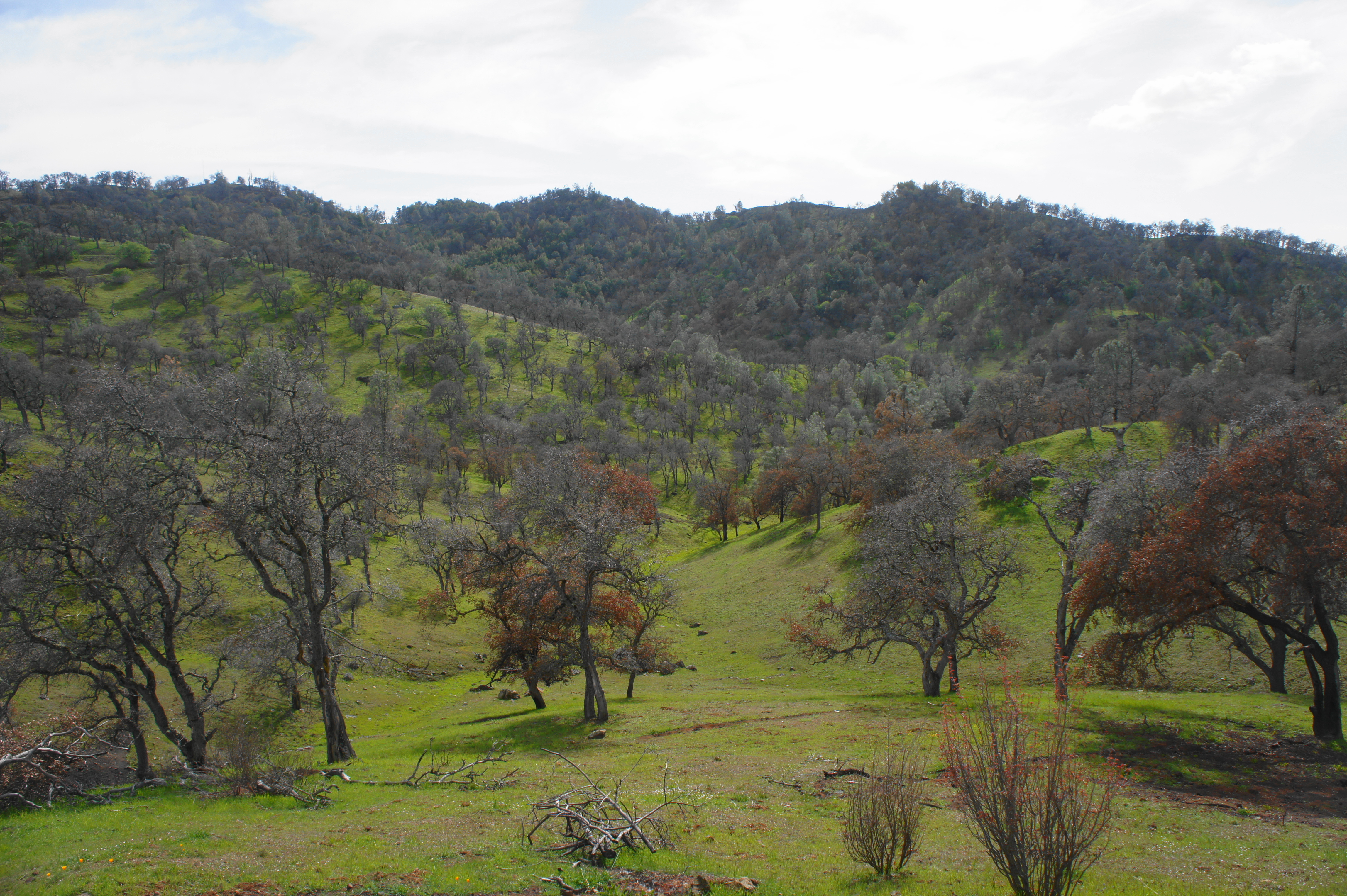
In the aftermath of the SCU Lightning Complex fires (August-September 2020), parts of the terrain north and east of Wasno Ridge appear scorched and tired. Many of the digger pines appear dead with browned needles, while scores of live oaks are charred irreparably. Yet the devastation was fortunately only partial: patches of blackened earth are interrupted by brilliant green hillsides, suggesting that the beauty of the rolling hills of Henry Coe—despite being at the heart of the SCU fire—stubbornly refuses to go away.
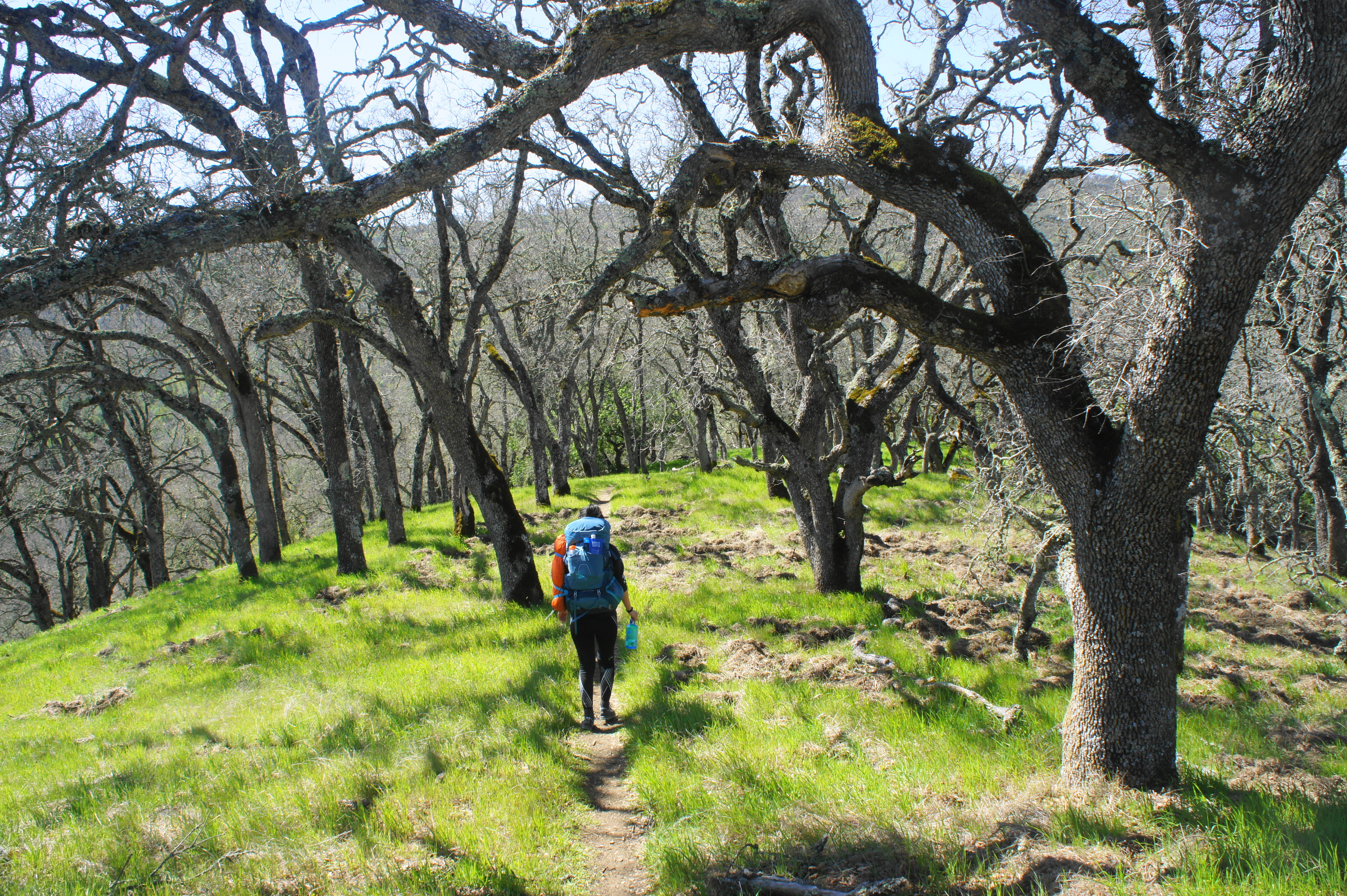
After taking a breather atop Wasno Ridge, bear left on Wasno Road and follow it northwest for 2/10 mile. Head right on the Kelly Lake Trail, a grassy track leading down the northern slopes of Wasno Ridge toward its namesake, dropping down through a gaggle of mostly healthy oaks.
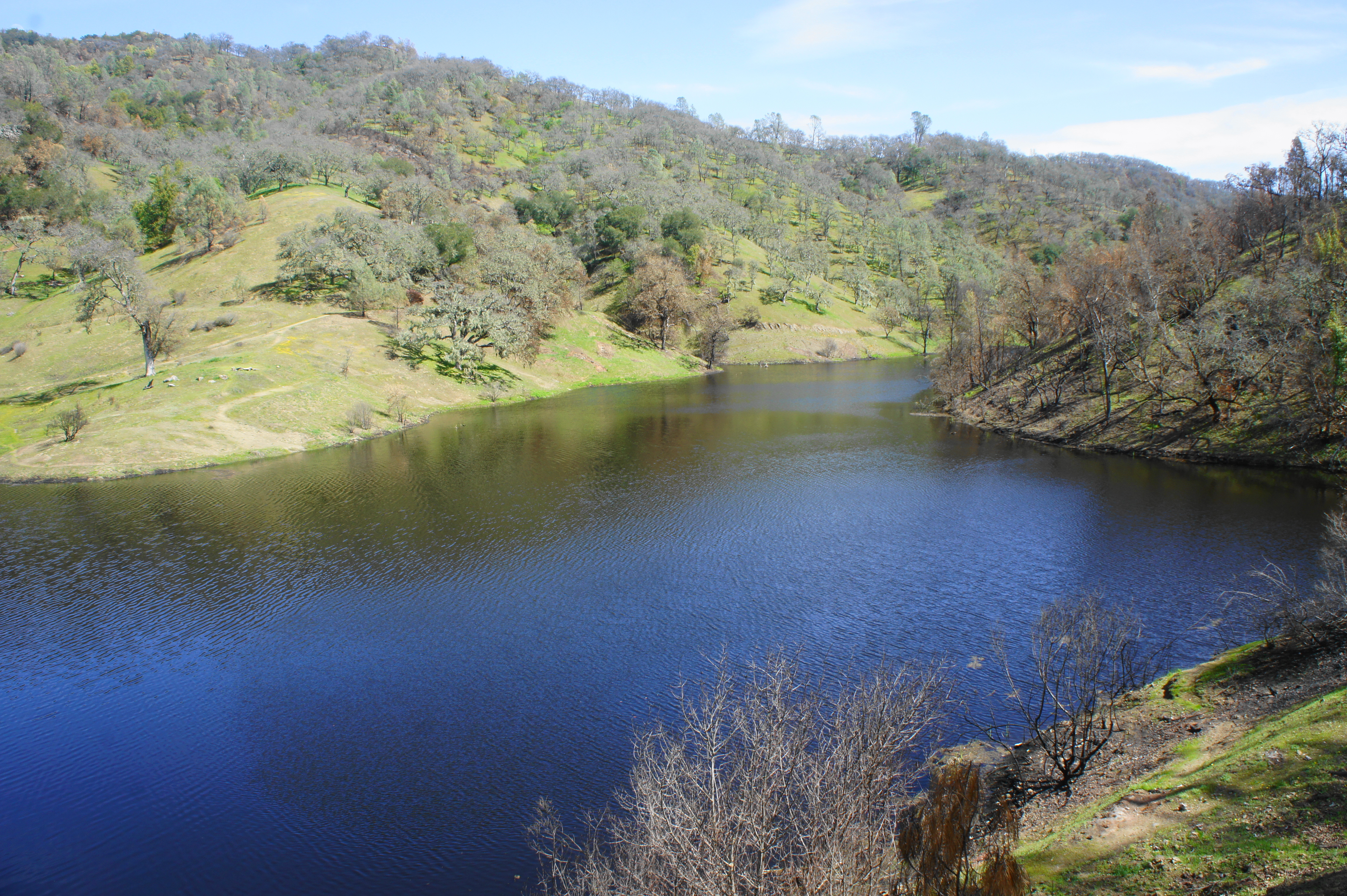
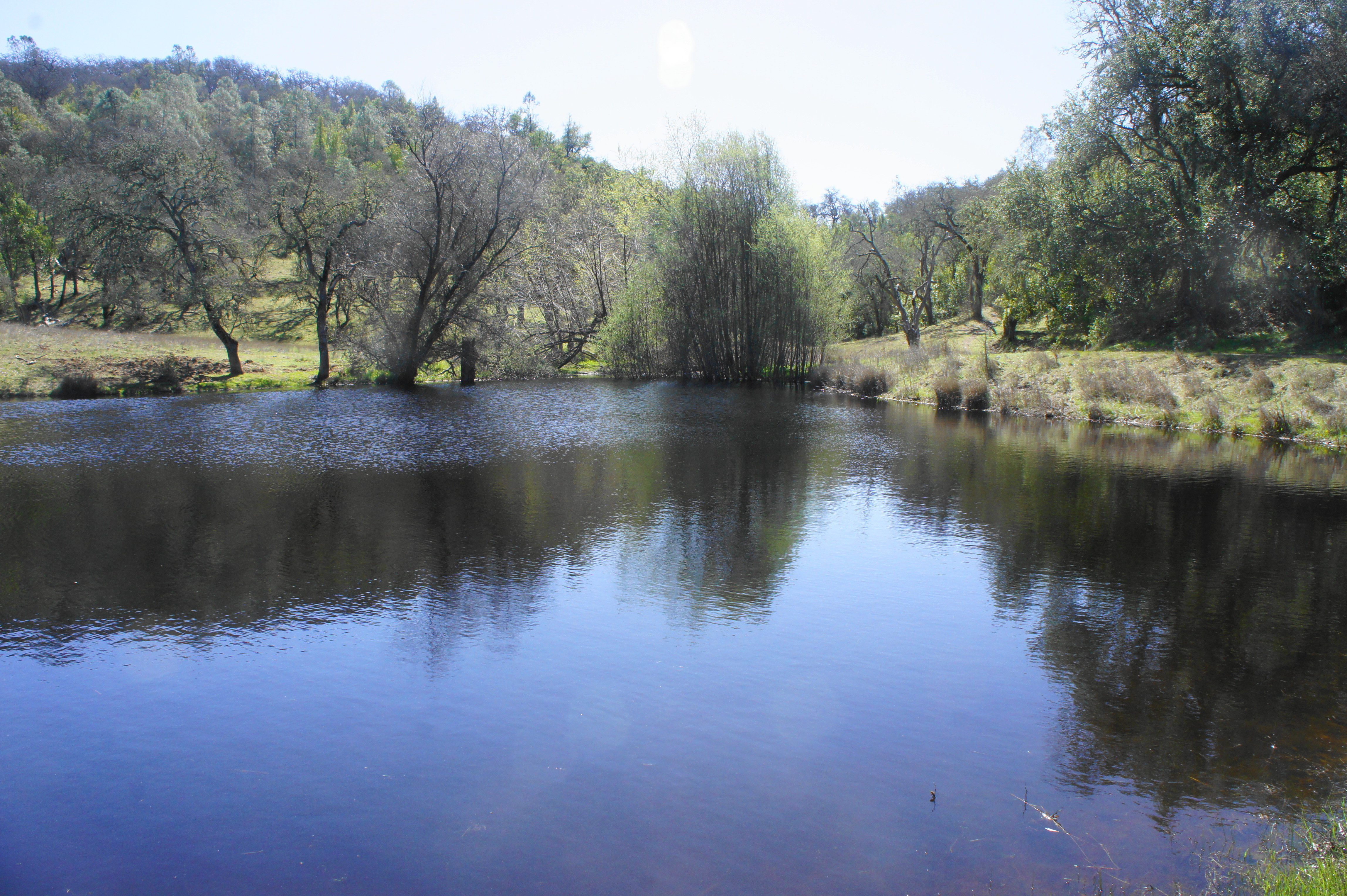
After nearly a mile on this pleasant trail, hikers reach the pretty western shores of Kelly Lake, a manmade reservoir fed by Kelly Creek. Unlike other lakes in the area, the banks of Kelly Lake are relatively free of reeds, allowing for open views across the calm waters, which are stocked with varieties of fish.
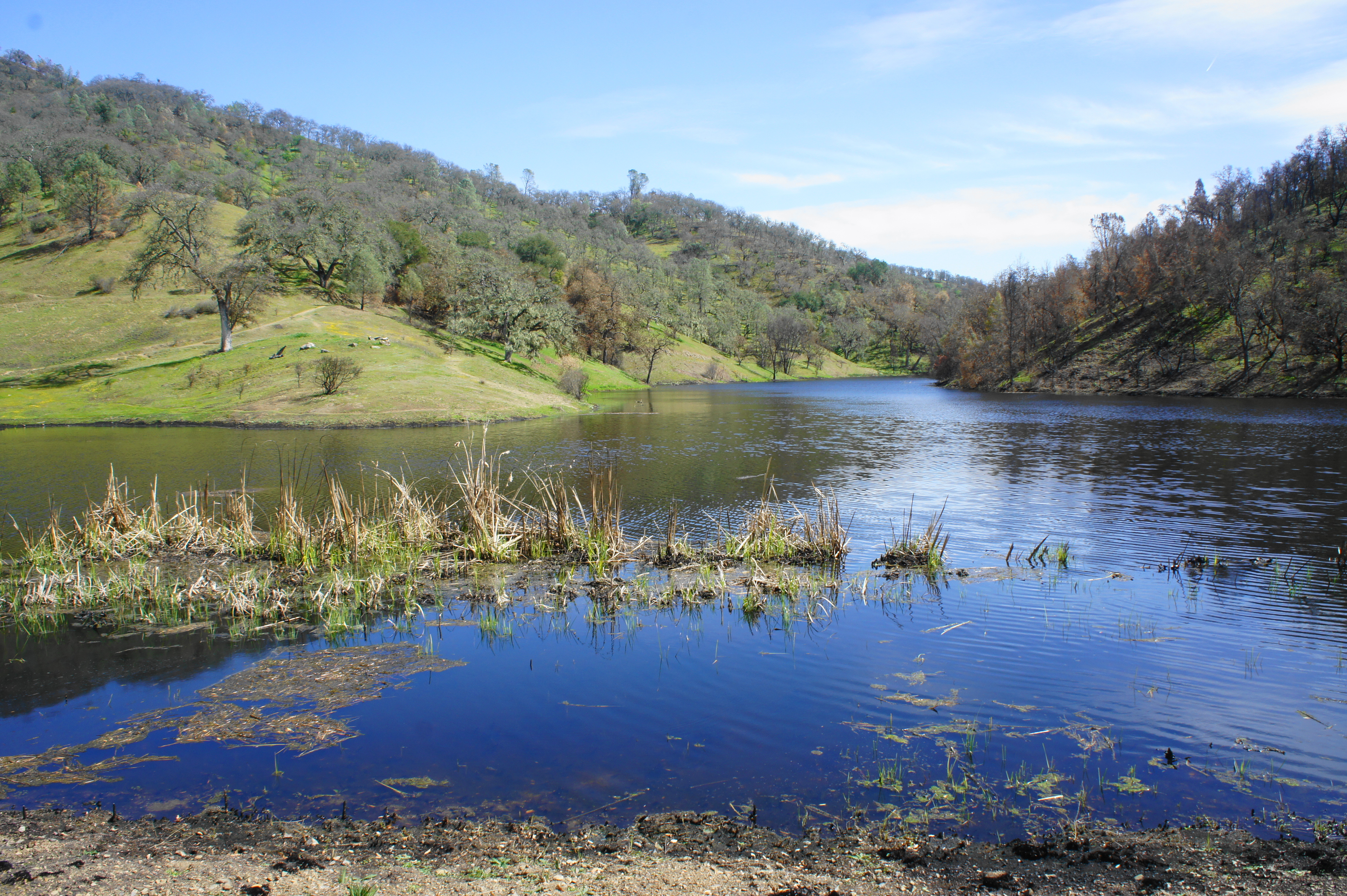
Down Kelly Creek Canyon to the north, there are a few shaded areas for camping, as well as a pit toilet. Follow the dam northeast, then bear left and make your way toward the restroom, bearing right on Coit Road, which leads up the scarred ridge to the east.
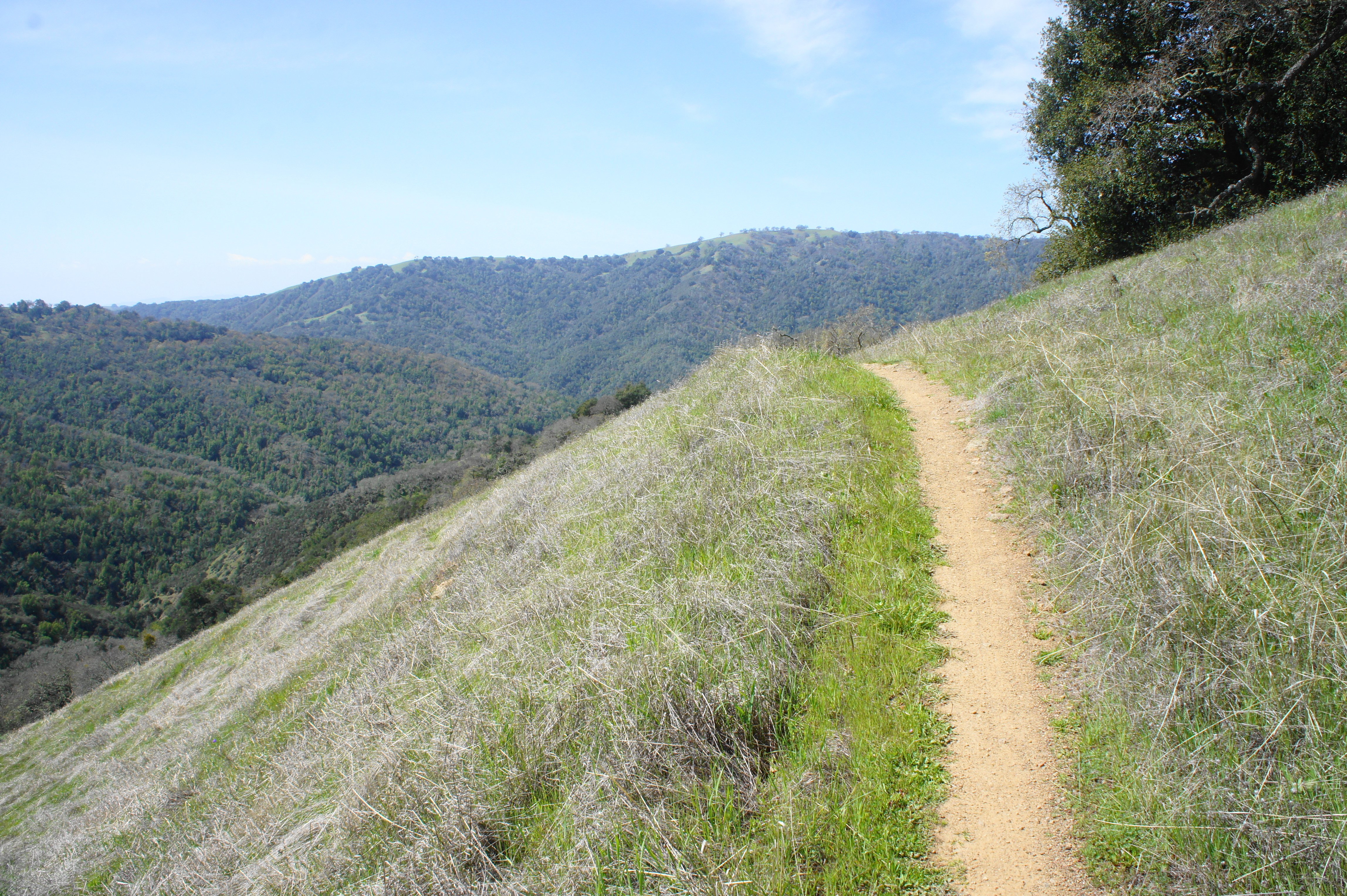
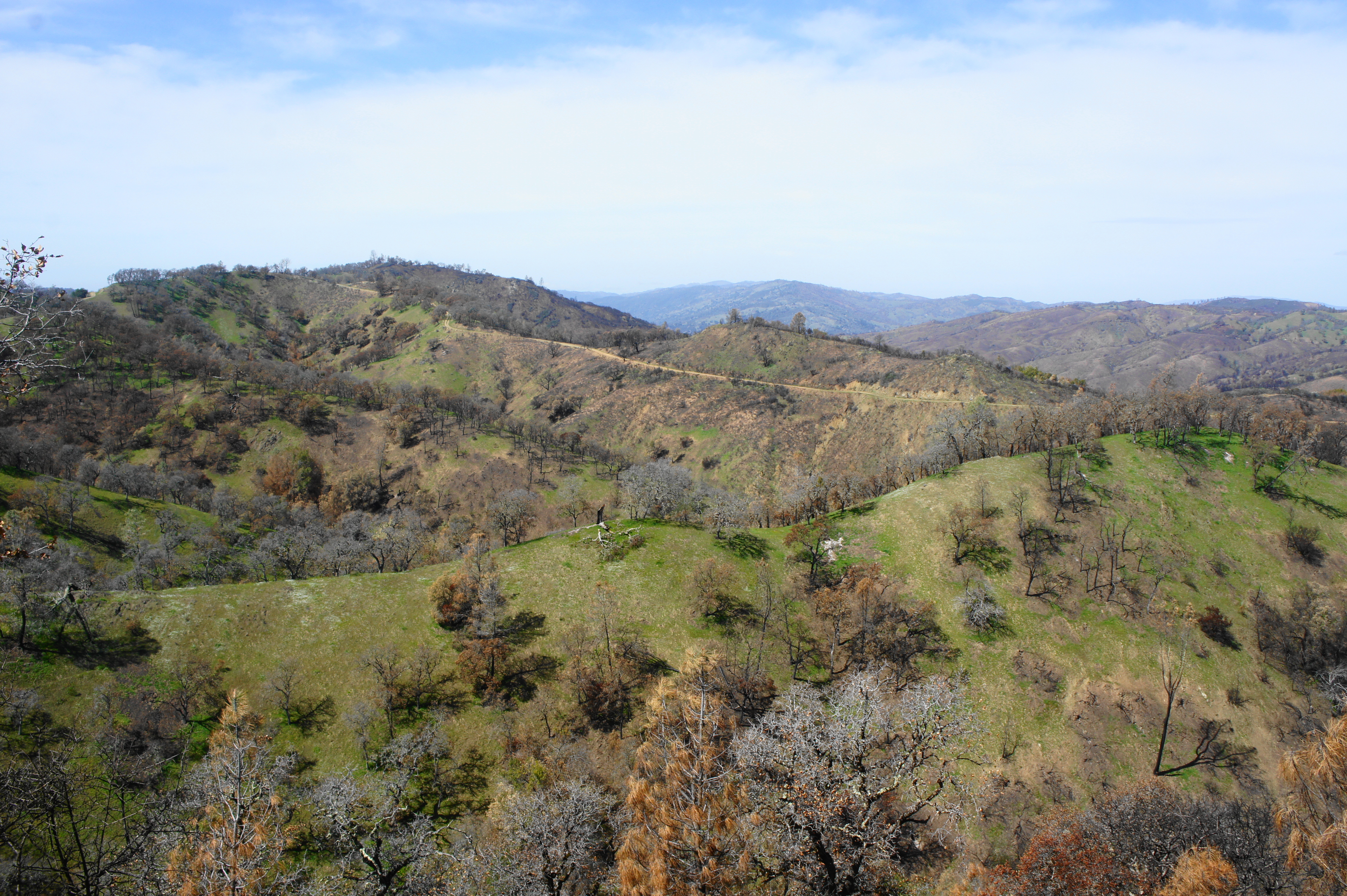
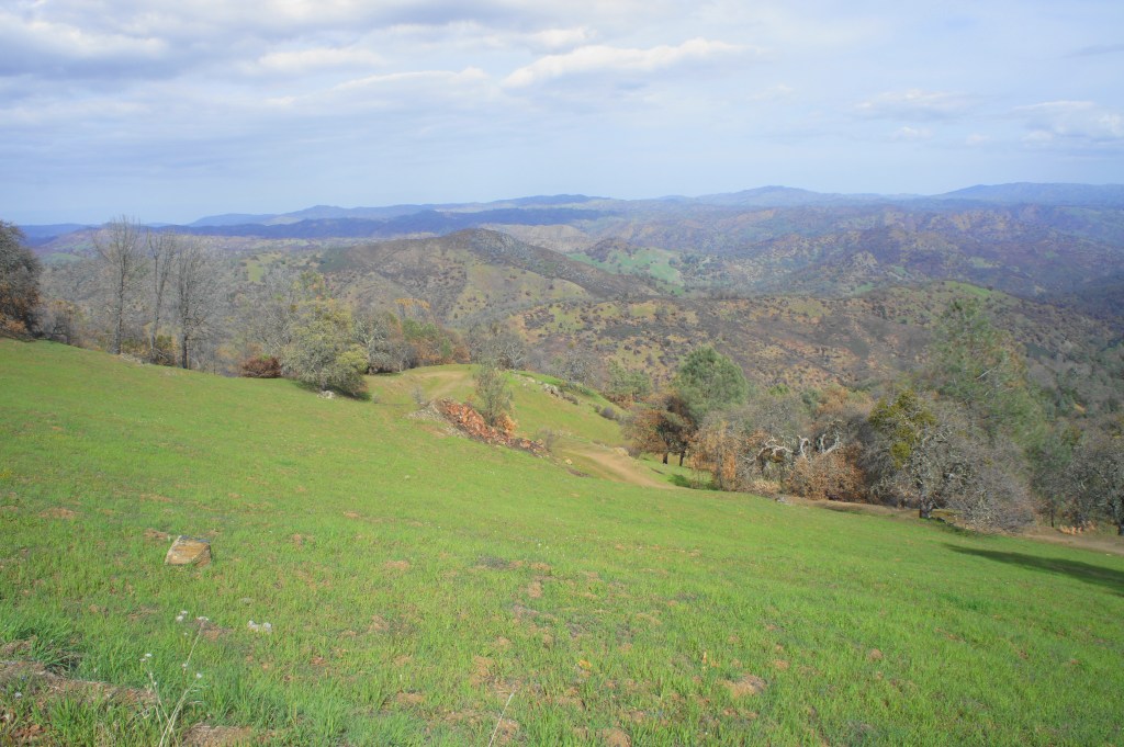
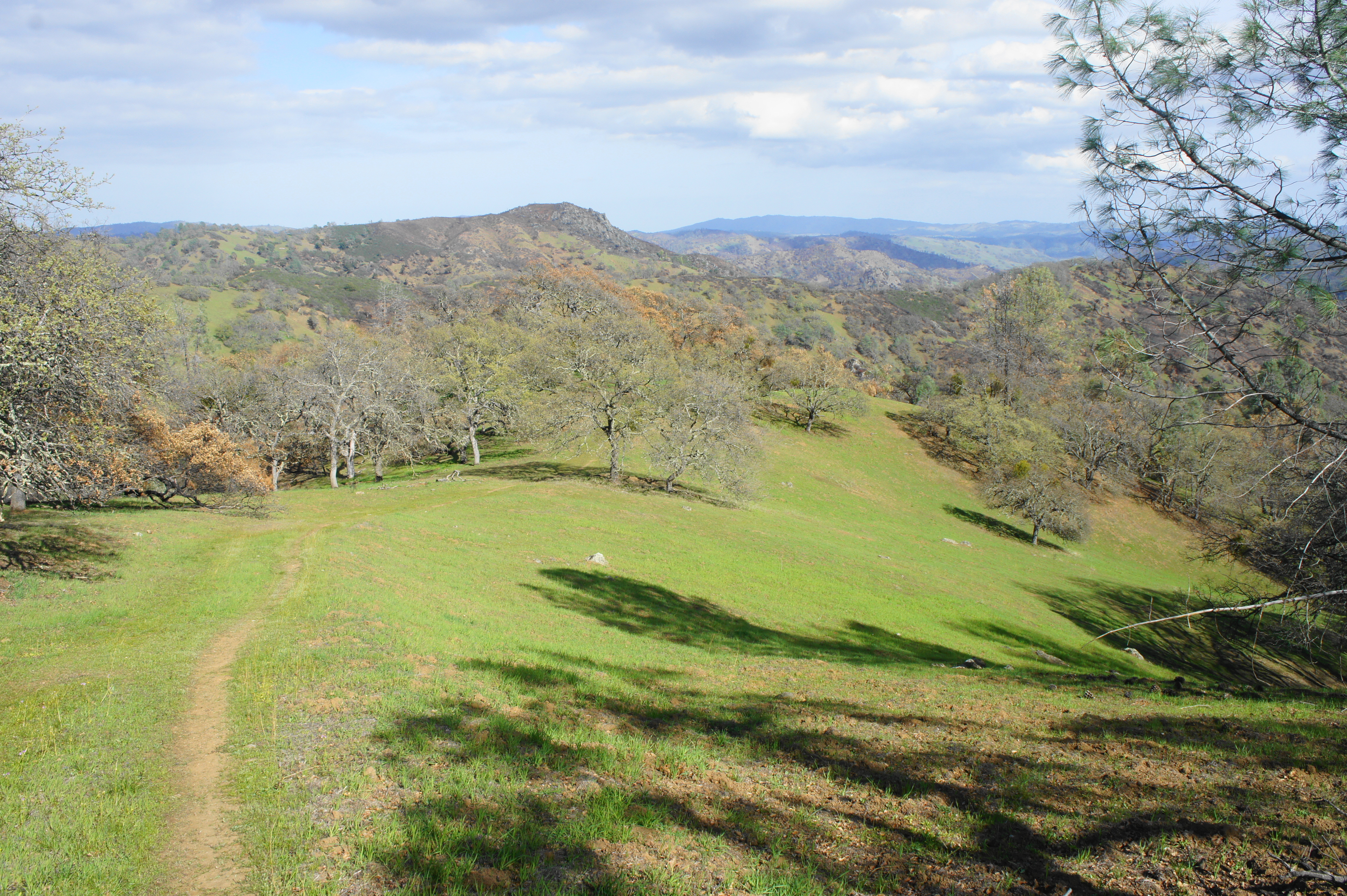
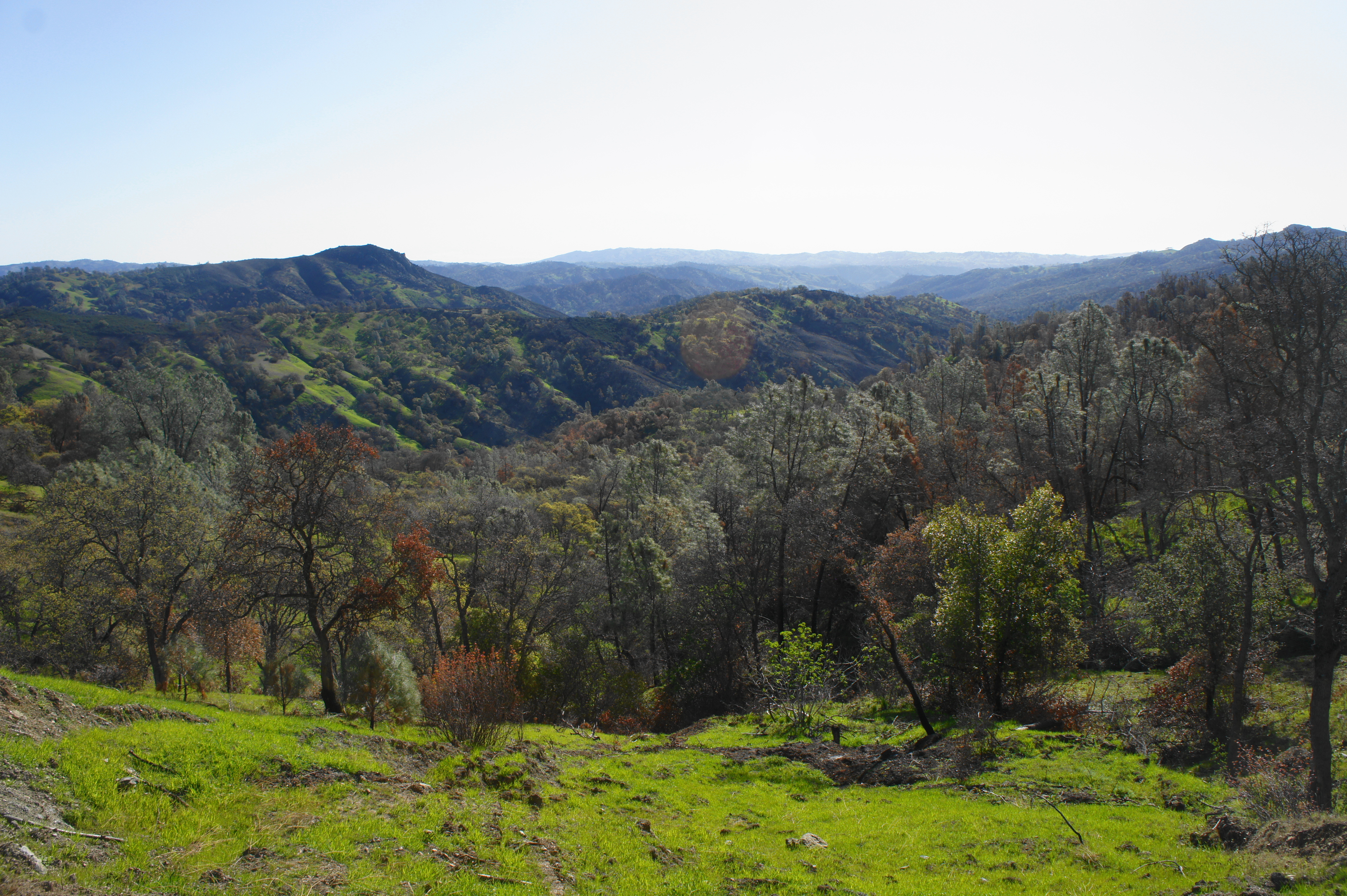
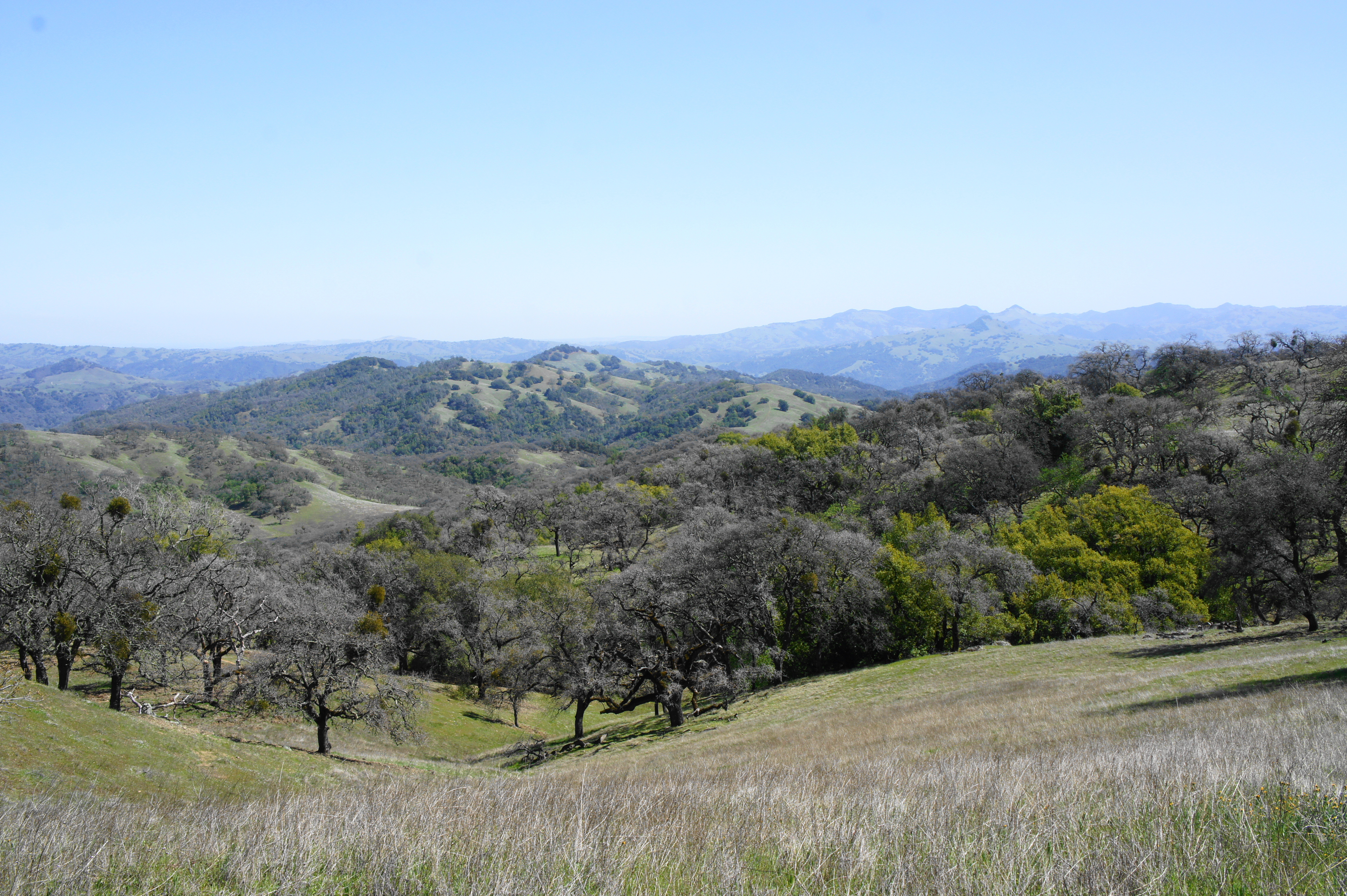
The subsequent climb up to the crest of Willow Ridge is relatively brief but, given its location 6.5 miles into the hike, can feel rather tiring with a full backpack. The wide, gravel Coit Road edges its way through several burned areas, with views back to the west toward Wasno and Mahoney Ridge. After gaining around 300 feet in elevation, the road approaches a low pass with an abundant wildflower bloom (in spring); stay straight as Coit Road bisects Willow Ridge Road and the Crest Trail, with the onward track gradually descending to the next drainage.
Climbing up through a burned area along Coit Road 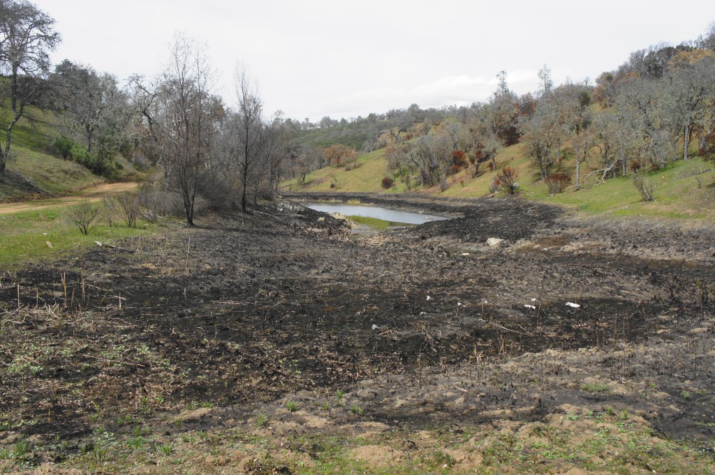
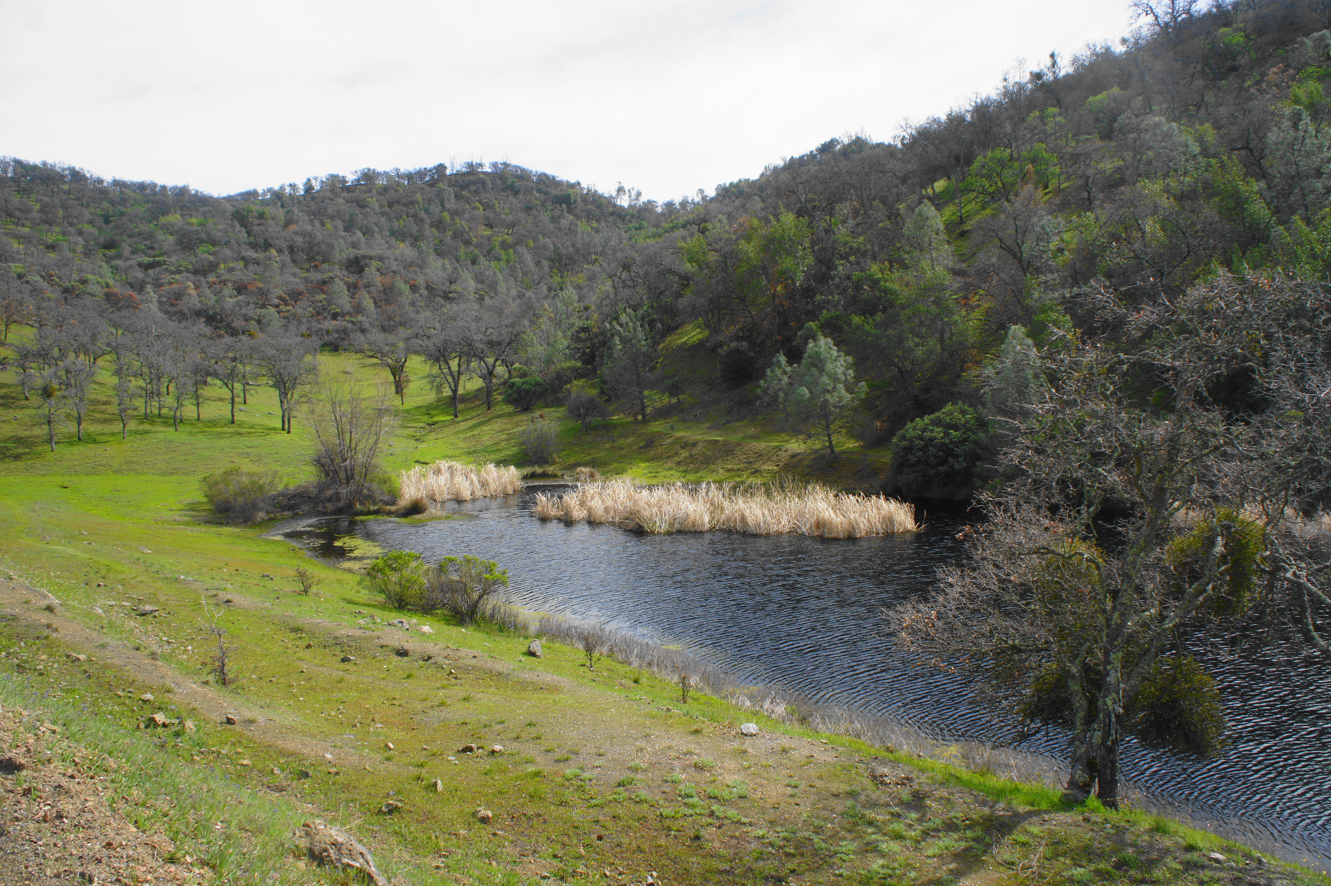
Approaching Coit Lake

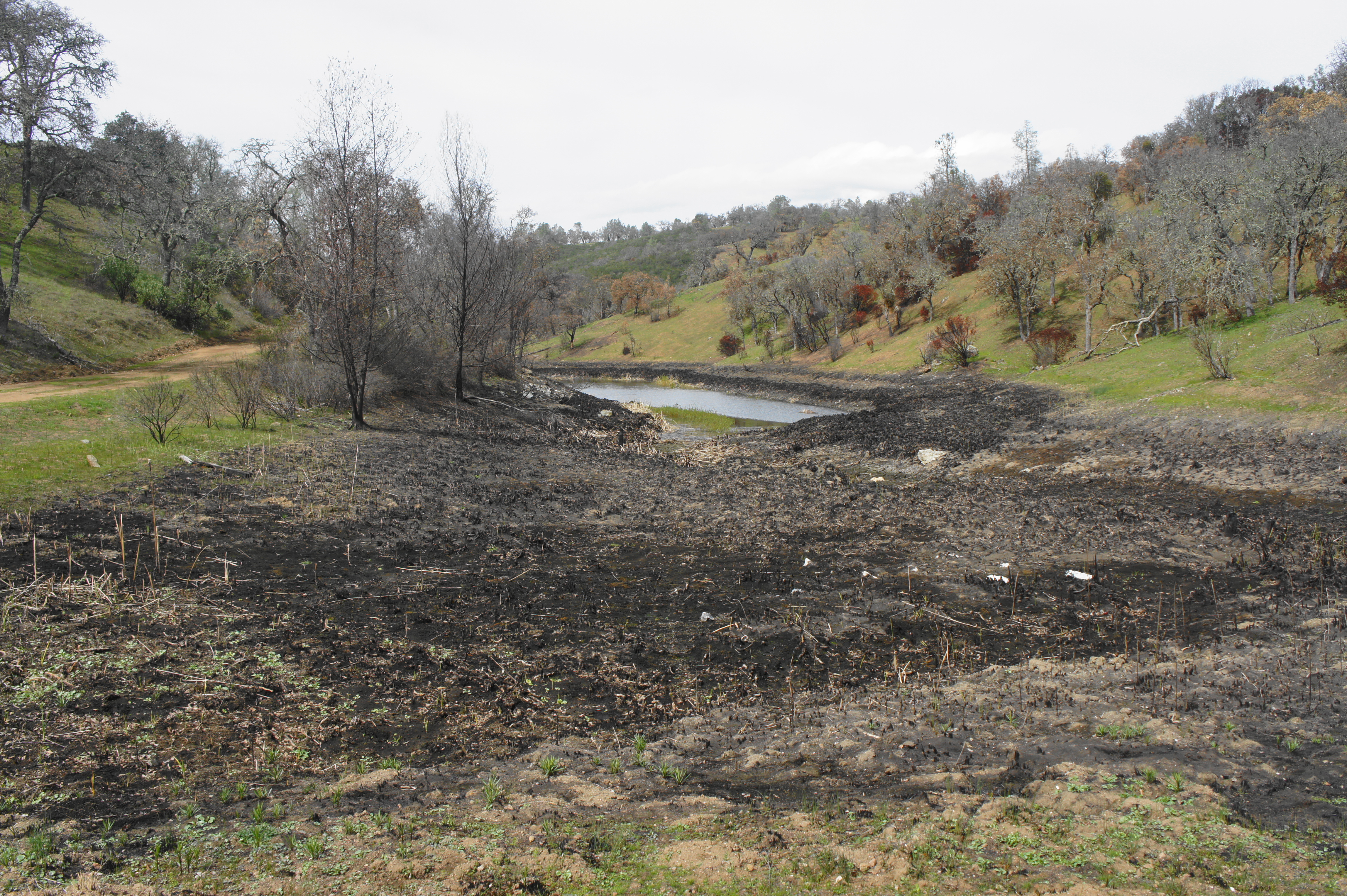
Around 7.5 miles from the start, hikers get their first glimpse of Coit Lake, the second reservoir encountered on the hike. A marked spur trail leads to another restroom, a picnic table, and the banks of the lake, which—unlike Kelly Lake—was caught in the crossfire of the SCU burn. As a result of the fire, the lake is lined with unattractive black scars—the remnants of an extensive system of reeds that fell victim to the flames. Nonetheless, the lake is reasonably pleasant and perhaps a decent place to stop for a break before pushing on toward Pacheco Falls.
From the turnoff to the lake, Coit Road continues eastward up a pleasant valley lined again with live oaks, passing the small Fish & Game Pond on the right. While the Henry Coe map appears to show a shortcut here (and there is a sign for it), the poorly-defined trail is not easy to find. Instead, continue along Coit Road as it winds gradually up to the top of Coit Ridge, intersecting with the Wagon Road at 8.1 miles.
Charming valley east of Coit Lake 
Fish & Game Pond
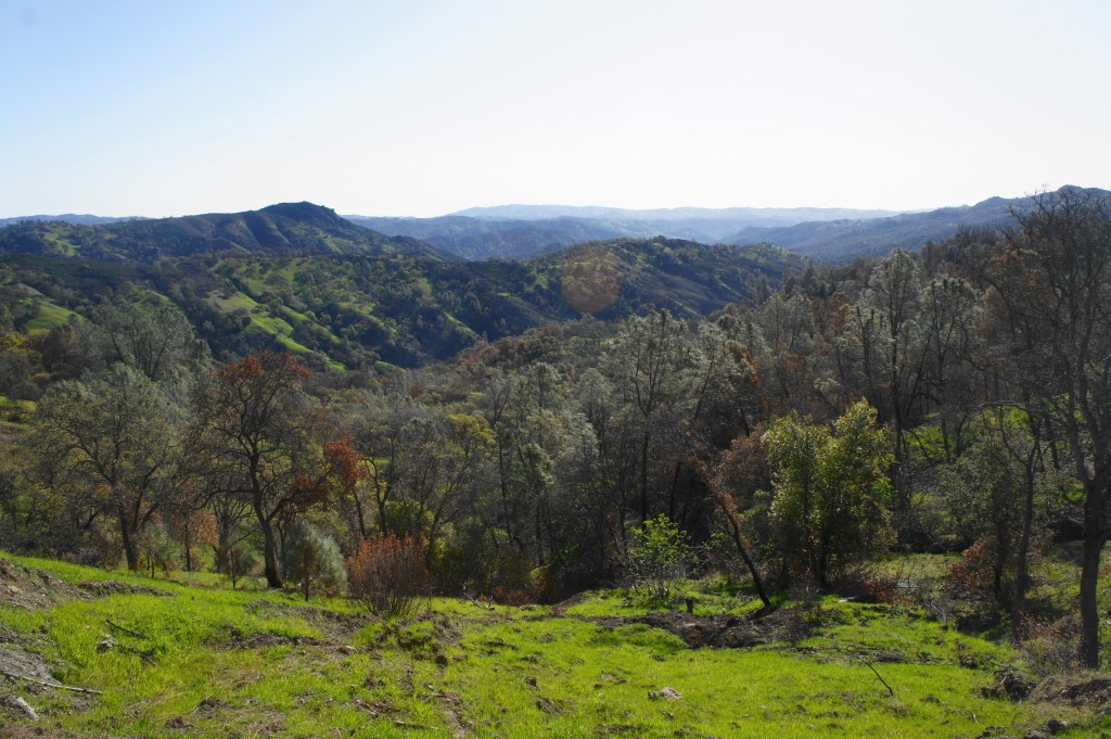
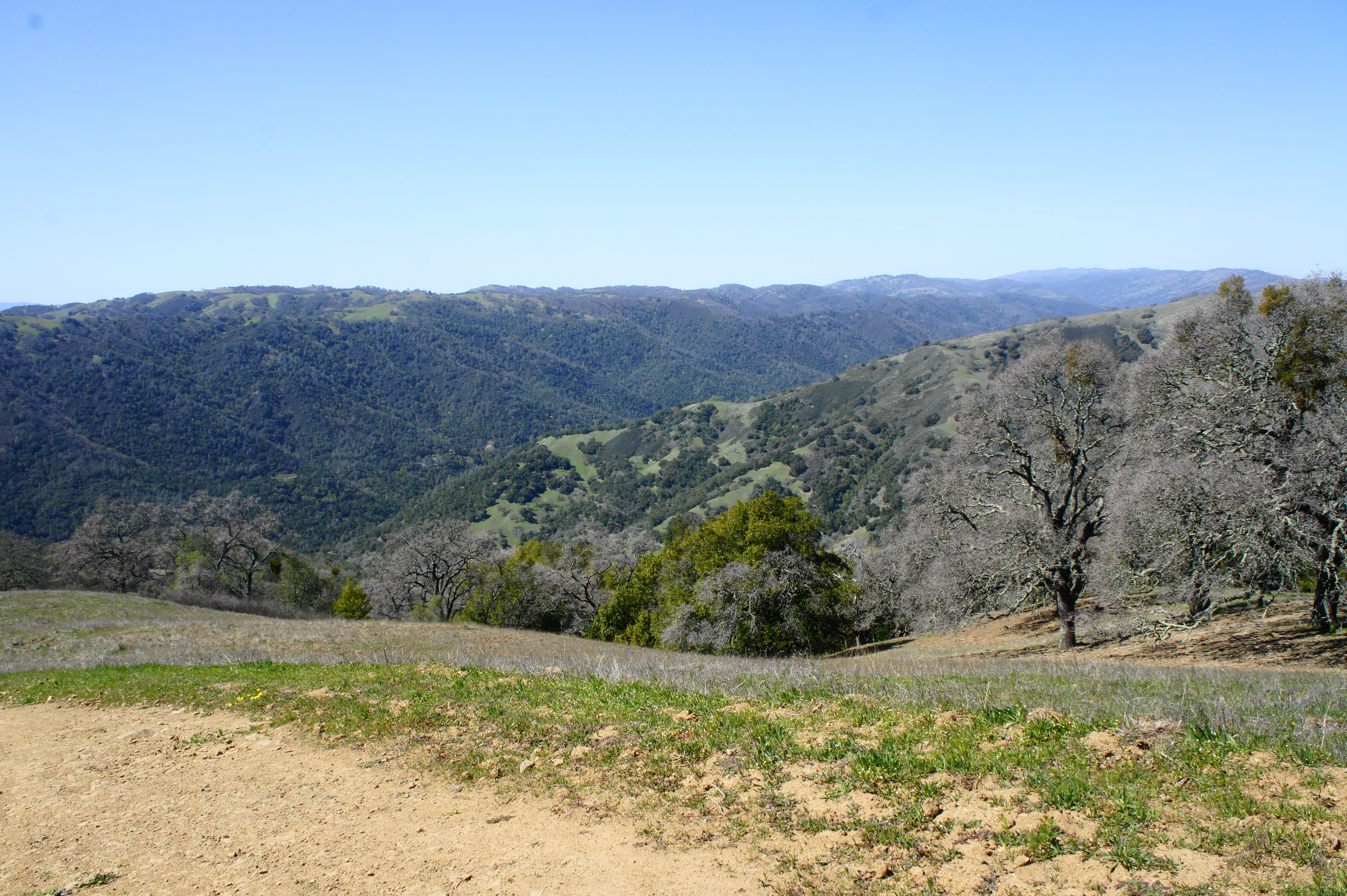
At last, hikers get their first views down into the Pacheco Creek drainage, as well as a broad vista across the Diablo Range to the east. While the hike to this point has been pleasant enough, it is at this point—looking across the vast landscape of protruding hills—that hikers will finally feel they are in the wilderness. Looking east, Pacheco Ridge and Walsh Peak (2,040’) are visible below, with the Mustang Peak (2,263’) area farther on. To the south, hikers get a good look at Burra Burra Peak (2,281’) and Rock Springs Peak (2,275’). (Note: Curiously, the high peaks on the horizon to the east and south are actually on private land outside the park, but they give the allure of endless mountains.)
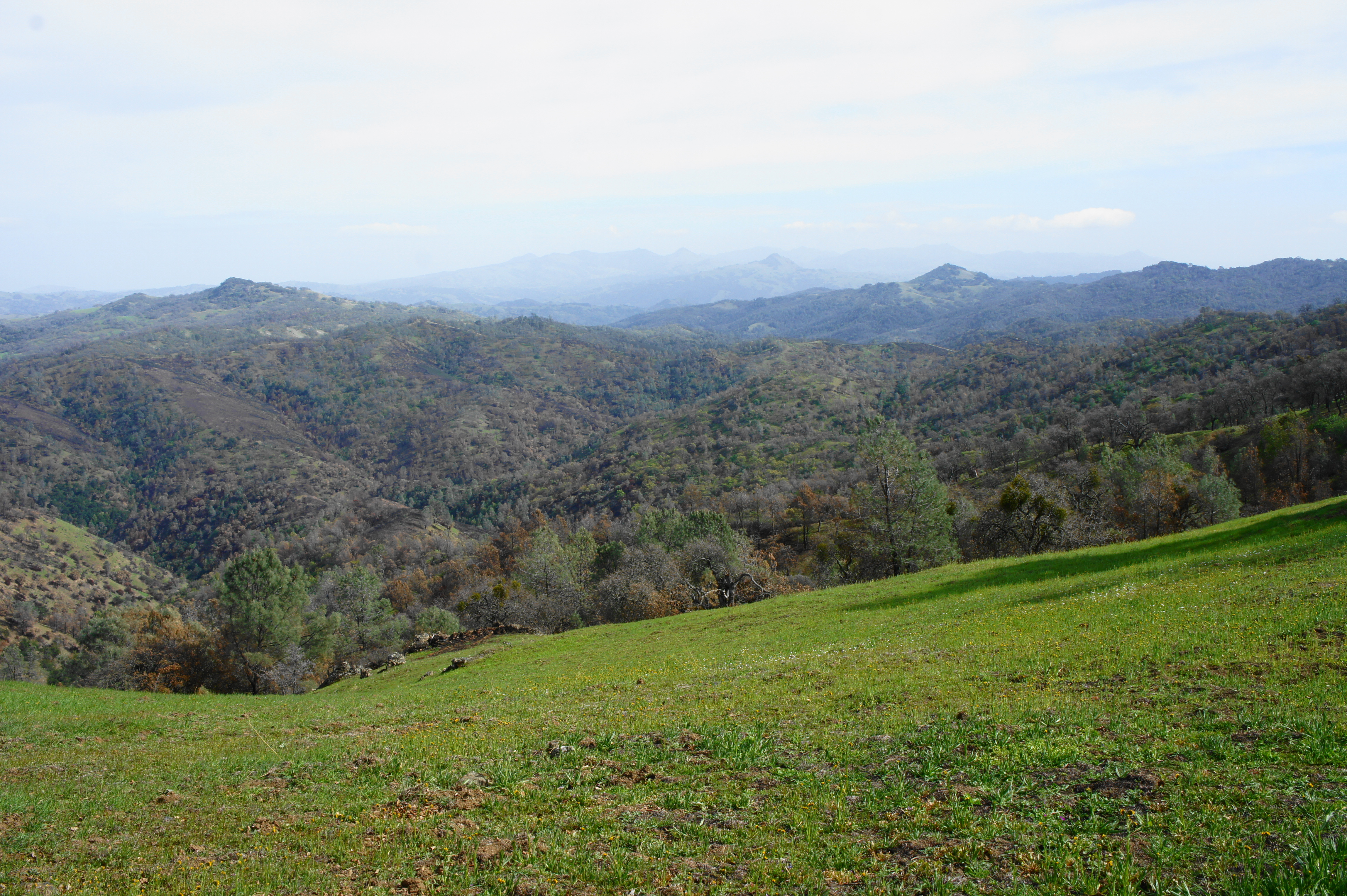
View into Pacheco Canyon and beyond 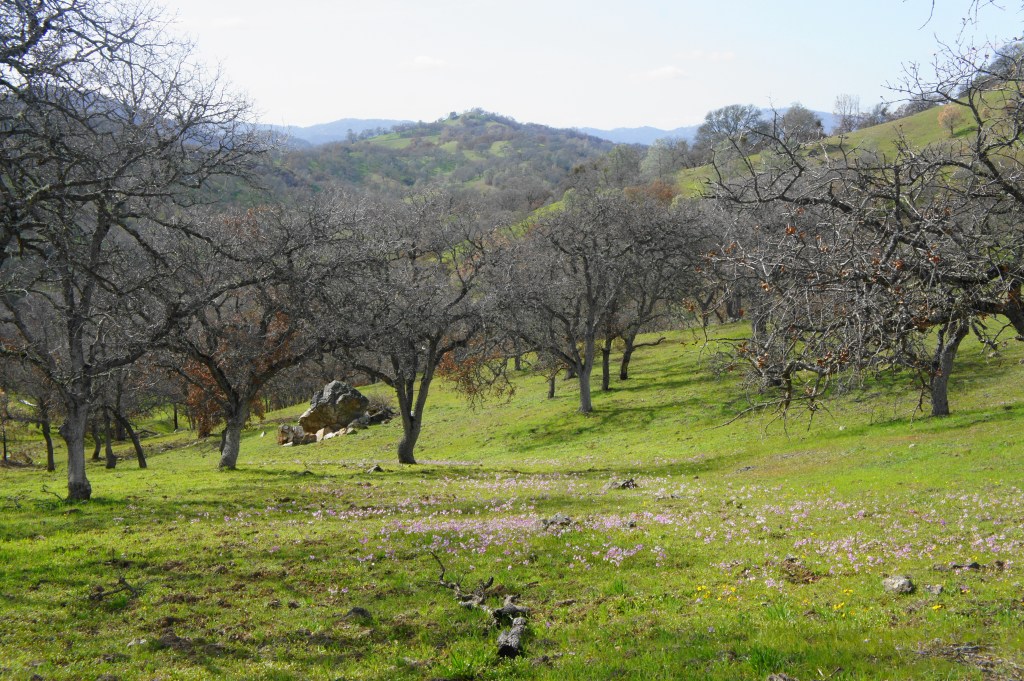
Looking back toward Coit Lake from the ridgetop
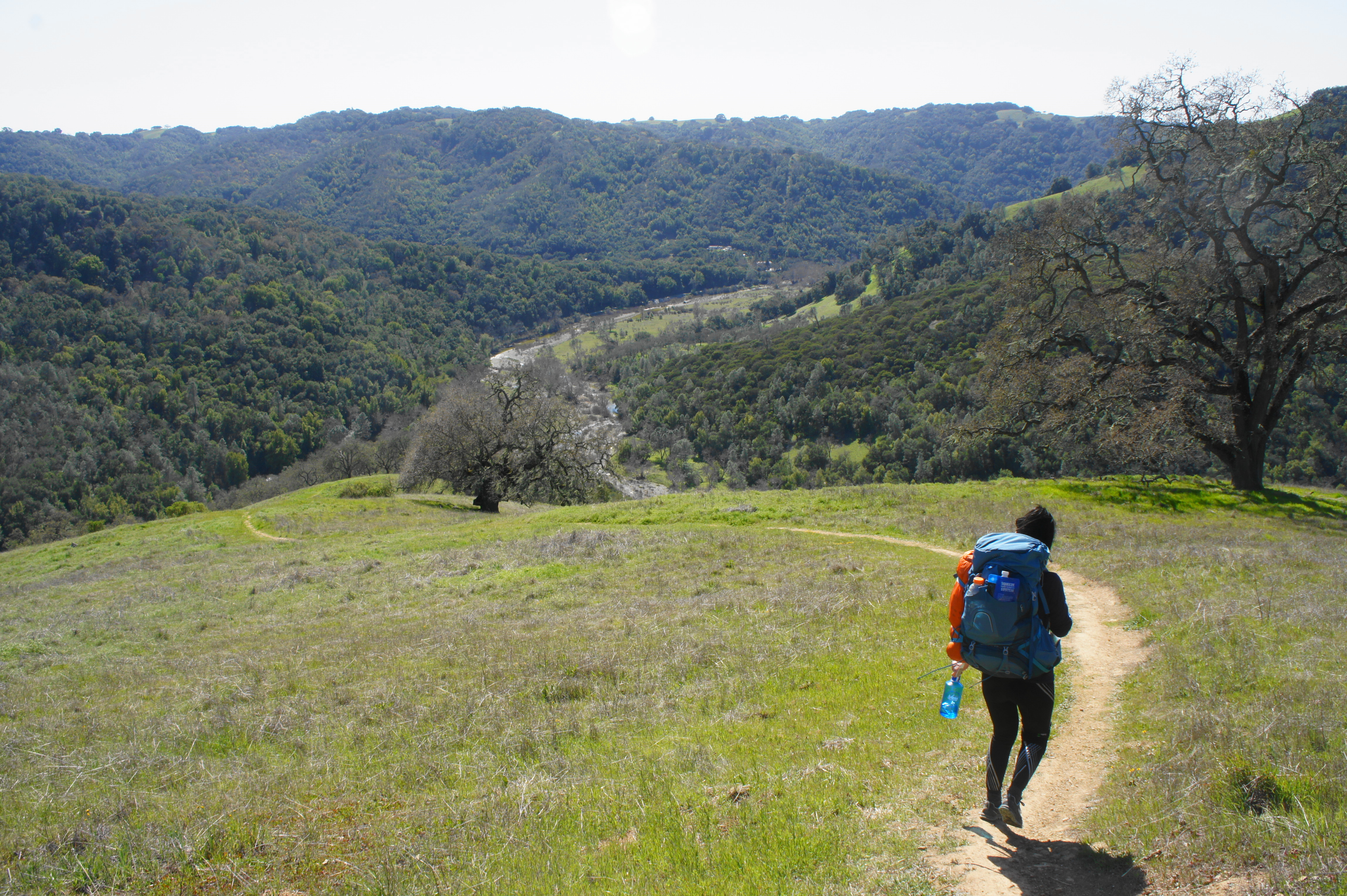
The views improve as hikers bear right on the Wagon Road and then, about 350 yards later, head left on the Live Oak Spring Trail. This wide track descends gradually, around a couple sharp curves, into Pacheco Creek Canyon, passing a spur to the left at 9.2 miles. Continue toward the falls, hiking up and down to a spur at 9.5 miles, where the Pacheco Falls Trail bears right and begins a sharp descent toward the intended destination.
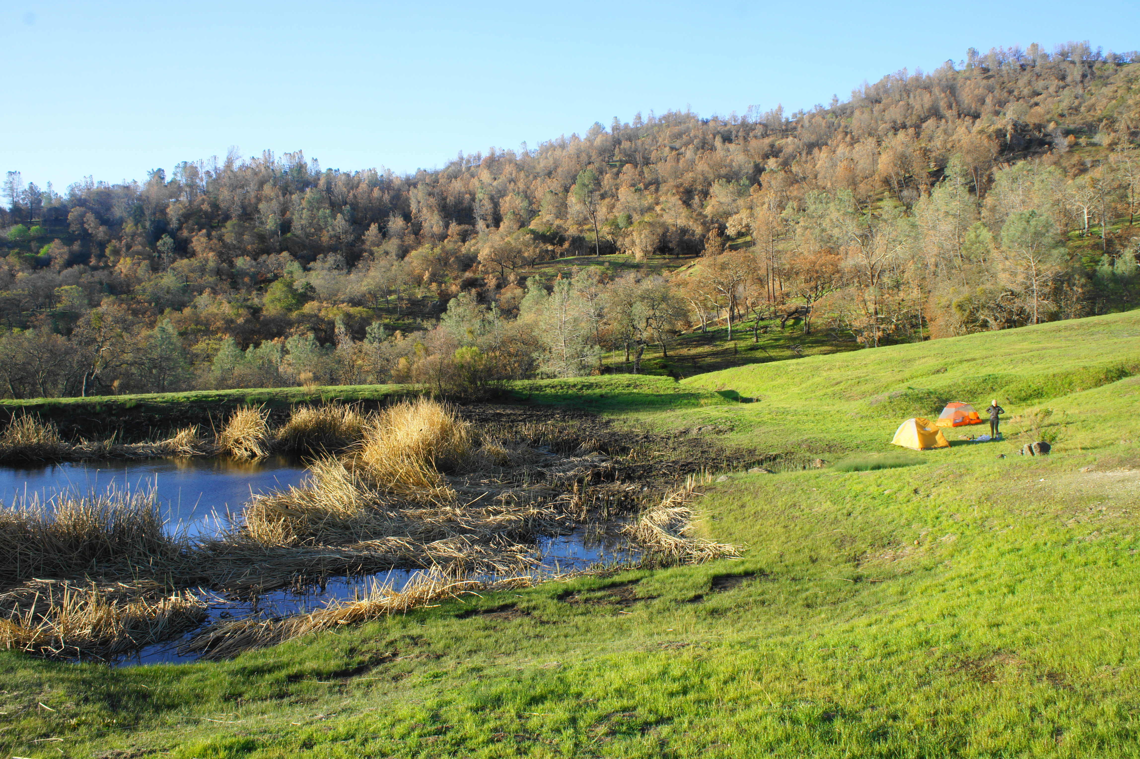
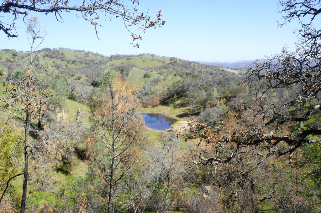
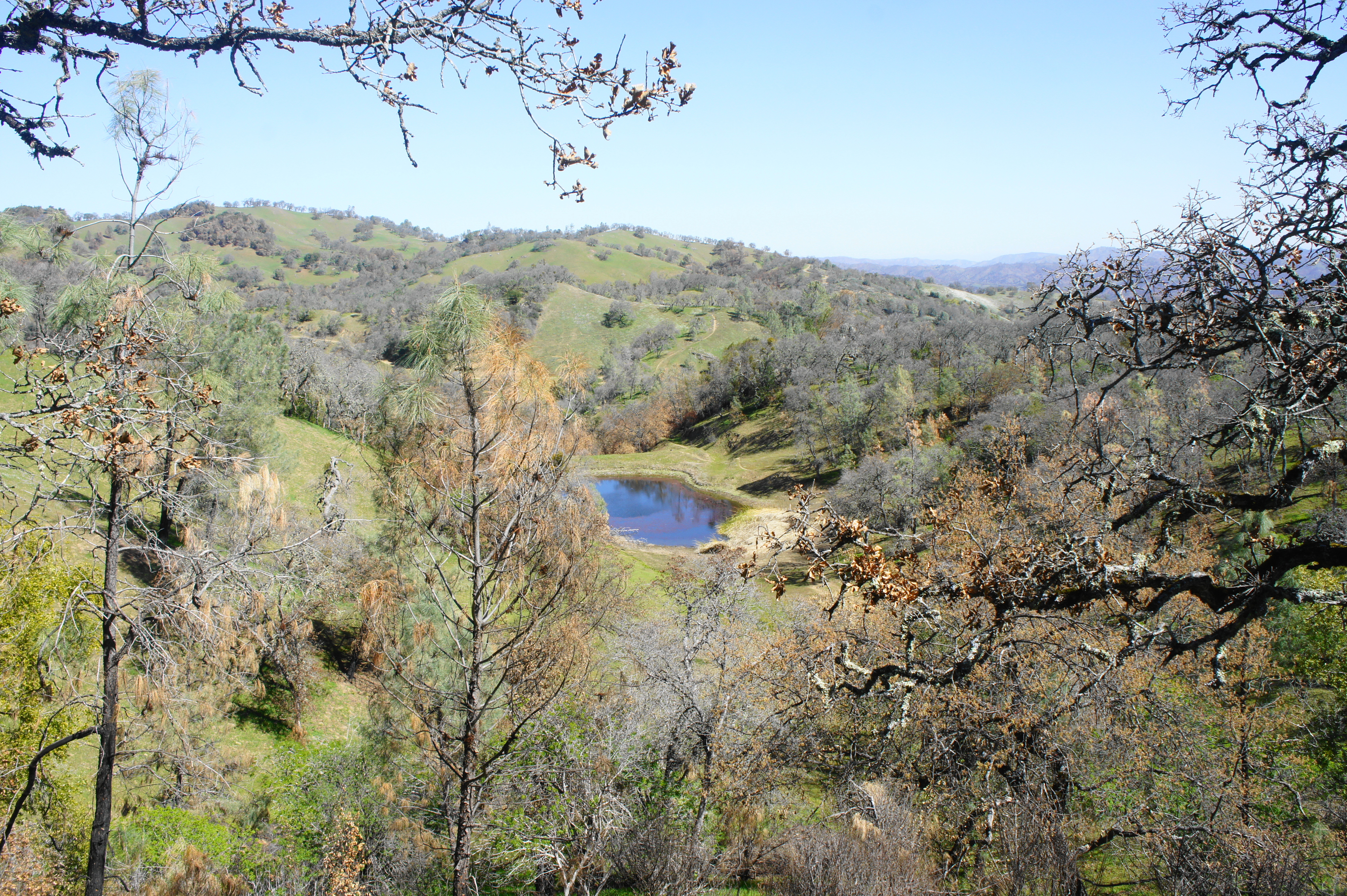
At 9.75 miles, hikers can peer down at their campsite for the night: Wood Duck Pond, a small but pleasant watering hole situated on a grassy shelf above the canyon floor. By mile 10, hikers arrive at the pond, tired and exhausted from a challenging day.

Set up camp for the night, then—if there is still some evening light—continue down the trail as it drops steadily through thick woods to the rocky notch harboring Pacheco Falls, 10.4 miles from the trailhead (otherwise, visit in the morning). This seasonal waterfall drops through a narrow rock cleft, ending in a magnificent pool lined with vegetation (including some poison oak).
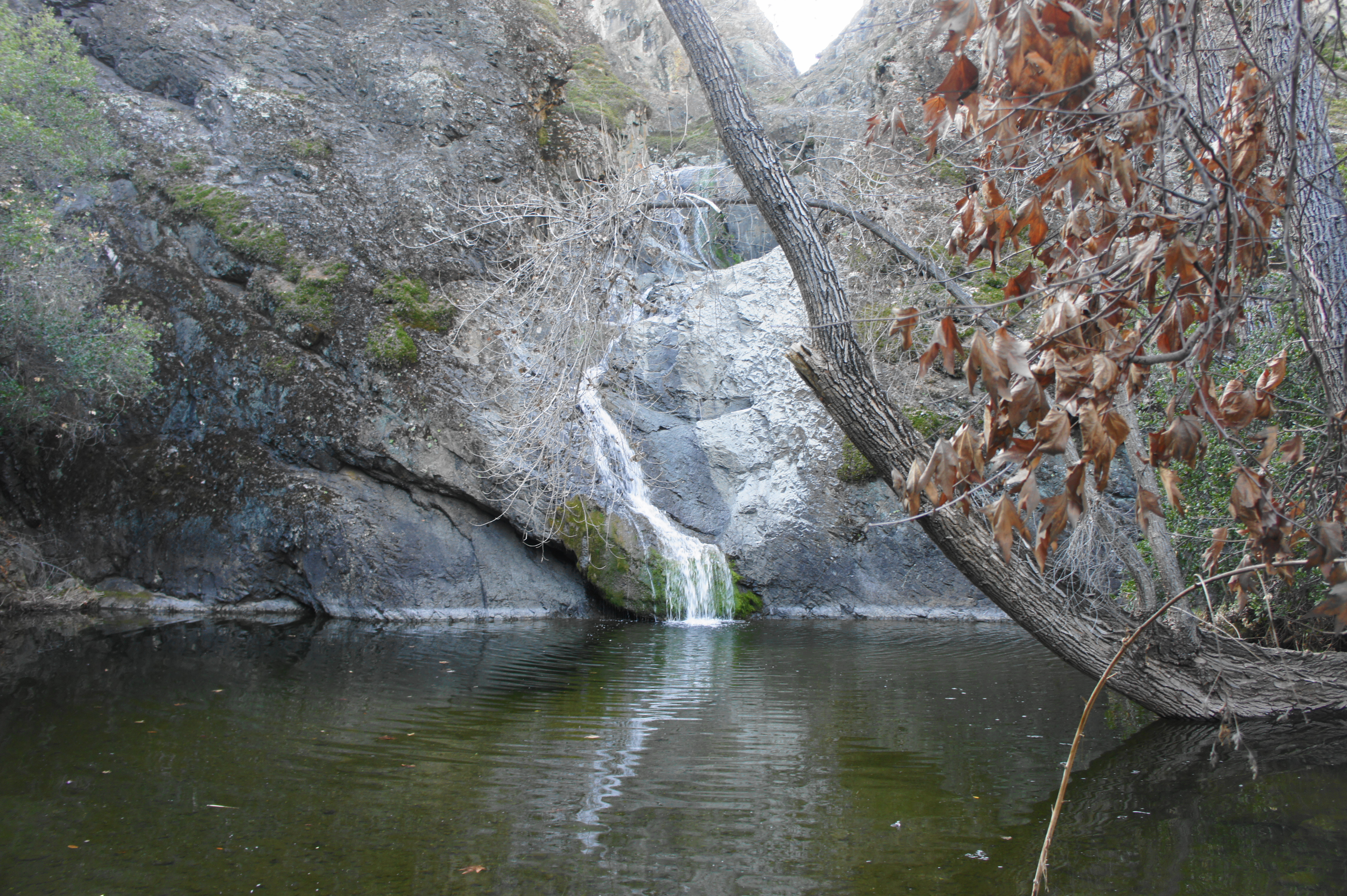
The flow is obviously best in spring after heavy rains, although the pool and shady drainage—even sans falls—are likely to be pleasant enough in summer as well. Campers can get fresh water (to filter) at Pacheco Creek before heading back uphill to Wood Duck Pond for the night.
DAY 2: Pacheco Falls to Hunting Hollow via Wagon Road and Steer Ridge (9.4 miles)
At 9.4 miles, the second day’s walk is shorter but no less challenging than the day prior, including a climb back to Coit Ridge, descent to Grizzly Gulch and Tule Pond, and difficult traverse of Steer Ridge before returning to Hunting Hollow. Once ready, make your way back up the Pacheco Falls Trail, then retrace your steps back along the wide Live Oak Spring track to the Wagon Road atop Coit Ridge (1.7 miles). This time, bear left, traversing new ground as the wide road bears southward and sports excellent views much of the way.
Looking down Pacheco Creek drainage in the morning 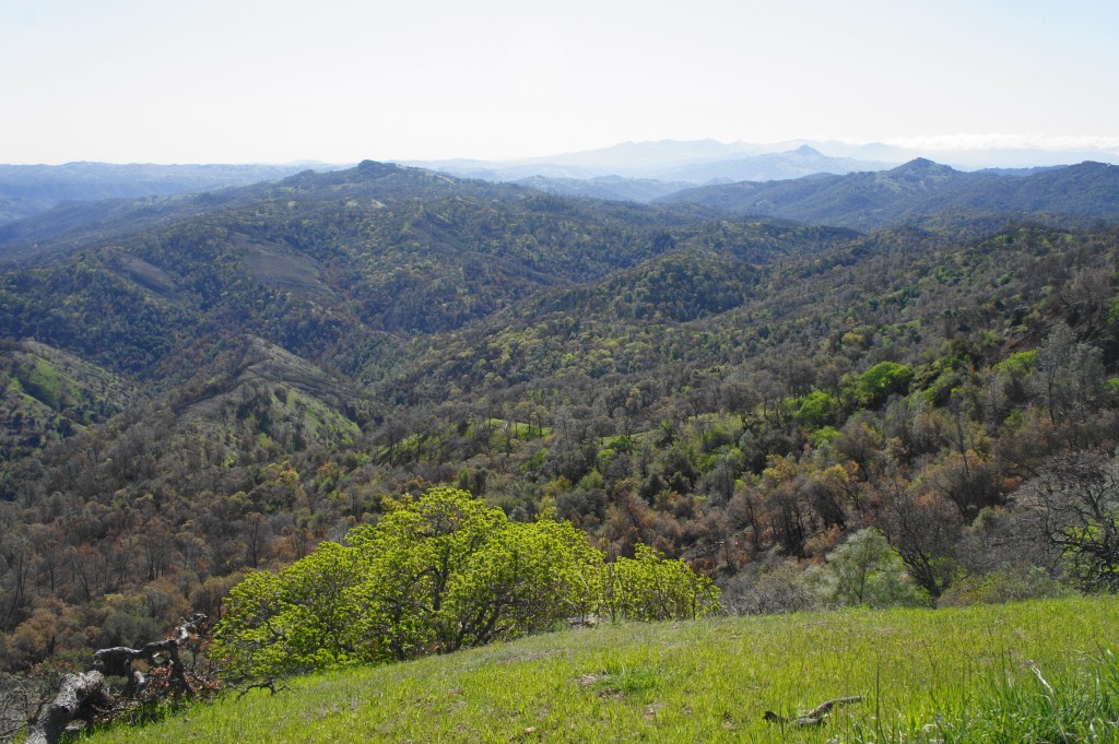
Burra Burra Peak and beyond

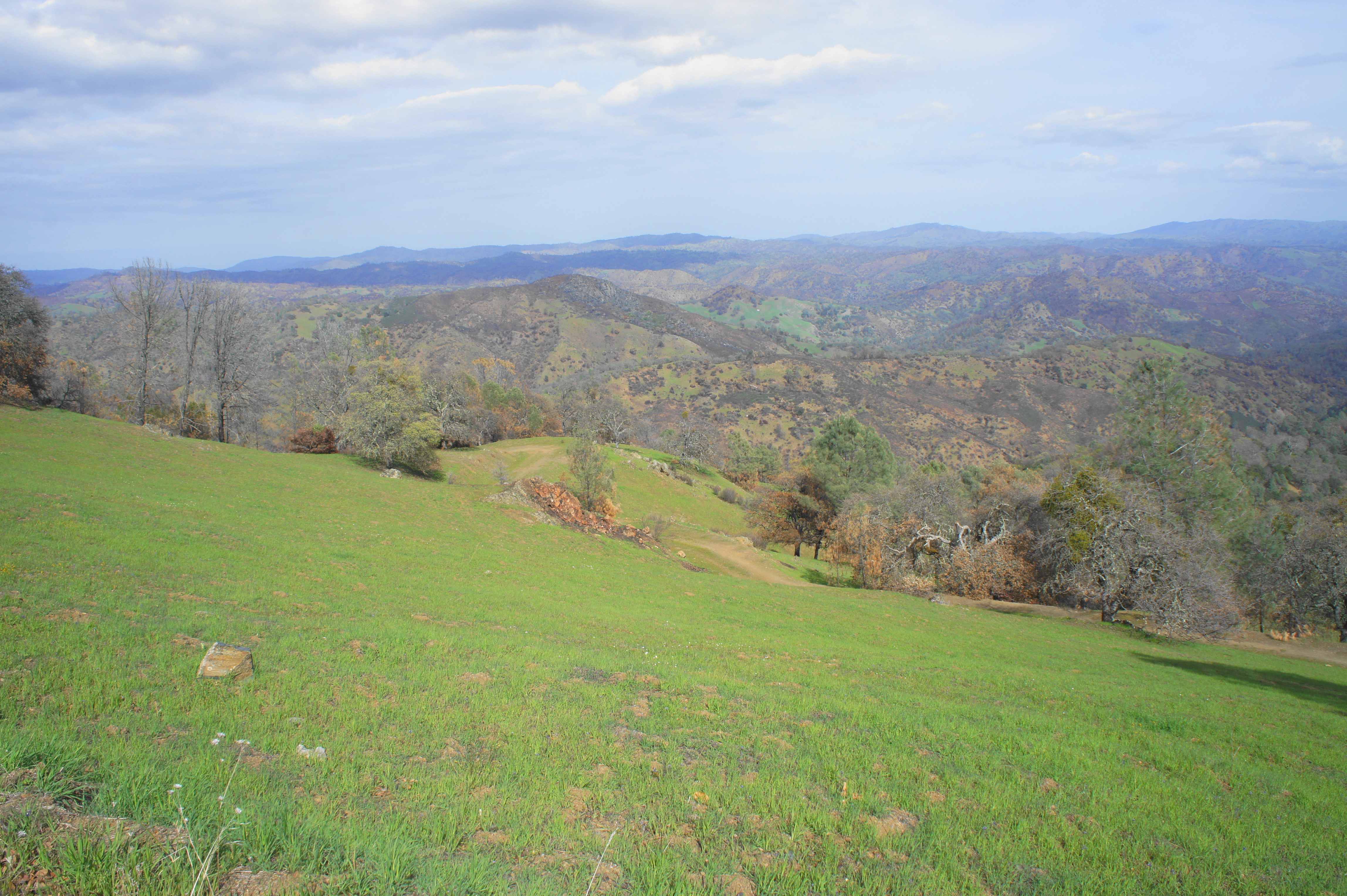
As Wasno Road winds to the south, it bounces back and forth between eastward and westward vistas. While the terrain to the west is largely wooded (and much of it burned), the expansive views to the east are some of the best of the hike. The two peaks in the foreground are Burra Burra and Rock Springs Peaks. Beyond the park boundary and slightly to the south, a taller range of 3,000-foot peaks dominates the skyline, including Cathedral Peak (3,480’) and Mariposa Peak (3,448’). The Diablo Range continues southward for dozens more miles, extending into southern California.
Stay straight at the next two trail junctions—with the Crest Trail (2.3 miles) and Rattlesnake Trail (2.5 miles)—then follow the Wagon Road as it descends gradually along an east-facing slope, reaching a prominent intersection with the Center Flats Road at 2.8 miles. Stay right, continuing southwest along a mild section with some limited westward views into the Kelly Creek drainage. At 3.8 miles, after a short uphill, the road forks again and a pit toilet offers hikers a bathroom stop.

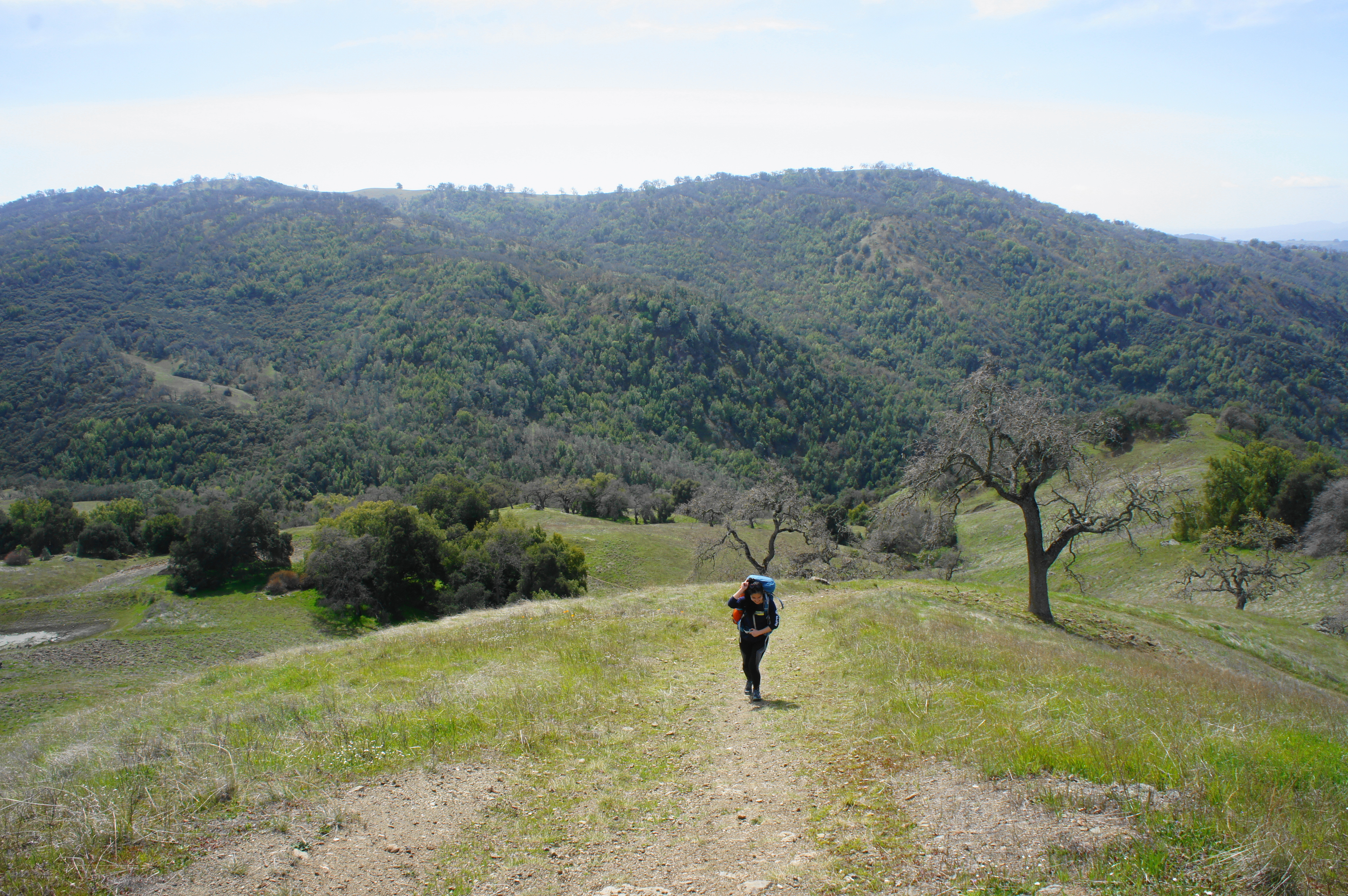
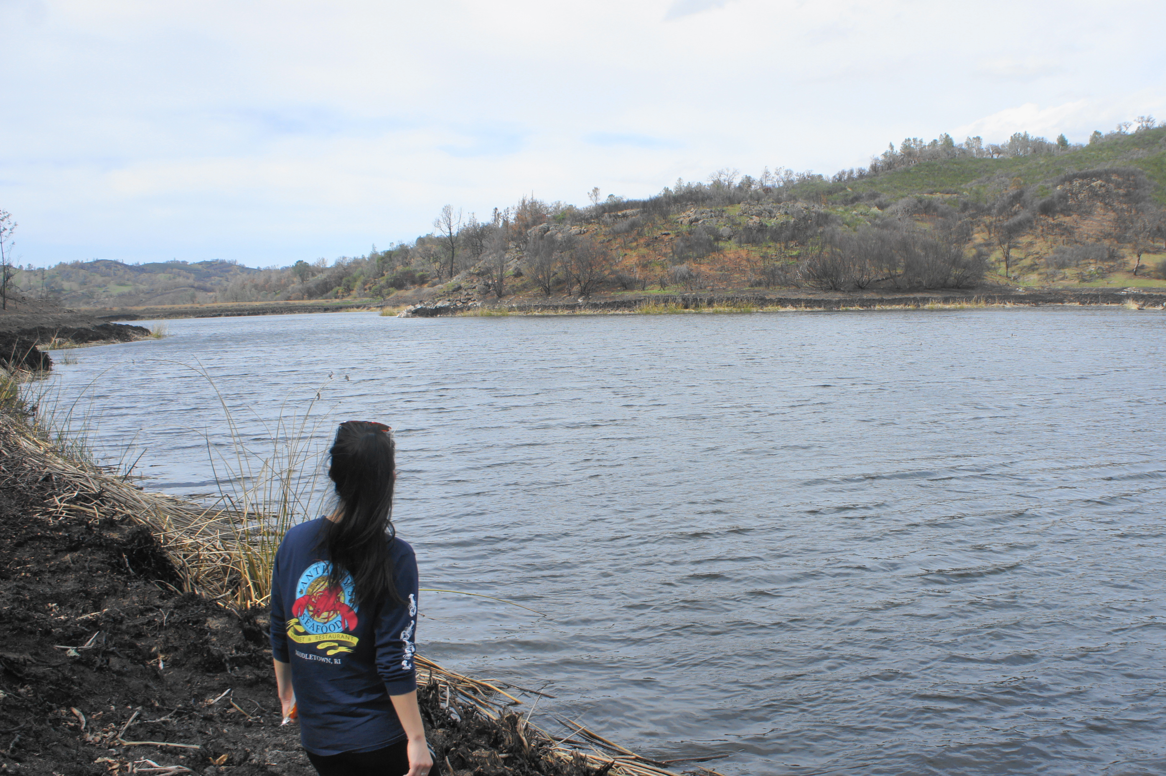
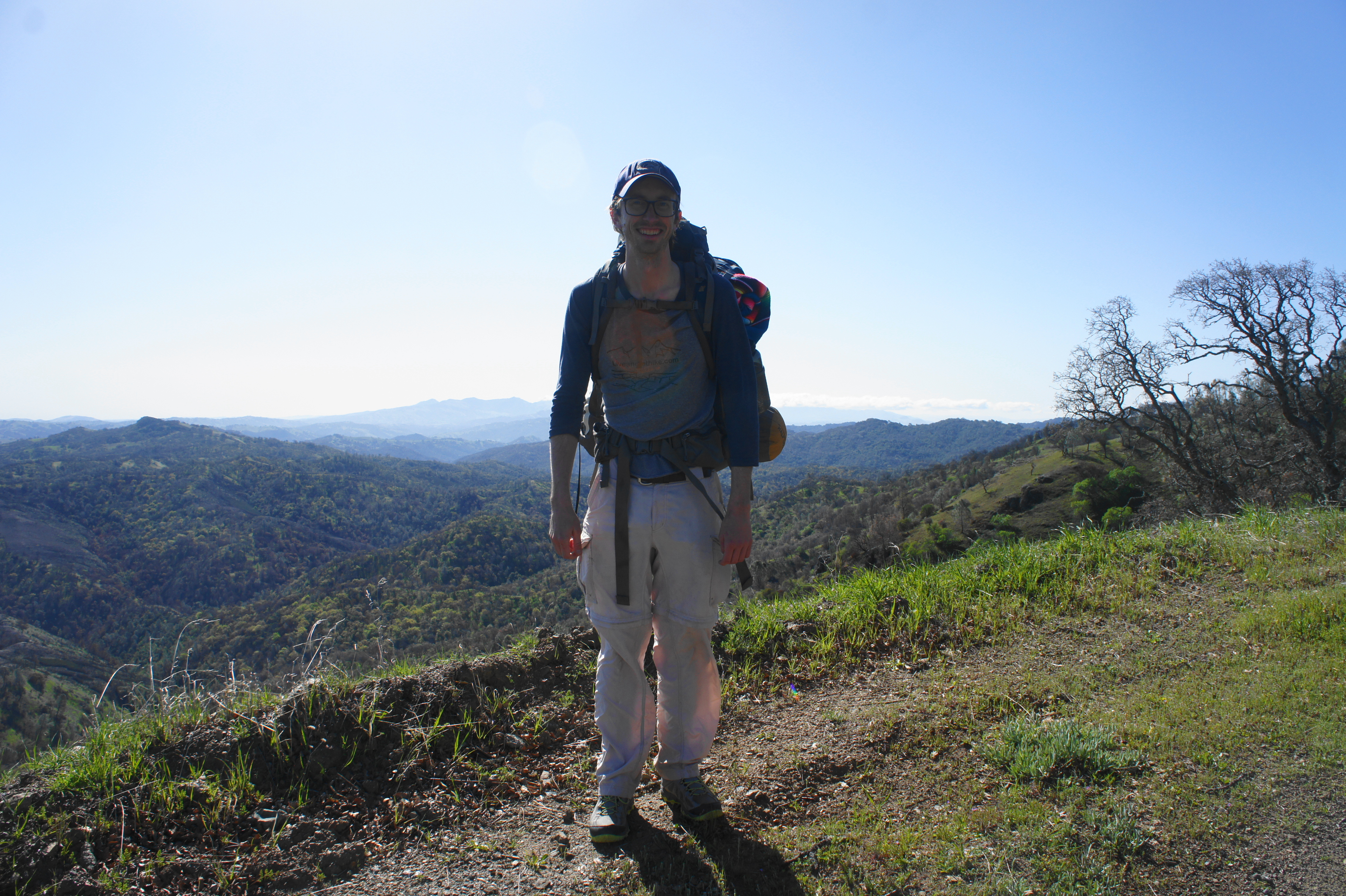
The author on the trail 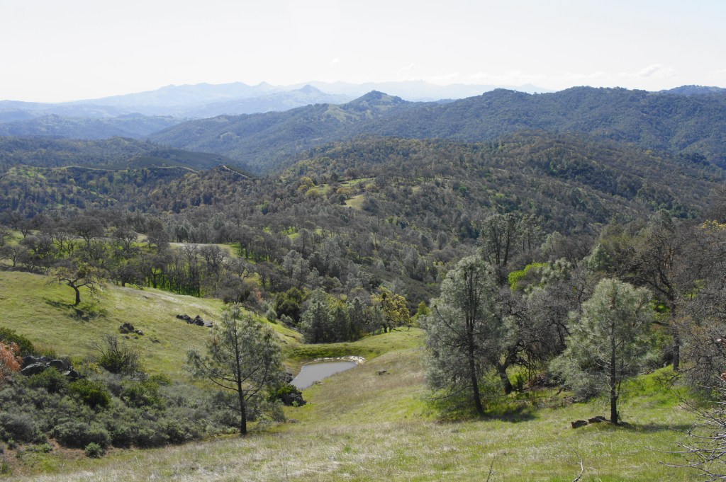
View southest toward Hurricane Pond and Rock Springs Peak

Bear right on Wasno Road, looking back to the north at Wasno Pond down in the gully below. From here the road climbs steadily to clear the ridgeline; at 4.4 miles, bear left on the Tule Pond Trail, a pleasant single-track that hugs a grassy, descending slope for 7/10 mile, ending at a crossing of Grizzly Creek (likely to be little more than a trickle here) and a junction with the Grizzly Gulch Road.
Wasno Pond from afar 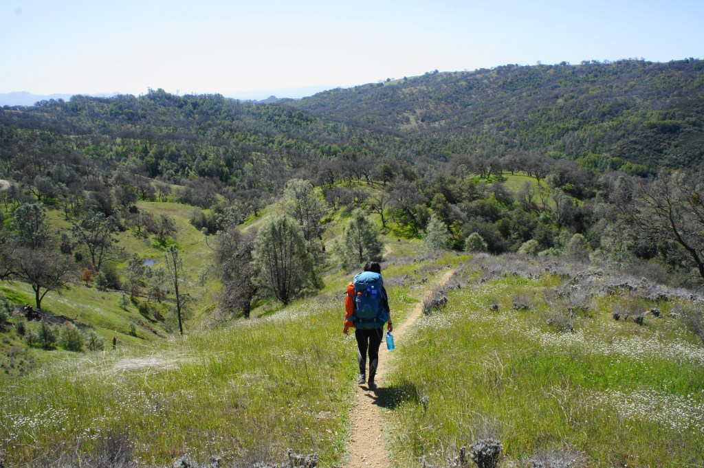
Descending Tule Pond Trail into Grizzly Gulch

Hang a right at the junction, then pass Tule Pond on your left. This small and austere pond is teeming with small turtles and other critters and makes for a nice lunch stop before the final push up and over Steer Ridge.
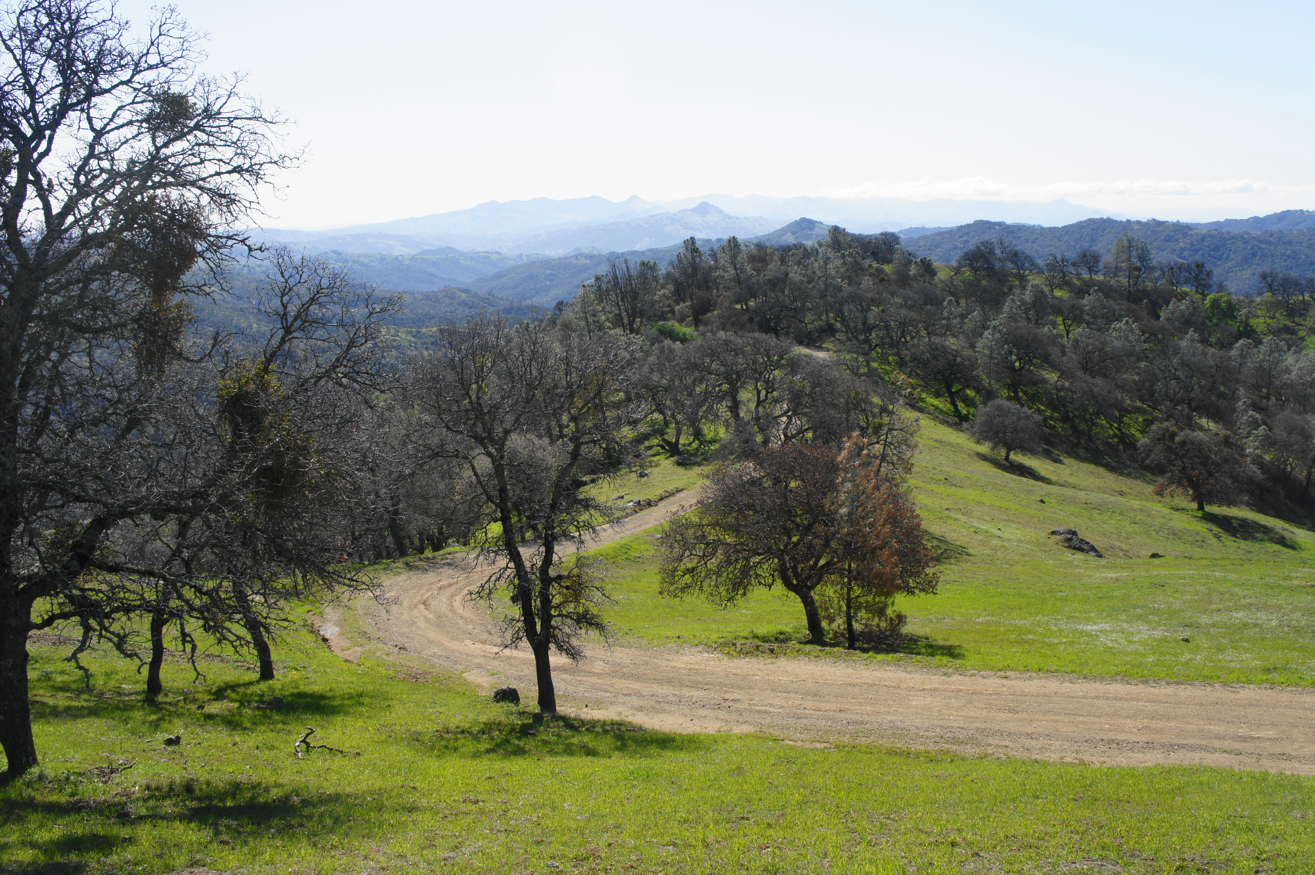
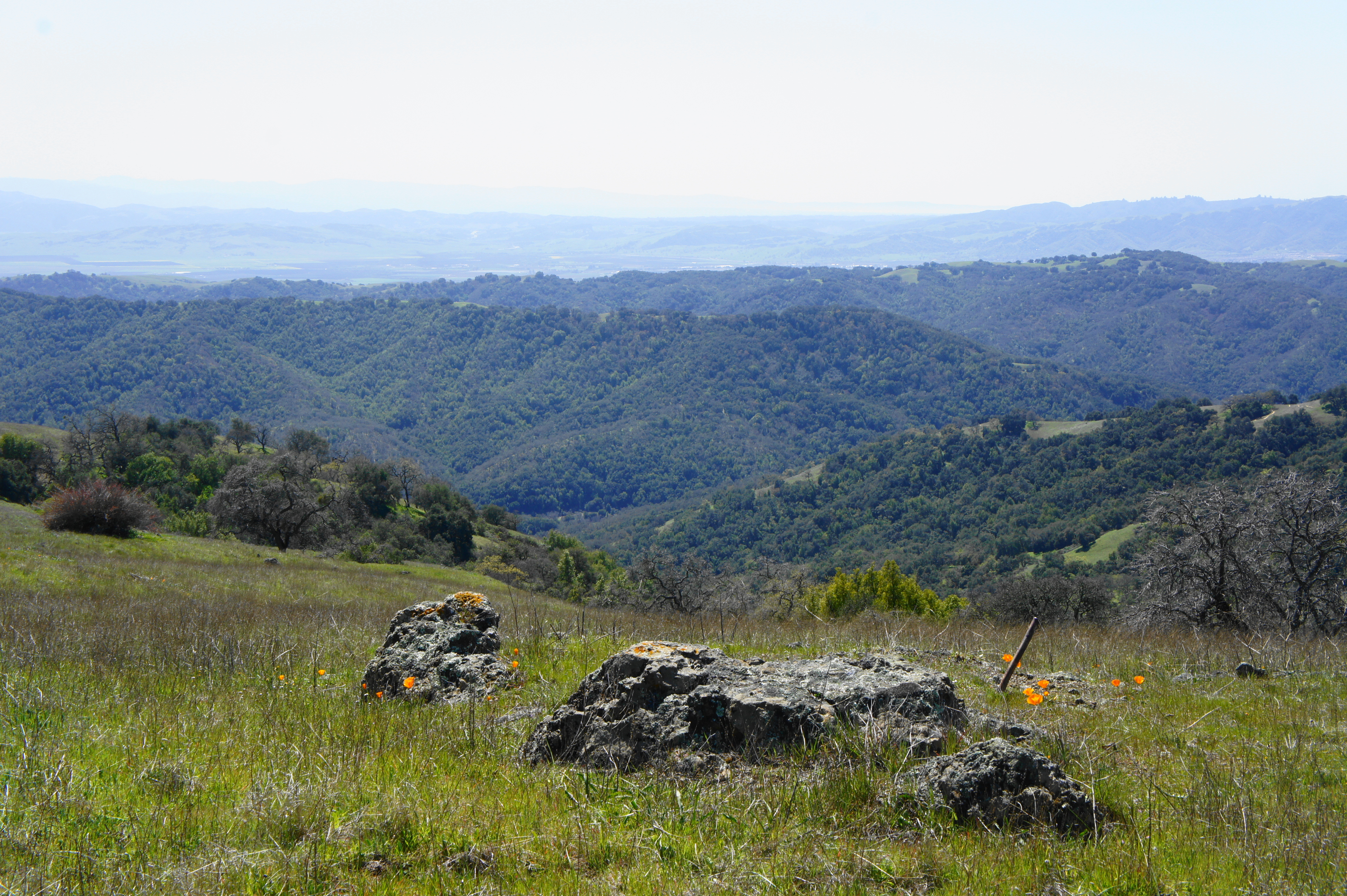
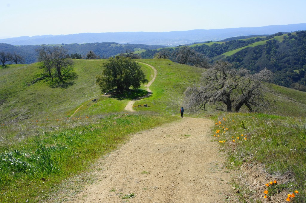
Beyond the pond, follow the road to the junction with the Serpentine Trail. This winding path climbs 600 feet in 9/10 miles, a tough ascent that is the last significant climb of the hike. Transitioning from the shielded valley to the exposed and windswept hilltops, the Serpentine Trail ends atop Steep Ridge at 6.3 miles; bear right on Steer Ridge Road, enjoying excellent views south and west down to Hunting Hollow and Osos Ridge, with the vast Santa Clara Valley beyond. (Note: Across the valley are the Santa Cruz Mountains and the Pacific Ocean.)

Serpentine Trail 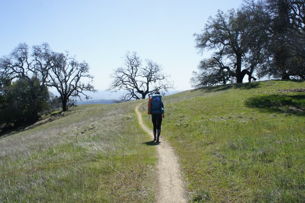
Climbing Steer Ridge on the Serpentine Trail

With Grizzly Gulch to your right and Hunting Hollow down to your left, bear westward on Steer Ridge Ridge as it ascends and descends gravelly slopes. There are a number of ways from here to return to the trailhead, but the shortest is to stay straight on the road until it turns to a narrow, steep track (Steer Ridge Trail) at 8.0 miles. This means ignoring the spurs to Willson Peak, Middle Steer Ridge, Spike Jones Trail, and Jim Donnelly Trail in turn.

Steer Ridge Road 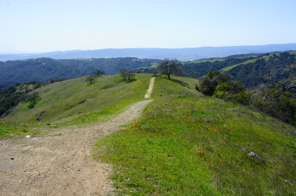
Steer Ridge Road as it descends to Hunting Hollow

As the trail descends sharply down the western flank of Steer Ridge, hikers get their first views north up Coyote Creek to Pine Ridge, where a close eye can pick out the barn at Coe Ranch, the main park headquarters and most popular trailhead in Henry Coe. (Note: See here and here for trails in this area.)
Winding descent 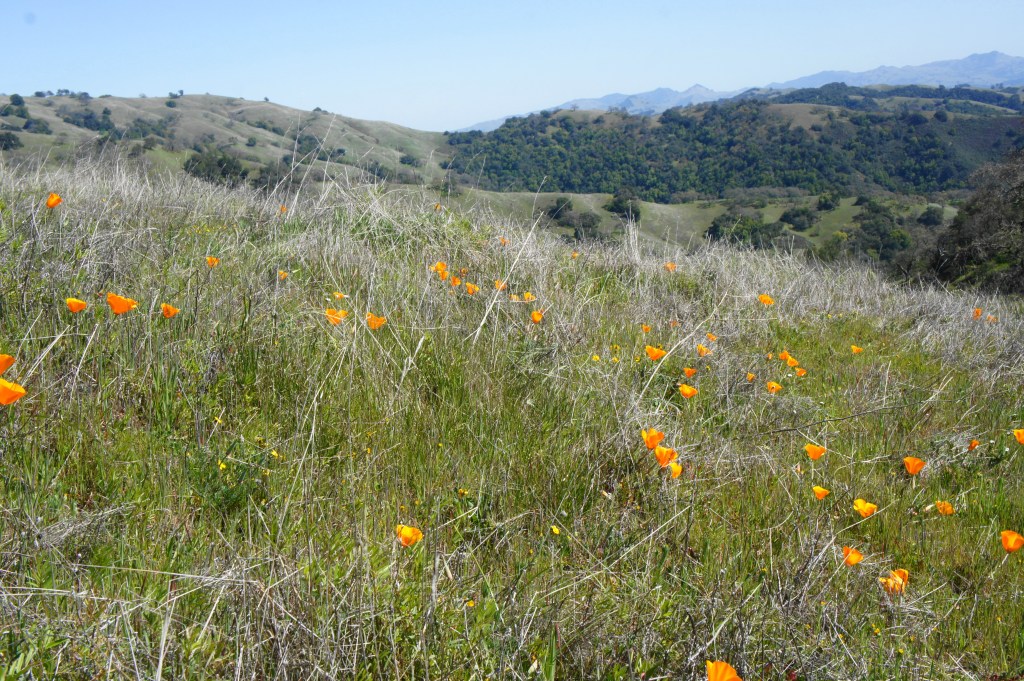
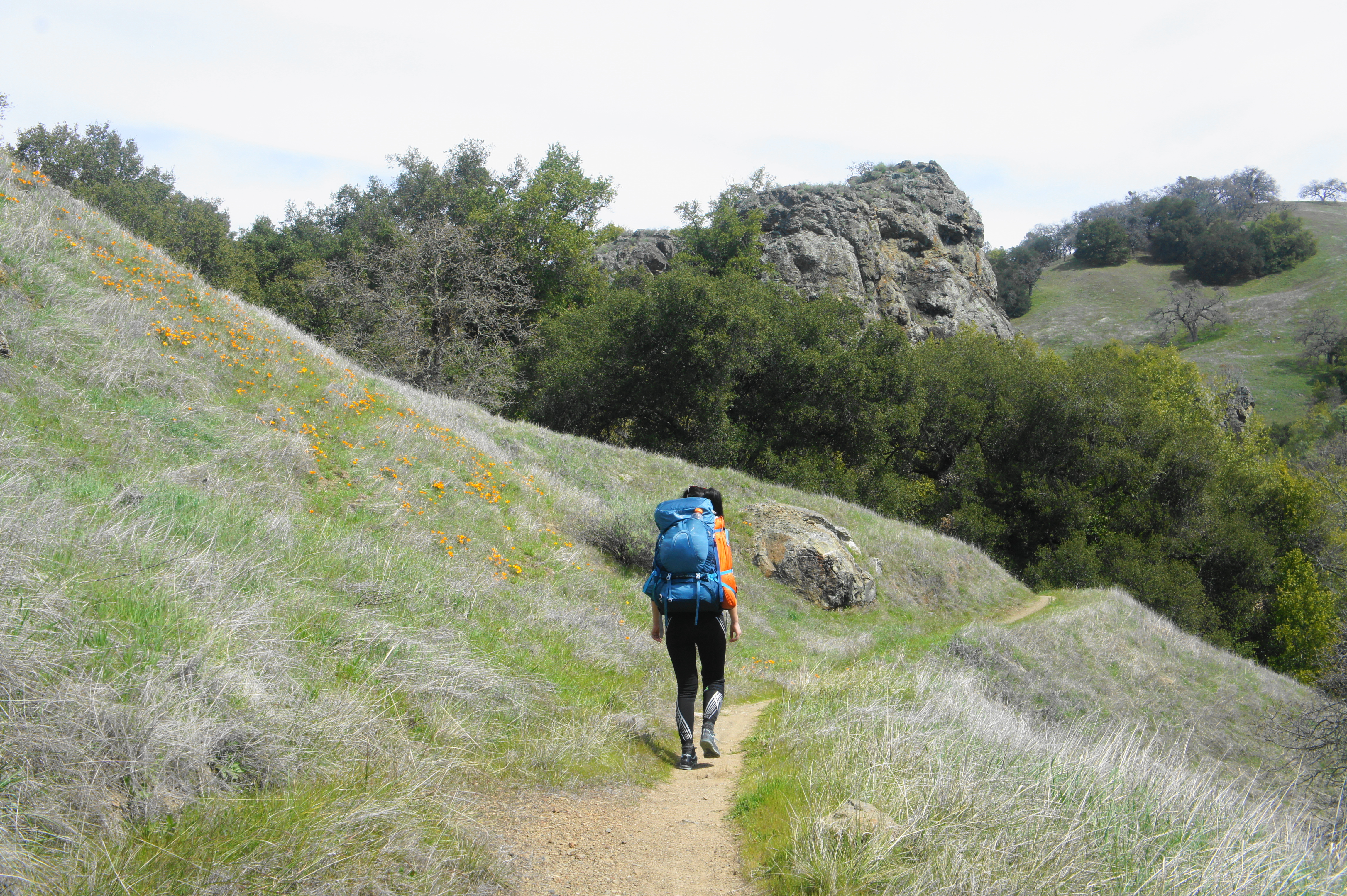
California poppies


The last 1.4 miles of the hike entail a brutal descent, shedding 1,300 feet in elevation with no real bends or switchbacks to speak of. (Note: If steep inclines are bad on your knees, consider taking the longer but more gradual Jim Donnelly Trail.) The declivity is crushing, but the determination of reaching the end helps propel hikers back to Hunting Hollow.
Steer Ridge Trail 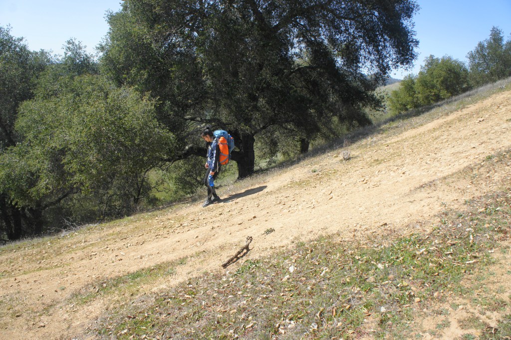
Brutal descent


Just before the parking area, cross Hunting Hollow Creek, then climb for 30-40 yards to return to the trailhead. All in all, the 20-mile round-trip to Pacheco Falls is certainly one of the more challenging overnight options in Henry Coe State Park (comparable perhaps to the out-and-back to Mississippi Lake). Particular in spring, however, the strenuous hike is worth the effort, allowing for exploration of a remote and relatively little-used section of the Diablo Range.

So nice!
Pacheco Falls, Wood Duck Pond and Kelly Lake look all very pretty and serene!
Pingback: Top 10 Hikes in 2021 | Live and Let Hike
Excellent writeup- two notes: “Day 2- Hang a right at the junction, then pass Tule Pond on your left.” is wrong. Should be “turn Left at the junction” (your cue sheet says left, but not the writeup, which we followed last weekend).
Also recommend making the Jim Donnelly trail the default return option- its very pretty- and much more pleasant.