

At 87,000 acres, Henry Coe State Park is the second largest state park in California and offers a beautiful landscape of rolling hills and woody ridges in the Diablo Range southeast of the Bay Area. Lacking any towering peaks, Henry Coe is nonetheless extremely rugged, with nearly every hike in the park entailing considerable elevation gain and loss. A fine introduction to the park’s oft-travelled “Western Zone,” the hike described below traverses Middle Ridge and Pine Ridge and dips to the Coyote Creek drainage, forming a roughly 10-mile loop. There are many options for longer or shorter variants – but this circuit tends to prioritize single-track trails where possible and opts for a more scenic alternative (the climb to Manzanita Point) over the relatively dull Poverty Flat Road. (Note: Springtime is the best time to hike in Henry Coe, when the temperatures are mild, wildflowers are in bloom, hillsides are verdant, and streams are flowing.)

The hike
Examining a map of California’s Henry Coe State Park, as it appears at first glance to show a network of roads crisscrossing the vast landscape. These are indeed roads, but they are rugged fire tracks inaccessible by car. The constellation of dirt fire roads combines with the park’s many single-tracks to form a complex web of hiking trails. Access to the park is limited to three entrances/parking area: Coe Ranch, Hunting Hollow, and Dowdy. Coe Ranch Headquarters is by far the most popular and includes a quaint visitor center, small store, and decent campground.
The drive to Coe Ranch is itself an adventure, rising more than 2,000 feet from the town of Morgan Hill in Santa Clara Valley. (Note: Take Exit 366 from Highway 101.) Thus the trailhead is already at around 2,600 feet, with expansive views across part of the Diablo Range from the start. Park in one of the many small lots around the Visitor Center.
Coe Ranch Headquarters to Middle Ridge Trail (2.5 miles)
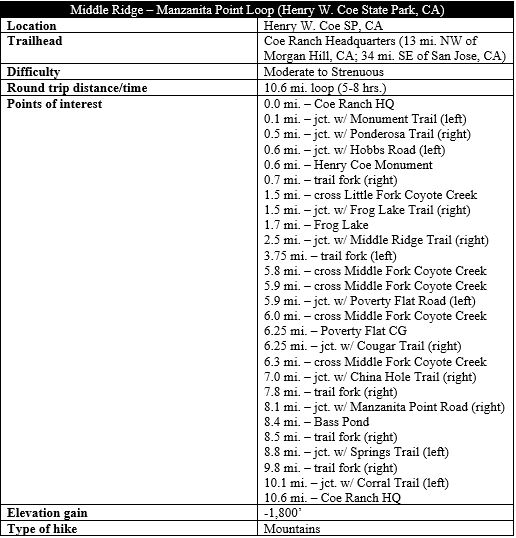
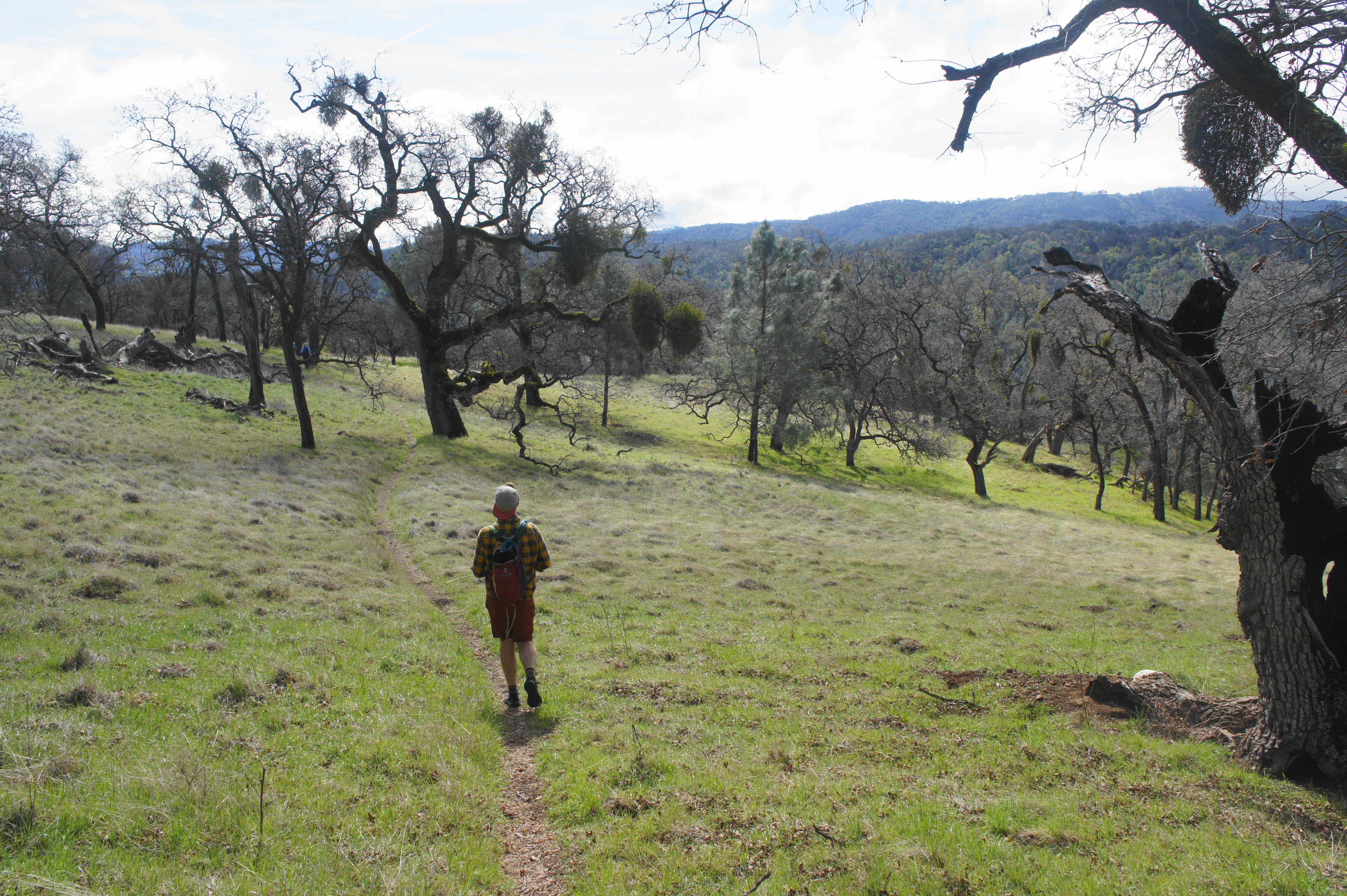
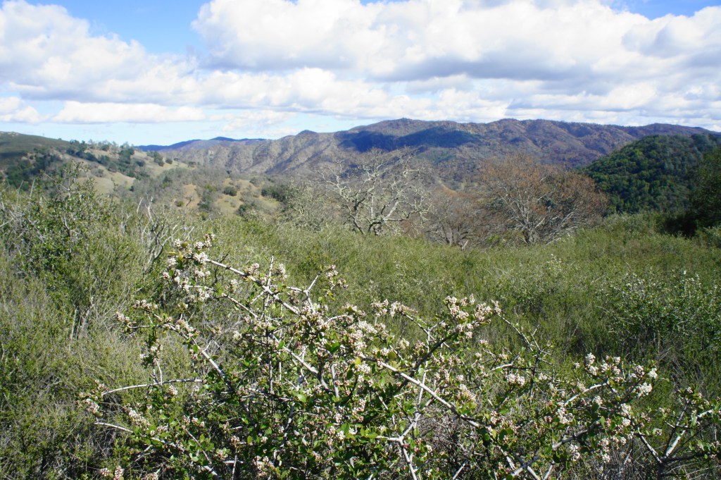
To start the loop hike (in a clockwise direction), head north and turn right on Manzanita Point Road, climbing for about 200 yards to the end of the paved track. Bear left on the dusty single-track path—the Monument Trail—which immediately begins to climb and switchback up a grassy hillside with partial views to the southeast. Hikers will quickly begin to notice a striking diversity of flora, including shaggy gray pines, manzanitas, toyon, and a spate of the East Bay’s typical oak and bay trees. In spring, multi-hued wildflowers are in abundance, including, most prominently, the magenta-colored Indian warrior (Pedicularis densiflora).


Monument Trail 
Climbing toward the Coe Monument
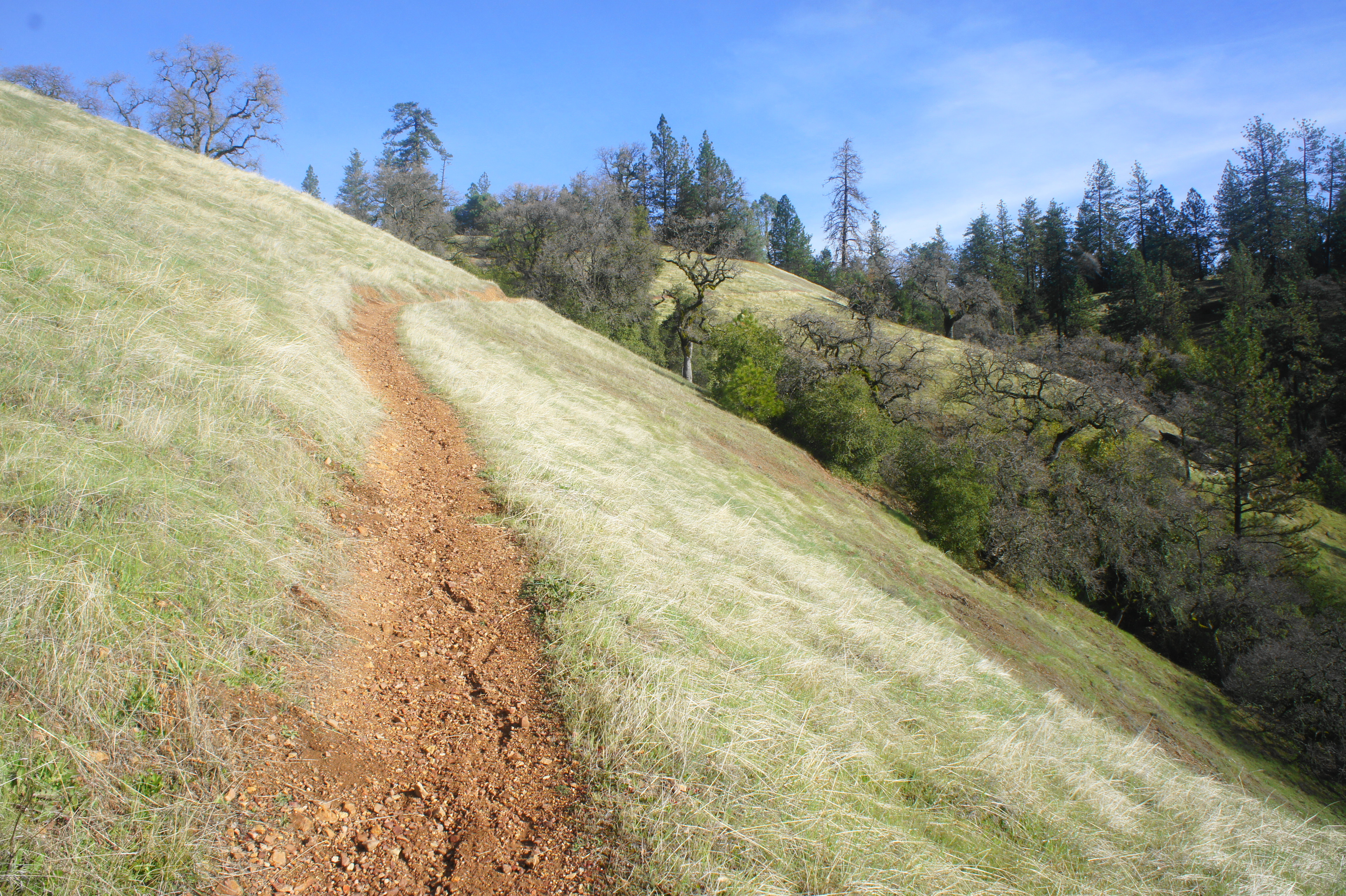

After gaining about 200 feet in elevation, the trail reaches a fork at ½ mile. While the quickest onward route is to stay straight, hikers seeking to view the Henry Coe Monument should bear right, quickly reaching an intersection with the wide Hobbs Road. The modest monument lies just across the road, a memorial to the local rancher Henry W. Coe, who claimed this area as his ranchland from the 1850s. After the property was passed down through two generations, Sada Coe Robinson (Henry W.’s granddaughter) deeded the ranch to Santa Clara County in 1953; the area became a state park—California’s second largest (behind only Anza Borrego Desert State Park)—shortly thereafter.
Henry Coe Monument 
View north from the monument


After checking out the monument, head north on Hobbs Road as it begins a gradual—then steep—descent to the Little Fork of Coyote Creek drainage. The iconic manzanitas and madrones are increasingly mixed in with the pines, oaks, and bay as the hike continues, and hikers eventually dip to cross the Little Fork at 1.5 miles. (Note: This is likely to be dry in summer.)
Manzanita along Hobbs Road 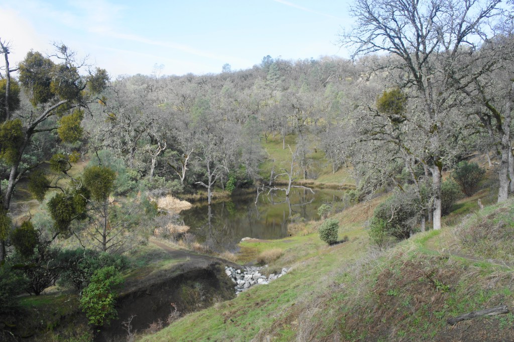
Frog Lake from above


Immediately after the crossing, there is another trail junction. Head right on the Frog Lake Trail, a single-track that begins a relatively mild and winding ascent of Middle Ridge, passing the namesake Frog Lake at 1.7 miles. The lake, at least in spring, is surprisingly charming—and perhaps a decent place to fish. True to its reputation, one can often hear the loud ribbit of frogs in and around the water (though they go conspicuously quiet when humans approach!).
At the lake, bear right, hugging the southern banks of the reed-choked lake, then continue the climb to Middle Ridge. The subsequent 8/10 mile covers about 300-400 feet in elevation gain, passing a turnoff for the Two Oaks Camp. At 2.5 miles, hikers reach a junction that provides access to the Middle Ridge Trail, the main thoroughfare for about the next 3 ½ miles.
Middle Ridge Trail to Poverty Flat (3.75 miles)
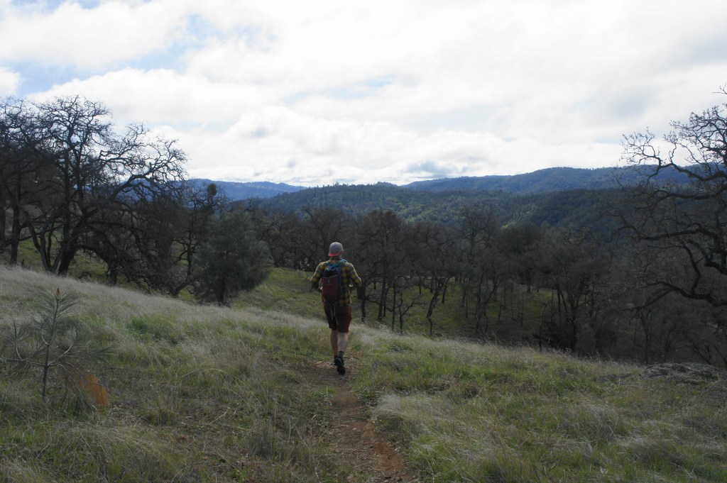
Heading southeast along the hilltops, the Middle Ridge Trail descends steadily to a grassy saddle with open views across the Little Fork drainage to Pine Ridge at 3.1 miles. From here the track climbs again, cresting a scenic hilltop at 2,700 feet before descending again amid windswept manzanita bushes and monkeyflower. (Note: Along the way, one might notice patches of torn-up earth: this is the characteristic mark of wild boars, which are relatively common in this area.) At 3.75 miles, the trail forks, with the Fish Trail—a shortcut back to the Visitor Center—bearing off to the right.
Downhill along the Middle Ridge Trail 
Middle Ridge Trail with Blue Ridge beyond


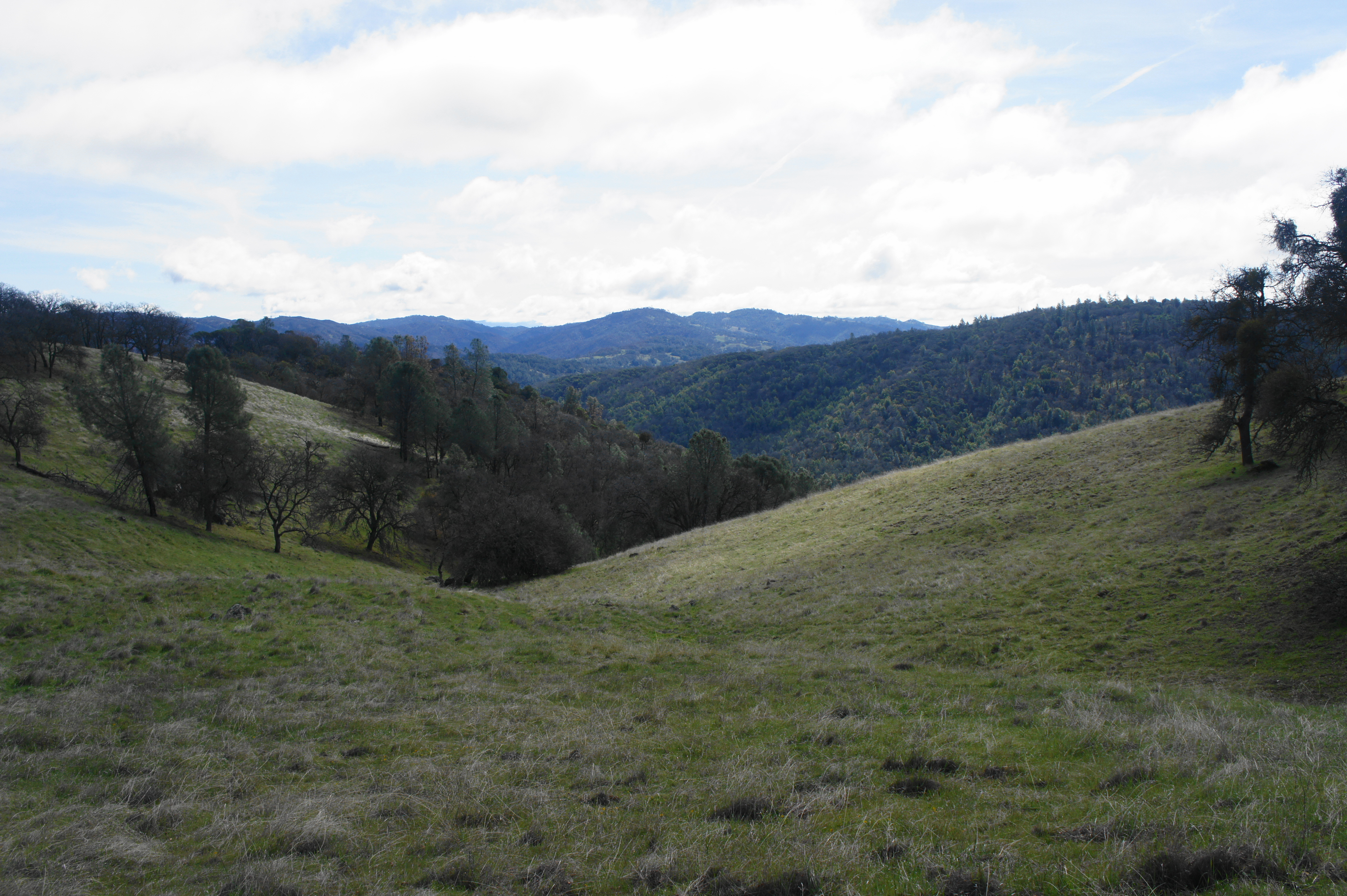
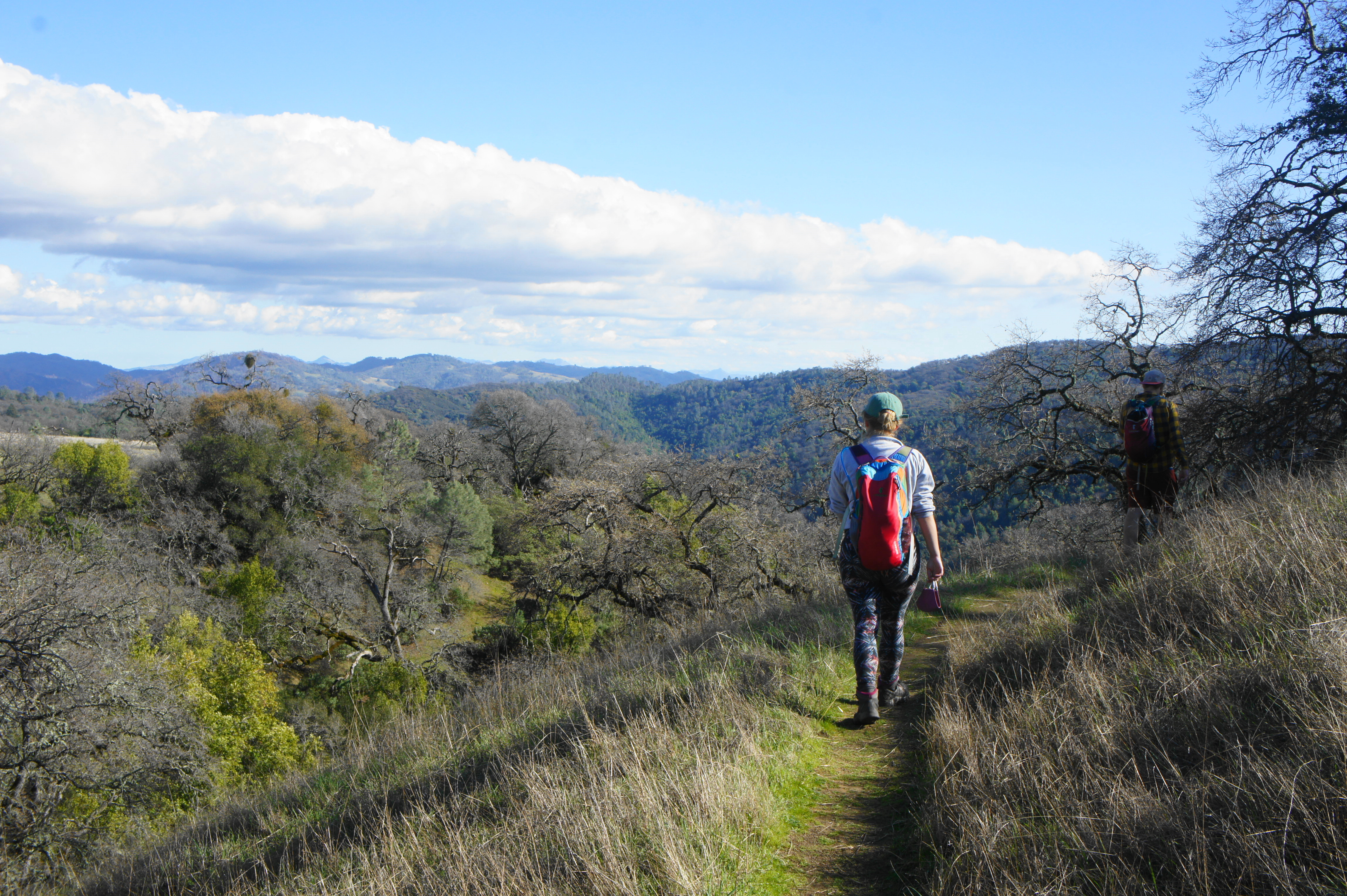
Stay left on the Middle Ridge Trail, entering one of the hike’s most scenic stretches, where rolling pastures yield wide-ranching views across the Diablo Range to the east. In winter and early spring, the oaks are devoid of leaves but the hillsides are verdant and lovely, inviting hikers to stop for a snack and a view.
Descending Middle Ridge Trail 
Pine Ridge from Middle Ridge Trail


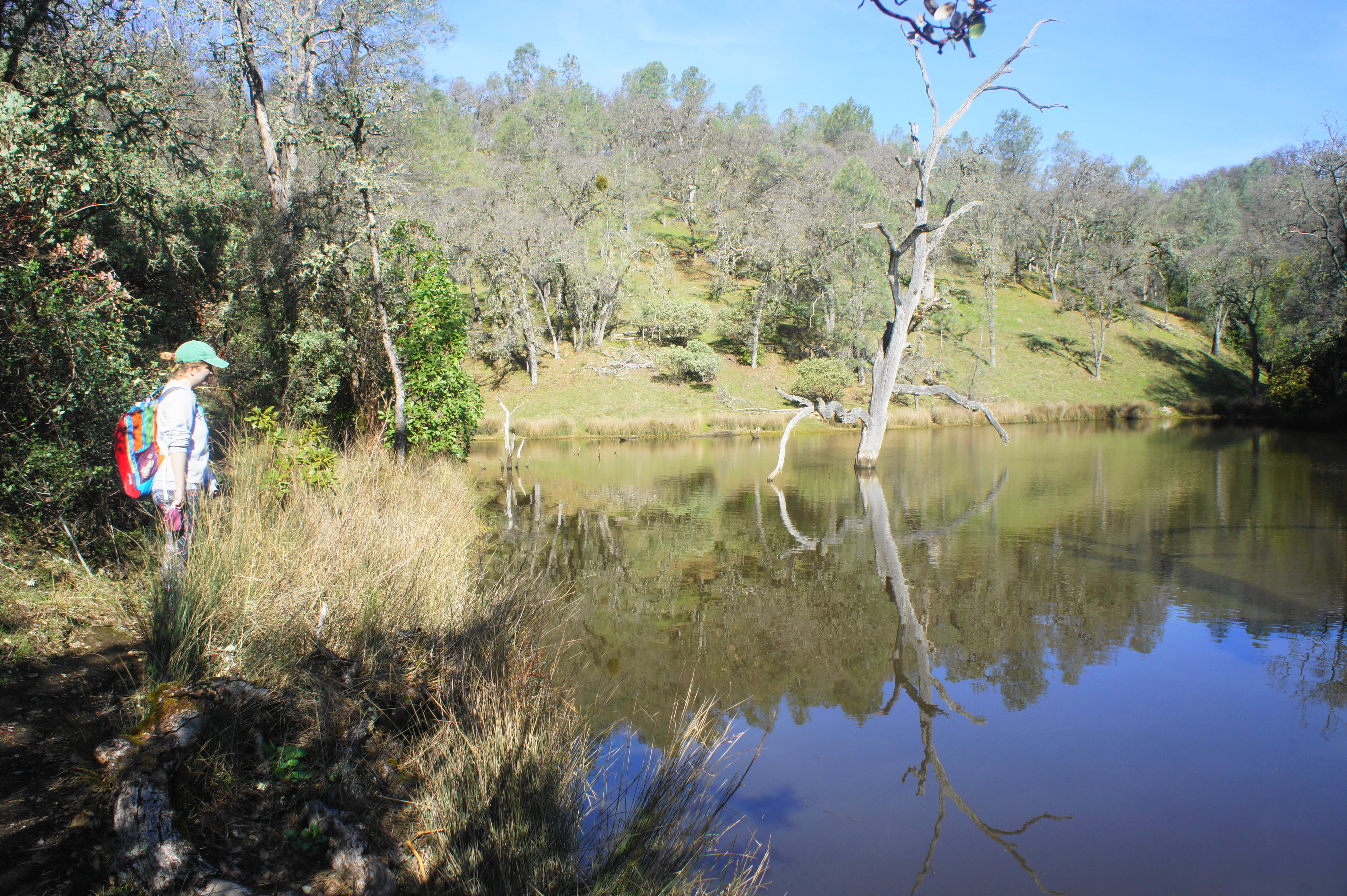
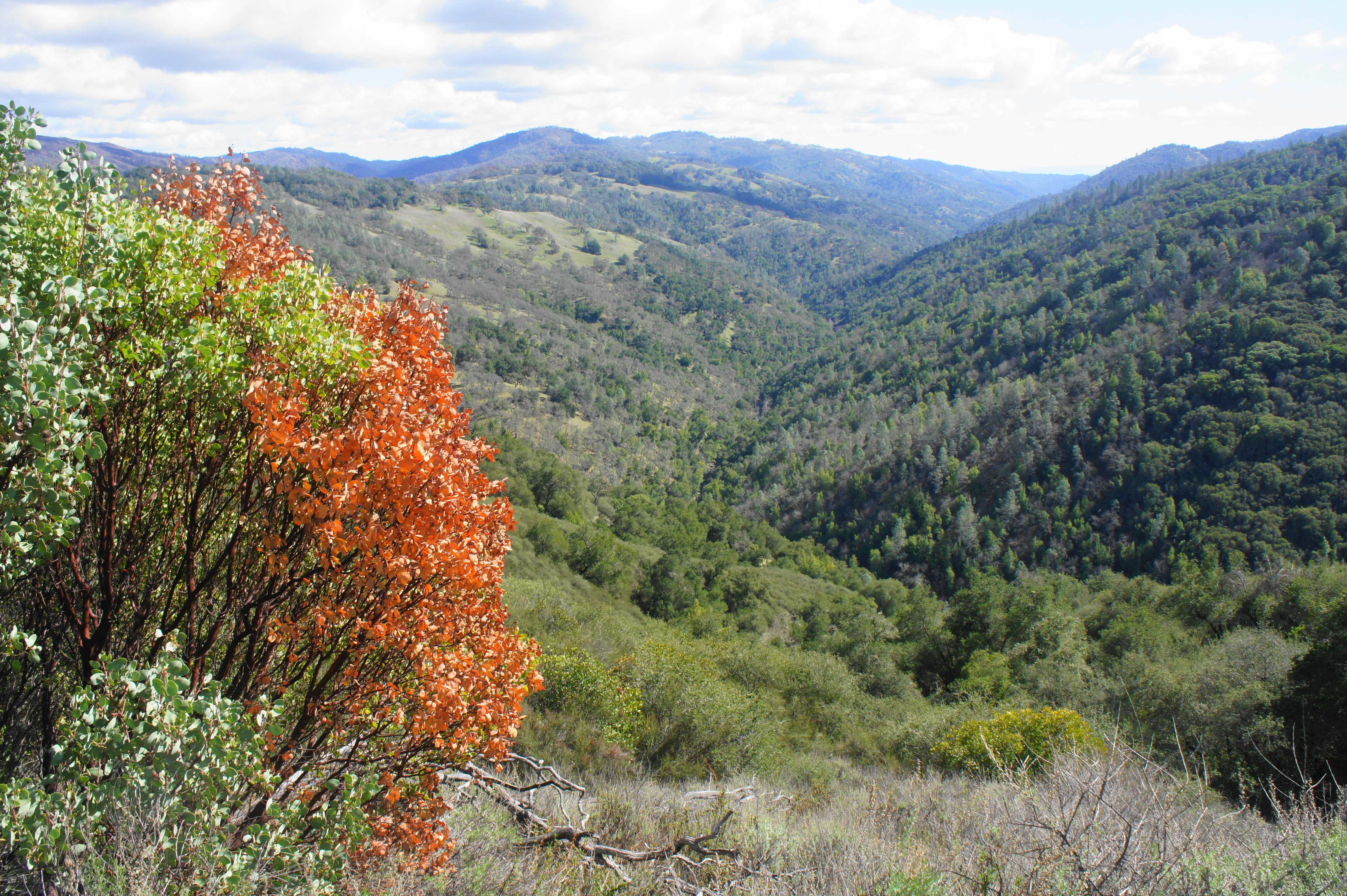
At 4.4 miles, the trail abruptly cuts left, passing through an old fence line and beginning a long and steady descent down to the Middle Fork of Coyote Creek drainage. Off to the left, across the valley, is mighty Blue Ridge, one of the tallest in the park (capped by Mount Sizer at 3,216’). The largely wooded decline passes scores of manzanita, madrone, oak, and California bay trees. Just before reaching the drainage, there is a particular steep but short descent, followed by a welcome flat. Through at least late spring, there is likely to be a decent flow of water at the junction of Little Fork and Middle Fork, and hikers should rock-hop across the stream at 5.8 miles.

Descending Middle Ridge Trail 
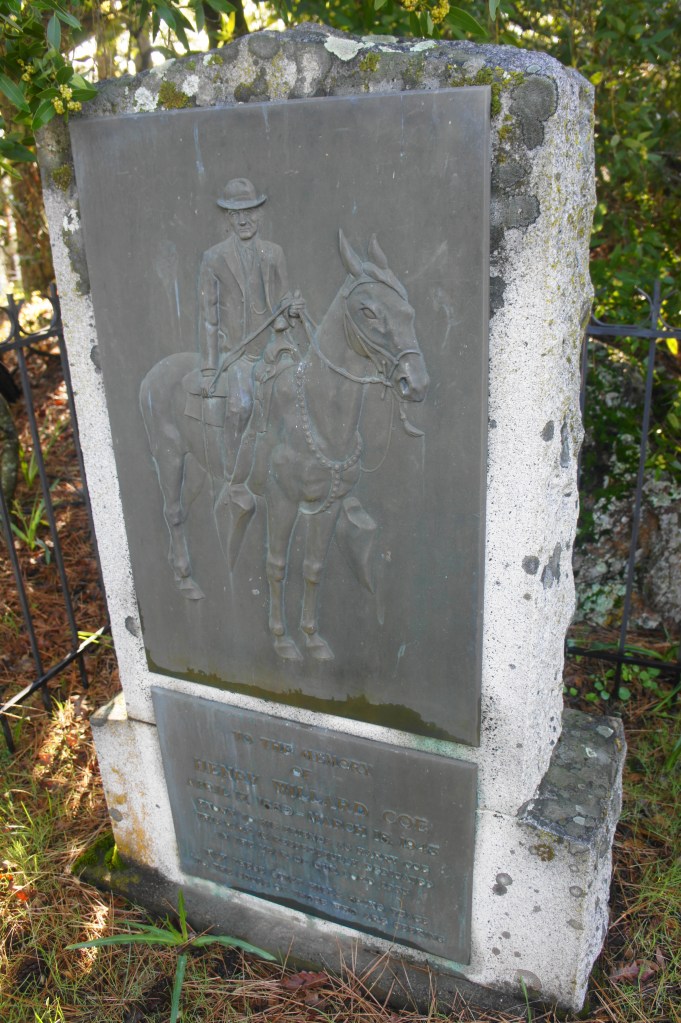
Manzanitas

Just beyond is the first of several campsites at Poverty Flat, a pretty riparian area once roamed by homesteader Joseph Finley, who had difficulty growing crops here (hence the name) but nonetheless held out on selling the property to Henry Coe. (Note: If you are backpacking to Poverty Flat, these campsites should be reserved upon arrival at Coe Ranch HQ.) Within minutes, the Middle Ridge Trail crosses back over Coyote Creek to the south side, then climbs the bank immediately to an elevated floodplain. Here the Middle Ridge Trail ends, emptying into the wide Poverty Flat Road. Bear left (east) on the wide track, which traverses some lovely fields lined by live oaks.

Poverty Flat to Manzanita Point Group Camps (1.8 miles)
At about the 6-mile mark, the road crosses back over the creek to the north bank and then enters the main camping area for Poverty Flat, where there is a water source and pit toilet. Look for a trail marker indicating a junction with the Cougar Trail, which doubles back to the west and traverses the camping area before leading to another stream crossing. While unmarked, the onward trail is visible across the creek.
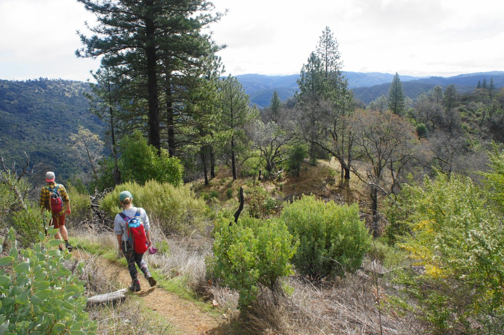
After traversing the stream for a final time, the single-track Cougar Trail immediately begins to climb. The subsequent ascent is the toughest of the hike, gaining nearly 700 feet in less than ¾ mile, although switchbacks and bends partially ease the pain.
Take your time as the trail climbs toward Manzanita Point, passing through a sea of bay, manzanita, madrone, and oak trees. The shade becomes less frequent near the top of the 7/10-mile stretch, and the tree canopy dissipates completely as hikers approach the junction with the China Hole Trail at the 7-mile mark.

From here hikers are rewarded with unobstructed views across the scrubby brush toward the Coyote Creek drainage, which bounds southward between Mahoney Ridge and Palassou Ridge in the distance. Chamise, coyotebrush, monkeyflower, and toyon line the China Hole Trail as hikers make their way west (right) en route to Coe Ranch Headquarters.
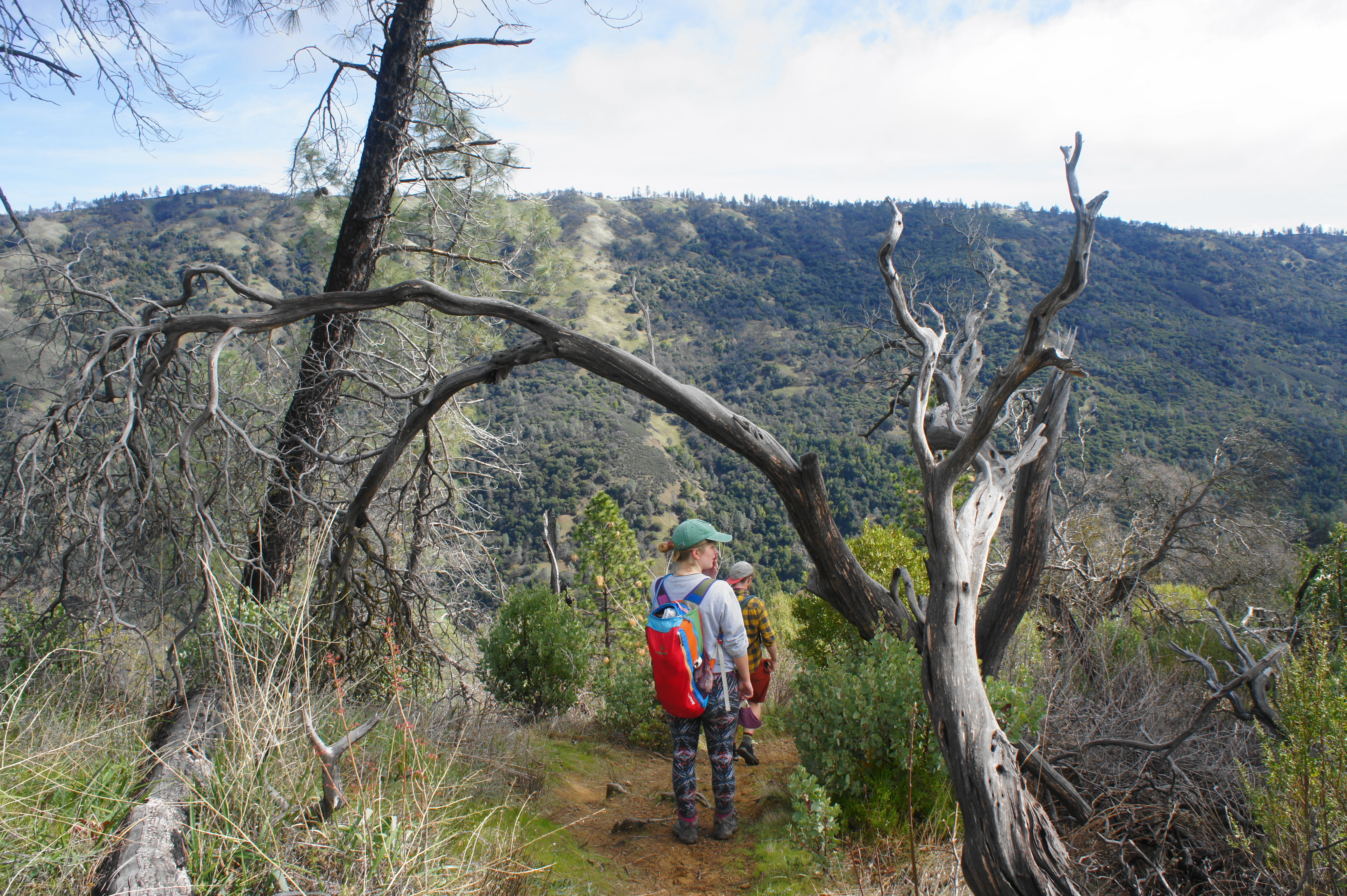
Looking east toward Jackass Peak (1,784′) and Bear Mountain (2,604′) 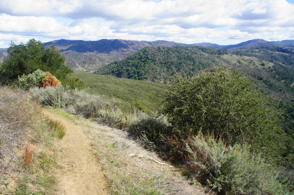
Eastward view

After the fork, the trail briefly follows the south-facing slopes looking down into Soda Springs Canyon before leveling off and winding to the north side of Pine Ridge, with obscured views down toward Poverty Flat and the Little/Middle Fork Coyote Creek confluence. Manzanitas—with their characteristic cold bark and reddish trunks—are ubiquitous in this section.
At 7.8 miles, stay right at the junction (which leads up to Campsites 8-10 in the Manzanita Point Group Camp), then emerge out into the open as the trail passes Campsite 7 on the right. From here the trail merges with Manzanita Point Road, a dirt track that bisects the group campground. There is another pit toilet here and an array of spur trails, including a steep descent to Madrone Soda Springs.
Manzanita Point Group Camps to Coe Ranch Headquarters (2.5 miles)
Bear right on Manzanita Point Road, a wide dirt path that acts as the main thoroughfare back to Coe Ranch Headquarters. At this point, there is no realistic single-track option for the next ¾ mile, so follow the road northwest as it passes spurs for Campsites 1-3, a somewhat pitiful watering hole called Bass Pond, and the Blue Oak Horse Camp. After a brief ascent, the route levels off again and approaches a four-way junction at 8.75 miles.

Springs Trail 
Returning toward Coe HQ on the Springs Trail

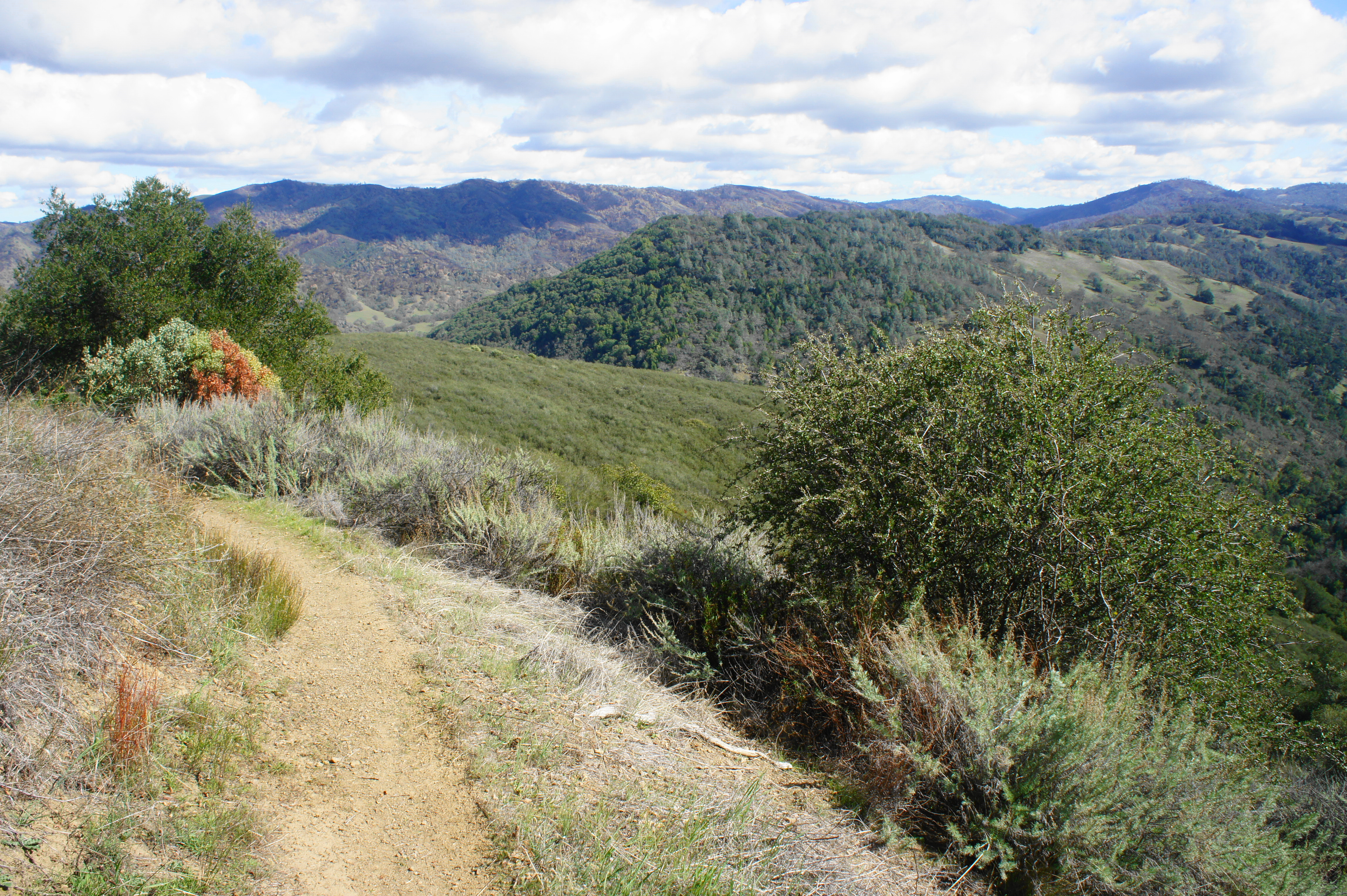
The quickest way back is to continue straight on the road, but heading left on the Springs Trail offers a considerably more scenic alternative, adding about 2/10 mile to the hike. This single-track gradually climbs in and out of oak-studded ravines, with long stretches of open vistas across Soda Springs Canyon toward Cordoza Ridge to the south. At 9.75 miles, stay right as a spur trail leads left down to Lion Spring. A quarter-mile later, the Springs Trail ends back at an intersection with Manzanita Point Road.

Just before the road, bear left on the signed Corral Trail, the final leg of the journey and a pleasant single-track trail that again weaves in and out of several ravines, including a rocky and precipitous gully where a protective fence and steps have been installed for hikers. From here it is a short walk up and out of another ravine to the end of the hike. The Corral Trail ends right across the street from the Visitor Center and White Barn, capping a 10.6-mile circuit.

This lengthy hike will take much of the day for most hikers. Ambitious trekkers can add additional destinations—such as China Hole, The Narrows, and the Madrone Soda Springs Trail—to the loop, or save these for another day. Do not underestimate the difficulty of hiking in Henry Coe, however, especially in the summer, when blistering heat combines with tough elevation gain. The area is much more manageable—and prettier—in early spring, when the various ridges sport green grass and wildflowers and the streams are flowing nicely.

Pingback: Madrone Soda Springs – China Hole Loop (Henry W. Coe State Park, CA) | Live and Let Hike
Pingback: Kelly Lake, Coit Lake, and Pacheco Falls Loop (Henry W. Coe State Park, CA) | Live and Let Hike