
Climbing partway up the sandstone cliffs of Canaan Mountain, this short hike—located just over the Utah border from Colorado City, Arizona—ascends rocky and sandy terrain to a beautiful perennial waterfall, short slot, and bowl-shaped narrows resembling “The Subway” in nearby Zion National Park. Water Canyon is notable for its year-round stream, which gives life to dense vegetation in an otherwise very dry, desert environment. Ambitious hikers can continue on to the hightops of Canaan Mountain, but most visitors will turn around at the waterfall/slot situated about 1.1 miles from the trailhead.


The hike
Water Canyon Trailhead offers access to the BLM-managed Canaan Mountain Wilderness, which protects a 44,500-acre tract of public space covering similar terrain as nearby Zion National Park. As visitors drive Water Canyon Road—a gravel track—north from Colorado City, Arizona and neighboring Hildale, Utah—the cliffs of thick Navajo sandstone begin to envelop the surroundings and rise nearly 2,000 feet above the canyon floor. Water Canyon Road first passes a series of residences and commercial “glamping” options, then continues past the Squirrel Canyon Trailhead on the right. The road ends with a set of two parking areas, separated by a stagnant pond. The far parking lot, closest to the start of the hike, is preferable but often fills up by mid-morning, requiring travelers to instead find a spot at the secondary lot about ¼ mile back. There are restrooms and a map at the trailhead.
The sandy Water Canyon Trail begins just beyond the restrooms and information board, immediately following a flowing stream on the right. The first ¼ mile sees the main path split into a series of forks, although most use trails tend to reconnect further upstream after a brief divergence. Amid the dense vegetation of oaks, junipers, pinyon pines, and others, numerous spurs lead down to the stream’s banks. The main track continues uphill, however, keeping the water largely just out of sight on the right. At ¼ mile, the path crosses a side stream with dense thicket.
At around 0.35 mile, an unmarked junction serves to confuse hikers; stay right, dropping to cross a second tributary before climbing steeply up the sandy bank to an open, sun-soaked hill. From here, the wide trail continues to rise, gradually and then sharply, as the sand gives way to larger rocks that require some careful footing to surmount. A myriad of different paths seems to lead in all directions; generally, one should stay straight and up, never quite descending to creek level but paralleling the ever-steeper drainage.
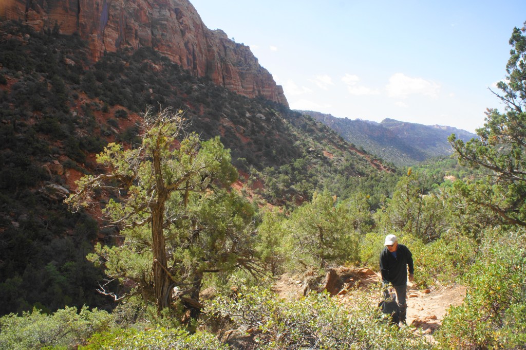
Climbing up Water Canyon 
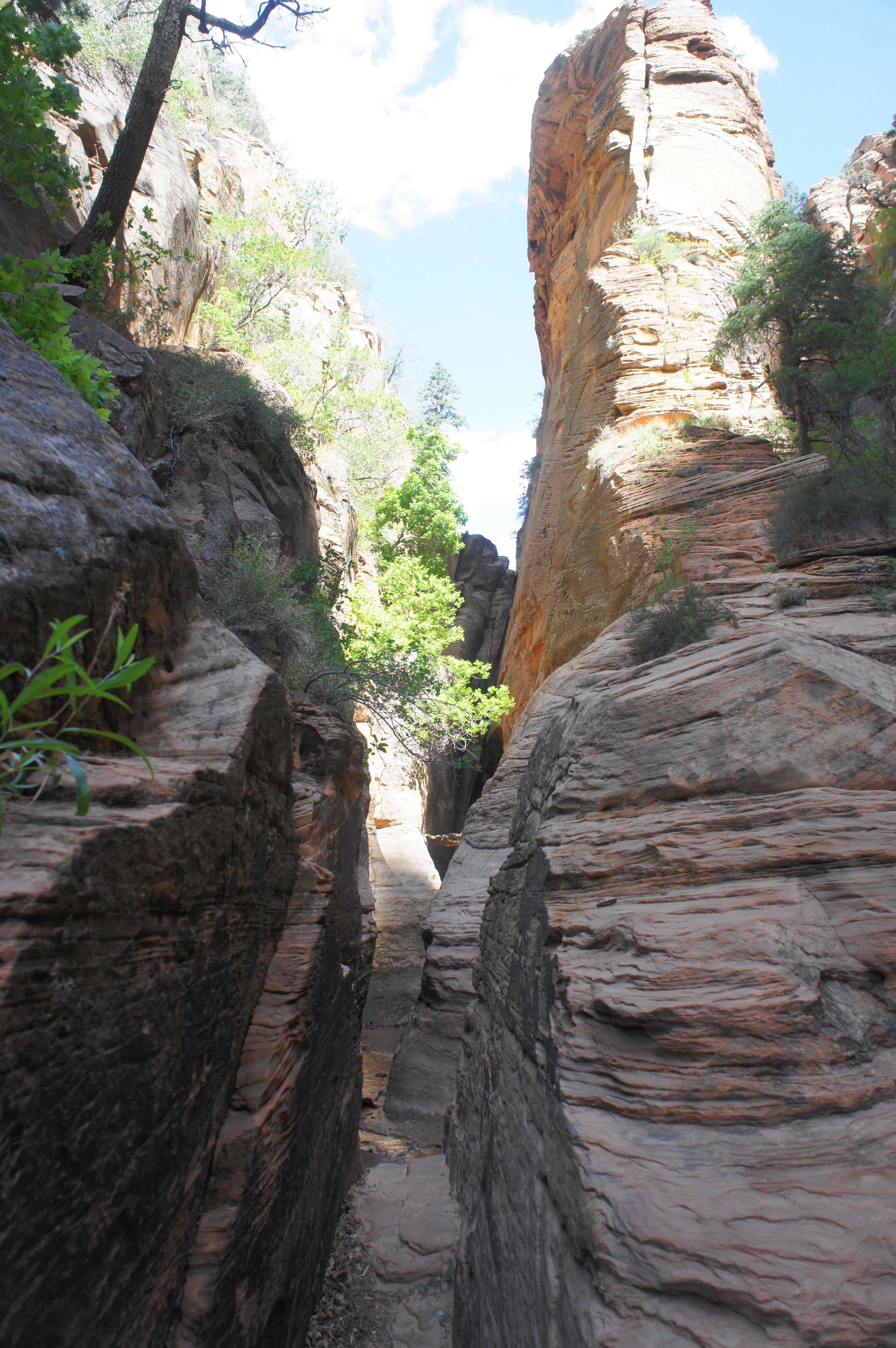
Heading toward the slot section
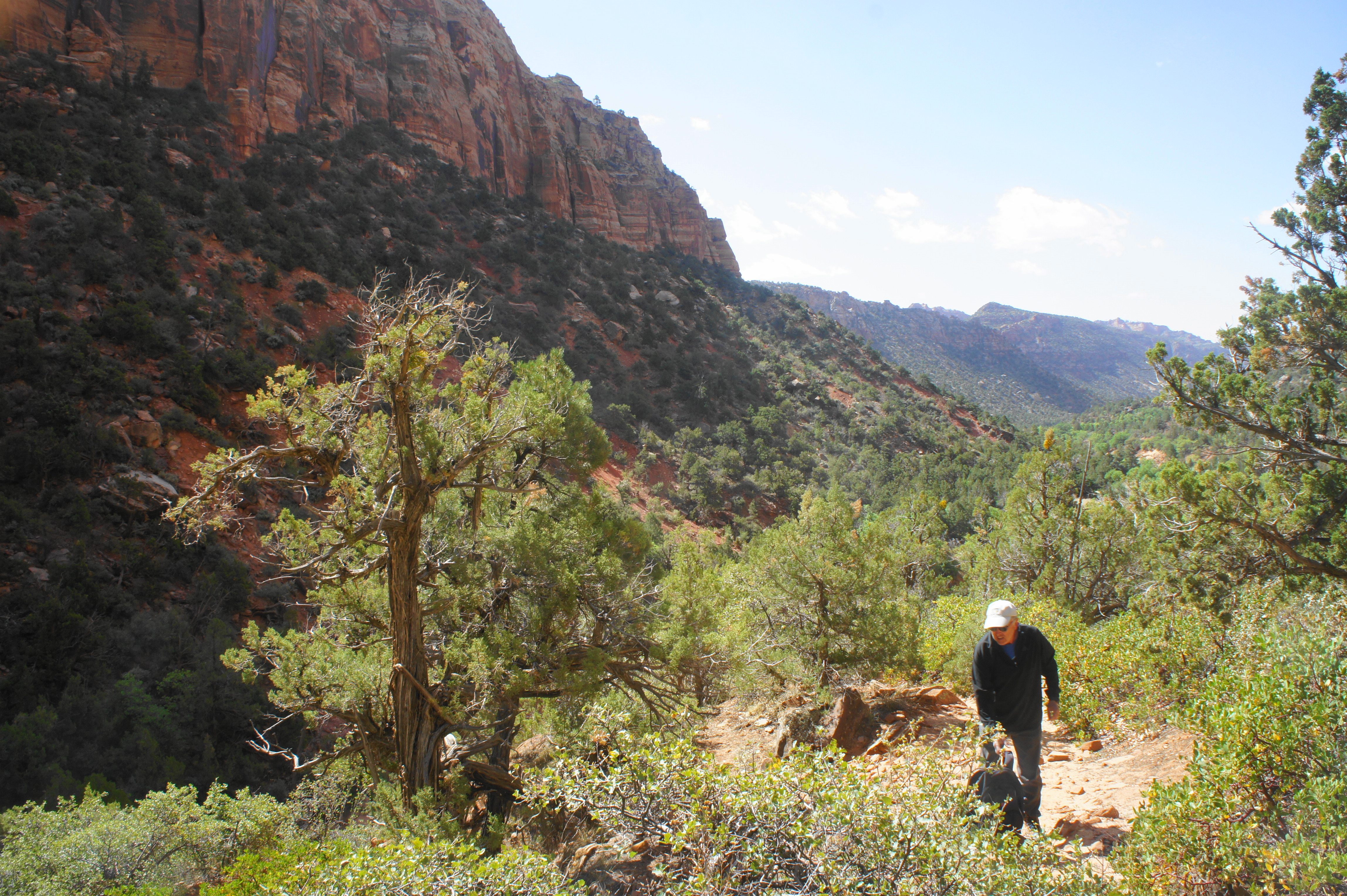

At ½ mile, the trail crests a hill and drops for a brief stretch; one can see minor cascades in the creek down below. The next stretch is somewhat level with brief ups and downs before ascending a rocky patch again and passes a batch of small, green ferns and thorny bushes. From atop a scrubby, sunny hilltop at 7/10 mile, one can see the dark, narrowing canyon ahead, as well as Water Canyon Arch—a high archway situated near the top of the Navajo sandstone cliff to the east.

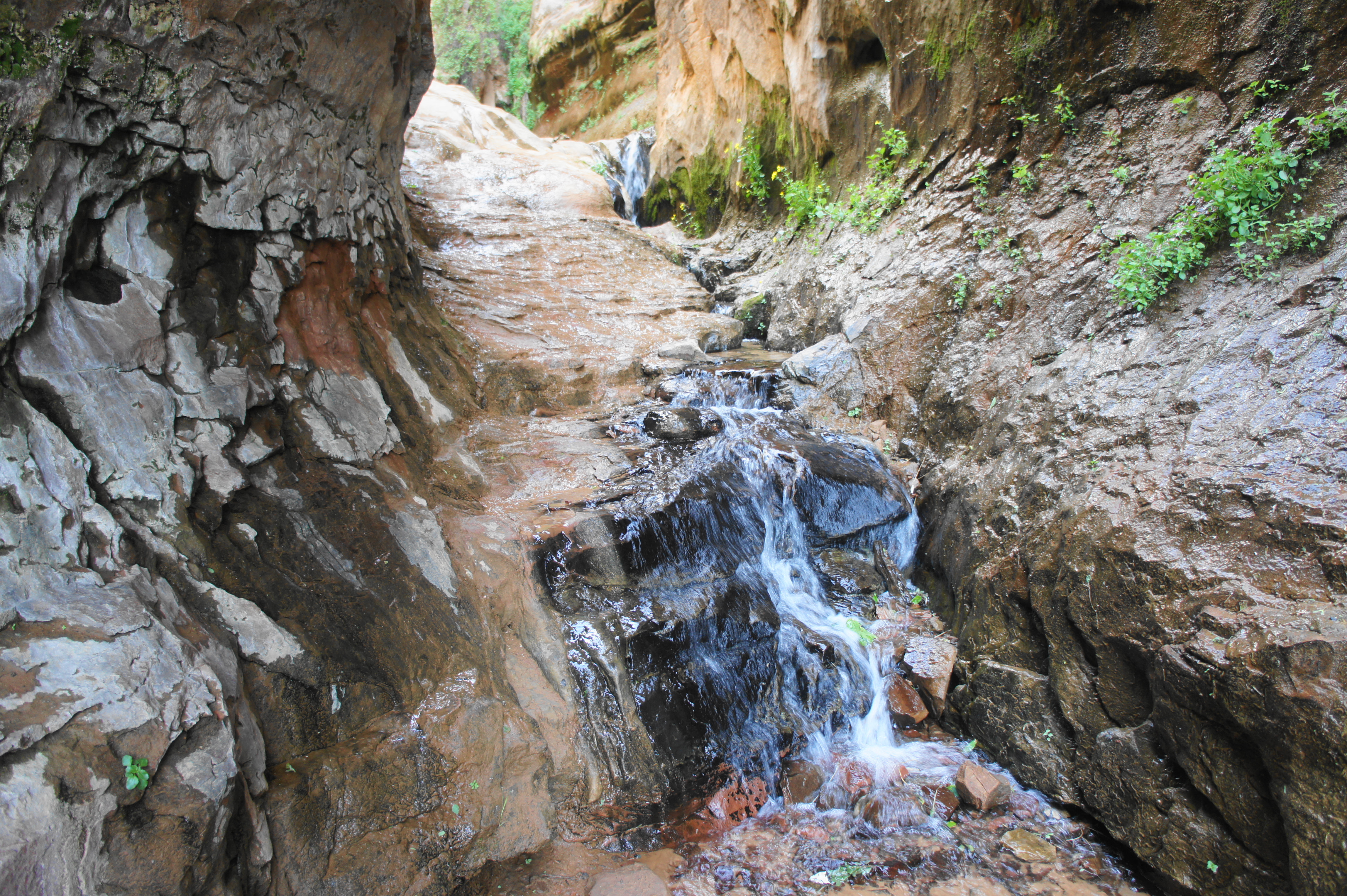
After passing a graffitied rock slab on the left at ¾ mile, the trail continues to rise before dropping to skirt a beautiful, moss-laden alcove. From here it is a short walk—and steep descent—down to the scenic subway section, where desert varnish forms vertical streaks in the bulging walls, and the water feeds monkeyflower and other plants lining the sides of the bowl-shaped drainage. This unique sight is an easy rival to Zion—with far fewer crowds.
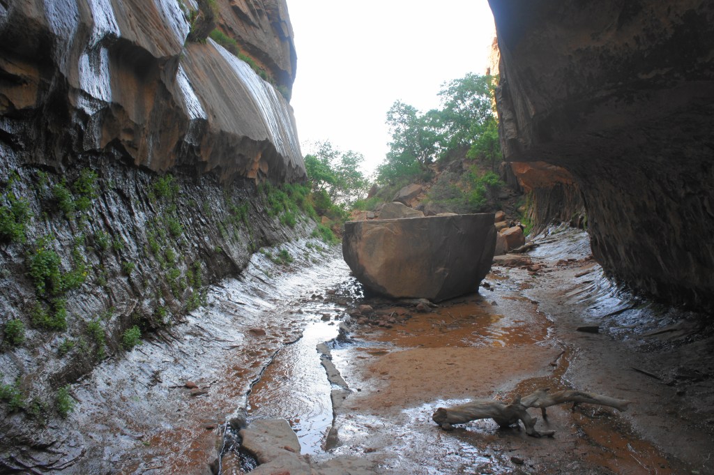
Water Canyon subway section 
Waterfall


At the far end of the subway is a lovely, multi-tiered cascade that could pass as a waterfall, a highlight of the hike. (Note: At higher elevations, there may be additional waterfalls, depending on recent rains/snowmelt, but this is the most reliable.)

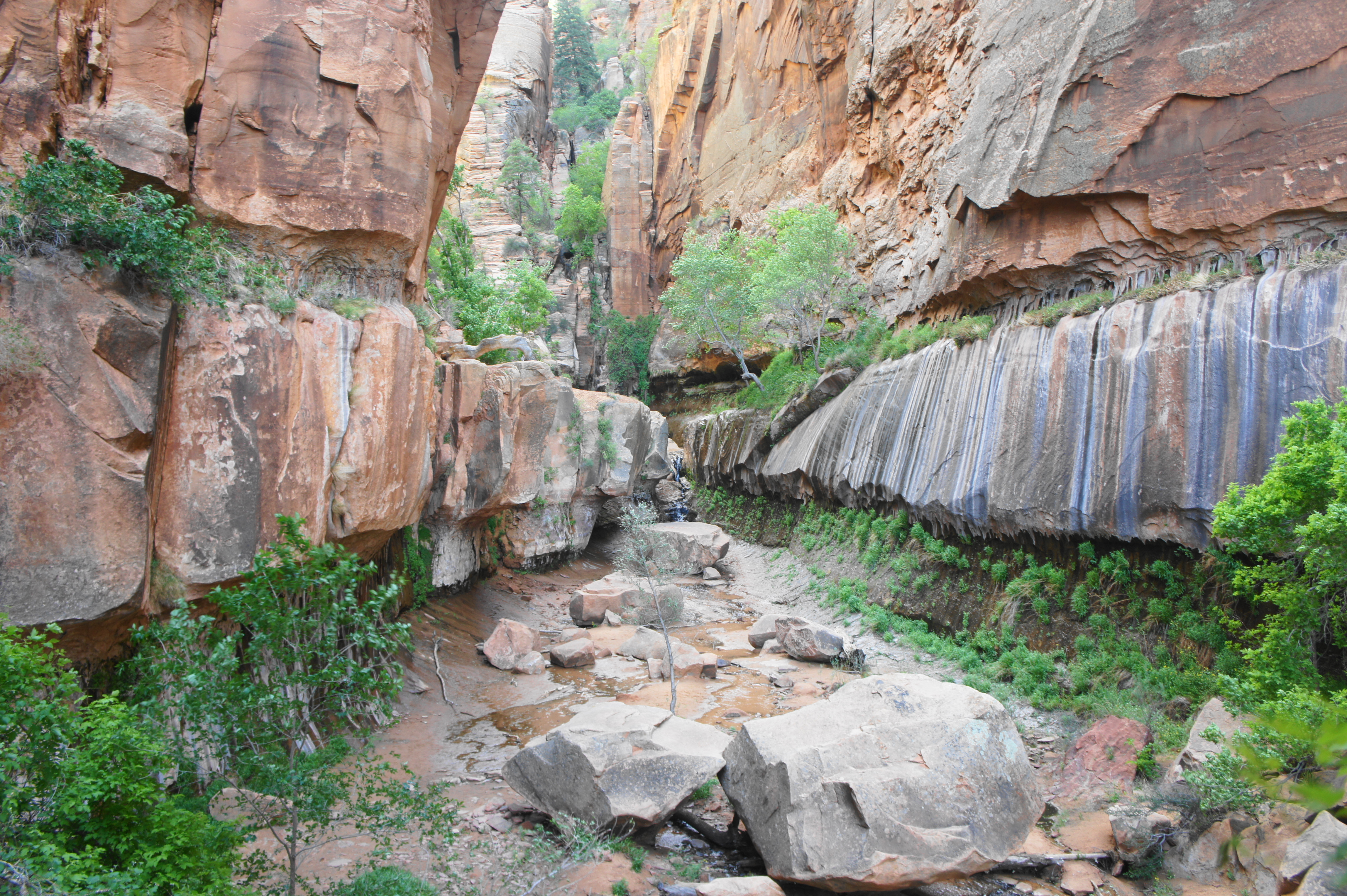
Chamber above initial waterfall 
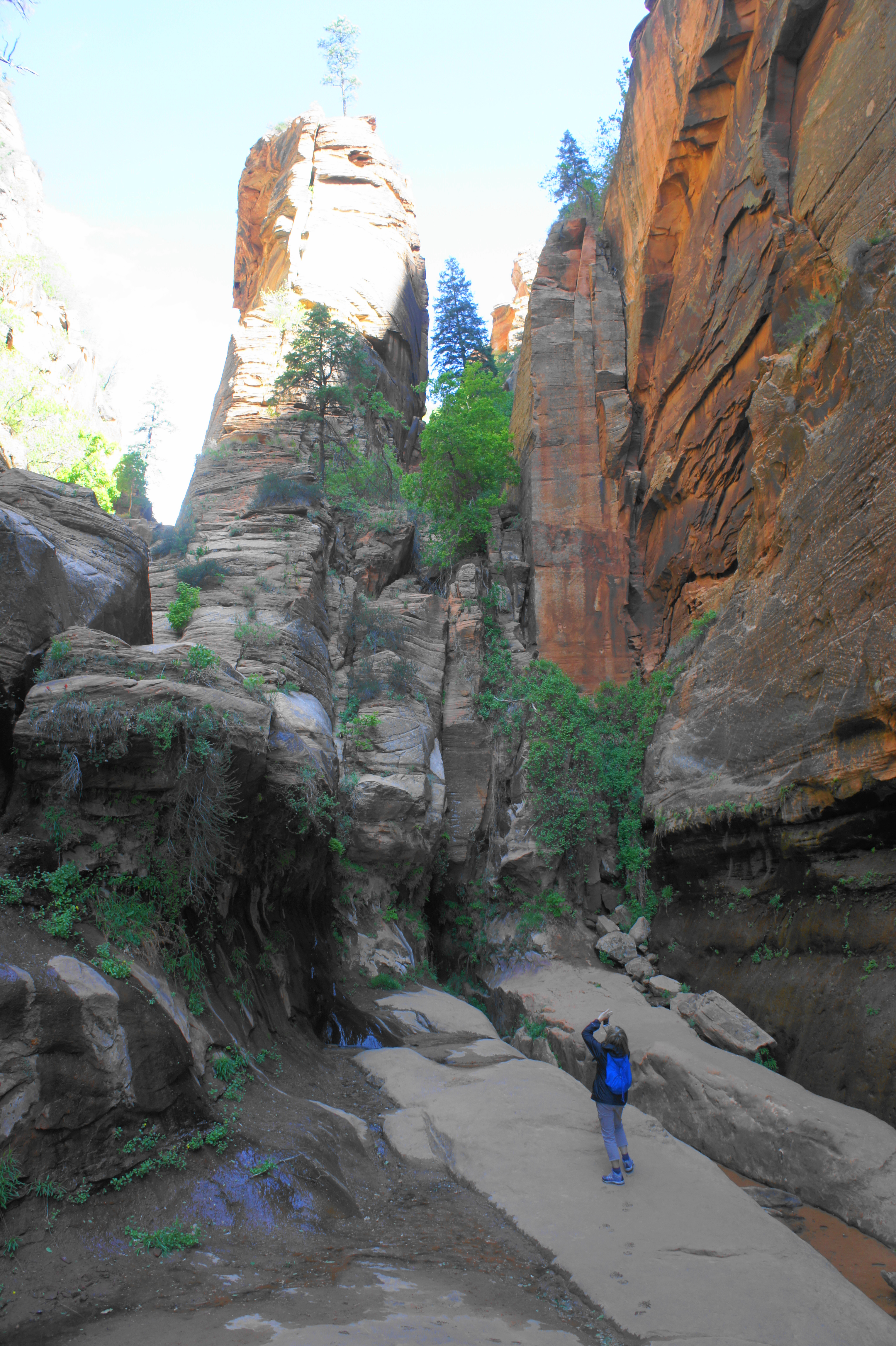
Looking farther up-canyon
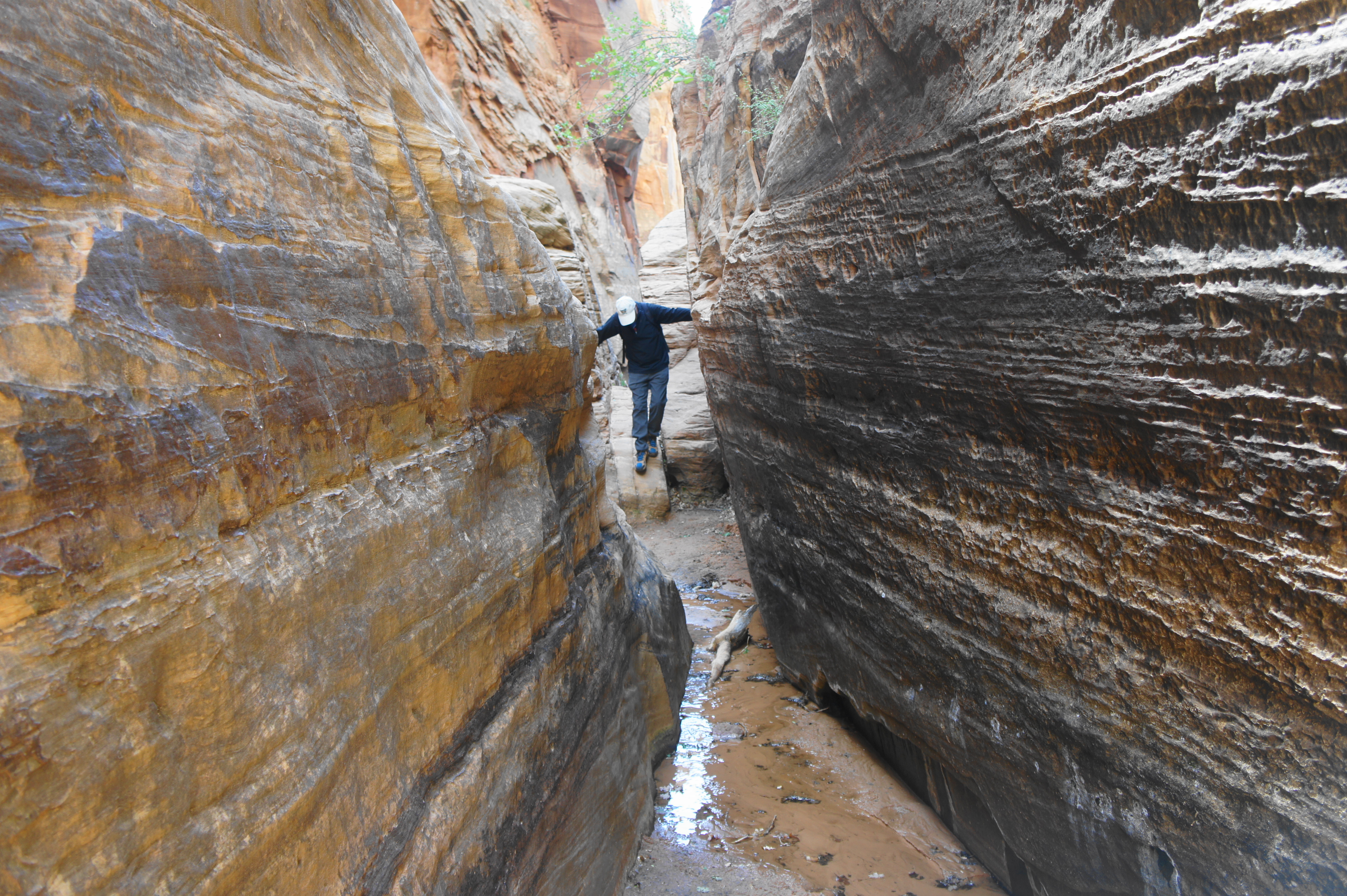
Onward passage requires ascending the throat of the falls or climbing a thin notch just off to the left; both lead up to a beautiful, fluted chamber surrounded by high walls. Here the sandstone splits into parallel chunks, each harboring some vegetation; some are passable partway before rising to near-vertical heights. A use path hugs a sandy slope on the left, doubling back to the south briefly before rising to the next level up. From here one can scramble across partly exposed ledges to a final slot—narrowing to a few feet across—which ends quickly at a murky pool. (Note: This sometimes hosts a beautiful waterfall, but it was not present as of mid-May 2021.)

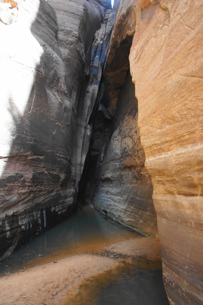
Pouroff at end of slot 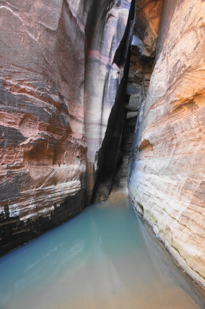
Pool in the slot at Water Canyon


The trail continues onward from here, offering access to additional narrows and eventually Top Rock, White Domes, and the summit of Canaan Mountain. However, most will turn around at this point, retracing one’s steps back down 1.1 miles to the start. This shortened version is moderately difficult, with some steep sections, requiring about 2-3 hours to complete.


Pingback: Top 10 Hikes in 2021 | Live and Let Hike