
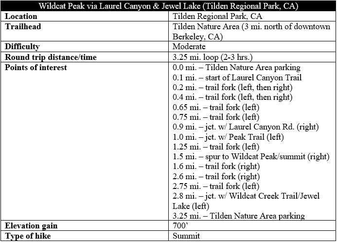
Truly unobstructed panoramas with views in all directions are a relative rarity in the Berkeley Hills of California’s East Bay, but Wildcat Peak in Berkeley’s Tilden Regional Park offers one of them with excellent vistas of the San Francisco Bay, the Carquinez Strait, the Briones Hills, Mount Diablo, and more. At 1,211 feet, Wildcat Peak is not the highest point in the Berkeley Hills (that distinction is held by nearby Vollmer Peak (1,905’)), but it is a popular destination in perhaps the East Bay’s most well-known regional park. The following description traces a 3.25-mile circuit, ascending shady Laurel Canyon before emerging out into the open atop windy Wildcat Peak, then returning via a switchbacking route and the very modestly-sized Jewel Lake.

The hike
The hike begins in the Tilden Nature Area, one of the most popular sections of Tilden Regional Park because of its so-called “Little Farm,” petting zoo, and nature center. The large parking area is often full on weekends but relatively lesser-travelled during the week, which is the ideal time for hiking in Tilden. Unlike other parts of the park, dogs are not allowed in the nature area, but the place is often crawling with families and school buses full of kiddos. After leaving the parking lot, crossing a short bridge over Wildcat Creek, and passing the Environmental Education Center on your left, however, the crowds tend to dissipate considerably.
To reach the Laurel Canyon Trail, cross the grassy field behind the visitor center and look for a sign marking the start of the trail leading into the oak/bay woodlands. The dirt track quickly enters the woods, passes a small structure on the right, and then ascends to a junction with the wide Service Road. Bear left briefly, then follow the continuation of the Laurel Canyon Trail as it veers right, entering a grove of tall eucalyptus trees.
These fragrant trees are ubiquitous to the Bay Area but technically an invasive species, brought to the area during the Gold Rush and known for their strikingly fast growth. As further research revealed that eucalyptus bark had a tendency to crack when dried, the trees disappointed those seeking to get rich off lumber, but the trees remained, rising to towering heights and scattered across the area. Today, Bay Area residents have a love-hate relationship with eucalyptus trees: even as they are invasive, they have become an iconic part of the landscape.
As hikers make their way northeast, the eucalyptus gradually decline in number, and hikers drop down a staircase to clear a pretty ravine at about ¼ mile. After a mild uphill, the trail forks again, reaching an intersection with the Loop Road. Bear left briefly on the wide track, then right again, catching the onward path. From here the Laurel Canyon Trail begins a steadier ascent, at one point ascending a set of sharp bends. The route crests 700 feet at about 0.65 miles, reaching a junction with the Pine Tree Trail that comes in from the right.
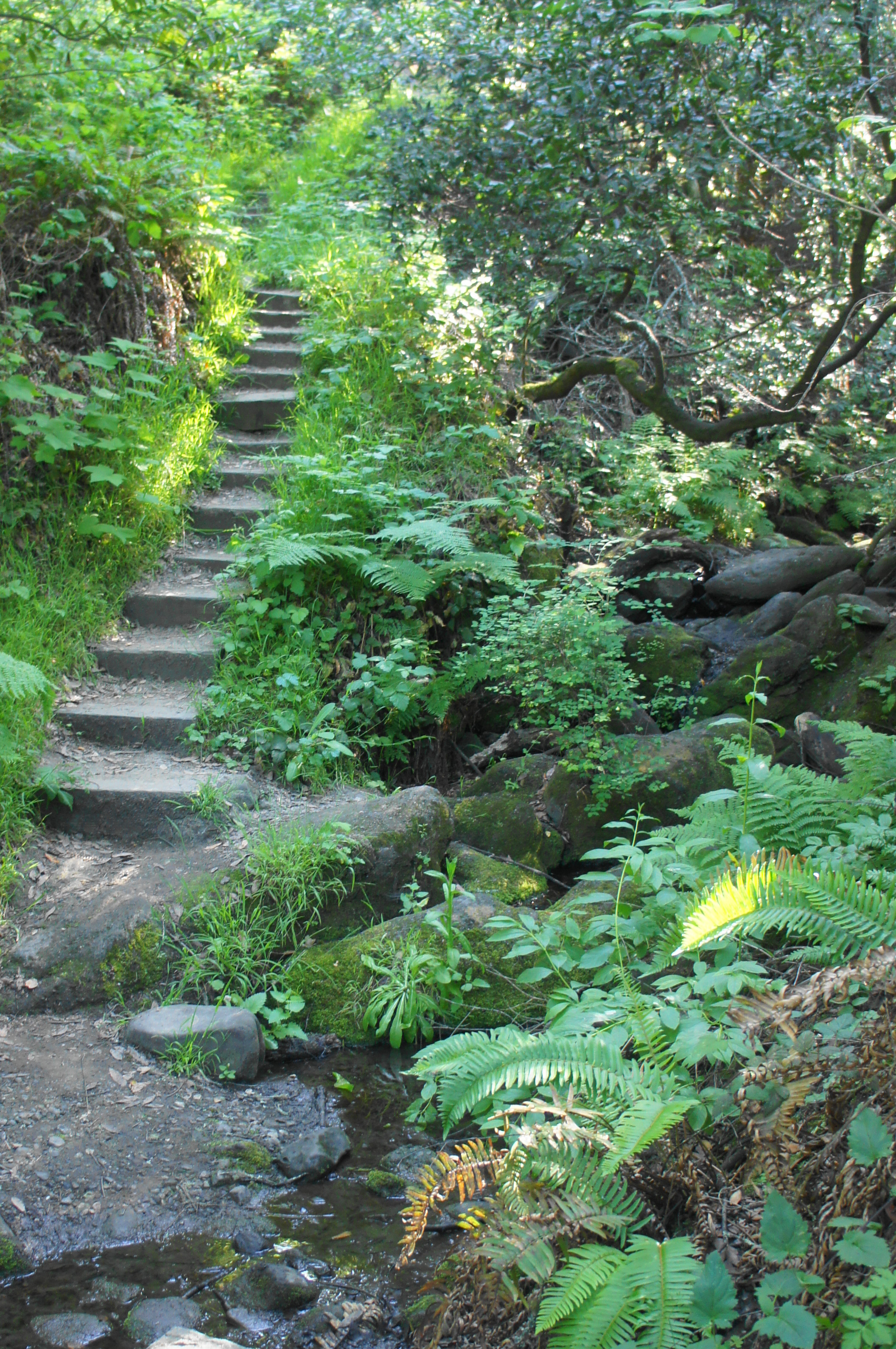
Stay left, descending to clear two short bridges, then follow the trail as it rises again to a shaded fork. Head left, following the signs for Laurel Canyon Road. The trail beyond descends sharply to a scenic crossing of Laurel Creek. From here the trail ascends a set of steep switchbacks, culminating at Laurel Canyon Road at 9/10 mile. Bear right on this wide track, continuing to climb, although more mildly, to another trail junction at about the 1-mile mark. Hikers should bear left here, following signs of the Peak Trail, which—you guessed it—leads toward Wildcat Peak.
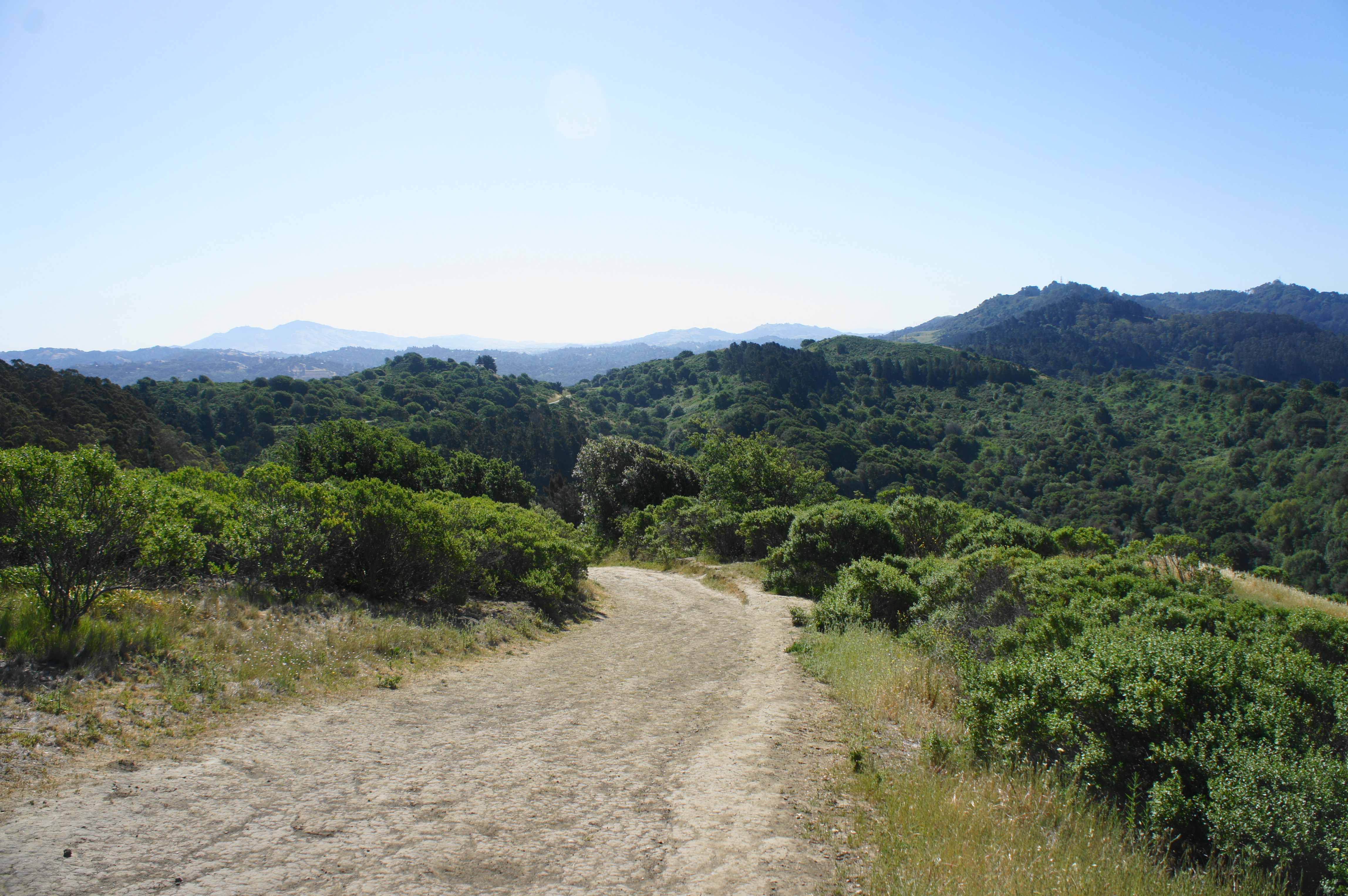
As the bay/oak woodlands gradually turn to scrubby chapparal, the singletrack trail rises to views of Wildcat Canyon and the westward hills beyond. Stay left at the next fork, by which most of the elevation gain has been completed. Bearing west, the trail passes the Berkeley Rotary Peace Grove and curls around to the south side of Wildcat Peak, reaching a final junction before the summit at 1.5 miles. Follow this spur (right) to the top of Wildcat Peak, marked by a long, circular stone bench.

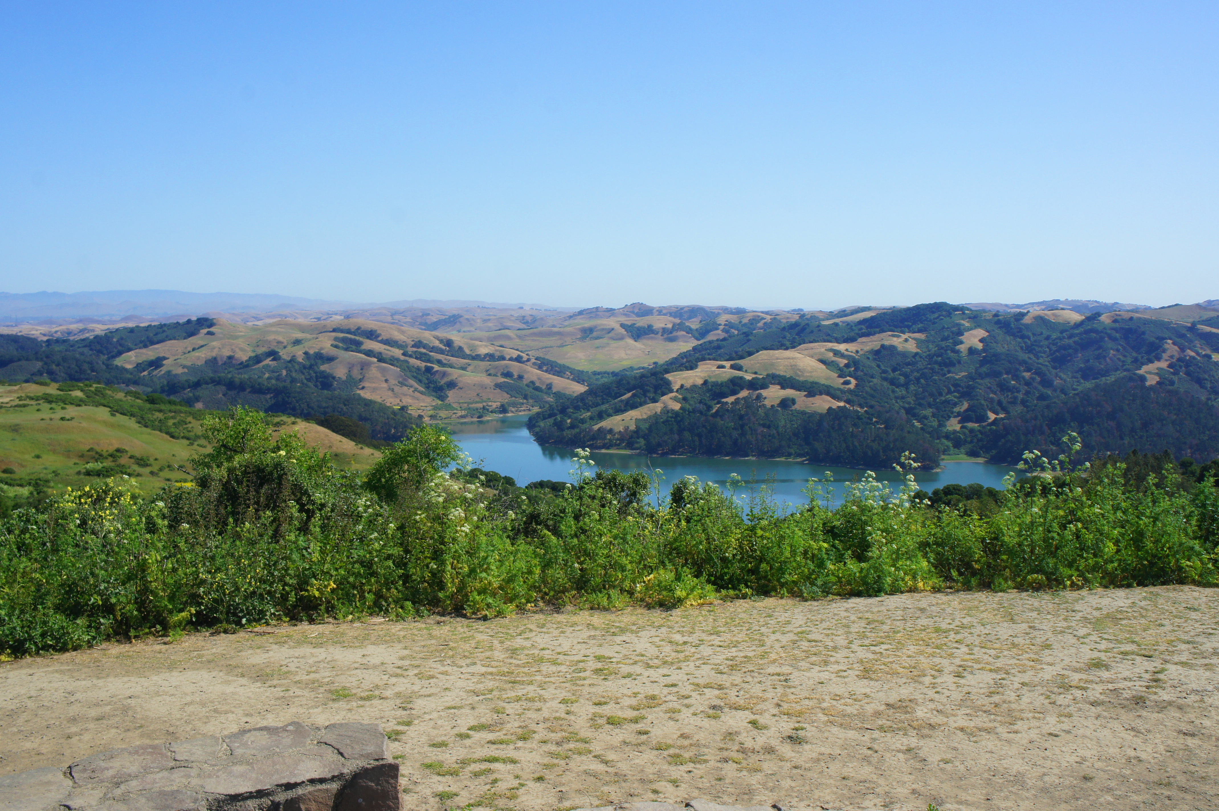
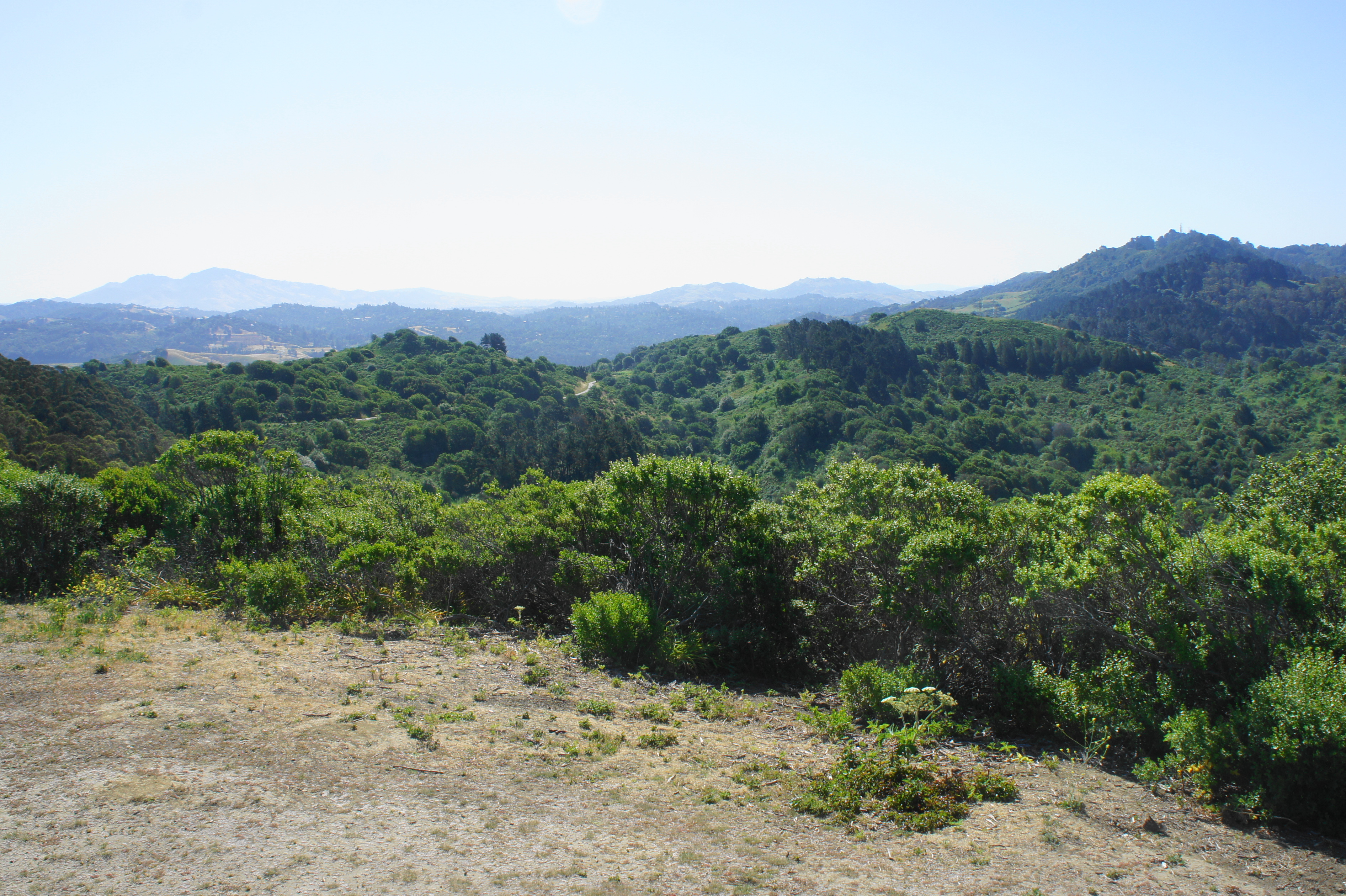
As promised, the panoramas (at least on a clear day) are terrific. Off to the west are San Francisco, the Golden Gate Bridge, the North Bay, Angel Island, Mount Tamalpais, and the Marin Peninsula. Northward, one can see across San Pablo Bay and the Carquinez Strait to the Napa/Sonoma area, while Mount Diablo—across San Pablo Reservoir and the Briones Hills—is the most prominent peak to the east. The Berkeley Hills stretch southward, with onward views blocked by Vollmer Peak and Grizzly Peak, two of the highest mountains in the range.

Once ready, return down the spur to the main Wildcat Peak Trail, which continues right en route to Jewel Lake, nearly 700 feet below. The views keep coming as the narrow path winds west and then south, passing wily oak and bay trees before returning to the odiferous eucalyptus. The subsequent junction is easy to miss; about one mile from the summit, look for a well-trodden path heading right; it quickly leads to a trail marker. Take this track as the Wildcat Peak Trail becomes the Sylvan Trail, which in turn drops to a second junction minutes later. Take a right, descending again amid the eucalyptus to the base of Wildcat Canyon and a junction with the Wildcat Creek Trail.

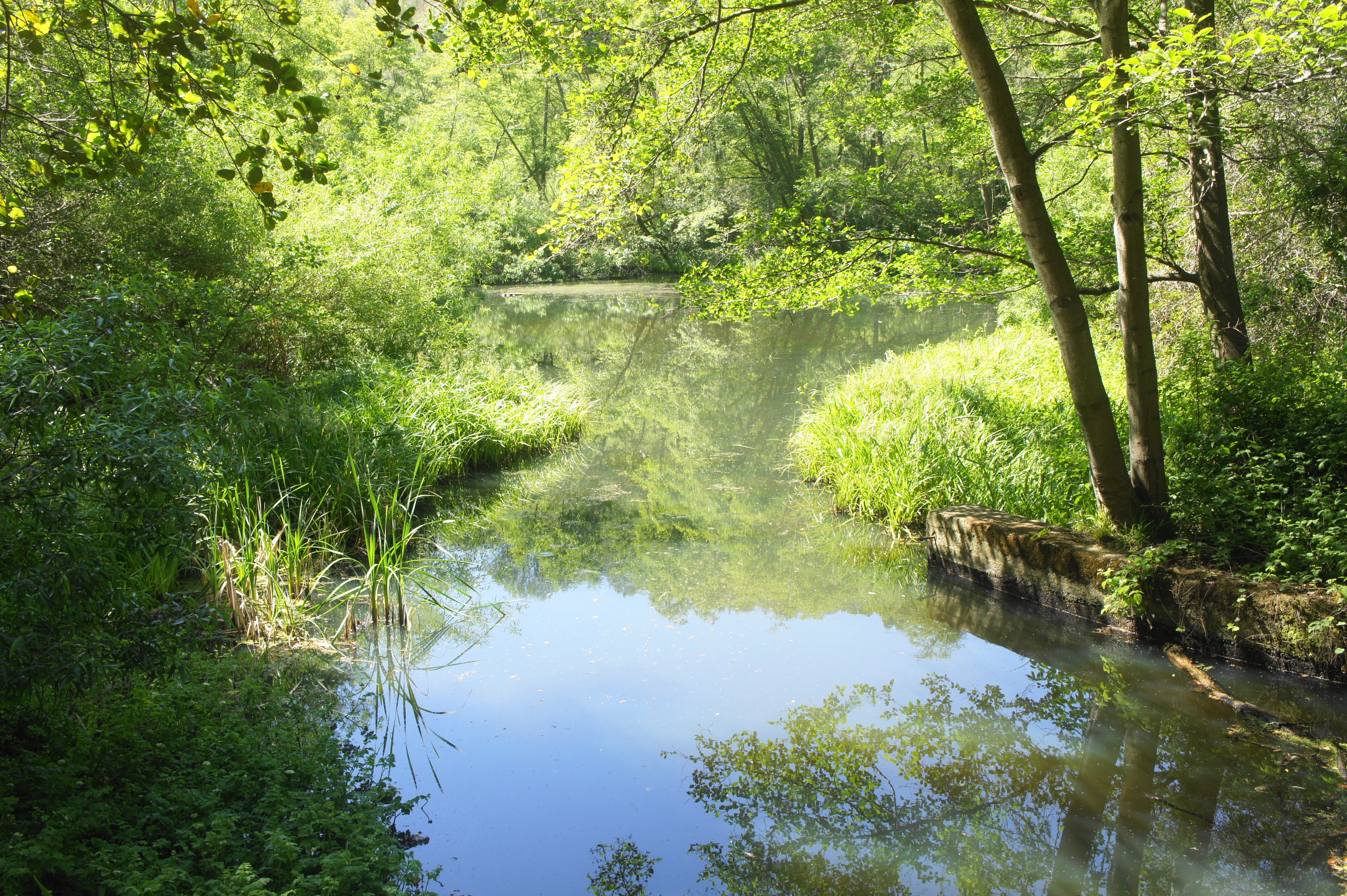
Straight ahead is Jewel Lake, a modestly-sized pond often frequented by turtles and waterfowl but often nearly dry in late summer and fall. The lake itself is dammed, and hikers can continue to the south side of the pond for some nice waterside picnic spots. The quickest return route is to the follow the wide Wildcat Creek Trail southeast, across level terrain, for nearly a half-mile. The path returns soon enough to Little Farm, the visitor center, and the parking area, completing the roughly 3.25-mile circuit hike.

By far, my favorite hike in Tilden. I also appreciate the early and mid Twentieth Century historical elements: the watershed created as Jewel lake, and the remnants of the old Nike Missile installations that ring The Bay. Great hike!
Pingback: Top 10 Hikes in 2021 | Live and Let Hike
Pingback: Hikes in Tilden Regional Park (North/Tilden Nature Area) | Live and Let Hike
Pingback: Top 10 Hikes in Tilden Regional Park | Live and Let Hike
Pingback: Hikes in Wildcat Canyon Regional Park | Live and Let Hike
Pingback: Top 5 Hikes in Wildcat Canyon Regional Park – Live and Let Hike
Thank you for this. We are visiting the area and used your guide to hike this trail. It was perfect. We had a fantastic day.