
Note: This is part one of a three-post effort to chronicle short day hikes in the East Bay’s Tilden Regional Park. The focus of this post is on the northern reaches of the park, mainly the section known as Tilden Nature Area.
Charles Lee Tilden Regional Park, named for a founding board member of the East Bay Regional Park District, is perhaps the most famous park in the Berkeley Hills and certainly one of the most popular. Recreation opportunities abound, with swimming, golf, biking, horseback riding, camping, picnicking, event spaces, a petting zoo, and even a kid-friendly steam train all available in the 2,079-acre tract. The hiking network is also impressive, with nearly 40 miles of trails—mostly fire roads but also some singletrack—straddling ecologically-diverse terrain. Here you’ll find plenty of natural landscapes resembling what the terrain looked like before it experienced encroaching development: bay/oak woodlands, seasonal streams, windswept hills, and craggy rock outcrops. But the non-native introductions also admittedly make for interesting walking, including stands of Monterey pine and blue gum eucalyptus and recovered pastures. The high ridgeline affords views to San Francisco Bay, Carquinez Strait, and San Pablo and Briones Reservoirs, while Wildcat Canyon harbors hidden (seasonal) cascades, magnificent bay stands, and two small (dammed) lakes. There is also a small botanical garden that highlights native flora from across the state of California.
The park also has the advantage of being relatively easily-accessible, with more than a half-dozen entrances and even a weekend bus line that runs to and from Tilden Nature Area. The park dates to 1936, in the early days of the East Bay Regional Park District, which has sought to try to restore the native ecosystem after the area was ravaged by ranching and logging in the late 19th and early 20th centuries.
My attempt to chronicle the various hike options in Tilden is quite the challenge given the dense trail network and dozens of possible permutations. But splitting the effort into three separate posts—into north, central, and southern sections—eases the task, and emphasis is on forming short and brisk loops, with longer traverses available for the more ambitious. The result is a collection of 26 hikes across the three segments. (Note: This does not include hikes in neighboring Wildcat Canyon Regional Park or the EBMUD Watershed, which abut the park but are documented separately in forthcoming posts.)
North Tilden and Tilden Nature Area
The focus of this post is on the northern part of the park, which is delineated as the 740-acre Tilden Nature Area. This area differs from other parts of Tilden owing to its stricter ecological protection rules: no dogs are permitted, and bicycles and equestrians are restricted to a handful of routes. The result is, at least in the upper reaches away from the main parking area, a more wild and rugged experience, with some challenging and narrow hiking routes and interesting diversity of landscapes and ecosystems, from scrubby chapparal to eucalyptus forest to riparian swamp.
Near the main parking area, however, is a different story. This is probably the most popular part of the entire park, in part because of the family-friendly walkways, playgrounds, and Little Farm—a small petting zoo situated near the parking area. There is also an Environmental Education Center that doubles as a visitor center and hosts many school field trips. The contrast between the peaceful natural spaces (generally up in the hills) and the hustle and bustle of the lower-elevation entry flats makes this a curious destination but often a reasonable starting point for first-time visitors to Tilden Regional Park.
One trailhead—the main parking at the end of Central Park Drive—services all but one of the 10 hikes featured below. (Note: The lesser-known Ye Olde School Trail is situated well up on the ridge from residential Kenyon Avenue in Kensington.) All of these hikes are in the nature area, with others that bear south into central Tilden covered in a subsequent post.
Packrat Trail Loop (0.8 mi. loop)
Trailhead: Tilden Nature Area
Difficulty: Easy
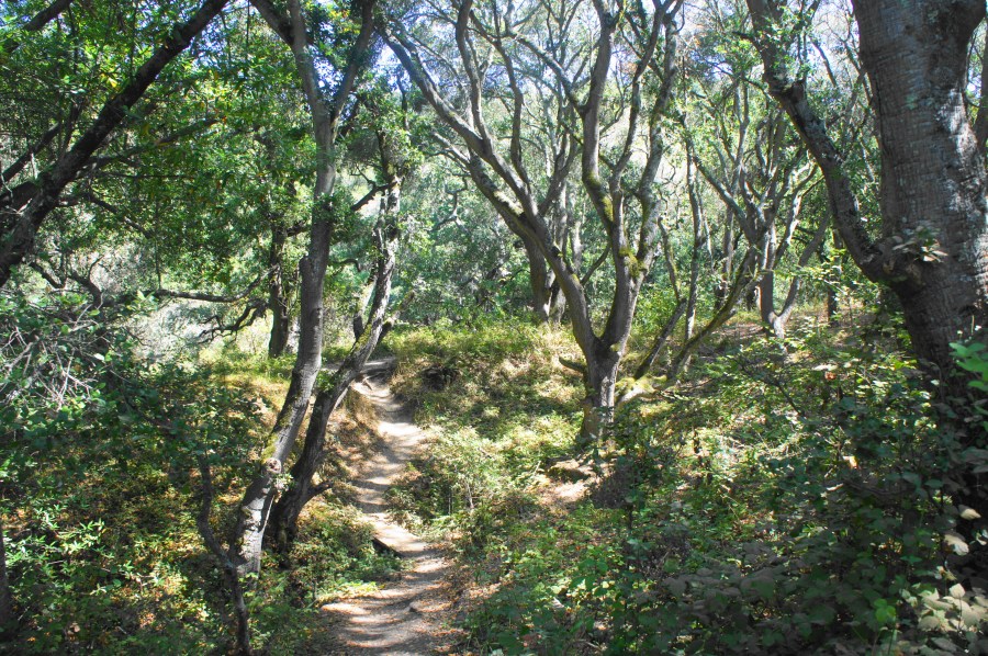
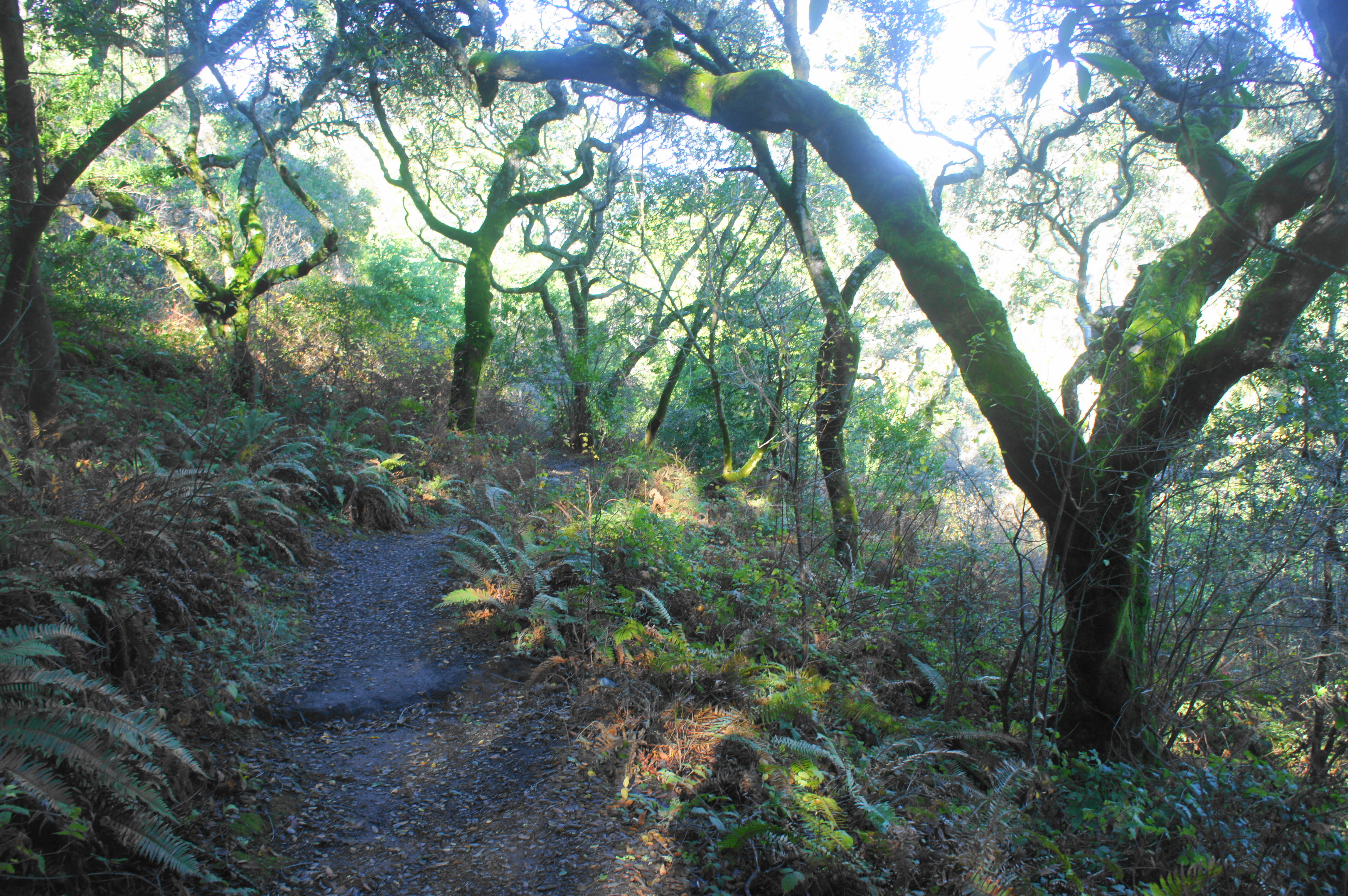
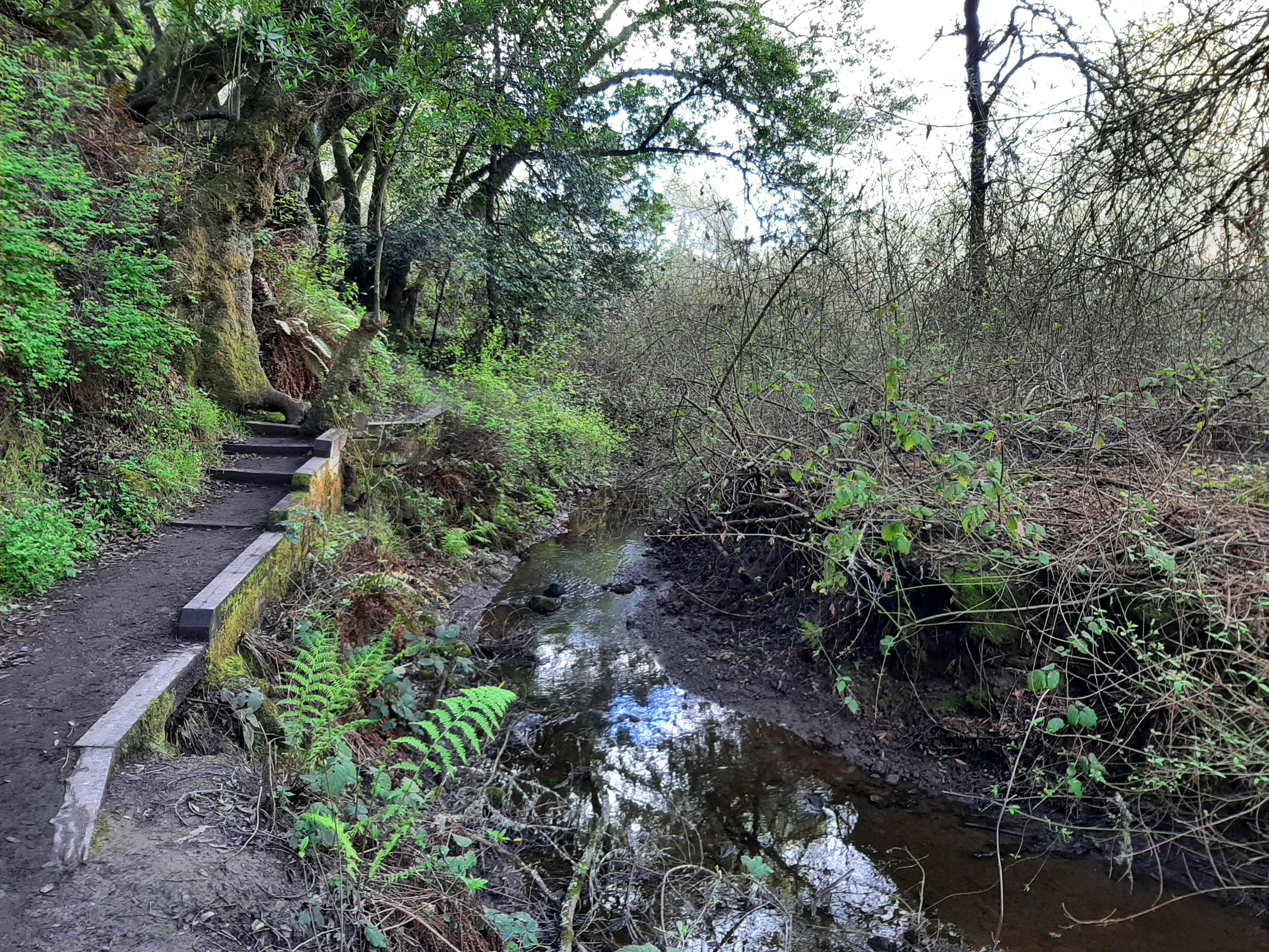
Tilden Nature Area, often packed with school groups and visitors to Little Farm, is not usually the place to escape crowds. But the Packrat Trail Loop provides relative solitude as it slithers through dense oak/bay woodlands along the western slopes above Wildcat Creek. Start from the parking area, heading west first on the Lower Packrat Trail, a dirt track that skirts the banks of Wildcat Creek and passes under moss-laden trees for 1/3 mile. At the first junction, bear left on the Upper Packrat Trail, which climbs to a higher shelf and doubles back toward the parking lot. Enjoy modest views of the willow-choked Wildcat Creek area, cross a wooden bridge, and bear left again at the next fork, following the Memory Trail downhill to return to the parking area.

Lower Packrat – Jewel Lake – Wildcat Creek Trail Loop (0.9 mi. loop)
Trailhead: Tilden Nature Area
Difficulty: Easy
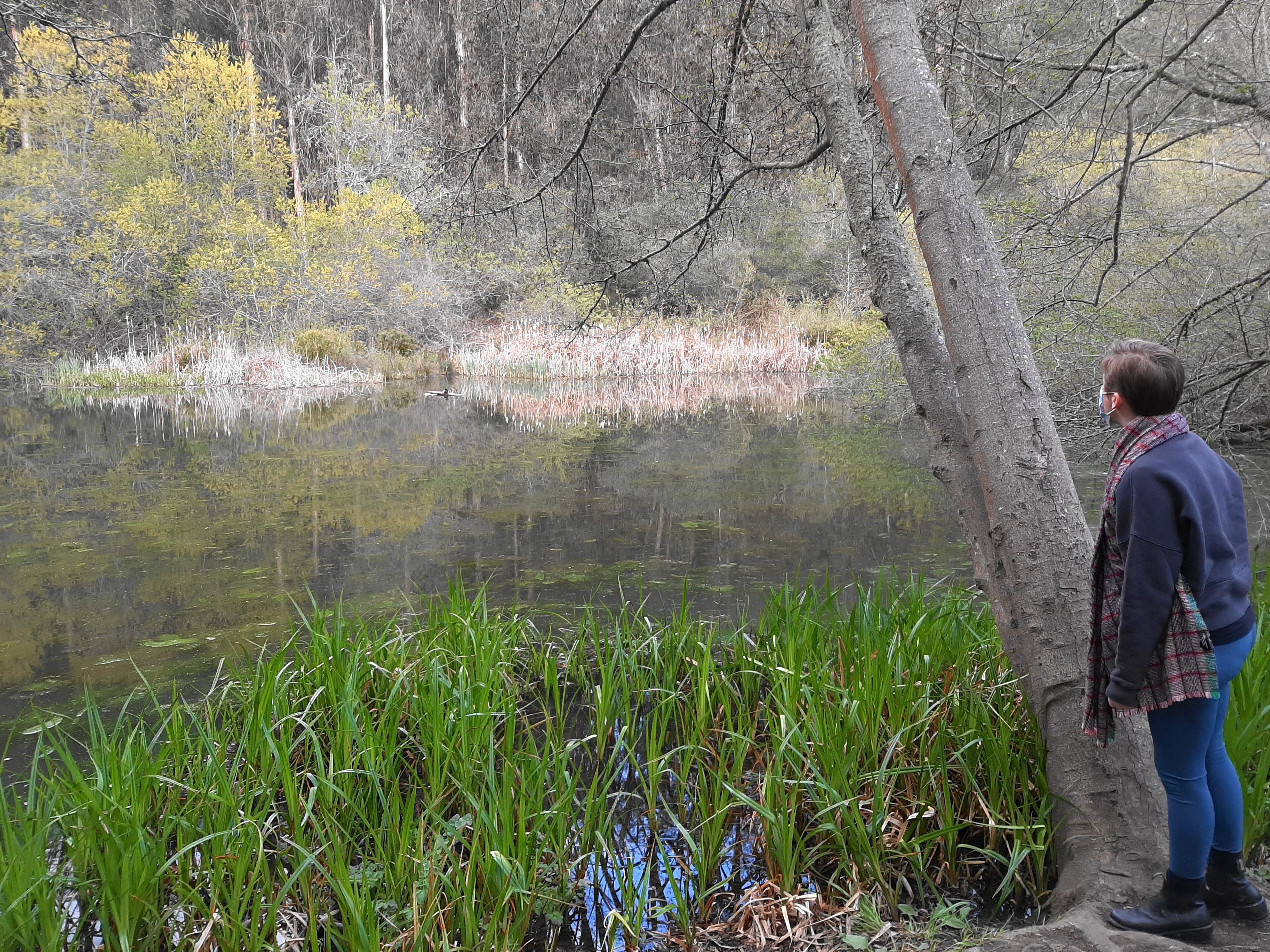
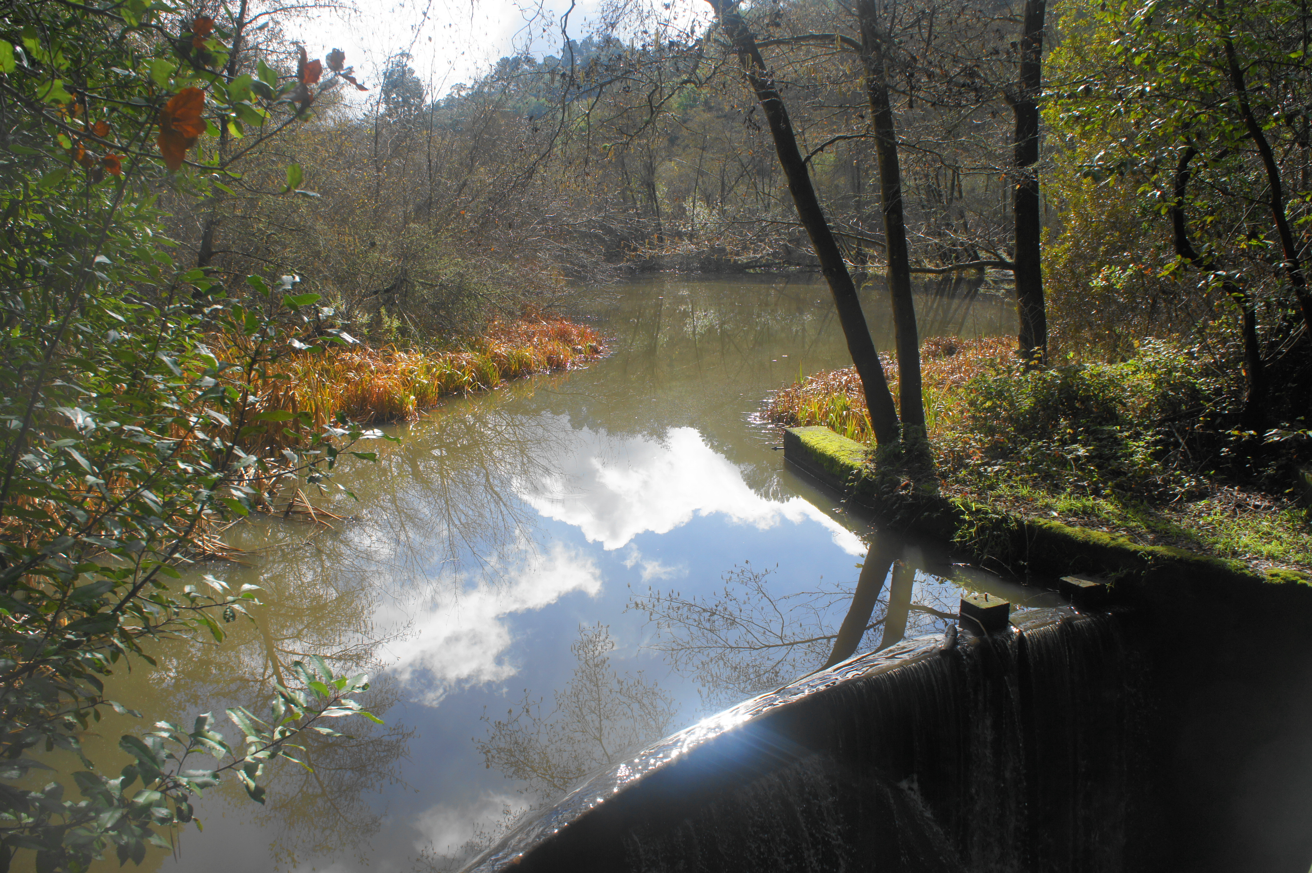
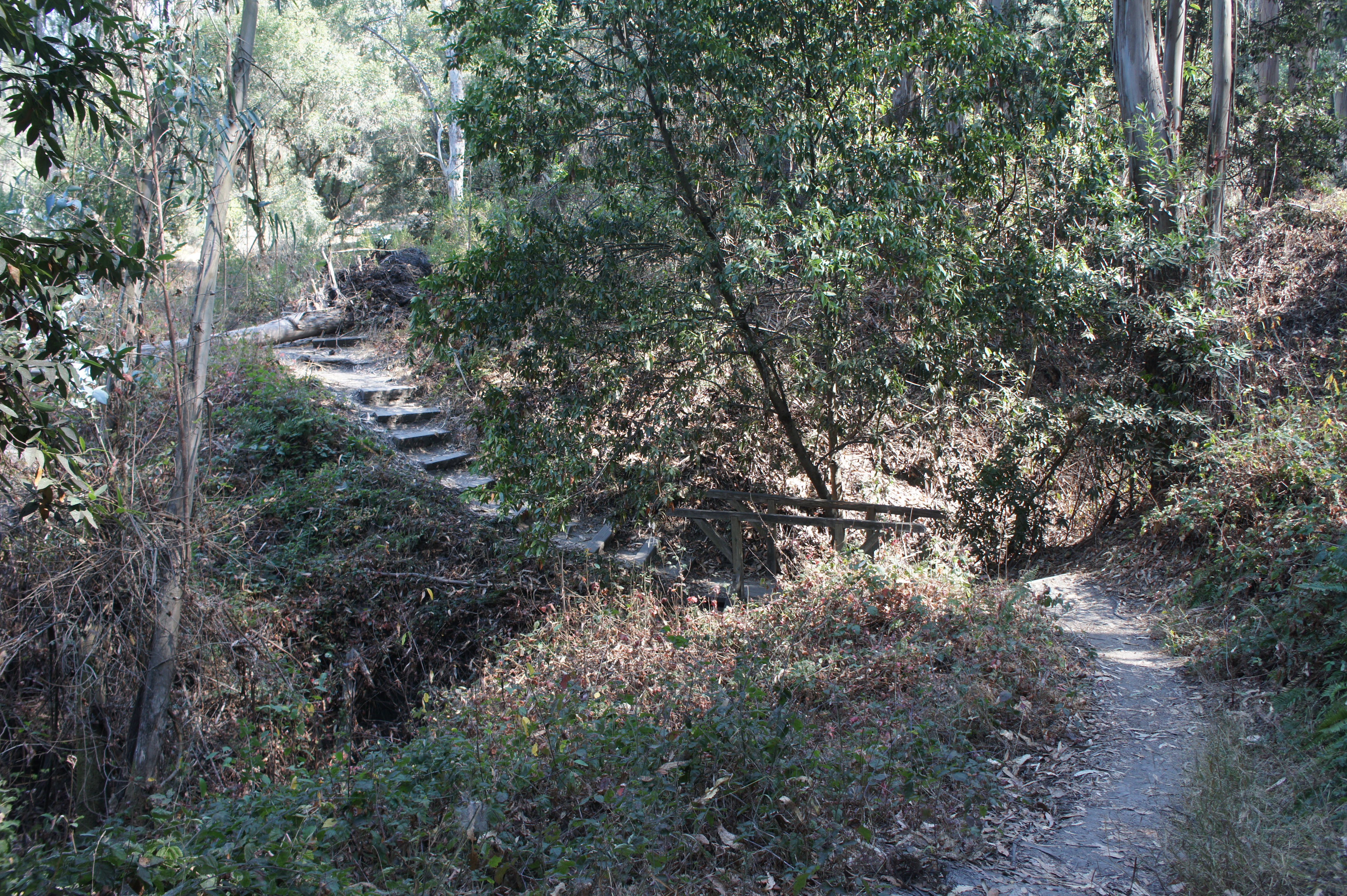
Jewel Lake is a seasonally-full pond sporting high reeds, turtles, and waterfowl and is the centerpiece of this short hike. Start by taking the Lower Packrat Trail from the parking area, bounding up through a clutch of pretty bay trees then descending through willows to the banks of Jewel Lake. Stay right at the fork, skirting the lakeshore and then cutting through a small redwood grove and crossing a bridge over a small dam and water chute. Turn right on the wide Wildcat Creek Trail, a popular thoroughfare which provides passage back to the start.

Jewel Lake Trail Loop (1.1 mi. loop)
Trailhead: Tilden Nature Area
Difficulty: Easy
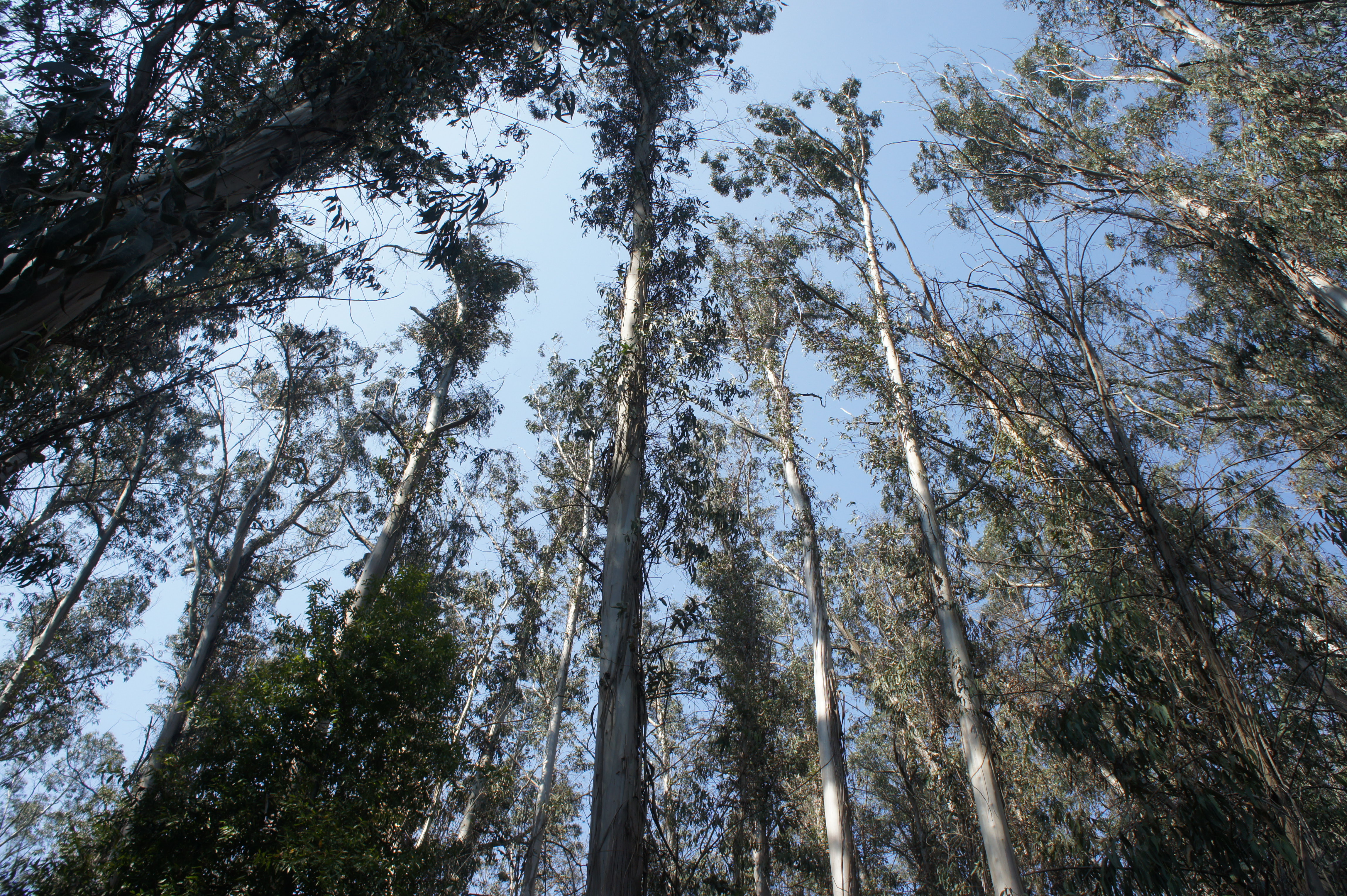
The Jewel Lake Trail is a moderately-interesting path that weaves through eucalyptus groves and descends to its namesake pond before returning to the trailhead. Start by walking around (or through) the Environmental Education Center and look for the Jewel Lake Trail on the north side of the open field beyond. Follow the signs as the path veers right, then left at two junctions, then crosses Laurel Creek. Bear left at the fork at ¼ mile, heading west through an excellent eucalyptus forest. Stay straight as the path crosses the Loop Road and then descends to Jewel Lake. Bear left on the Wildcat Creek Trail, then follow a parallel singletrack that skirts the northern shore of the lake. As the trail leaves lakeside, it follows a lengthy boardwalk for 2/10 mile back to the Wildcat Creek Trail. Take a right and return to the parking area.


Sylvan Trail Loop (1.3 mi. loop)
Trailhead: Tilden Nature Area
Difficulty: Easy
The Sylvan Trail climbs partway up the wooded hillside of Wildcat Peak, traversing a dense eucalyptus grove before winding back down to Jewel Lake. Make your way to the Environmental Education Center, then take the Jewel Lake Trail for nearly 300 yards as it traverses two congested streambeds and then forks. Head right on the Sylvan Trail, climbing to a point that crosses the wide Loop Road before bearing westward through a thick stand of towering eucalyptus. After the Wildcat Peak Trail comes in from the right, the trail descends steadily to the Wildcat Creek Trail, where hikers should bear left. Follow the wide path (past Jewel Lake on the right) for nearly ½ mile back to the start.


Ye Olde School Trail (1.5 mi. stem-and-loop)
Trailhead: Kenyon Avenue (Alternatives: Highland Boulevard, Lake Drive, Kensington Court)
Difficulty: Easy
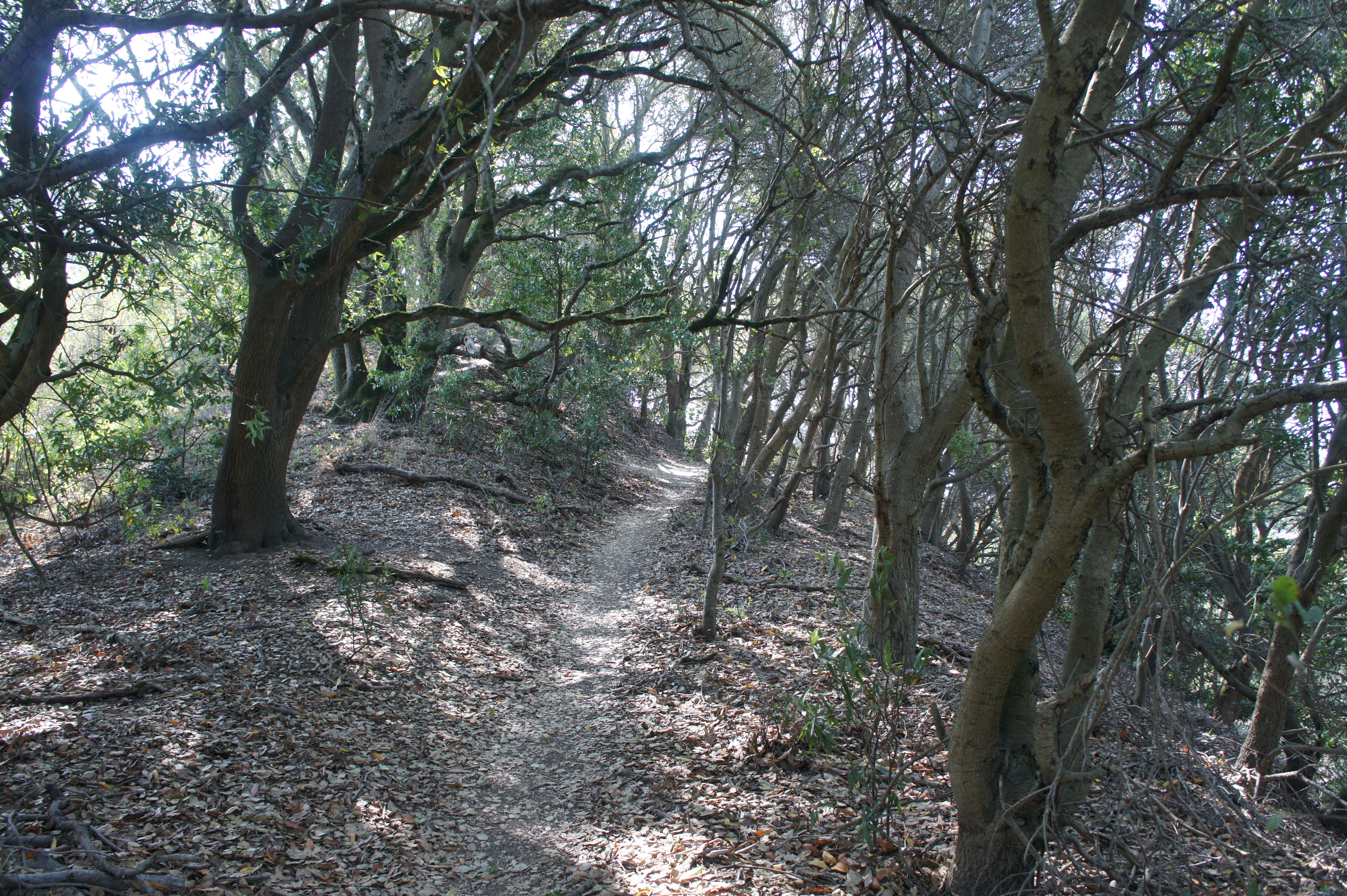
This is the redheaded stepchild of the group, located within Tilden’s boundaries but situated away from the main nature area trails and not advertised in park brochures. The Ye Olde School Trail is a hidden gem known mainly to local Kensington residents and traverses a ¾-mile segment of the ridgetop west of Wildcat Canyon. Access from Kenyon Avenue—or one of the three others above. From Kenyon, a sign marks the start of the route, which immediately offers views to Wildcat Peak and Tilden then enters bay/oak woodlands; bear right or left at the first fork (together one can make a loop) and continue westward with sporadic views of Wildcat Canyon. The two routes merge together again soon, after which the route approaches a small pine forest, with a spur heading left behind Kensington Hilltop Elementary School. Stay right as the route narrows, bobs up and down, and ends at a driveway at the end of Kensington Court. Return via the same route or the alternative loop option for a 1.5-mile jaunt.


Loop Road Circuit (1.6 mi. loop)
Trailhead: Tilden Nature Area
Difficulty: Easy
The Loop Road is not the area’s most scintillating trail but offers a wheelchair-accessible circuit through some nice eucalyptus groves. From the parking area, follow the Wildcat Creek Trail northwest toward Jewel Lake, then bear right on the Loop Road at 3/10 mile. Follow the broad path slightly uphill as it enters impressive eucalyptus stands, crosses Laurel Creek, then descends gradually back southwest toward the start. Head right at the fork at 1 mile to descend to Little Farm and the parking area—or continue left to follow the track to its end at Lone Oak Road. Follow Lone Oak Road and Central Park Drive back to the main parking lot.


Laurel Canyon – Pine Tree Trail Loop (1.6 mi. stem-and-loop)
Trailhead: Tilden Nature Area
Difficulty: Moderate
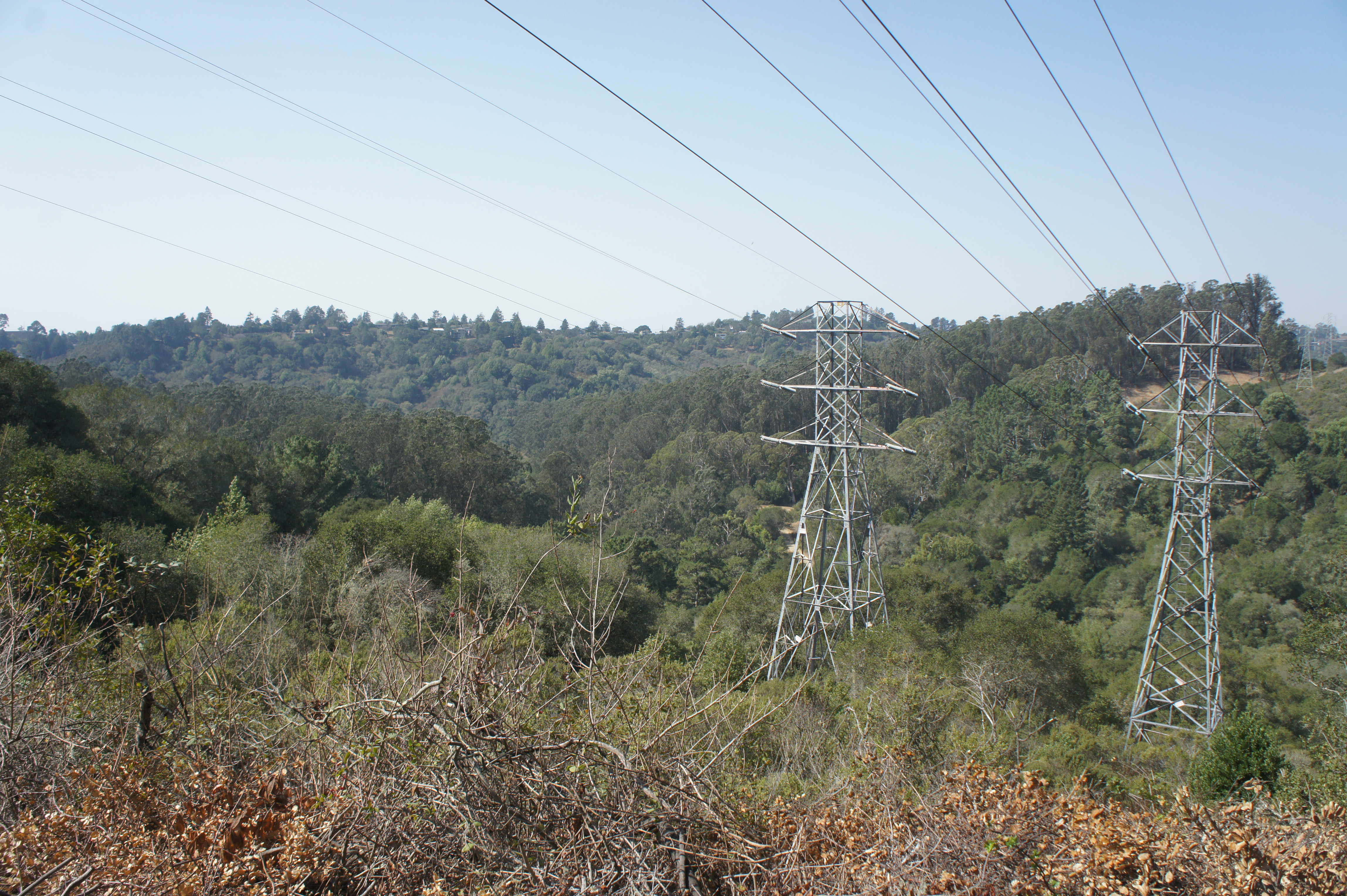
The Pine Tree Trail is a decent amount of work for relatively limited views and surprisingly sparse sightings of its namesake. But the trail is at least a pleasant singletrack that offers a more significant workout than the majority of paths in the Nature Area. Start by taking the Laurel Canyon Trail from the visitor center, following it for ½ mile as it crosses the Loop Road and flanks several minor gullies. Take a right on the Pine Tree Trail, which immediately climbs a steep ridgeline. Three-quarters of a mile from the hike’s start, the trail passes under power lines, offering some limited vistas of Wildcat Canyon and beyond. After finally encountering a batch of tall pines, the trail drops down a series of bends and returns to the Loop Road. Bear left and follow the road, past Little Farm, back to the entrance.
Laurel Canyon Loop (2.25 mi. loop)
Trailhead: Tilden Nature Area
Difficulty: Moderate
A shorter and shadier alternative to the Laurel Canyon-Wildcat Peak Loop (below), this 2.25-mile circuit traverses several different tree ecosystems, starting in eucalyptus forest, then climbs through extensive oak/bay woodlands to a patch of tall pines near the crest of the Berkeley Hills. Ascend the Laurel Canyon Trail for around 1.2 miles, gaining roughly 400 feet in elevation, then follow the wide Laurel Canyon Road back down toward the start. Begin and end your hike at the Environmental Education Center, next to Little Farm, in the Tilden Nature Area.


Laurel Canyon – Wildcat Peak Trail Loop (3.25 mi. loop)
Trailhead: Tilden Nature Area
Difficulty: Moderate
Arguably the premier hike in Tilden Nature Area, this moderate circuit climbs shady Laurel Canyon to the summit of Wildcat Peak (1,211’), which boasts 360-degree panoramic views of the area. Catch the Laurel Canyon Trail behind the visitor center and follow it for nearly a mile, bearing left on a connector trail that descends to Laurel Creek before ascending steep switchbacks to Laurel Canyon Road. Bear right on the road, then left at the next junction, taking a pleasant single-track up to the Rotary Peace Grove. Stay left at the next two forks, then take a right, rising to the summit, where hikers get views of San Francisco, Marin, the Golden Gate Bridge, and San Pablo Reservoir. Descend the winding Peak Trail and bear right on the Sylvan Trail as it cuts through dense eucalyptus cover en route to Jewel Lake. Skirting the pond on your right, bear east on the wide Wildcat Creek Trail, following it back to the start.


Pingback: Hikes in Tilden Regional Park (Central) | Live and Let Hike
Pingback: Hikes in Tilden Regional Park (South) | Live and Let Hike
Pingback: Top 10 Hikes in Tilden Regional Park | Live and Let Hike
Pingback: Top 5 Hikes in Wildcat Canyon Regional Park – Live and Let Hike
Pingback: Top 10 Hikes in 2024 – Live and Let Hike