Note: This is part two of a three-post effort to chronicle short day hikes in the East Bay’s Tilden Regional Park. The focus of this post is on the central part of the park, namely the sections located roughly between the Tilden Nature Area to the north and Botanic Garden to the south. For parts one and three of the series, see my other posts—North/Tilden Nature Area and South.
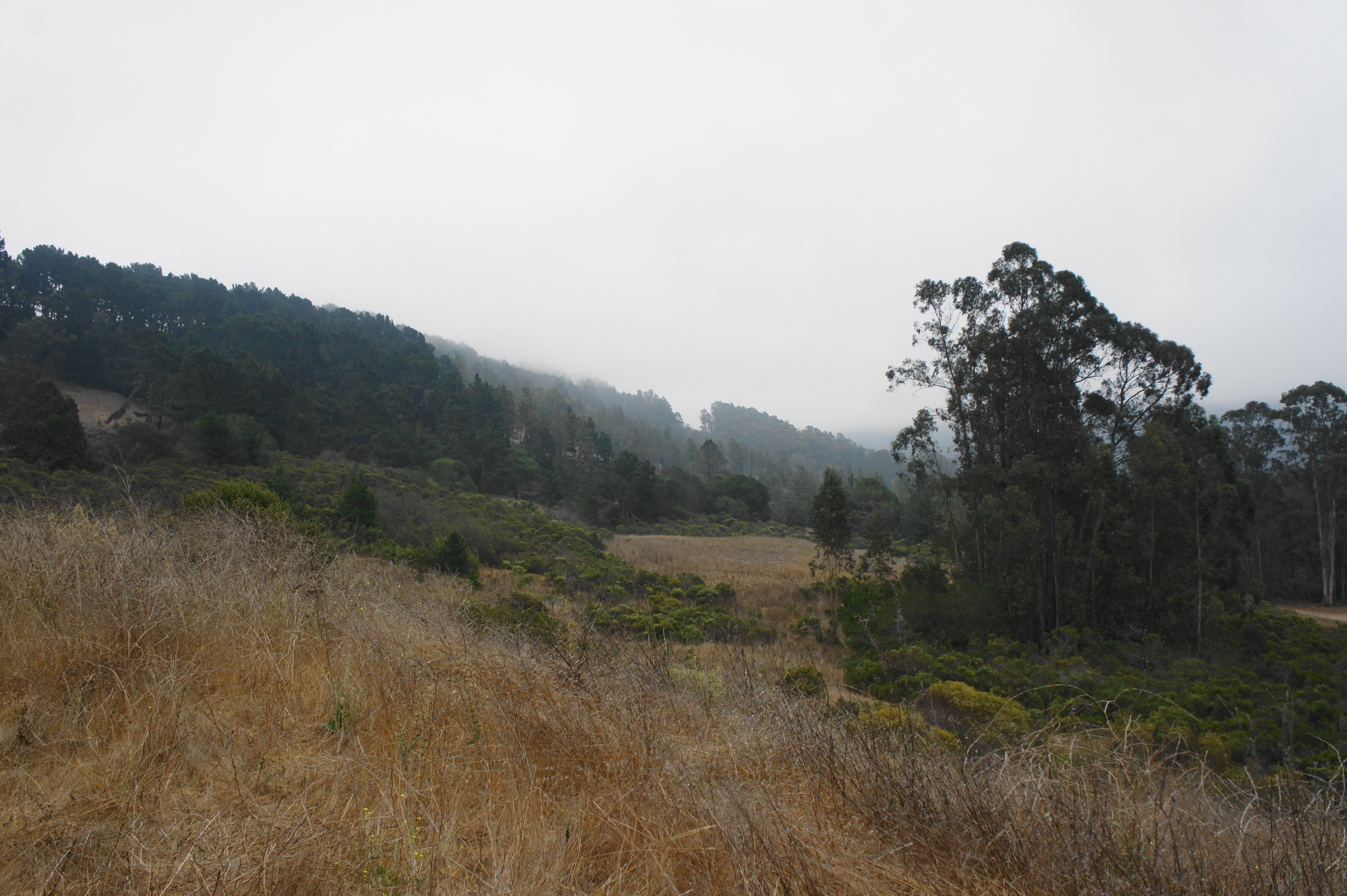
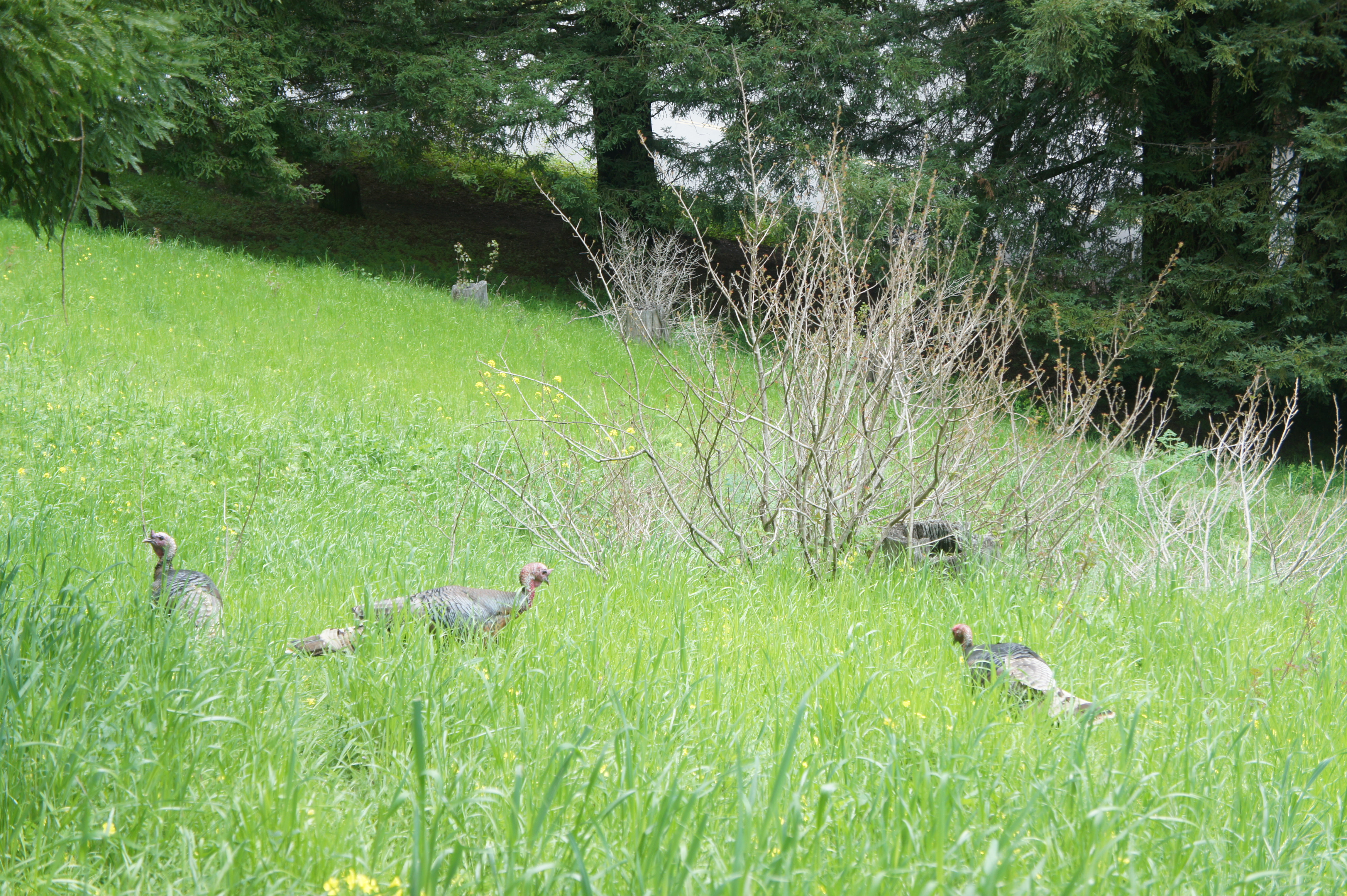
Charles Lee Tilden Regional Park, named for a founding board member of the East Bay Regional Park District, is perhaps the most famous park in the Berkeley Hills and certainly one of the most popular. Recreation opportunities abound, with swimming, golf, biking, horseback riding, camping, picnicking, event spaces, a petting zoo, and even a kid-friendly steam train all available in the 2,079-acre tract. The hiking network is also impressive, with nearly 40 miles of trails—mostly fire roads but also some singletrack—straddling ecologically-diverse terrain. Here you’ll find plenty of natural landscapes resembling what the terrain looked like before it experienced encroaching development: bay/oak woodlands, seasonal streams, windswept hills, and craggy rock outcrops. But the non-native introductions also admittedly make for interesting walking, including stands of Monterey pine and blue gum eucalyptus and recovered pastures. The high ridgeline affords views to San Francisco Bay, Carquinez Strait, and San Pablo and Briones Reservoirs, while Wildcat Canyon harbors hidden (seasonal) cascades, magnificent bay stands, and two small (dammed) lakes. There is also a small botanical garden that highlights native flora from across the state of California.
The park also has the advantage of being relatively easily-accessible, with more than a half-dozen entrances and even a weekend bus line that runs to and from Tilden Nature Area. The park dates to 1936, in the early days of the East Bay Regional Park District, which has sought to try to restore the native ecosystem after the area was ravaged by ranching and logging in the late 19th and early 20th centuries.
My attempt to chronicle the various hike options in Tilden is quite the challenge given the dense trail network and dozens of possible permutations. But splitting the effort into three separate posts—into north, central, and southern sections—eases the task, and emphasis is on forming short and brisk loops, with longer traverses available for the more ambitious. The result is a collection of 26 hikes across the three segments. (Note: This does not include hikes in neighboring Wildcat Canyon Regional Park or the EBMUD Watershed, which abut the park but are documented separately in forthcoming posts.)
Central Tilden
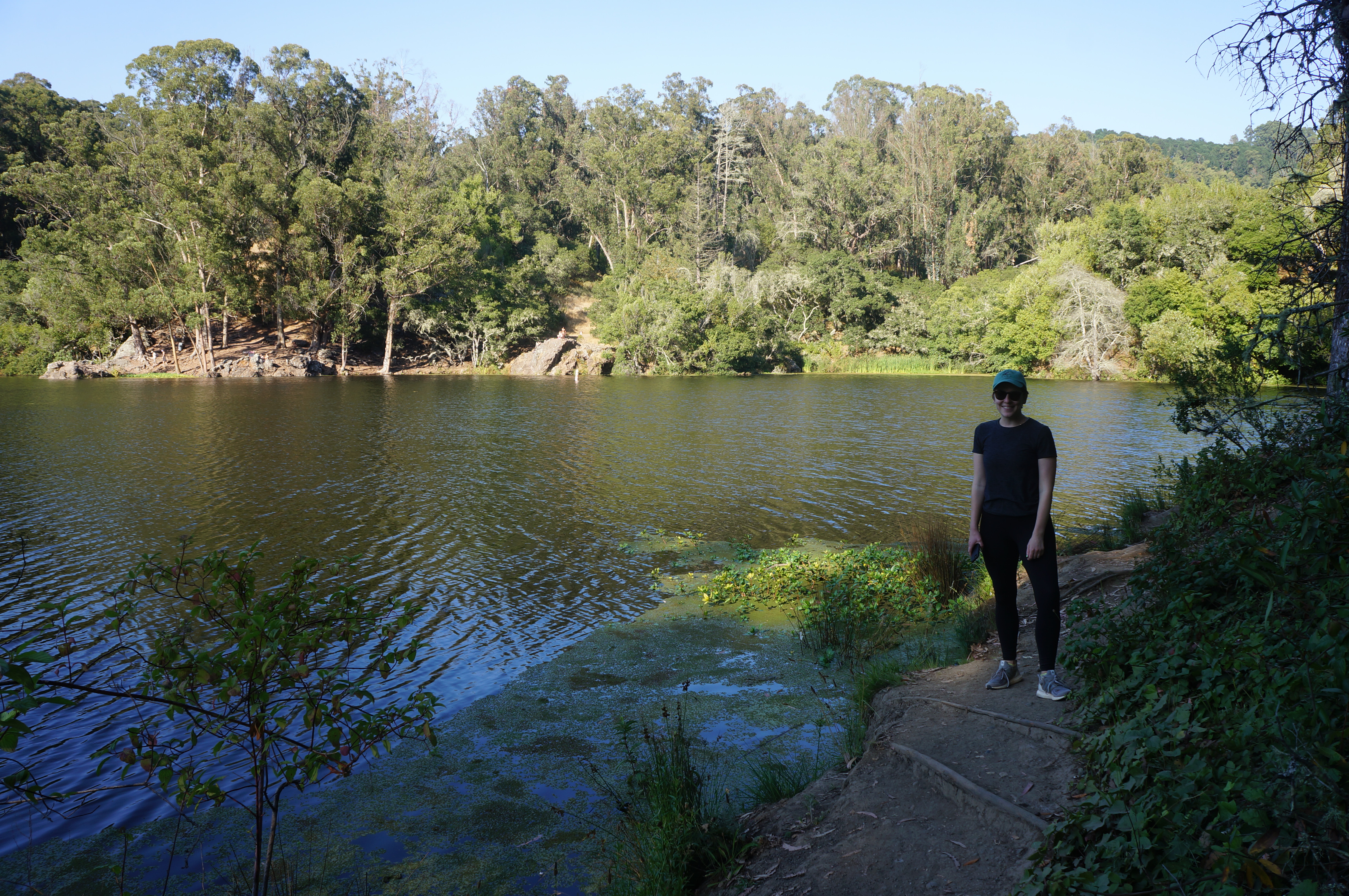
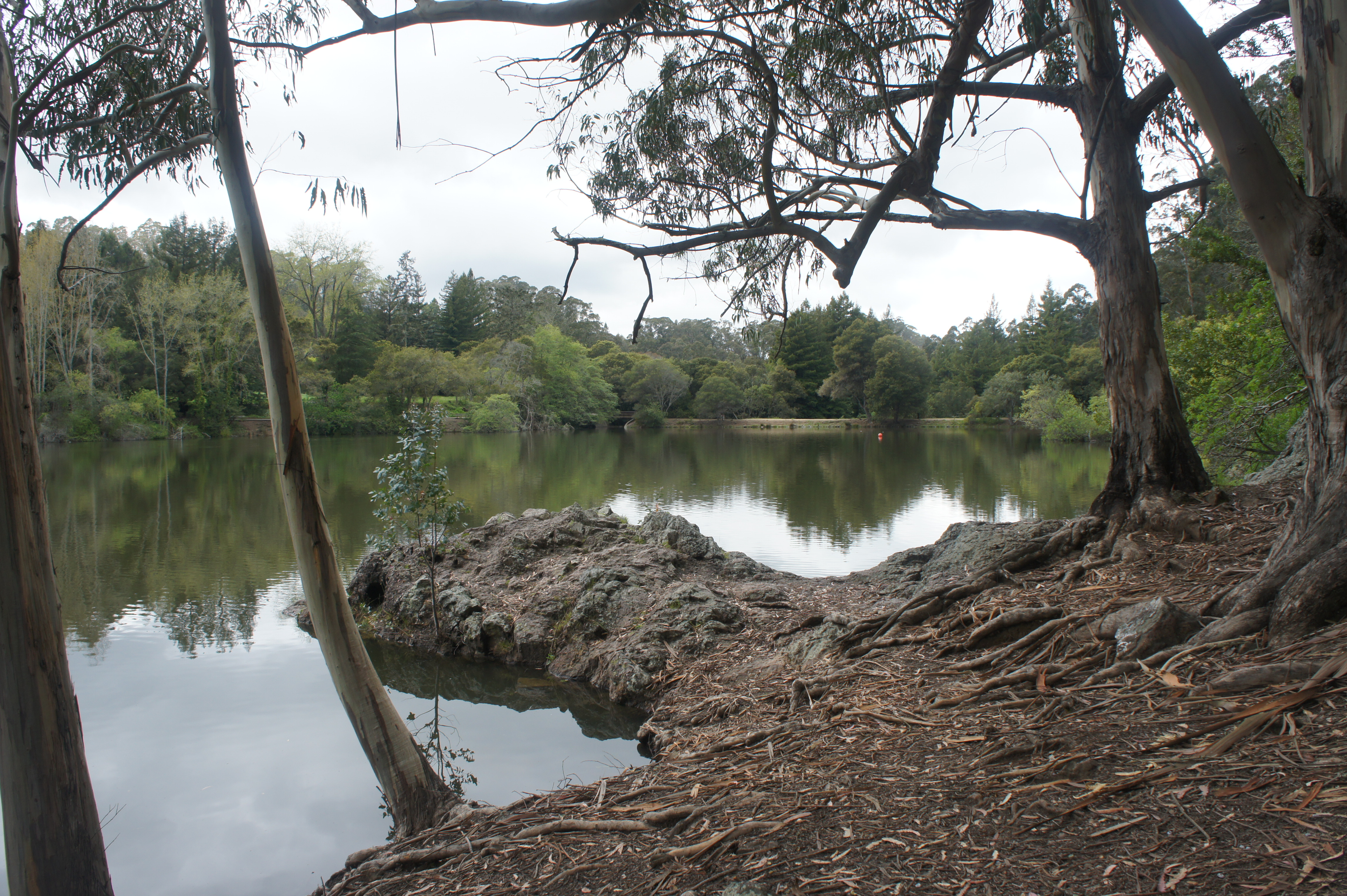
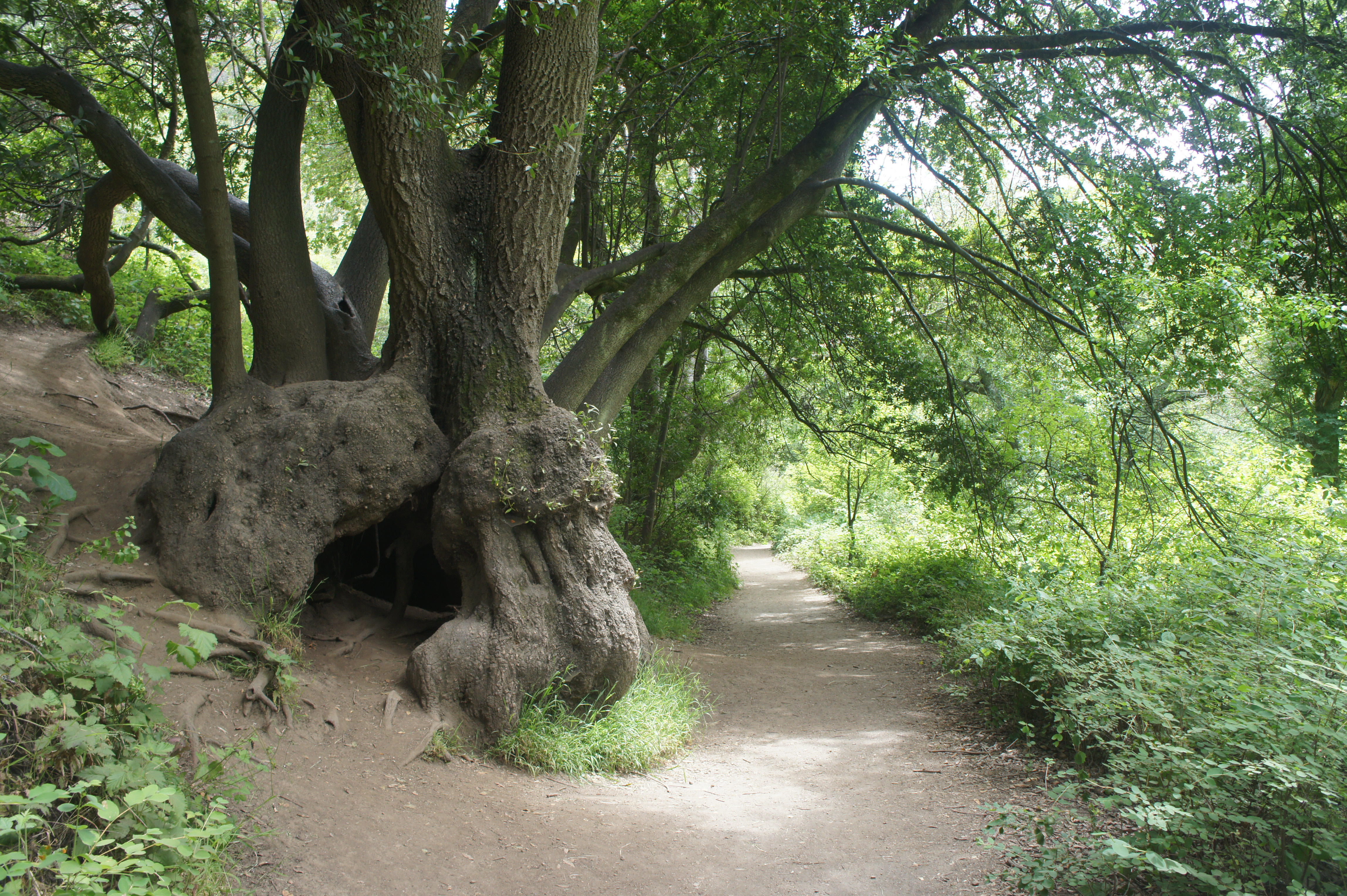
This post details Tilden’s wildly diverse central section, comprising the area roughly between Tilden Nature Area to the north and the Tilden Park Golf Course and Botanic Garden to the south. Within this perimeter lies a variety of trail options, including scenic singletracks, paved bike paths, and dusty fire roads; some of the terrain, especially around the rocky shores of Lake Anza, is surprisingly rugged. The trail network is centered around the Wildcat Creek drainage, which here narrows to a scenic gorge with seasonal cascades and perennial, low hanging bay trees. The creek is dammed to form Lake Anza, a popular swimming and hiking destination. Some sporadic redwoods can be found on the Selby Trail, which covers higher ground on the Berkeley side of the park, while terrific eucalyptus groves are more common east of the canyon. The area also contains the ever-popular Inspiration Point, a roadside stop with scenic views stretching to Carquinez Strait, Briones Reservoir, and beyond. (Note: Unlike the Tilden Nature Area, dogs, bicycles, and equestrians are permitted on most of the trails in Tilden’s center.)
There are several trailheads that service hikes into Tilden’s interior, with many doubling as picnic areas with small parking lots. Six are noted below, including Brook, Inspiration Point, Lake Anza, Lone Oak, Mineral Springs, and Quarry. (Note: It is perhaps easiest to consult a Tilden Regional Park map). Trails never meander too far away from the park roads, but the immersive scenery helps hikers to quickly put civilization behind.
Suggested hikes are listed below, in order of length.
Central
Mineral Springs Trail (0.7 mi. loop)
Trailhead: Mineral Springs (parking area opposite ES Anderson Equestrian Camp)
Difficulty: Easy
The Mineral Springs Trail skirts a stand of eucalyptus trees and offers access to Lake Anza—dammed in 1938—from the east. Park at the pull-off across Wildcat Canyon Road from the ES Anderson Equestrian Camp, then follow the fire road downhill to the edge of a sloping meadow. Stay right at junction, following the circuit in a counterclockwise direction. Pass a wily batch of bay trees on the right, then peer over to the west for obscured views of the lake. After bearing south and descending, the trail reaches a junction at 1/3 mile, with access to Wildcat Creek and Lake Anza off to the right. Stay left, climbing up through the eucalyptus grove and across the opening meadow, returning to the initial trail junction. Bear right to return to the parking area.


Lake Anza Short Loop (0.75 mi. loop)
Trailhead: Lake Anza
Difficulty: Moderate
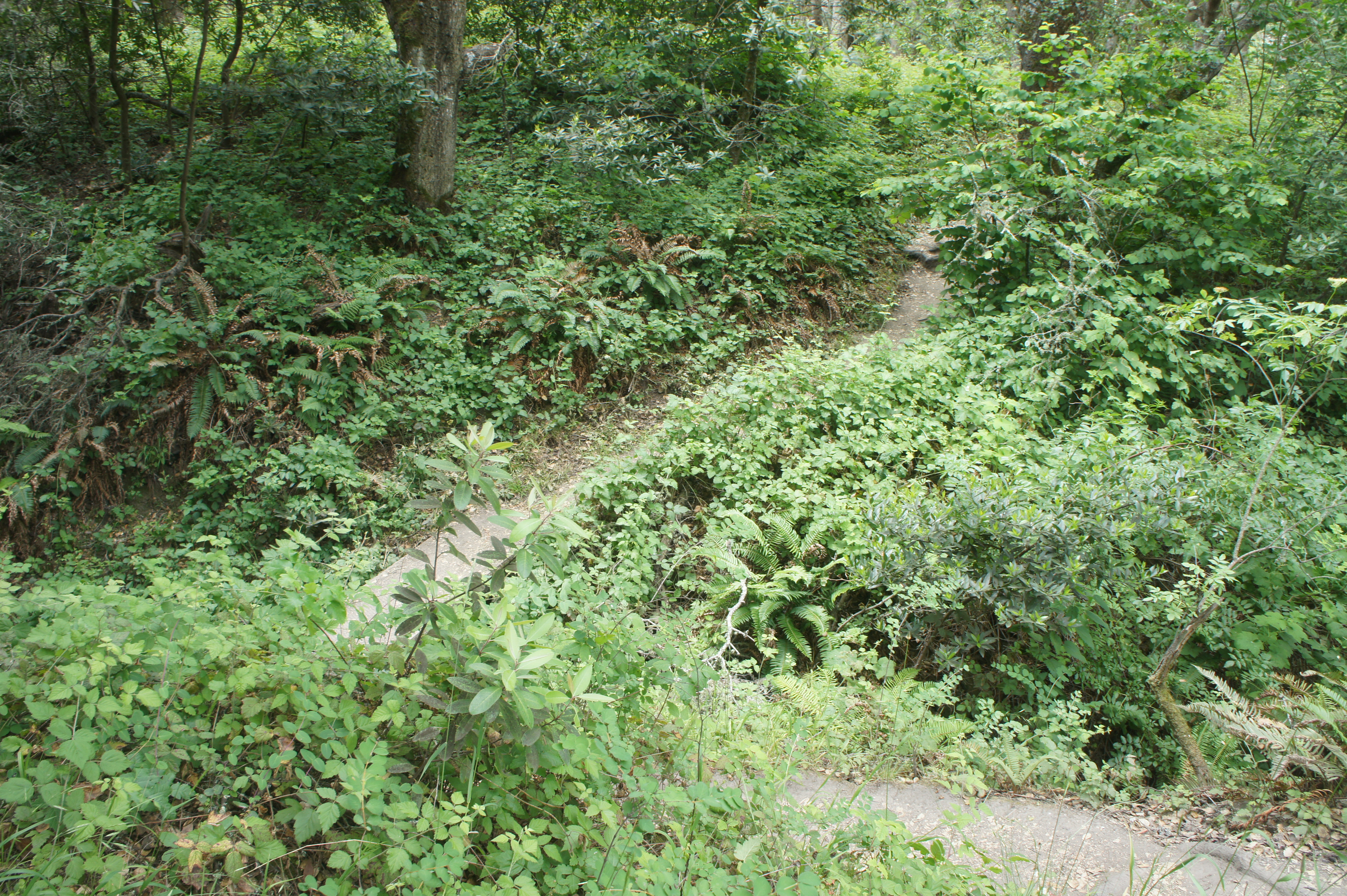
The terrain around Lake Anza is surprisingly rugged and textured, making this ¾-mile loop considerably more interesting than your run-of-the-mill lake circuit. Start at the Lake Anza parking area and walk down to the entrance to the beach but stay right, coursing around the south side of the lake. Come to a junction at the end of a fenceline and take a left, following a narrower, up-and-down stretch that is partly overgrown and laced with tree roots. Drop to a cove at the lake’s easternmost point, where the trail gets very thin, paralleling the shore. (Note: At high water, this section becomes nearly—though not quite—impassable.) Cross a bridge over Wildcat Creek and bear left, taking a rugged path along the north shore with several fine lake vistas. Drop to a point where the trail abuts the lake directly, then stay left and loop back around to the start. This is a short but surprisingly scenic walk in the heart of Tilden Park.


Quarry – Seaview Trail Loop (1.0 mi. loop)
Trailhead: Quarry
Difficulty: Easy
This short hike traces a triangle from the popular Quarry Picnic Area, navigating diverse terrain with decent views across Wildcat Canyon. Take the Quarry Trail from the parking area, then bear right at the first junction. Follow the Quarry Trail as it climbs gradually through low scrub before passing under a stand of tall pines. At 4/10 mile, bear left on the Lower Big Springs Trail, climbing to a woody ridgeline. Bear left on the Seaview Trail and follow it for 1/3 mile as it drops through a eucalyptus forest back to the picnic area.


Lake Anza Long Loop (1.3 mi. loop)
Trailhead: Lake Anza
Difficulty: Easy
A lengthier alternative to the Lake Anza loop described above, this 1.3-mile circuit adds portions of the Wildcat Gorge and Selby Trails as they cut through a lush, stream-fed valley. From the parking area, follow the Wildcat Gorge Trail in a clockwise direction, traversing the rocky north and east shores, then continue as the path weaves away from the lake at about 4/10 mile. Stay right on the Wildcat Gorge Trail as it follows Wildcat Creek under dense canopy cover, then cross a wooden bridge and climb within earshot of Anza View Road. At a small field surrounded by eucalyptus at 9/10 mile, stay right on the Selby Trail, then follow it uphill—then down—to a four-way junction. Stay straight on the Lake Anza Trail, following it past the changing rooms on the right and back to the parking lot.


Meadows Canyon – Curran – Wildcat Gorge Trail Loop (2.9 mi. loop)
Trailhead: Lone Oak (Alternatives: Brook)
Difficulty: Easy
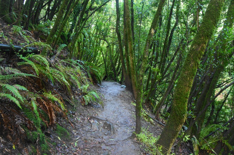
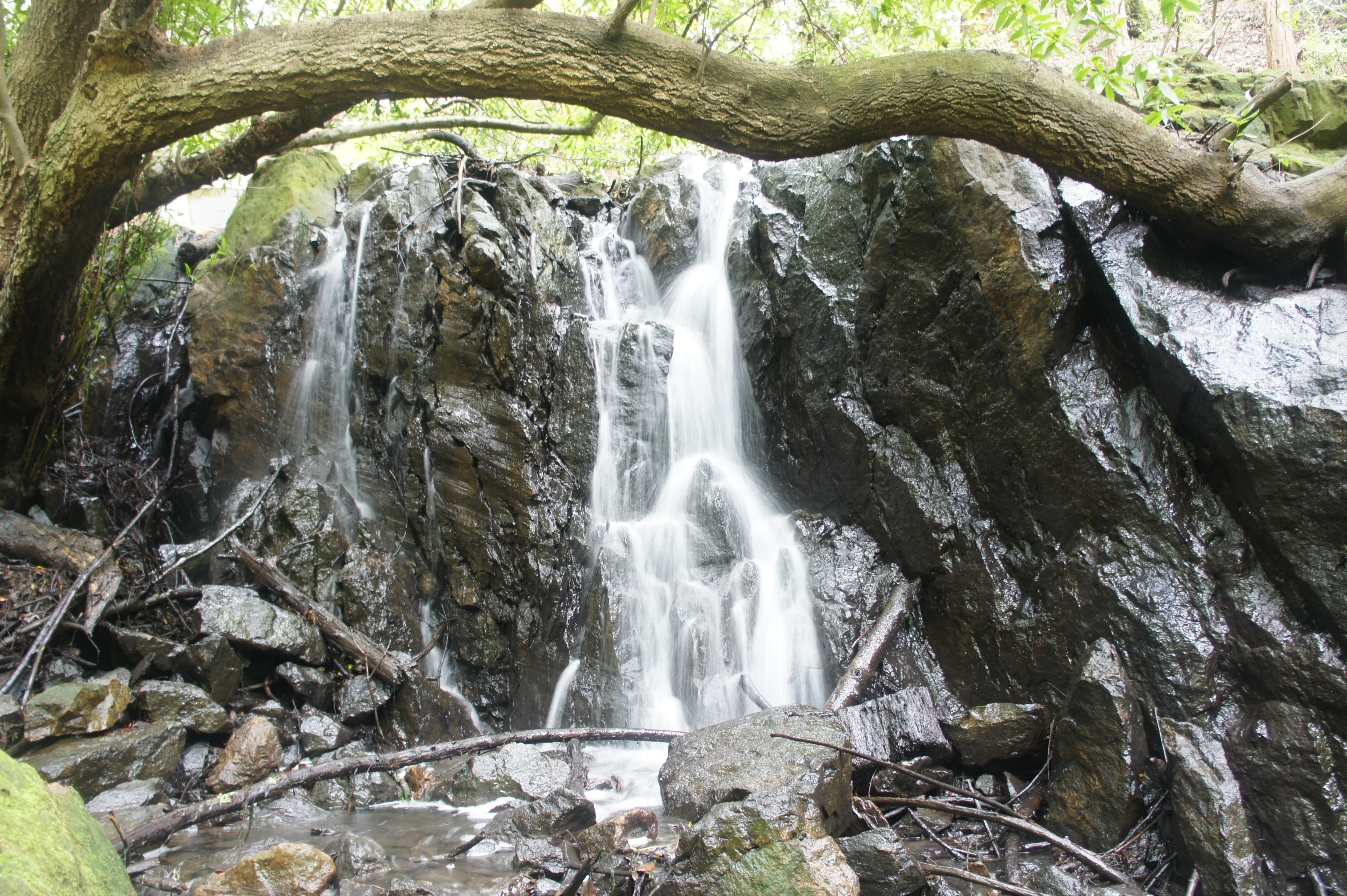
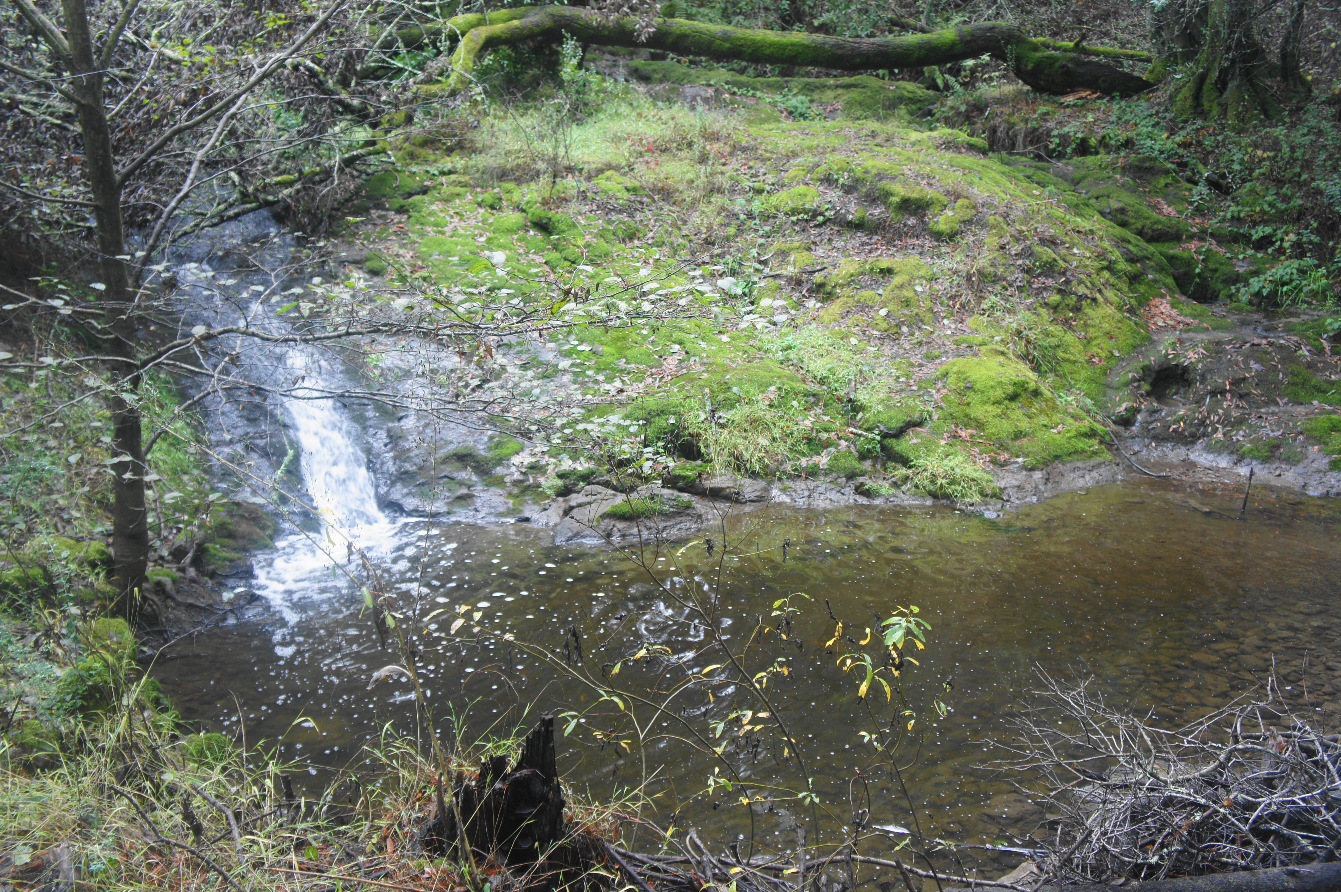
A longer but still easy alternative is the Meadows Canyon-Curran-Wildcat Gorge Trail Loop, which runs through the heart of Tilden and combines high views with a shady and intimate walk through a narrow canyon. Starting from the Lone Oak picnic area, the Meadows Canyon Trail follows a wide track, climbing mildly and edging around three successive ravines, with modest views of the Wildcat Gorge area and surroundings. Reach a bench that serves as a nice lookout at 1.25 miles. After about ¼ mile in the scruffy chaparral, bear right (then right again) on the Curran Trail, which dives into an impressive grove of eucalyptus. Another bench offers views of Wildcat Gorge at 1.8 miles, then the trail descends to reach the banks of Wildcat Creek. Head right, following the beautiful Wildcat Gorge Trail as it parallels the babbling (seasonal) stream, passes under wildly-branching bay trees, and visits several small groves of second-growth redwoods. After passing a beautiful pool with a small waterfall, the trail leaves the creekside, traverses an open meadow, and returns to Lone Oak.


Selby – Wildcat Gorge Trail Loop (4.2 mi. loop)
Trailhead: Tilden Nature Area (Alternatives: Brook, Lake Anza, Lone Oak)
The penultimate loop connects many of the park’s major sights—including the Tilden Nature Area, Lake Anza, and Wildcat Gorge—into a scenic 4.2-mile circuit in the heart of Tilden. From the Nature Area parking lot, climb the Upper Packrat Trail to the Memory Trail, bearing left and rounding a right-hand cut before crossing Canon Drive and ascending steeply up the woody hillside. Bear left on the Selby Trail, following it for nearly two miles, passing occasional canyon views and small redwood stands, flirting frequently with Wildcat Canyon Road above. Continue to a bridge crossing over Wildcat Creek, where the route turns into the Wildcat Gorge Trail and follows the scenic brook to the banks of Lake Anza. Trace the east side of the manmade lake, pass over the dam, and take a hard right as the trail descends sharply, passing some a (seasonal) waterfall and traversing the lush, clover-lined gully. Stay straight as you approach the Brook Picnic Area (across the creek) and follow Wildcat Gorge for more than ¾ mile to Lone Oak Picnic Area. Bear left, then right on the road to return to the main staging spot.

Laurel Canyon – Nimitz Way – Curran – Wildcat Gorge Trail Loop (4.3 mi. loop)
Trailhead: Tilden Nature Area (Alternatives: Brook, Inspiration Point, Lone Oak)
Difficulty: Moderate
About 50 percent longer than the Meadows Canyon/Wildcat Gorge combination described above, this similar jaunt adds a leafy climb through Laurel Canyon and pleasant stroll along the ridgeline to Inspiration Point. Starting from the Tilden Nature Area, head for the Visitor Center and take the Laurel Canyon Trail as it enters dense woods, following the signs for 1.2 miles to the junction with the Laurel Canyon Road. Bear right, then right again on Nimitz Way, following the asphalted path for 1.3 miles to Inspiration Point. Just before the parking area, take a hard right and descend the dirt Curran Trail, which drops through eucalyptus groves and offers bird’s eye views of stony Wildcat Gorge. Descend to the gorge and bear right, traversing the lovely Wildcat Gorge Trail as it follows the trickling stream through a forest of bay laurel, oaks, and redwoods. After passing a beautiful pool with a small waterfall, the trail leaves the creek side, traverses an open meadow, and ends at Lone Oak picnic area. Follow the road back to Tilden Nature Area to complete the 4.3-mile circuit.


Pingback: Hikes in Tilden Regional Park (South) | Live and Let Hike
Pingback: Top 10 Hikes in Tilden Regional Park | Live and Let Hike
Pingback: Top 10 Hikes in 2024 – Live and Let Hike