

Most desert rats in Utah’s canyon country will know of Capitol Reef National Park’s three most prominent slot canyons: Burro Wash, Cottonwood Wash, and Sheets Gulch. They will also be familiar with the short, family-friendly narrows in nearby Headquarters Canyon. Much less promoted is the unnamed slot just off Capitol Reef’s Pleasant Creek, which boasts two impressive sets of narrows and at least two awesome, relatively challenging obstacles. Combined with a pleasant stroll alongside Pleasant Creek, this slot canyon adventure makes for a nice day hike in a beautiful area that sees relatively few visitors. Adventurous hikers can continue ¾ mile beyond the slot to a small natural bridge, hidden amid a series of sculpted waterpockets, or tanks.

The hike
Despite being a short drive (around 11 miles) from the Visitor Center, the Pleasant Creek area remains scarcely visited—or even known—relative to its well-trafficked cousins, Grand Wash and Capitol Gorge. This is one explanation for the dearth of knowledge about one of Pleasant Creek’s most interesting attractions—the short but spectacular slot.
Another explanation involves the slot’s relative distance from the Pleasant Creek Trailhead, where an unmaintained route takes off east into the deeply-chiseled Waterpocket Fold (see my most recent post for a description of the Pleasant Creek route). The side drainage, one of Pleasant Creek’s most significant, appears approximately 2.7 miles from the trail’s start—by which time you will have crossed the perennial stream 10 or 11 times.
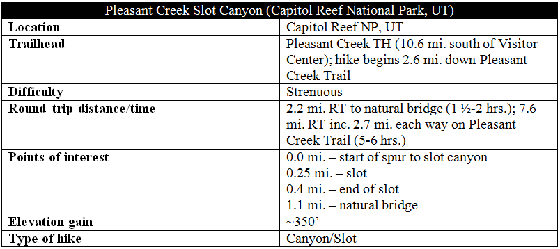
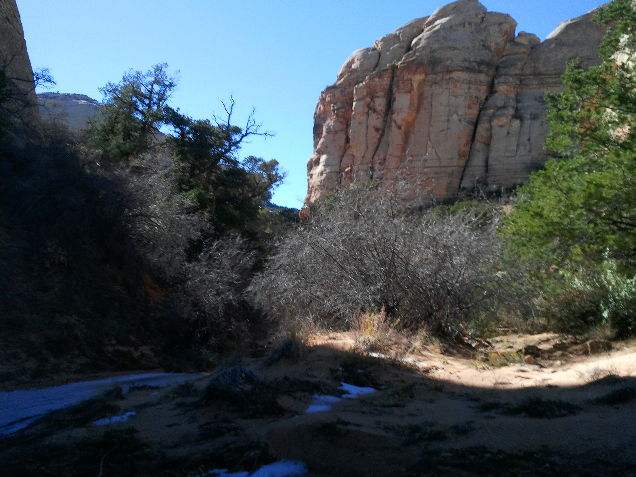
Finding the correct side canyon is relatively easy. At about the two-mile mark on the Pleasant Creek Trail, the main drainage squeezes through two narrow bends. Both meanders bring the creek in almost direct contact with the immense cream- to gray-colored walls of Navajo sandstone. At 2.6 miles, the canyon suddenly opens up—the sandstone domes on the south side recede, revealing a broad flat populated by pinyon pines, junipers, sand, and cryptobiotic crust. At the same time, Pleasant Creek cuts into the pink-tinted bedrock, forming a series of small cascades. The creek is thin enough here to jump across in one swoop.
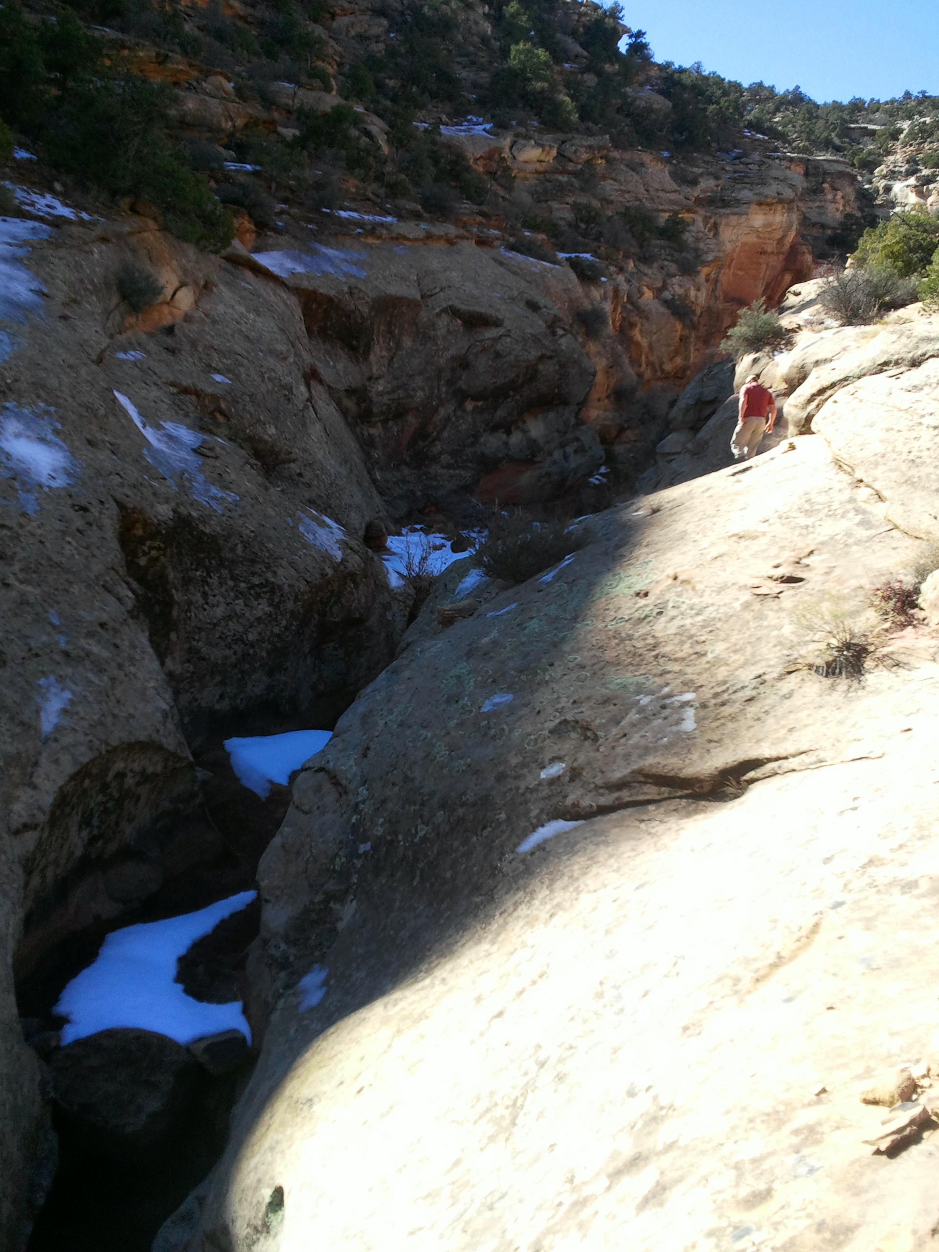
When the scenery matches this description, you will likely be on the north side of the stream. Where possible, cross to the south side and look for a well-worn, hiker-made footpath leading off into the flat. Follow this sandy trail toward a deeply-crossbedded sandstone dome, where a narrow cut in the Navajo veers off to the southwest. After maybe 200 yards, the trail drops into a dry wash. Follow this drainage upstream.
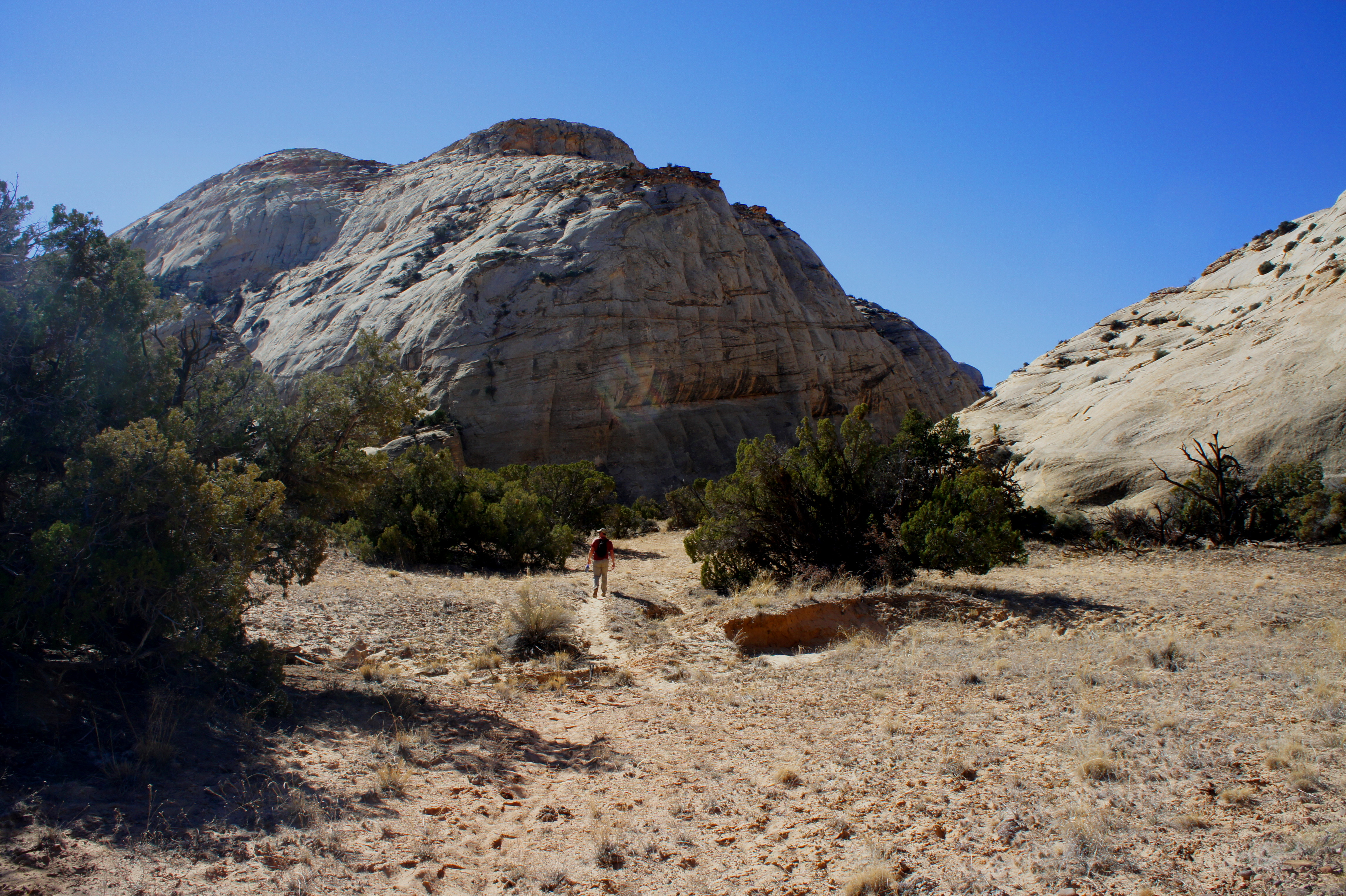
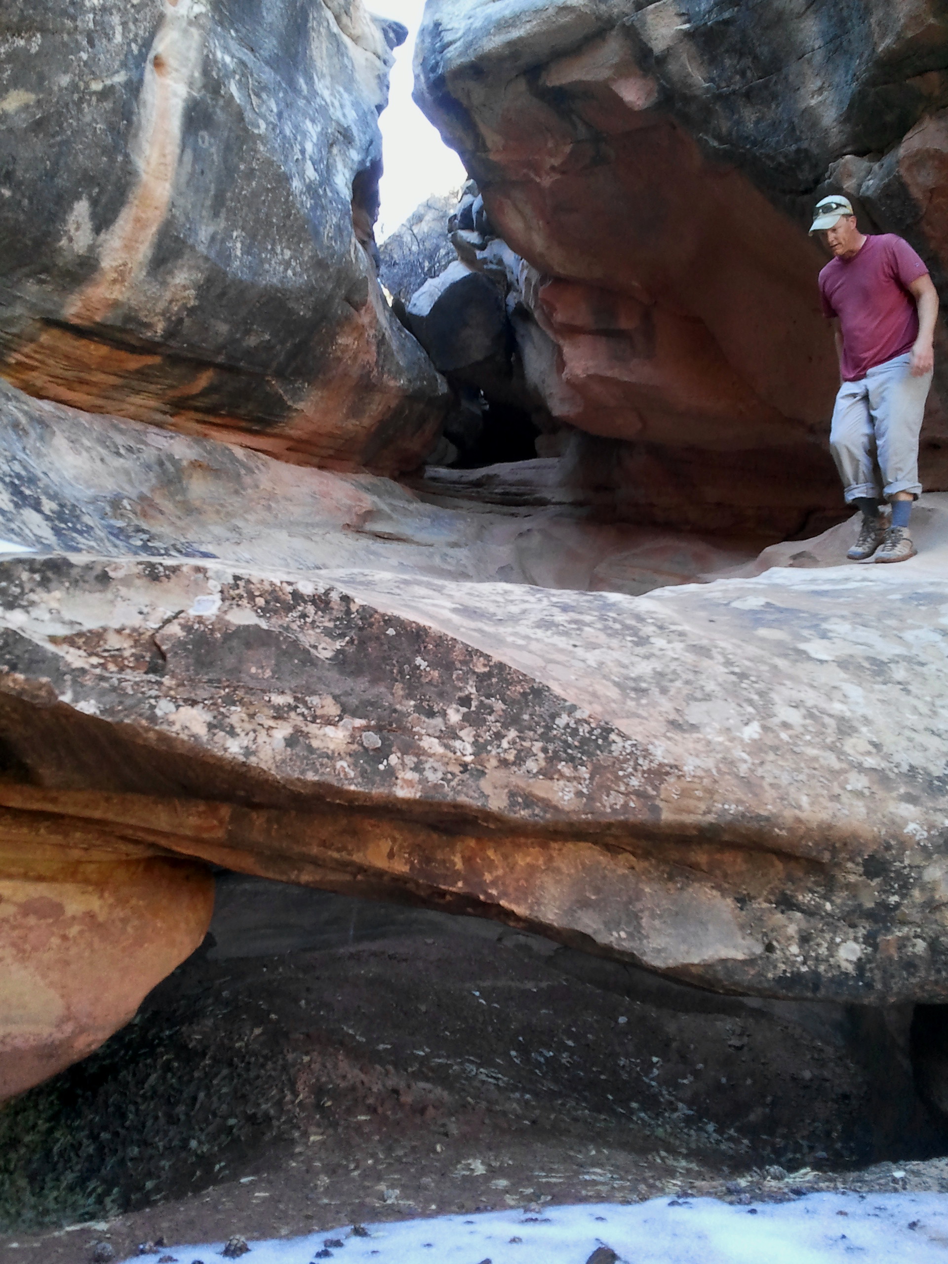
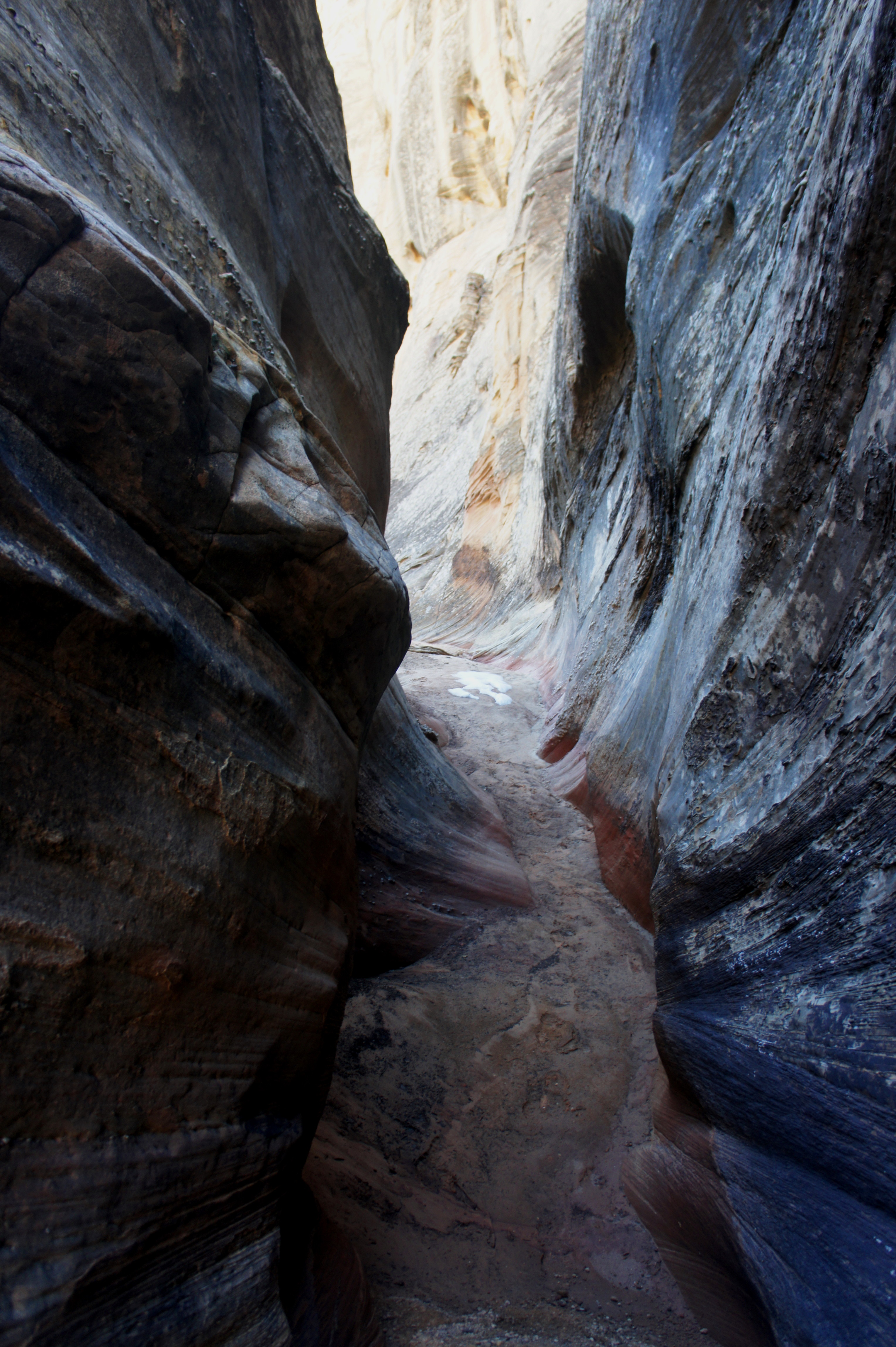
Immediately thereafter, the ravine begins to constrict; beautiful fluted cliffs adorn the left-hand wall. Around ¼ mile from Pleasant Creek, the first slot section begins. Herein lies the first potential obstacle—at the time of writing (February 2015), there was a thin pool of ankle-deep water, dammed by a minor chockstone at the end. Unless new, tall stones are placed in the pool for support, it’s hard to avoid getting your feet wet. Don’t let this deter you—wet boots are a worthy price for the scenery to come.
Shortly after the pool, the first slot section ends, revealing a sunny opening. But it is not long until the canyon constricts a second time—a gnarled juniper is the only obstacle in this section. The canyon then widens again for a short period, before thinning once more.
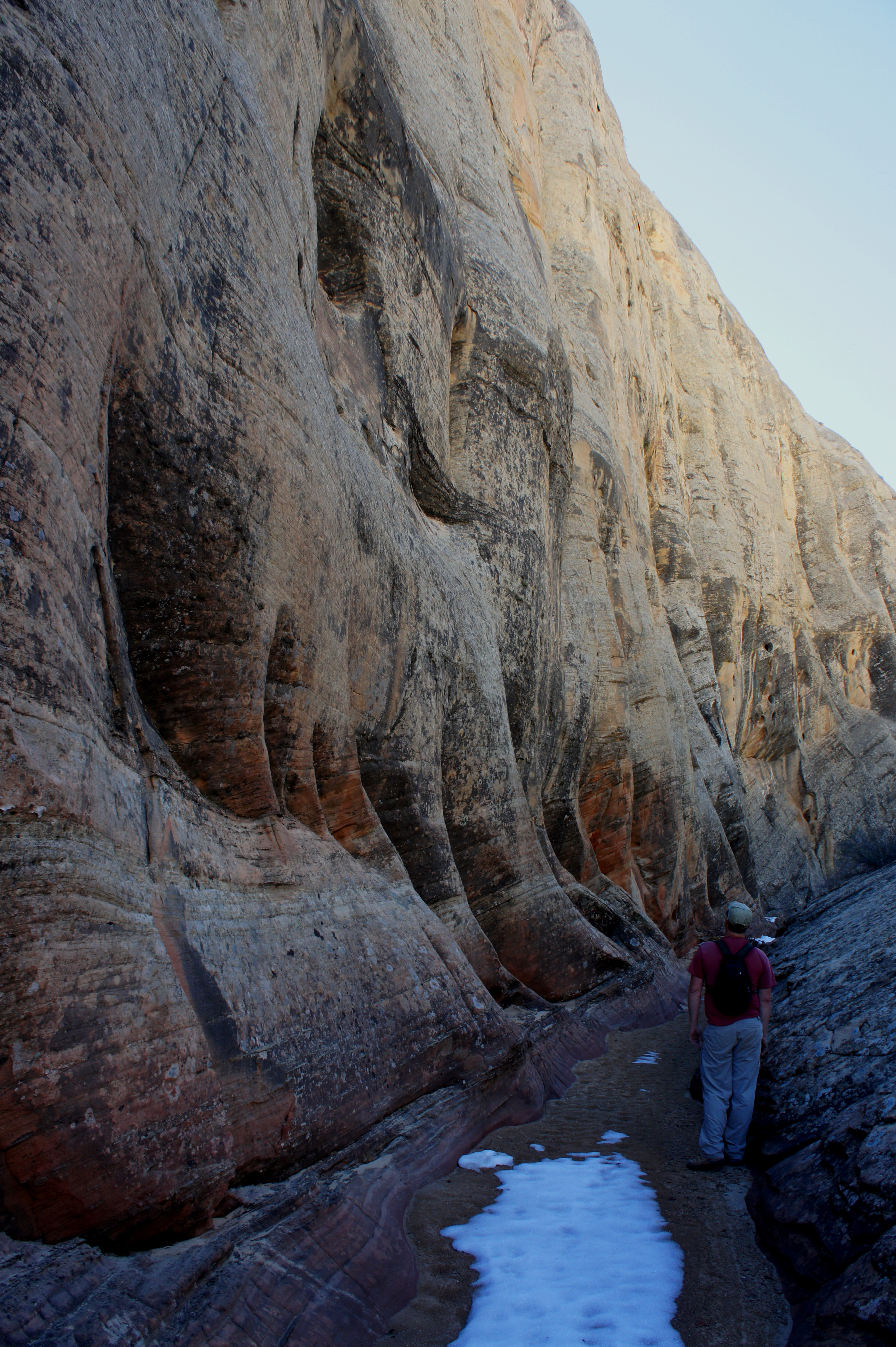
The final slot section is the most intriguing, as it plays host to two excellent obstacles. The first is a cavernous 6-foot dryfall (which I’d imagine is often preceded by a small pool but was dry when I encountered it). The pouroff is surmounted by a fun and relatively easy stem move that nonetheless may be too much for slot canyon beginners.
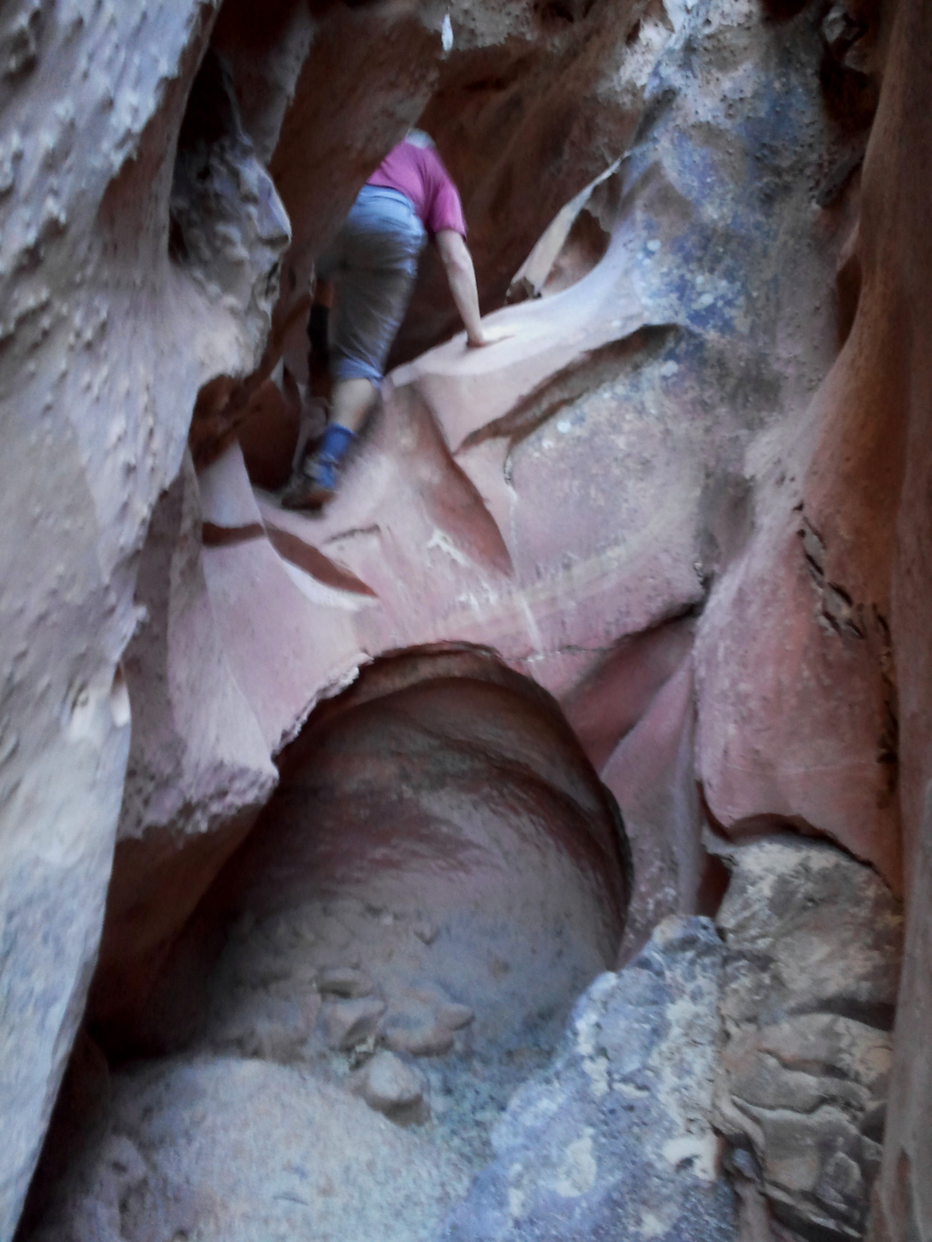
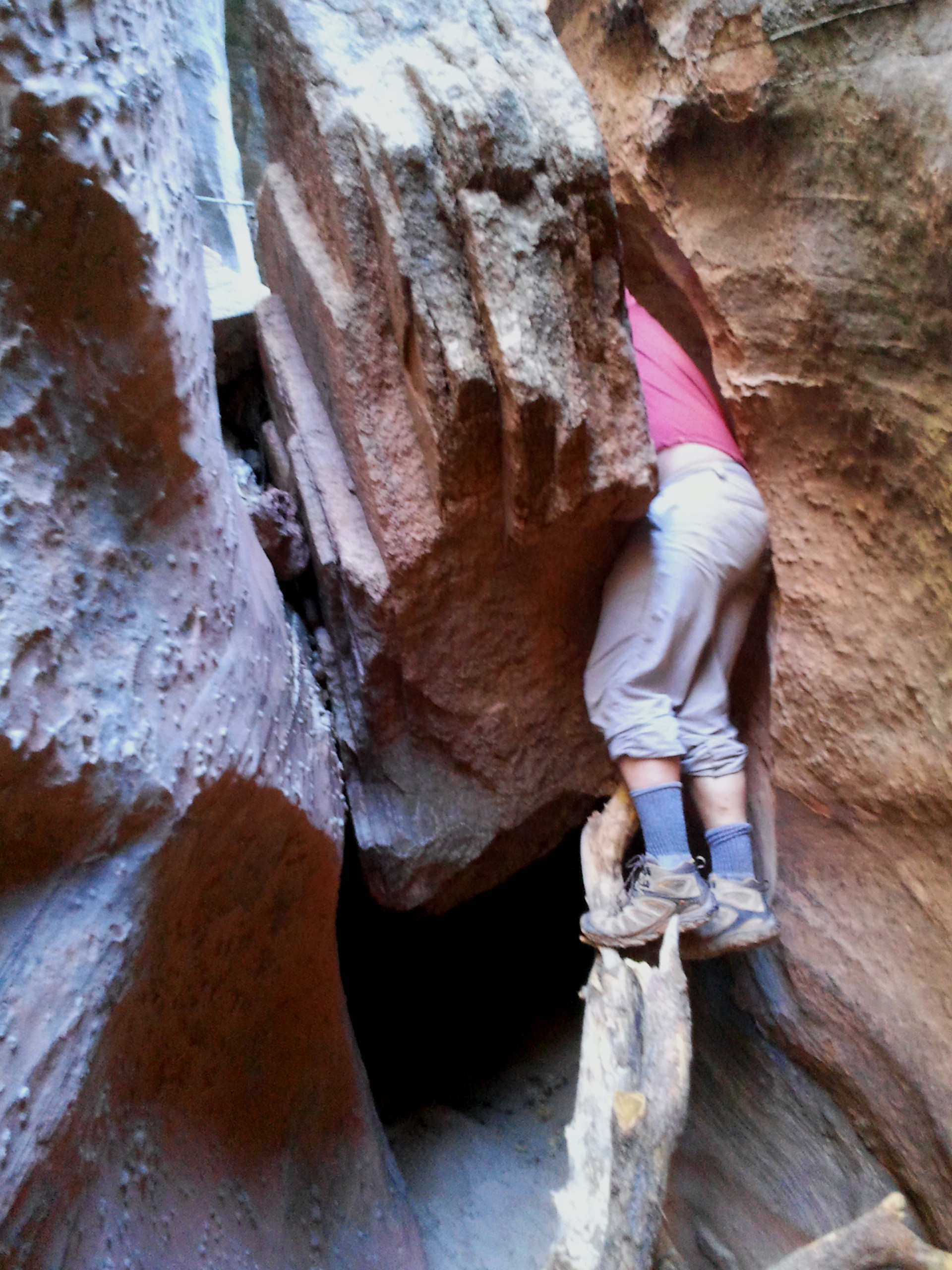
A minute or two up-canyon, an 11-foot high chockstone towers over the canyon floor. The obstacle is best circumvented through a thin crack on the right; the approach is assisted by a sturdy and well-placed tree branch that lifts climbers to a point where they can enter the notch. Squirming through the thin crack, it definitely helps to be skinny.
Once atop this final obstacle, the coast is clear to the end of the slot. Approximately 1/3-4/10 mile from the start of the Pleasant Creek spur trail, the canyon opens up dramatically.
It is possible to continue perhaps a couple miles up-canyon from here, though the scenery lacks the punch of the exciting slot. For the first 1/3 mile, the wash is wide and relatively sandy. Eventually the walls begin to constrict to some degree as you enter the ledgey Kayenta formation. A small set of waterpockets in the Kayenta slickrock is easily bypassed. Shortly thereafter, it becomes difficult to continue up the wash itself. Skirt around a series of muddy potholes and steep pouroffs by traversing a shelf on the right.
After a brief respite where you can return to the wash bottom, a deeper and steeper collection of waterpockets features a small natural bridge near the top. In terms of size and shape, the bridge is comparable to Nels Johnson Bridge on Capitol Reef’s popular Hickman Bridge Trail. (As far as I am aware, it is unnamed.)
The canyon appears to continue for a considerable distance beyond this point, though it is unclear whether there are any additional points of interest. That makes the natural bridge a good turnaround point, especially for a day hike—it’s slightly more than a mile back to the Pleasant Creek route, and a one-way trek of around 4.9 miles from here to the Pleasant Creek Trailhead. The combination of the lengthy approach hike, scrambling, and exploring makes for a rather full day.
Extra credit
If you have not had enough of Pleasant Creek, turn right (east) upon returning to the main trail and walk 1.1 miles downstream to the park’s eastern boundary. (More details on the Pleasant Creek route here.)

Pingback: Pleasant Creek (Capitol Reef National Park, UT) | Live and Let Hike
Hey Thanks for the information! I think I’ve found one of my new favourite hiking blogs