
If I were to guess, I’d say upwards of 90-95 percent of visitors at Utah’s Capitol Reef National Park spend their entire stay along the main arteries running through the central district—Highway 24 and the Scenic Drive. But the southern portion of the park—a long tongue known as the Waterpocket District—is equally, if not more, appealing. The main deterrent for visitors, of course, is the length of the journey along the relatively remote, unpaved Notom-Bullfrog Road, which runs 44 miles north-south between Highway 24 and the Burr Trail Road to Bullfrog Marina. There is no reliable water and very limited facilities along the road.
This is the rugged, backcountry Capitol Reef experience. And Headquarters Canyon is arguably the area’s best short hike. Though it takes more than an hour to reach the trail from the Capitol Reef Visitor Center, the hike itself is a short, easy ramble through mounds of bright orange Entrada, sinuous canyon curves, and—most of all—an excellent slot section that narrows to as little as 2-2 ½ feet wide. If you’re looking for a quick slot canyon experience in Capitol Reef without the time or patience for Burro Wash or Sheets Gulch, this is it.

The hike
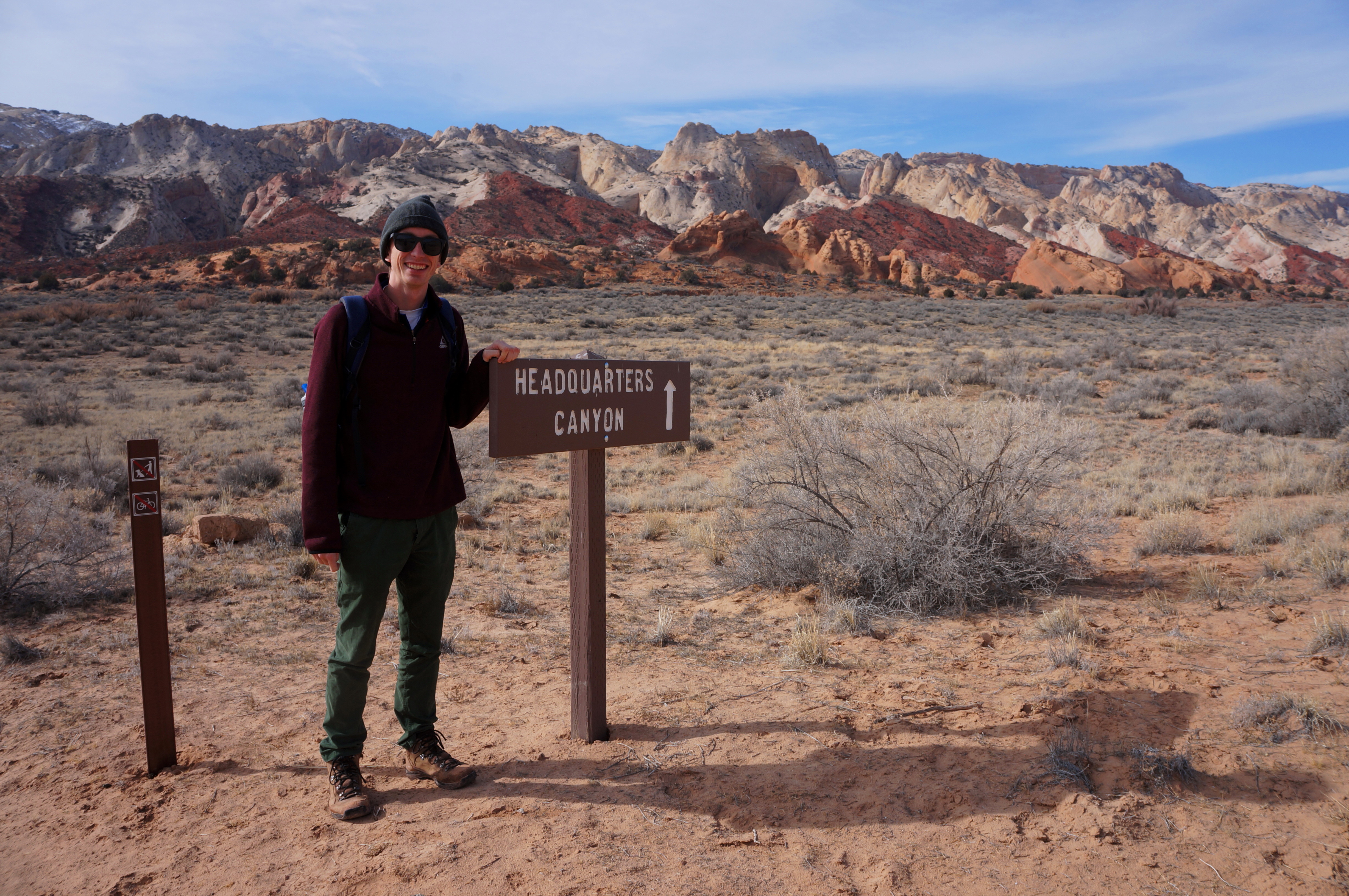
To reach the trailhead, drive nine miles east on Highway 24 from the Capitol Reef Visitor Center and turn right on the well-marked Notom-Bullfrog Road. The first several miles are paved, after which the road turns to dirt but is usually passable to 2WD passenger cars. Especially in the early morning sun, views of the 100-mile long Waterpocket Fold along this route are spectacular. Roughly 33 miles down the Notom-Bullfrog drive, another road known as the Burr Trail veers off to the right; stay left. Continue from here 2.3 miles to the Headquarters Canyon parking area. The trail, marked by a sign, begins on the right.
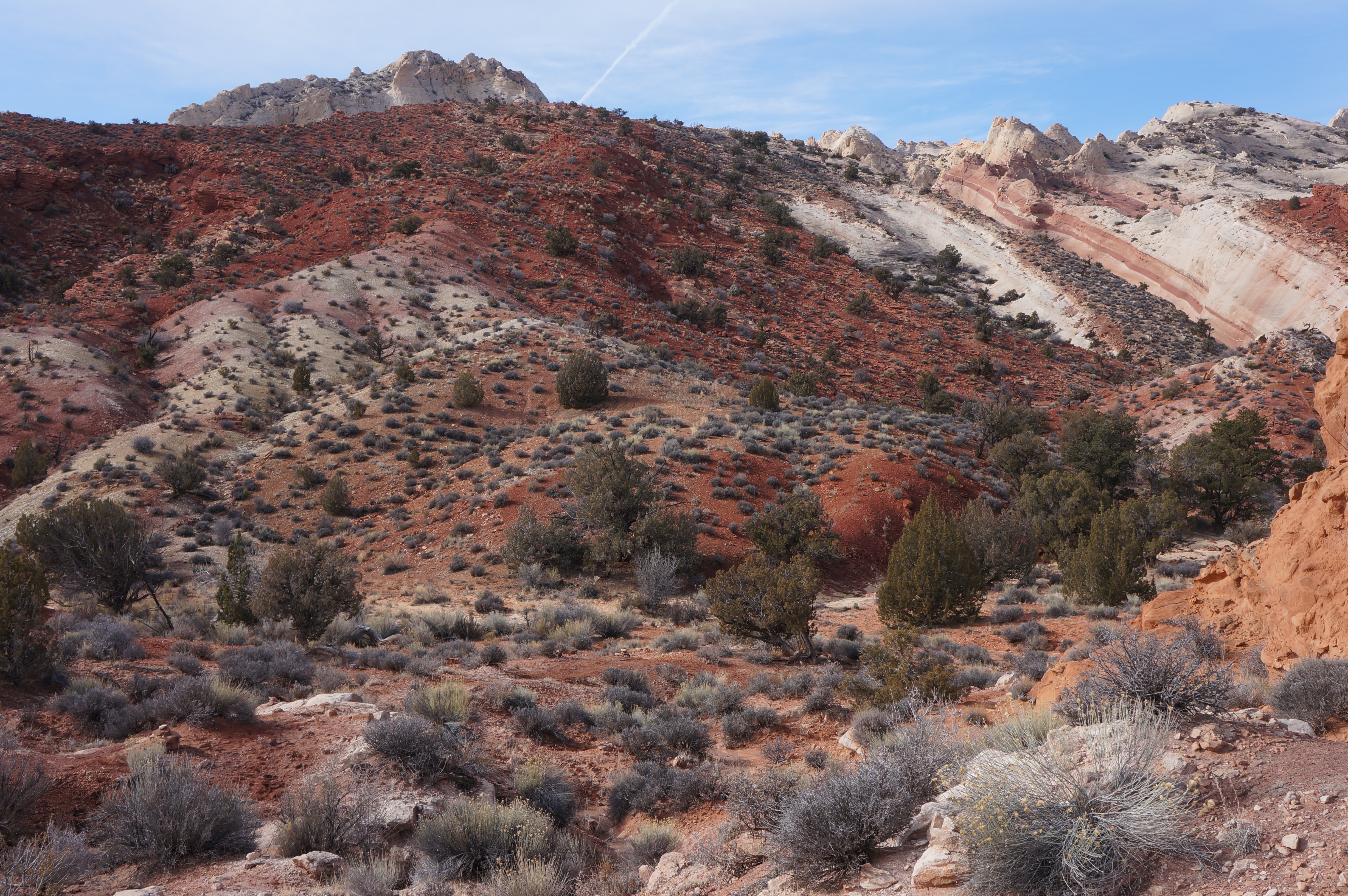
Before you, across the brief plain, lies the Waterpocket Fold, North America’s best example of what geologists call a “monocline”—i.e., a fold in sedimentary rock layers with one steep flank and one more gradual. Here you are facing the gently-sloping side (though it’s still a slog to climb). The most visible rock strata (all dating to the mid- to late-Jurassic Period) are, from top to bottom, the orange Entrada sandstone, the mostly red Carmel formation, and the generally cream-colored Navajo sandstone (identifying the layers by their color is not perfectly accurate, but reasonably close). Newer layers—from the Cretaceous Period—are mostly hidden under the brushy plain.
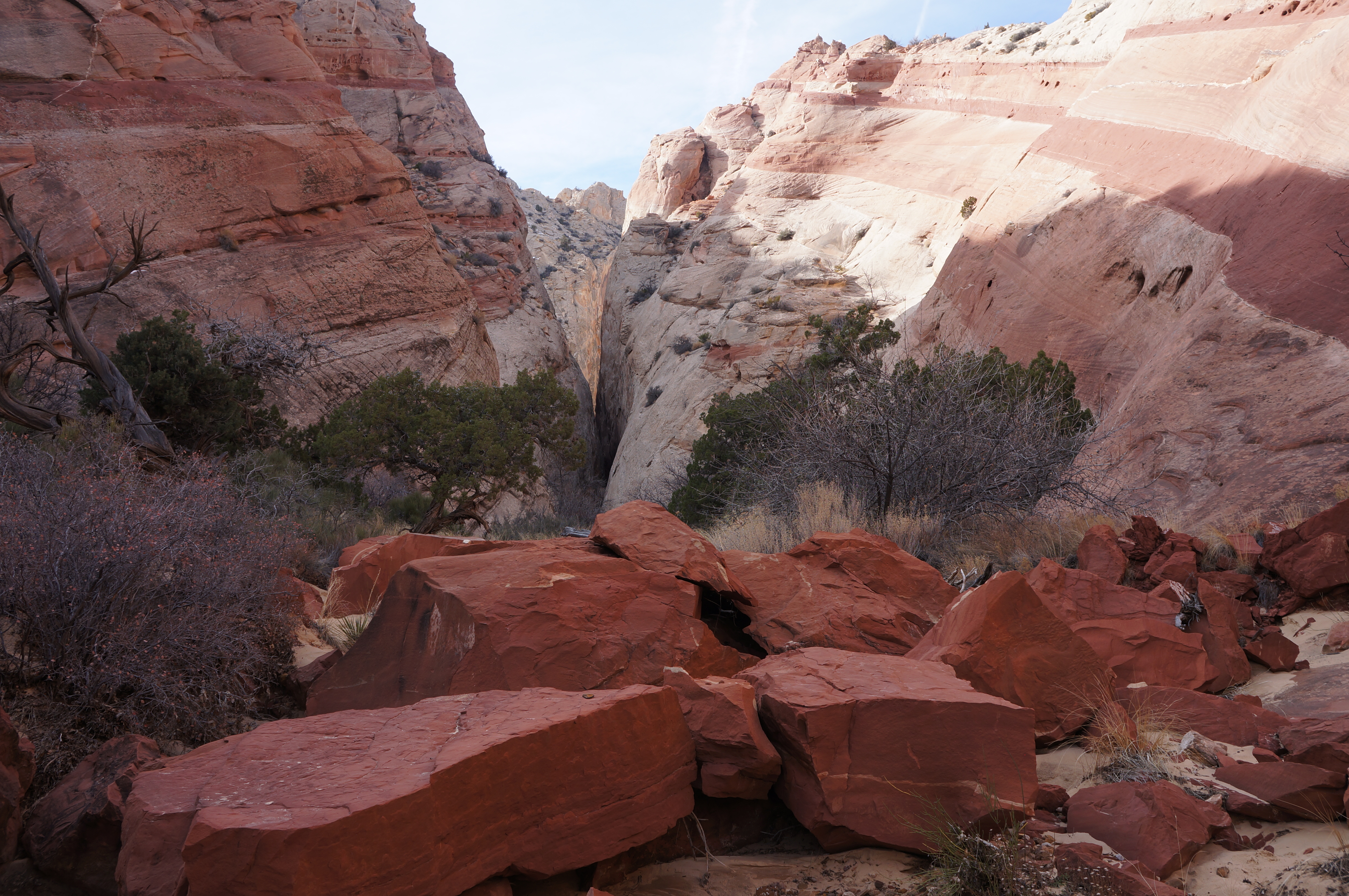
With the Waterpocket Fold in your sights, the single-track path crosses a rather nasty, steep-cut arroyo after 0.1 mile of hiking. Within ¼ mile, the sandy trail skirts around a slickrock knob of Entrada sandstone, followed by another. The path—occasionally cairned and generally easy to follow—crosses a couple of dry washes before finally dropping into a much-wider gulch where the Entrada ends and the Carmel—hence the ubiquitous burgundy-colored stones—begins. With a couple exceptions (shortcuts over small meanders), the route from here on simply follows the wash bottom into Headquarters Canyon.
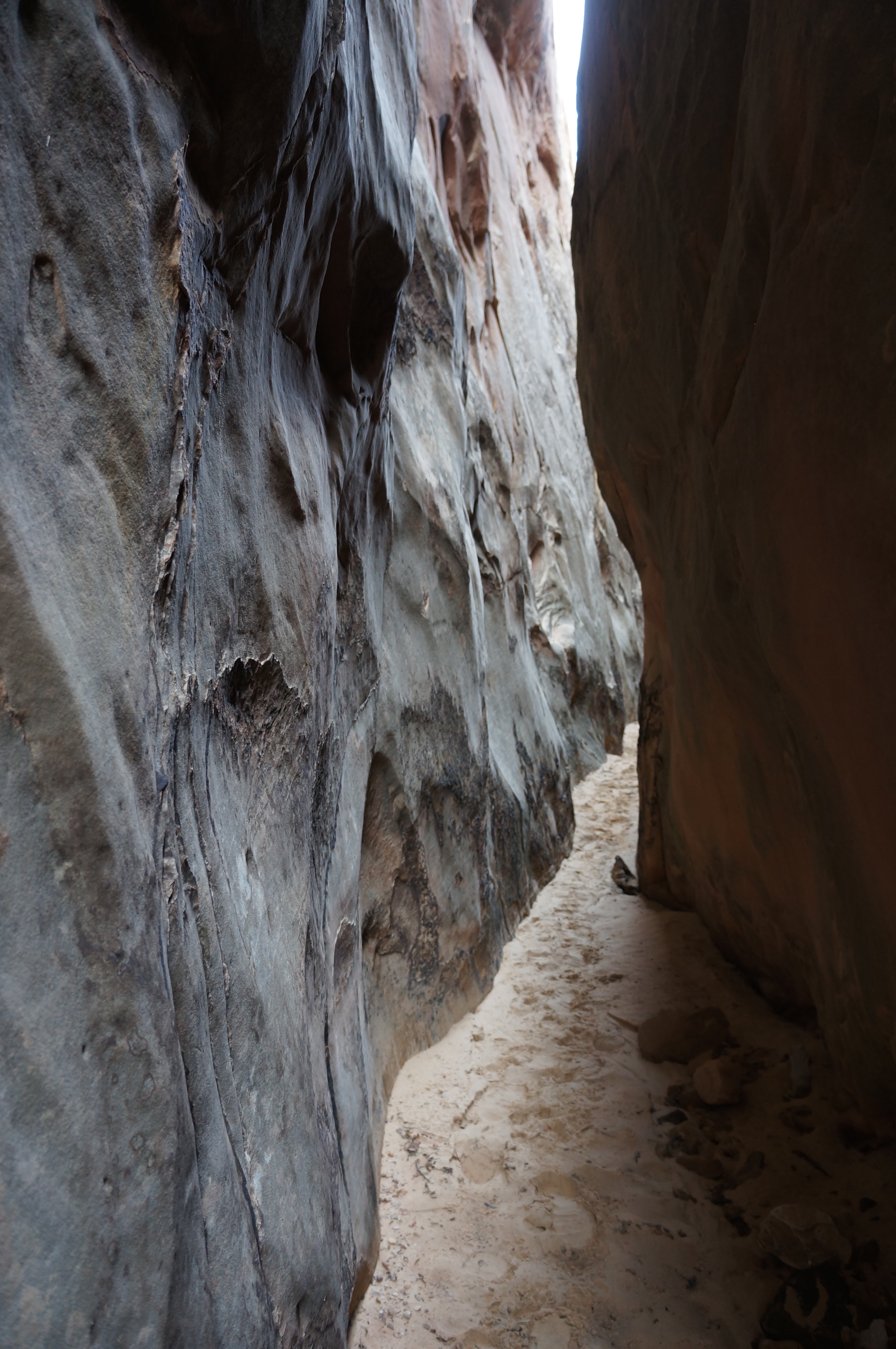
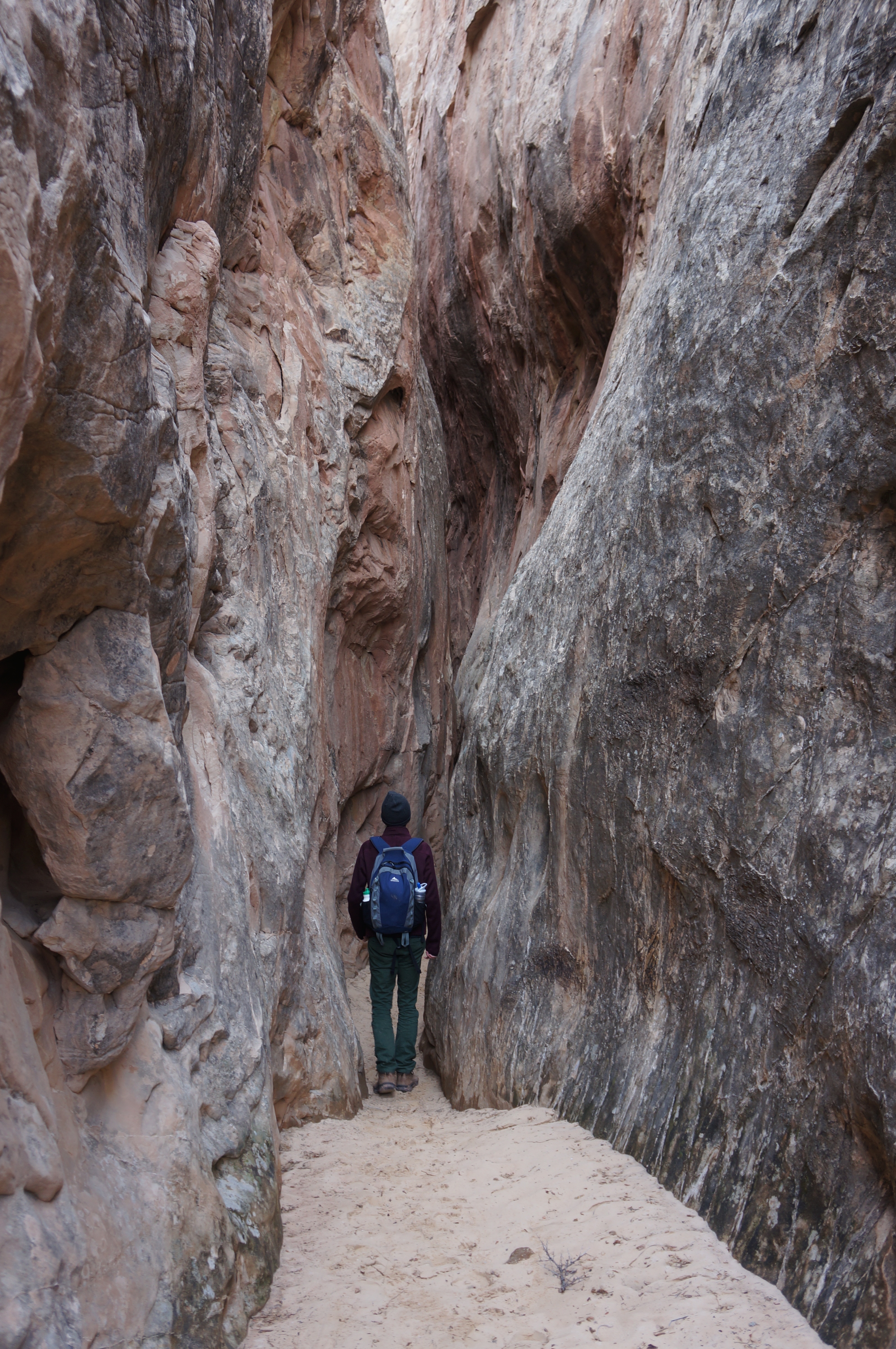
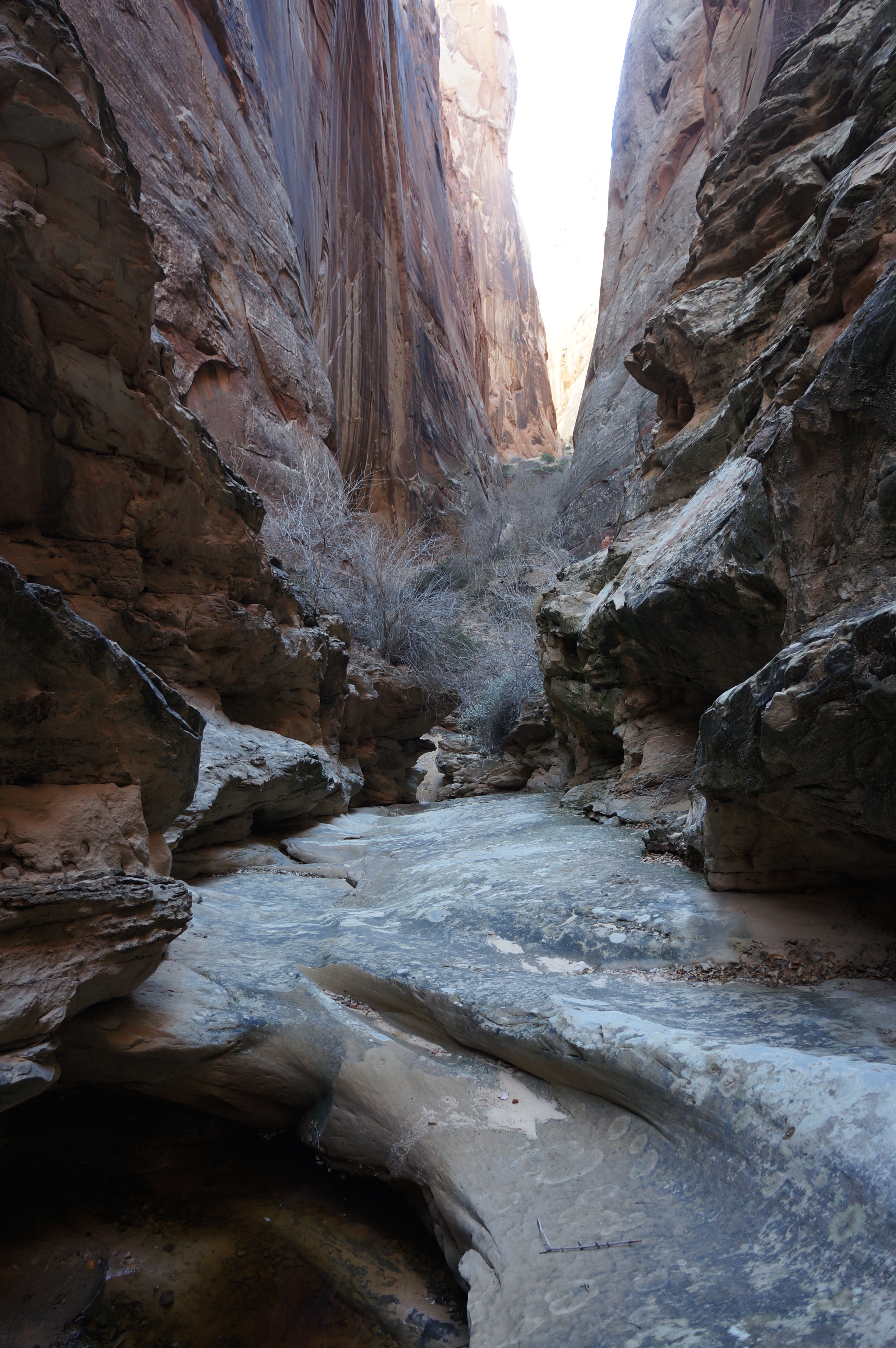
The colorful wash—filled with a multitude of rocks of varying shades—bends to the right before cutting left again. The south-facing wall is lined with several salmon- to pink-colored strips, forming a beautiful swirl in the Navajo sandstone. Ahead the canyon narrows and darkens—this is the Headquarters slot.
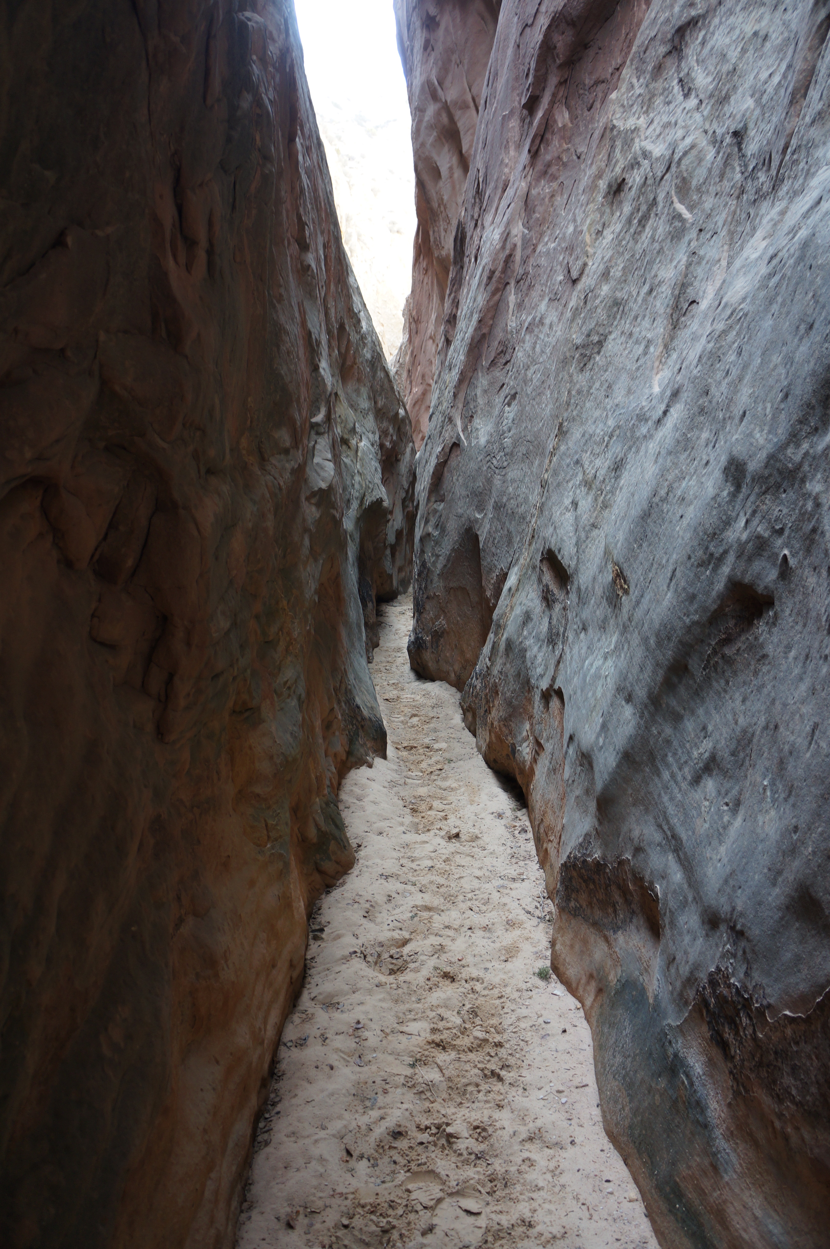
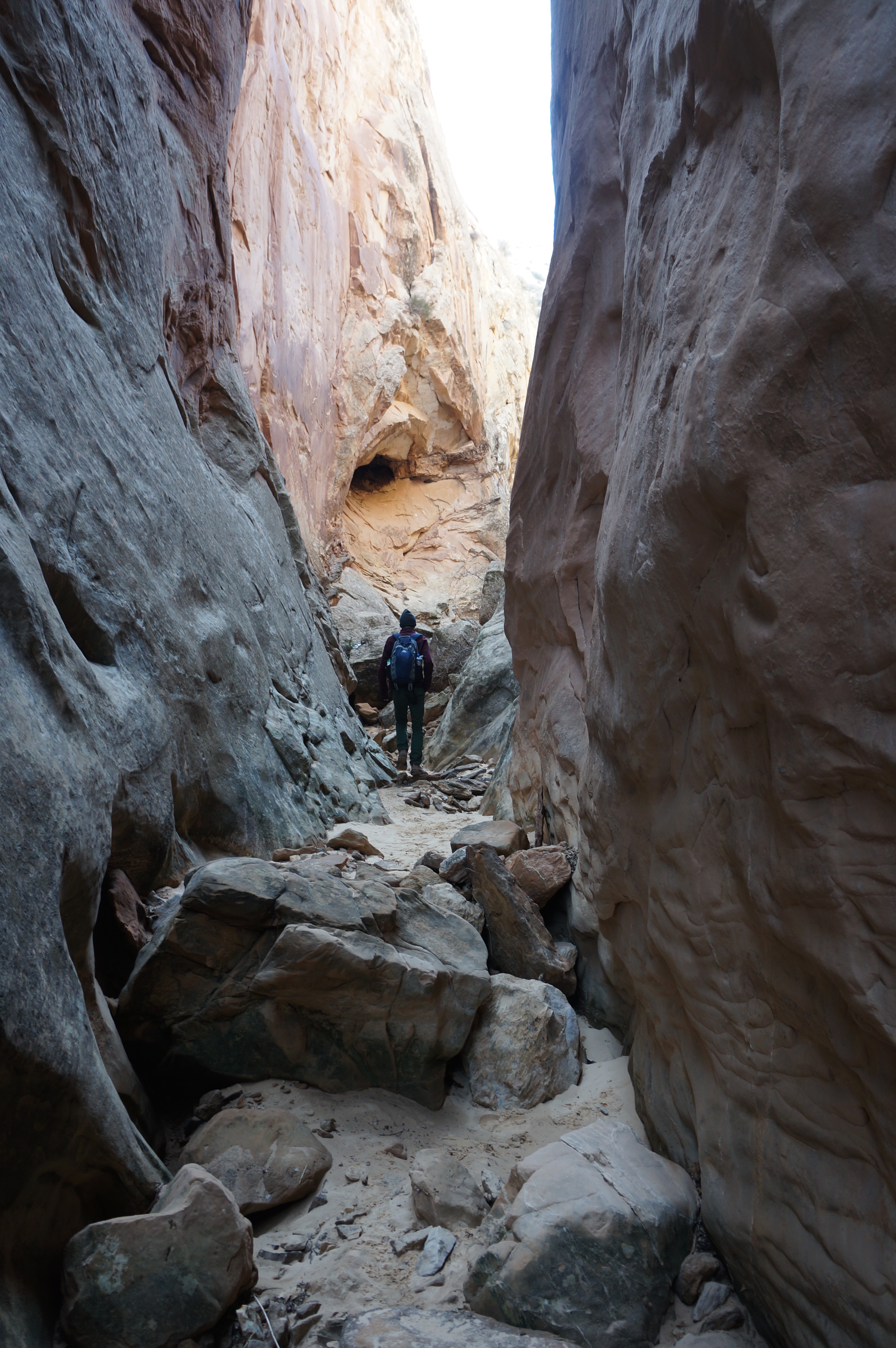
As far as slots go in Capitol Reef, you’d be hard pressed to find one better so close to the road. Though it’s less than 75 yards before the canyon opens up, Headquarters slot cuts deeply through 300-foot walls, just enough to block out much of the sunlight and give the claustrophobic chills. There are no obstacles, save for two easily-surmounted boulder jams at the end, making this slot a fine destination for small children.
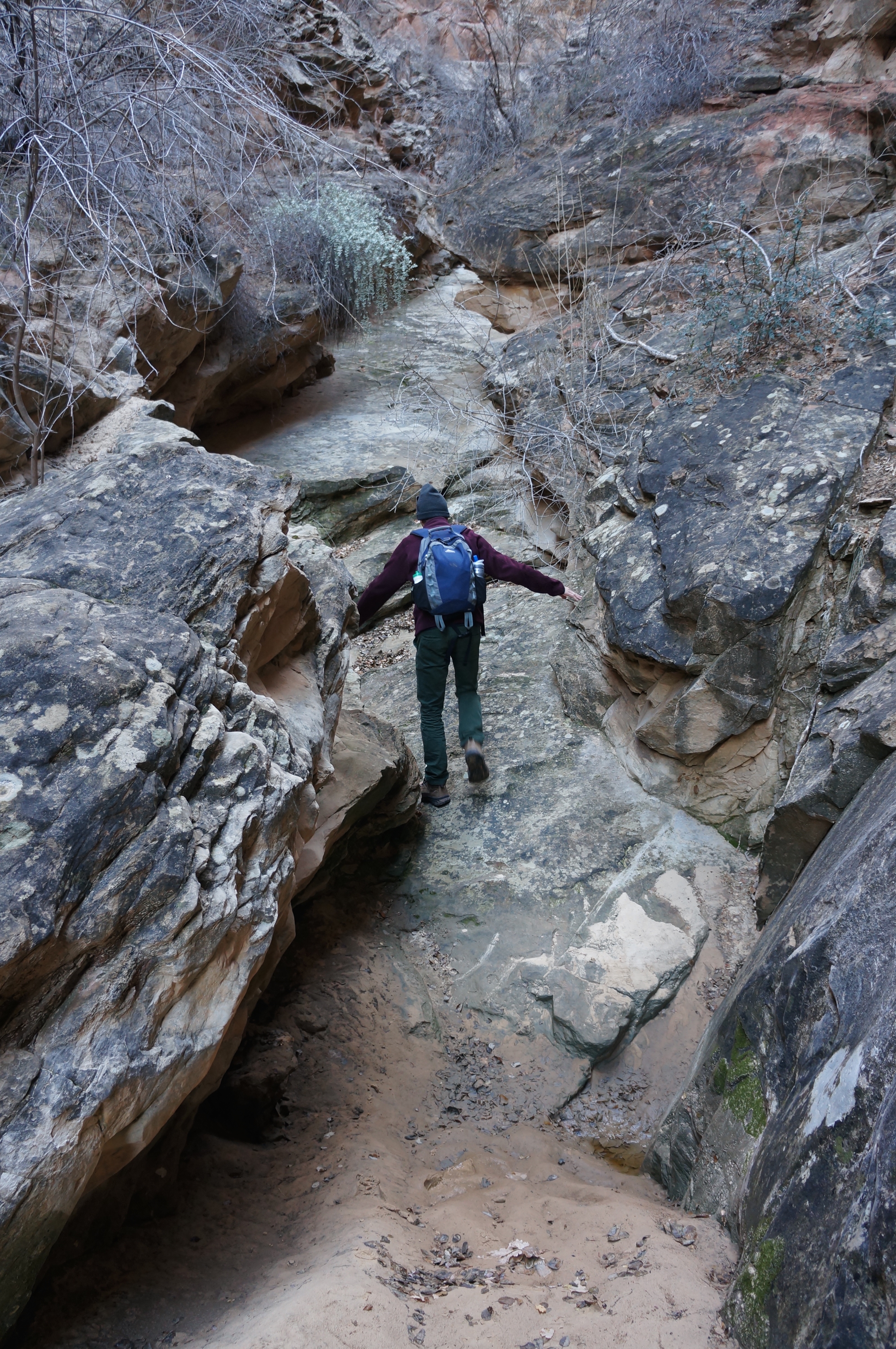
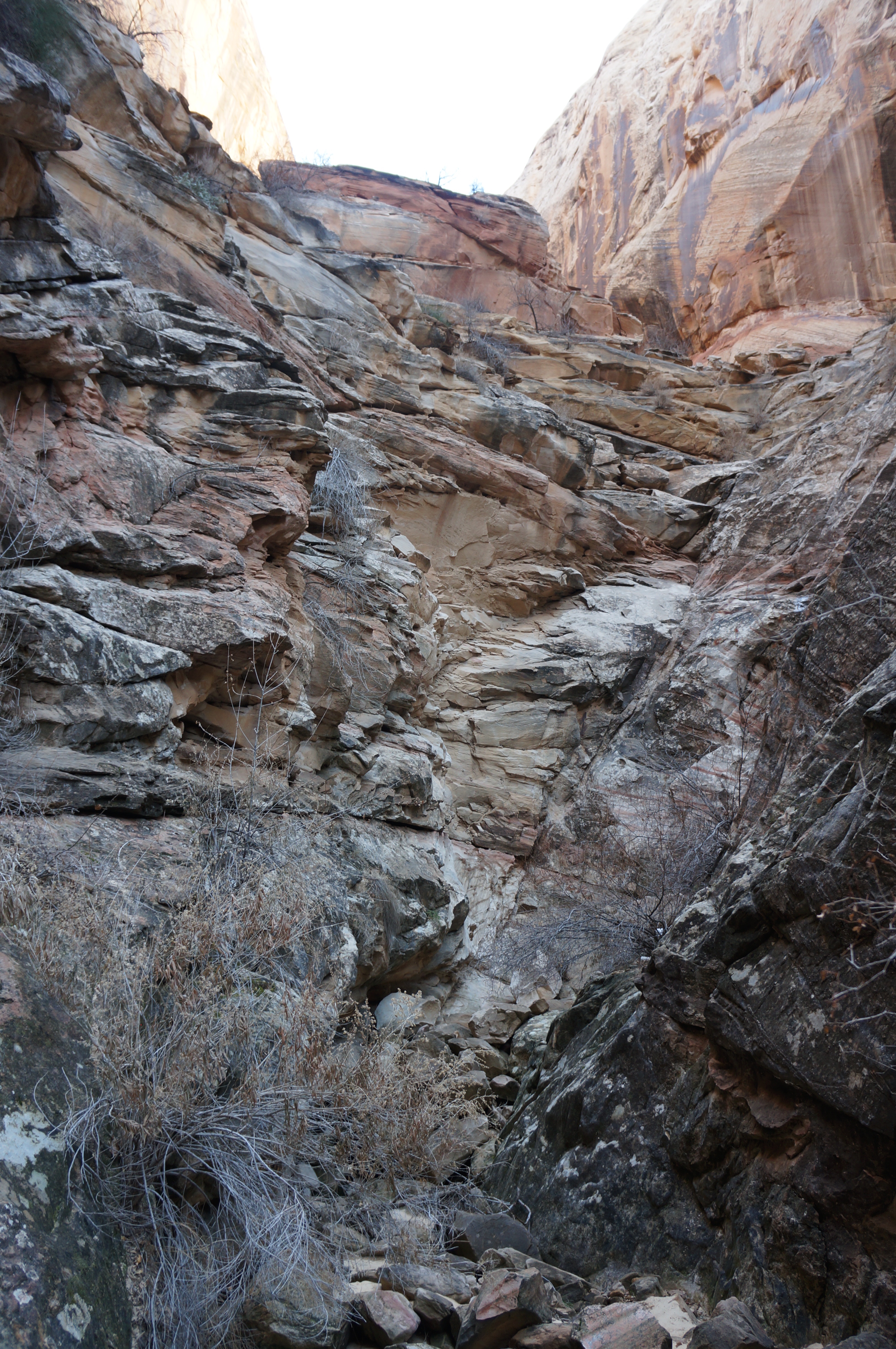
Beyond the slot, the canyon opens up for the next 0.8 mile but remains much taller than it is wide. The wash winds through a healthy riparian environment that includes box elders, Gambel oaks, roundleaf buffaloberry, Fremont barberry, and Mormon tea.
At roughly 1.6 miles, the sandy wash abruptly ends at a sandstone ramp in the Kayenta formation, the ledgey fourth rock layer encountered on this hike. It’s an odd sight: a slide composed of sheer slickrock, interrupted only by one or two muddy potholes, that can be friction climbed with relative ease, albeit at a 35-40 degree angle.
The top of the slide is guarded by a 6-foot dryfall. With several hand and footholds, the green-stained pouroff can be easily climbed with a couple scrambling or chimney moves. (Obviously the ramp and dryfall are not recommended when wet.)
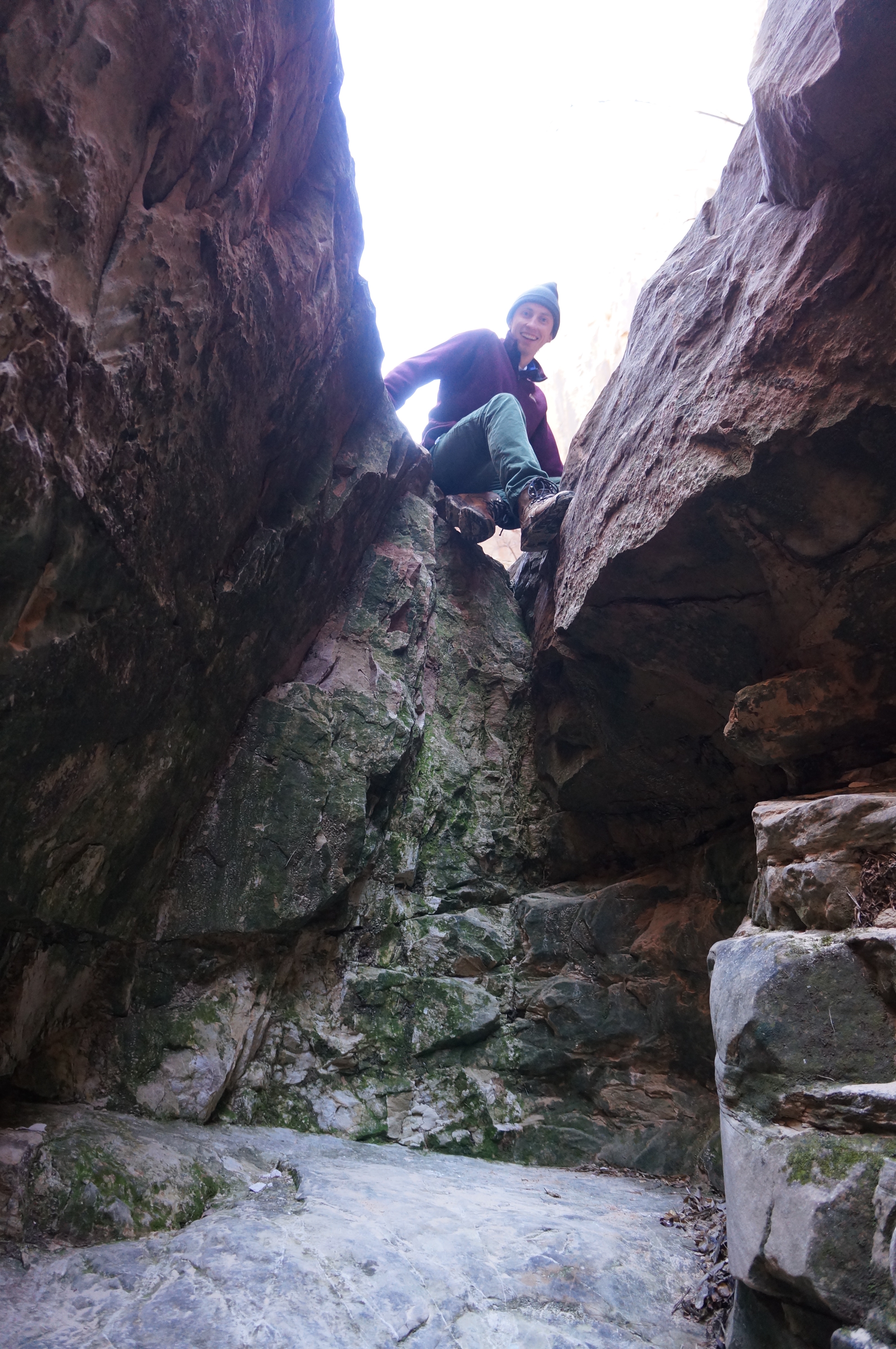
The canyon continues for a couple minutes’ walk beyond this point, until progress is halted by another dryfall, this one at least 70 feet high and considerably more daunting. It’s possible to bypass the pouroff via the ledge system on the left, but it is an extremely exposed climb—at least Class 3 or 4. (Besides, there’s not likely to be a payoff beyond that justifies the climb.) Therefore, it’s best to call it quits here; return the way you came.
Allot 1 ½-2 hours for the round-trip hike.
Extra credit
Try Headquarters’ deeper yet wider cousin, Surprise Canyon, located back up the Notom-Bullfrog Road about one mile. (See my trail report here.)

Pingback: Surprise Canyon (Capitol Reef National Park, UT) | Live and Let Hike
Pingback: Pleasant Creek slot canyon (Capitol Reef National Park, UT) | Live and Let Hike
Pingback: Top 10 Hikes in Capitol Reef National Park’s “Backcountry” | Live and Let Hike
Pingback: TEXAS TO WASHINGTON ROAD TRIP – Mountains & Valleys