
There is so little information on the web about this scenic yet obscure hike outside Bicknell, Utah that even its name is in doubt. According to National Geographic’s 1995 “Trails Illustrated” map of the area, it is called the “Durfey Canyon Trail,” though it is unclear whether a “Durfey Canyon” even exists. Meanwhile, one website describes a portion of the hike as the “Hemlock Meadows Trail.” Some locals refer to it as the “Boy Scouts Trail,” named for the young wilderness explorers who have apparently helped maintain the path. On maps of Utah’s Fishlake National Forest, it is known officially only as trail #147.
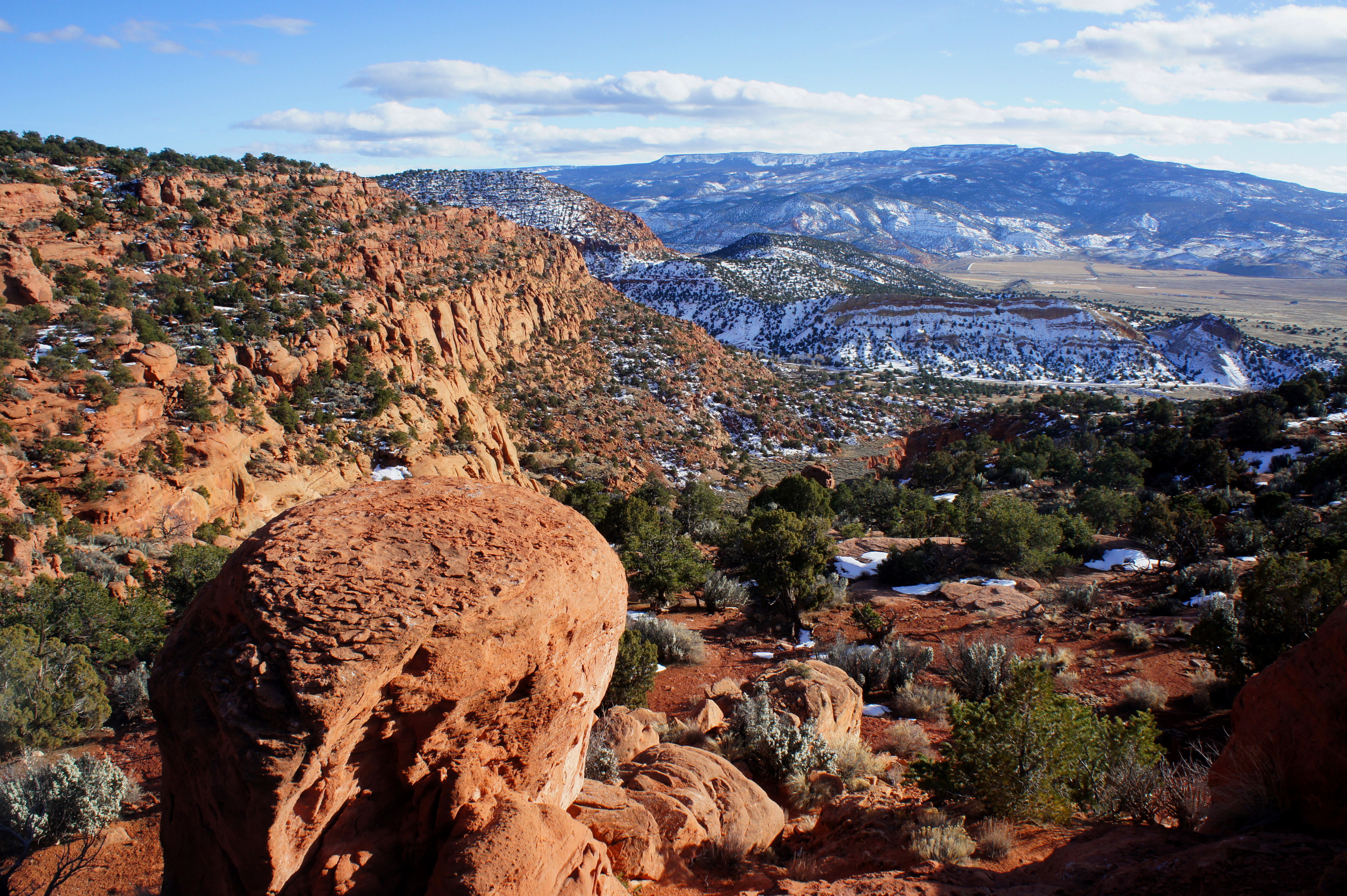
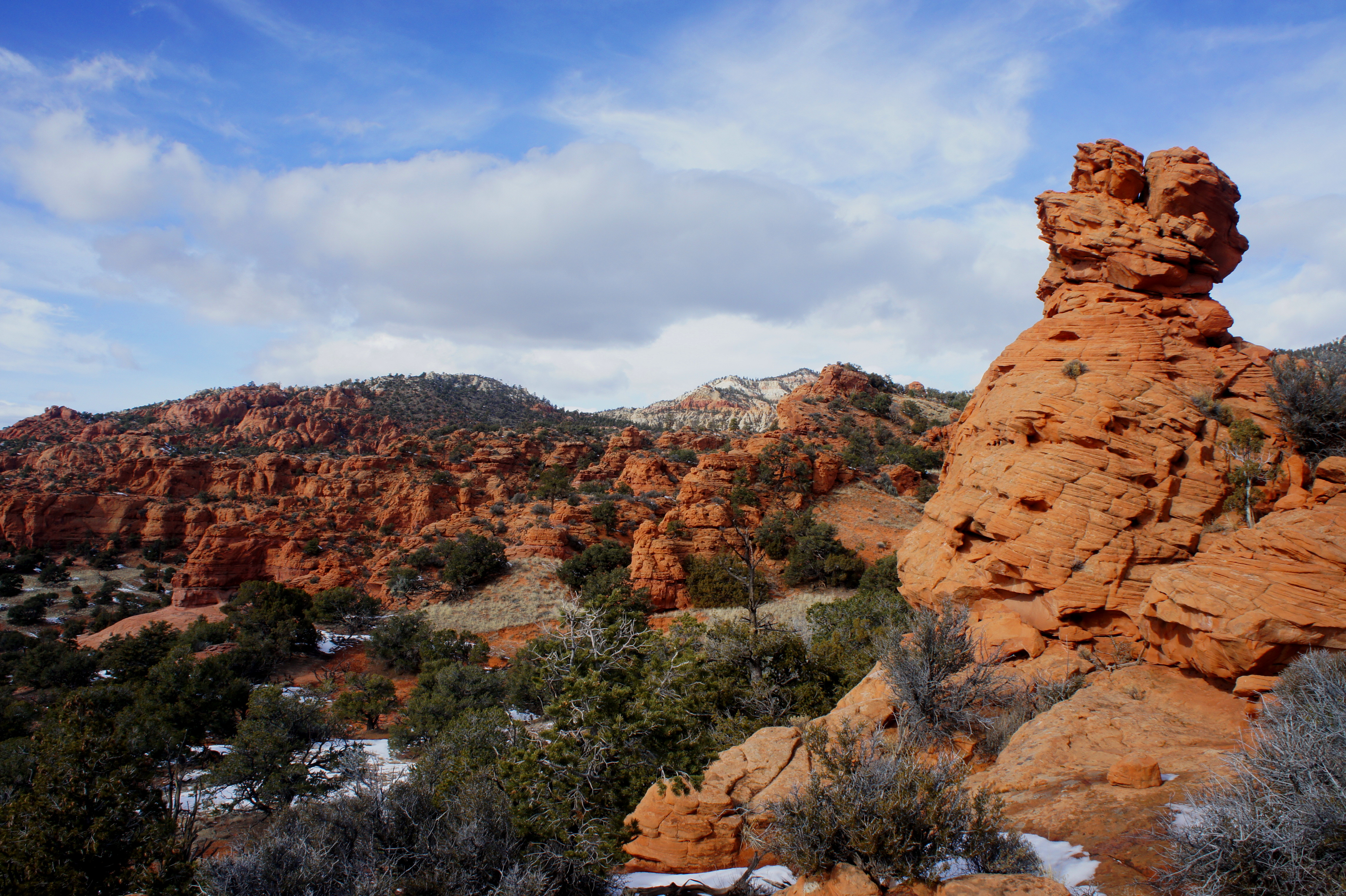
The black hole of beta is all the more surprising considering the trail’s many picturesque waypoints and convenient location—just over a mile northeast of Highway 24 outside the town of Bicknell, in the heart of “Capitol Reef Country.” Sunglow recreation site, a popular camping alternative when sites at nearby Capitol Reef National Park are full, is less than ½ mile from the trailhead. Yet the Durfey Canyon route, climbing through peaceful meadows and deep red canyons skirting the southern cusp of Thousand Lake Mountain, is scarcely visited.
But it’s there—even if, like many national forest hikes, the trail is often hard to spot—and it’s begging to be explored.


The hike
The Sunglow area is accessed via paved Fishlake National Forest route 143, north of Highway 24 just east of Bicknell, Utah. Sunglow encompasses three major drainages—Crescent Canyon, Red Canyon, and East Fork of Red Canyon—all sporadically carrying water from mountain snowmelt and natural springs. While the majority of Thousand Lake Mountain (11,306’) is alpine or coniferous, the mouths of these lower-elevation canyons support a desert environment of junipers, pinyon pines, cacti, and sagebrush more commonly associated with nearby Capitol Reef. The addition of perennial streams makes possible the emergence of grassy meadows, wedged beside walls of craggy, red-orange Wingate sandstone—the predominant, cliff-forming rock layer of the area.
To reach the start of this hike, drive 0.7 miles up FR 143 (which begins on the southeastern outskirts of Bicknell) in the direction of the glimmering rouge cliffs, visible from Highway 24. Pass Pete’s Pond—a small, fenced-off pool—on your left. At the first right-turning bend beyond the pond, a dirt double-track takes off to the left. This is the rather inconspicuous start to the Durfey Canyon/Boy Scouts Trail. (If you pass the Fishlake NF sign on your right, you’ve driven too far.)
To begin the hike, follow the dirt track across a wide (mostly dry) wash and up over a grassy flat, keeping the red-brimmed box canyon ahead of you. This is called Crescent Canyon. Eventually (before making a second wash crossing, which will put you on the wrong side of the canyon), you will want to leave the jeep track in search of a faint single-track hidden at the foot of a whitish-gray slope to the left. Cut over to the slope until you find the trail—it is not marked, but it will be obvious once you’ve found it. It is important to stay on the west side of the canyon, as shortly up from the mouth of Crescent Canyon a deep-cut ravine will divide the two halves.
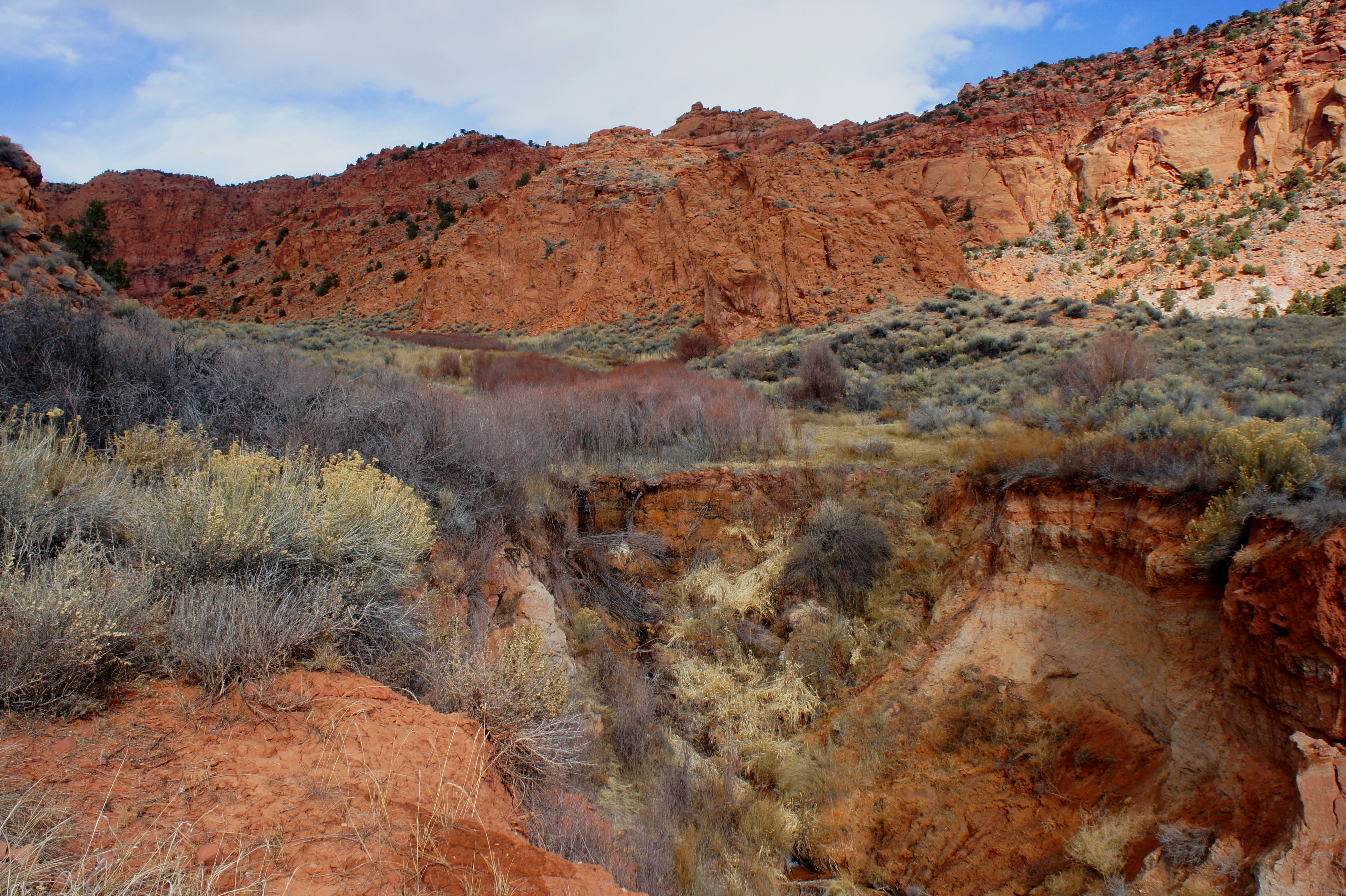
The soil color abruptly changes from gray to dark orange as you continue up-canyon, while the single-track footpath weaves in and out of a series of minor washes. Roughly 1/2 mile from the trailhead, the trail drops down to Hemlock Meadow. Here the brushy cut bank suddenly vanishes, ending at a grassy pouroff that produces a small waterfall. In the meadow that follows, rabbitbrush and Indian ricegrass abound, and willows and cattails form a dense thicket immediately beside the gently flowing stream. The trail leaves the dirt slope and strikes out across a field of trampled grasses, keeping the main stream within reach on the right. A couple minutes’ walk from the waterfall, an enormous rock cairn indicates that you are indeed on the correct path.
About ¼ mile from the start of Hemlock Meadow, the route crosses over to the east side of the thin, rippling creek. Two large cairns mark the beginning of the first of many rocky climbs, where the trail switchbacks up the west flank of a prominent ridge.

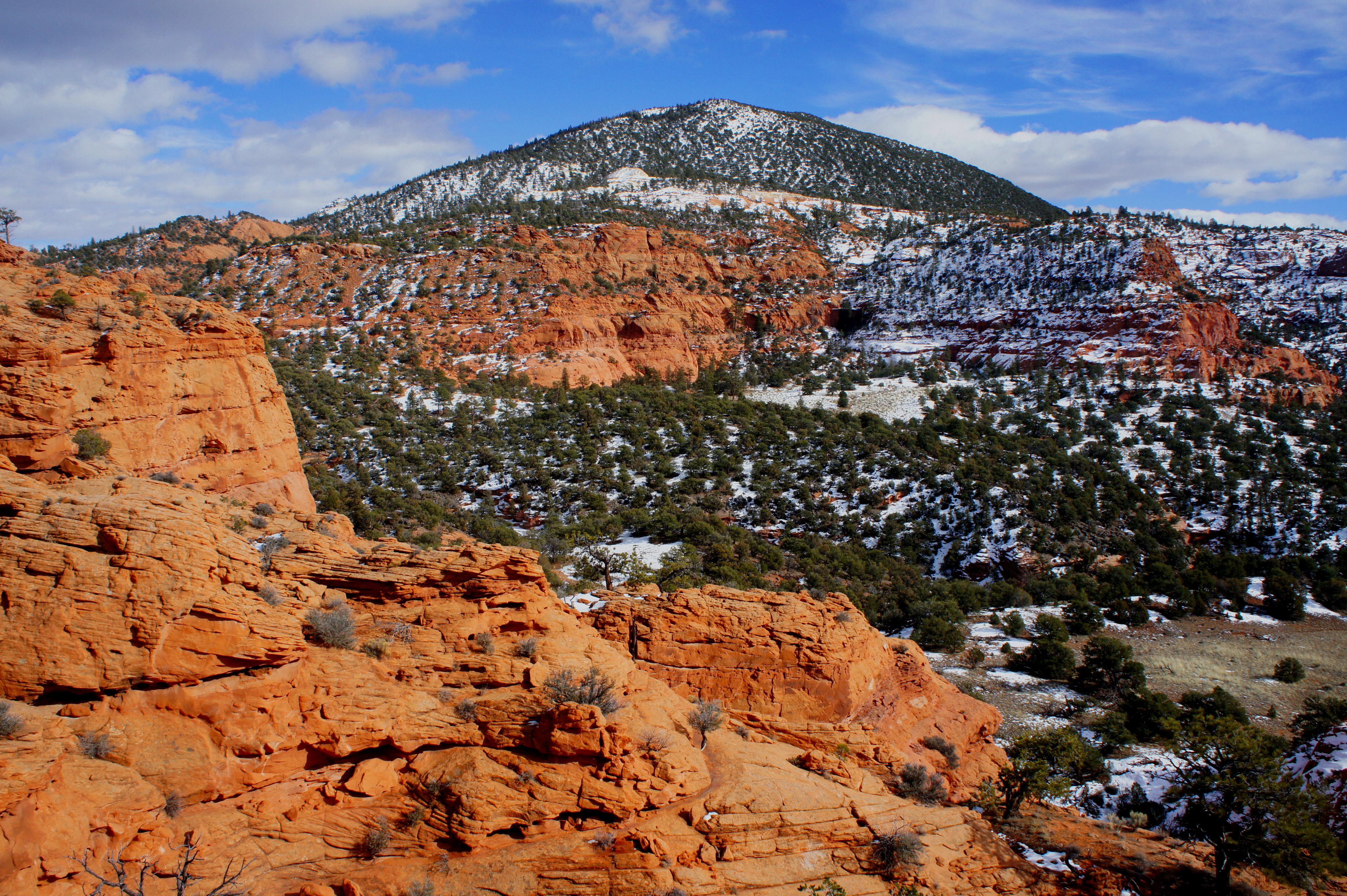
The Durfey Canyon route gains more than 200 feet in less than 2/10 mile, with the steepest section coming just before the path crests the first ridgeline. From here, enjoy outstanding views of Boulder Mountain (11,317’), as well as a peek into an interesting side canyon to the east. The next leg of the hike will skirt the east-facing cliffs of this side canyon. Take a minute to indulge in the solitude: the only noises are likely to be sounds of the wind and the cawing of broad-winged birds.
After a short section where the trail is exposed on the right, the lightly-cairned footpath climbs up the gut of a steep-sloping drainage to the crest of a second ridge. By now you have gained close to 400 feet in just less than a ½ mile. Detour to a mostly flat bench populated by junipers on your left for excellent views of Upper Crescent Canyon.
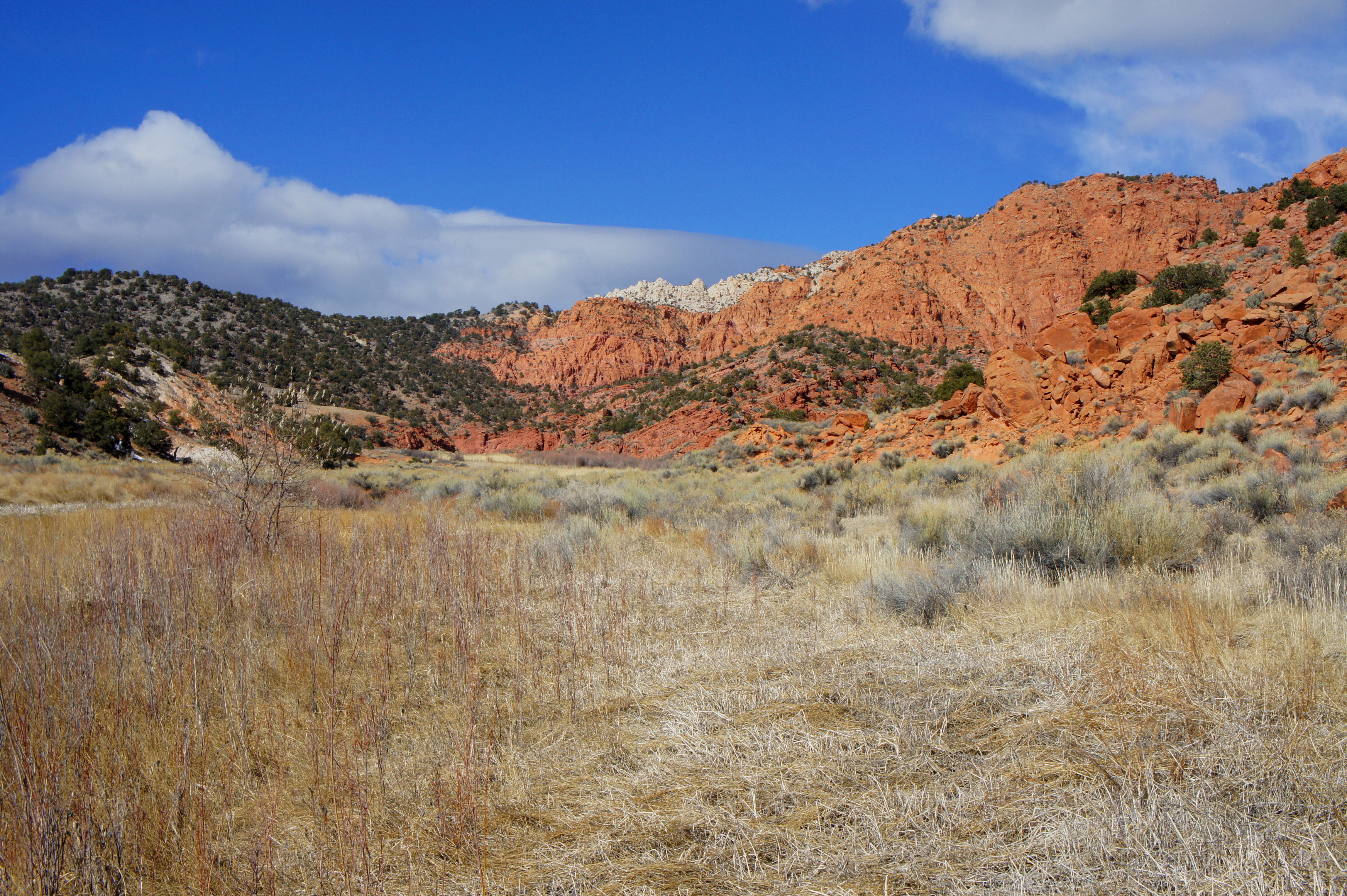
Return to the trail, which stays to the right side of the ridgetop as it winds through pinyon-juniper communities. One feature that makes the Sunglow area aesthetically different for nearby Capitol Reef is the higher density of vegetation, with smatterings of forest green thrown in amid a landscape of striking orange and red. Higher precipitation levels on Thousand Lake Mountain also help everything grow fuller and taller, perhaps most evident in the enormity of the agave-colored roundleaf buffaloberry plants in the area.
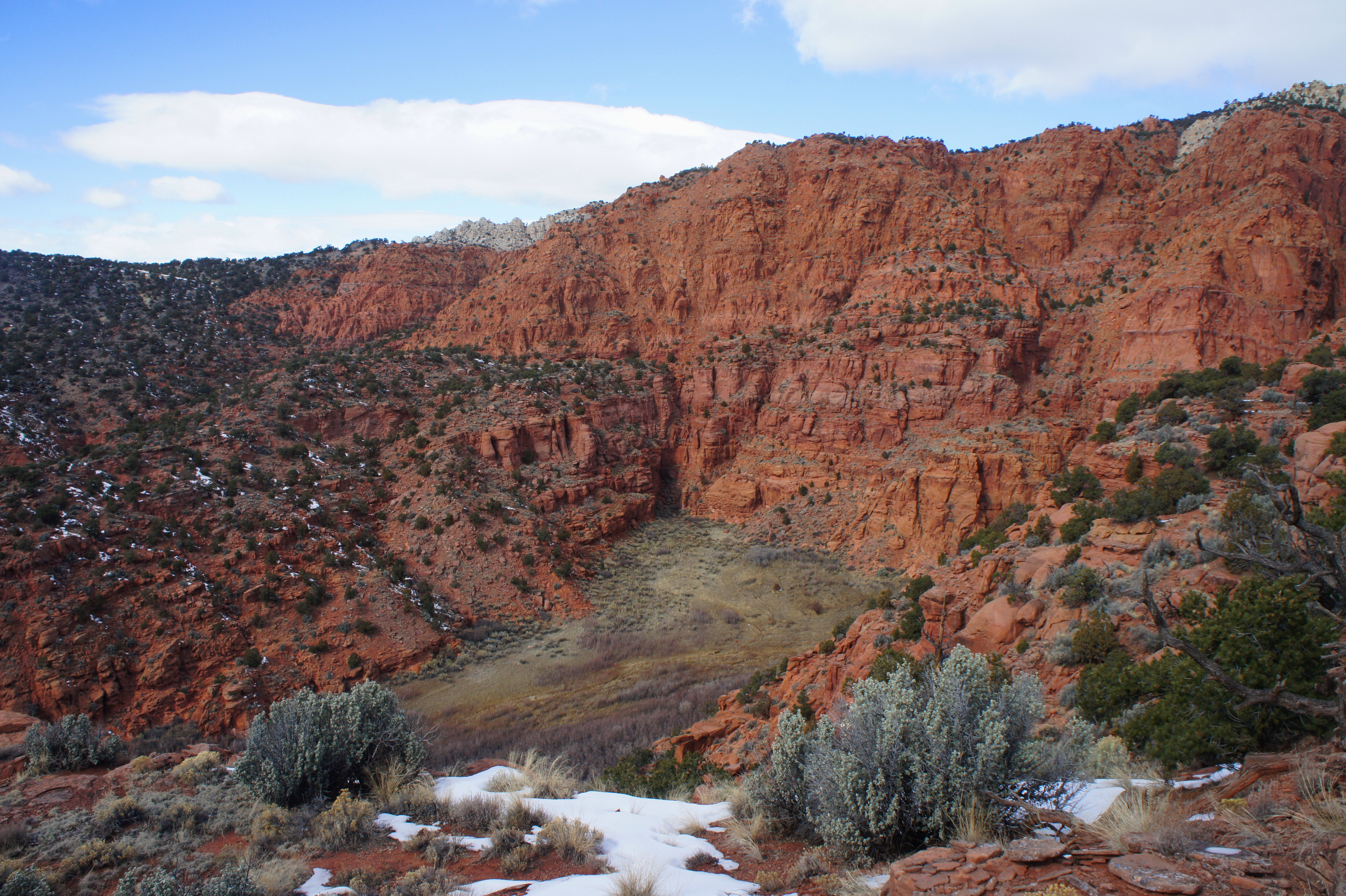
The gradient lessens dramatically beyond the second ridge crest, as the trail edges eastward along a wide shelf for the next ½ mile. After rounding a significant bend, the route—easy to follow in this section—begins a gradual decline into drainage #2, beautiful and sinuous Red Canyon. At a couple of points near the top of the descent, it is possible to peer down to the dry wash bottom some 200 feet below. The trail crosses the wash (at a break in the sheer canyon walls) about 0.4 mile farther north.

The best view of Upper Red Canyon comes partway up a steep climb on the eastern bank, where a gap in the trees reveals a stunning gallery of amber-colored knobs and spires, just down canyon from an amphitheater of chalky white cliffs. Saddle Pass—and the upper reaches of Thousand Lake Mountain—lie just beyond.

After the initial climb out of Red Canyon, the trail levels again before gradually descending to another dry wash surrounded by gads of cryptobiotic soil. West of the wash, the trail is easily lost amid grassy patches and occasional slickrock. On the east side, cairns periodically mark the route, but in winter, these north-facing slopes are often covered in thick snow. If you get lost, simply beeline for the obvious objective: a low pass over the towering ridge. Here the trail is marked by another gargantuan cairn.

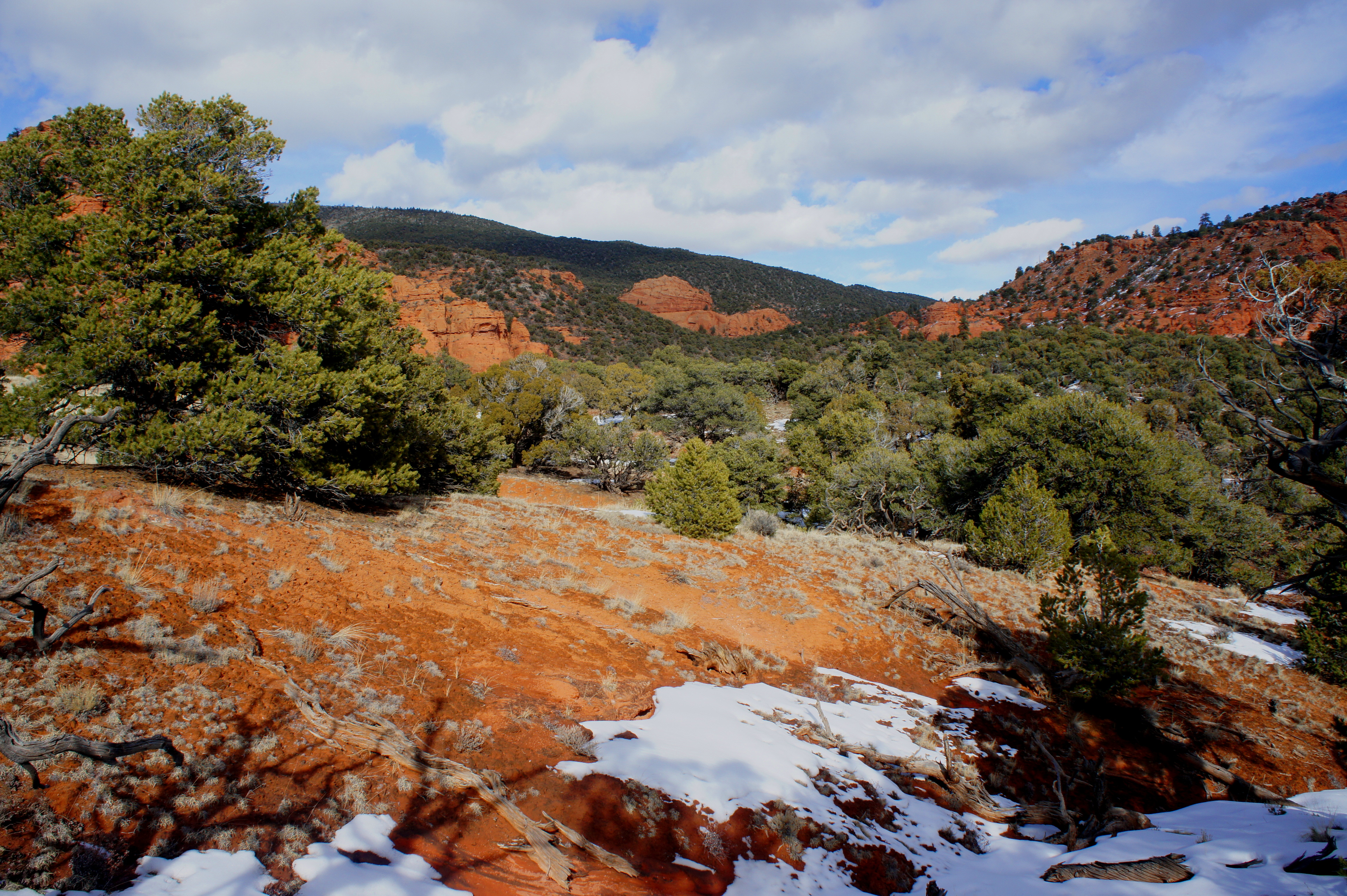
From the ridge pass, scramble up the stony slickrock to the left for an awesome 270-degree panorama. To the west, rows of Wingate sandstone knobs dot the landscape. Looking south, enjoy another excellent view of Boulder Mountain and subalpine Rabbit Valley. Finally, to the east, a tall, pine-studded crest (9,291’)—curiously named The Ant Hill—dominates the scene. Red-orange cliffs give way to a broad ravine known as the East Fork of Red Canyon. In the foreground is a broad, grassy meadow.
Alas, beyond this point, the trail appears to simply wither away as it crosses the meadow. This is generally not a problem for day hikers, as the meadow makes for a good turnaround point anyway. Backpackers can continue northeast, where—according to the map—the route crosses the East Fork (at roughly 8,000’) and climbs to the top of Hells Hole (9,518’) and Saddle Pass (~9,700).
Consider timing your return journey to correspond with late afternoon for views of the canyon walls in their best light. As the sun sets on Thousand Lake Mountain, the chiseled cliffs radiate a deep orange color, bordering at time on dark red. Hence the name of the area…Sunglow.


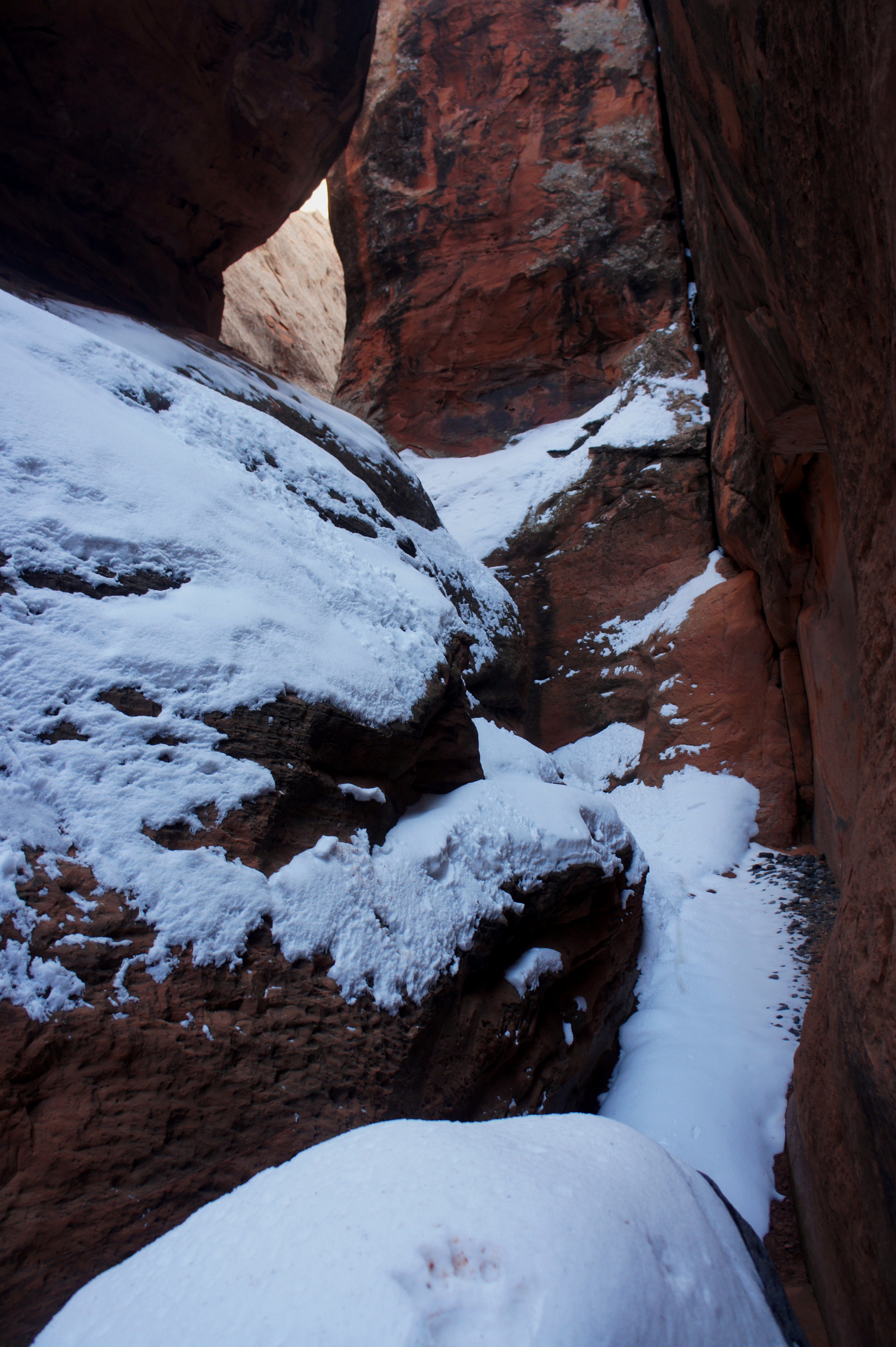
(Note: Though it looks appealing on a map to loop back to your car by descending the East Fork of Red Canyon, do not attempt to do so unless you are prepared to repel. About 2/3 mile down-canyon from the meadow, the canyon walls narrow to about six feet wide. After comfortably mastering a handful of small chockstones and 4- to 10-foot pouroffs, I stopped at the sight of a precarious 10-foot dryfall with no prospect for bypass (photo below); I am rather certain there are additional, higher drop-offs beyond this point. It’s likely a similar story for Red Canyon proper.)


Hello! I love you photos and your information, I am a local and love visiting this place, and other nearby areas of curiosity. Of such I would like to share with you, are you interested in receiving info and pictures of the surrounding area? (Hells Hole, the Back of the Anthill, Pete’s dragons Canyon, and Shingle Mill Creek)!