

Connecting Highway 24 and the Fremont River with the Scenic Drive, Grand Wash is one of only six drainages cutting east-west through the 100-mile Waterpocket Fold. It also happens to be one of the flattest and easiest hikes in Capitol Reef National Park. The scenic walk, a great option for children or those looking for a casual stroll, follows the wide and dry creek bed for nearly 2 ½ miles through sinuous curves and three different layers of rock: the towering white cliffs of Navajo sandstone, the ledgey Kayenta formation, and the deep red Wingate sandstone. In the ½ mile-long narrows section, the varnished canyon walls reach as far as 500 feet high; the pearly white cliffs beyond reach even higher. It’s therefore no wonder that Grand Wash is one of Capitol Reef’s most popular hikes.


The hike
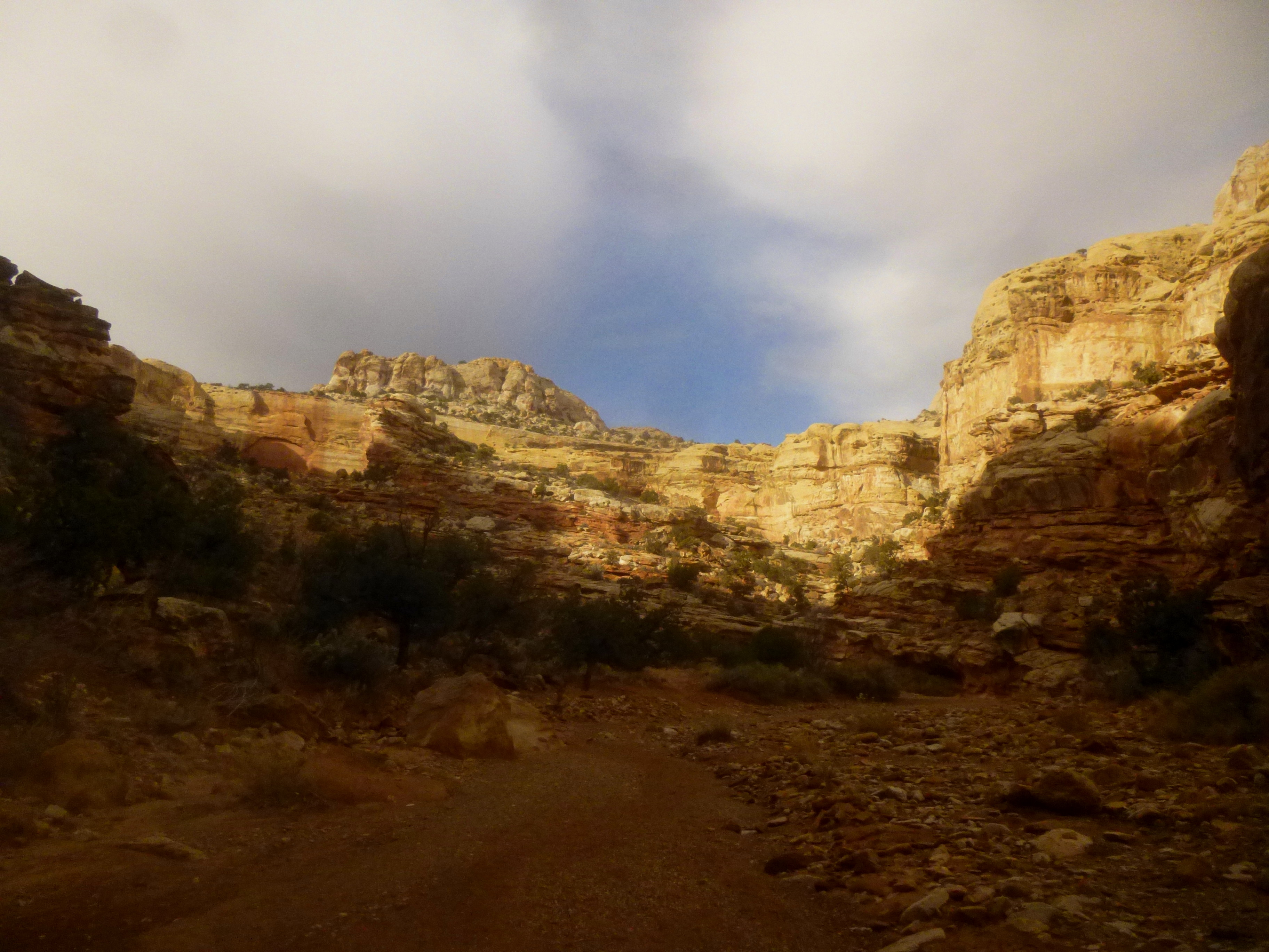
Though following the same drainage for 2.4 miles from end-to-end, Grand Wash feels like two hikes in one. The lower half (closest to the Highway 24 entrance), which includes the Narrows, features sheer vertical walls of the Navajo sandstone—decorated in places with dark streaks of iron oxide “varnish” and reminiscent of the more famous Narrows section in Zion National Park. The upper half is more of a free-for-all: a broader canyon littered with boulders and vegetation and travelling through the pink-and-gray Kayenta and holey, red-orange Wingate. Many visitors choose only one: hiking only as far as the Narrows from either the Highway 24 entrance or the Grand Wash spur off Scenic Drive. If you have two vehicles or a shuttle, I recommend doing the whole 2.4 miles end-to-end. If not, all the better: doubling back the way you came will provide new angles and spark new observations that you missed the first time around.
It’s hard to say which end is a better starting point, as the elevation gain is negligible (you will hardly notice you are gaining/losing 200 feet). But for quick passersby seeking to avoid the $5 entrance fee on Scenic Drive, the mouth of the canyon at Highway 24 (4.5 miles east of the Visitor Center, on your right) is perhaps slightly preferable. You are also less likely to encounter a full parking lot here on a busy summer afternoon than you would at the trailhead off Scenic Drive.
At the marked Highway 24 pull-off, you will find a wayside exhibit with a map of the route (though the distance is listed as 2.2 miles one-way—a closer estimate is 2.4 miles) and the beginnings of a well-worn trail along the wash’s west bank. After following the sandy path for less than 100 yards, footprints disappear into the drainage: Grand Wash itself will serve as the trail most of the way.
Upon entering the drainage, you will immediately notice on your right a smooth chunk of Navajo sandstone dotted with holes resembling a natural honeycomb. No, these were not formed by gnawing insects or animal cave dwellers! Rather, they are what geologists call “solution pockets” or “tafoni”: small, cave-like openings in the rock left behind when old sand grains (or minerals like calcite) are washed out of the stone through water erosion. Thousands upon thousands—perhaps millions—of these solution cavities can be found in Capitol Reef.
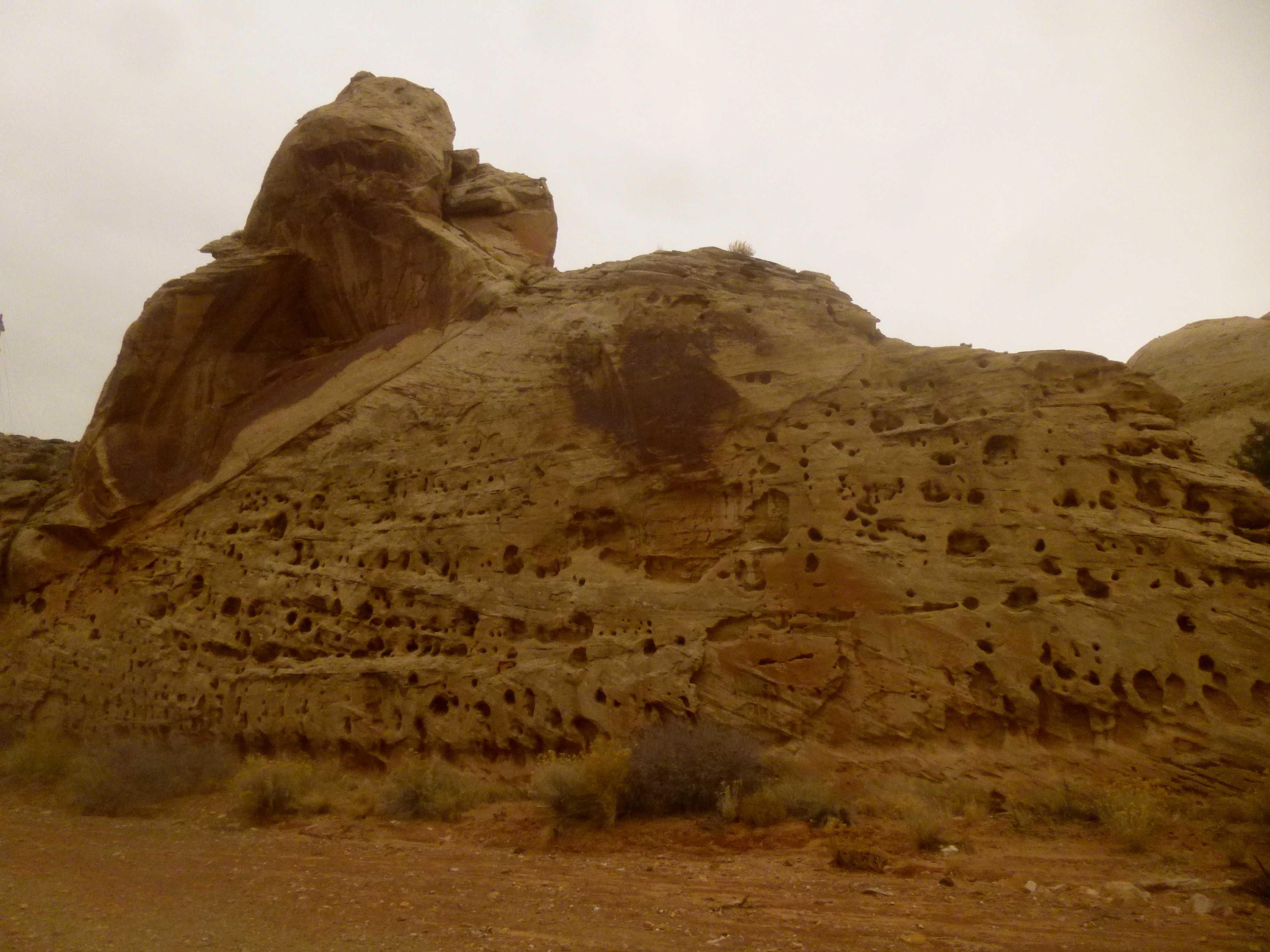
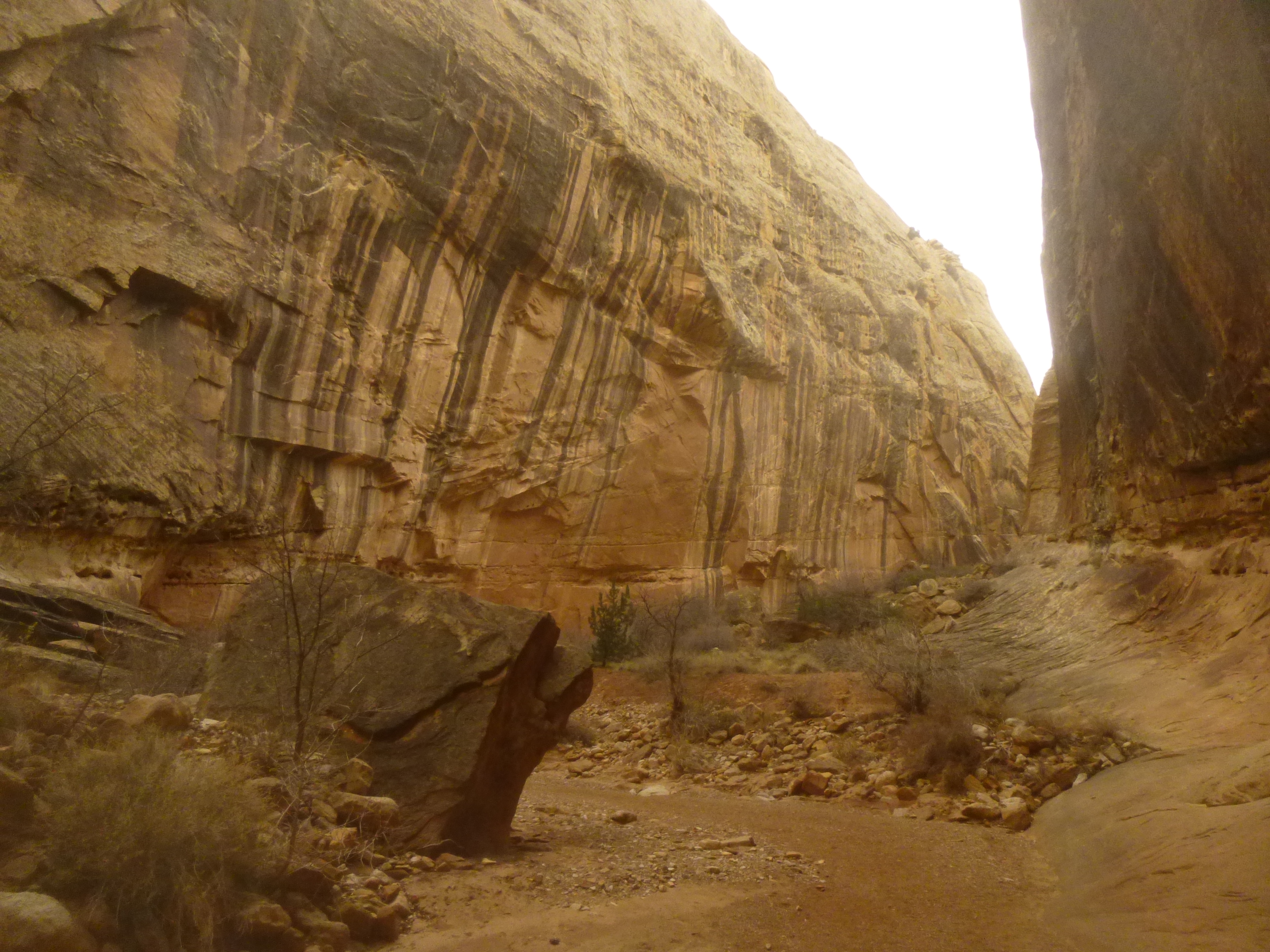
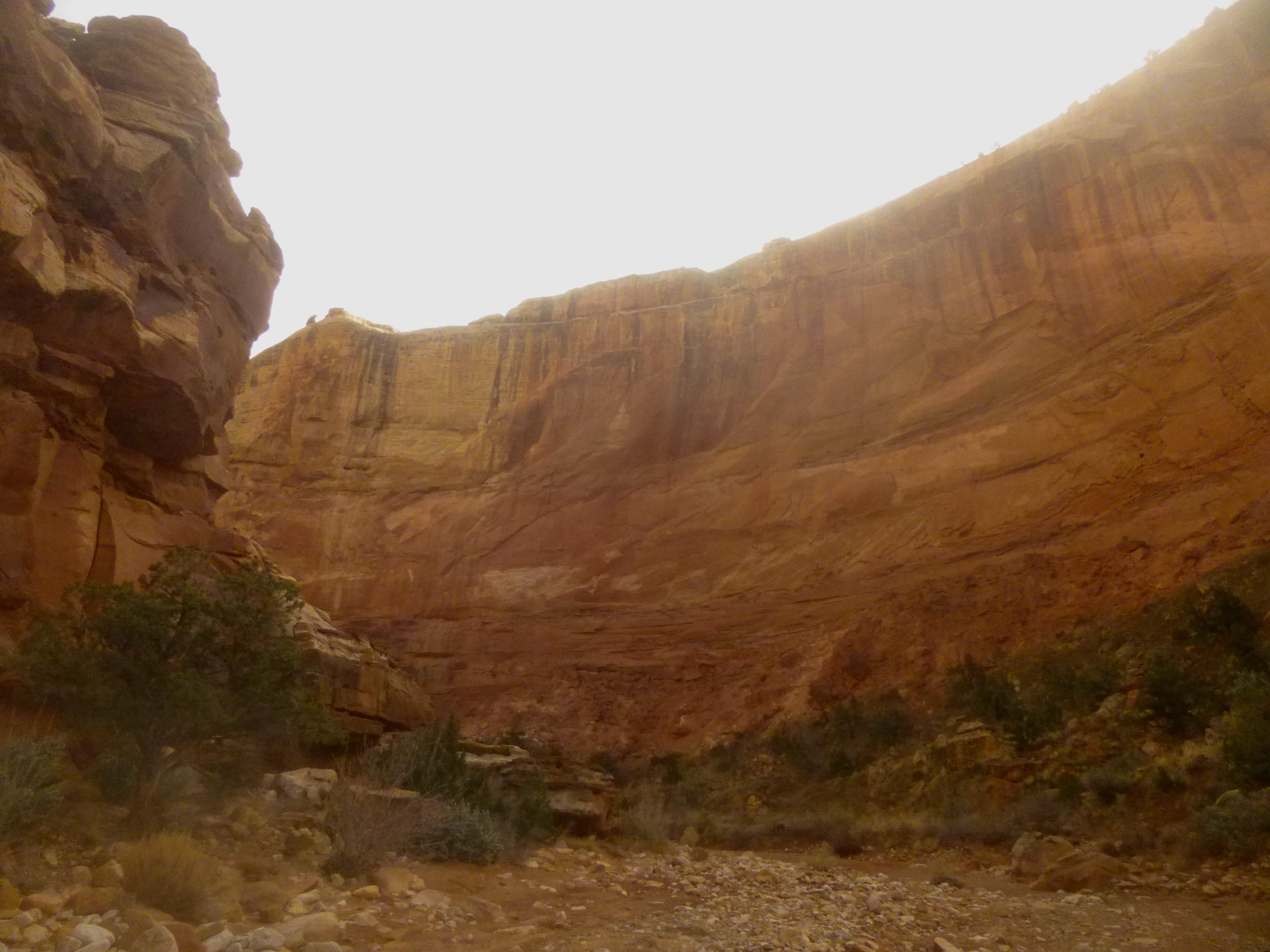
The second feature you will notice throughout the hike are the deep brown or black streaks coloring an otherwise tan or white sandstone. Known collectively as “desert varnish,” these colorations are formed by a variety of minerals and oxides—often iron or manganese—glued to the walls by tiny bacteria. They are most common along cliffs in frequent contact with water, especially at runoff points.
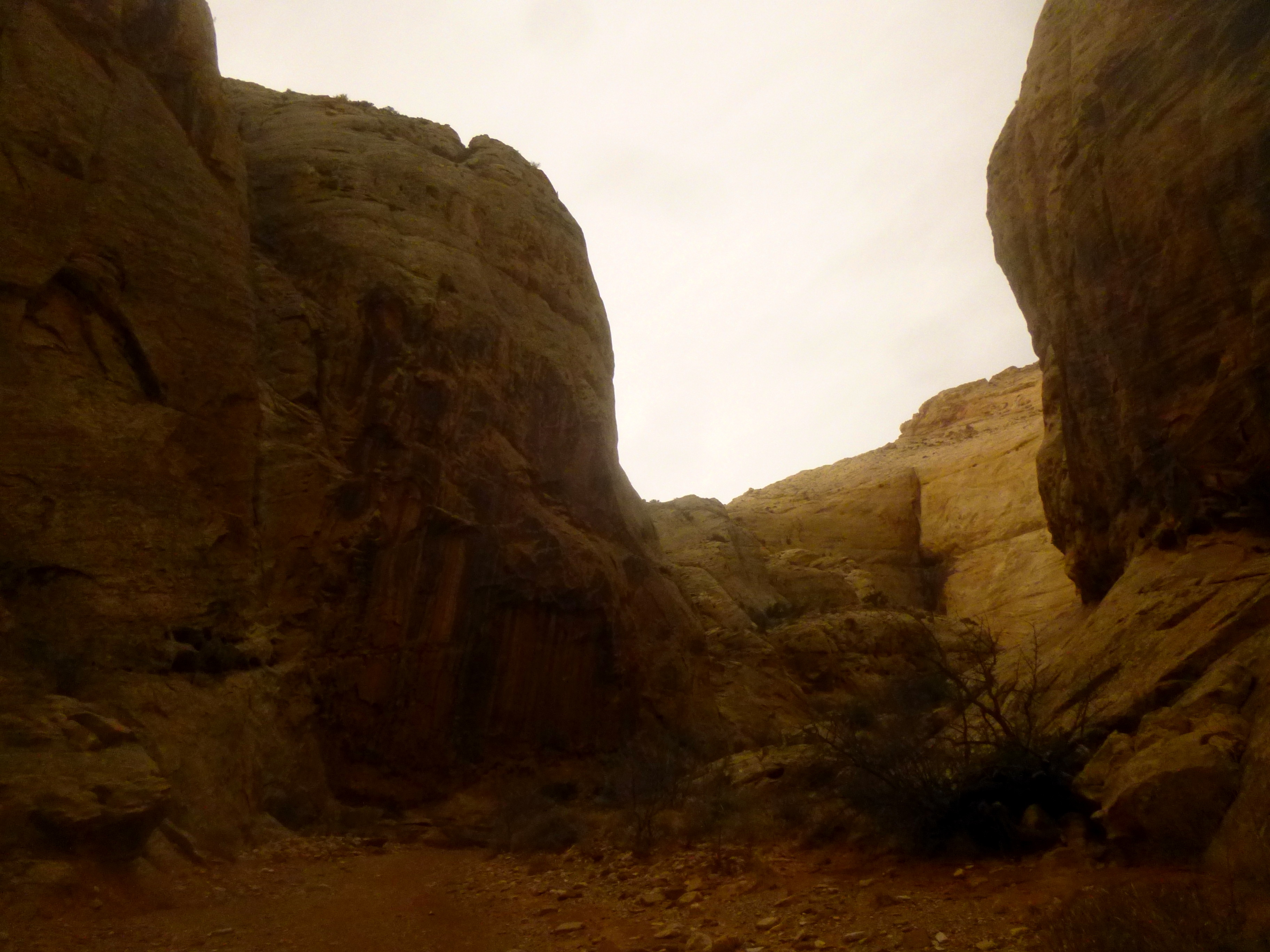
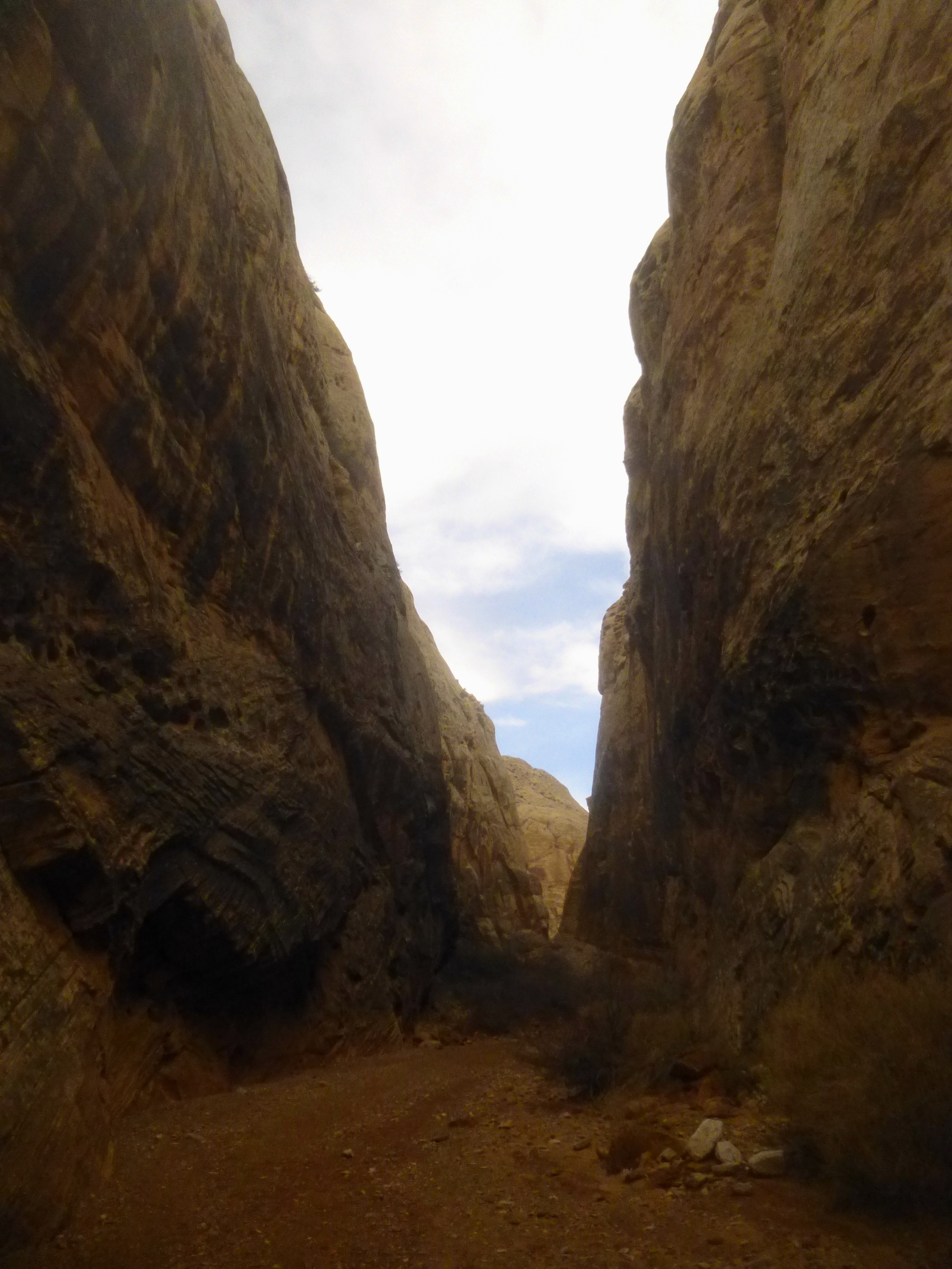
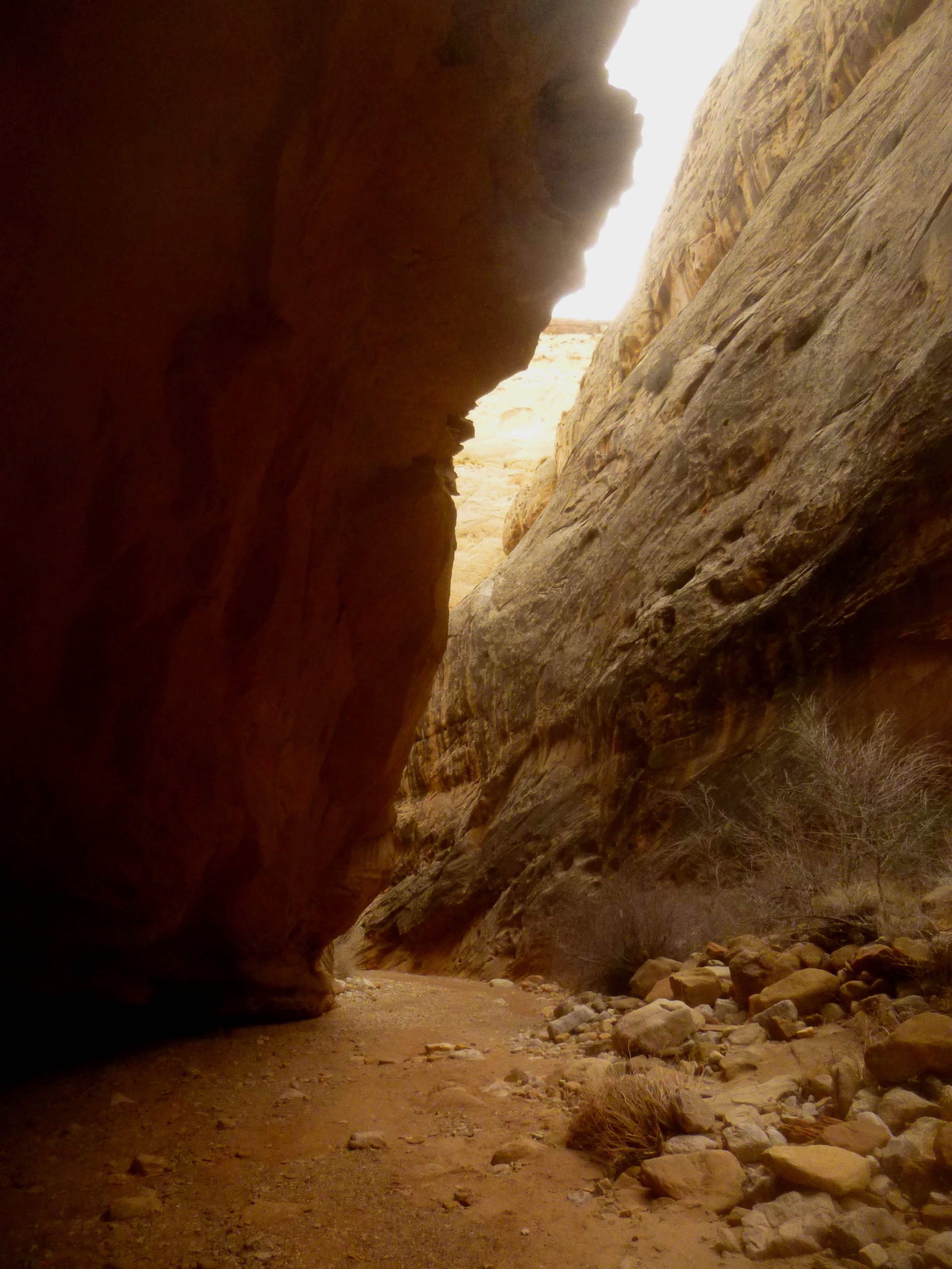
The first 7/10 mile offers a teaser of the splendid geology before the wash enters the dramatic Narrows section, which continues for about ½ mile. Here the canyon walls appear to constrict; at one point, the canyon is only 16 feet wide. There are few signs of life in the Narrows—only the rare shrub caught in a zigzag of contorted canyon bends.
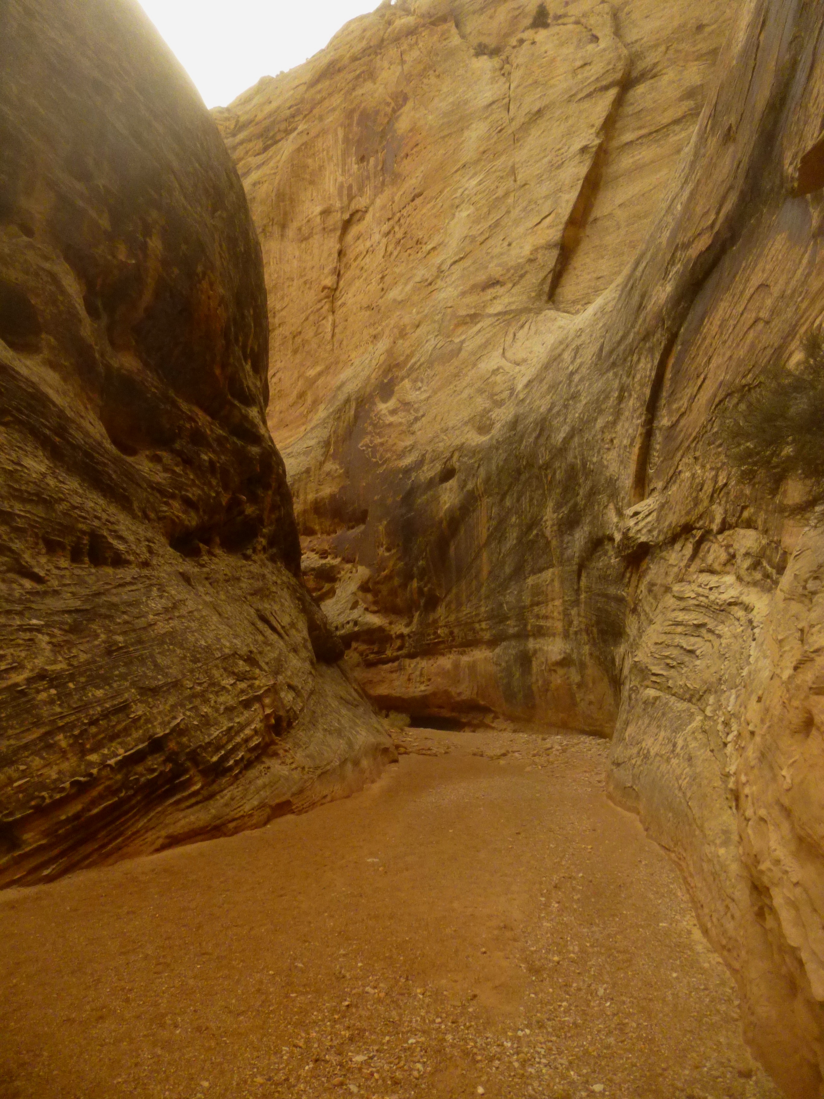
About 2/3 of the way through the narrows, a bushy side canyon appears as a tempting diversion to explore—but a sharp right turn leads to another 300 yards of uninterrupted narrows, punctuated by a beautiful bend with a cavernous cove on the right, opposite a striking display of streaking desert varnish on the left.
Within a minute’s walk, the canyon walls abruptly recede and the wash opens up dramatically into a wide and suddenly vegetated flat. This is the midpoint of the hike.
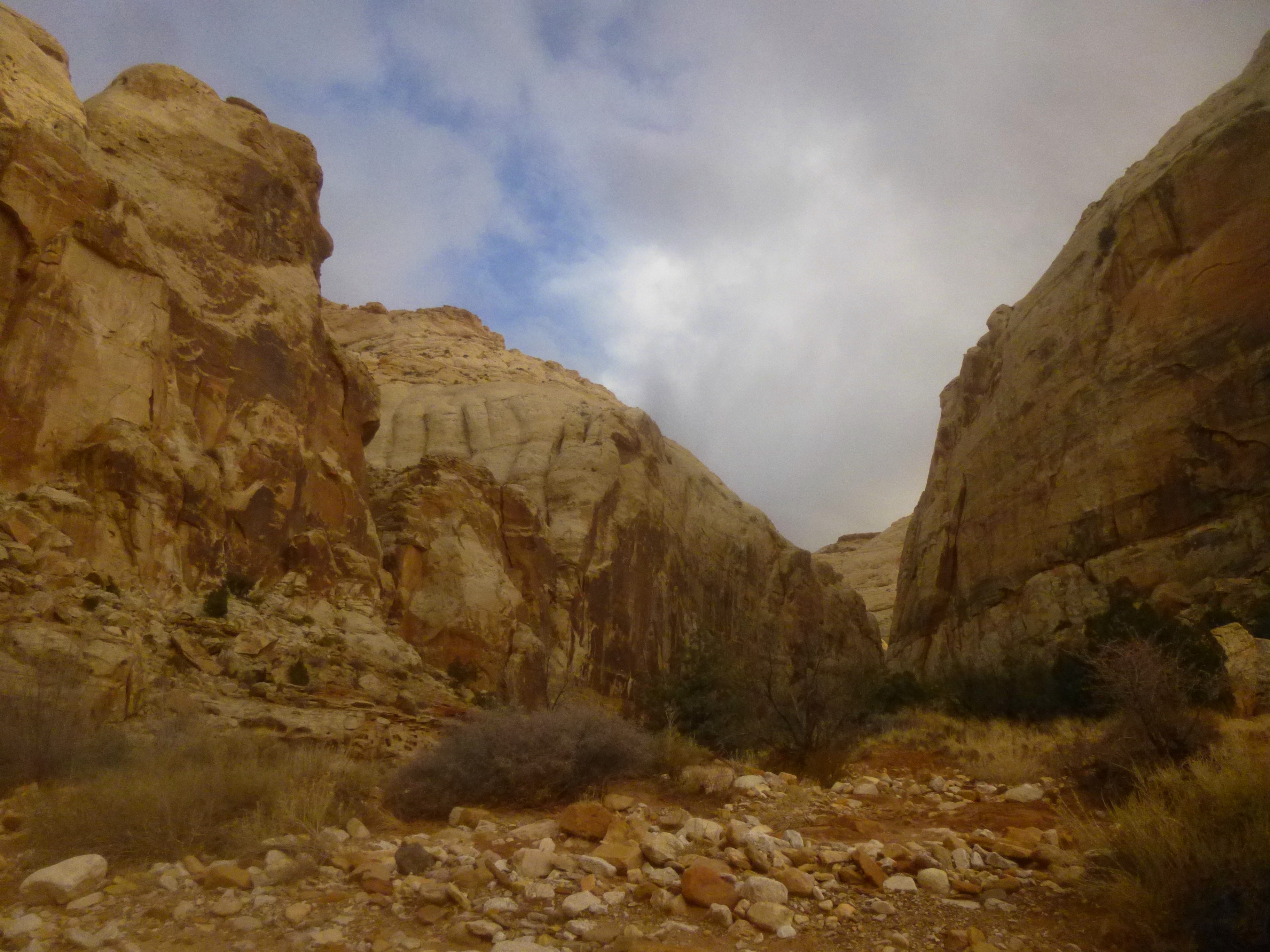
After another 200-300 yards, the first visible chunk of the pink, ledgey Kayenta formation appears on the right, though still dwarfed by a large brown-tinted Navajo spire just above. In the distance ahead, you can make out the distinctive white-capped knobs of the Kayenta. On the December morning I hiked Grand Wash, ominous rain clouds briefly gave way to the warm sun, producing receding shadows along the Navajo walls.
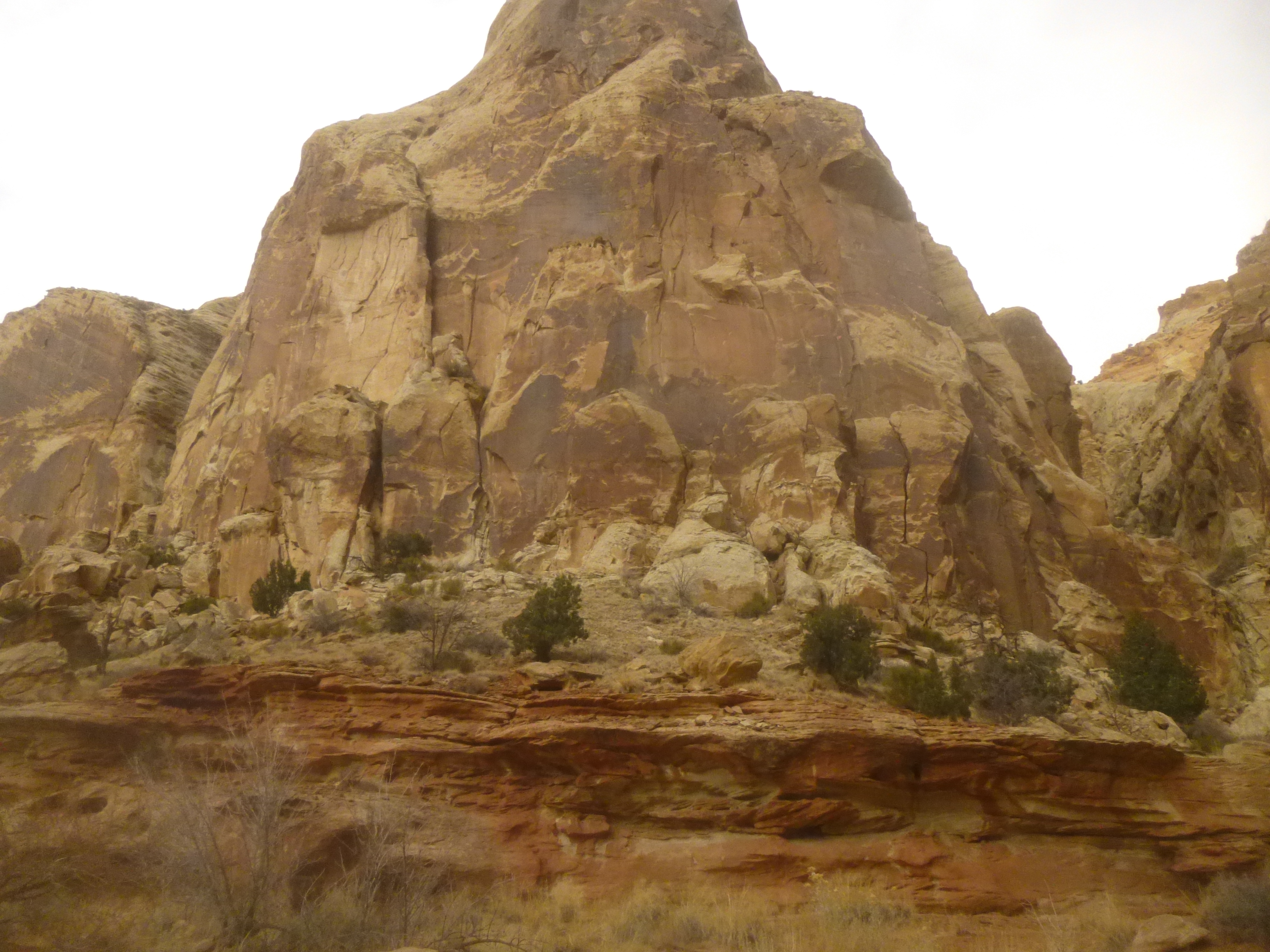
The wash itself also changes. It becomes less sandy and more rock-strewn—and lined with pinyon pines.
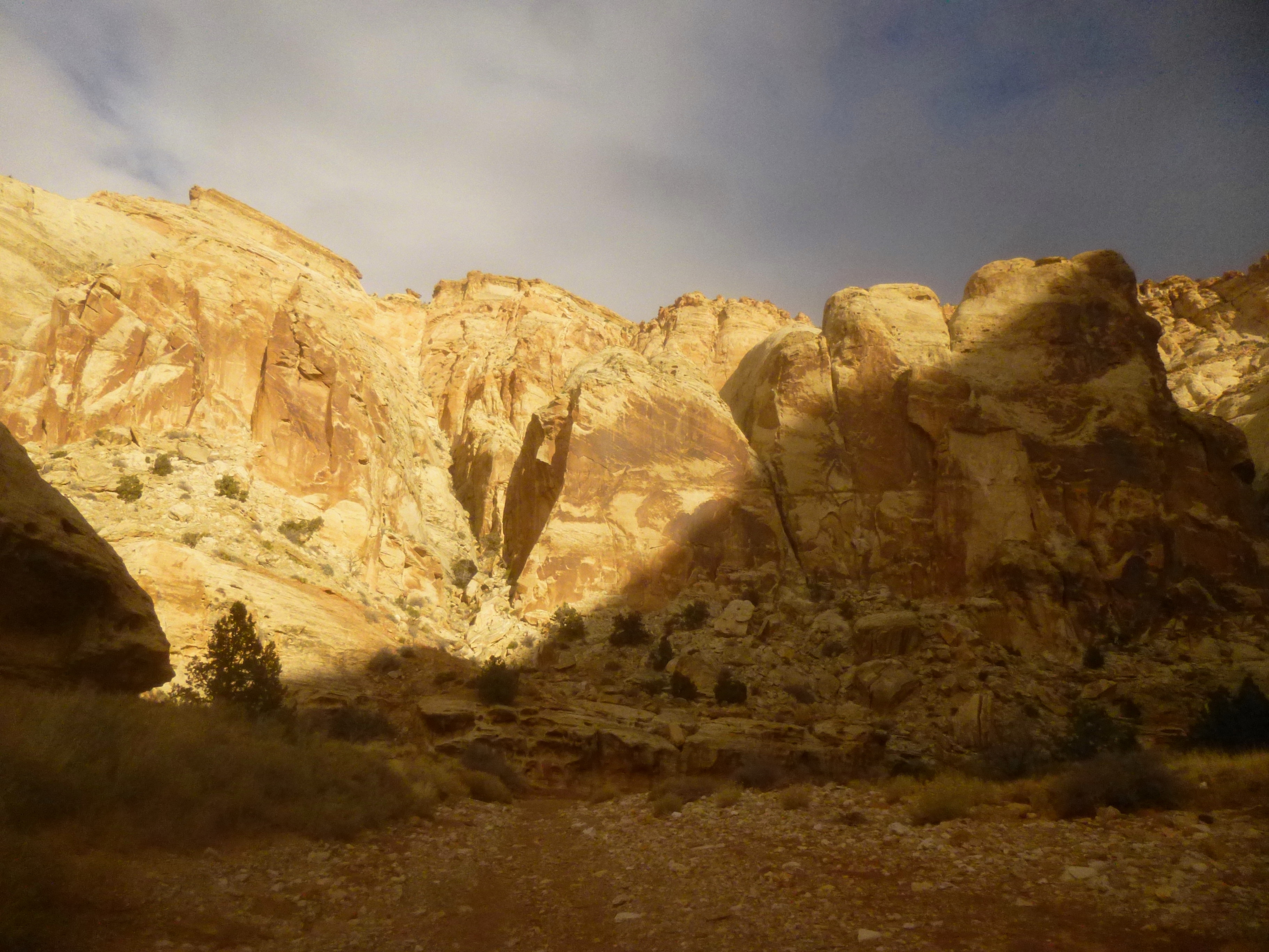
The dry drainage weaves through this open expanse for around ½ mile before cutting right into another narrower section; this time Grand Wash carves into the colorful Kayenta, followed quickly by the classic red-orange Wingate.

The final stretch leads in a general southward direction toward Grand Wash Trailhead. On the left, a large sign indicates the start of the Cassidy Arch Trail, which climbs steeply up the right flank. From here, follow the wash straight for another 150 yards until spotting a small wooden sign on the right indicating that the trail is finally leaving the dry creek bottom.

It is 1/10 mile further along a well-worn path amid a handful of junipers to the dusty Grand Wash Trailhead. There is a bathroom here if needed. Expect the parking lot to be crowded during peak season (on the winter day I did Grand Wash, it was deserted).
If you’re expecting a ride, this is the end of your hike. If not, take a breather before retracing your steps back through the wash! The total round-trip should take around 2 hours.

Pingback: Cassidy Arch Trail (Capitol Reef National Park, UT) | Live and Let Hike
Pingback: Frying Pan Trail and Frying Pan Canyon (Capitol Reef National Park, UT) | Live and Let Hike
Pingback: Pleasant Creek (Capitol Reef National Park, UT) | Live and Let Hike
Pingback: Pleasant Creek slot canyon (Capitol Reef National Park, UT) | Live and Let Hike
Pingback: Sunset Point Trail (Capitol Reef National Park, UT) | Live and Let Hike
Pingback: Halls Creek Narrows via “airport route” (Capitol Reef National Park, UT) | Live and Let Hike
Pingback: Cohab Canyon Trail (Capitol Reef National Park, UT) | Live and Let Hike
Pingback: Capitol Gorge Trail (Capitol Reef National Park, UT) | Live and Let Hike
Pingback: Top 10 Hikes in Capitol Reef National Park’s “Frontcountry” | Live and Let Hike
Pingback: Return to Capitol Reef National Park | Live and Let Hike