

The mostly level and shady Capitol Gorge Trail continues up the narrow canyon where the scenic Capitol Gorge Road ends. A geological cousin of nearby Grand Wash, Capitol Gorge also played a central role in the area’s human history. For nearly 80 years, despite its extreme narrows, the canyon was the only reliable transit point for Mormon pioneers seeking to pass through the towering, 100-mile long Waterpocket Fold. In fact, it was not until 1962, with the construction of Highway 24, that this rugged route—dubbed the “Blue Dugway”—was closed to vehicle traffic. Historic inscriptions, axle grease, and the remains of old telephone lines provide a taste of Mormon pioneer history, while ancient Fremont petroglyphs offer a flavor of life in the Capitol Reef area 1,000 years prior. The geologically-minded can continue on through the narrow canyon to the “Tanks,” an interesting set of undulating waterpockets perched in a row high above the canyon floor. Those with additional time can follow Capitol Gorge to the park’s east boundary.
The hike
From the Visitor Center, drive south on the Scenic Drive for eight miles, turning left onto the unpaved Capitol Gorge Road. There are spectacular views from the road itself as it hugs the canyon walls. (Note: At the Visitor Center, we would tell visitors that the drive is like a “slot canyon for your car.”)
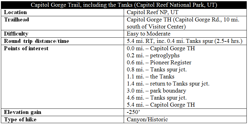
The parking lot at the end of the road is often quite crowded; arrive early or late in the day to secure a spot. Two trails take off from the Capitol Gorge Trailhead: a steep, moderately strenuous climb to a viewpoint of the Golden Throne and the easy stroll through the gorge. The Capitol Gorge hike begins at the covered picnic area at the road’s terminus and strikes out east into the slender canyon.

Follow the wide and sandy track for around ¼ mile, resisting the urge to take one of the many hiker-made spurs dropping down to the wash bottom. Doing so would overlook the first, and oldest, set of inscriptions encountered on the hike: a group of 1,000-year-old petroglyphs traced to the Fremont Indians, who once inhabited the region. These are marked with a small wooden post along the left-hand wall. (Note: Alas, these etchings have faded considerably over time. For a better set of anthropomorphic figures, try the better-preserved petroglyphs along Highway 24.)

Just beyond the petroglyphs, the trail does indeed drop into the wash bottom, where most of the remainder of the hike will stay. Scan the right-hand wall for a peculiar sight: the names of six surveyors near the top of the vertical face—Stewart, Stewart, Hayes, Hurst, Ollrton, Gifford—and the date: September 24, 1911. How—and why—did these adventurous contractors carve their names so high up the canyon wall? The story told today involves what amounted to a pioneer prank. The six contractors conceived an idea: lower one of the members down from the top in a bucket to carve the names, then return a few years later with their families, to whom they would explain with astonishment—lying that they once etched the names standing in the wash bottom—“look at how much the canyon has eroded!” Whether the trick achieved its desired effect remains a mystery.

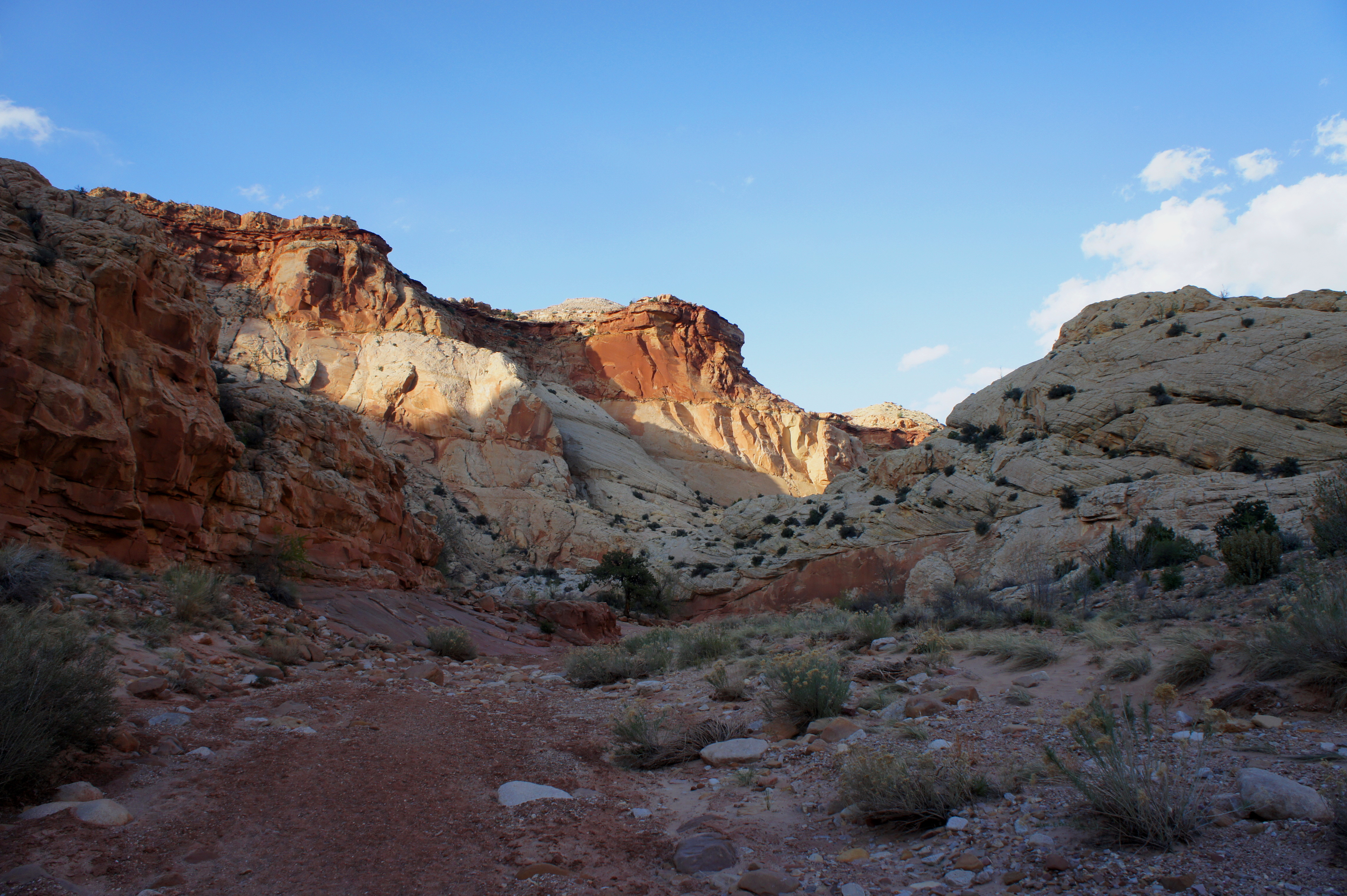
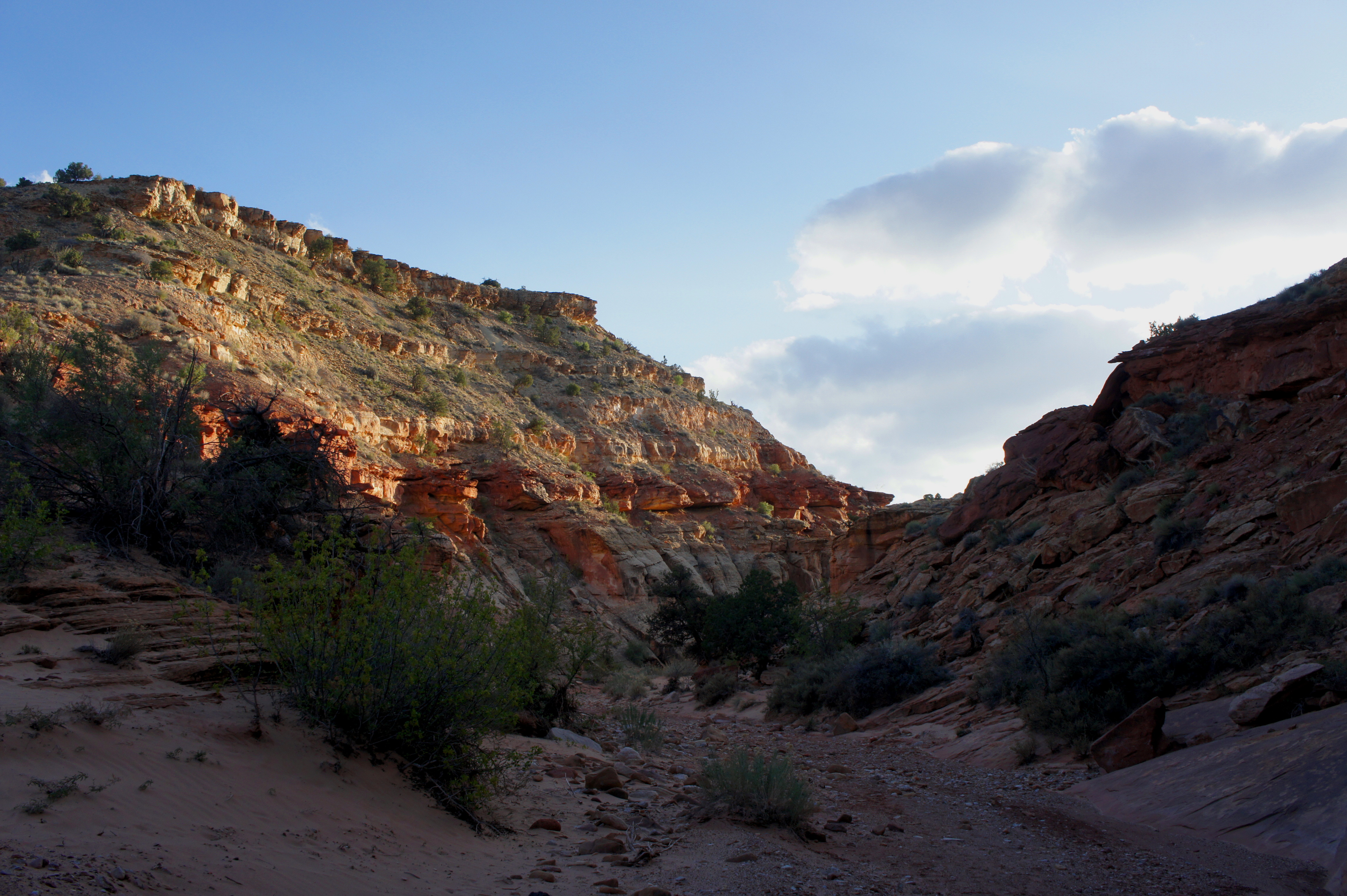
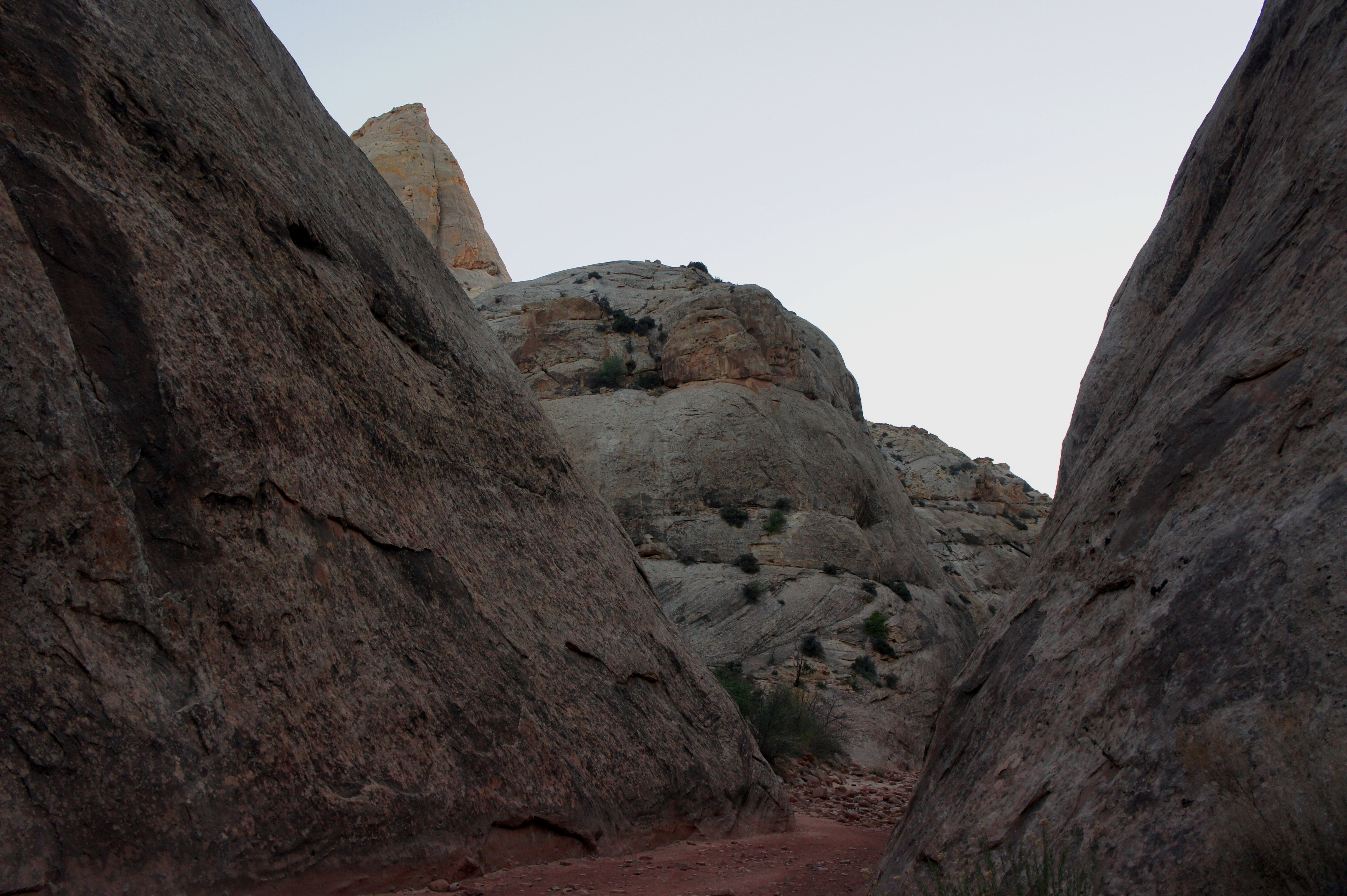
From here, Capitol Wash slices through the Navajo sandstone, carving a canyon that thins to as little as 15-20 feet wide in several places. The etchings continue—and pick up in frequency—as hikers approach the Pioneer Register, a jumble of names and dates on the left-hand wall roughly 6/10 mile from the trailhead.
Among them is an inscription by Cass Hite, one of Utah’s most famous prospectors in the 19th century. While most were scrawled with a sharp point, some engravings were assisted by the use of axle grease, hearkening to the early 20th century, when automobile drivers used Capitol Gorge as a thruway.

After the register, two minor ravines enter from the left and right, followed within minutes by another pair of larger side canyons. To the south is Waterpocket Canyon, where exploration is quickly impeded by an impassable dryfall. To the north is Tanks Draw, which hosts a series of waterpockets accessible by a short spur trail.
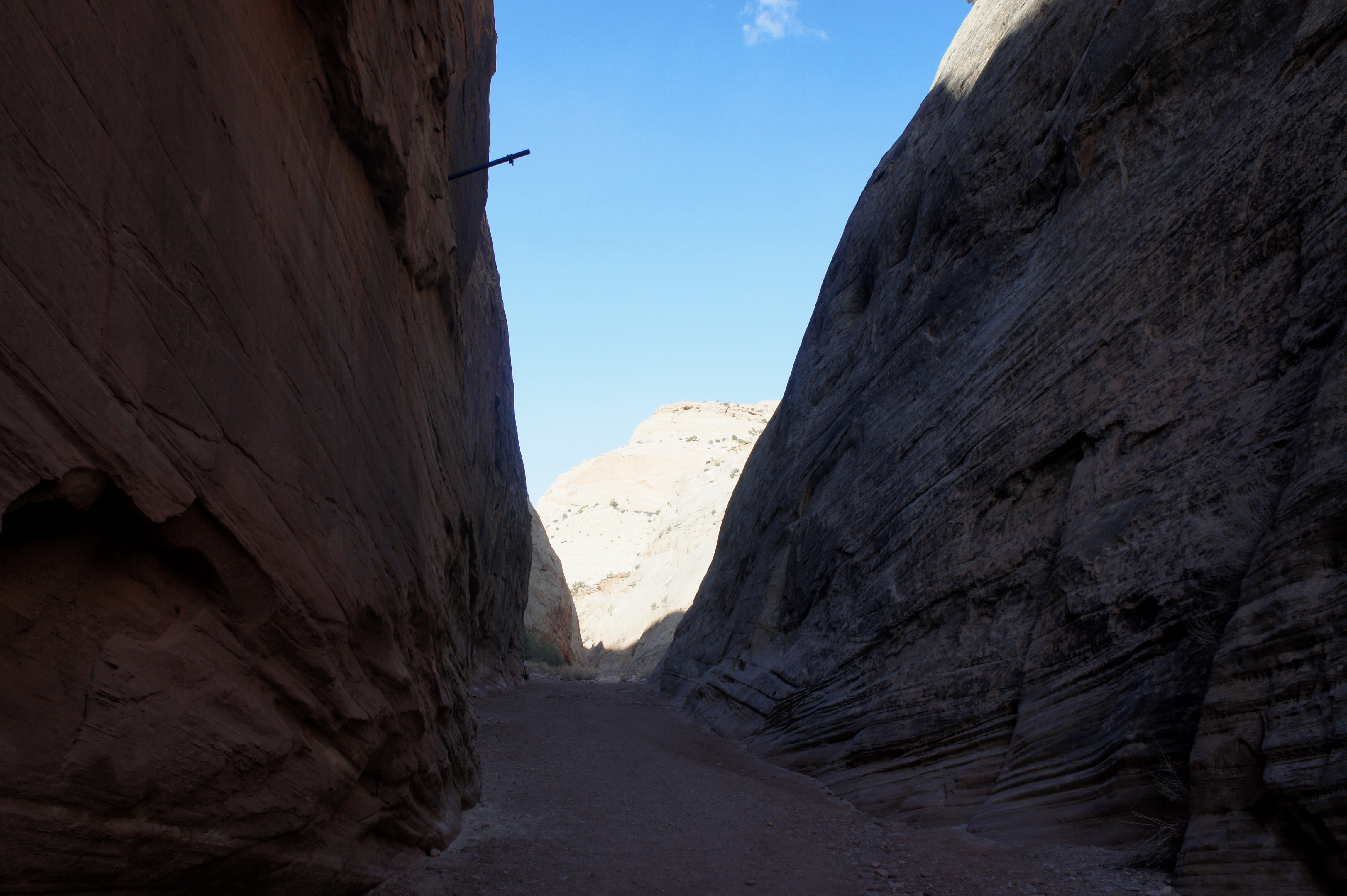
The side trip to the Tanks is well-marked and begins approximately 8/10 mile from the trailhead. The trail is rocky and rugged and climbs more than 100 feet over the course of ¼ mile, ending at an attractive drainage boasting—at most times—a half-dozen potholes full of water. (Note: In early April 2015, the Tanks were conspicuously dry—though this is rarely the case.) The Tanks support one of Capitol Reef’s most interesting microenvironments—check for tadpoles and fairy shrimp, as well as lichens and mosses.
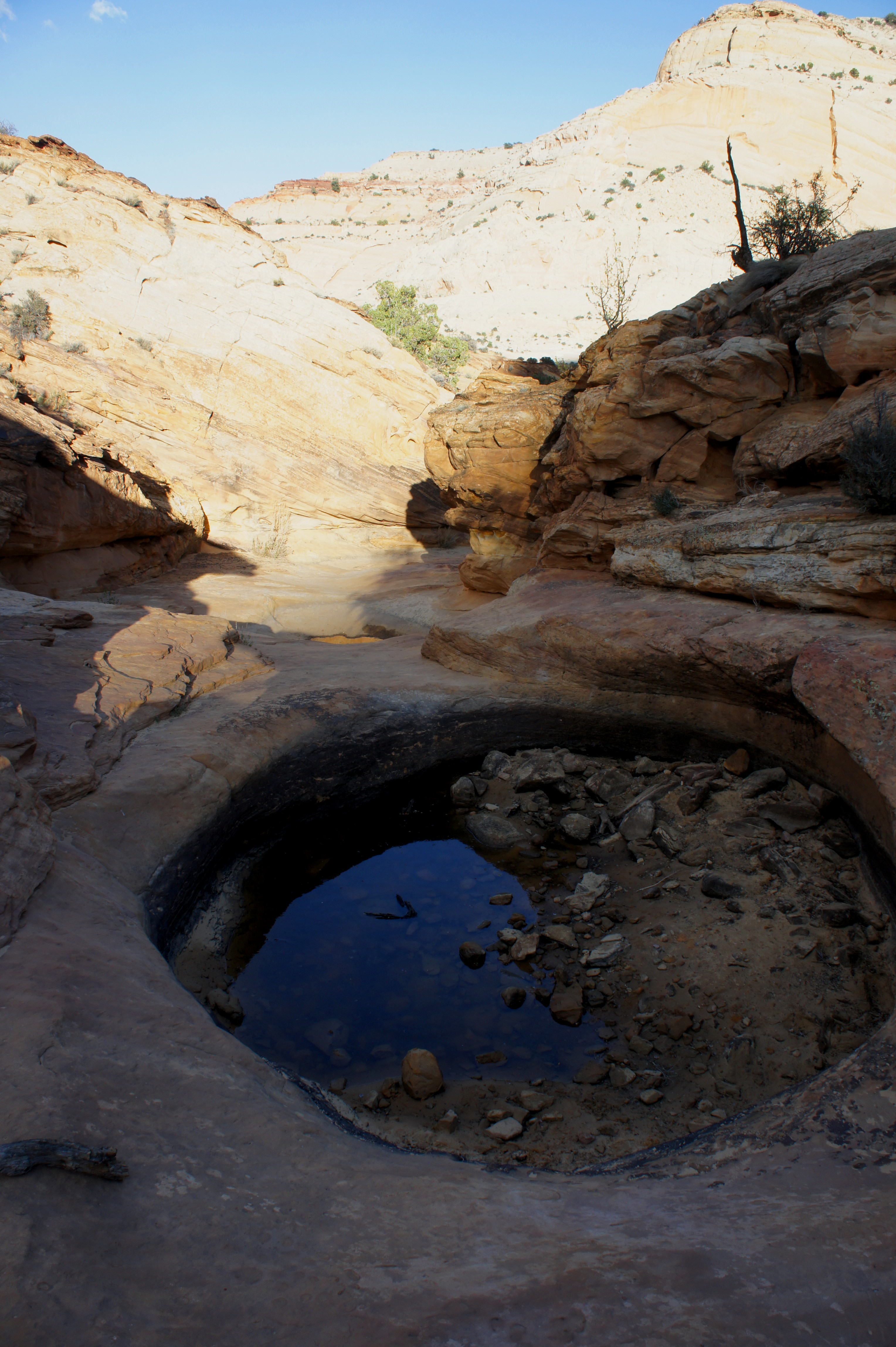
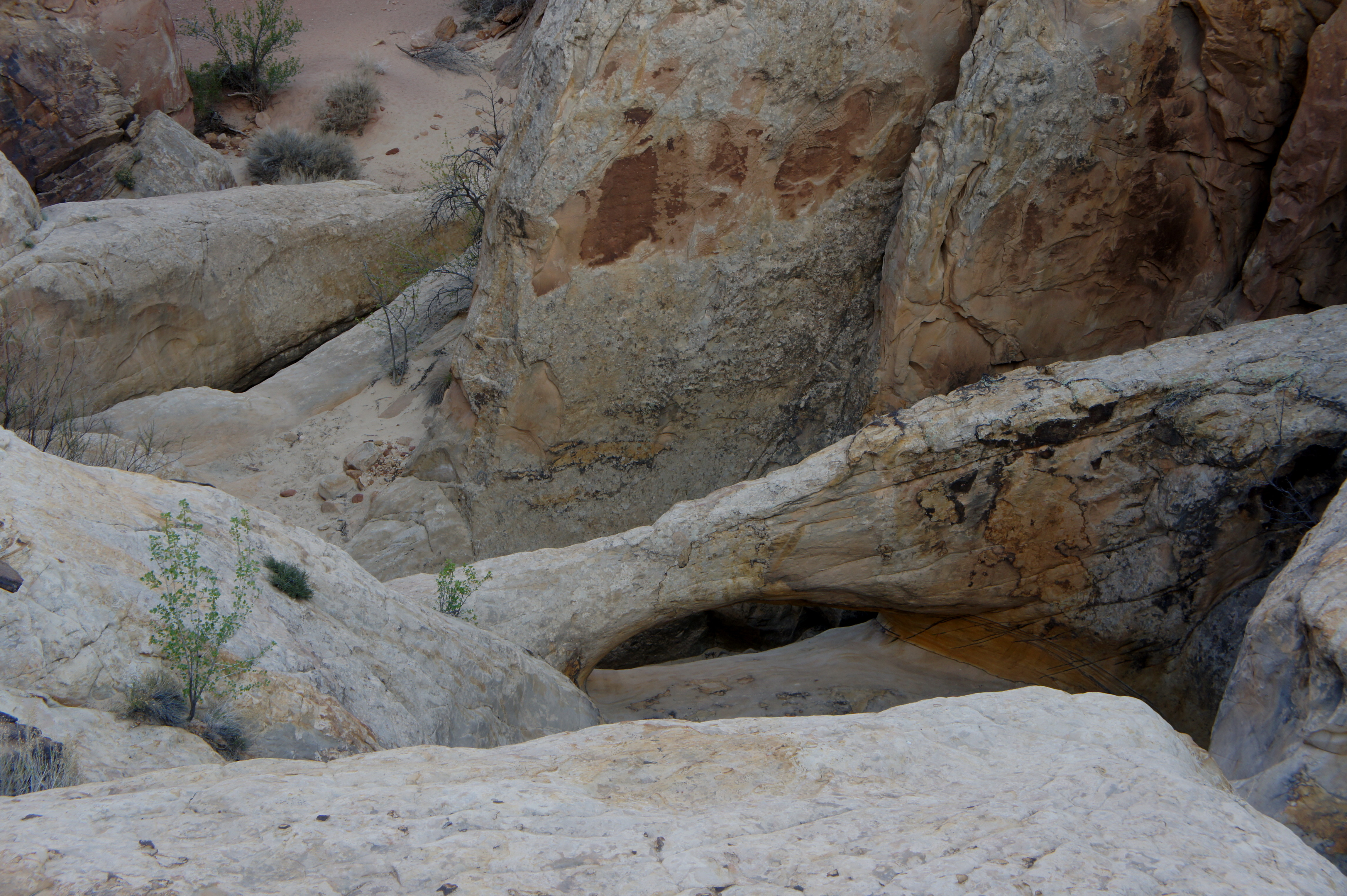
On the way back down to Capitol Wash, peer down Tanks Draw to see if you can spot a small natural bridge, formed from a hollowed-out pothole. The Tanks spur also offers fantastic views of Capitol Gorge from above—especially around midday.
Many hikers will turn around after visiting the Tanks, making for a roughly 2-mile round-trip. Those with additional time can continue farther down-canyon. Rounding the next left-hand bend reveals the hike’s first good look at the Page sandstone and Carmel formation, situated above the Navajo due to the tilt of the Waterpocket Fold. Here the cream-colored Navajo fades to yellow (Page) and red (Carmel) and gives the hike a rather different flavor.
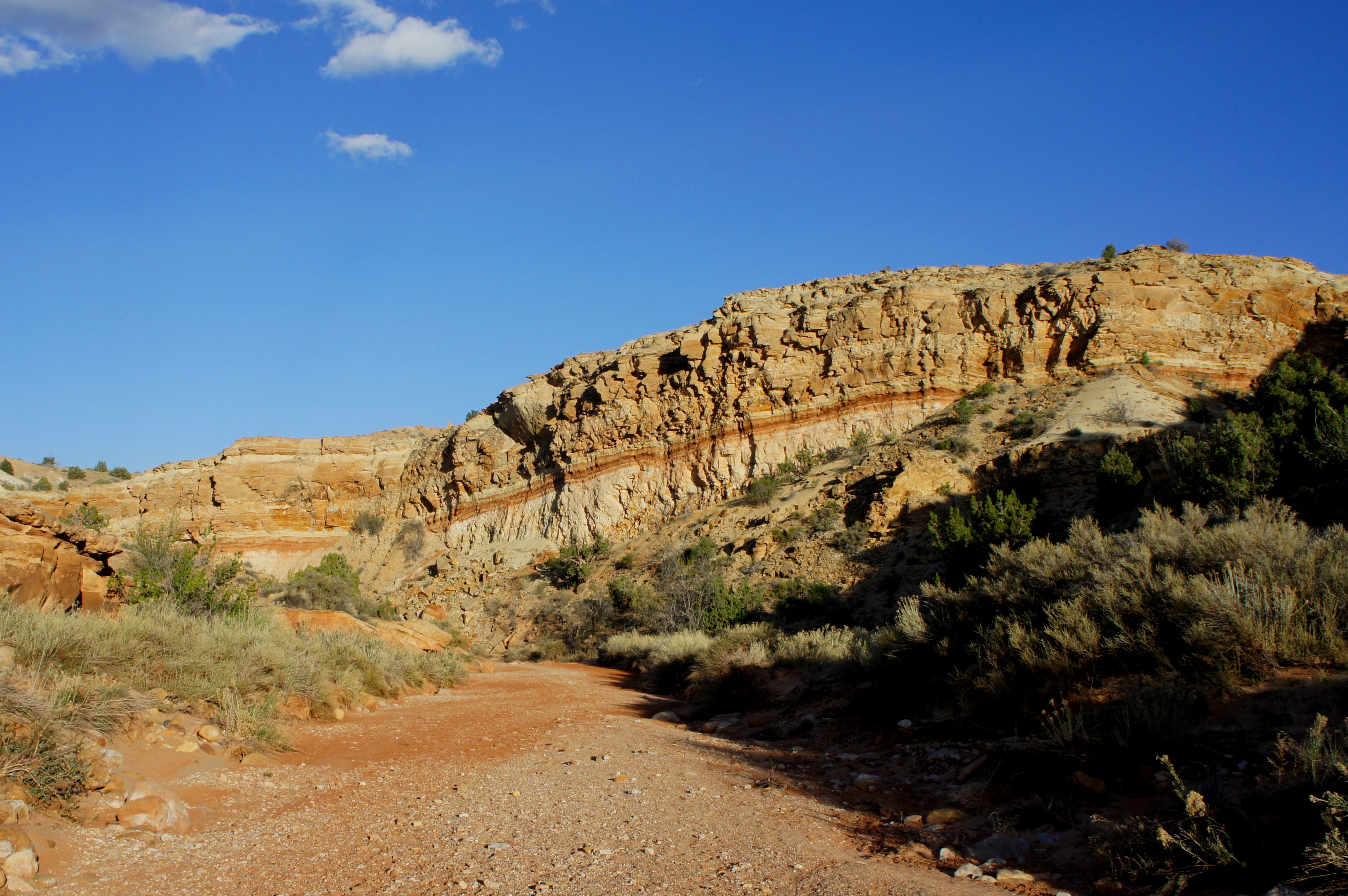
It is roughly a 10-minute walk from the Tanks junction to a concrete dam, which comes as somewhat of a surprise. 5-10 minutes later, the wash passes under a deep red wall on the left, rounds a bend into a sunny expanse, and encounters a second minor dam. (Note: Both dams are easily bypassed on the left.) The walls ahead are firmly situated within the Page, Carmel, and the beige-colored Salt Wash member of the Morrison formation.
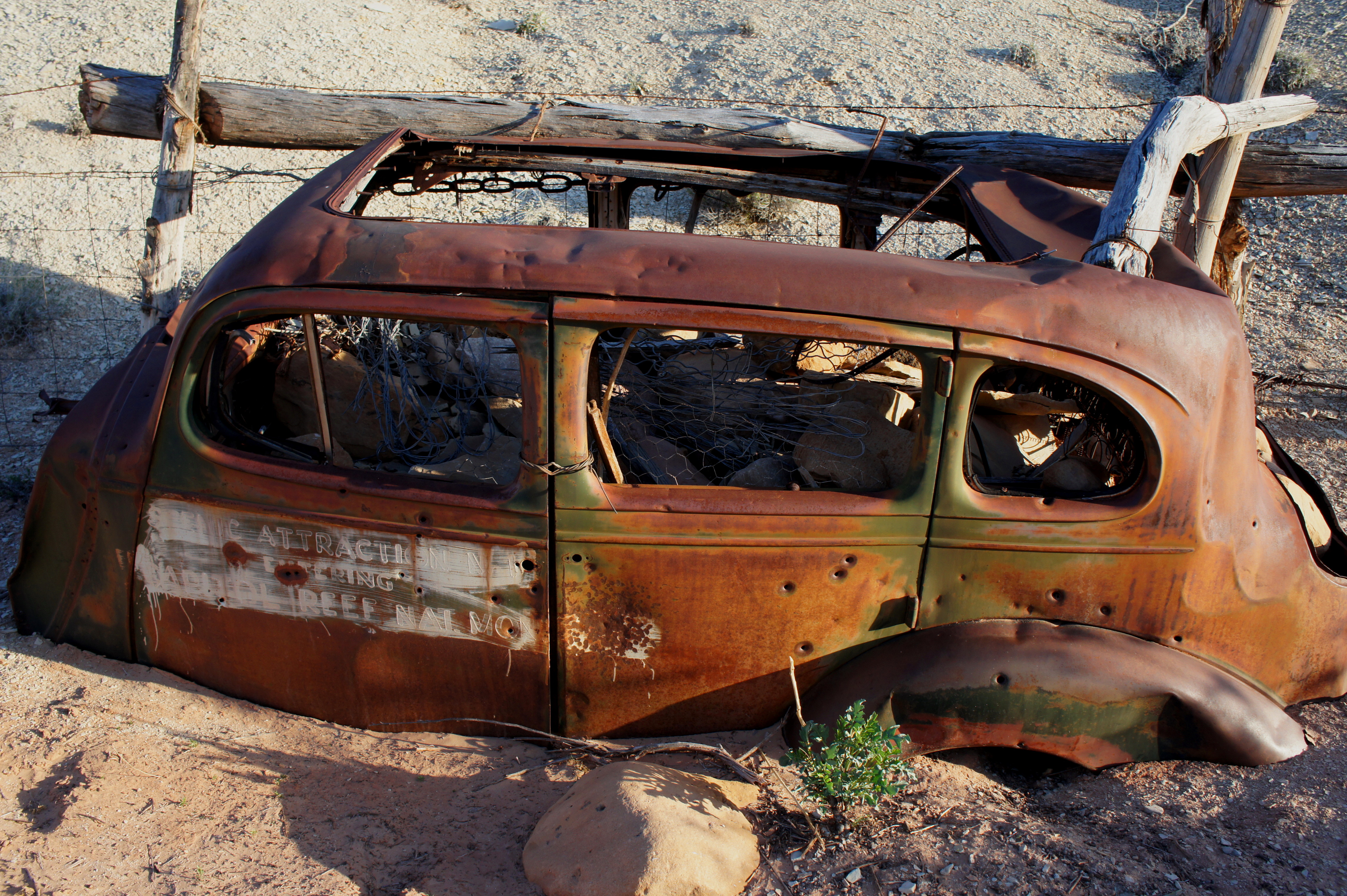
At a point a little over 1.5 miles from the Tanks spur junction, the hike ends abruptly at the park boundary, demarcated by a wire fence. A stone’s throw beyond the fence is another interesting relic: an old weathered car, buried in sand and filled with rocks, sporting a tourist marker on its side reading “Scenic Attraction; Entering Capitol Reef National Monument.” Do not venture farther down-canyon, as the land beyond is private property (and relatively uninteresting).
It’s a roughly 2.5-mile walk—pleasant and not at all strenuous—back to the trailhead from the park boundary. Allot between 2.5 and four hours for the out-and-back hike, including the short detour to the Tanks. If the Tanks are your endpoint, allot around 1.5 hours to soak in this popular and interesting hike.

This is a fun easy hike. Definitely going beyond the tanks is a must. Very cool! I think the Capital Gorge Road is one fo my favorite with the great views and beautiful rock walls.
Pingback: Top 10 Hikes in Capitol Reef National Park’s “Frontcountry” | Live and Let Hike
We will be doing Capitol Reef in August. Love to hike and hoping the heat doesn’t kill us.
Pingback: Capitol Gorge & The Tanks | Otter Gardens
Pingback: Capitol Reef Scenic Drive: Beautiful Things to See - PhotoJeepers
Pingback: Capitol Reef Scenic Drive: Things to See, Do and Photograph – AKANMAN
Thanks for a great rread