

The purpose of the Golden Throne Trail is to provide fine views of the trail’s namesake, a 7,042-foot sandstone dome that shines a deep yellow in the sun. However, visitors hoping to summit Golden Throne—or even to touch it—are likely to be disappointed: the 2-mile trek ends abruptly at a rock outcropping a good distance away, some 900 vertical feet short of the top of the dome and 400 feet below its Navajo sandstone base. The hike itself, however, offers sweeping views of Capitol Gorge and some interesting side canyons, and the adventurous can venture beyond the route’s anticlimactic endpoint into an unnamed gorge I have dubbed “Golden Throne canyon.” The extra journey—which follows the use trail to George Benchmark (7,289’) for part of the way—is worth the effort, as it passes some splendid waterpockets and ends at a brief but nifty little slot.


The hike
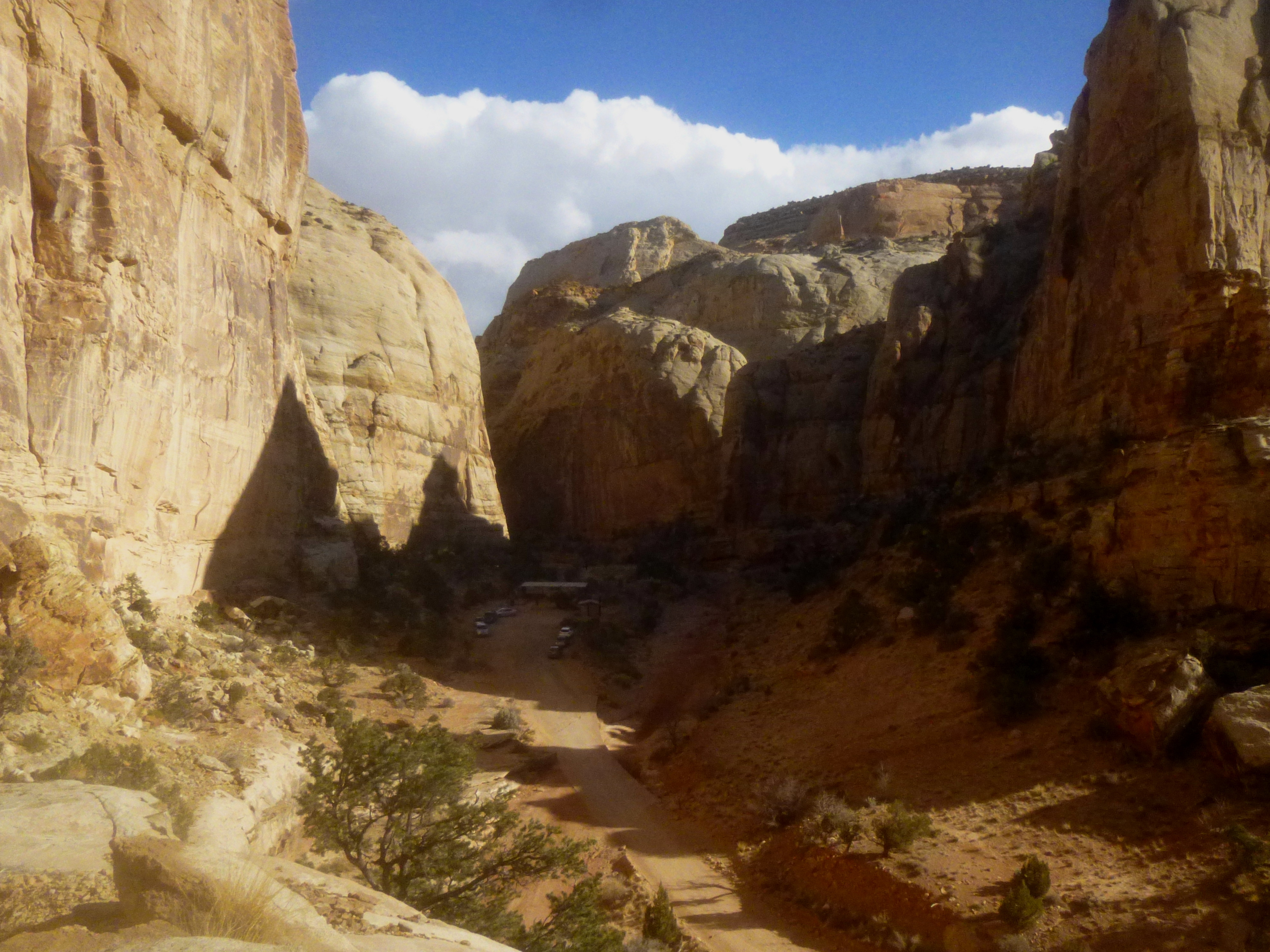
The Golden Throne Trail begins and ends at the parking lot at the culmination of the Capitol Gorge Road, approximately 10.3 miles from the Visitor Center in Capitol Reef National Park. After roughly 8 miles on the paved Scenic Drive, the road turns to graded dirt for the final 2.4 miles to the trailhead. Barring recent snow or severe flooding, this drive should be passable to even low-clearance, 2WD vehicles. The Capitol Gorge Trailhead doubles as a picnic area, and most hikers parked here are likely traipsing along the flat and easy Capitol Gorge Trail, leaving Golden Throne virtually free of traffic.
Standing in the parking lot facing the restrooms and picnic area, the start of the Golden Throne Trail is visible on your left, marked by a large sign marked “BASE OF GOLDEN THRONE 2 MI.” The route immediately begins to climb, tackling roughly two dozen steps in the first 200 yards, though the ascent is relatively gradual. At roughly 2/10 mile, the trail dips in and out of a small, terraced wash. Most of the hike will remain in the ledgey shelf rock of the Kayenta formation, which separates the sweeping domes of the Navajo sandstone and the red-orange cliffs of the Wingate sandstone.
As the trail snakes around a bend, the last views of the parking lot fade away. You will briefly pass through a collection of impressive boulders before turning the corner to the sight of the first of four deep-cut side canyons—tributaries of Capitol Gorge—encountered on the trip (the trail technically ends before the fourth). Skirting the right flank of the precipitous ravine, the trail flattens out as it completes the detour around the canyon. After crossing the wash (about ½ mile from the trailhead), the trail climbs again, rounding a second bend that precedes a second drainage.

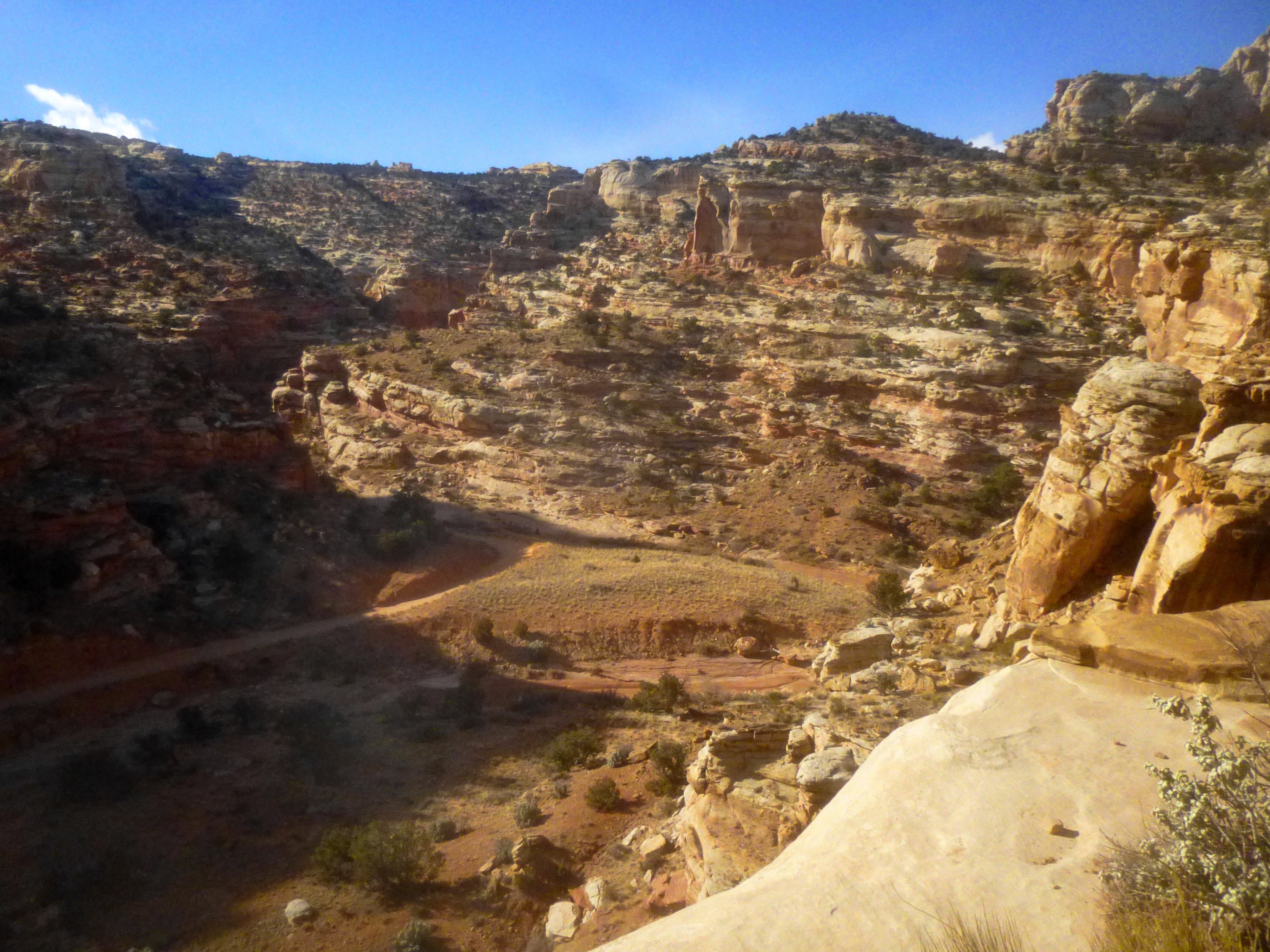
Then the sequence repeats: a gradual descent to the wash, followed by another climb around a bend. As total elevation rises, vistas to the south render a landscape dotted by white-capped domes; down below, the Capitol Gorge Road occasionally reveals itself. To the north, another sea of white and brown: colossal Navajo sandstone walls cut by intermittent incisions forming canyons, chiseled by flash floods and ice.

The third wash is perhaps the most impressive, as it affords the trail’s first views of Golden Throne. The aureate dome, primarily Navajo sandstone, is capped by a small remnant of the Carmel formation, laid down in the Mid-Jurassic period (144-208 million years ago). This is one of the few spots where the Carmel stratum is visible in this section of the park.
Below Golden Throne lies an impressive wall of Navajo sandstone colored by black streaks of desert varnish. (The upper section of this side canyon would make for an interesting off-trail excursion.) The trail crosses the third major drainage at roughly 1.3 miles; the canyon drops off to the left into a pseudo-slot (I climbed down it a bit, but it was brushy and had far more rock obstacles than was worthwhile).

After crossing the wash, the trail again climbs up and over a crest, this time facilitated by several switchbacks. A much smaller tributary wash is crossed, and the trail continues to slope up to a perch offering nice views of Capitol Gorge and the surrounding area. As the grade lessens, the trail passes a number of nice examples of cryptobiotic soil, a crusty feature resembling tiny tree shards that is actually the work of microscopic cyanobacteria. Pinyon pines, junipers, Mormon tea plants, and roundleaf buffaloberry are ubiquitous as well.

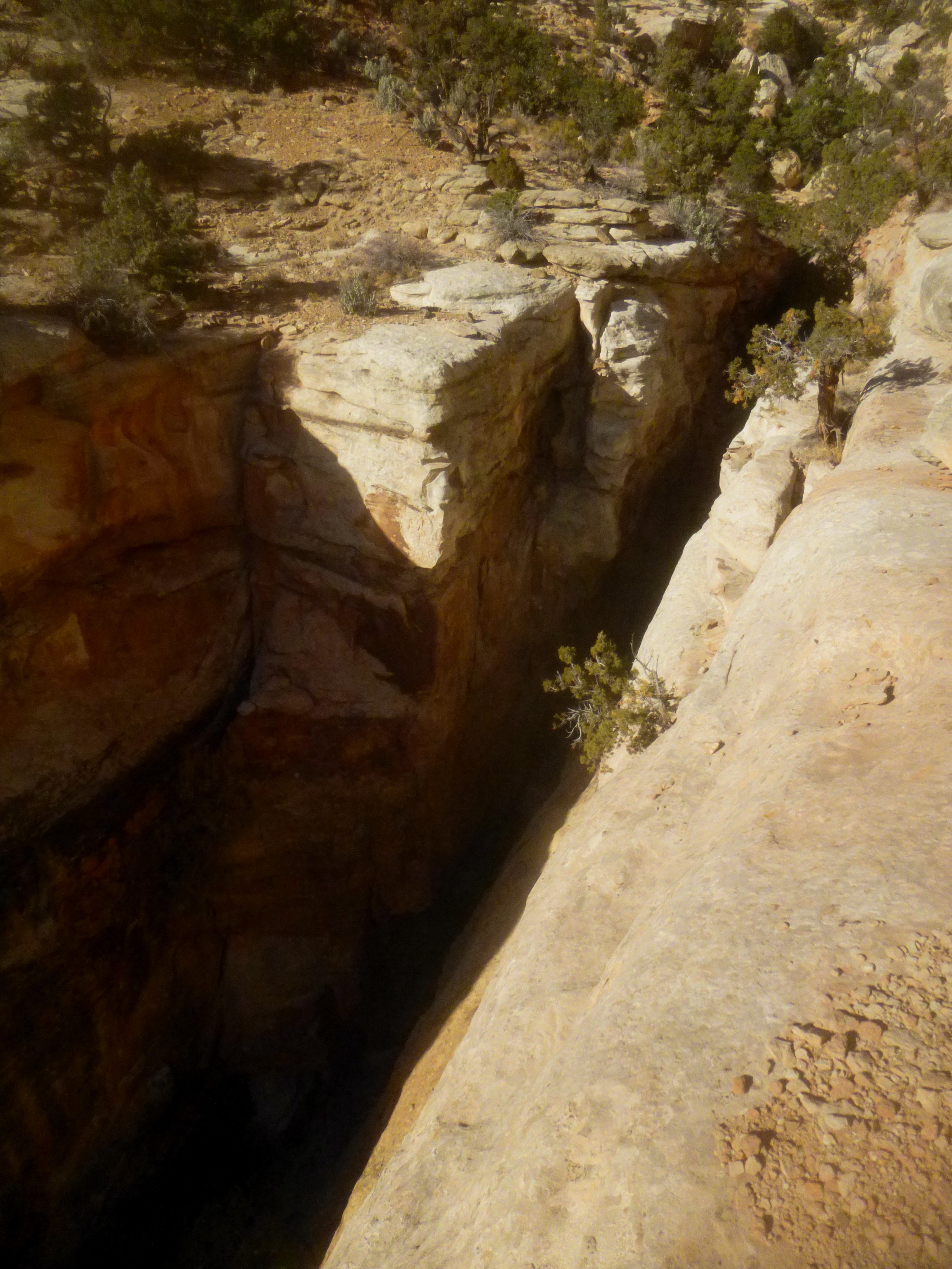
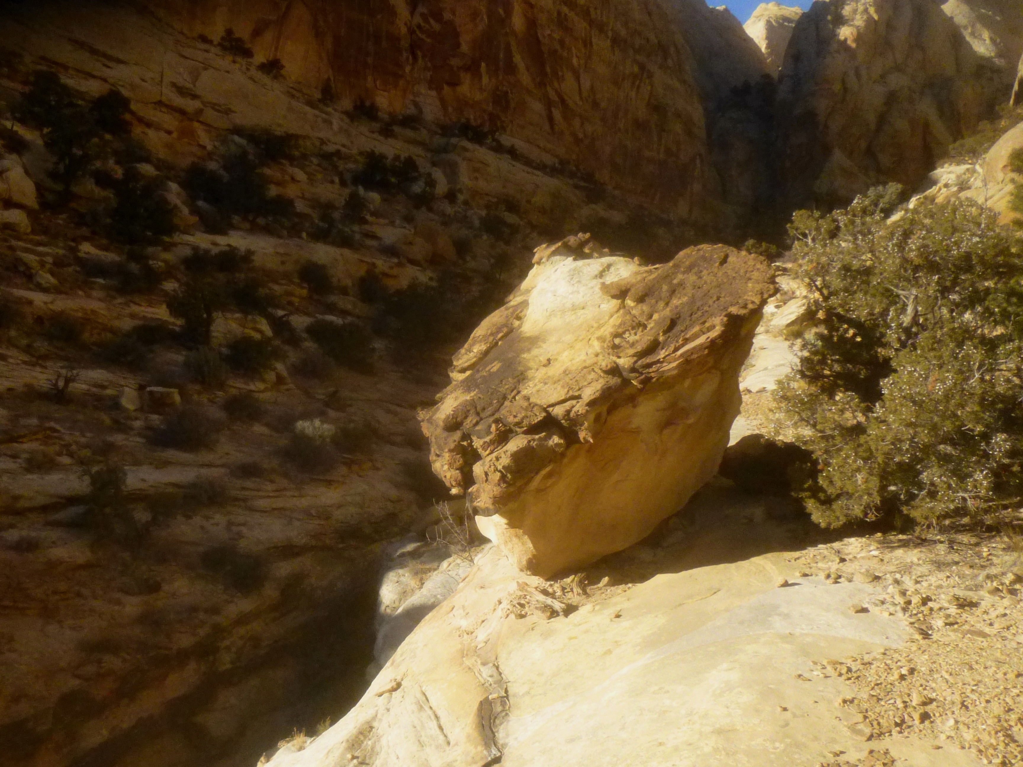
The final stretch edges left, skirting the edge of the sandstone walls, and climbs a slickrock slope to the trail’s terminus (marked with an “END OF TRAIL” sign) and the vaunted “base” of the Golden Throne. This is not really the base at all (that would be a shelf in the Navajo sandstone another 400 feet higher), but the spot does offer a decent vantage point of the golden dome. The overlook is further enhanced by a fourth significant tributary wash that has carved a narrow canyon through the Kayenta, below the Golden Throne…

Extra credit
…For lack of a better name (there is no official or even unofficial title), I will call this canyon “Golden Throne Canyon.” If time allows, hikers can continue as far as a mile (or, with some Class 3 scrambling/rock climbing skills, perhaps more) into the upper reaches of this ravine, passing by some picturesque waterpockets and through a neat little slot.

To access the canyon, visible from the Golden Throne viewpoint, descend about 75 yards to the base of the slickrock slope and turn left onto a narrow use trail heading north. The gradually-sloping trail is relatively easy to follow (save for one spot where it dips in and out of a dry wash bed); be sure to stay on the already-trodden path to avoid stepping on cryptobiotic soil. The unofficial trail—used by intrepid hikers heading to the summit of George BM (7,289’)—is sometimes even marked with small cairns.
Just short of ½ mile across a relatively flat bench, the trail skirts the edge of a dropoff, from which you can make out—to the north, at the bottom of a dryfall—a noticeably large pool. At the head of the dryfall—the trail spits out into the main wash here—you’ll find some additional waterpockets that have formed small shady caverns in the slickrock. Though not as large as the tanks along the Capitol Gorge Trail, these potholes are impressive in their own right.

The trail to the George BM highpoint crosses the wash and climbs off to the left, but exploration in Golden Throne Canyon is best done by following the dry wash bed upstream. The drainage is sandy and brushy in places, but not unbearably so. About 0.3 mile after the waterpockets, a golden-brown promontory divides the creek bed into two: to the right, a narrow ravine clogged with vegetation; to the left, a wider wash. Take the left fork; from here on, the canyon walls begin to narrow, forming shady alcoves streaked with spurts of desert varnish.
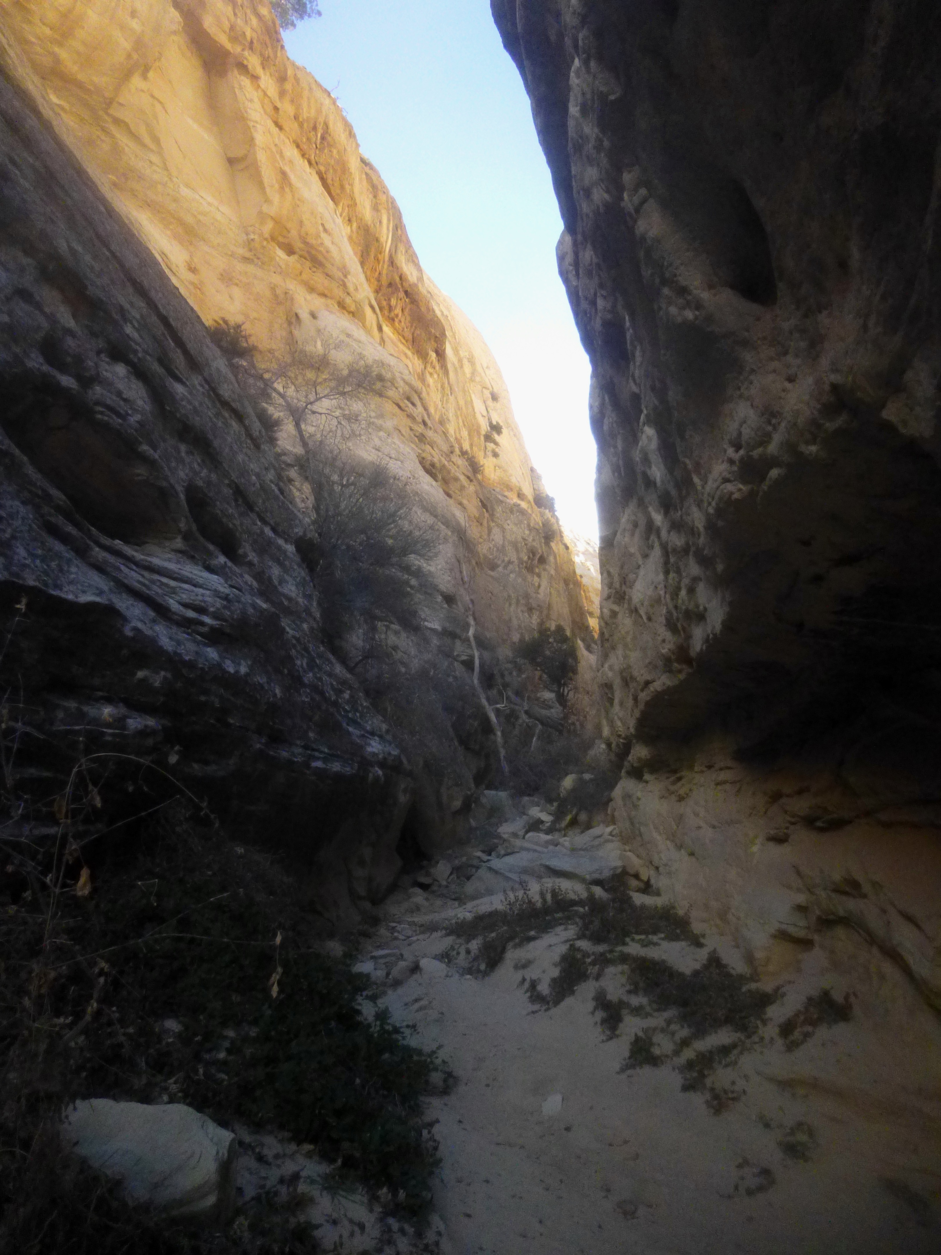
As the canyon constricts to a width of about 10-15 feet, you will encounter two or three boulder obstacles that require some maneuvering—no more than some easy Class 2 scrambling—to surmount.
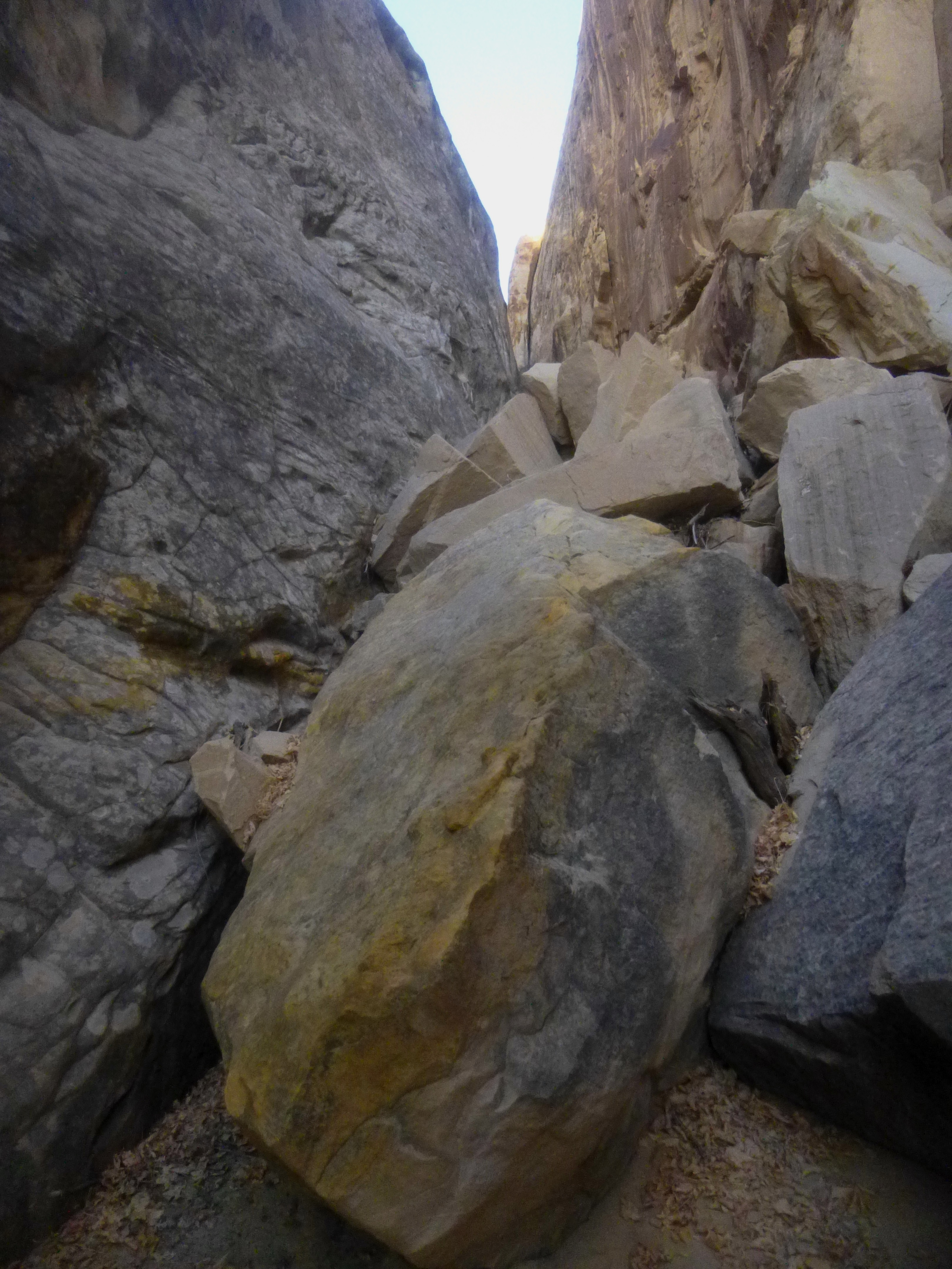
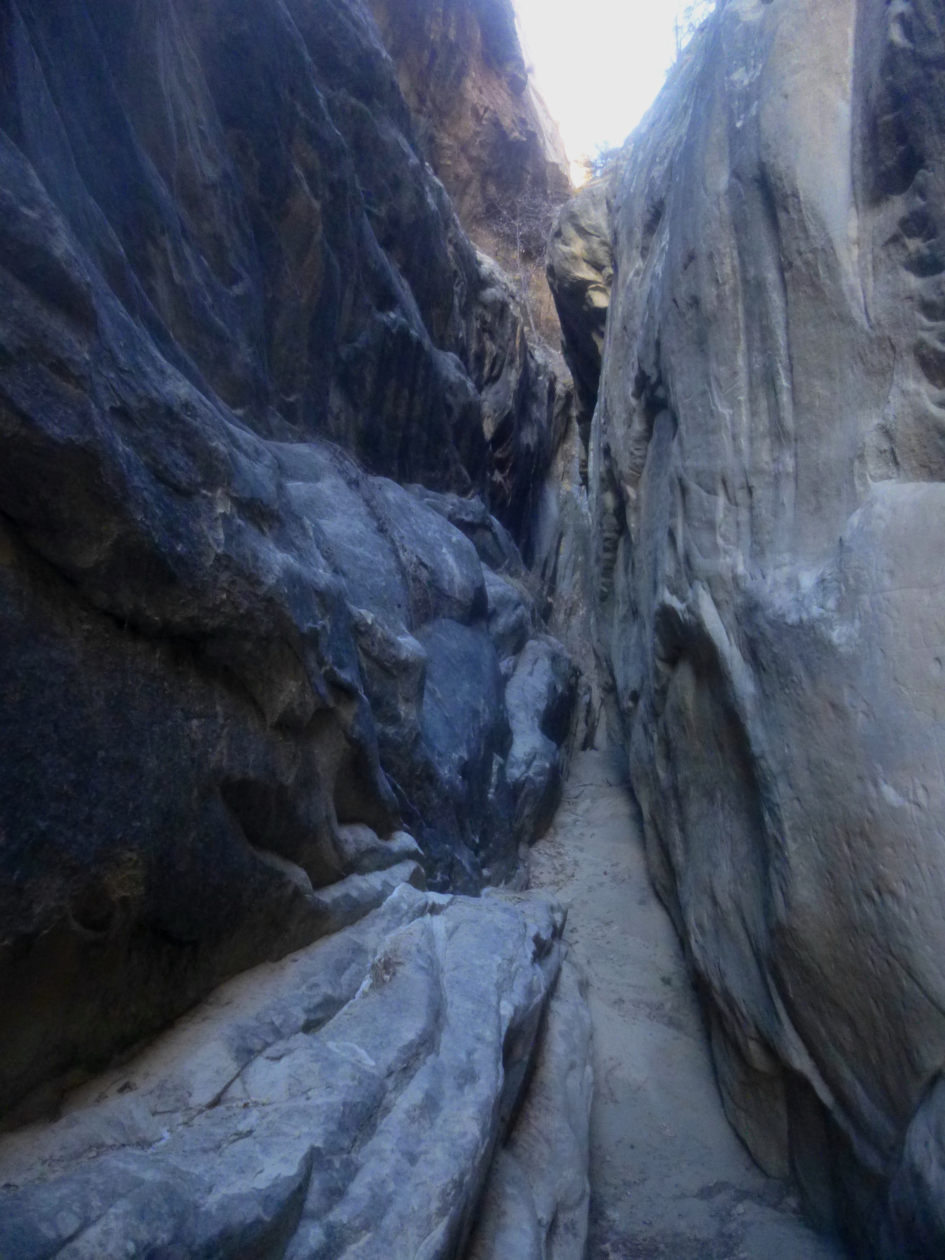
Finally, after a beautiful stretch of narrows, the walls close in even further, forming a 2-4 foot-wide slot. The slot is short and sweet, ending after about 50 yards at a 20-foot dryfall. Experienced rock climbers could probably complete this low Class 4 climb with ease, but for most hikers, the journey will end here.

Return the way you came: it’s about a 75- to 90-minute hike back down to the trailhead.

Pingback: Capitol Gorge Trail (Capitol Reef National Park, UT) | Live and Let Hike
Pingback: THE TANKS TRAIL – Overland For Good