
There is perhaps no better word to describe the hike to the top of Meeks Mesa than epic. Though the 2.2-mile trail lies just outside the western boundary of Capitol Reef National Park (it is on Fishlake National Forest land), it is arguably equally as, if not more, scenic—and the strenuous climb of more than 1,000 feet feels far more rugged and wild than its more popular neighbors (Chimney Rock, Navajo Knobs, etc.). Even in the middle of peak season, you are more likely than not to have the trail to yourself (though local canyoneers will know the route as the best approach to a challenging slot known as “Pandora’s Box”). The out-and-back hike actually consists of two distinct sections. For a shorter hike, turn around somewhere atop Cooks Mesa, a boulder-strewn shelf on the cusp of the red-orange Wingate sandstone. Hikers with greater stamina and some basic Class 2 scrambling skills can complete the second step, a wild and scenic 300-foot climb through a narrow ravine to the top of towering Meeks Mesa. From here, an awesome array of Wingate knobs, gnarls, and narrow slot canyons beg to be explored. Hikers with more time and decent route-finding abilities can walk out to the rim of the mesa to the southeast or traverse the mesa to the edge of Pandora’s Box to the northeast (Note: Hiking late in the day, I was not able to check out the latter).


Adapted from: http://www.mytopo.com/maps/
The hike

The hike most often advertised as simply “Cooks Mesa” begins and ends at the overflow camping lot just west of Capitol Reef National Park, roughly 4.2 miles northeast of Torrey, UT. If coming from Capitol Reef, look for a red dirt turnoff on your right, about 0.3 mile west. If you turn southwest, with the Sinclair station and Capitol Reef Resort in sight, you’ve gone too far. The parking area is a wide figure-8 of sorts, partly shaded by pinyon pines and junipers at the foot of a green, red, and purple slope (the Chinle formation). The trailhead is not marked, but makeshift fire pits – and, when the Fruita campground in Capitol Reef is full, the presence of large RVs – serves as an indication that you are indeed in the right spot.
The trailhead is not marked, but there is a discernable trail that quite obviously begins at the end of a dirt track some 15 to 20 feet up a brushy hill. For the first 0.3 mile, the route to the lip of Cooks Mesa ascends steeply through the multicolor Chinle formation; one particularly grueling section involves climbing the spine of a gray-green hillside with no switchbacks.

The incline dissipates a bit at the foot of a rocky section—the beginning of the Wingate sandstone layer. From here, the mostly obvious path switchbacks up the rock, eventually spitting into a flat wash—parallel with the rim of the mesa—between two small ridges. Another short climb amid red-orange Wingate boulders eventually brings hikers to the crest of Cooks Mesa, where the gradient abruptly levels out, offering a chance to catch your breath after the brutal 300-foot ascent.
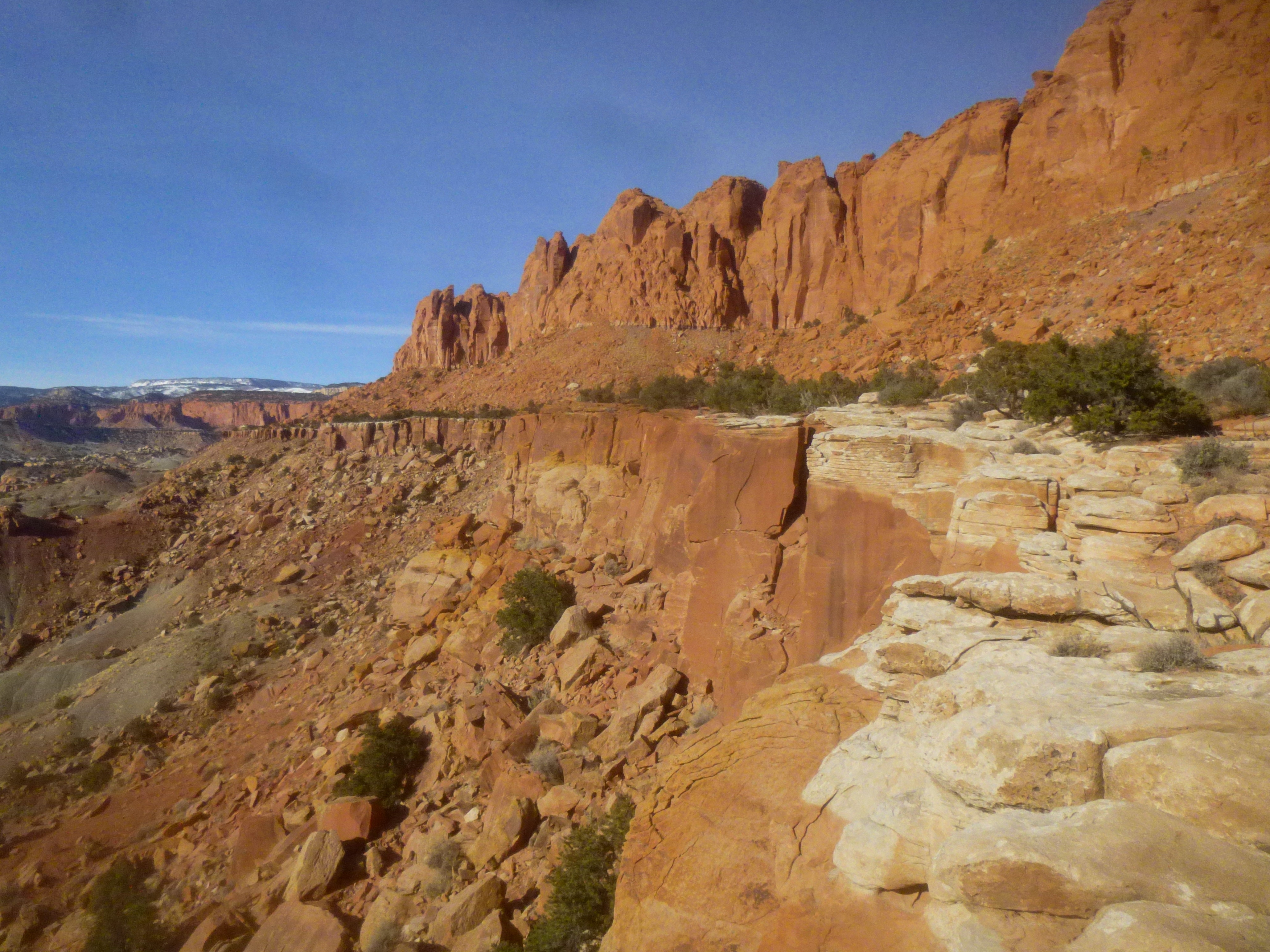
The next 1.5 miles follow a wide bench as it snakes north to the approach to Meeks Mesa, which is another several hundred feet higher. If you have only 1-2 hours for the round trip, you can go as far as time allows along the shelf before turning around. For the first ¼ mile on top of Cooks Mesa, the trail can be difficult to spot, as it winds in and out of a couple of dry washes. As long as you are walking generally to the northwest, following the exact route is not overly important, though of course avoid stepping on crusty cryptobiotic soil, which is ubiquitous on Cooks Mesa.
Eventually you should be able to find the trail again as the shelf tightens and the path enters a large boulder field. There is one particularly memorable rock shaped like a crane, or an anvil of sorts, that is certainly worth of a picture or so.
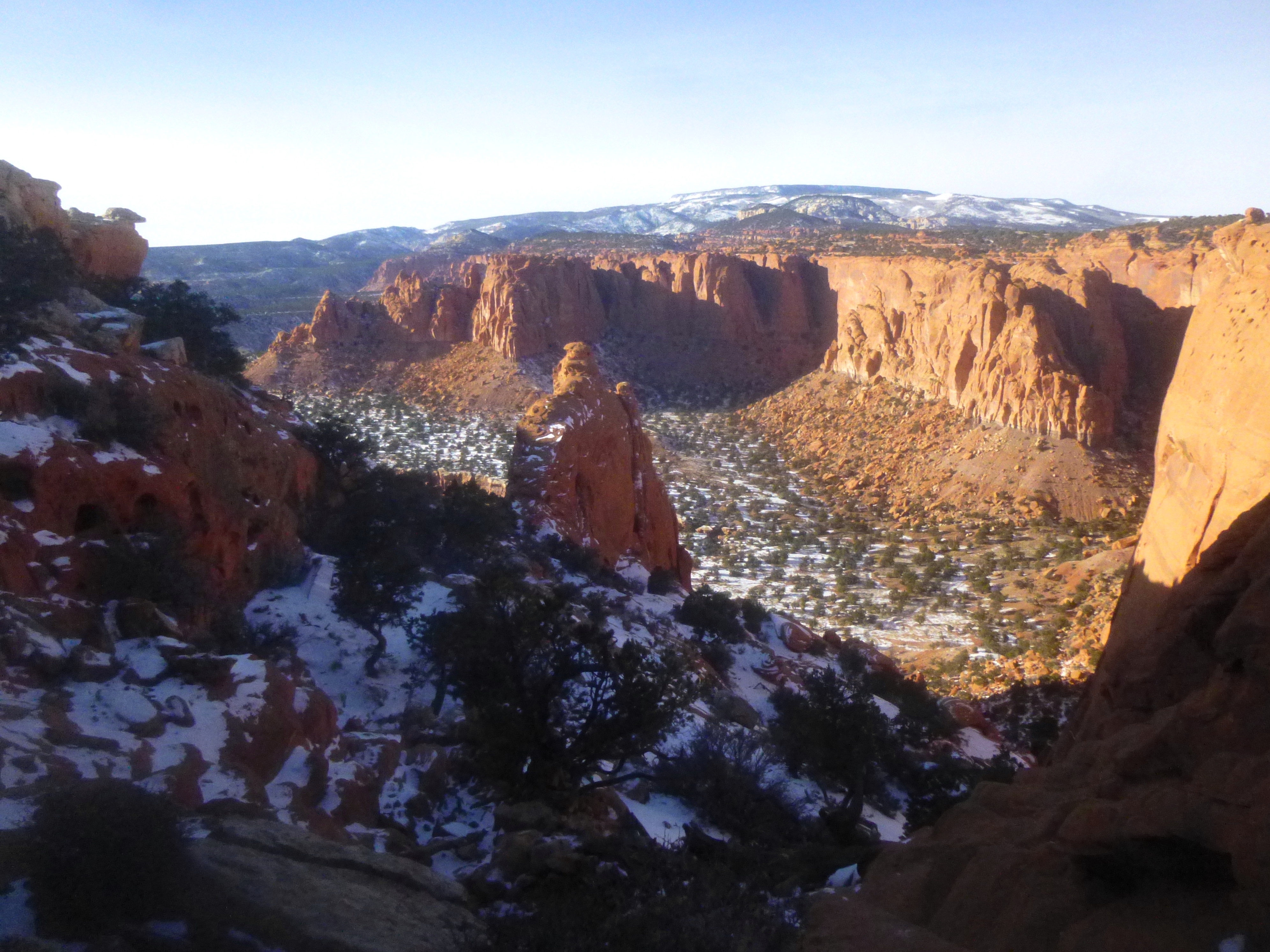
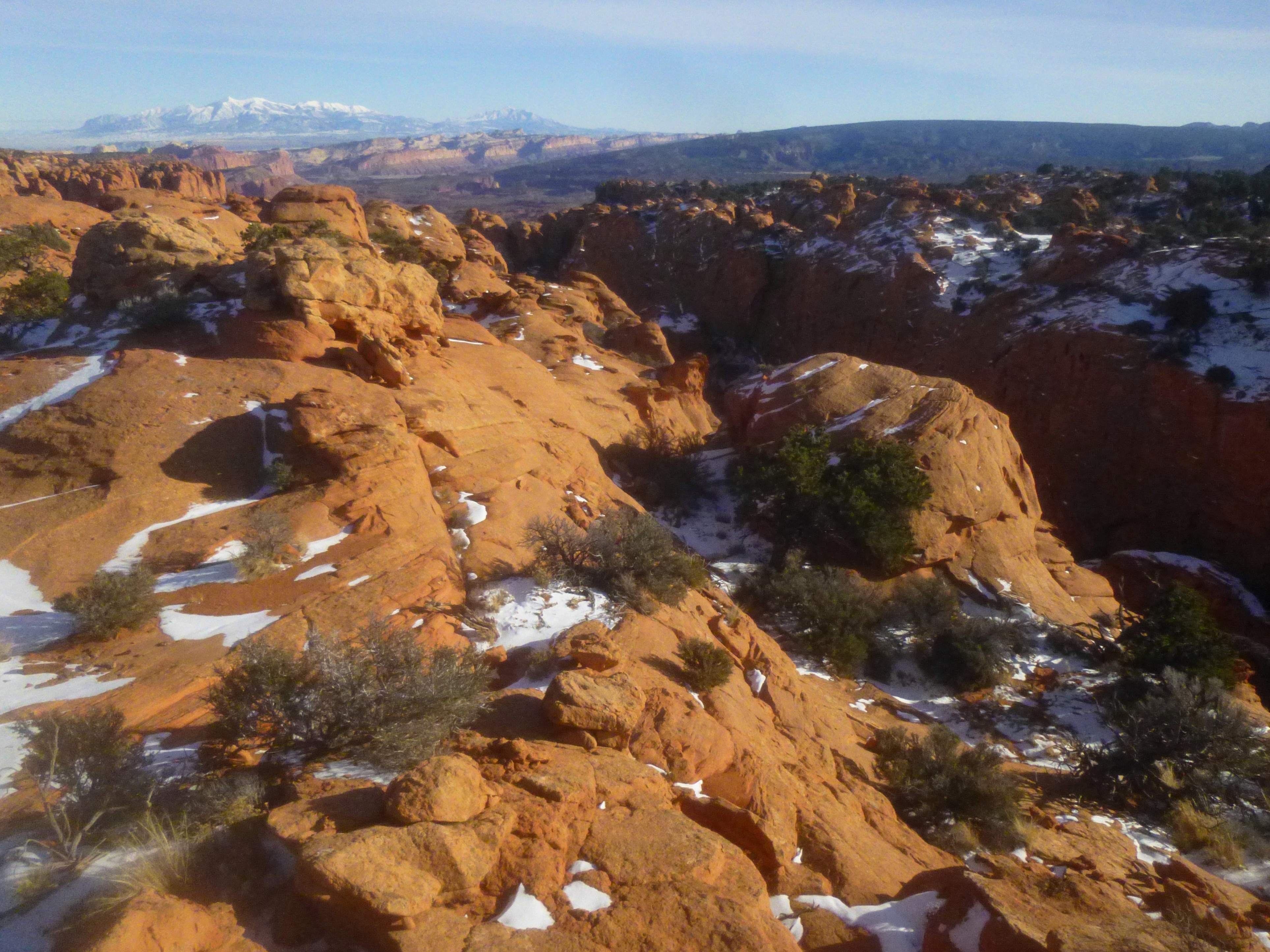
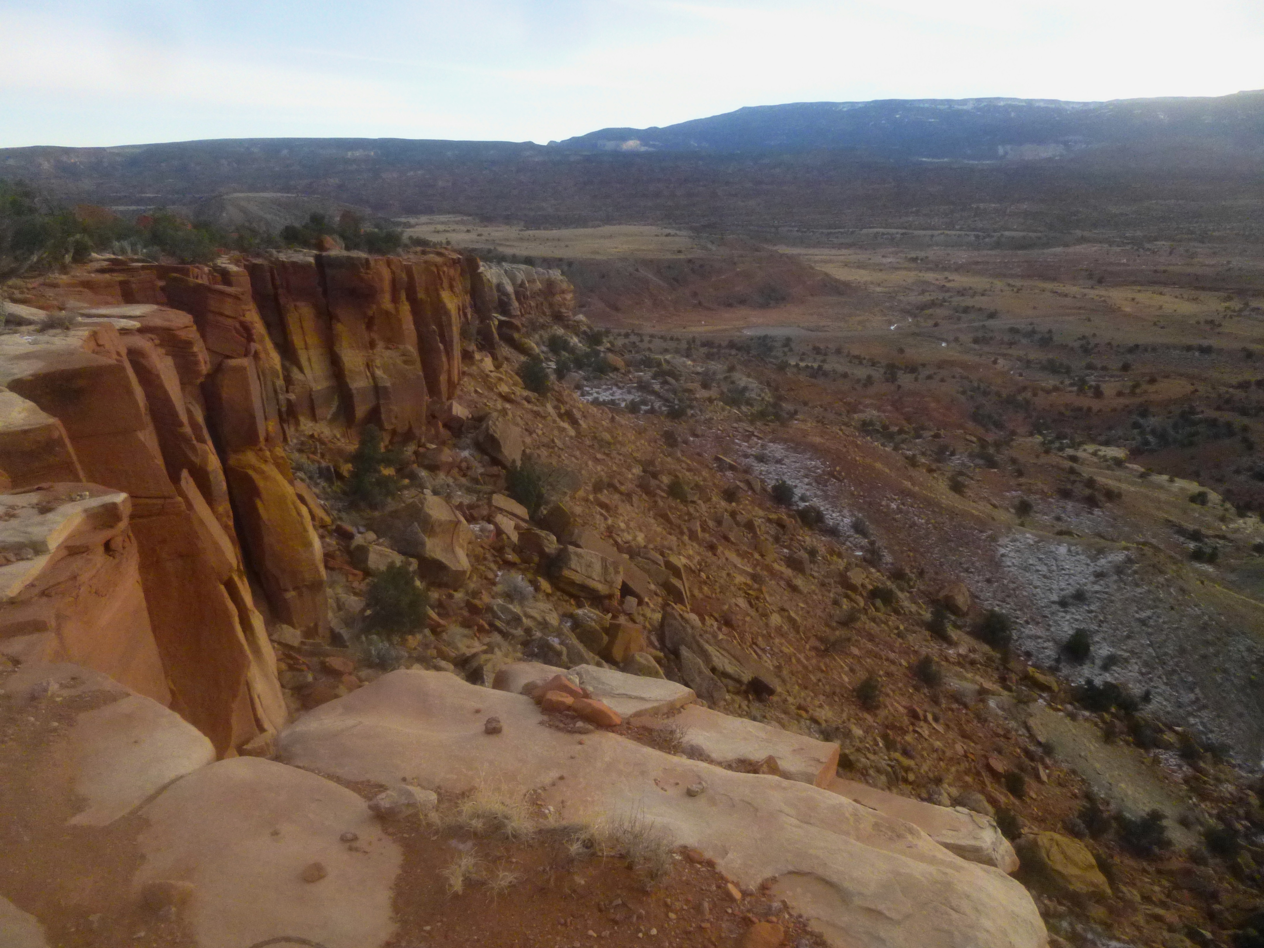
The trail periodically skirts the rim of Cooks Mesa, affording excellent views of nearby Holt Draw and point 8,235’ to the west and Miners Mountain (~7,900’) and Boulder Mountain (~11,300’) to the south. For much of the way, the snowy Henry Mountains are visible beyond the white sandstone domes of Capitol Reef to the east.

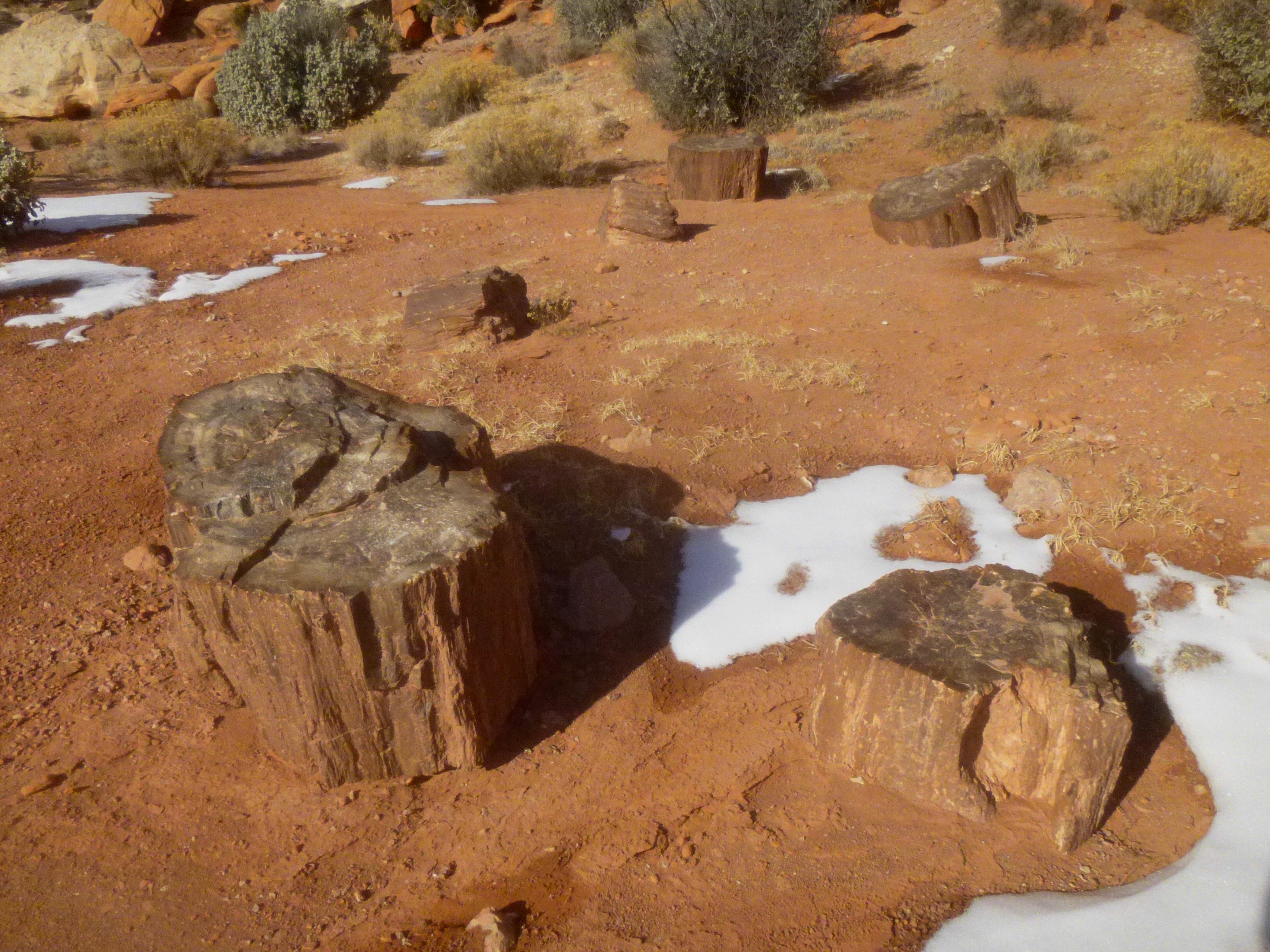
The trail, which is mostly easy to follow, gains nearly 400 feet over the course of its 1.5 miles on Cooks Mesa, but the ascent is gradual and feels for the most part like a flat, pleasant jaunt. About 1.1 miles from the trailhead, the route passes a collection of petrified wood stumps, and at around 1.5 miles, it rounds a bend offering nice views of Holt Draw. A series of prominent fins jut out from the shady cliff walls to the right, and a tempting side canyon comes into view straight ahead. You can barely make out a change in geological layers atop Meeks Mesa—where the steep Wingate cliffs are replaced by the ledgey and vegetated Kayenta formation.
Tucked away in this shady basin, Cooks Mesa is now littered with junipers and pinyon pines. On the day I passed through, patches of snow lent additional color to the beautiful landscape.

Approximately 1.7 miles from the trailhead, a narrow ravine comes into view to the right. Knowing that this ravine serves as the approach to the top of Meeks Mesa, it is tempting to prematurely cut right, up a steep hill, to attack the ravine along its right flank. But the trail actually dips down to the left—in the opposite direction—to skirt around the hill; look for a large cairn indicating the beginning of the descent.

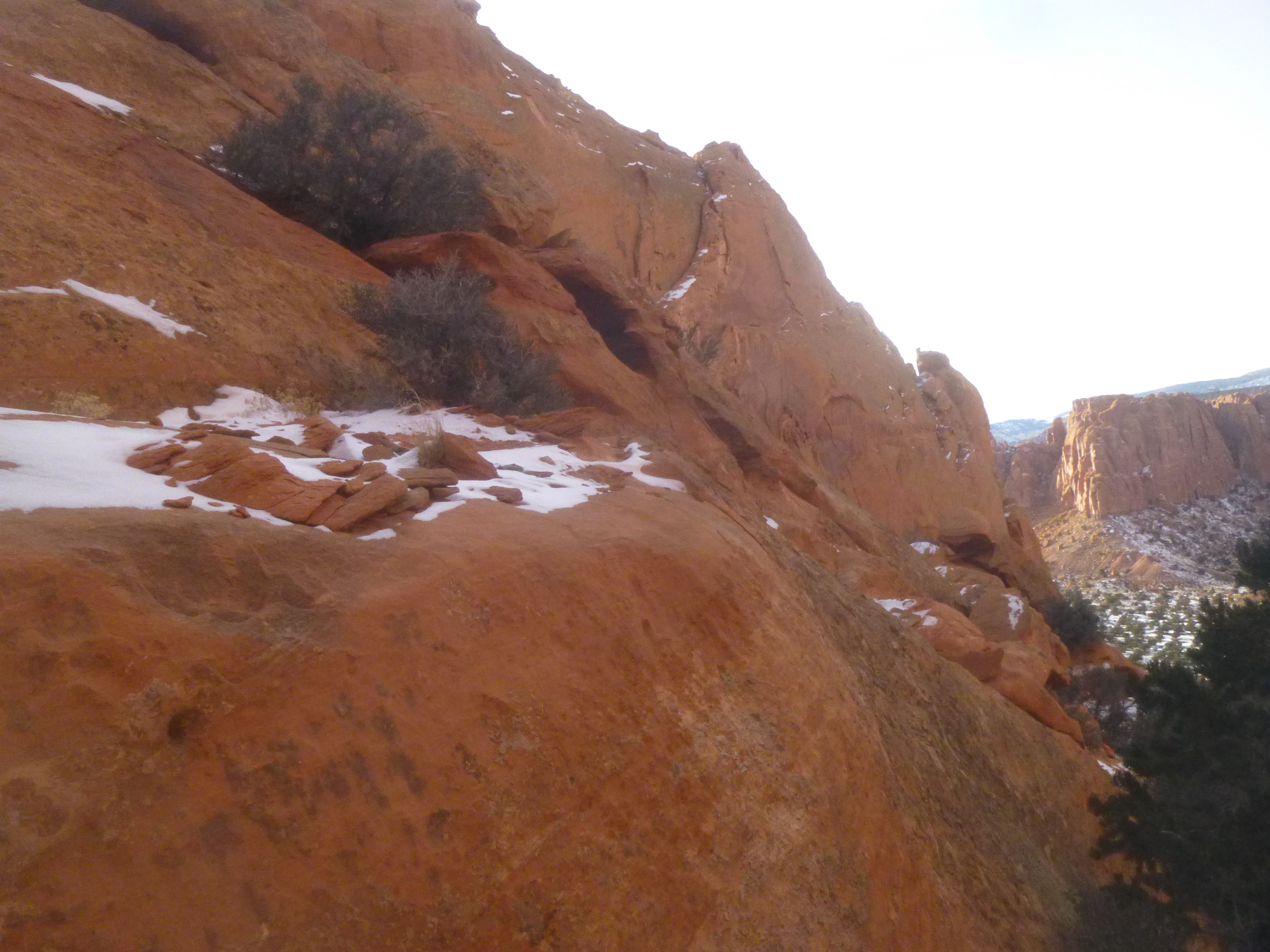
The lightly-used path (once an old cattle trail) then finally approaches the ravine, ascending its left flank. Eventually the trail butts right up against the base of the Wingate wall. After a short flat section, the path dips down and then up again, crossing the wash at the sight of a large sandstone block that straddles two boulders, forming a three-foot-high tunnel beneath. This chockstone marks the beginning of a steep scramble.

The old cattle trail bypasses this waypoint on the right, then begins to sharply climb up a slope on the right flank. The wall on the left is one sheer, 200-foot cliff; the expanse to the right consists of a series of fins, benches, and ledges.

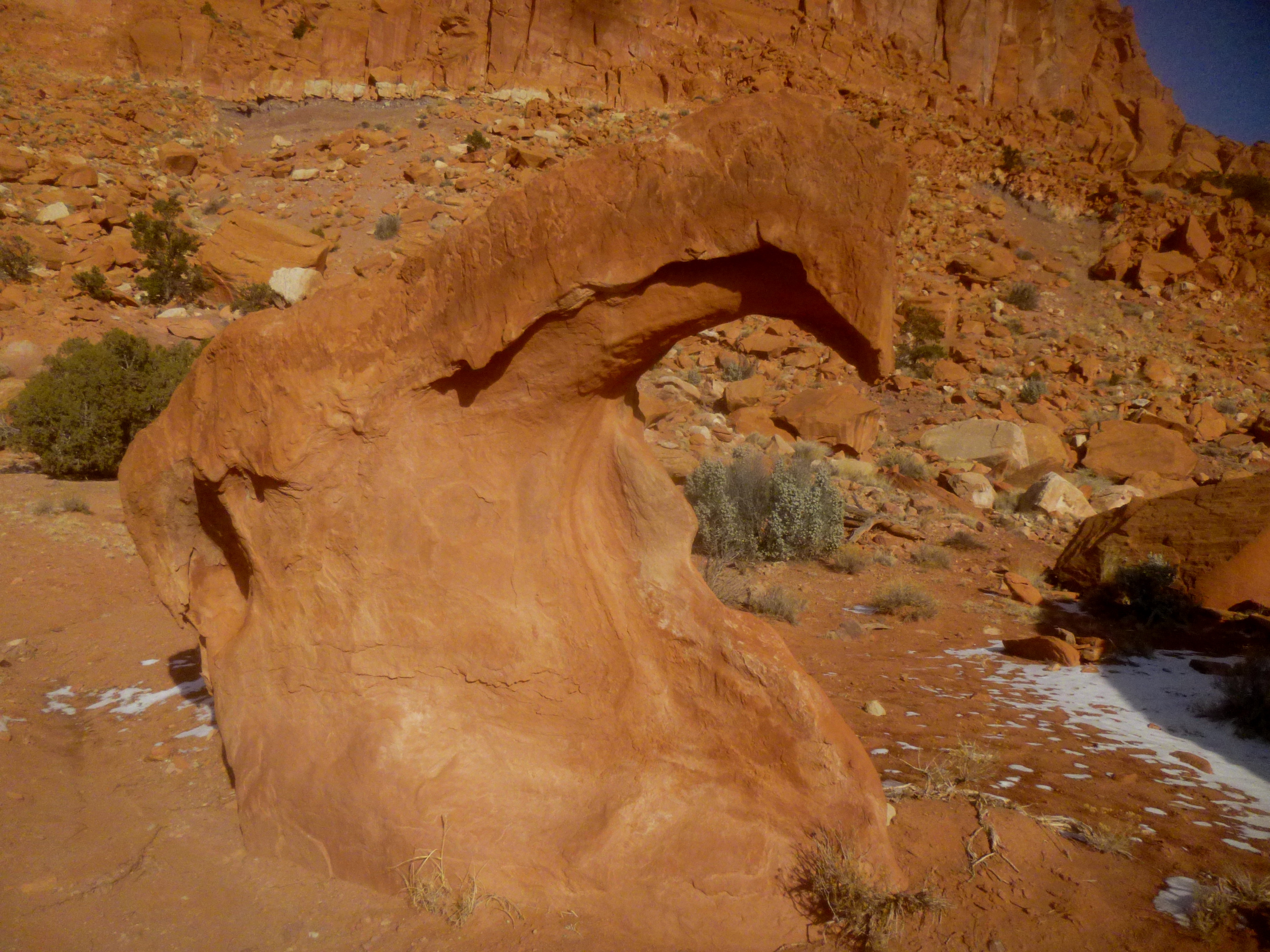
While the path is only lightly-cairned, it is relatively easy to follow, with one exception: at one spot about halfway up the ravine the trail appears to lead straight into a terrace of smooth ledges that, in order to climb, would involve some Class 3 scrambling (which can be a little harrowing for beginners). Facing the ledge, you’ll notice a small arch to your right—this is the easiest spot to crest the first 3-foot ledge. However, while it may seem counterintuitive, the best approach is not to scramble up the ledges at all but to actually climb down about four feet along a gradually-sloping bench occupied by a small juniper. Bypassing the juniper, the trail will become discernable again after about 30-40 more feet. Here you will find vestiges of the old cattle route: a drooping wire fence. Turn left at the fence and switchback up the slope. Eventually the trail switchbacks twice more, the final turn coming at the base of a rock promontory dividing the approach ravine from a second, which drops off on the left.

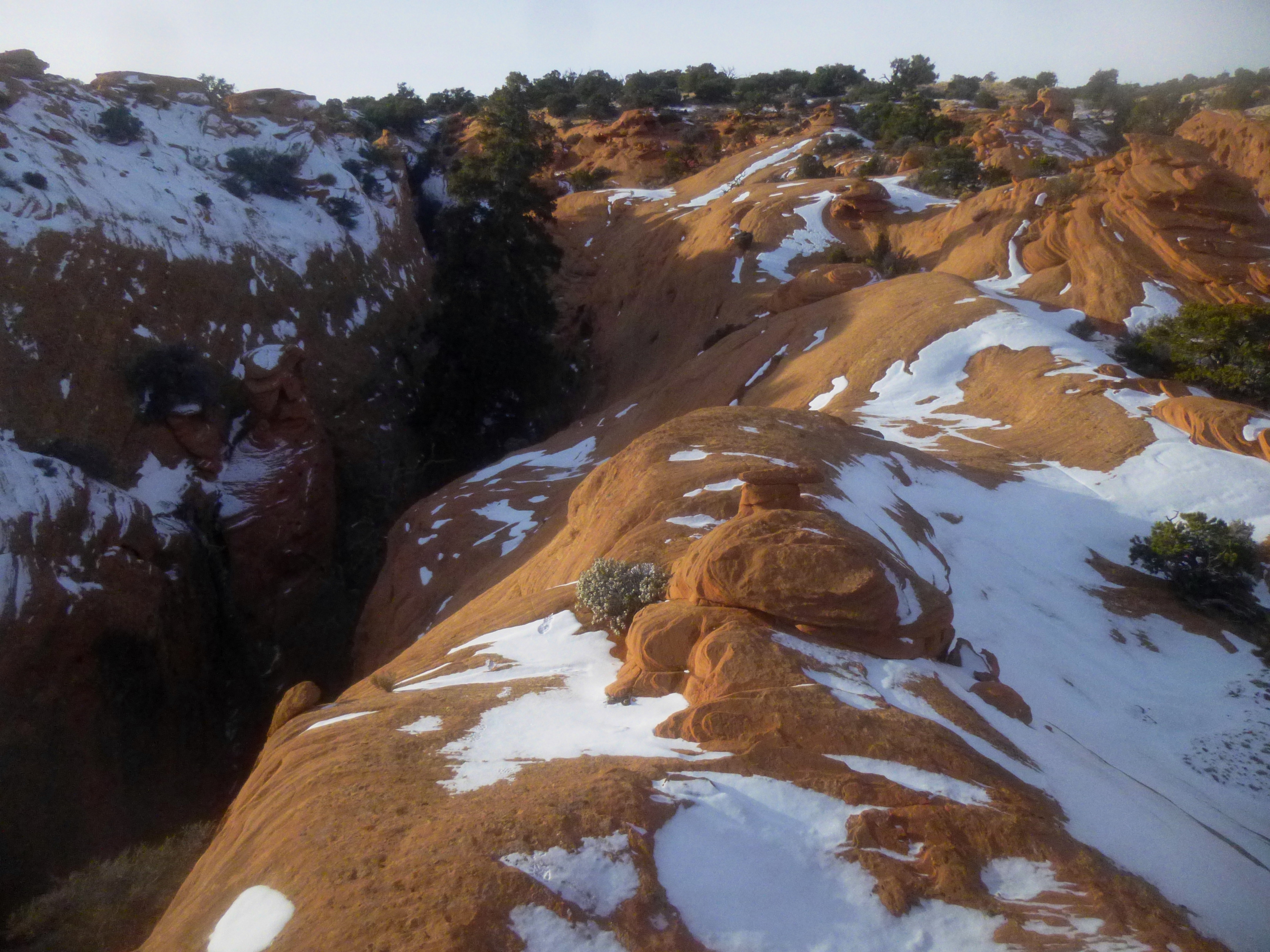
The last section, likely to be shady in late afternoon, climbs up a rock-strewn wash that demands you pay attention to every step. It is maybe 200 yards to the top; the entire ravine section climbs about 300 feet in 0.4 mile. At last, passing below a handful of short Wingate knobs on your right, the trail crests the top of Meeks Mesa and flattens out. This is officially the end of the road…

Extra credit
…However, there may be a handful of faint use trails leading in a number of directions. For an interesting look at a series of neat slot canyons, traverse the mesa in a southeast direction (keep going straight from the end of the trail) for about 2/10 mile. Climb out to the end of one of the fins for a nice view of the narrow canyons, as well as Capitol Reef and the Henry Mountains beyond. It’s worth exploring this area for a half-hour or more if time allows—however, try to stick to slickrock to avoid stepping on the fragile cryptobiotic soil.
Another option is to wander off in a northeasterly direction in search of Pandora’s Box, a tributary of Spring Canyon popular with local canyoneers. It is roughly ½ mile to the head of the slot canyon. (Note: I did not attempt this side trip; for better information on finding Pandora’s Box, see here. A compass and GPS are recommended.)
Once you’ve had enough, return the way you came. Remember not to descend into the ravine too early; follow the trail all the way out to the promontory—and then again out to the wire fence— before switchbacking down into the gulch. If you plan to do a little bit of exploring atop Meeks Mesa, allot 3-4 hours for the round trip. For the hike to Pandora’s Box, add another hour. For an abbreviated trip of 1-2 hours, climb as far as Cooks Mesa (the petrified wood at 1.1 miles makes for a decent destination) before turning around.

Pingback: Upper Spring Canyon (Capitol Reef National Park, UT) | Live and Let Hike
Well, we accomplished Meeks Mesa yesterday! We had a day of sun and no rain in the forecast. What a great hike! I can’t believe any cattle made it up there…crazy! Going up that last bit was much easier than coming down. However, we had a little bit of trouble finding the trail to return down! So after two hours of searching and 4.2 extra miles, we finally came to the trailhead down!!
So our short 4.4 mile hike turned into 8.2 miles. But it was a great day! You’ll have to watch for our blog in a couple days!