

Peering down at Highway 24 or the Visitor Center from Rim Overlook or atop Navajo Knobs will give you a very different perspective of Capitol Reef National Park than the average visitor. The predominant view in the park is to look up—up at canyon walls, up at ancient petroglyphs, up at the Wingate sandstone cliffs along the Scenic Drive. Not so on this 9 ½-mile round trip out-and-back hike to two (or three, if counting a short jaunt to the radio tower) outstanding viewpoints. The visitor center, Fruita orchards, schoolhouse, and campground—some 1,400-1,500 feet below—appear tiny and insignificant, while the 360-degree vistas reach as far as Thousand Lakes Mountain and the Cathedral Valley District to the north, Factory Butte and the Henry Mountains to the east, and Miners and Boulder Mountains to the south. Though most hikers turn around at Rim Overlook, visitors looking for a challenging, half- to full-day walk will regret not trudging the additional 2.5 miles to Navajo Knobs.
The hike
Note: Depending on what material you consult, the total one-way distance from Hickman Bridge Trailhead to Navajo Knobs ranges from 4.2 to 4.8 miles. The most accurate estimate appears to be: 2.3 miles to Rim Overlook, 4.7 miles to Navajo Knobs. There are also conflicting measures on the elevation change to Navajo Knobs: Rick Stinchfield’s Capitol Reef National Park: The Complete Hiking and Touring Guide lists the total gain as 2,400 feet, while the park brochure and sign at the trailhead show only 1,620 feet. The reason is this: Stinchfield’s estimate includes every time the trail goes uphill, including dips in and out of washes and a 300-foot climb on the return journey between the Knobs and the radio tower—while the park estimate simply subtracts the low point (Hickman Bridge TH) from the high point (the Knobs).
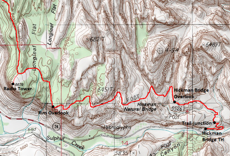

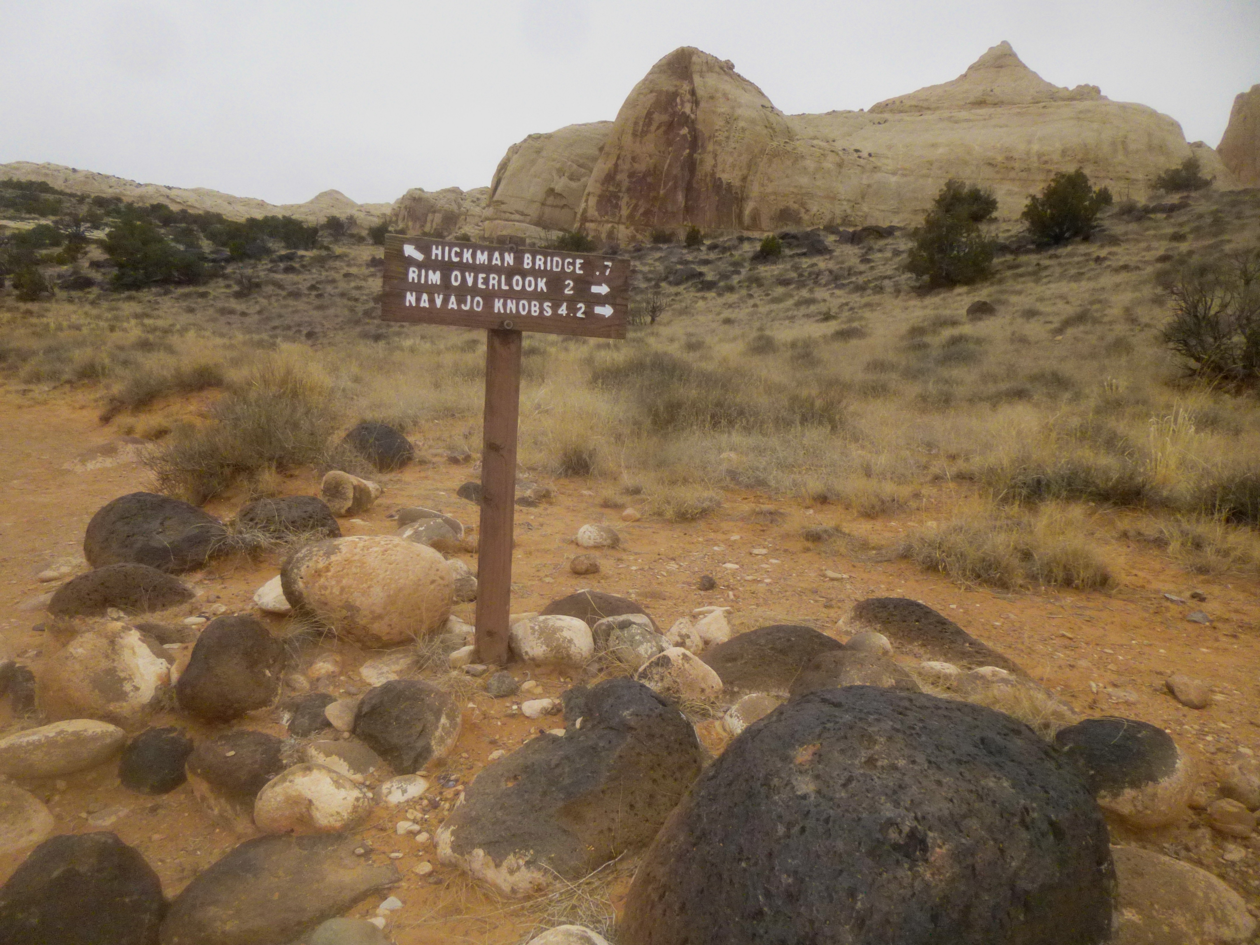
This classic Capitol Reef hike to Rim Overlook and Navajo Knobs begins and ends at the Hickman Bridge Trailhead (~5,400’), found adjacent to the Fremont River 1.9 miles east of the Capitol Reef National Park Visitor Center. There are pit toilets and an interpretive sign at the trailhead; the majority of other visitors you might encounter in the parking area are likely heading to Hickman Bridge, a popular 1-1 ½ out-and-back hike to a picturesque natural bridge. Don’t worry—you’ll only be sharing the trail with these folks for about ¼ mile.
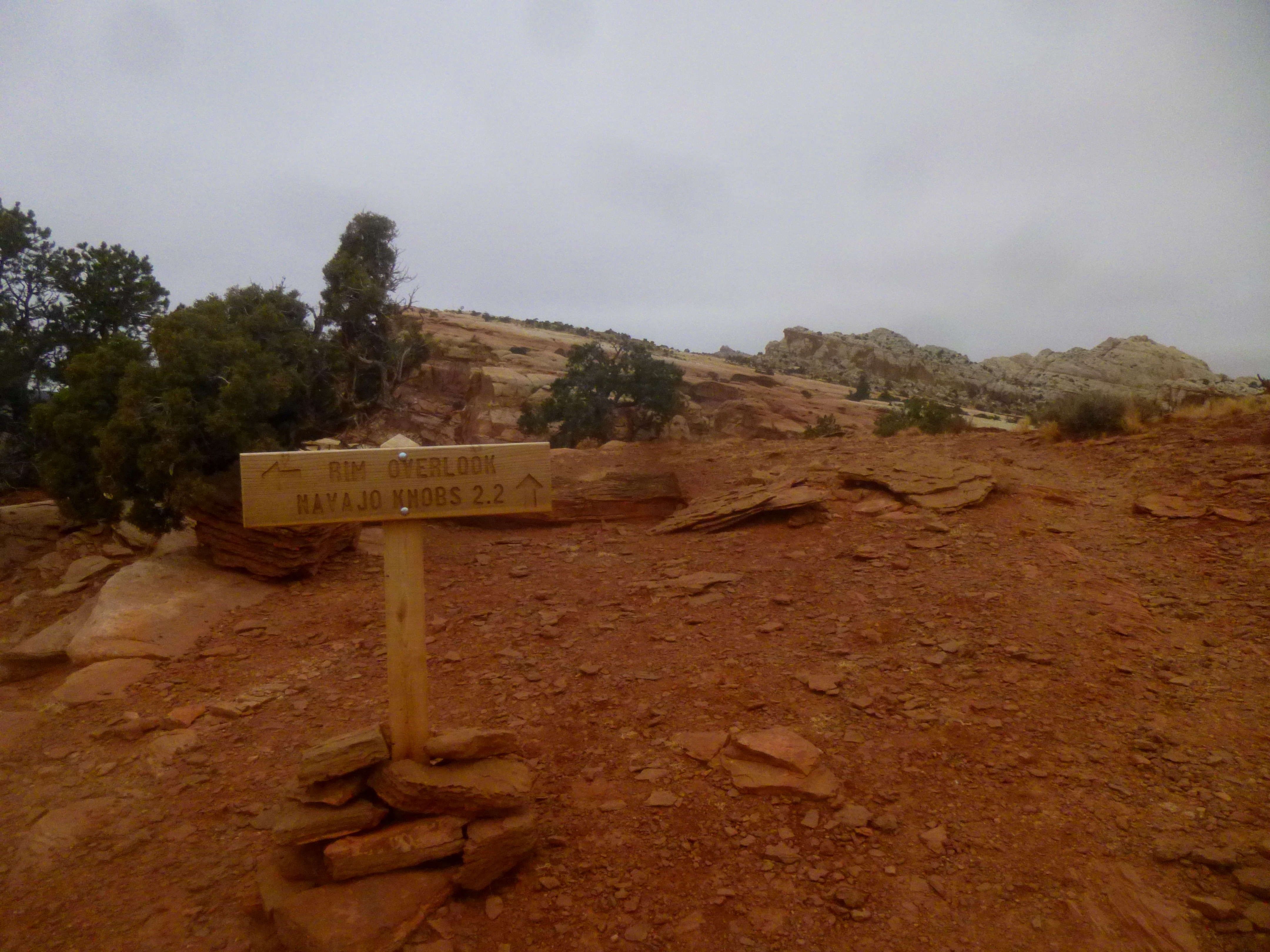
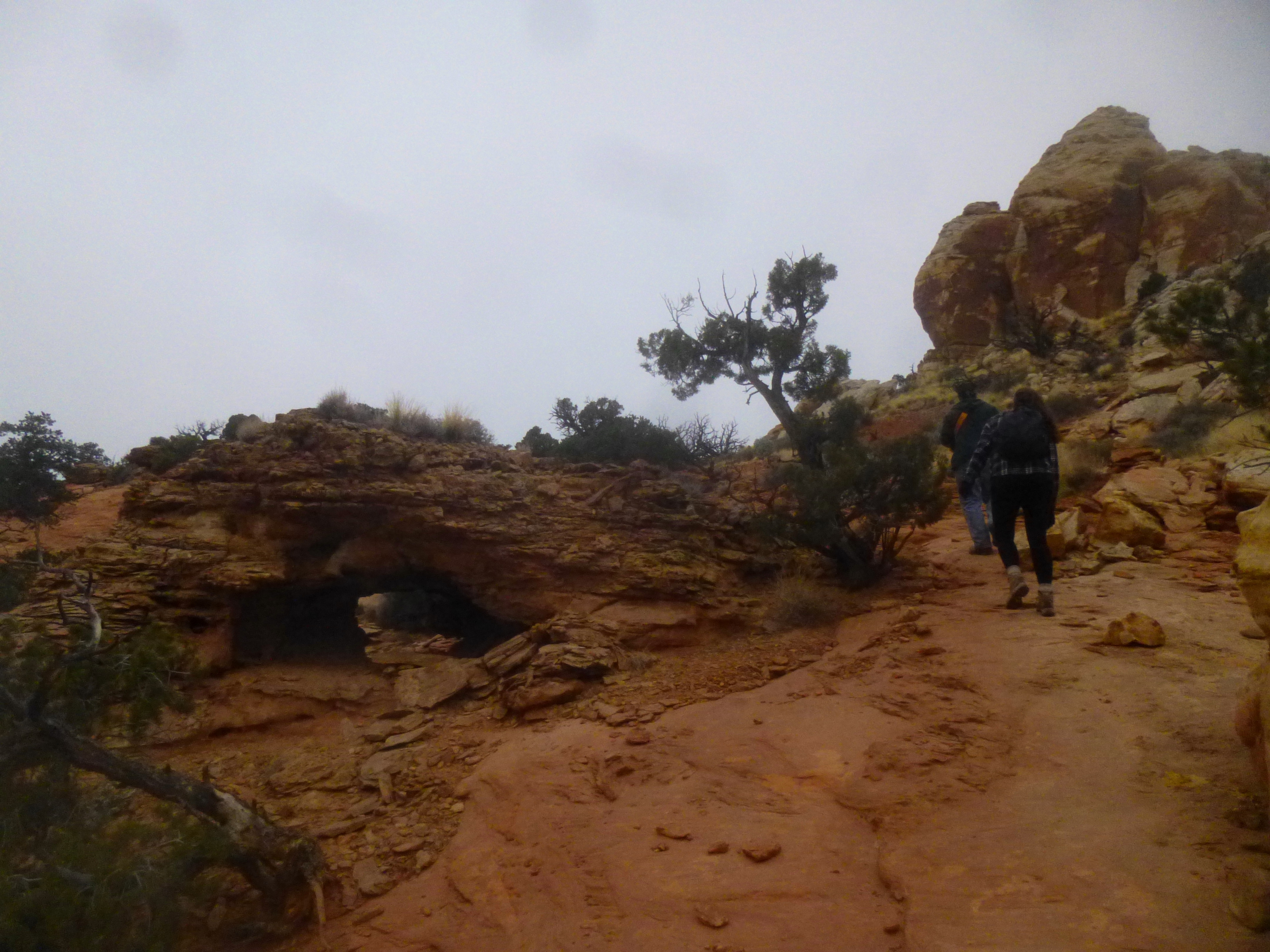
The hike begins by hugging the bank of the Fremont River for roughly 1/10 mile, passing the scene of a scary rockfall in spring 2013 that closed the trail for nearly seven months. The well-established route then climbs steeply—first up a set of stairs, then switchbacks—as it leaves the red-orange Wingate sandstone cliffs behind. Just before the trail junction at ¼ mile, the incline levels out. You are now atop a long, sloping shelf in the Kayenta formation, a colorful and diverse rock layer that you will follow for most of the hike. Note: The sign at the junction, while roughly correct for the Rim Overlook, inaccurately reads: “NAVAJO KNOBS 4.2.” The actual distance from this spot is closer to 4.4 or 4.5 miles.
After turning right at the junction, the trail to Rim Overlook climbs gradually, briefly skirting—then crossing—two whitewashed drainages with up-close looks at the towering Navajo sandstone cliffs to the north. There are fantastic views of Pectol’s Pyramid (6,207’) and Capitol Dome (6,029’) to the south and east.
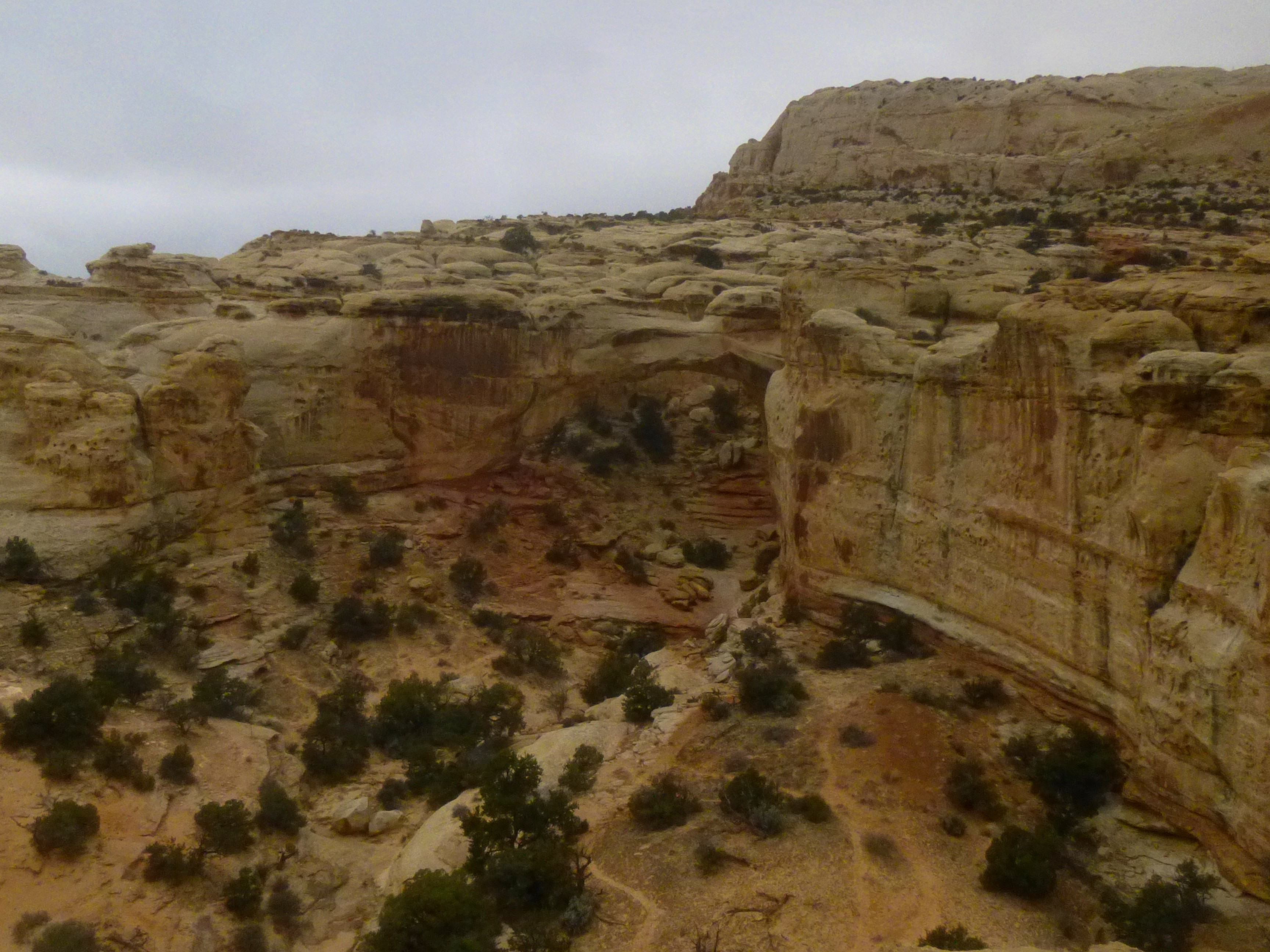
Beyond the second wash, the trail continues to climb gradually across slickrock and through occasional groves of Capitol Reef’s ubiquitous pinyon pines and junipers. Roughly ¾ mile from the trailhead, the Hickman Bridge Overlook can be accessed on the left—the natural bridge is visible in the canyon below, though it can be hard to distinguish from the rest of the tan-brown rock. Views from the actual Hickman Bridge Trail are typically better, though the overlook offers a nice place to stop and take in the scenery in all directions.
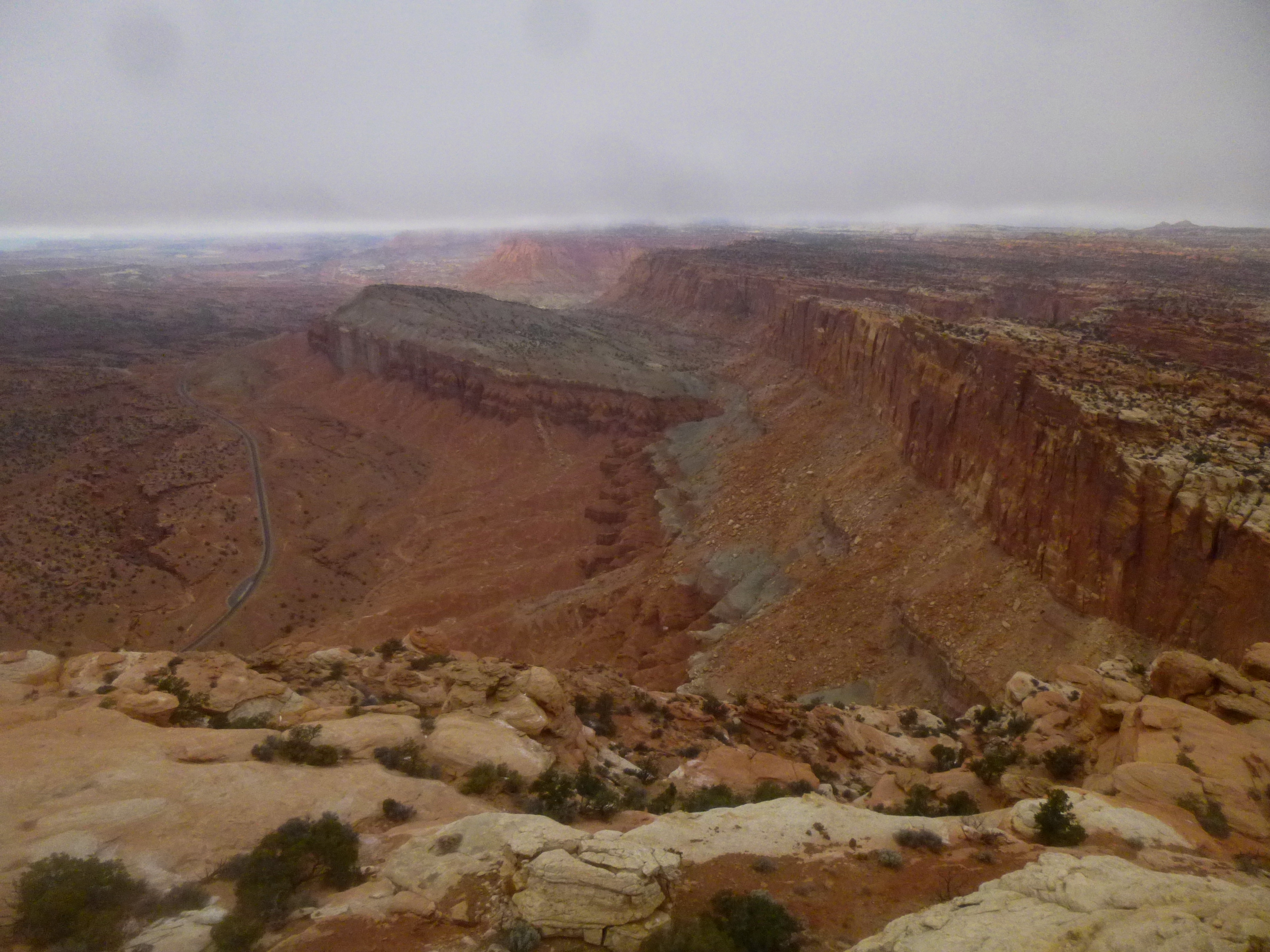
From here, the route covers 1.5 miles and drops into four significant washes (all tempting side trips) on the way to Rim Overlook, followed each time by gradual-yet-persistent climbs of 100-200 feet. The trail is mostly well-marked with rock cairns, as well as faint remains of old yellow, painted footprints (the latter tactic obviously abandoned in favor of lower-impact alternatives). Perhaps the most challenging ascent comes after the fourth wash, with the total elevation here approaching 6,400 feet. Depending on your pace and endurance, you should be able to reach the lofty Rim Overlook within 1-2 hours.
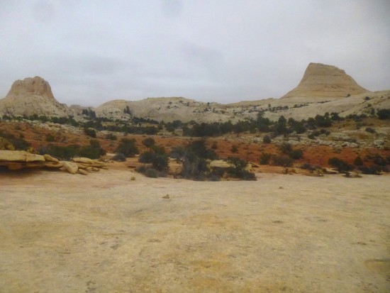
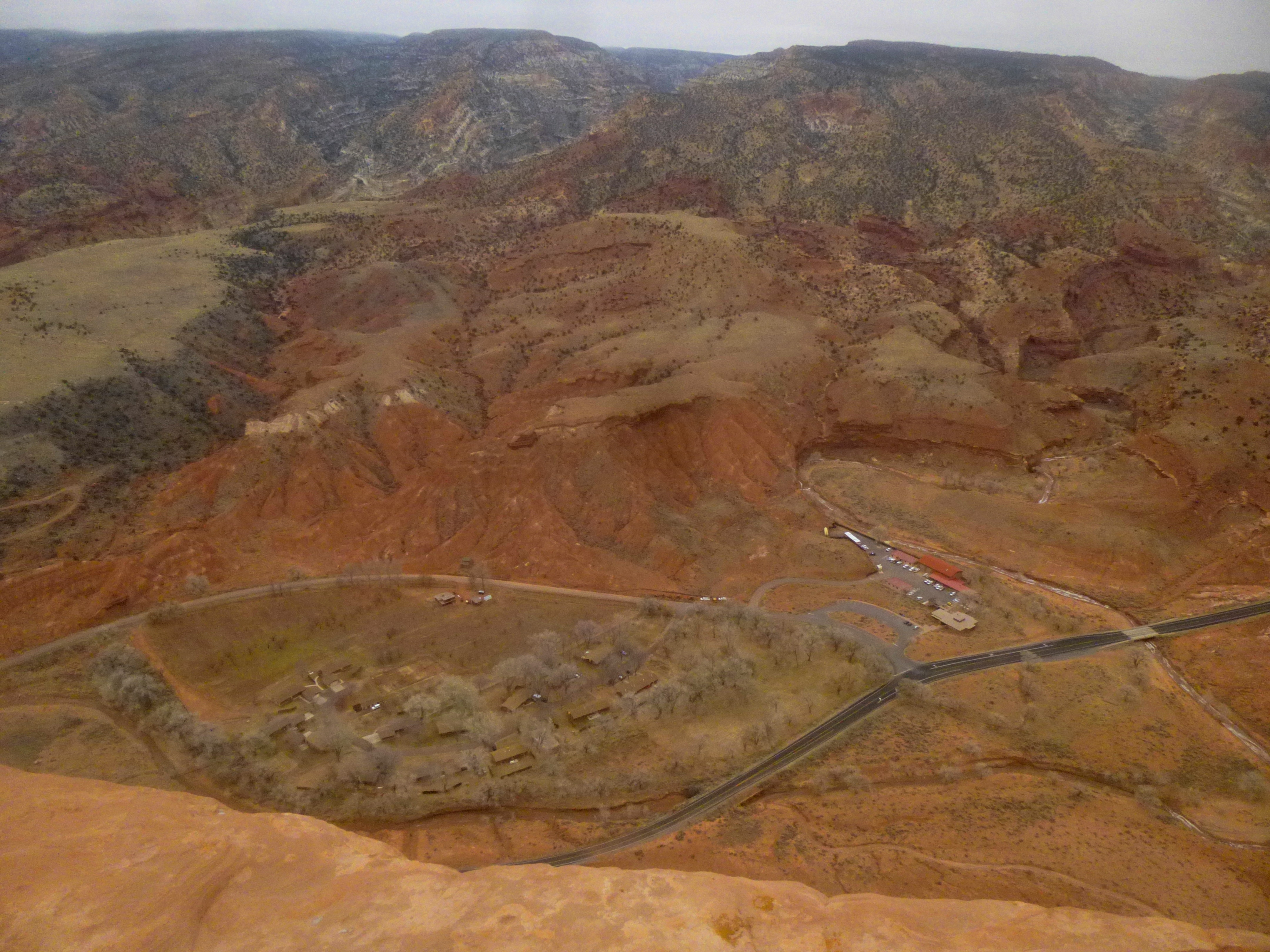
The upward-slanting Kayenta shelf at Rim Overlook offers sweeping views of the Fruita Historical District below, including a multitude of fruit and nut orchards, the historic schoolhouse, the Gifford barn, the shady campground, and the first few miles of the Scenic Drive. It is hard to miss the 22 switchbacks leading up to Cohab Canyon (a great hike of its own), as well as six jagged slots known to canyoneers as “The Wives.” Beyond Cohab, it’s more Kayenta, then the higher Navajo sandstone. The humorously-named Fern’s Nipple (7,085’) can be seen on clear days, as can the Henry Mountains.
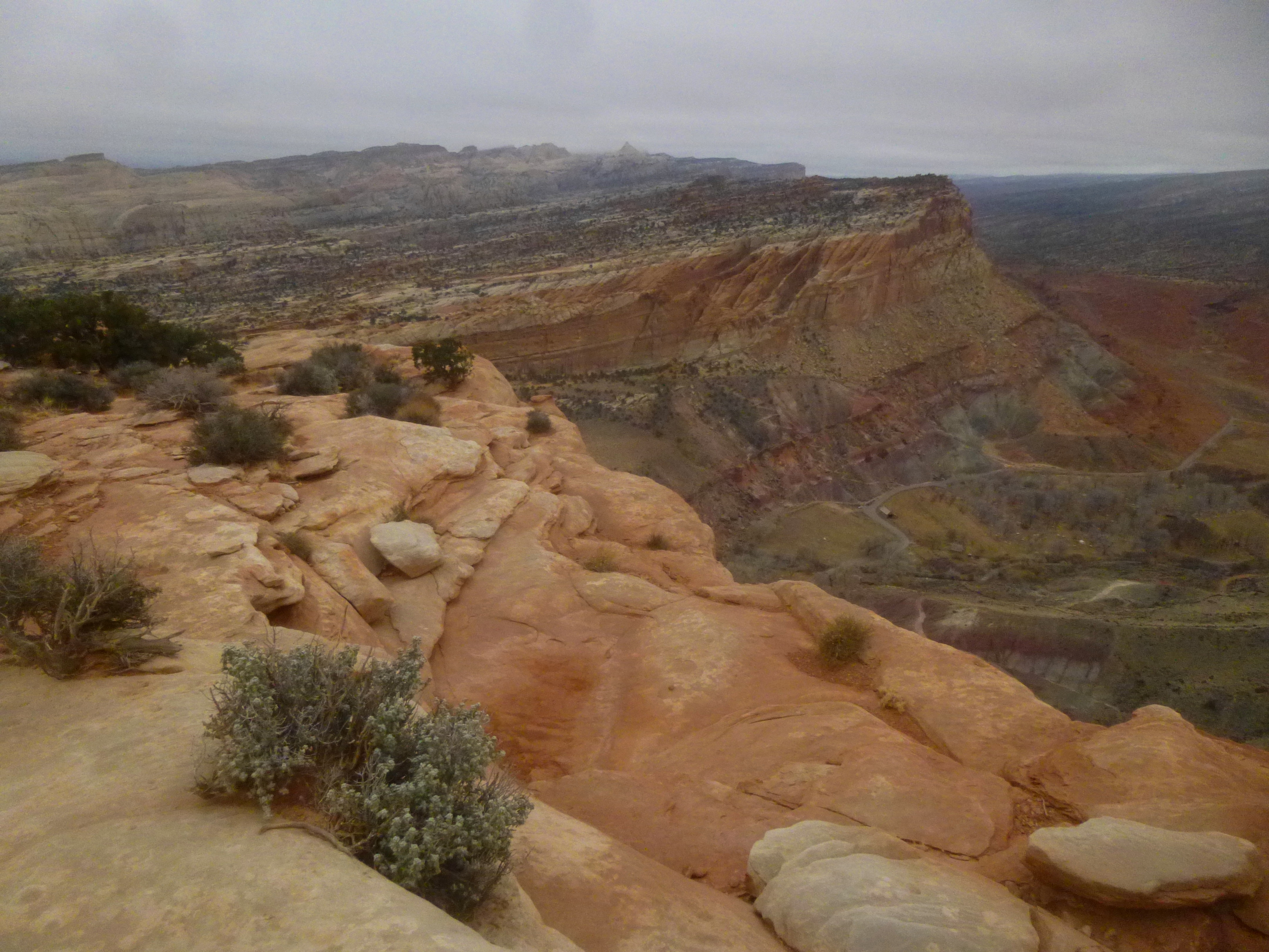
Just to the west of Fruita, the landscape is dominated by green-speckled Miners Mountain (~7,900’), bisected by the deep-cutting Fremont River Gorge and fronted by the smaller flattop known as Johnsons Mesa (~5,800’). Snowy Boulder Mountain (~11,300’) rises behind Miners to the southwest.
Looking due west, it’s easy to spot the Visitor Center and red-roofed Park Headquarters, as well as Sulphur Creek Canyon. Highway 24 weaves west out of sight—but you’ll see more of it from atop Navajo Knobs, 2.5 miles farther.
If time only allows for a 2-3 hour hike, Rim Overlook is your turn-around point. For hikers continuing on to Navajo Knobs, the lookout is roughly halfway to your destination. And although the Knobs are only 600 feet higher than the Rim Overlook, the steepest sections of the hike are yet to come.
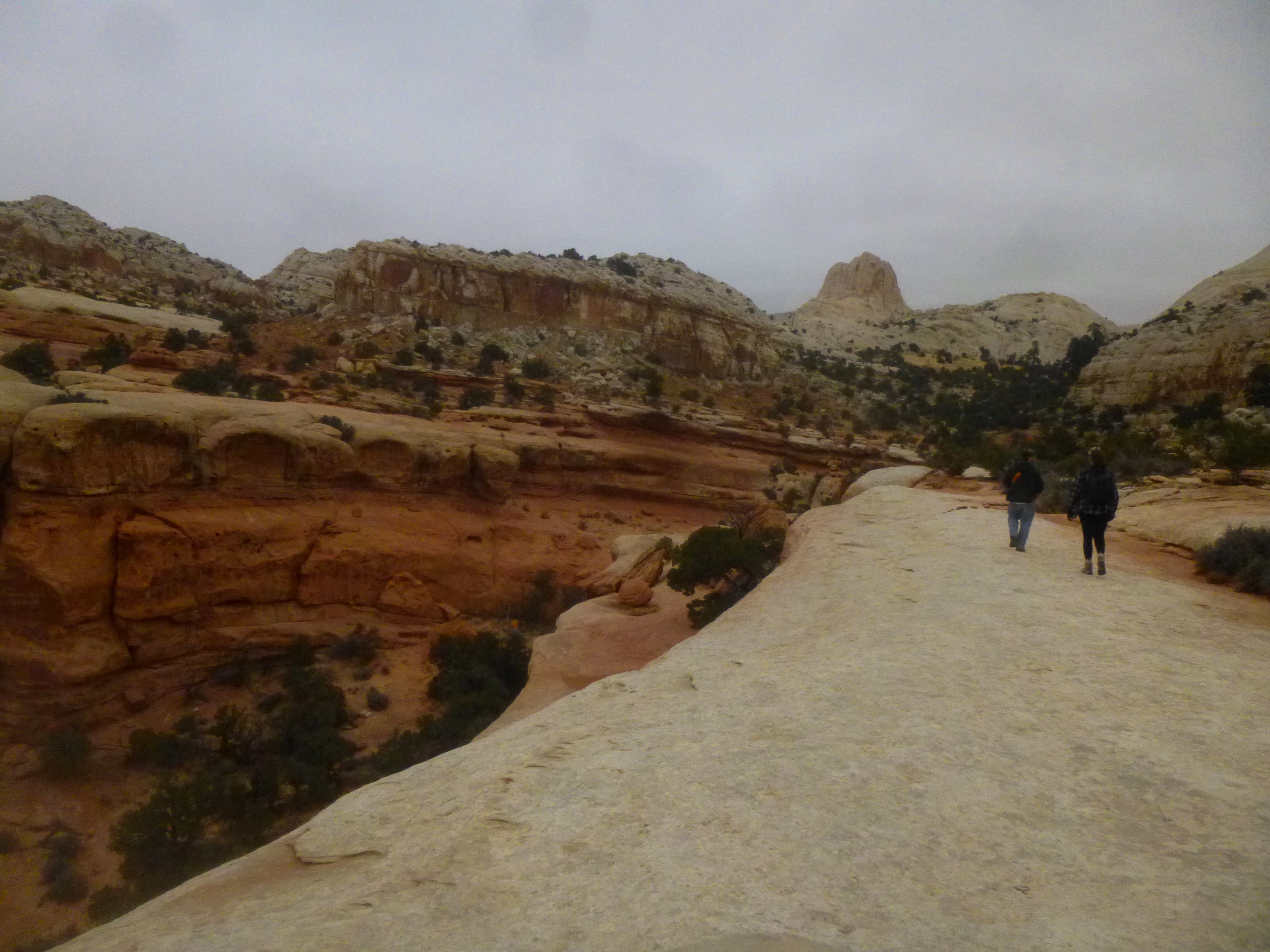
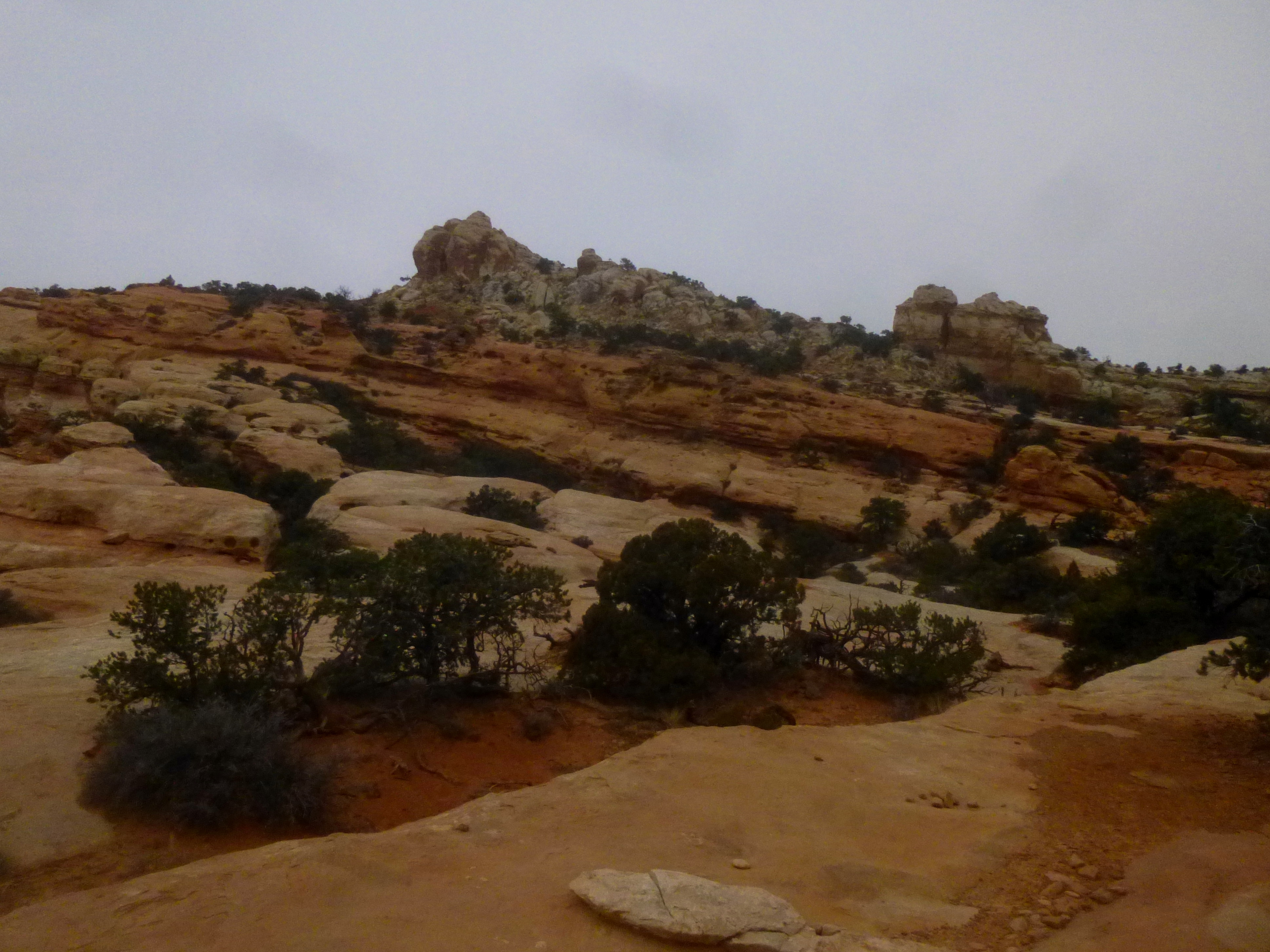
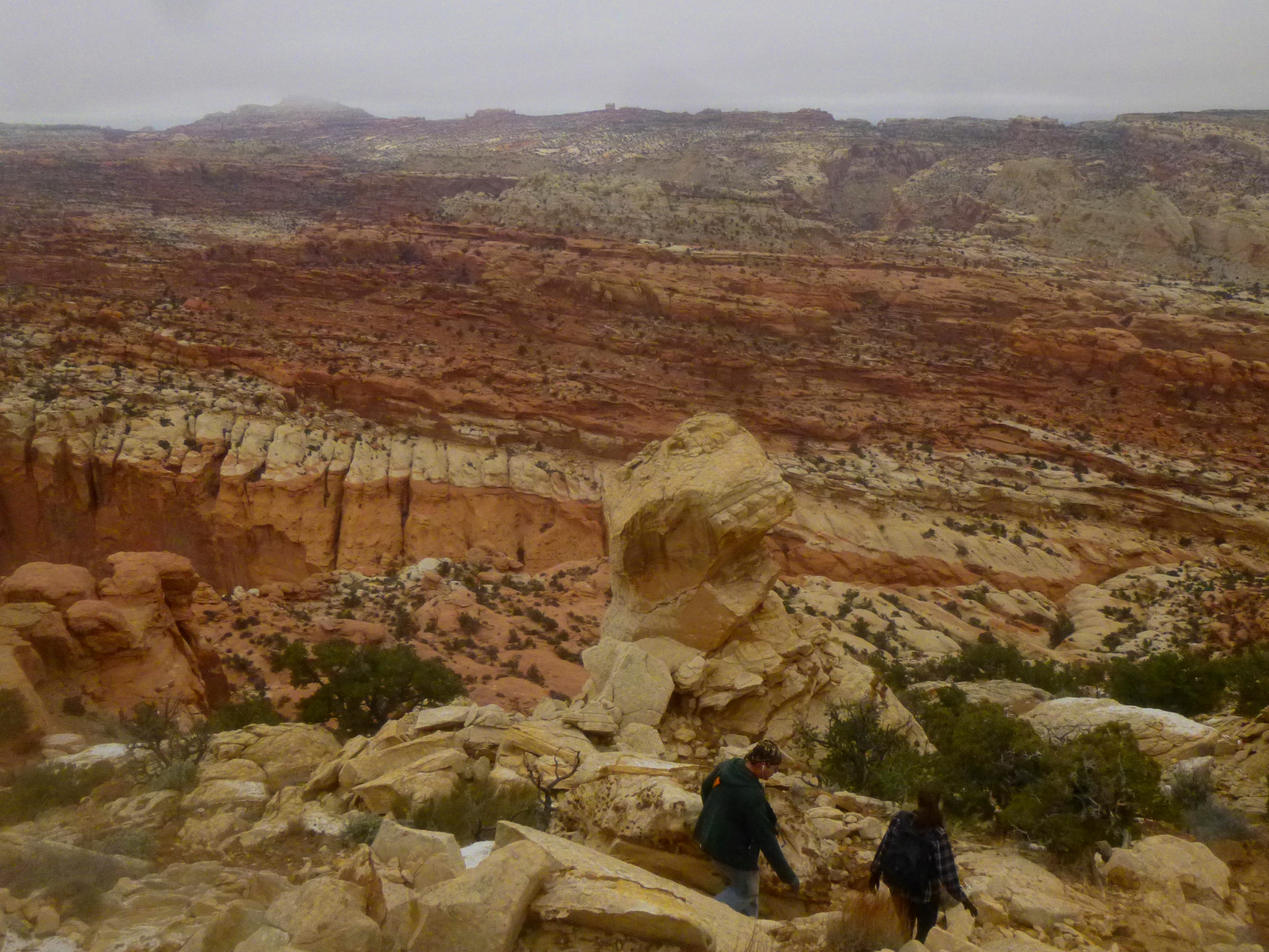
Heading north from Rim Overlook, the trail follows the mostly flat right flank of a colorful and interesting side canyon for ¼ mile. The wash itself is dense with gnarled junipers, as well as spotty cryptobiotic crust (do not step on this interesting, protected soil!). After crossing the wash, the path resumes its steady climb, rising 150 feet to Longleaf Flat. For backpackers, this area, dotted with ponderosa pines, offers several nice places to pitch a tent. Looking north and east across the flat, the highlight is the pearly white fin labeled on topographical maps as point 6,821’ (known to some as “The Stegosaur”).
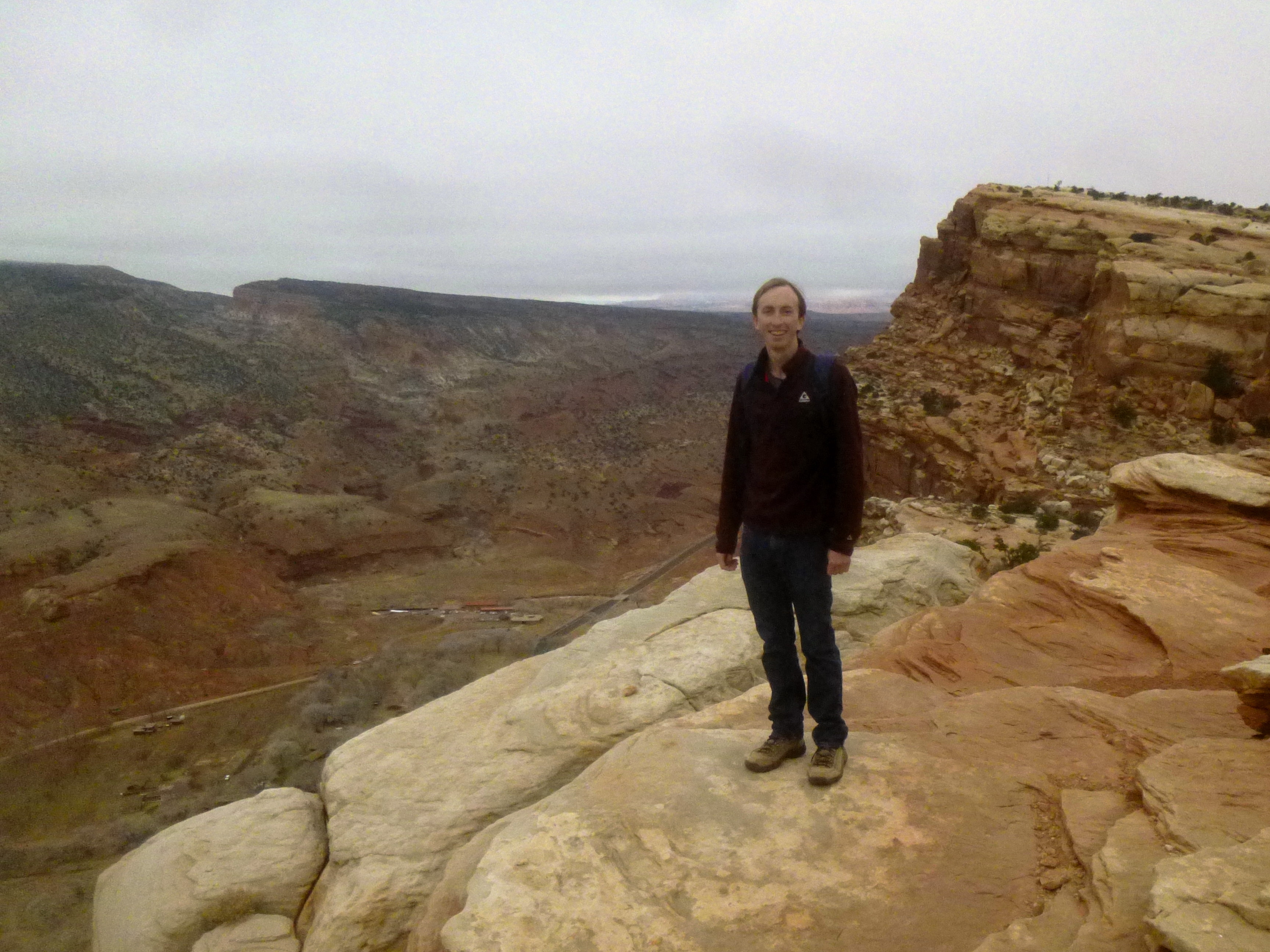
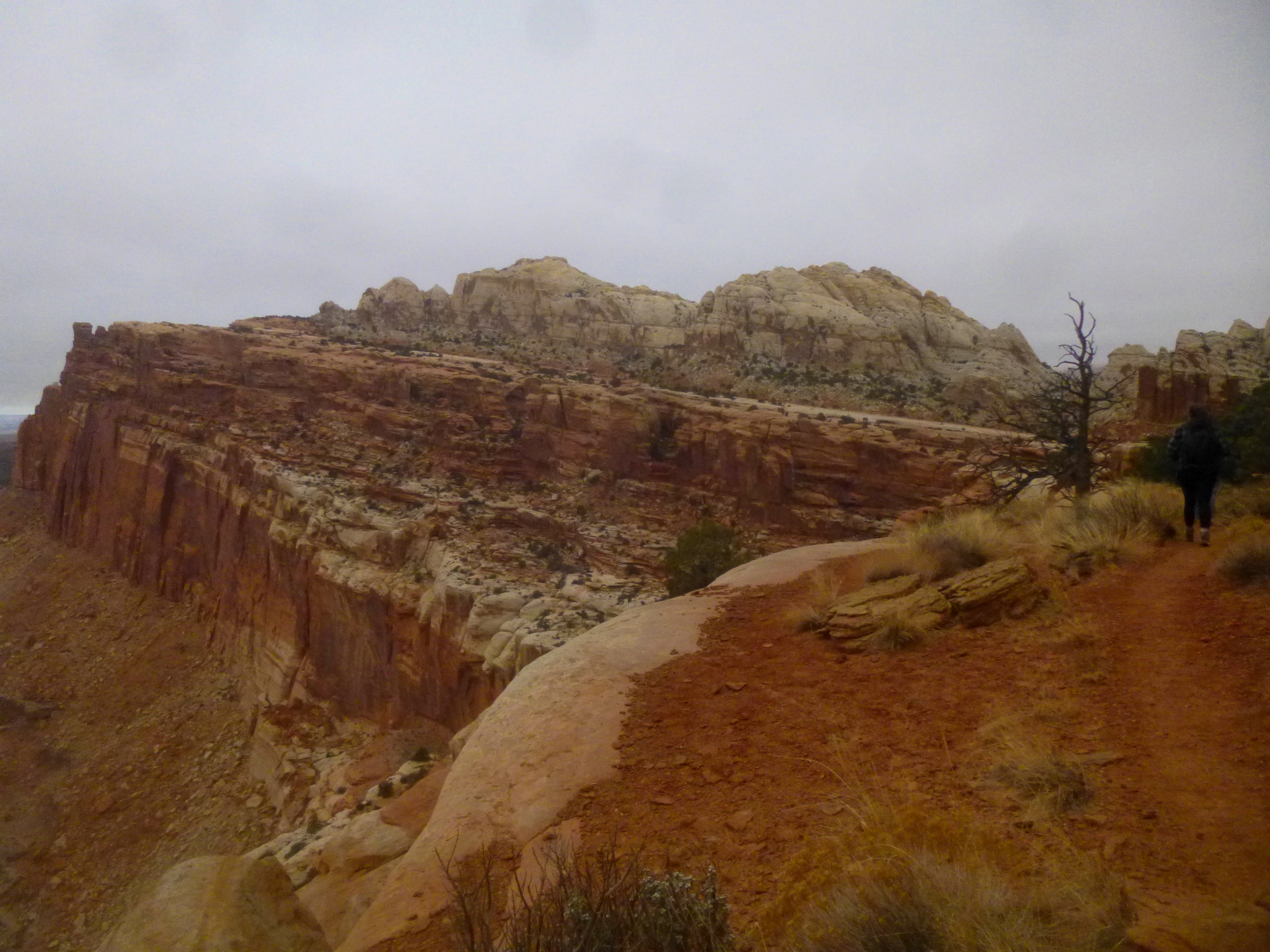
Leaving Longleaf behind, the trail crests a ridge with excellent views of The Castle (6,387’) below. A couple hundred yards of off-trail scrambling will bring hikers to point 6,629’, site of a small radio tower (visible from down on Highway 24). Here, while stopping for a snack and a rest, you can spy on the Visitor Center and Park Headquarters area 1,100 feet below.
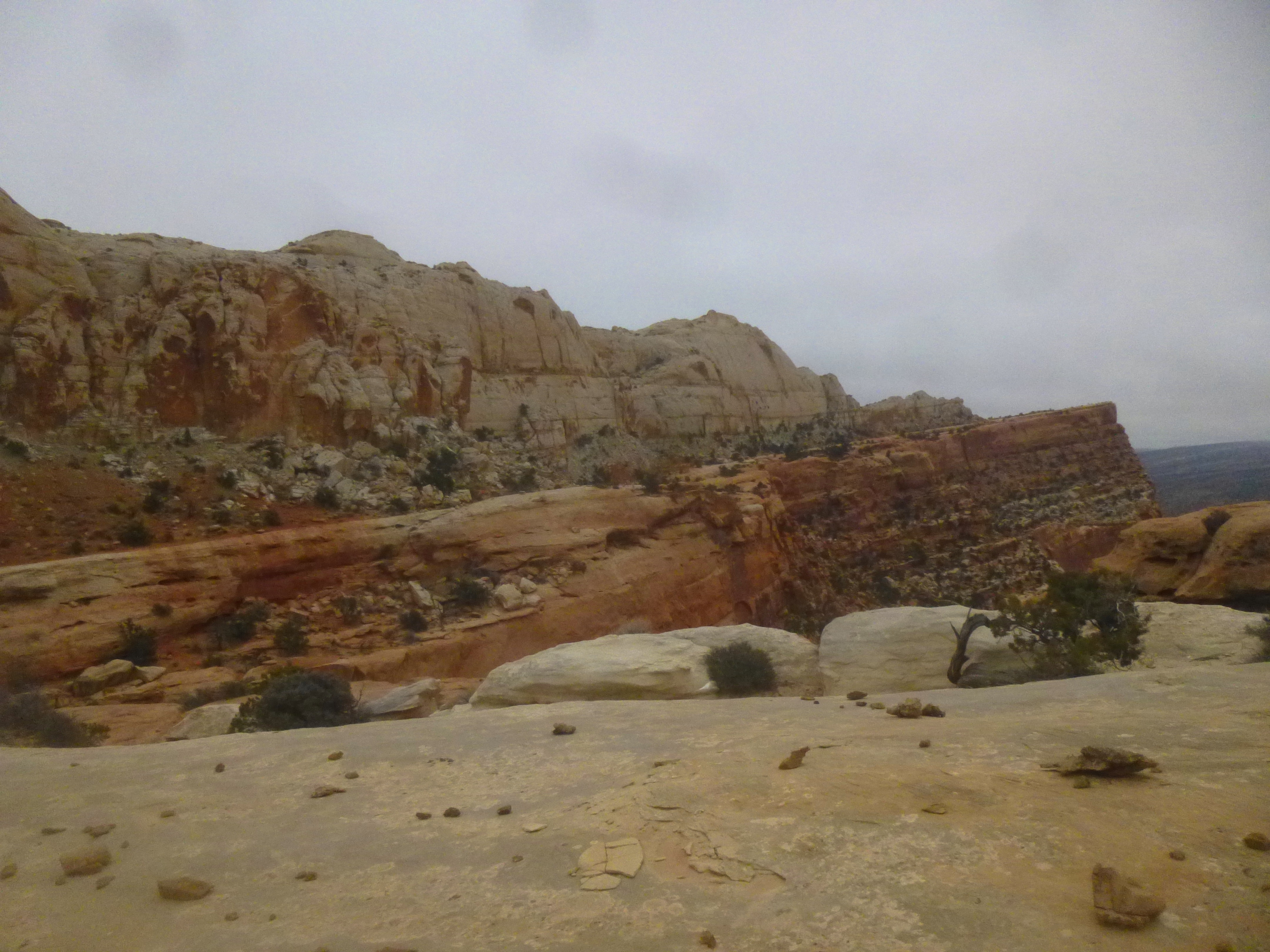
Returning to the trail, the destination is now in sight: across the purple-gray canyon behind The Castle and above the red Wingate cliffs, the clusters of white and brown buttes ahead are the Navajo Knobs (the trail climbs the shortest one, furthest to the left). There’s still a long way to go, however—around a massive bend that seems to stretch on for miles.
The first section is extremely pleasant: downhill, with constant views of The Castle, Meeks Mesa, and beyond. The path passes through two washes, surrounded by impressive mounds of bacteria-studded cryptobiotic soil.
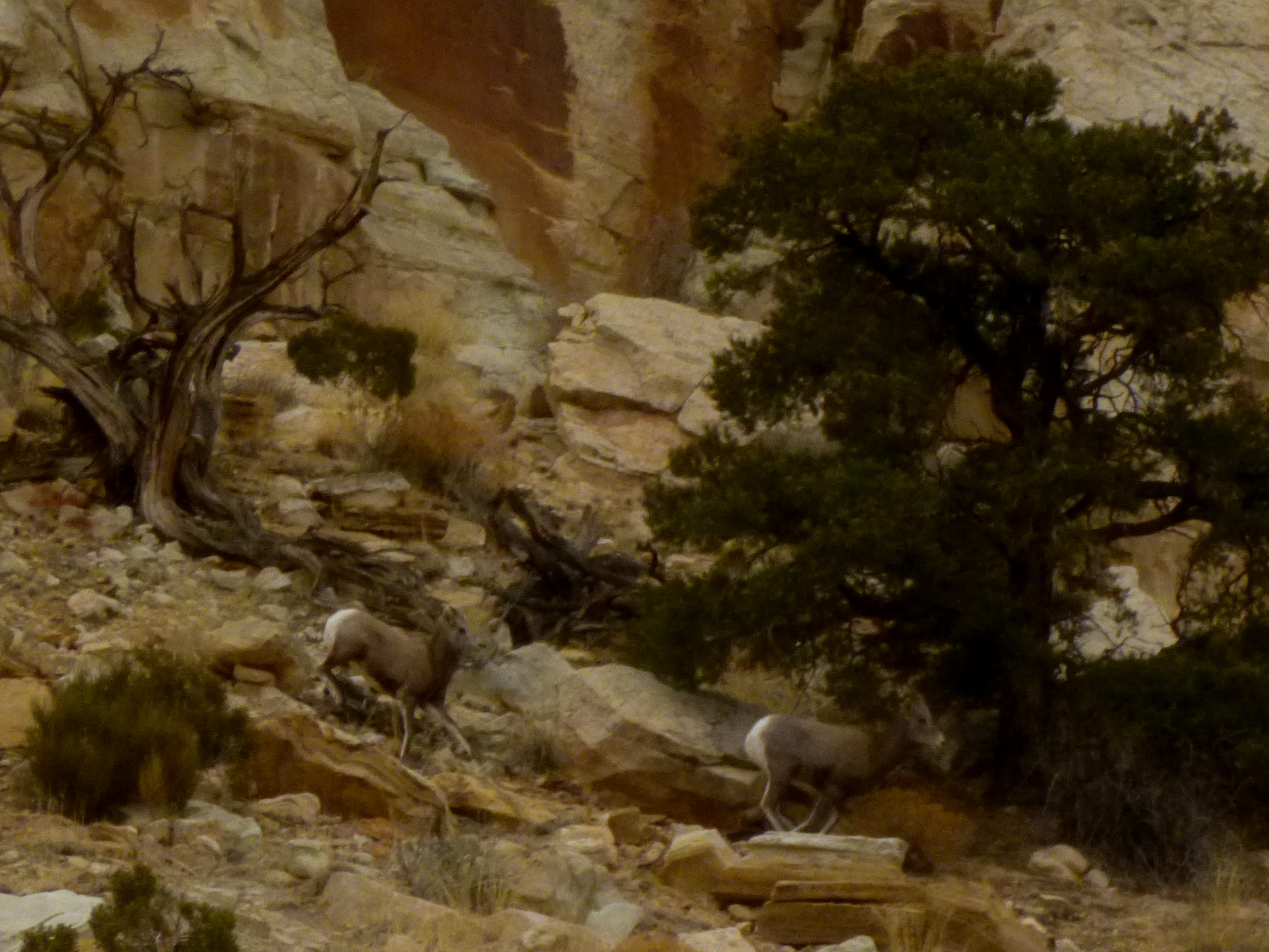
With about a mile remaining to the Knobs viewpoint, the trail begins the penultimate, 600-foot climb, mostly up exposed slickrock. (On the day I visited, we spotted three bighorn sheep prancing in the opposite direction.)
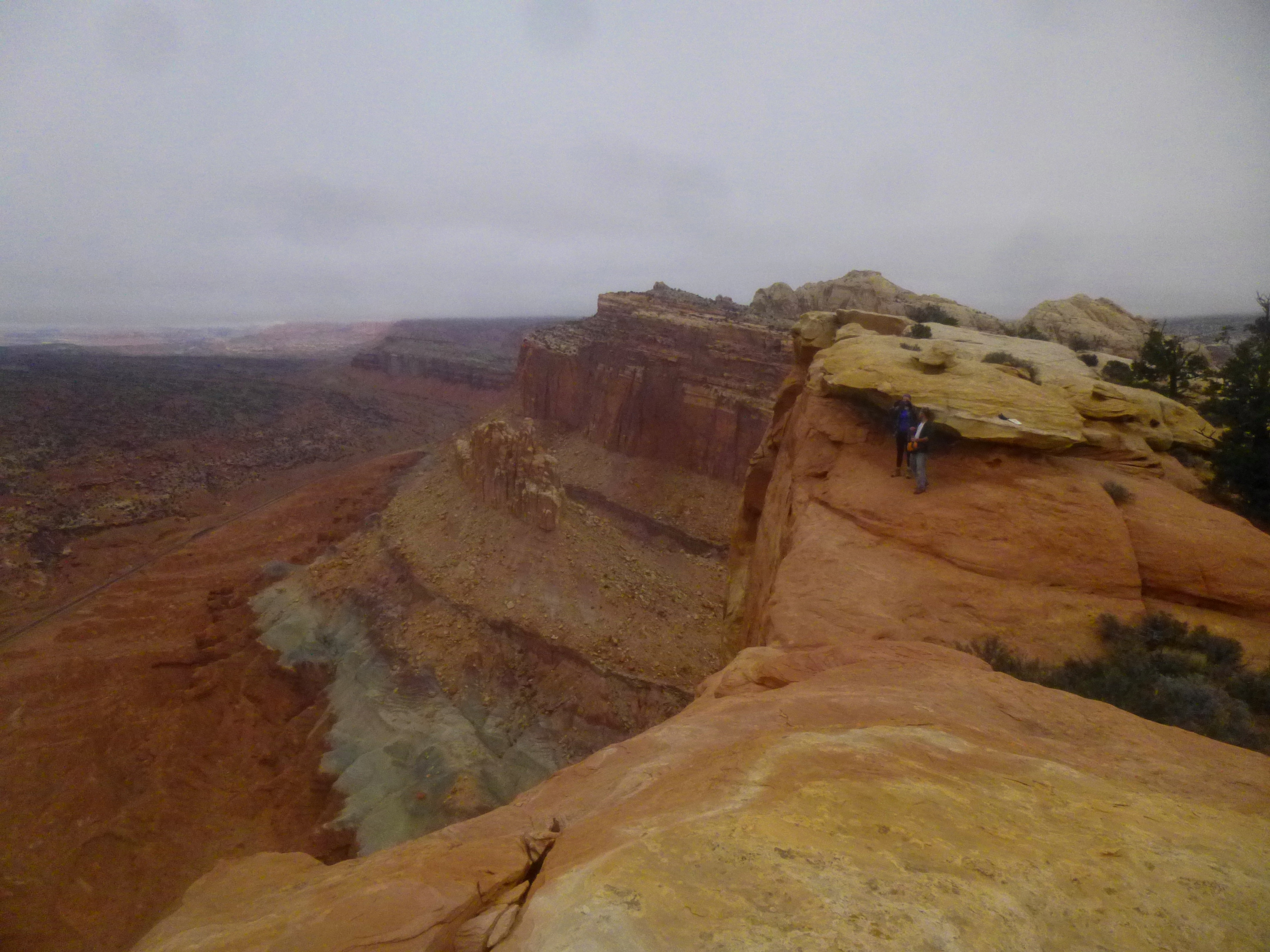
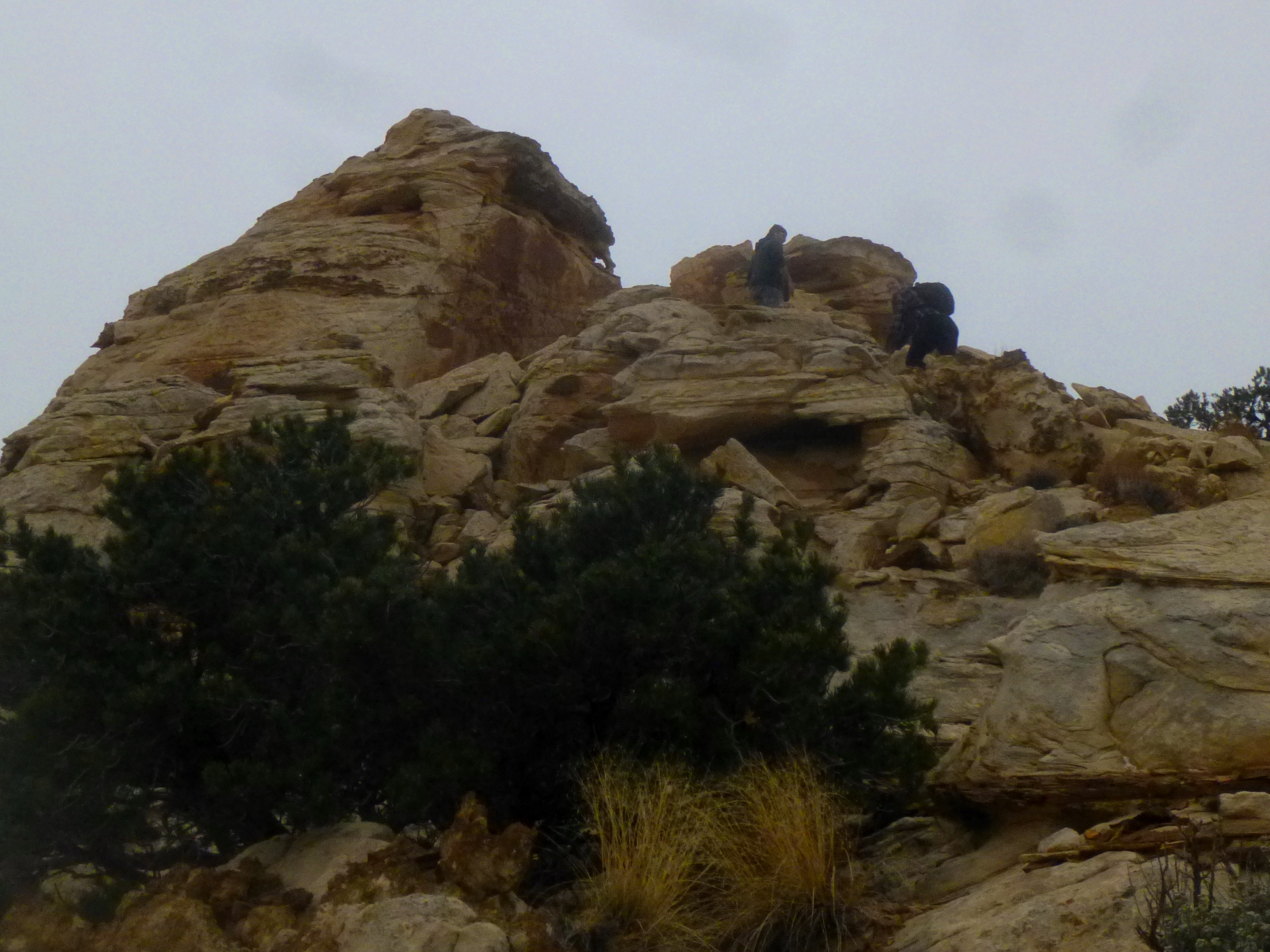
One final side canyon (a beautiful red-orange) must be sidestepped before coming upon the final obstacle: a steep, 30-foot scramble to the top of the knob. There a number of approaches, though the easiest is to follow the trail to the base of the knob, ascend right, then stay right until reaching a solitary hoodoo, at which point, a nice route cuts left and winds up the butte to the top. Note: The top of the knob is very exposed—exercise caution, especially if the summit is crowded (it’s hard to fit more than 5 people on the top at a time).
At 6,979’, the views from atop this butte (the smallest, but most accessible of the Navajo Knobs) are spectacular. To the west, the red-orange Wingate cliffs extend for miles, disrupted only for a moment by the green and deep red Chinle/Moenkopi formation known as Mummy Cliff (see Chimney Rock Trail). To the south, the highlights are Miners Mountain, Boulder Mountain, and Sulphur Creek. To the north, Navajo Knobs offers a rare view of the northern reaches of the reef, with South Desert and Cathedral Valley beyond.
The deep red gorge of Spring Canyon cuts through the rows and rows of Kayenta, whetting the appetite of hikers for another day. To the east, look for Factory Butte and North and South Caineville Mesa, with the Abajo Mountains and the Henrys beyond. On a clear day, it’s possible to see more than a hundred miles in several directions.
The return journey to Hickman Bridge Trailhead retraces the route described here. Though it is mostly downhill, tired legs must bear one more 300-foot climb to reach the radio tower and Longleaf Flat. Past Rim Overlook, heading downhill affords greater views of Pectol’s Pyramid and Capitol Dome before making the final dip down to the Fremont River.
The entire hike can take hikers anywhere between 3 and 6 hours, so be sure to allot plenty of time before sunset to complete the beautiful but challenging 9.4 miles.


Pingback: Fremont Gorge Overlook Trail (Capitol Reef National Park, UT) | Live and Let Hike
Pingback: Cooks Mesa and Meeks Mesa (Fishlake National Forest, UT) | Live and Let Hike
Pingback: Chimney Rock Trail (Capitol Reef National Park, UT) | Live and Let Hike
Pingback: Upper Spring Canyon (Capitol Reef National Park, UT) | Live and Let Hike
Pingback: Hickman Bridge Trail (Capitol Reef National Park, UT) | Live and Let Hike
Pingback: Top 10 Hikes in Capitol Reef National Park’s “Frontcountry” | Live and Let Hike
Thanks, Andrew, for all the information for this hike. Yesterday, we had a cloudless sky, very little breeze, and an expected high of 61…perfect day to tackle this climb:) We had a great killer day. Boy, that climb up is never ending and those two climbs returning were really tough. But the view was awesome! We arrived at the top after everyone but one woman left. The three of us sat forever looking in each direction. I had written down what we would see in each direction from you blog. It was cool being able to identify everything. There was little haze and we really could see for 100 miles…amazing!! You’ll have to check out the look with a clear sky:) No bighorns, though. Our post should be out tomorrow or Friday. Again, thanks for such great details:)
Great! Alas, the quality of my photos from this hike are…er…a little sub-par. Looking forward to seeing your post, which undoubtedly will be sunnier and clearer!
I’m so glad I stumbled across your blog. What a fantastic trip report, great details! I especially like the geology and geography references. Your biography gave me an idea why 🙂
I was working on my own blog post when I found yours. I’ve flagged it and will be using it when I prep for future jaunts.
Post will be up pretty soon.
Here’s the link: http://wp.me/p3Fcuf-17x
Great! Glad you’ve found the site helpful. I’ll definitely follow yours!
Pingback: UT – Capitol Reef – Navajo Knobs Trail . . . 360 degree views, yes please – Jan's Jaunts and Jabberings
Thanks for the information! Is this trail a good choice for late March?
Hi Steve – the trail should be nice and clear in late March, barring a late-breaking snowstorm.
Wow, great post. Are there any places to camp on this route if we wanted to make it an overnight?
I think you could camp – perhaps around Rim Overlook – if you find a flat space, though it may be windy! Be sure to get a permit at the visitor center.
awesome, thanks!