
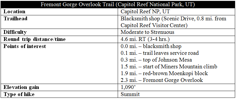
It’s hard to choose a favorite among the multitude of fantastic hikes in Capitol Reef National Park, especially as there are a handful of front-country and backcountry trails I have yet to explore. Yet the subjective leader to date may be the stunning Fremont Gorge Overlook Trail, an underrated and oft-forgotten 4.6-mile out-and-back beginning just down the road from the Visitor Center. The route gains 1,090 feet in 2.3 miles, but the ascent is broken up by a flat, pleasant jaunt across the length of Johnson Mesa, littered with junipers, Mormon tea, and Capitol Reef’s famous “black boulders.” The panorama from windy Fremont Gorge Overlook offers both a terrific view of the gorge and a splendid vantage point of the park’s precipitous, multicolor cliffs—making the arduous climb worth every step. Note: For the best views of Fremont Gorge, hike early in the morning to avoid dark shadows; for the rest of the panorama, hike in the afternoon. Arriving at the overlook around noon or 1 p.m. offers a fine look of both.
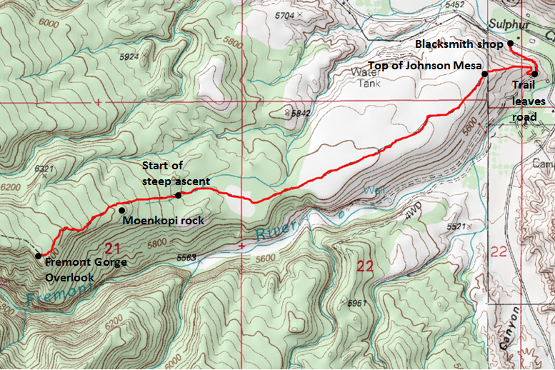
Adapted from: http://www.mytopo.com/maps/
The hike
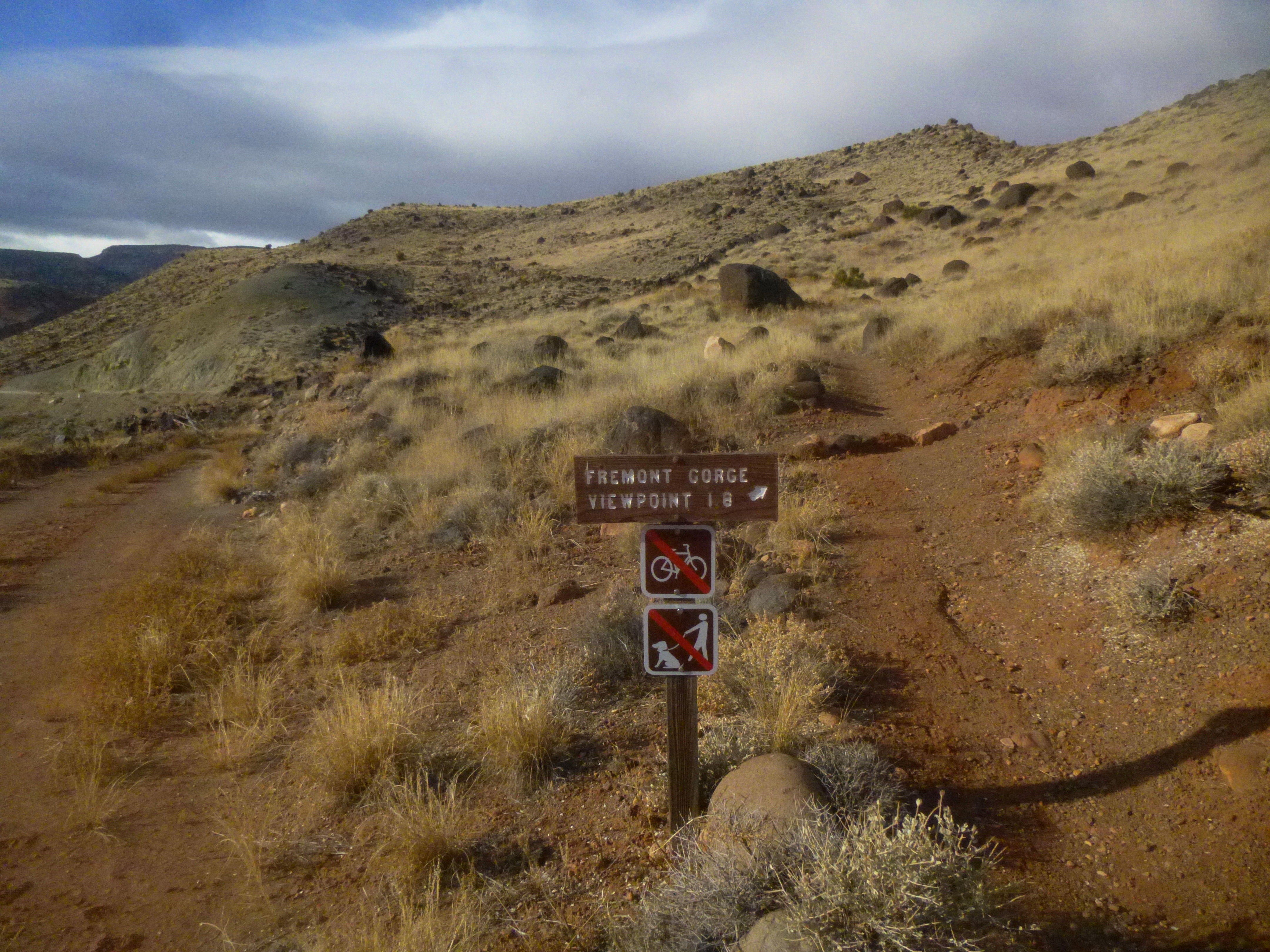
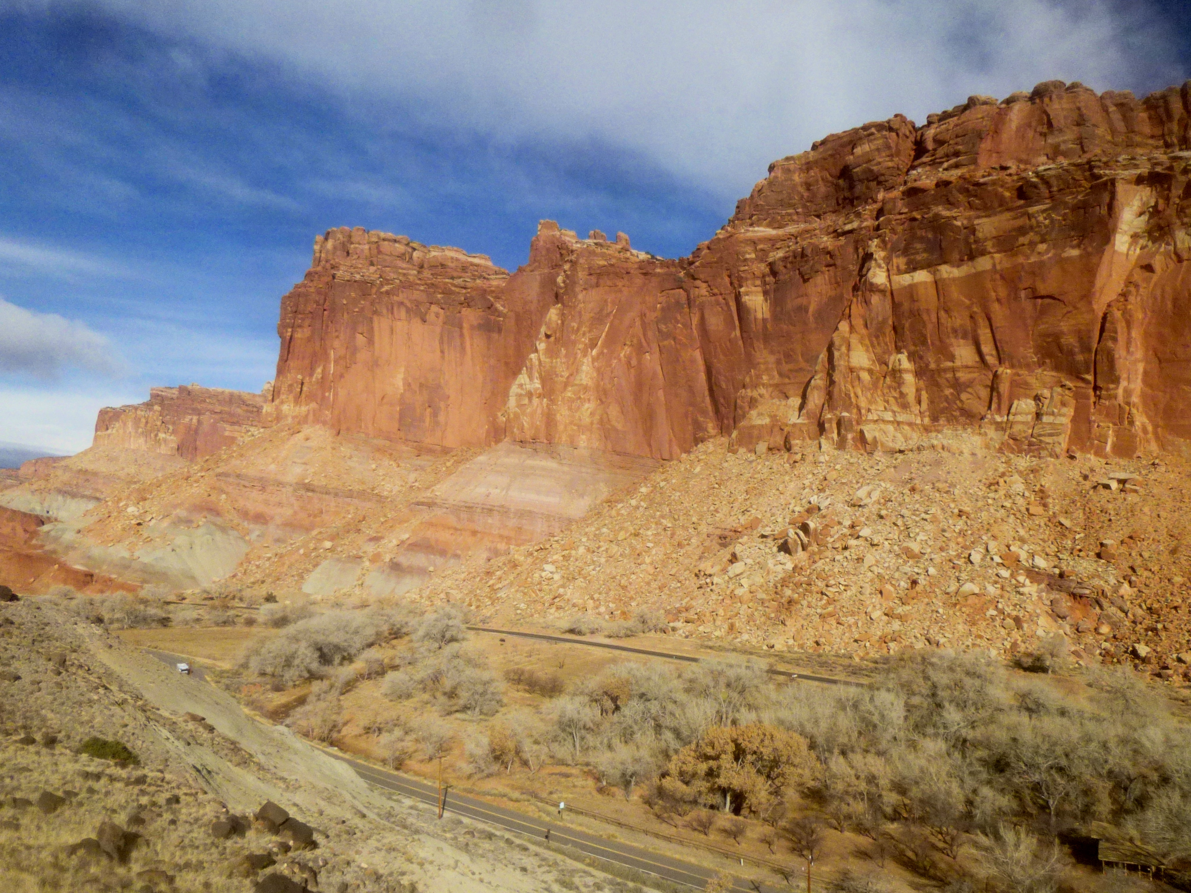
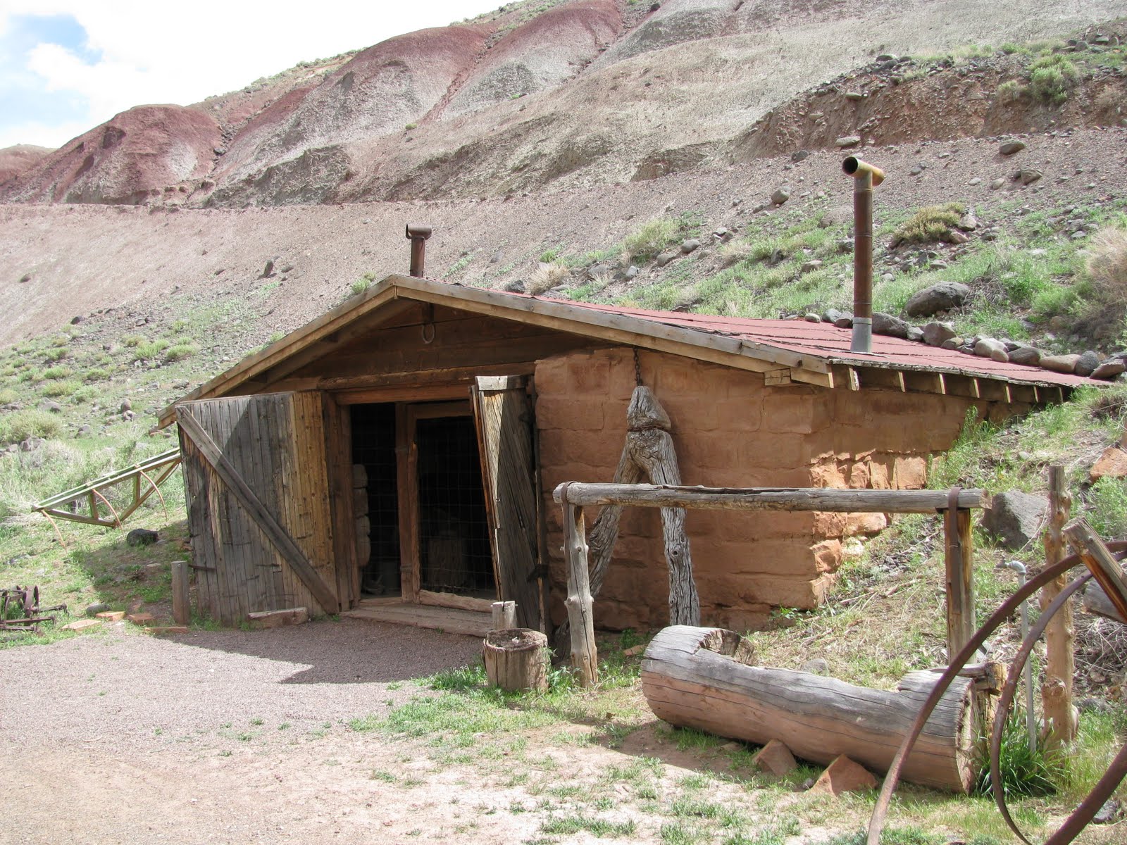
The 2.3-mile hike (one-way) to Fremont Gorge Overlook begins 0.8 miles down the Scenic Drive from Capitol Reef Visitor Center. Park at the historic Fruita blacksmith shop (if coming from the Visitor Center, it will be on the right), which sits at the base of gray-green Johnson Mesa. The first 1/10 mile of the trail climbs up a wide, dusty service road; just after rounding a bend, the trail leaves the road at a sign indicating “FREMONT GORGE VIEWPOINT 1.8.” (Note: This distance is incorrect; it is closer to 2.1-2.2 miles to the overlook from this point.)
From here, the trail swerves up a switchback and then ascends steeply up the spine of Johnson Mesa. 18 steps are followed by a more gradual reprieve; 16 more steps lead to the top of the mesa. 3/10 mile from the trailhead, the trail levels out after gaining about 300 feet of elevation.
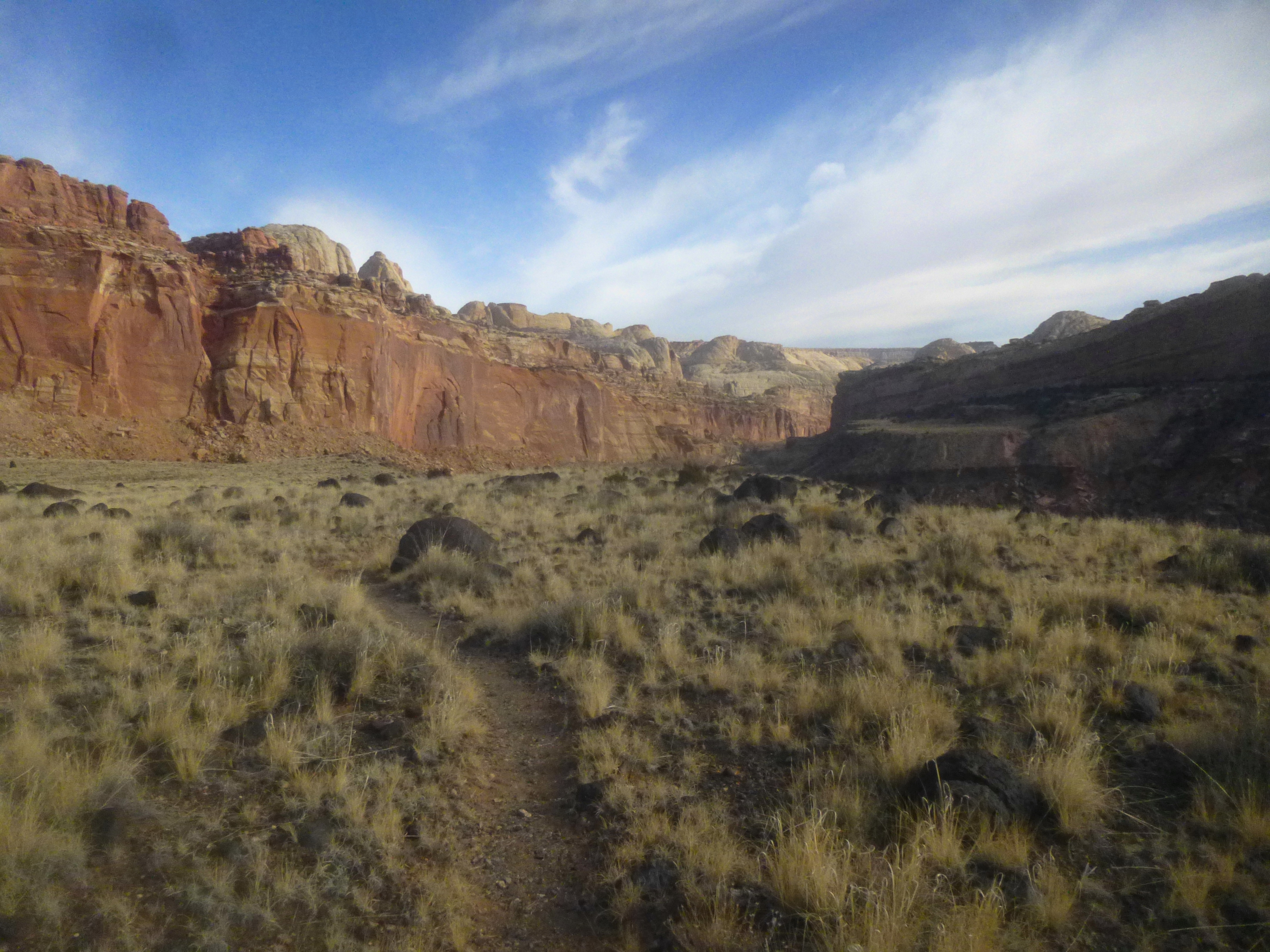
The first thing you will likely notice upon climbing Johnson Mesa is the abundance of black boulders. These rounded stones are obviously not sedimentary rock like the park’s ubiquitous Wingate or Navajo sandstone. Rather, they are igneous—volcanic—rocks cast down from nearby Thousand Lake Mountain and Boulder Mountain during the last Ice Age (circa 10,000 years ago). The prevailing theory suggests that, as crustal pressure built up under these two volcanic peaks, the breaking of immense glaciers atop these volcanic peaks sent molten rock tumbling down the hillsides. The landscape atop Johnson’s Mesa is now the best spot in the park to see these basalt boulders, interspersed among yellow grasses and sagebrush.

Offering more than enough time to catch your breath, the 300-foot climb is followed by more than a mile of hiking across nearly flat terrain (I spent much of it following fresh bighorn sheep tracks). The views are stunning: straight ahead is green-speckled Miners Mountain (~7,900’), sliced dramatically in two by the partly-visible Fremont Gorge. Behind you, above red Wingate sandstone cliffs, the tips of several white Navajo sandstone peaks emerge—from Fern’s Nipple (7,085’) to Capitol Dome (6,029’) to Navajo Knobs (6,979’). (See yesterday’s post for the hike to Navajo Knobs.) The Reef glistens in the early or late afternoon sun.
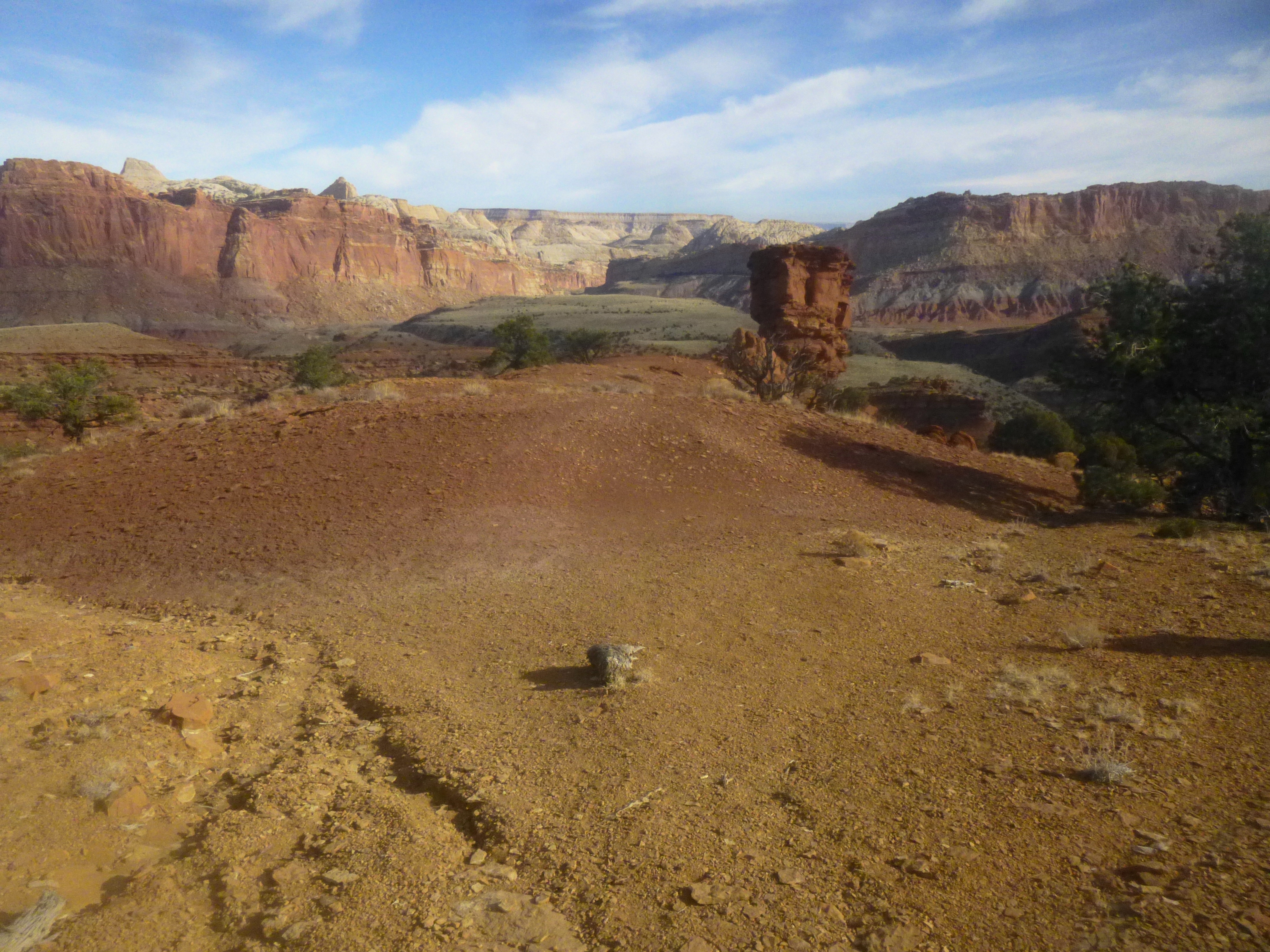
About ½ to ¾ mile across the mesa, the boulders begin to gradually dissipate, replaced with a nice array of junipers and pinyon pines. They reappear briefly before the soil turns to a deep red: the photogenic Moenkopi formation. An isolated thumb of red-brown Moenkopi rock ahead serves as a guide: the trail will pass this stone monolith on the right during the final ascent up the slopes of Miners Mountain.
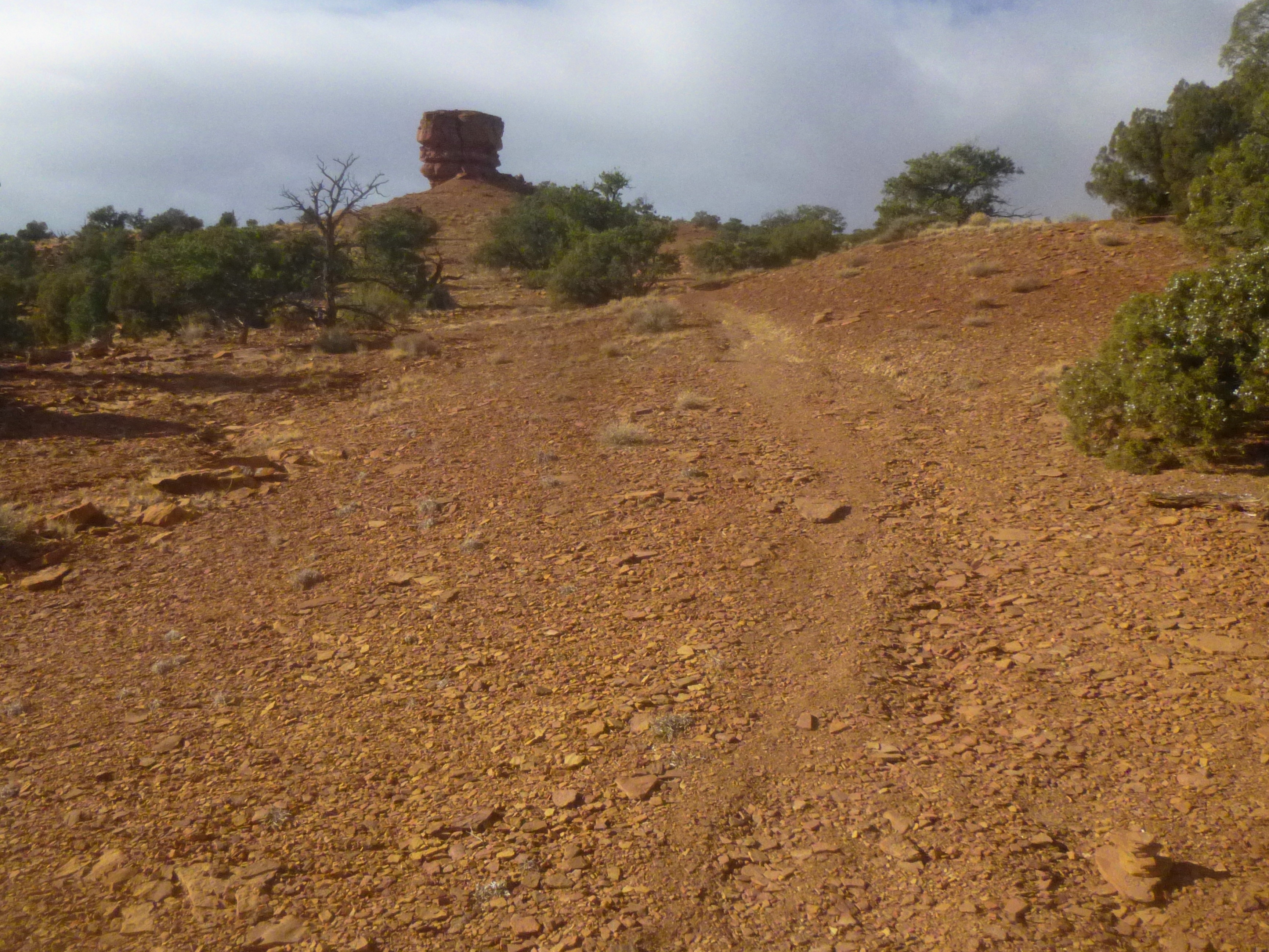
In the meantime, after more than a mile on Johnson Mesa, the trail begins to climb—first gently over the crest of a small reddish hill, then steeply up to the Moenkopi pillar. This is the toughest section of the hike. Just beyond the rock thumb, there is an interesting stretch in which the trail is flanked by a hillside of the reddish Torrey Member of the Moenkopi Formation on the left and yellow-brown Sinbab Limestone Member on the right. After abruptly leaving the Torrey Member behind, the remainder of the hike entails clambering up the crumbly limestone.
About 0.2 miles past the monolith, the trail veers left to the rim of Fremont Gorge, offering the first up-close views of the canyon. It’s another 0.2 miles uphill from here to the Fremont Gorge Overlook, marked by a giant rock cairn on the left.
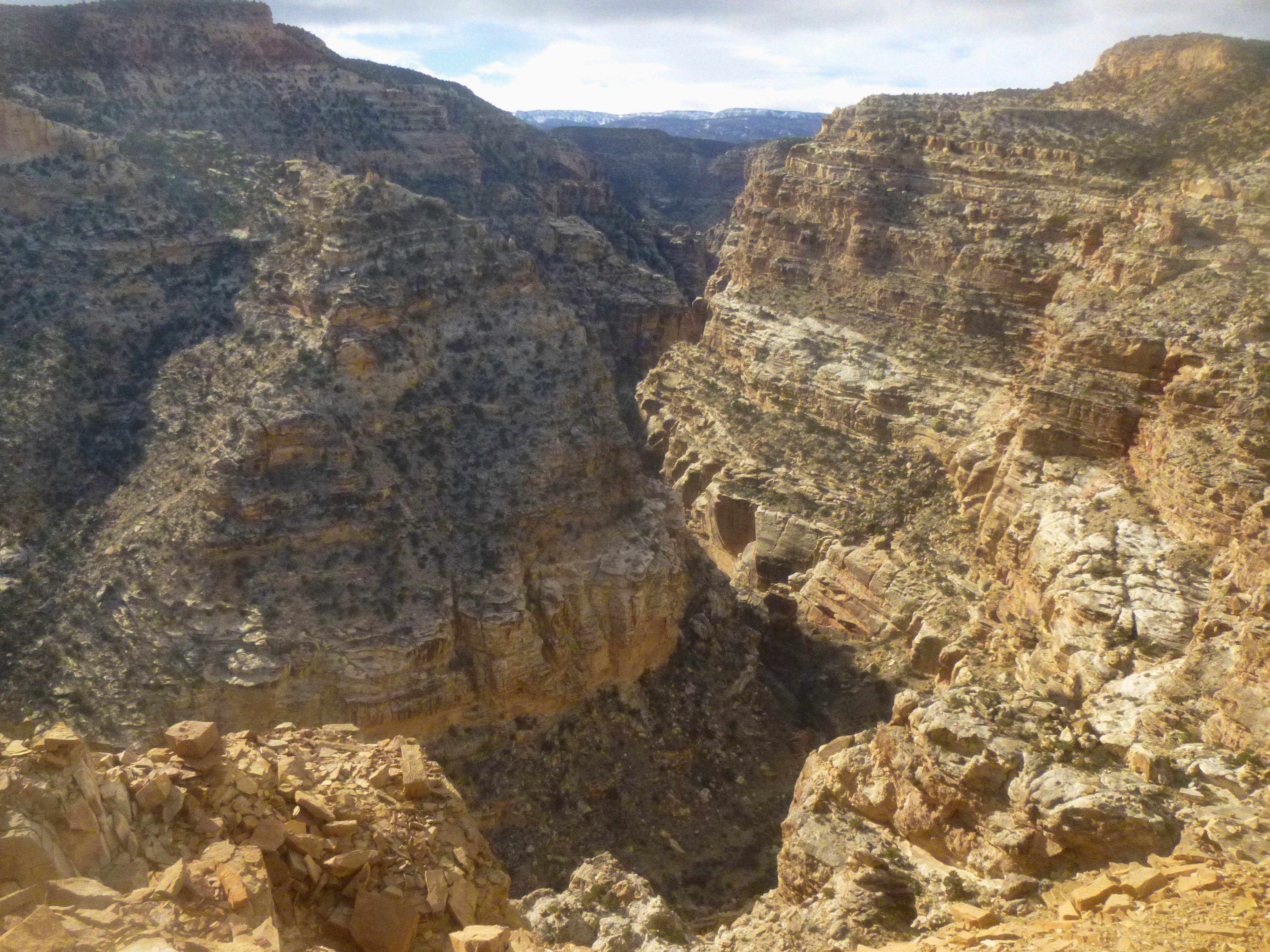
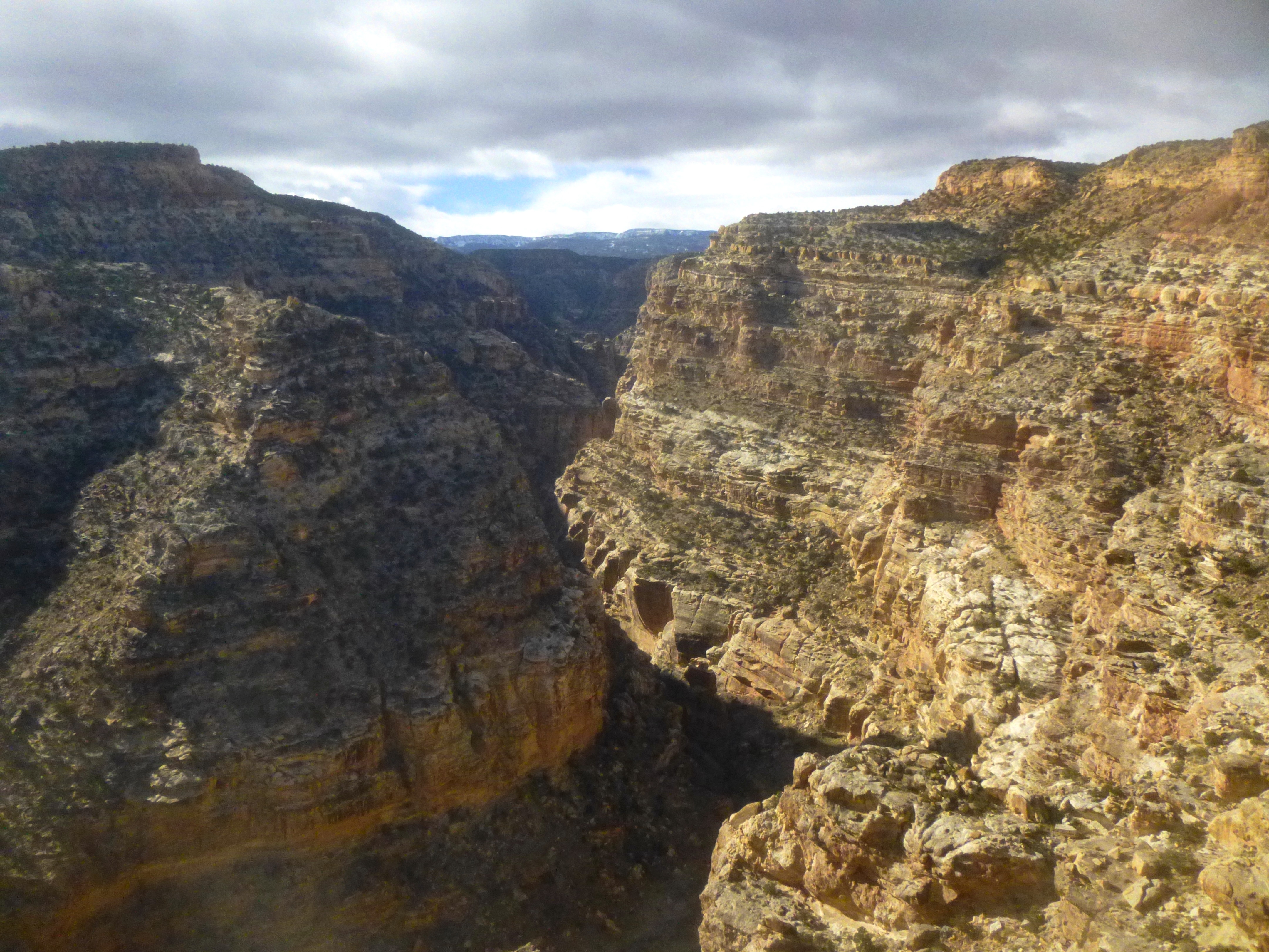
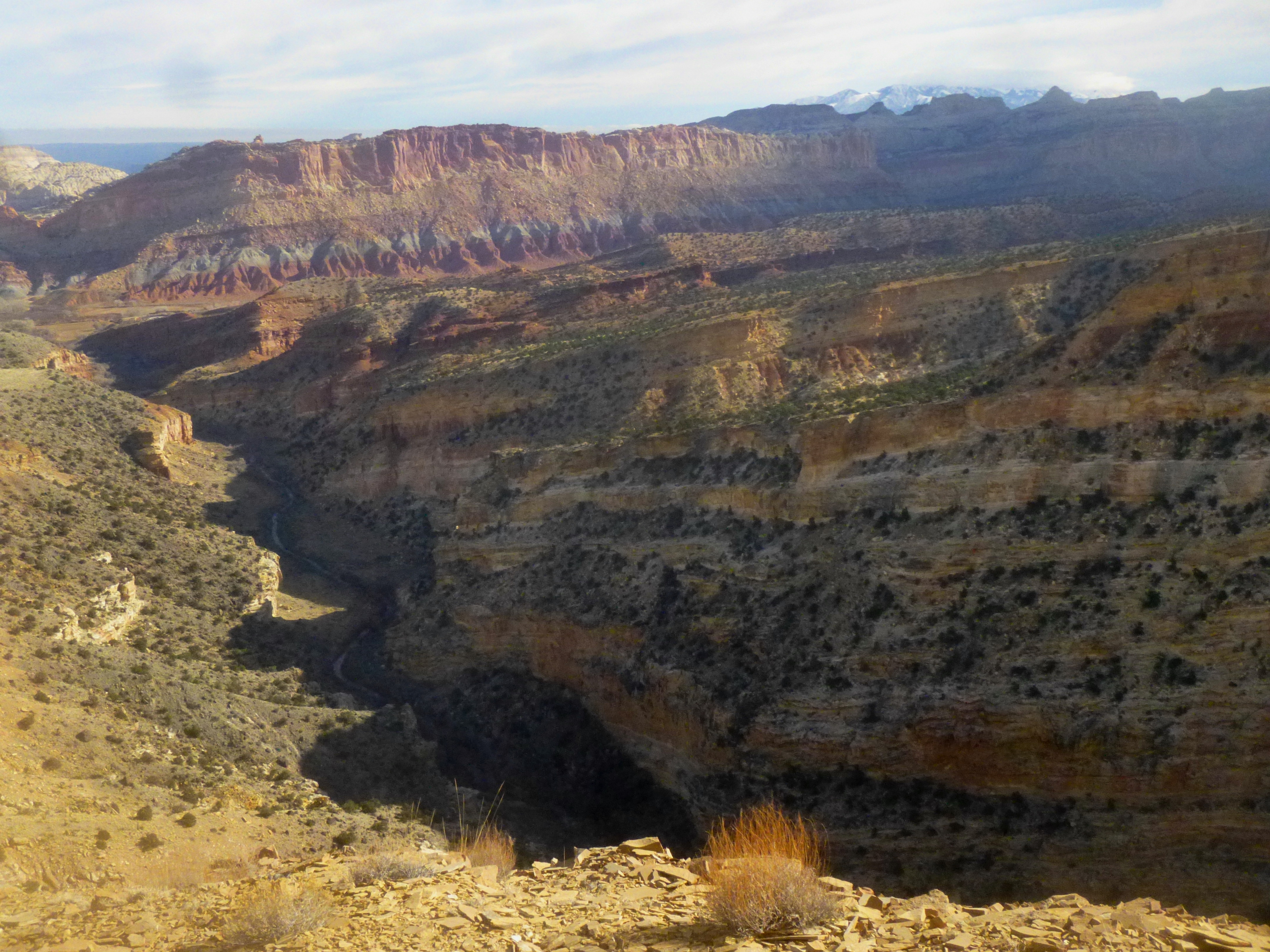
The view 800 feet down into the gorge from the overlook is remarkable. Fremont River snakes its way through the lower rock layer of White Rim Sandstone, leaving behind sheer cliffs and brown-tinted ledges that glimmer in the morning sun. Verdant Boulder Mountain (the source of all those black boulders on Miners Mountain) is framed by the canyon rims to the east, and exposed diagonal streaks of yellow limestone color the southern walls. Here you are observing the two old oldest rock layers in the park, dating to the latter half of the Paleozoic era (541-252 million years ago).
Though there are similar views from the easily-accessible Goosenecks Overlook, Fremont Gorge seems infinitely more rewarding when considering the distance traveled (and elevation gained) to see it.
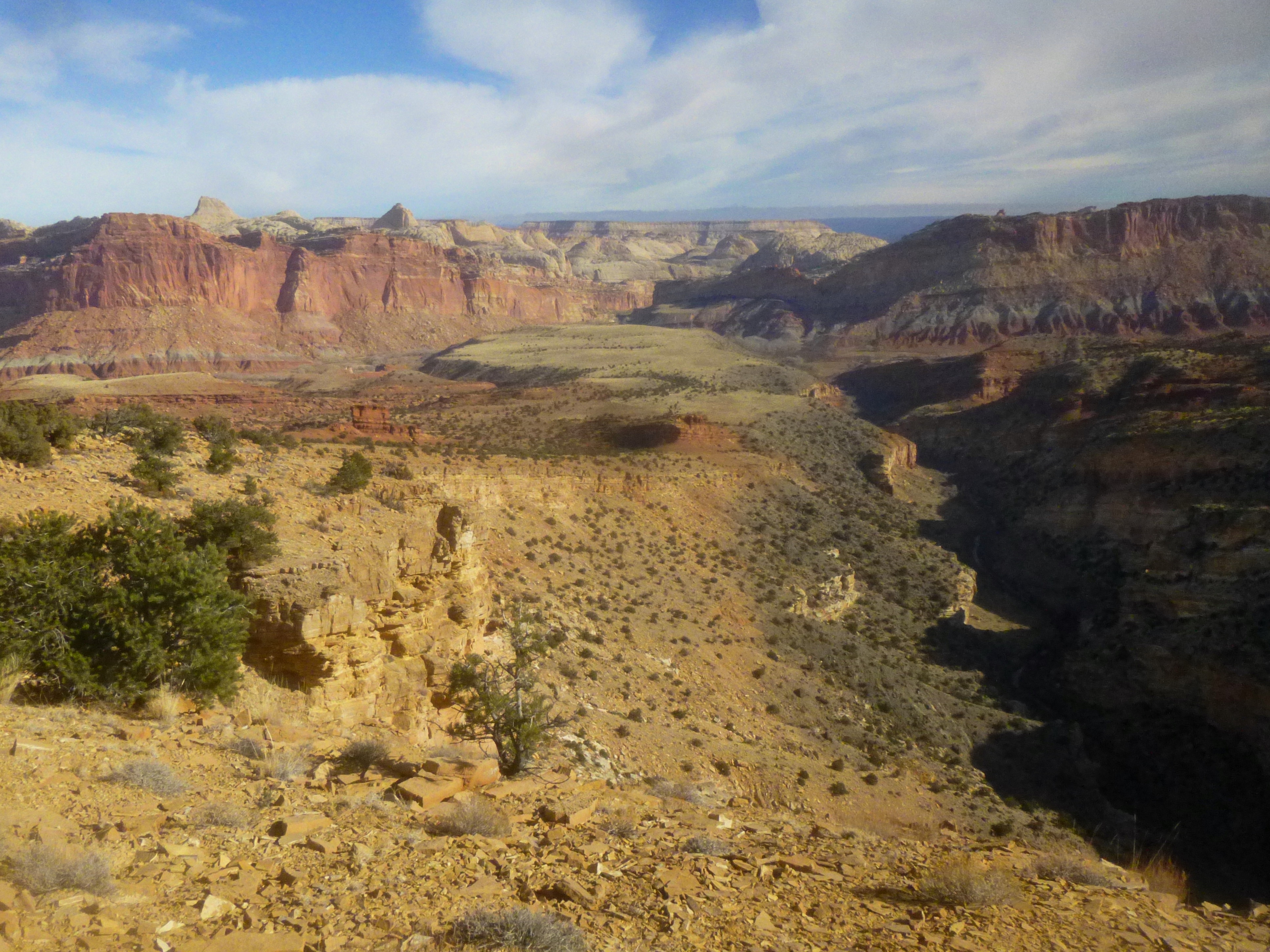
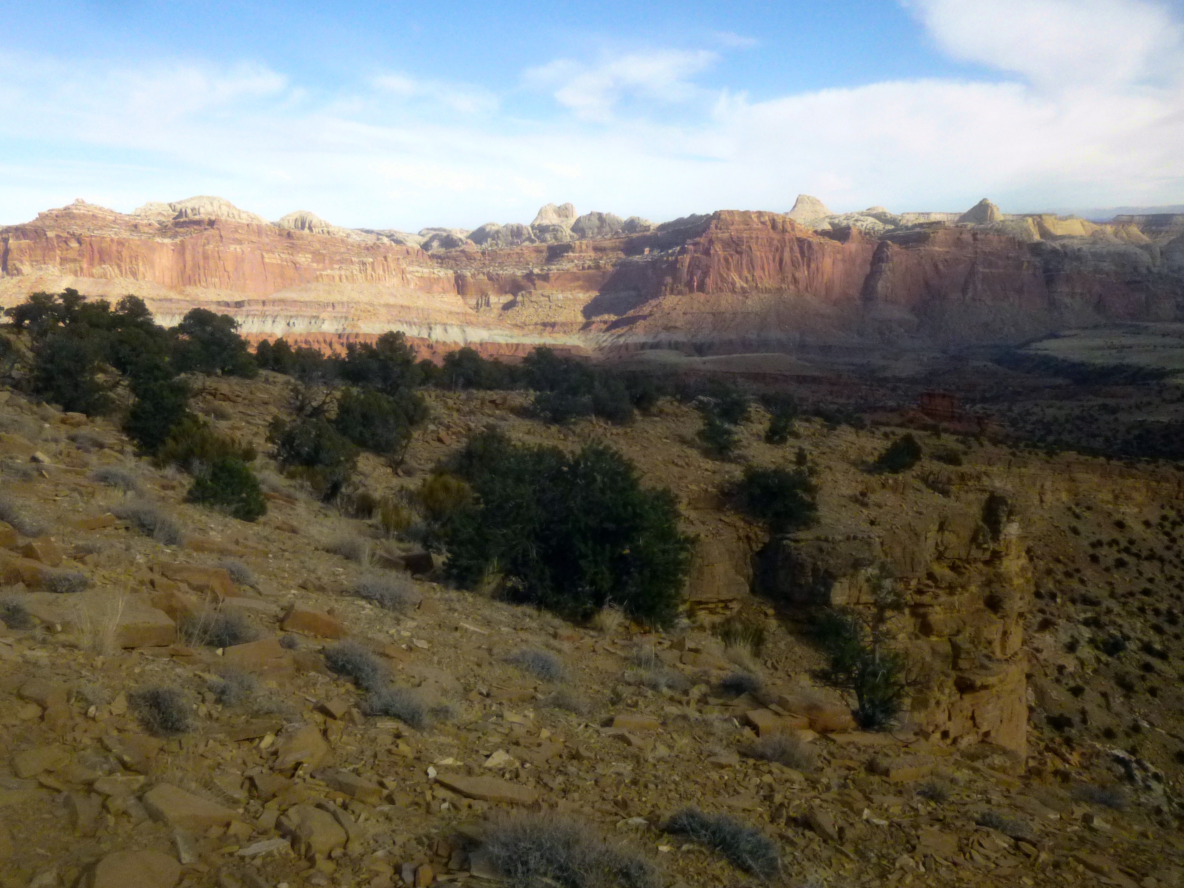
After absorbing the splendor of the gorge, turn around and discover a beautiful 180-degree view of the Waterpocket Fold, accented by various shades of pink, red, green, white, and yellow. On clear days, you can also spot the shadowy Henry Mountains and South Caineville Mesa in the distance. It is this explosion of color that makes this my new favorite hike.
The return trip is virtually all downhill, back down past the Moenkopi monument, across grassy Johnson Mesa, and down the slope to Fruita and the blacksmith shop. The entire trip, depending on your pace and ability, can take anywhere from 1 1/2-5 hours (I completed it in just over two). Bring lots of water…and certainly a camera.

Pingback: Fremont River Trail (Capitol Reef National Park, UT) | Live and Let Hike
Pingback: Hickman Bridge Trail (Capitol Reef National Park, UT) | Live and Let Hike
Pingback: Cohab Canyon Trail (Capitol Reef National Park, UT) | Live and Let Hike
Pingback: Top 10 Hikes in Capitol Reef National Park’s “Frontcountry” | Live and Let Hike
I am hoping I can leave a comment that is retained here regarding the Fremont Gorge Overlook trail. It is incomprehensible to me that there are no comments 11 year’s after Andrew’s write-up. Let me start by saying that my spousal hiking partner and I have done virtually all the “frontcountry” trails in CRNP: Chimney Rock, Fremont River, Cassidy Arch, Cohab Canyon (go to viewpoints), Navajo Knobs, etc.
Probably because this trail seems “out of the way,” we had not done it until 2023, highly inspired by Andrew. I took along a (Andrew’s) physical printout of the hike, which was close to invaluable. It was so great to read about Johnson Mesa, the monolith, the contrasting soil (rock) colors, the gorge itself, and more.
It is hard to describe some of the sensations we experienced. Perhaps the most notable was when we got to Johnson Mesa. We exchanged a few words and then were completely silent for the next 25 minutes crossing the mesa, totally transfixed by its subtle beauty (or something else?). The rest of the hike was fun, approaching and passing the monolith, semi-scrambling up to the overlook. We went in the afternoon, so the view of the gorge was not that good, but it didn’t matter a bit. We spent a good deal of time admiring the flowers, especially the abundant cactus. As sublime as Johnson Mesa was, the trip back, facing the beautifully illuminated Waterpocket Fold was nearly as precious. An enormous thank you to Andrew. If this inspires even one person to take this hike, I will be pleased. I think, in retrospect, for us it was less a hike than an experience. Thanks so much again, Andrew.
Fantastic. Sounds like you had a great time. Thanks for your thoughtful and thorough reply!