

Spring Canyon—a winding gorge that cuts roughly east-west through Capitol Reef National Park—is traditionally segmented into two parts: a lengthy upper section beginning outside the park’s western boundary and a shorter, narrower lower portion that spits out at the Fremont River. Visitors with limited time should prioritize Lower Spring Canyon, which boasts some of the best wilderness landscapes in the park (see my March 2015 post here). Upper Spring Canyon is pleasant enough, however—and is especially appealing to those who prefer the deep red and orange cliffs of the ubiquitous Wingate sandstone. In contrast with Lower Spring, the upper gorge is scarcely visited, despite having trailheads on busy Highway 24. With two vehicles or a shuttle between trailheads (Holt Draw and Chimney Rock), Upper Spring can be completed as a long day hike of 18+ miles—or better yet, as a 2-3 day backpack.

The hike
Note: The 18-mile route described below demands both considerable endurance and first-rate route-finding ability. With a dearth of route markers, negotiating the 4-mile approach to the “W”—a thin cleft providing access to Upper Spring Canyon—can be a very difficult endeavor. Carry a topographic map, compass (or GPS), and a detailed route description (such as that below).
Most through hikers will negotiate Upper Spring Canyon from west to east to lessen the elevation gain and to knock out the most challenging route-finding at the start. To follow the route in this direction, park one vehicle at Holt Draw, a poorly marked trailhead roughly 3.5 miles east of central Torrey, UT or 7.2 miles west of the Capitol Reef Visitor Center.
If approaching from the Visitor Center, drive west on Highway 24 until leaving the park. At mile marker 73, pass the overflow camping lot on the right (which doubles as the trailhead for the strenuous hike to Cooks Mesa and Meeks Mesa). Beyond, Highway 24 bends southwest, with the Sinclair gas station and Capitol Reef Resort visible ahead. Halfway through this straight stretch, before reaching these man-made structures, look for a dirt track veering off to the right (northwest). This drive, the Holt Draw access road, is located at approximately mile marker 72.4. Follow the short track to its end, where a wire fence precludes further progress by car. The land beyond belongs to Fishlake National Forest—it will take 4-5 hours of hiking before you enter Capitol Reef proper.

Holt Draw to the “W”
To begin the hike, slip through the wire gate, passing a thin post limiting the route ahead to foot traffic, bicycles, and horseback. The first 1.5 miles are straightforward, as the hike simply follows an old double-wide track northwest. After around a mile from the start, the track splits—follow the right fork. Here the hike leaves Holt Draw behind, instead veering toward the drainage of Upper Sulphur Creek, which at this point likely contains little more than a flowing dribble. The obvious track ends at a crossing of Sulphur Creek.

From here it is possible to traverse the creek to the opposite bank and catch a faint trail that edges west. However, within minutes, the trail forks; the most obvious route actually veers off course to the north, up a muddy side canyon, while the correct path shortly reenters Sulphur Creek. Therefore, it is easier to simply drop into the Sulphur Creek drainage at the first crossing and follow it upstream. Stay in the wash bottom for about 2.5 miles, treading carefully on the muddy basin littered with rounded basalt boulders.
Two rock strata predominate in this area—the red, crumbly Moenkopi formation (more precisely, the Torrey member) and the multicolor Chinle formation. The Moenkopi cliffs here are capped by the sturdy Shinarump member of the Chinle, here an off-white or tan color, which slows the erosion of the brittle Moenkopi. (Note: Measuring just 10-30 feet thick in most places, the Shinarump member is relatively thin due to the transience of its associated depositional environment in the late Triassic period—that of a meandering river.)

Following Sulphur Creek upstream, the creek bed enters the Shinarump layer after approximately 1.2-1.5 miles. It begins with large boulder deposits, two of which form jams that must be bypassed on the right. Immediately after the second boulder choke (which may harbor a small waterfall), Sulphur Creek winds through interesting narrows. Here the walls are almost entirely composed of the whitish-tan Shinarump. Exposure to the elements has chiseled jagged ridges and gaping holes into the rock.
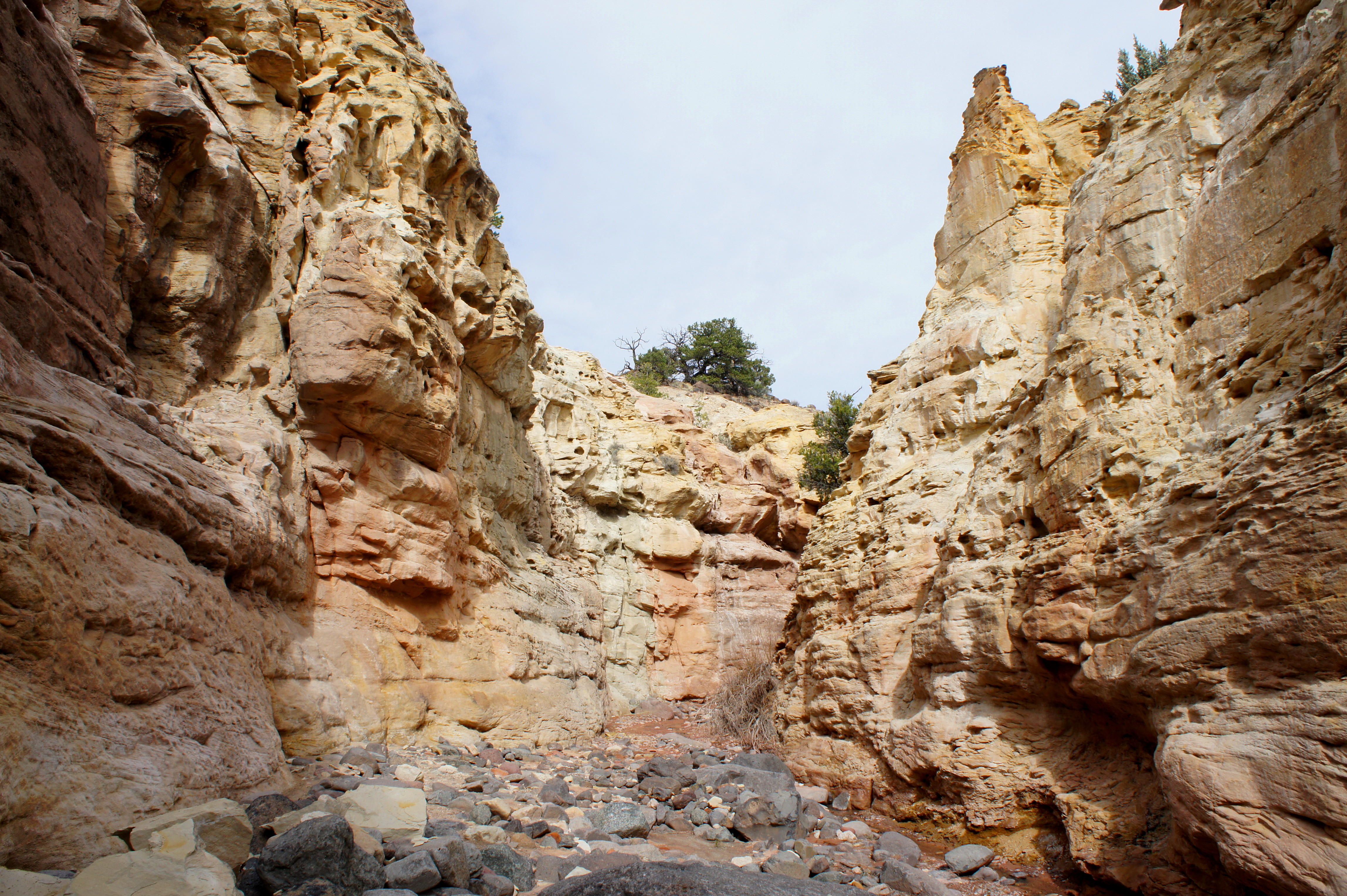
The narrows serve as a helpful landmark for the hike going forward. As the walls recede, it is less than one mile to the start of the steep approach to the passage into Spring Canyon known as the “W.” (A double prong in the Wingate sandstone appears ahead to the north, but this is not the W.) Exit the main Sulphur Creek drainage at the appearance of the first significant wash past the narrows on the right. The turnoff is located just before Sulphur Creek makes a 90-degree bend to the west. Up the side drainage to the east, pinkish-purple badlands (of the Monitor Butte member of the Chinle) serve as a marker that this is, indeed, the right spot.

While cairns may be intermittent at the base of the ascent, they are more frequently spotted as the route climbs the spine of a rocky ridge, affording views of the Sulphur Creek drainage from above. A final cairn is situated at the top of a relatively level shelf, where a metal survey marker from 1921 lurks just beyond. Here, as of this writing, the cairns temporarily disappear.
The absence of signs, cairns, or even footprints makes route-finding atop the flat bench quite demanding. Map and compass are essential.
After catching your breath from the steep climb, the intended route to the W edges east-northeast. It’s easy to get disoriented: a cursory glance at the landscape—a low pass, bounded on the north by Wingate cliffs—suggests, falsely, that the climbing is done and that Upper Spring lies just beyond. However, continuing east over a series of small hills reveals a longer line of Wingate crags to the north—the W is visible after passing the second promontory on the left.
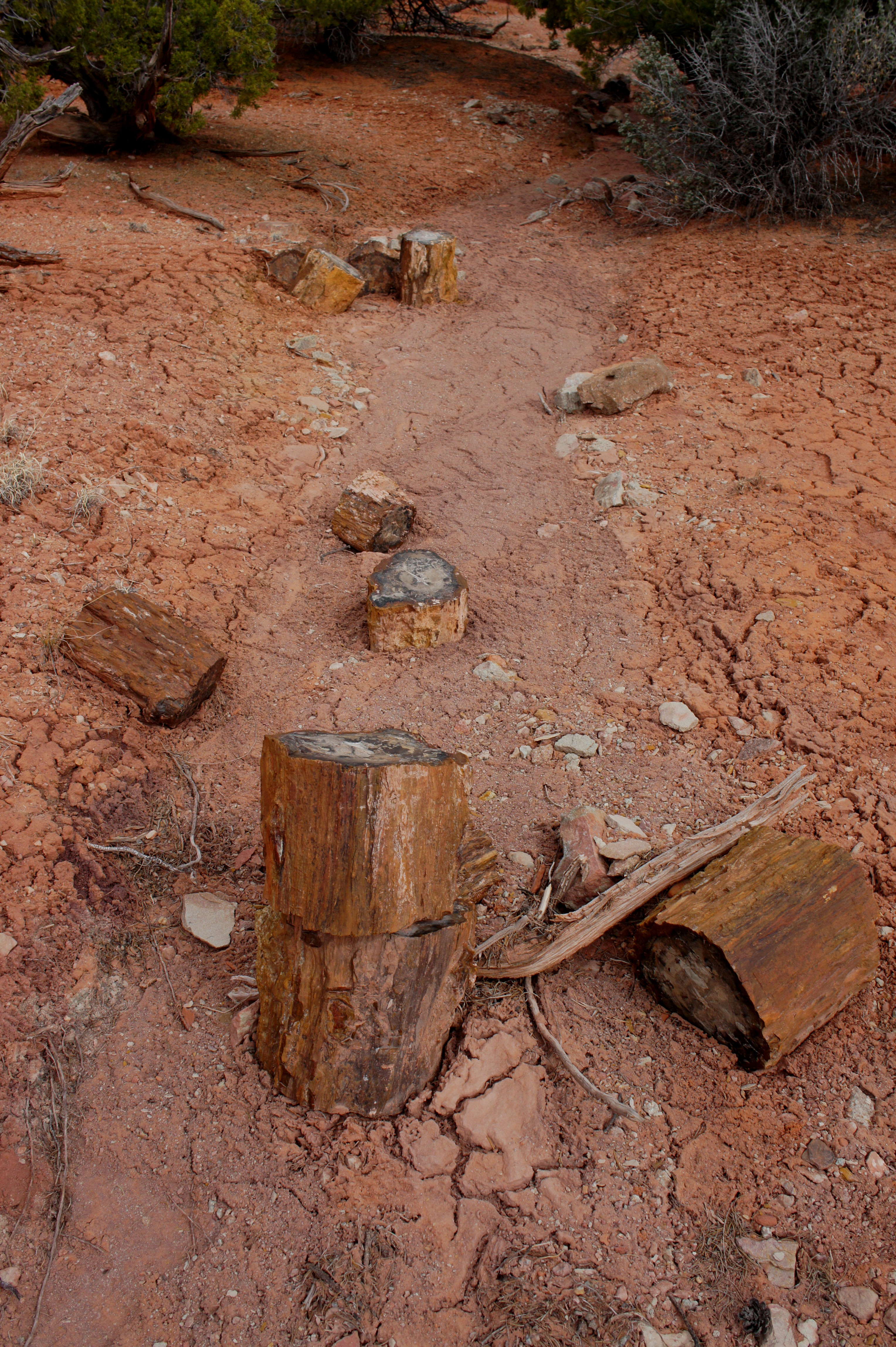
To get to this point, bear east across the gently-sloping bench, following existing hiker-made paths, if possible, to avoid fragile cryptobiotic soil. Do not expect an obvious, dominant path, however, for the first 200-300 yards. A decent marker is a collection of around a dozen stumps of petrified wood strewn across a wash bottom. From here, a faint path can be discerned heading east, climbing a low knoll. Once atop the hill, the trail becomes easier to follow, using small, hiker-made cairns as a guide.
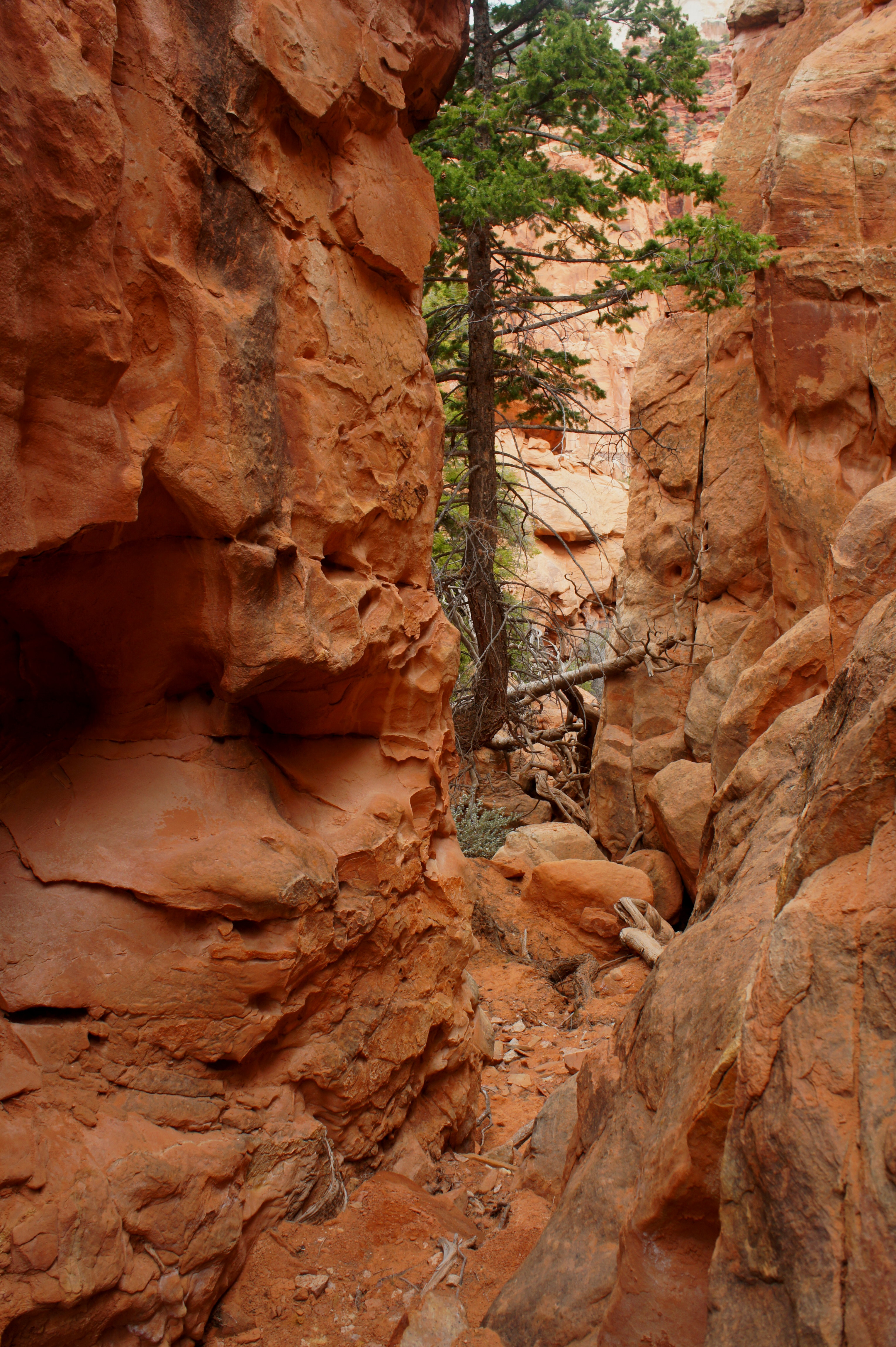
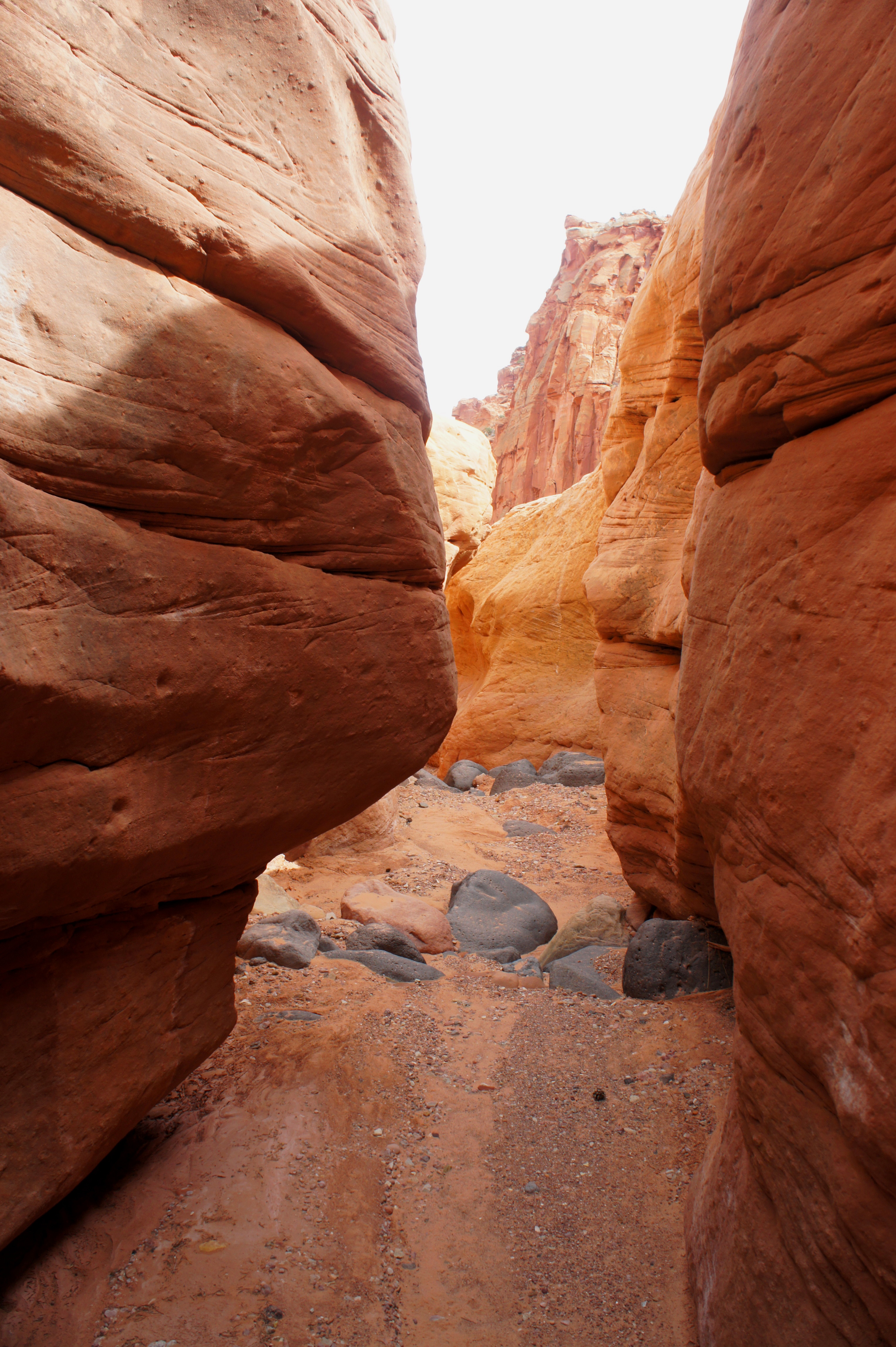
After passing the two Wingate protrusions on the left, the so-called “W” appears to the northeast. The pass is composed of two narrow notches in the canyon wall, separated by a chunk of Wingate. The lightly-cairned route drops into a wash bottom, then skirts its left flank to avoid boulders and dense brush. While the wider and more obvious choice appears to be to climb to the right notch, the correct path in fact edges to the left. Make your way up to the thin notch up ahead; a significant cairn has been placed at the top of the passage. Boulders, logs, and small dryfalls present minor obstacles.

The notch itself, the high point of the hike (roughly 7,700’), is shaded by four tall Douglas fir trees. “Doug firs,” as they are often called, can reach heights of more than 200 feet, making them the second-tallest species of conifer in the world (after redwoods). Stop for a snack or lunch under these evergreen giants, admiring the view back south, across Rabbit Valley to Boulder Mountain (11,317’), and north, to the tantalizing, slotted cliffs of Upper Spring Canyon. Expect to take approximately 2.5-3 hours to complete the 4-mile journey from the trailhead to the W.

South Fork of Spring Canyon
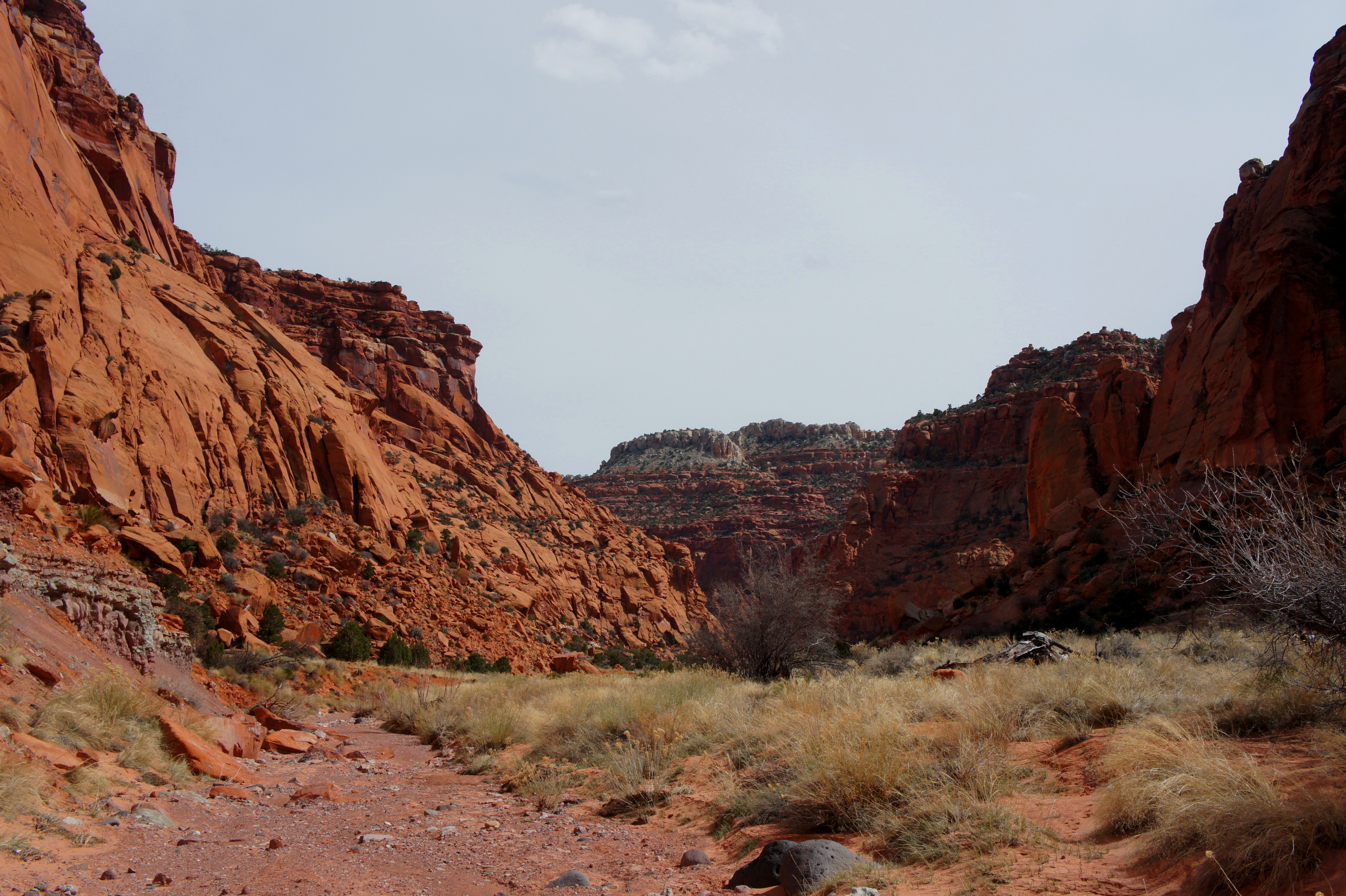
The descent from the W to Spring Canyon is as scenic as it is steep. Twisted junipers and fallen Douglas firs line the slender notch, and the Wingate walls are frequently speckled with tafoni, or “swiss-cheese rock.” Just beyond the narrowest point, hikers must negotiate a tumbled boulder, best bypassed by passing underneath. The side canyon thereafter opens up significantly, and a faint hiker-made path skirts the left flank of a brushy wash to avoid vegetation. After perhaps 10 minutes, the route meets the main drainage—the first steps in Upper Spring Canyon. This junction is likely to be marked with large cairns.
To be precise, this wide gulch is actually the South Fork of Spring Canyon—it will merge with the North Fork roughly 1.5 miles down-canyon to the east. While the gorge at this point is relatively broad, it is strewn with boulders, many of the igneous variety. Working your way east, it is possible to bypass a short, rocky section just downstream from the junction by traversing a sandy flat to the north. For overnighters, this would make for a fine campsite. Within 100 yards, however, one should descend the left bank back into the drainage.
Approximately ¾ mile of rock-hopping brings travelers to the first significant obstruction of the Spring Canyon—a 50-foot dryfall in the Shinarump, which here forms the canyon’s bedrock. The view down-canyon from the top of the pouroff is tremendous, but the obstacle must be bypassed by way of a steep path on the right-hand side. Once clear of the dryfall, the quickest descent back to the wash bottom involves a somewhat tricky climb down a small, boulder-strewn ravine. Hikers may want to lower their packs before attempting the 15-foot drop down a series of thin, exposed benches, and those with a fear of heights may choose to continue along the southern bank until finding a more amenable escape route to the valley below.

Downstream from the dryfall, average boulder size seems to increase dramatically. These grandiose stones pose minor obstacles that require concentration to descend. Another dryfall in the Shinarump, this one barely eight feet, is easily bypassed on the left.
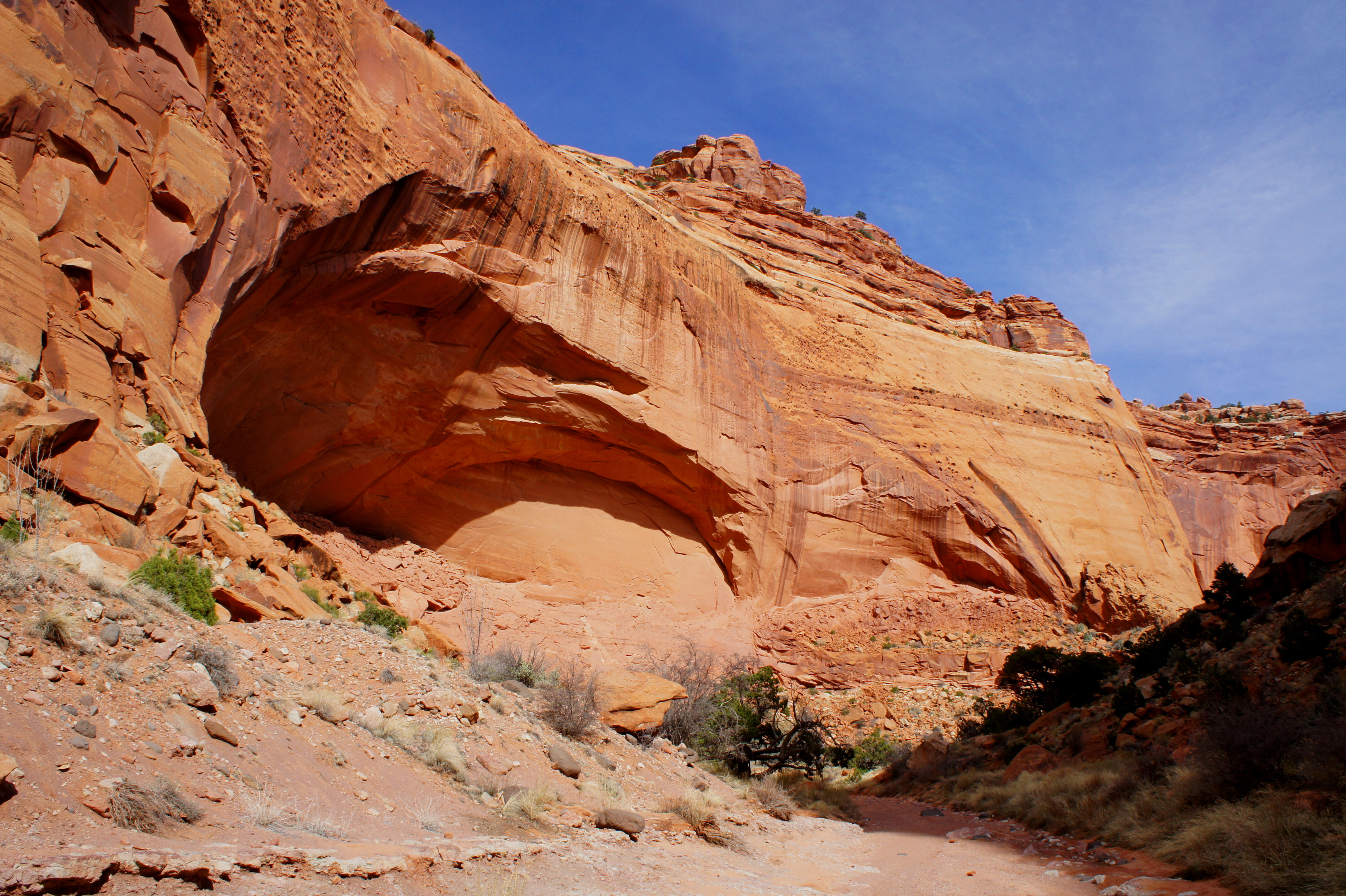
Just below the drop in the bedrock lies a steep hillside of green-gray bentonite clay on the right. For the next mile, the wash will cut through the hard, tan Shinarump and crumbly clay pastels of the Monitor Butte member of the Chinle. At times, the Shinarump walls will narrow to a scenic, shallow slot with minor downclimbs. The ragged slopes are pockmarked with tafoni, or solution pockets. Above, the ever-present Wingate sandstone walls rise to more than 600 feet.

Upper Spring Canyon to Chimney Rock Canyon
Almost two miles from the top of the W, a significant tributary enters from the left. This is the North Fork of Spring Canyon. The confluence of the two canyons, a good benchmark for measuring time and distances going forward, is reached after about six miles of hiking from Holt Draw. It is roughly 9-10 miles from here, down Spring Canyon, to the exit route via Chimney Rock Canyon.
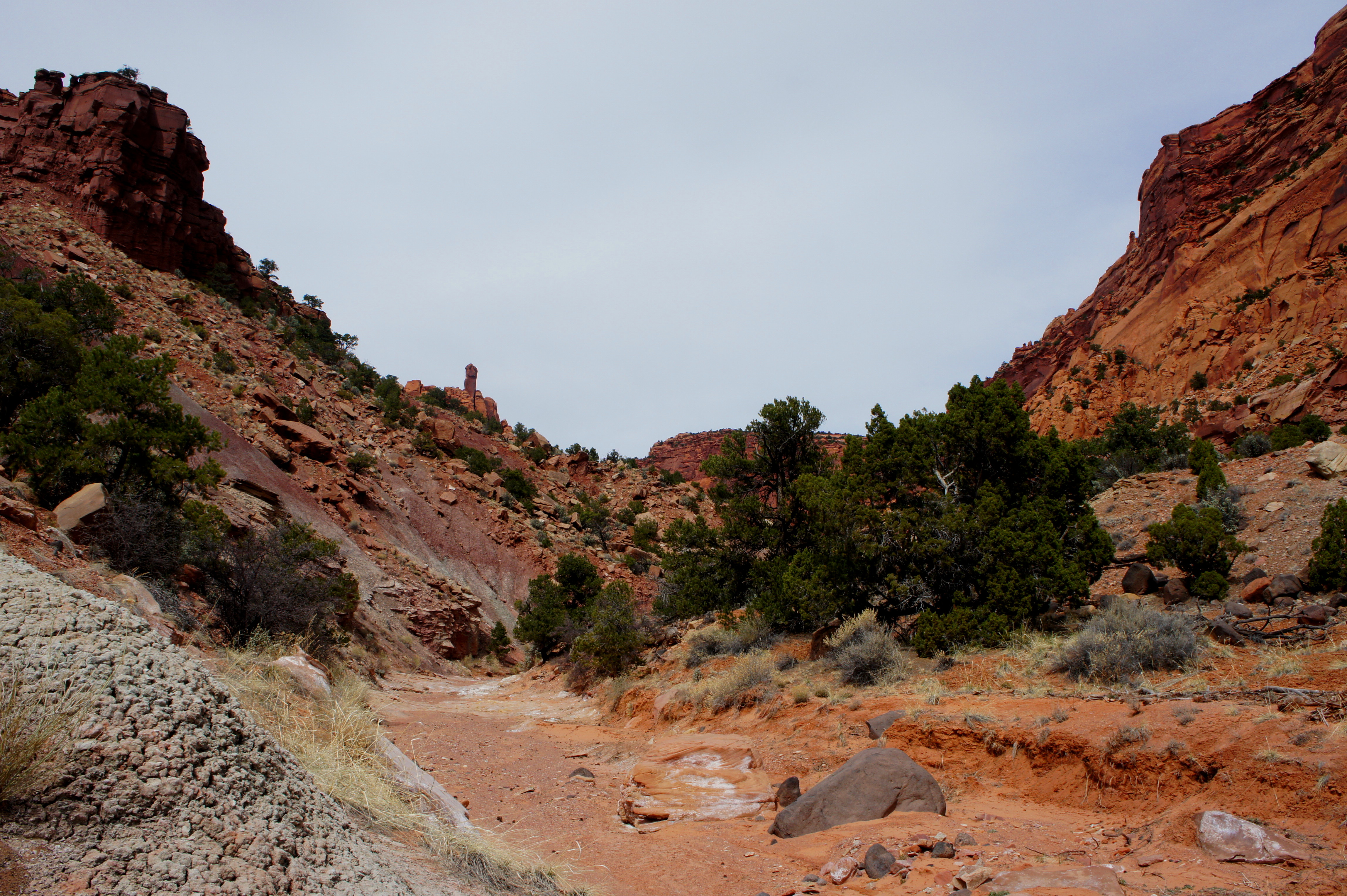
The hike down-canyon is straightforward and relatively free of boulders. The cliffs of Meeks Mesa rise up to 800 feet on the right, while equally impressive walls tower over Upper Spring Canyon on the left. Roughly 1.5 miles from the confluence, the wash cuts again through the Shinarump to form a minor slot. The short, twisting narrows can be passed through with relative ease. Five minutes downstream from the end of the slot, a minor drop-off can be avoided by descending a ledgey terrace on the left. Though there are no signs or fences to indicate the change, you have by this point finally entered Capitol Reef National Park.
A particularly beautiful section lies ahead, as the canyon narrows slightly and makes a sharp right-hand bend. Around the curve, the first prominent cottonwood tree appears on the right—six gnarly trunks extend diagonally like a multi-headed hydra. A purple hoodoo with a head of Shinarump rises opposite the cottonwood along the eastern bank.
The next meander to the left sports a sea of rabbitbrush, a shrub with tall, light green stems and flowers that shine yellow when in bloom. It is 5-10 minutes from here to the next landmark, namely the entrance of a box canyon with high, varnished walls on the right, which serves as the exit for a difficult canyoneering endeavor known as “Pandora’s Box.” This point is located 2.5-3 miles down-canyon from the confluence of the North and South Forks.

Within the next hour, the canyon will drop through one brief, boulder-strewn section that necessitates minor scrambling, and—after a short hiatus—noticeably picks up the pastel Chinle again. Violet-colored stair steps in the bedrock intermittently appear, a reminder that you are gradually losing elevation as your amble downstream (in fact, over the course of 9-10 miles, the canyon drops more than 1,000 feet between the confluence and the exit via Chimney Rock Canyon).
A couple miles east of Pandora’s Box, a sweeping alcove appears on the left, and three cottonwood trees line the bank. Within 15 minutes, a small tributary enters from the left, with additional cottonwoods dotting the junction. Thereafter, the canyon turns sharply to the southeast; the wall ahead is capped by two cream-colored fins of Navajo sandstone, the hike’s first view of this Jurassic-era rock layer. After a short distance, a prominent ravine enters on the right; the spectacular, south-facing wall ahead is spotted with hundreds of tafoni.

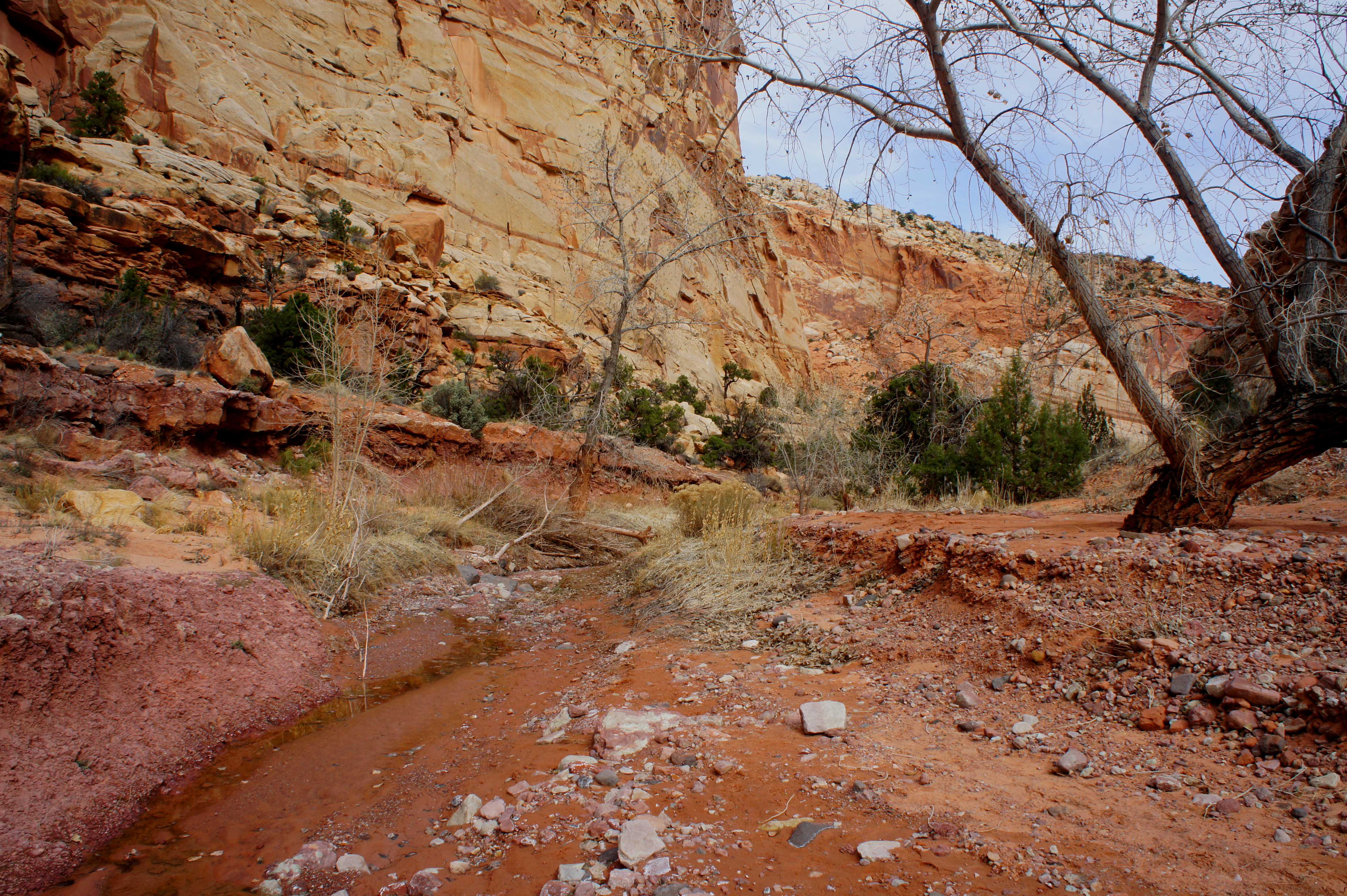
15 minutes down-canyon, past another short boulder choke, Upper Spring’s first flowing water may appear (depending on recent precipitation levels), but is likely too muddy to drink. A more reliable spring lies ahead, but this is not it.
With water appearing and disappearing intermittently, the wash passes under a second, larger alcove on the left, this one streaked with black desert varnish. 15 minutes later, a third, smaller undercut topped by a chiseled dryfall is passed on the left. It is 20-30 minutes from here to the much-anticipated spring, where the water levels pick up and the banks are lined with cottonwoods and spindly reed grasses.
The distance from the spring to the Chimney Rock junction is approximately 1.5 miles. About 1/3 of the way, the main drainage bends south, and a significant side canyon enters from the left. (This boulder-strewn gully is visible from the end of the nearby Navajo Knobs hike.) By now, in all likelihood, the water source has dissipated, but the riparian vegetation—cottonwoods, willows, tall grasses—has not. A particularly dense stand of cottonwood trees lines the sandy wash below a neatly varnished wall. This is another ideal spot to set up a campsite for the night.

Within 1/2 mile of this point, look for a sandy single-track trail bearing off to the right just as a large canyon of comparable size enters from the west. This is the junction with Chimney Rock Canyon, marked with a faded wooden sign. To the left is Lower Spring Canyon; to the right is the exit route to Chimney Rock and Highway 24.

Chimney Rock Canyon to Highway 24
Chimney Rock Canyon—with high, varnished walls and prominent Wingate promontories—is arguably as scintillating as Spring Canyon itself. (For a fuller description of Chimney Rock Canyon, see my Lower Spring Canyon trail description.) By now, however, especially if completing Upper Spring as a day hike, hikers are likely to be quite tired. The relatively level tread of the canyon is welcome.

After passing the third of three prominent side drainages on the right (roughly 1.25 miles from the junction), a well-worn trail ascends a minor ravine to the Chimney Rock Trail, a popular loop hike in Capitol Reef. (For a full trail description of this hike, see here.) Turn right at the signed trail fork, following a relatively uninteresting, 0.9-mile section of the Chimney Rock hike up to a low saddle in the Chinle. At the second signed junction, turn right. The trail here immediately begins to switchback down a steep slope, dropping 300 feet to a relatively level basin. From the bottom of the hill, it is an easy quarter-mile along a well-maintained trail to the Chimney Rock Trailhead, where a vehicle (hopefully) awaits.
Allot at least 8-9 hours for the shuttle hike, building in plenty of extra time for the near-inevitability of getting lost. Hiking in the winter demands an early morning start, as the hours of sunlight are fleeting. All but the most experienced hikers will probably want to break up the 18-mile trek through Upper Spring Canyon as a 2-3 day overnight. This also allows for more time to explore the scenic and remote area.

Pingback: Lower Muley Twist Canyon – Upper Section (Capitol Reef National Park, UT) | Live and Let Hike
Pingback: Sulphur Creek (Capitol Reef National Park, UT) | Live and Let Hike
Pingback: Top 10 Hikes in Capitol Reef National Park’s “Backcountry” | Live and Let Hike
Hi Andrew – great writeup. Do you know whether there is an entry route to this hike further to the east of Holt Draw TH? I’d like to do part of Upper Spring Canyon followed by Lower Spring Canyon, but I am not sure I’ll have time to complete the entirety of the former as described in your report above. Thanks!
Hi Michael – thanks for the question. Unfortunately that’s no realistic cutoff route (without rappelling equipment) between Holt Draw and Chimney Rock THs. But if you start at Chimney Rock Trailhead you can be at the east end of Upper Spring within an hour or so and you could explore upstream a bit before proceeding down Lower Spring Canyon. To be honest, I don’t think there is much to see in Upper Spring that Lower Spring doesn’t have (e.g., alcoves, high walls, towering spires, etc,), so just a trip down Lower Spring may whet your appetite!
Thanks, Andrew – that’s quite helpful. I may do as you suggest and take a quick detour into Upper Spring before continuing through Lower Spring. Glad to see you’ve been getting out to Henry Coe in recent posts. Perfect time to be hiking out there right now!
This is an incredibly helpful write up! Do you know of any services that can provide a shuttle from Chimney Rock to Holt Draw?
I don’t, unfortunately, but hitching a ride is relatively easy if you’re willing to do so. You could also ask around town in Torrey or at the Visitor Center.
Andrew, thanks for this detailed writeup. My group is considering this hike in a few weeks and this will be a huge help. Understanding that it changes from year to year, what is your experience with water availability?
Hi Chad, good question. I remember the first water appearing about 14 miles in (just before the jct with Chimney Rock Canyon). I’m not sure how reliable it is, however. Perhaps because it is spring-fed it is less vulnerable to drought conditions, but I suspect it may be at low levels. In short, I might not count on it being there for an overnight trip? You might consider calling the Visitor Center for the latest conditions.
Is it possible to reach Spring Canyon from the Chimney Rock parking lot/trail withOUT climbing up the Chimney Rock switchbacks? Can one just head left and skirt “the hill” when the trail starts up into its switchbacks? Thanks!