
Spring Canyon—a popular overnight destination in Capitol Reef National Park—is often considered in two separate parts: a lengthy upper canyon that begins outside the park’s western boundary and a roughly 7-mile lower portion. Chimney Rock Canyon, accessed by way of the well-maintained Chimney Rock Trail, provides the most popular access to both sections. At 9.9 miles end-to-end (including a 3-mile approach), Lower Spring Canyon can be hiked in a long day—that is, if you have a car waiting for you on the far end (or hitch a ride back to Chimney Rock). The deep, winding gorge joins the Fremont River Canyon at the end of the hike. There is no bridge over the Fremont River, requiring hikers to carefully ford the fast-flowing stream.

The hike
This hike begins and ends at Highway 24, though the trailheads are seven miles apart. Lower Spring Canyon is best enjoyed as a shuttle hike—necessitating hitching a ride or dropping a vehicle at both ends. Most start at the Chimney Rock Trailhead, located three miles west of the Capitol Reef Visitor Center, and finish at the parking area at mile marker 83 in the Fremont River Canyon. This west-to-east route enjoys a slight downhill slope and saves the river ford for last, minimizing the time spent with wet boots.
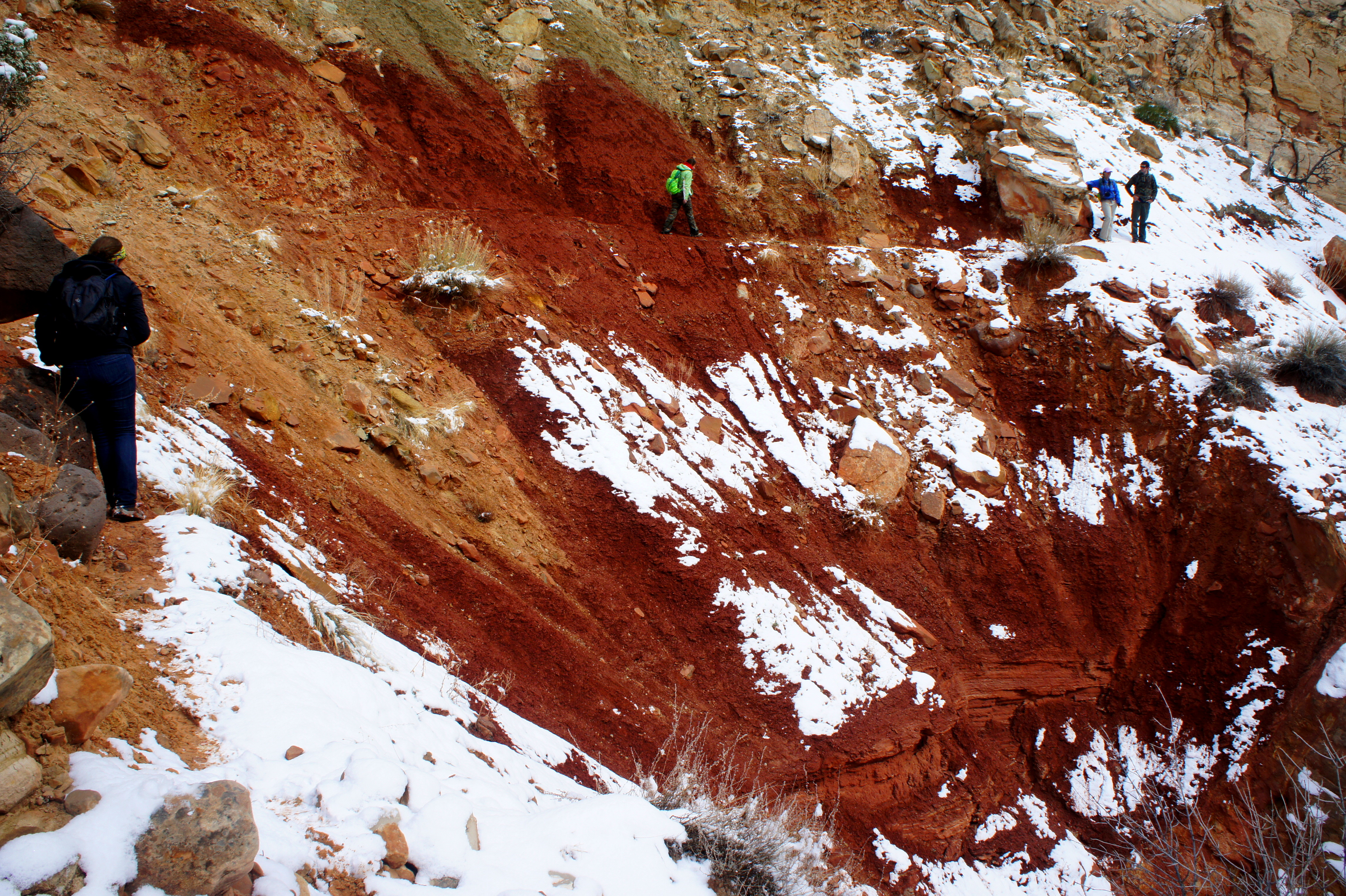
It is approximately three miles from the Chimney Rock parking lot to Spring Canyon proper, though there is plenty to see on the way. The first ¼ mile of the Chimney Rock Trail (see here for a full description of this loop hike) traverses gently sloping hills in the deep red Moenkopi formation and affords excellent views of the hike’s namesake, an impressive spire to the right. As the trail enters the tan-colored Shinarump Member of the Chinle formation, it begins to climb sharply up a clay slope. Here you are climbing to a top of a fault, where the horizontal layer of the gray-green Chinle drops 150 feet. To the north and west, the landscape is dominated by red-orange cliffs of Wingate sandstone.
At ½ mile, bear left at a trail junction, following signs for “Spring Canyon.” For nearly a mile, the trail dips in and out of a minor drainage to a second fork—again bear left, dropping into Chimney Rock Canyon. With the exception of the short approach, the route from here simply follows the wash bottom to Spring Canyon.
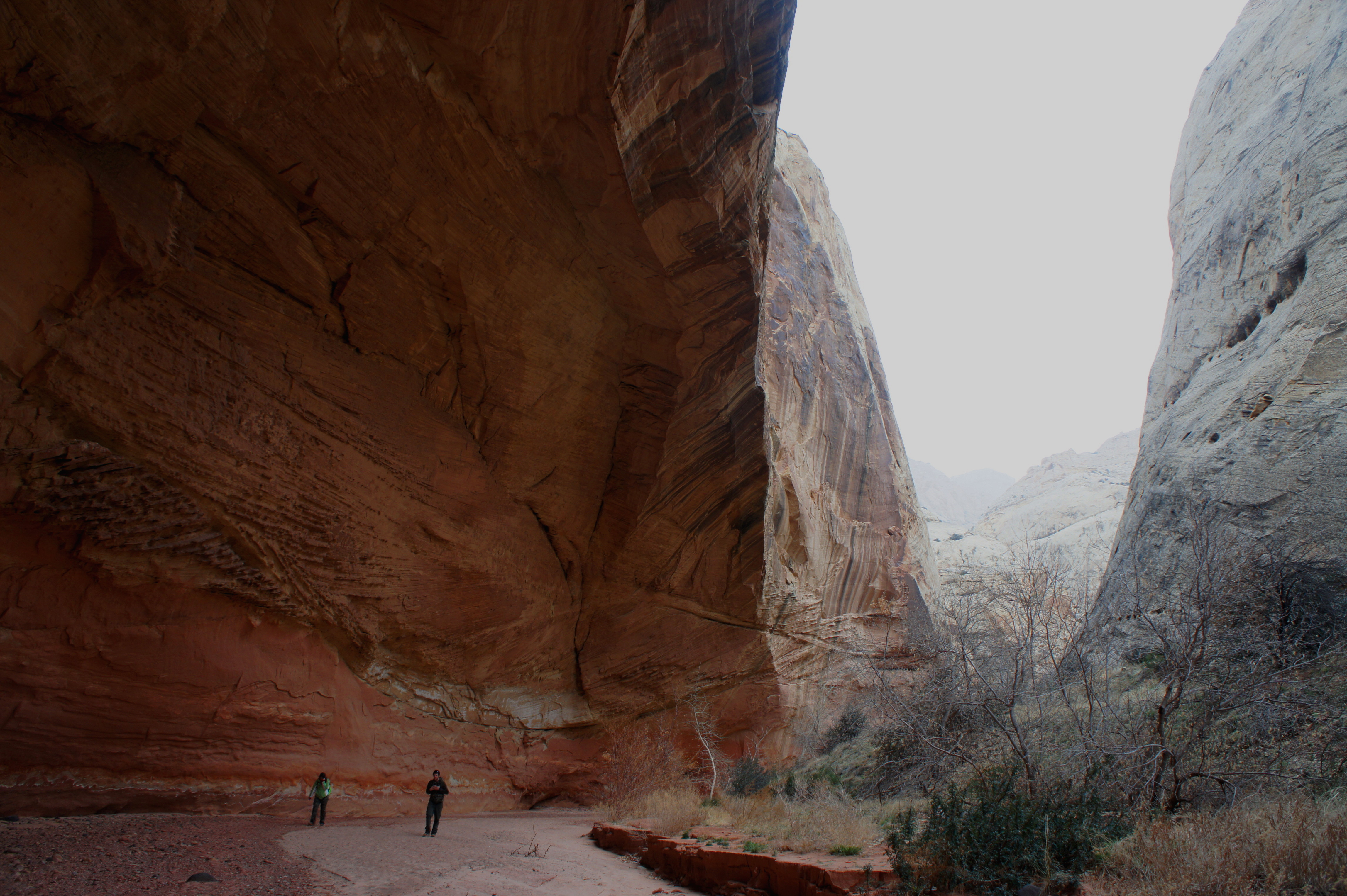
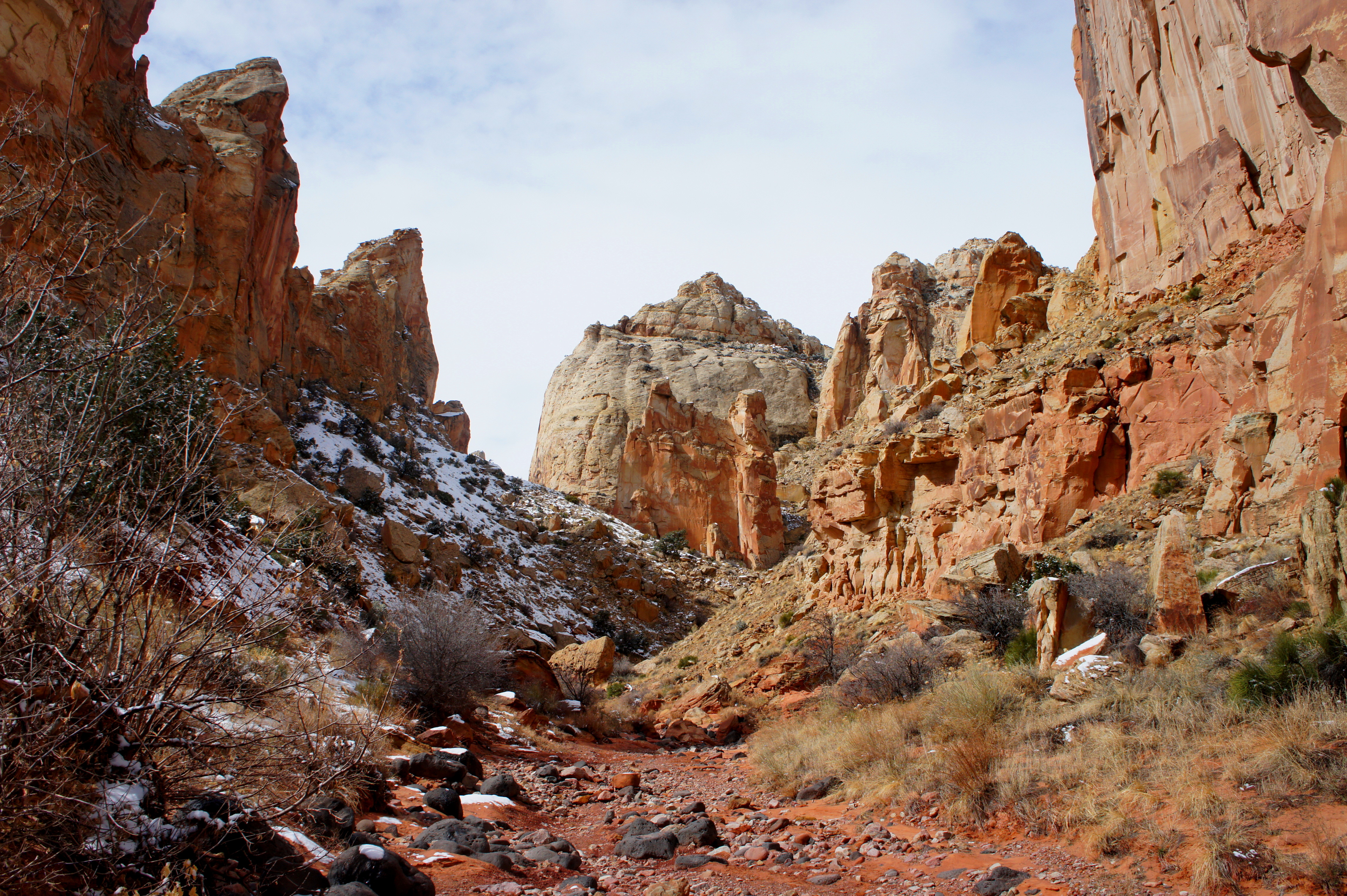
Chimney Rock Canyon is impressive in its own right, boasting sweeping Wingate cliffs, mammoth boulders, and abundant examples of honeycomb weathering (a.k.a. “swiss cheese rock”). As you continue deeper into the canyon, several vertical walls approaching 400 feet high are neatly decorated with desert varnish.
Over the course of roughly 1 ½ miles in Chimney Rock Canyon, three significant side canyons enter from the left. The first—even wider than the main drainage—emerges just a few minutes from the start of Chimney Rock Canyon. The second and third, also quite large, are spotted on the left farther down-canyon.
Roughly three miles from the trailhead, Chimney Rock Canyon intersects with Spring Canyon. There is a small wooden sign at the mouth of Chimney Rock. Head right (down-canyon) to begin the lengthy stroll down Lower Spring.
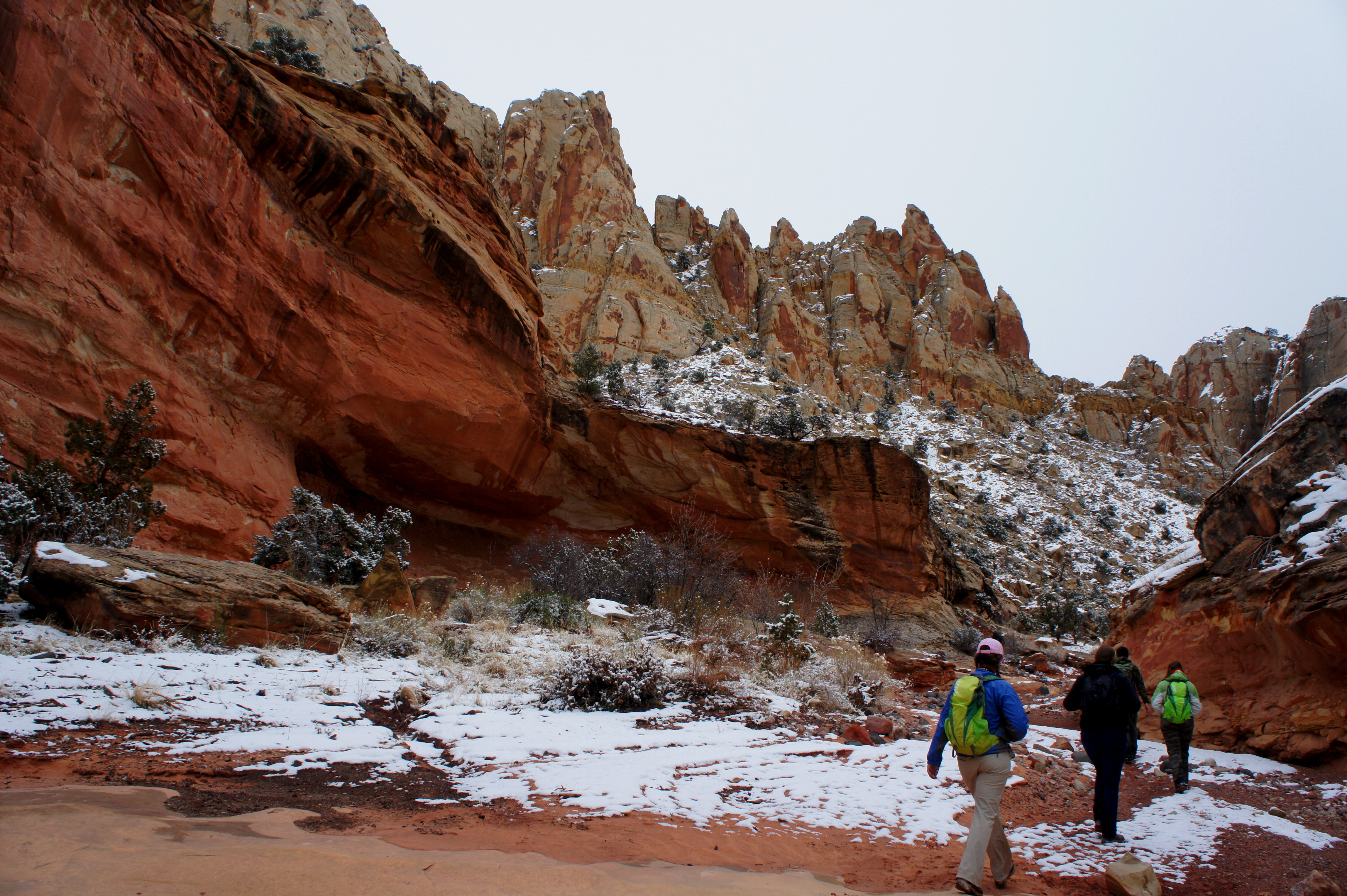
After a few minutes’ walk, the sweeping Wingate walls flirt with the shelves and ledges of the Kayenta formation. Though hiking downhill, you are working your way up the rock strata, from early to middle Jurassic formations. This is due to the unusual tilt of the Waterpocket Fold, the 100-mile long wrinkle in the earth that is Capitol Reef’s defining geological feature.

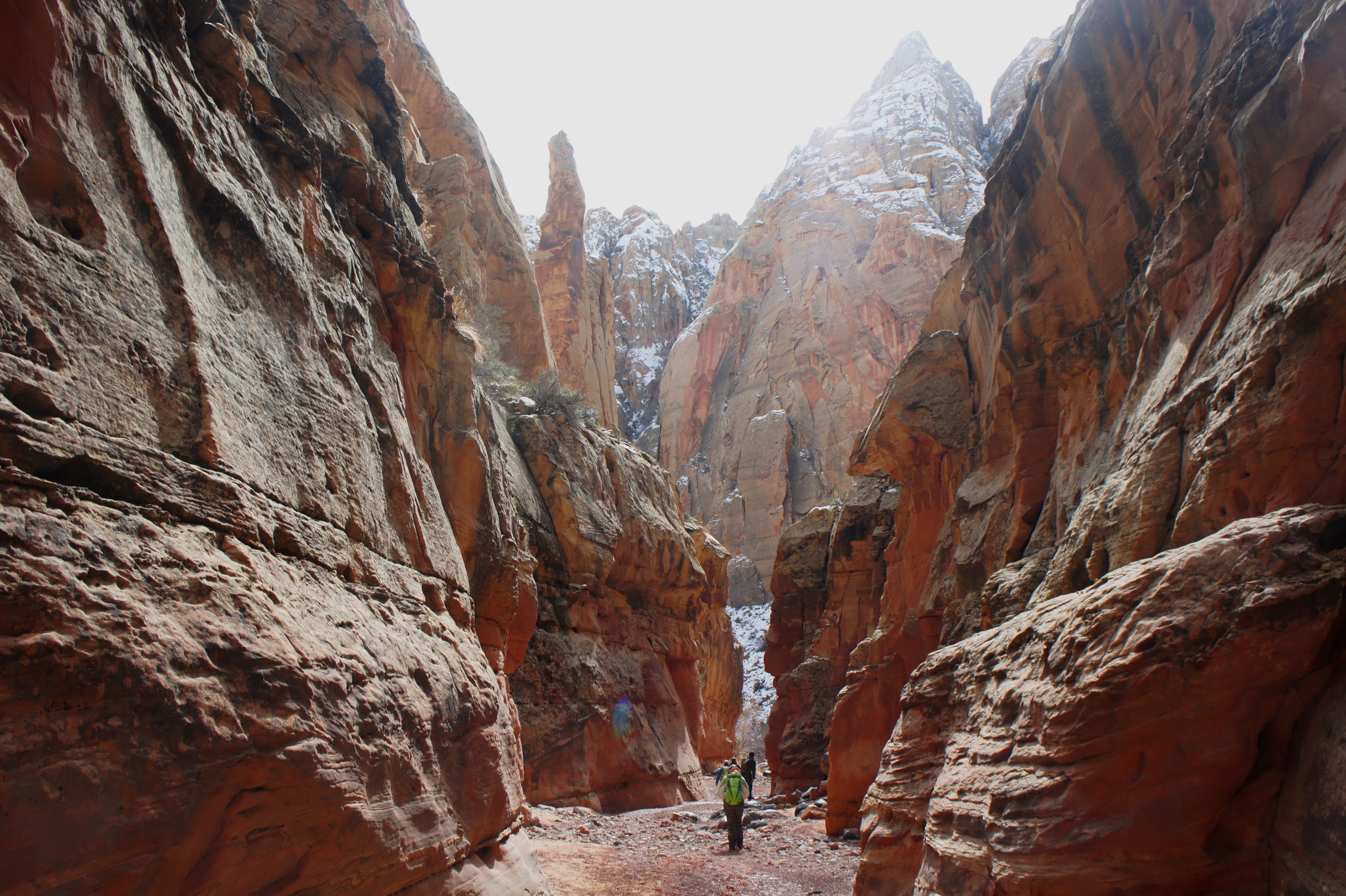
The canyon gradually narrows, with occasional boulder chokes. About 1-1 ½ miles from the Chimney Rock Canyon junction, the canyon bottom thins to a narrow, sinuous slot. The slot can be explored for maybe 50-75 yards before it drops over an impassable pour-off into a muddy pool. Continuing down-canyon requires backtracking to a bypass on the north flank.


A faint social trail winds around a left-turning bend before edging two relatively exposed slopes that may give pause to the faint-of-heart. Hikers of all experience levels will want to go slow through these sections to ensure secure footing.
Down in the canyon, the slot gives way to slightly wider narrows, which can be explored upstream once the bypass trail returns to the wash bottom.
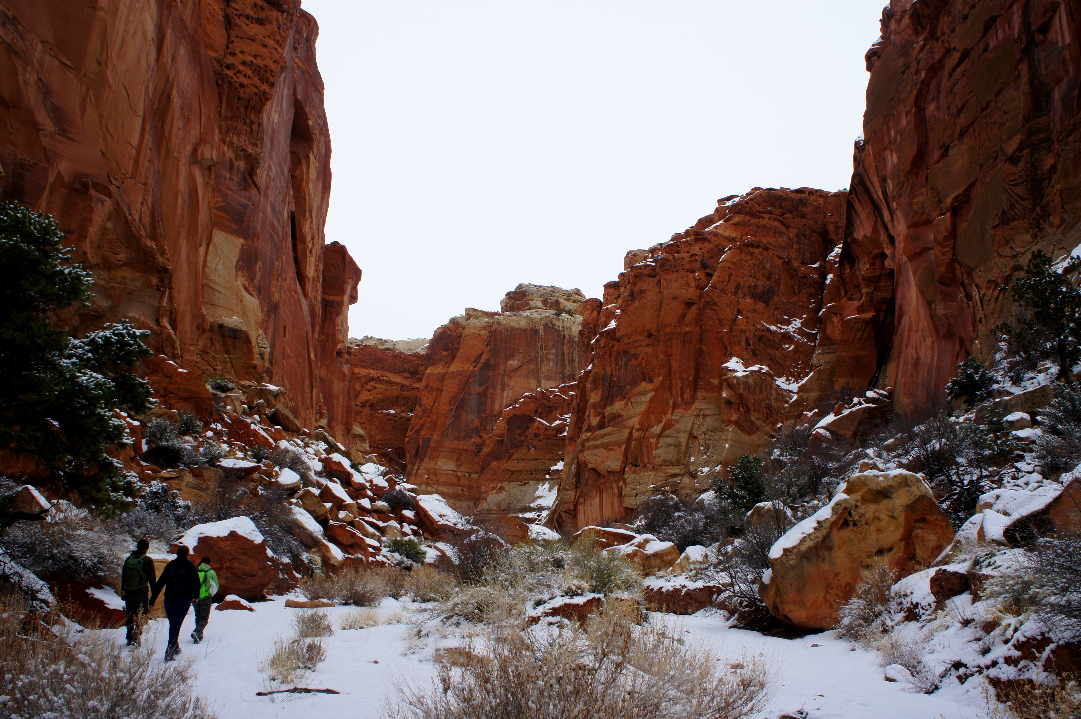
Ahead, the Kayenta formation begins to disappear, replaced by towering domes of cream-to-tan Navajo sandstone. Occasional monolithic spires offer additional flavor to the scenery.
Perhaps 1 ½-2 miles from the slot, the wash rounds a narrow, right-angle curve. With nearly 500-foot vertical walls on either side, this is arguably the most impressive section of the entire hike. Just beyond, a lofty pinnacle of impressive height reveals itself. Within 30 minutes of this spot, look for a rather large arch high up in the cliffs on the left side.

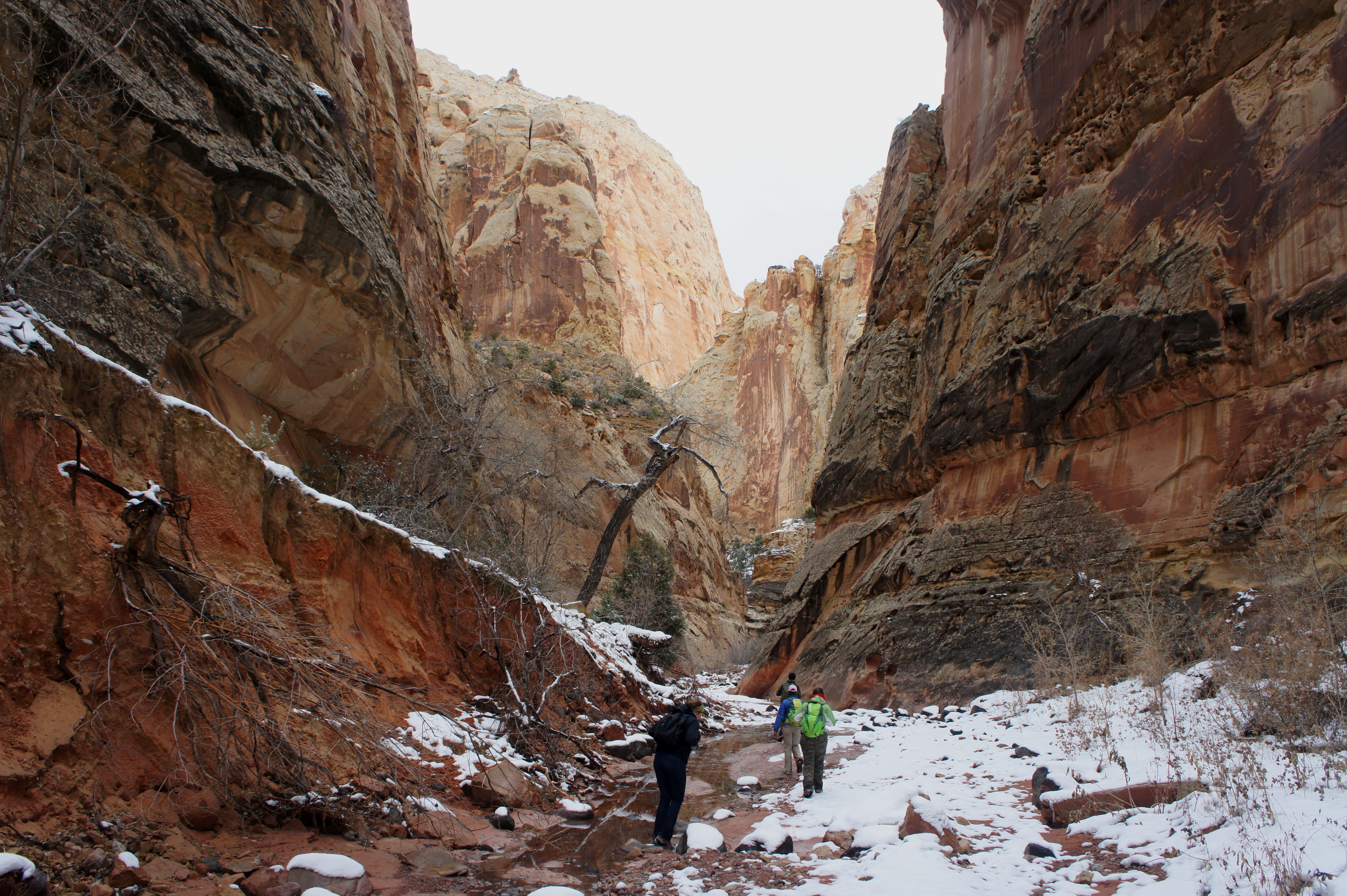
It is perhaps another half hour to the first grove of cottonwood trees, which grace a now rather broad wash relatively free of boulders and other obstacles. The sight of cottonwoods also indicates the presence of water. Down-canyon, seeps and springs feed a stream that persists except in the driest of circumstances. (In early March 2015, it was possible to follow standing or gently-flowing water for about a mile before it petered out.)
In this section, Spring Canyon alternates between expansive bends and relatively narrow passages. Woody vegetation—cottonwoods, pinyon pines, junipers, and Gambel oaks—becomes increasingly conspicuous.
By now, multiple hours into the hike, it’s natural to wonder when the canyon will ever come to an end. Yet bend after bend reveals more and more, with the scenery never abating—though visitor patience might. Around nine miles from the start, an extraordinary alcove of colossal size indicates that the end is relatively near. Within a half mile, the high canyon walls finally recede and hikers soon enter a dense thicket of riparian grasses and trees. The abundant plant life suggests that the Fremont River is within reach.


The small creek exiting Spring Canyon intersects with the Fremont River at a point less than 1/10 mile from Highway 24. However, the presence of a high, muddy berm on the opposite bank can make finding a generous spot to cross the river somewhat difficult. One popular option is to edge your way upstream—against a moderately potent current—to a spot where the earthen wall on the south embankment eases. Water will often be knee- to thigh-deep (during or just after floods, it can even be impassable).
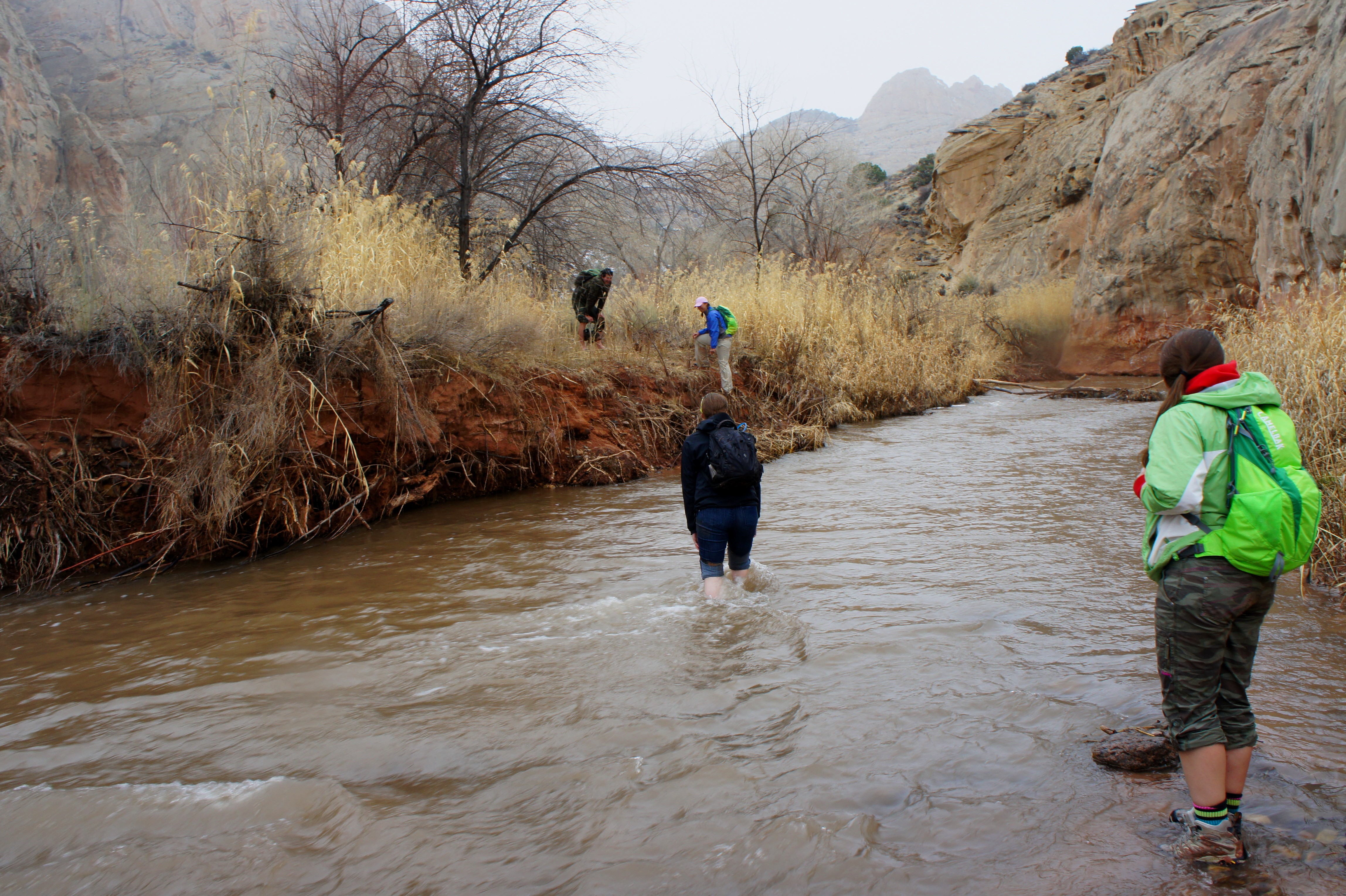
With the river crossing mastered, it’s a short jaunt to milepost 83, where hopefully your vehicle (and dry socks and shoes) is awaiting your arrival.

Pingback: Upper Spring Canyon (Capitol Reef National Park, UT) | Live and Let Hike
Pingback: Sulphur Creek (Capitol Reef National Park, UT) | Live and Let Hike
Pingback: Top 10 Hikes in Capitol Reef National Park’s “Backcountry” | Live and Let Hike
Hi Andrew,
I am visiting Capitol Reef this weekend and have time for one backpack. Would you recommend lower spring canyon as an out and back, or the lower muley twist with hamburger rock spur trial? thanks!
Hey Jared, I would recommend Lower Muley Twist for sure: https://liveandlethike.com/2015/03/30/lower-muley-twist-canyon-and-hamburger-rocks-capitol-reef-national-park-ut/. One of the best in Utah!
Thanks for the quick reply! I was actually able to swing an extra day off. So am now considering Hall creek narrows (22 mile route) or the Lower muley twist (25 mile) starting at burr trail and including hamburger rock spur. Water availability is a main concern as we will be spending 2 nights in either locale. Whichever backpack you would choose if you only had time for one. Thanks again man, love your page!
Both are great options. Halls Creek Narrows is my favorite but harder to access. If you have a 4WD vehicle, I would suggest Halls Creek. Double check whether Capitol Reef is giving out backcountry permits, however.
Is it possible to reach Spring Canyon from the Chimney Rock parking lot/trail withOUT climbing up the Chimney Rock switchbacks? Can one just head left and skirt “the hill” when the trail starts up into its switchbacks? Thanks!