
The circuitous hike through Capitol Reef National Park’s Lower Muley Twist Canyon extends for close to 12 miles from the Burr Trail Road to its southern mouth at the Halls Creek drainage. Highlights along the backcountry route include 1,000-foot cliffs and countless, varnished alcoves of immeasurable length. A short detour to Hamburger Rocks—a collection of peculiar, plump hoodoos—and a gut-wrenching traverse of the steep Post Cut-Off add additional adventure. The first four miles of Lower Muley Twist are described in a previous blog post found here. The following description covers a 15-mile loop hike—plus the 2-mile out-and-back to Hamburger Rocks—that starts and ends at the Post Corral. This section comprises arguably Lower Muley’s most spectacular spectacles.
(Note: Though feasible as a long and exhausting day hike, the 17-mile hike described is best enjoyed as a 2-3 day backpack.)


The hike
Visitors to Lower Muley Twist Canyon may choose from a number of hiking options. The first is to start at the trailhead on the Burr Trail Road, just atop the switchbacks, and hike down-canyon, including the upper, 4-mile section and the lower, 8-mile stretch. With a second vehicle at The Post, hikers can complete a 17-mile point-to-point (or 19, with the Hamburger Rocks spur). With just one car, the full stem-and-loop—including five miles in sandy Grand Gulch and the 2-mile Post Cut-off traverse—amounts to roughly 23 miles. Of course, day hikers can complete parts of the hike in smaller tranches.
The below describes a 15-mile loop starting from the Post, with a 2-mile out-and-back to Hamburger Rocks, forgoing the 4-mile upper canyon jaunt. To avoid a steep climb over the cutoff, hike in a clockwise direction—south down Grand Gulch, then up Lower Muley, leaving the Post Cut-off for last. (Those uncomfortable with downclimbing friction slopes, however, might consider heading up the Post Cut-off first and doing the circuit counterclockwise.)
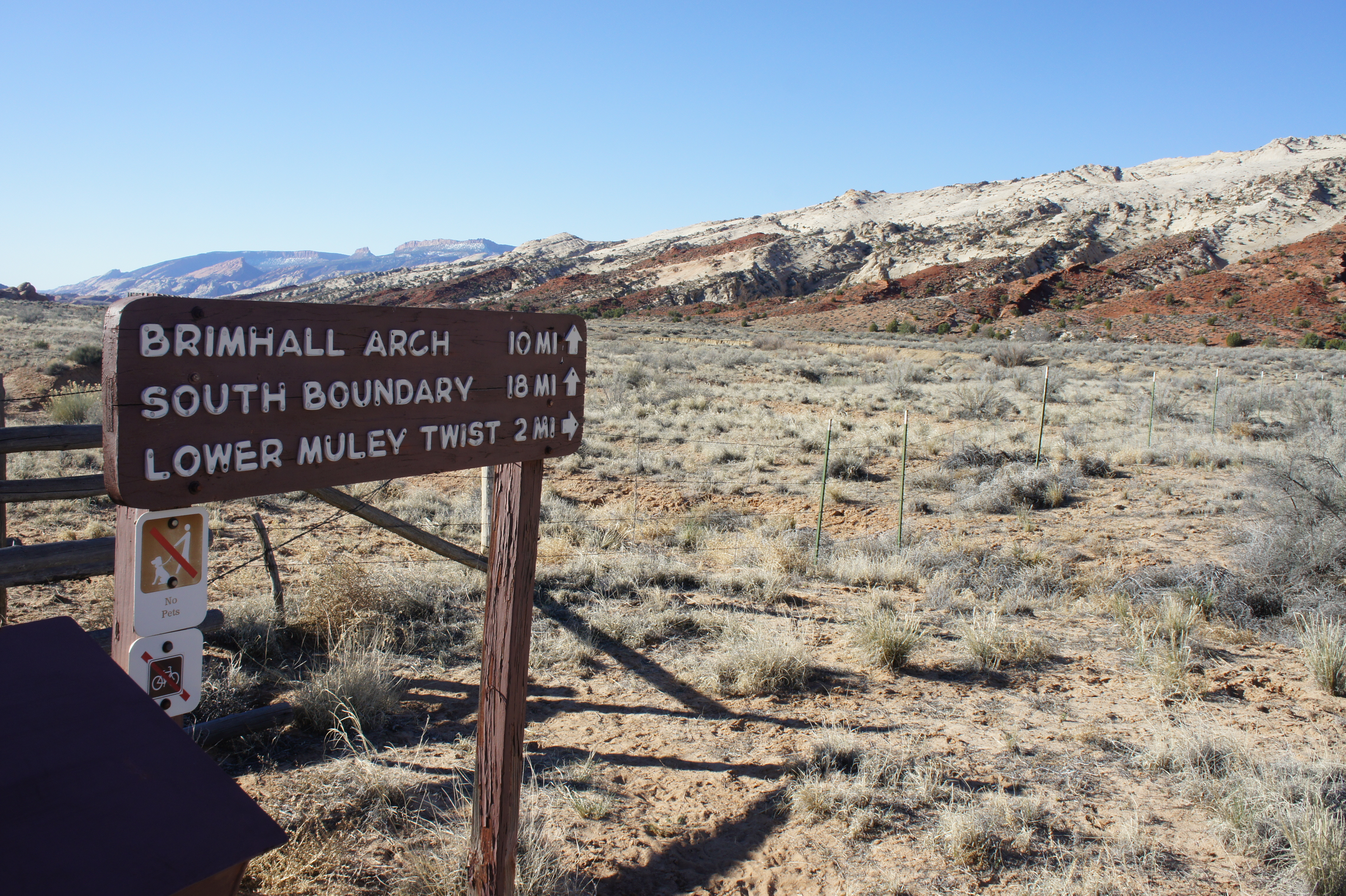
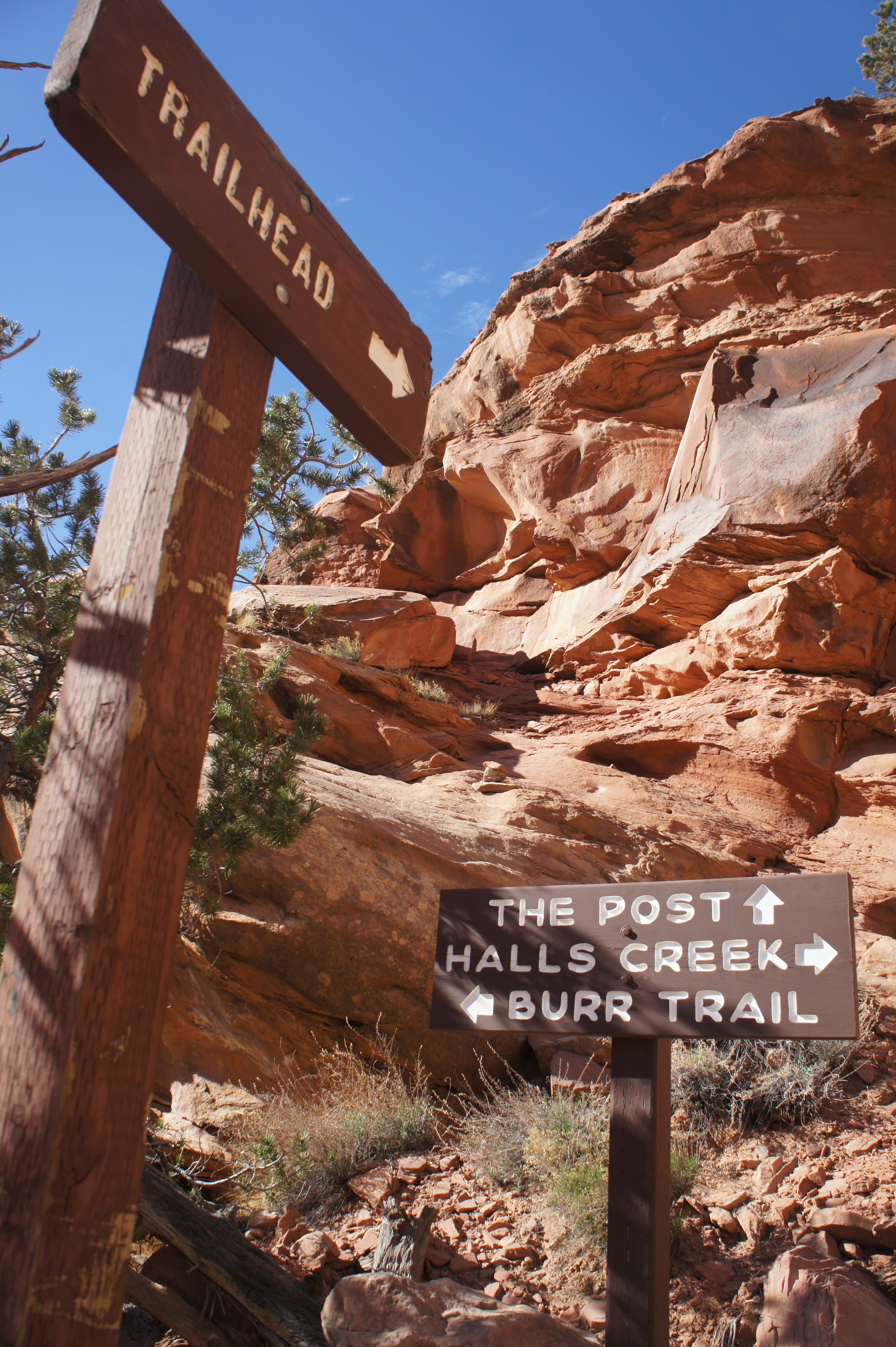
Either way, the hike described begins and ends at the Post Corral, site of an old staging ground for horses and now a popular trailhead. To reach the Post from the Capitol Reef Visitor Center (where overnighters will be required to pick up a free permit), drive nine miles east on Highway 24 to the park boundary and turn right on the Notom-Bullfrog Road. Follow this road, unpaved after the first 10 miles, south for approximately 35 miles, passing the Burr Trail junction on your right. Bear right onto the ½-mile spur road to the Post Corral, signed as “Lower Muley Twist Trailhead.” The drive from the Visitor Center should take 1-1 ½ hours. (Note: In dry conditions, the Notom-Bullfrog Road should be passable to passenger vehicles. Recent precipitation or floods, however, may make this drive impassable. Also note that a sharp, rutted dip on the Post spur road may cause trouble for low-clearance vehicles. Pass with care.)
Grand Gulch to Lower Muley Twist Canyon
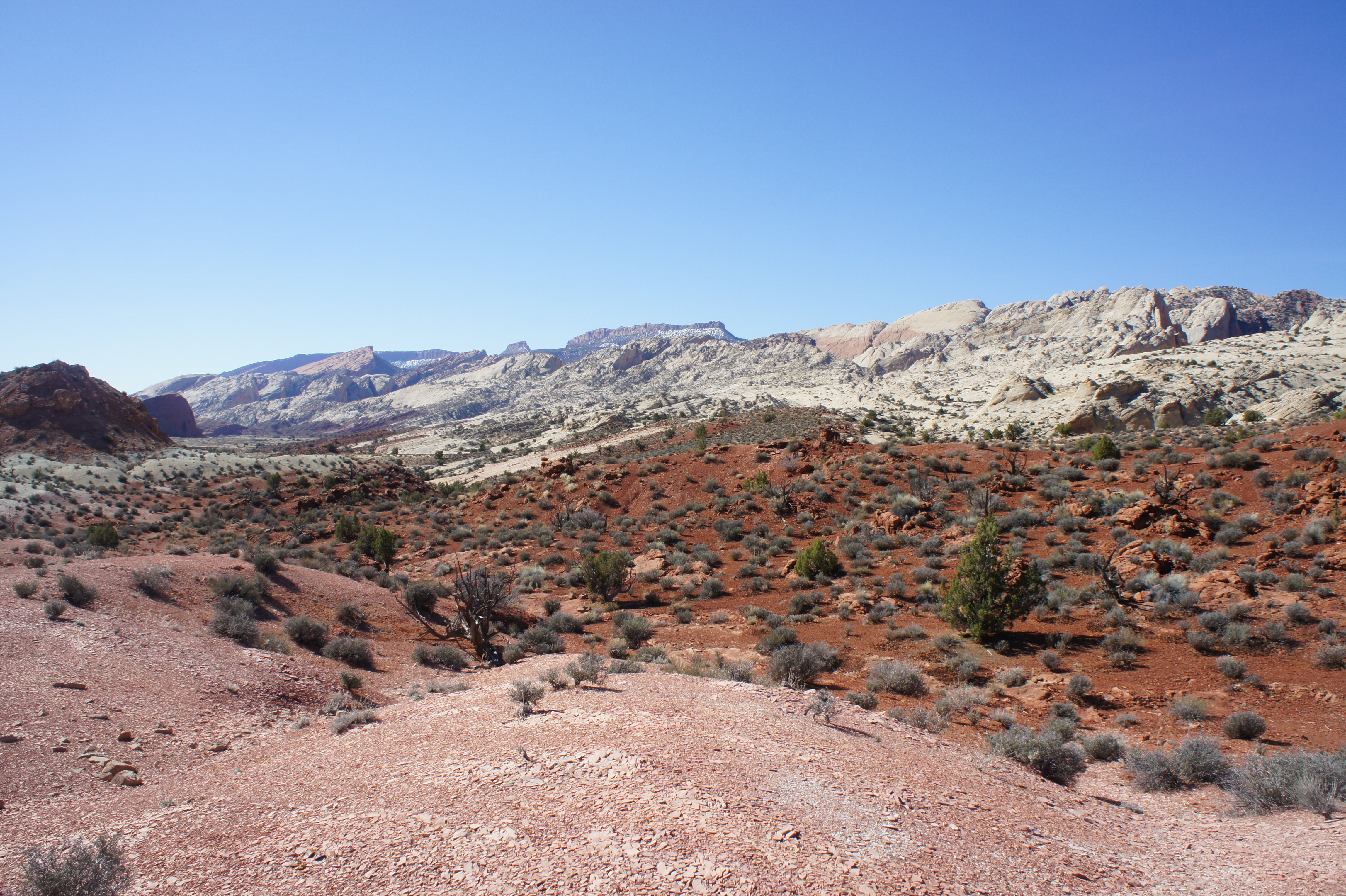
Two routes begin at the edge of a fence line a short walk south of the Post Corral. To the east, white blazes indicate a path across the barren sagebrush flat to the Post Cut-off. To the south, a foot/horse trail extends down Grand Gulch, the name given to the wide valley in this area that separates the Waterpocket Fold from a sequence of shale mesas and clay badlands to the east. A trail register and orientation sign guard the thin entrance through the wire gate.
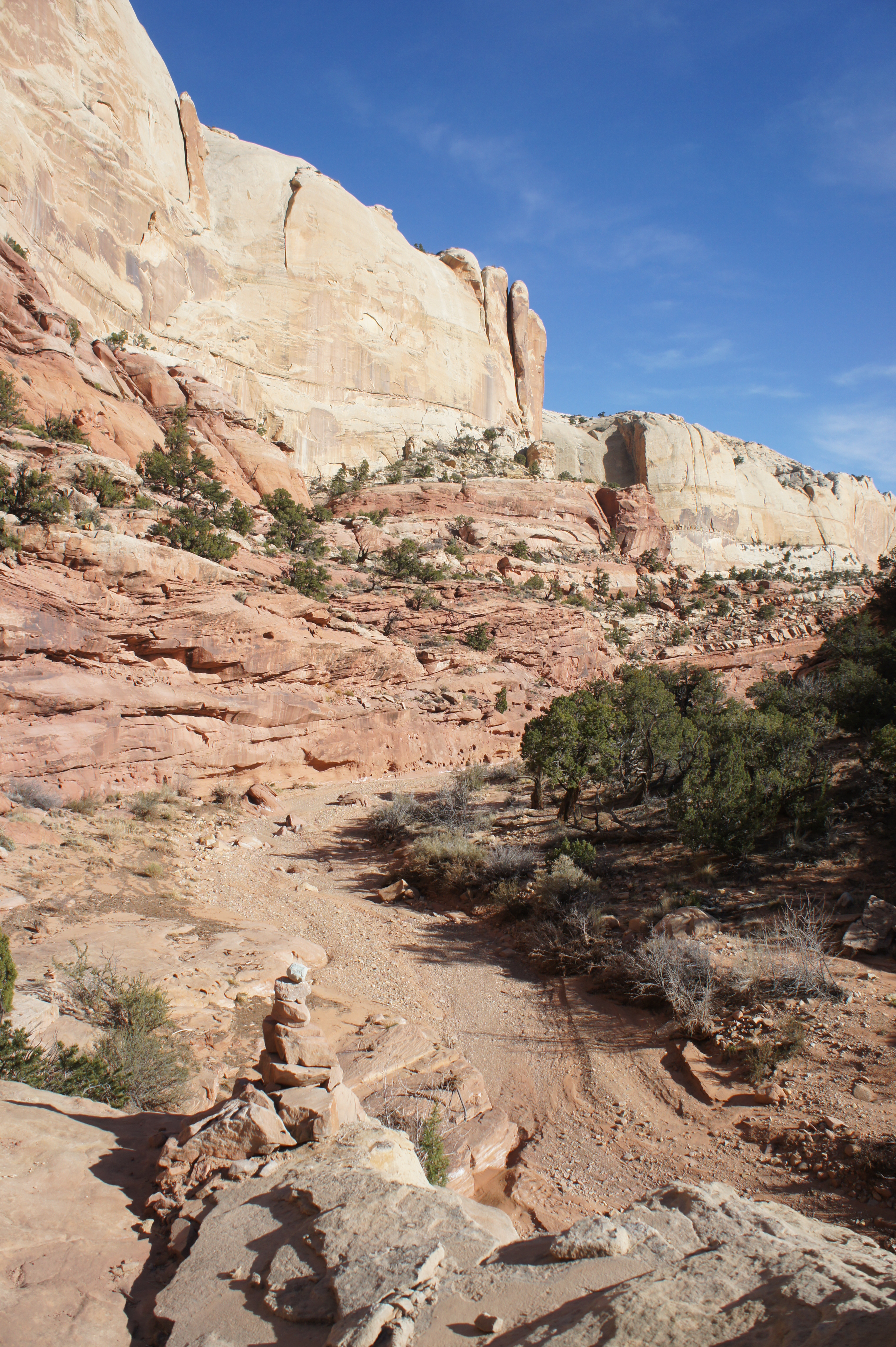
The five-mile stretch down Grand Gulch to the mouth of Lower Muley is arguably the least interesting of the hike, but the easy walking can be completed in about two hours. Some route-finding abilities are required, as the trail is rarely marked, save for the wear of footprints. A boot-worn path roughly follows the dry bed of Halls Creek downstream, with shortcuts across meanders to reduce hiking time.
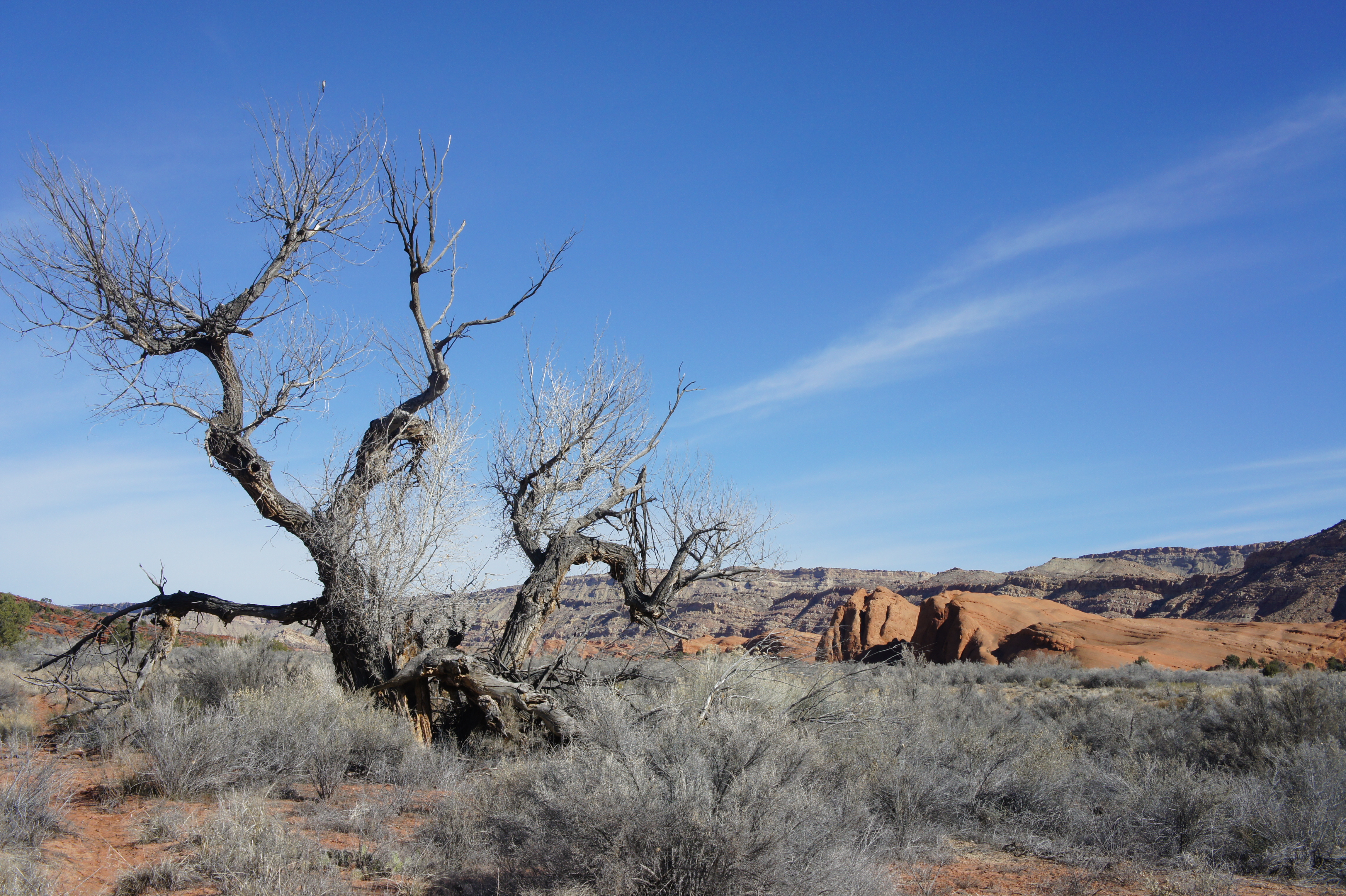
The opening tread is sandy and easy to follow. There is virtually no shade, making this section much less inviting in the heat of a summer day. Sagebrush and the ubiquitous Russian thistle (a.k.a. tumbleweed) are the predominant plant life.
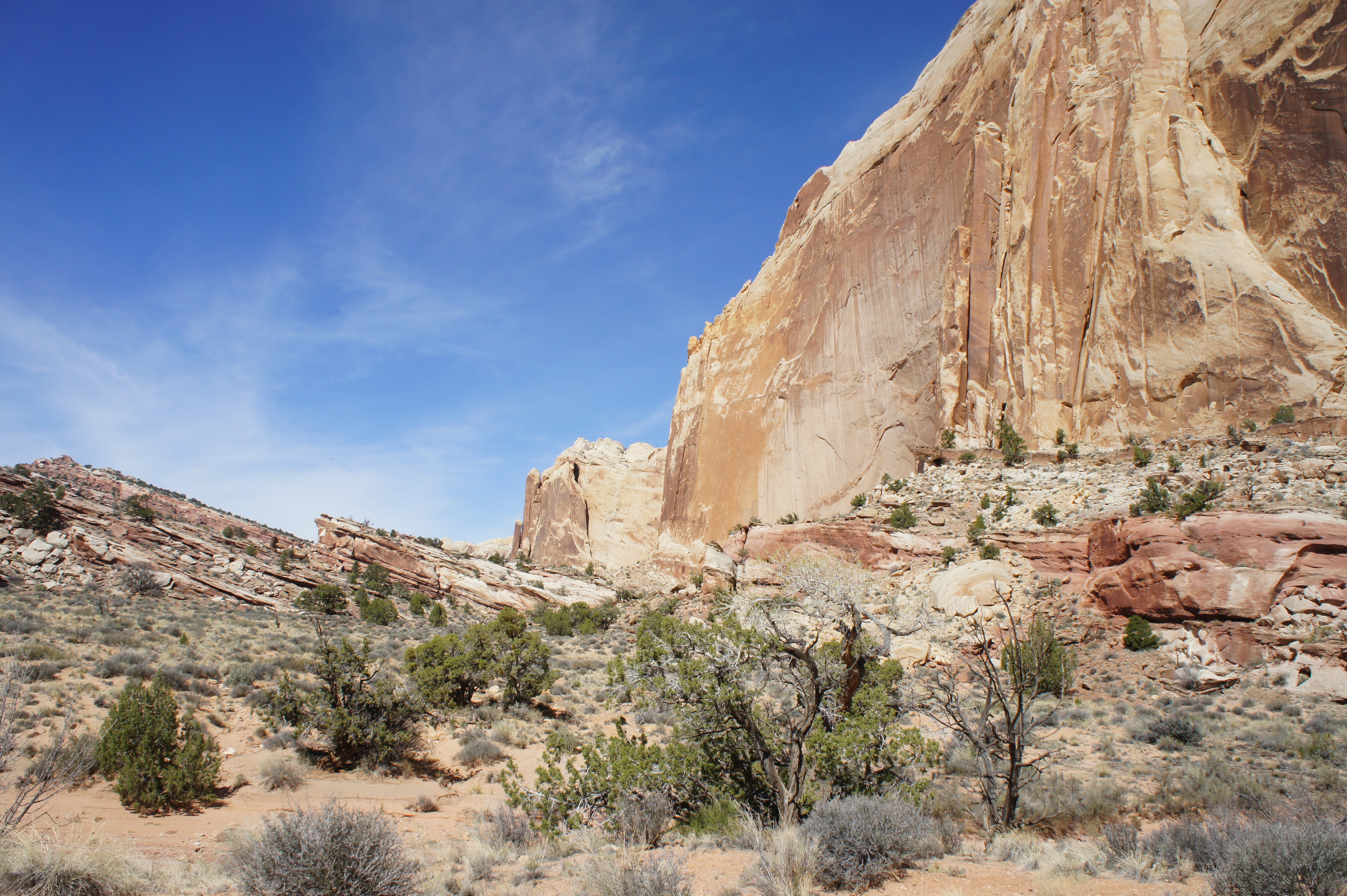
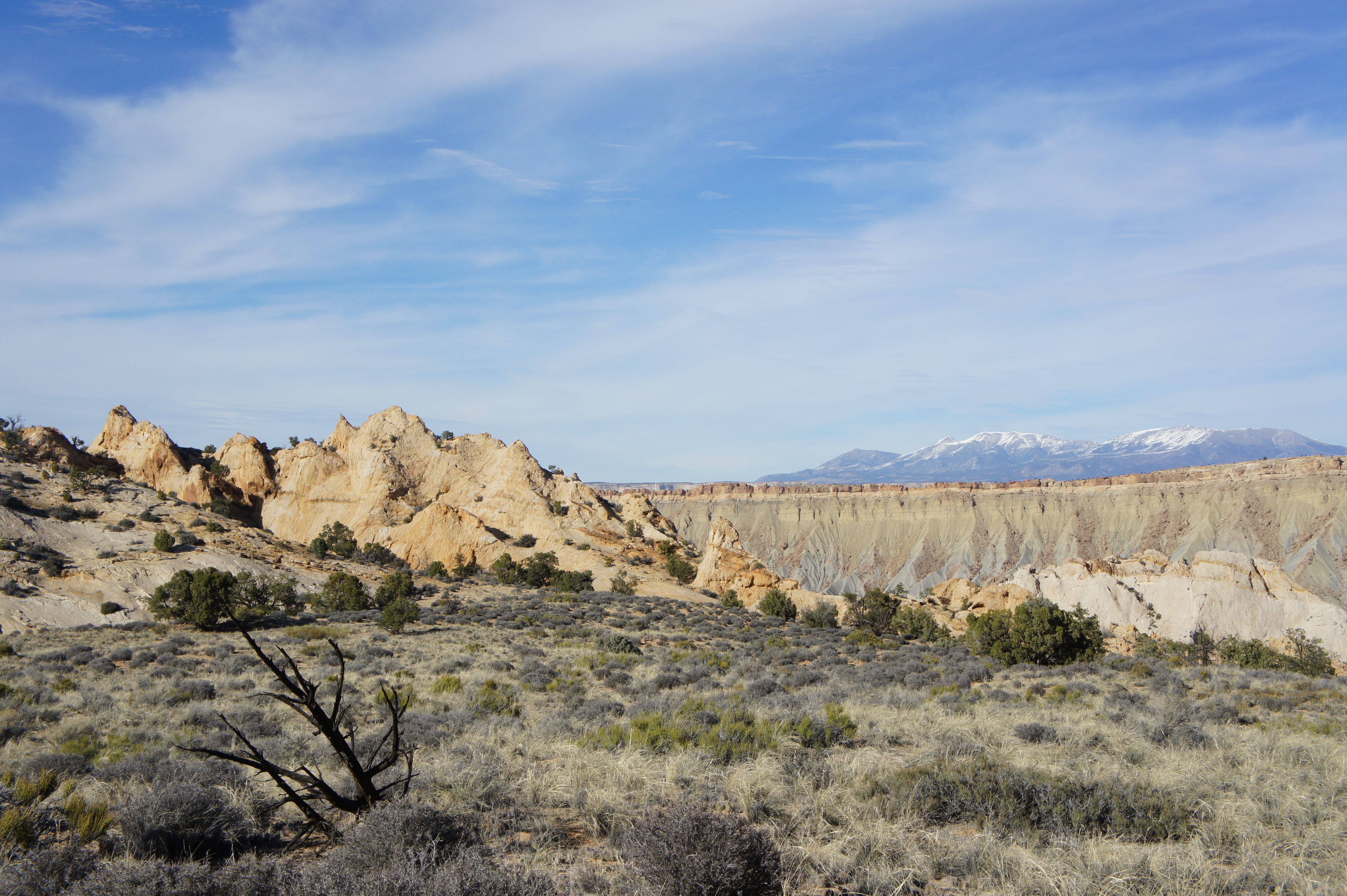
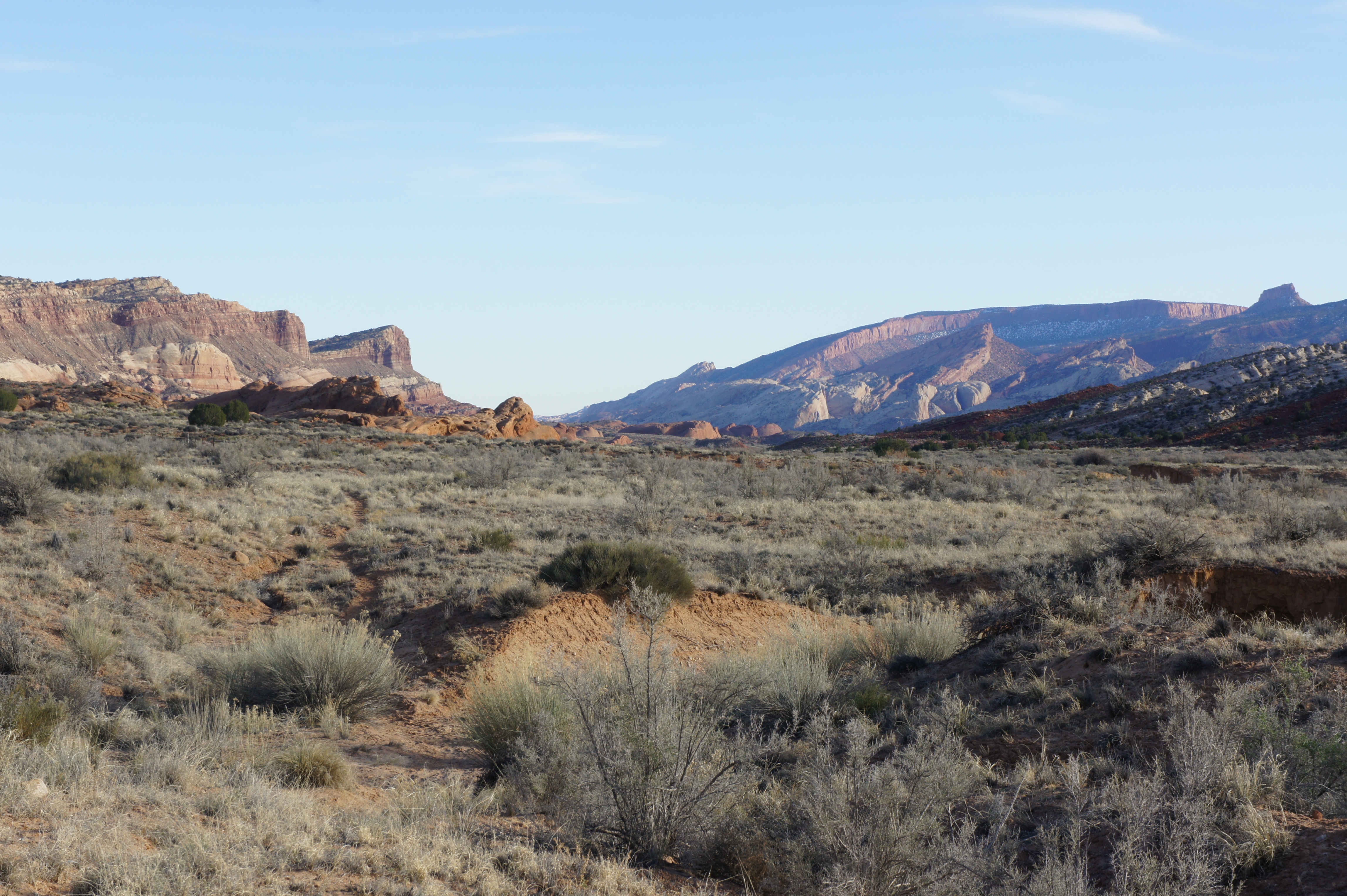
While the sagebrush scrub at surface level is less than scintillating, morning’s light on the Waterpocket Fold to the west provides outstanding views. Steep slopes of cream-colored Navajo sandstone tower over stark red soils of the Carmel formation. Within the first few miles, hikers pass at least a half-dozen deep, narrow ravines in the Navajo that beg to be explored. One canyon encountered early on in the hike reveals a high, rounded natural bridge. (This bridge is also visible from the Post Cut-off.)
Approximately ½ mile from the trailhead, the sandy track crosses the parched Halls Creek drainage for the first time. A relatively obvious path reemerges on the opposite side. A ½ mile farther, the trail crosses Halls Creek again. The footpath then cuts a brief meander, drops into the wash again, and disappears. To catch the trail again, walk downstream (left) 20-30 yards before a visible track mounts the bank on the right.
About 1 ½ miles from the Post Corral, it may come as a surprise to find a wooden sign directing hikers west to the Cottonwood Tanks. These potholes in the Navajo offer a relatively reliable water source for multi-day backpackers. (Note: natural water sources in Capitol Reef should always be treated). Owing to the presence of water, bushy junipers, Fremont barberry, and even Coyote willows extend down to the trail in this area. (Gnarly cottonwood trees will appear sporadically in the miles ahead.)
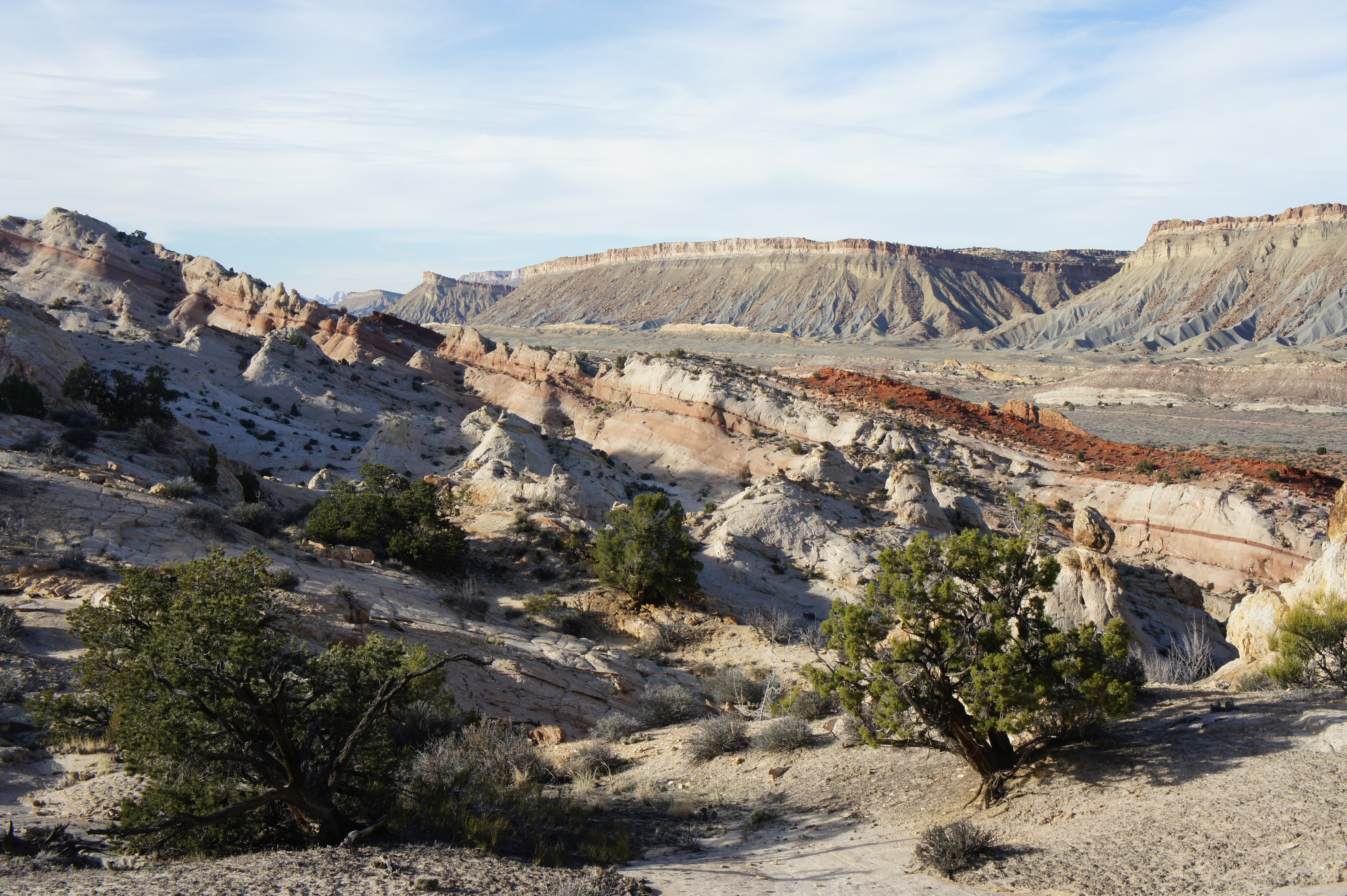
Within the next 15 minutes, the foot and horse trail merges with an old, rugged dugway, likely once used to access uranium mines down the Waterpocket Fold. Globs of orange Entrada sandstone add color to the relatively barren landscape to the east, while the trail flirts with the rosy Carmel on the west.
After a short hiatus, Halls Creek reappears off to the left, roughly 2.5-3 miles south of the Post, and the trail crosses it shortly thereafter. About 30 minutes from the spur to Cottonwood Tanks, the trail passes a two-step canyon with high walls and dark chambers visible off to the right. Back down at hiker level, the sandy single-track descends steeply to cross a tributary of Halls Creek, then regains a grassy knoll and leads to another rendezvous with the old road.
The terrain becomes more rugged at around the 3.5-mile mark, when the trail drops into a meandering wash bed—another tributary of Halls Creek. Here the once-broad and level plain has been filled in with curvy hillsides and bulky Entrada spaceships. After crisscrossing Halls Creek, the main drainage turns sharply to the west, cutting into the Navajo sandstone. The route continues south, gaining a low divide in the Carmel after cresting two ruddy hills. From the Post to this point, you have gradually dropped 100 feet in elevation—then suddenly regained it all in a short span. Occasional cairns mark the route.
As the track descends a slickrock slope to again meet Halls Creek, attention to route-finding becomes quite important. It is easy to confuse the crossing of Halls Creek, ten minutes from the crest of the divide, for the entrance of Lower Muley Twist Canyon. Instead, continue bearing south, catching the old road on the opposite bank.
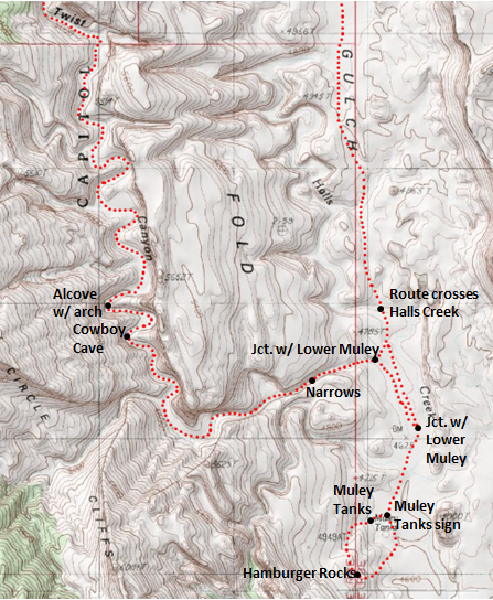
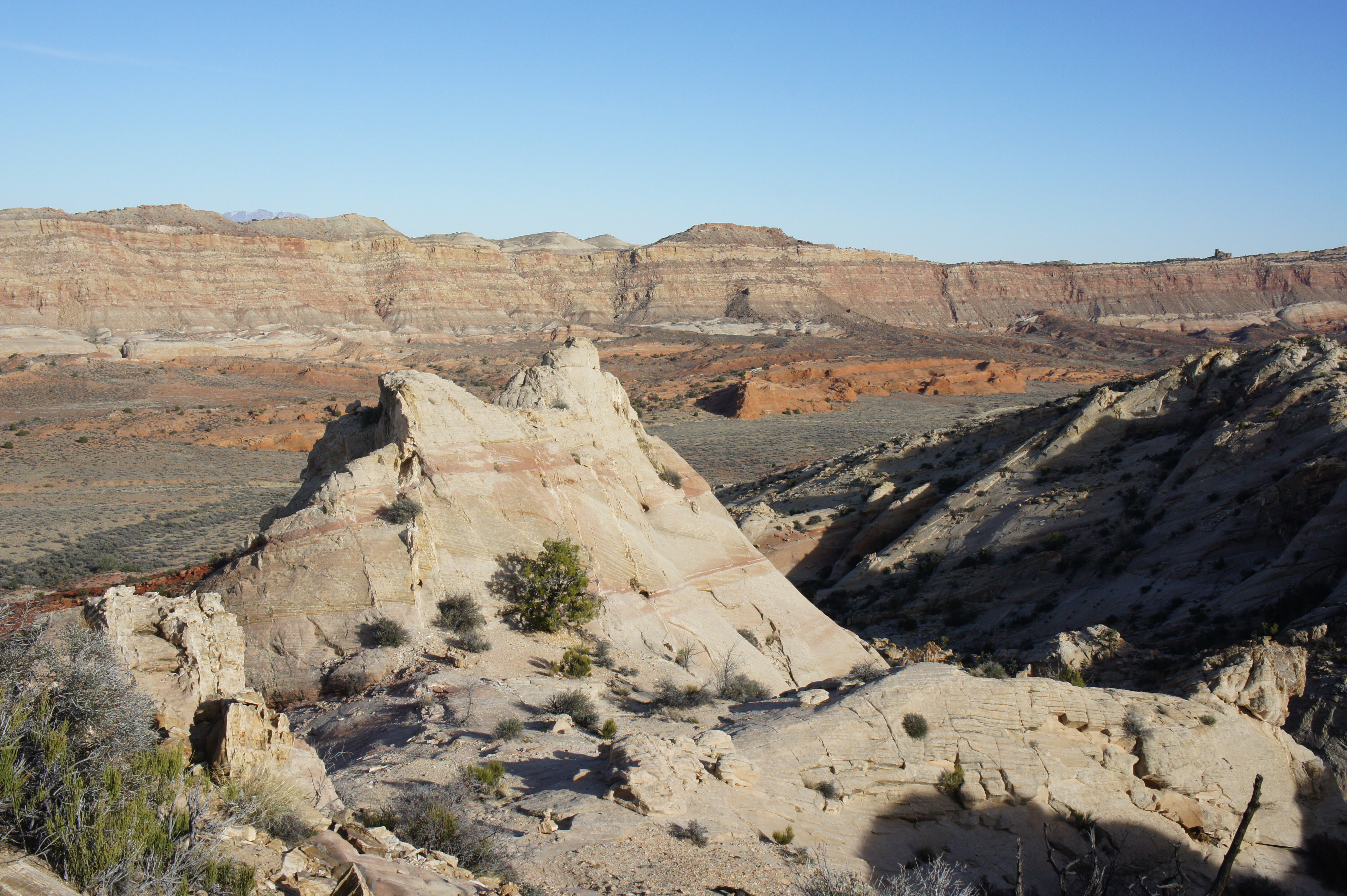
At some point in the next five minutes that is not at all clear, a purportedly cairned route leaves the dusty road and bears southwest to the rocky wash of Lower Muley Twist Canyon. Visitors interested in the detour to Hamburger Rocks, however, are best suited by continuing to follow the overgrown jeep tracks heading nearly due south. (See map above)
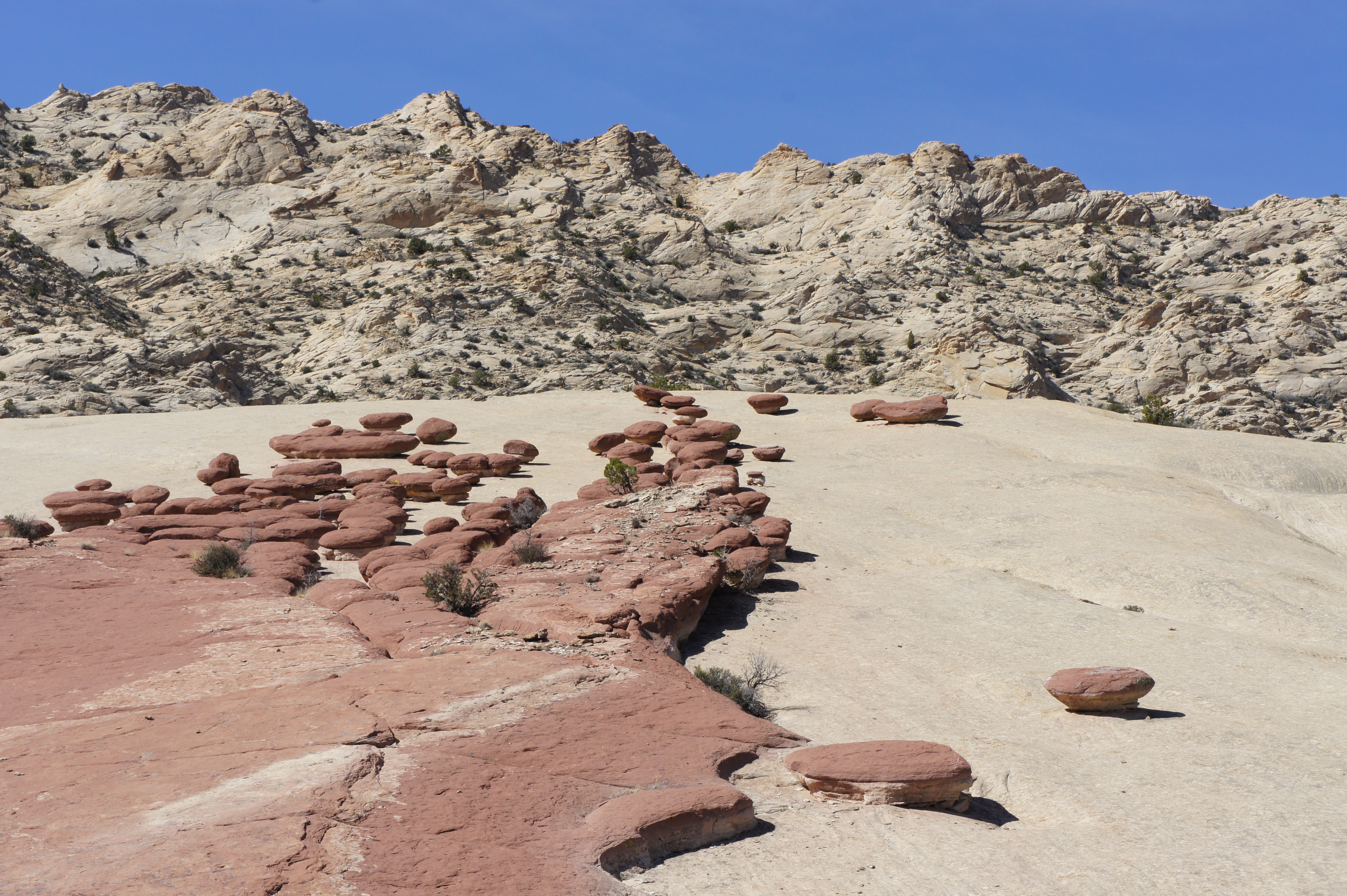
Detour to Muley Tanks and Hamburger Rocks
The next wide drainage crossed is that of Lower Muley Twist, though it is encountered at a point perhaps ½ mile downstream from where the cairned shortcut crosses the wash to the northwest. The walk down this wash to its confluence with Halls Creek is less than 2/10 mile, but for the easiest approach to Muley Tanks and Hamburger Rocks, hike across the drainage and pick up the faded double-track again on the other side (it does not descend to the wash here, but rather skirts it, so look closely). The road stays clear of Halls Creek on the west side and provides a relatively straight shot to Muley Tanks, which are conveniently marked with another wooden sign. (To provide another indicator, they are also roughly level with a protruding Entrada outcrop, the highest in the area, on the left—labeled as point 4,900’ on most topographic maps.)

A short spur trail from the wooden marker leads to the tanks. These surprisingly deep and relatively clear potholes have been carved into the Navajo sandstone and extend in a more-or-less straight line up a slickrock ravine to the west. They are as reliable a source of water you can ask for in this arid desert environment. (On my hike in mid-March 2015, I counted at least 13 separate pools carrying bluish-green water.) In the event of recent rains, the pools may be connected by a series of small waterfalls.
There are two options to get from the tanks to Hamburger Rocks. The shorter of the two—though more strenuous—is to skirt the edge of the pools and mount the slickrock ridge to the south. After this steep, nearly 200-foot climb, you are likely to approach the peculiar hamburgers from above. Coming level with the reddish knobs, descend the Navajo slope to reach your destination.
The second choice is to return to the Muley Tanks sign, turn right, and follow the old road for another ¼ mile. After passing a point level with the southern lip of the Entrada outcrop to the east, turn up a brushy wash to the right. When possible, friction climb up the gradual slickrock grade. Perhaps 50-75 feet in elevation gain later, the destination will be accessible on your right.
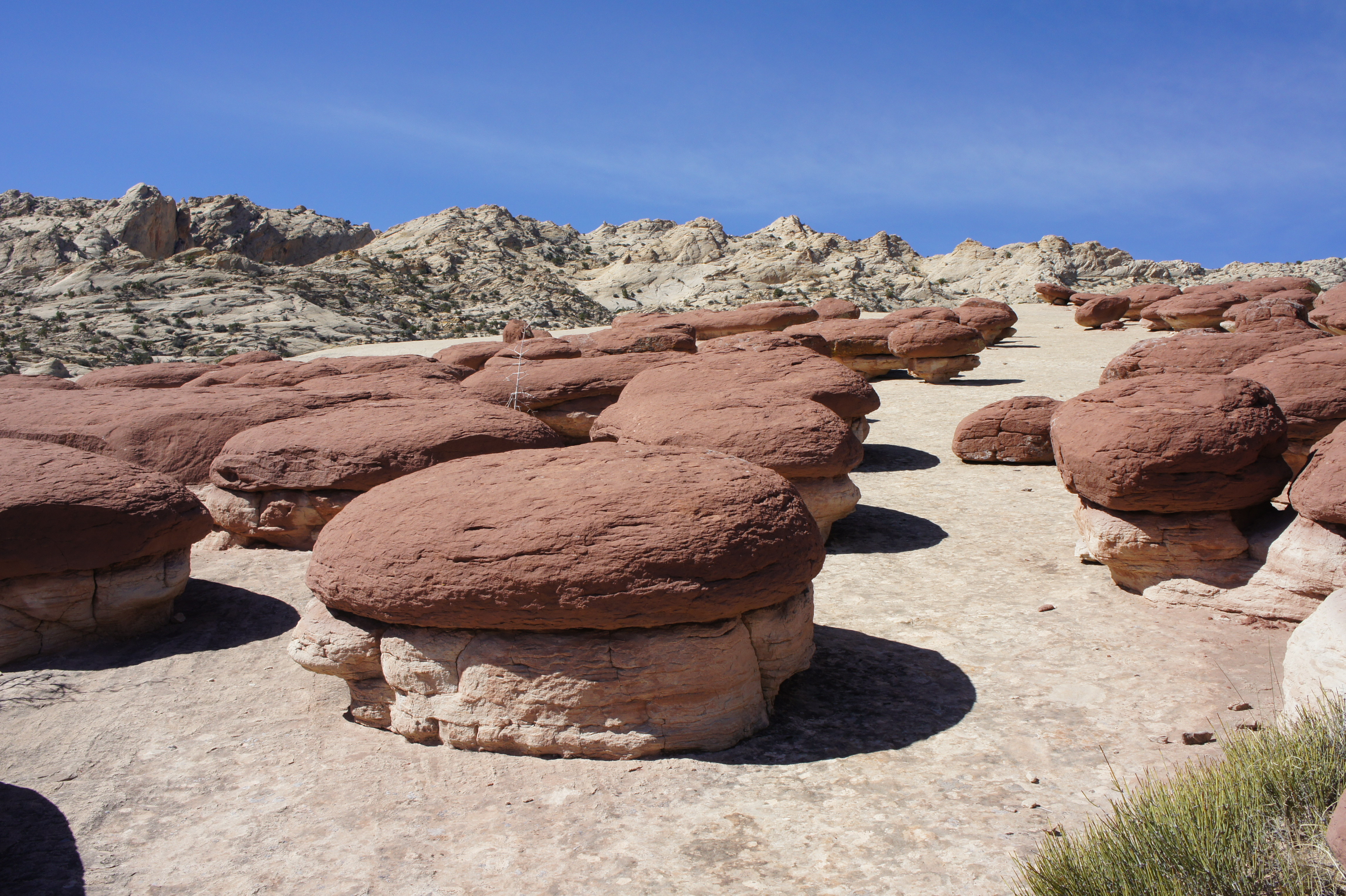
The Hamburger Rocks—a favorite among a select group of photographers and Capitol Reef hipsters—are a collection of perhaps 50 mushroom-shaped hoodoos, each barely reaching 2-3 feet in height. They are peculiar for their stark contrast from their surroundings: their rounded tops betray a reddish hue of Carmel, while their thinner, Navajo sandstone underbellies remain white. According to geologists, an alteration in iron content at some point made the carmine “hamburgers” more resistant than their whitish pedestals.
All the talk of hamburgers makes this spot a decent place to stop for lunch. On hot summer days, however, Grand Gulch is fully exposed to the scorching sun. The second of the two approach options offers the better alternative for returning to the Lower Muley Twist junction. Be sure to bear slightly right (south) from the bottom of the hamburgers to avoid a precipitous drop-off.
(Note: A shorter, 9-mile day hike to Hamburger Rocks can be started from the Halls Creek Overlook in Capitol Reef’s remote southeast. For more information on this route, see the National Park Service trail guide here.)
Lower Muley Twist Canyon to the Post Cut-off
From Hamburger Rocks, following the old road—past the Muley Tanks sign—for almost a mile eventually dumps one back at the wash into Lower Muley at a point ½ mile upstream from the other entry point described above. (In fact, it is possible to spot the other crossing from the road as it bends northwest to parallel the drainage bottom.) Here the elusive cairned route from the northeast enters through a minor gully on the opposite bank, located roughly at the contact point between the ruddy Carmel and the cream-colored Navajo. As the wash bends to the west, walls of Navajo sandstone bound the canyon mouth to the north. Follow the wash bottom upstream, into the Waterpocket Fold.
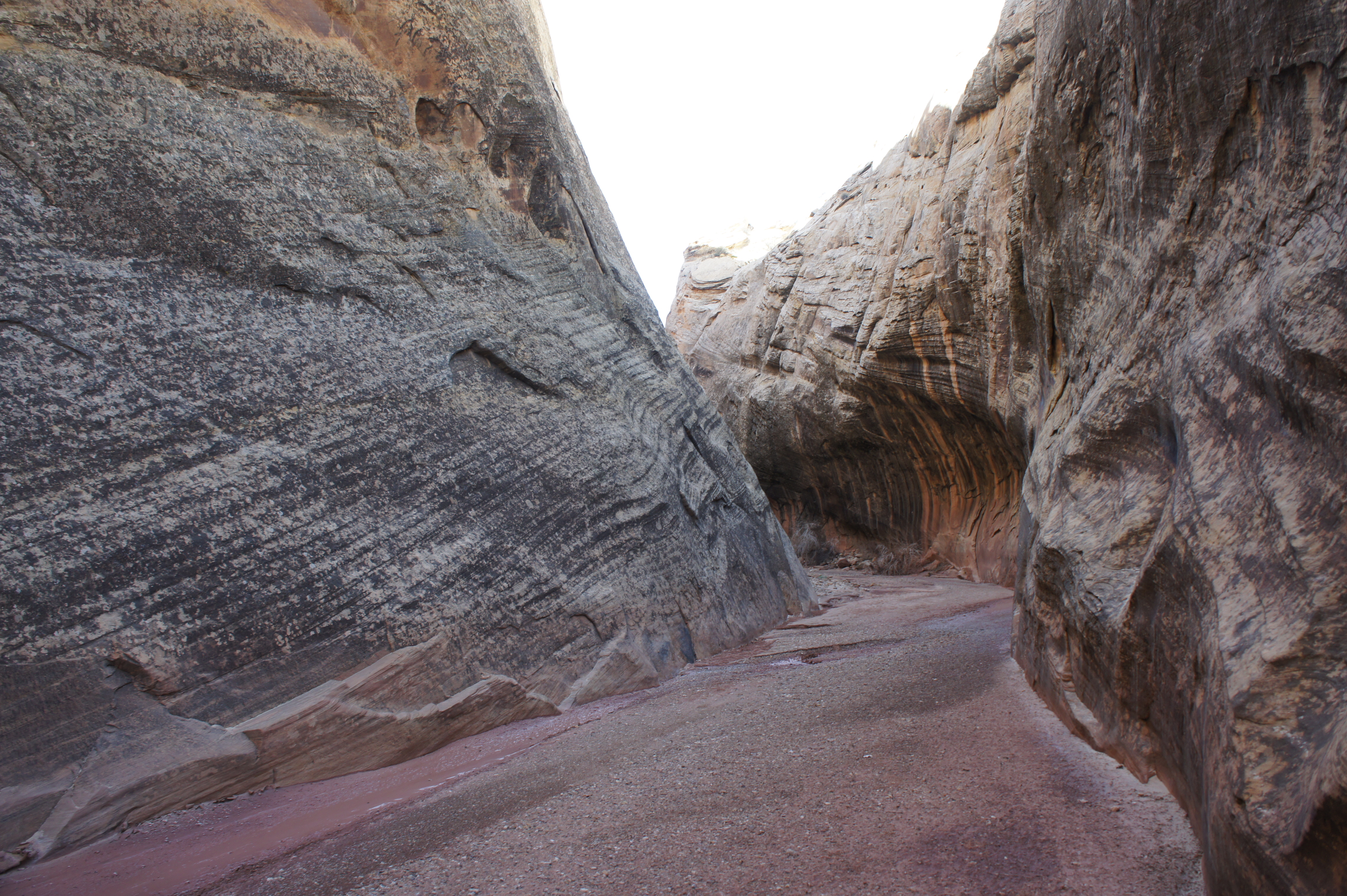
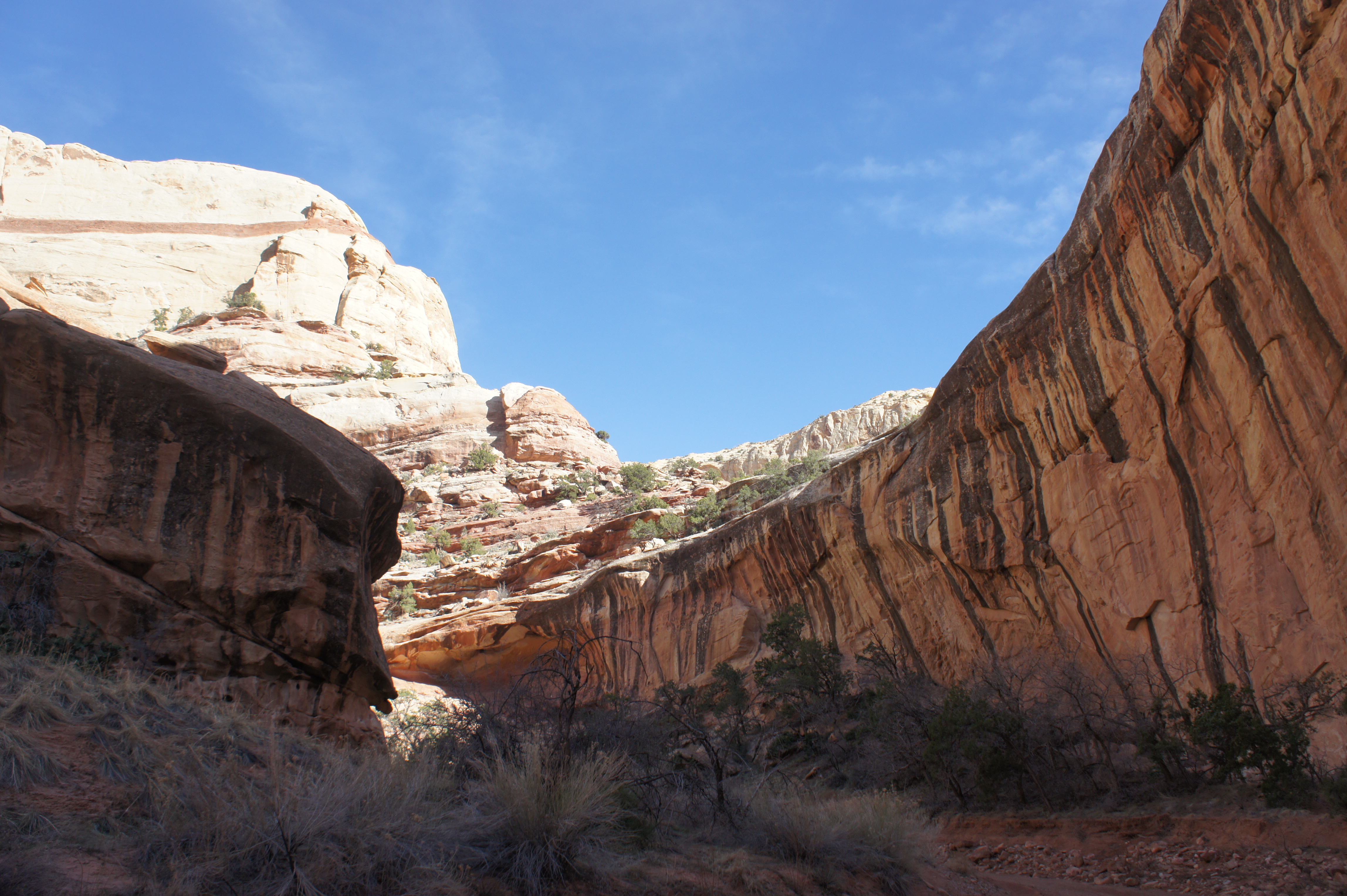
Within minutes of rounding the west-bound curve, the canyon constricts considerably. Shortly into the narrows, the walls on both sides are colored with black streaks of desert varnish. The cliff face on the left is particularly spectacular, as it frequently exudes a golden-yellow color. As the canyon thins to its narrowest point (maybe 20-30 feet wide), excellent examples of sedimentary crossbedding are on full display.
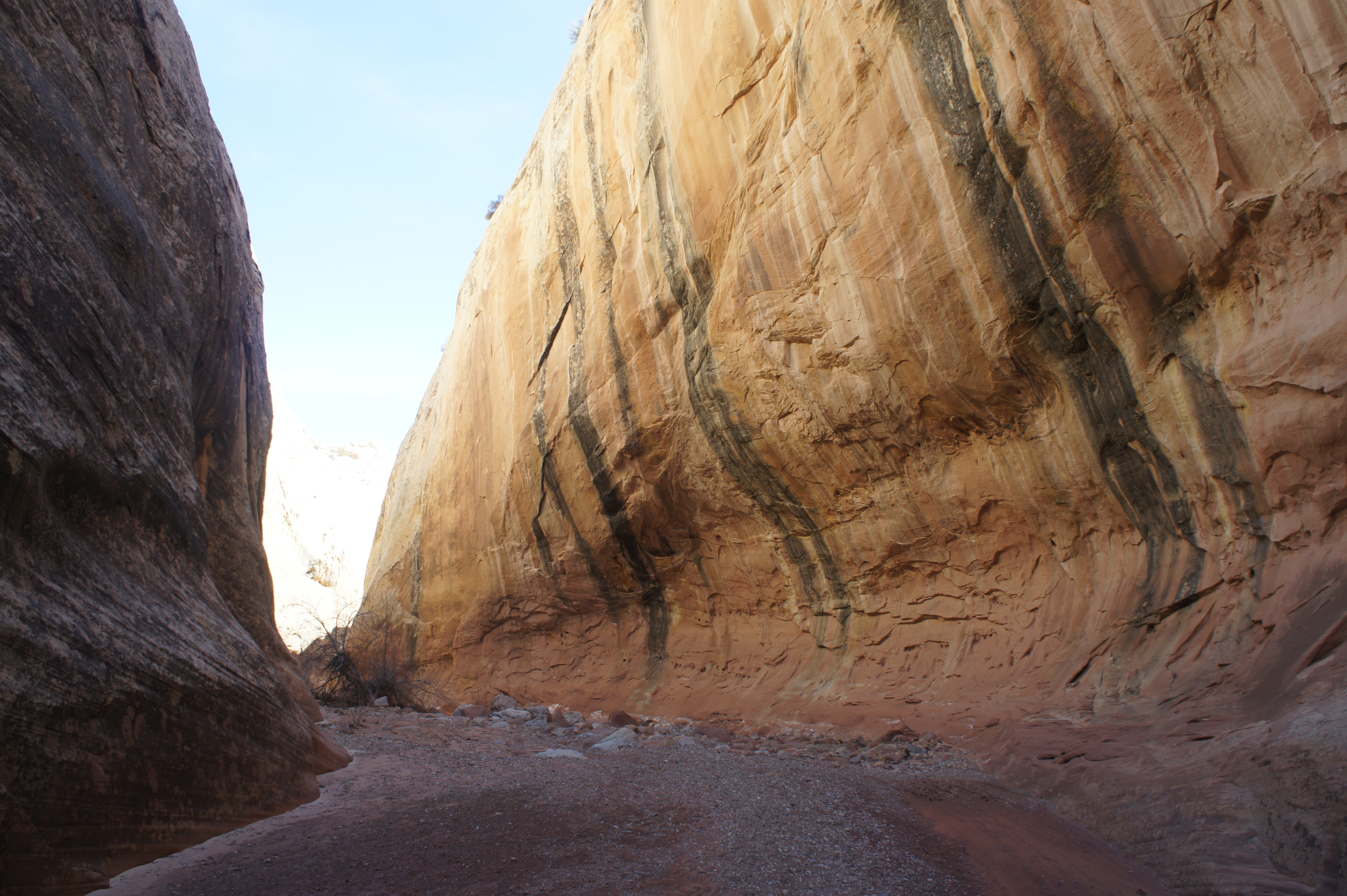
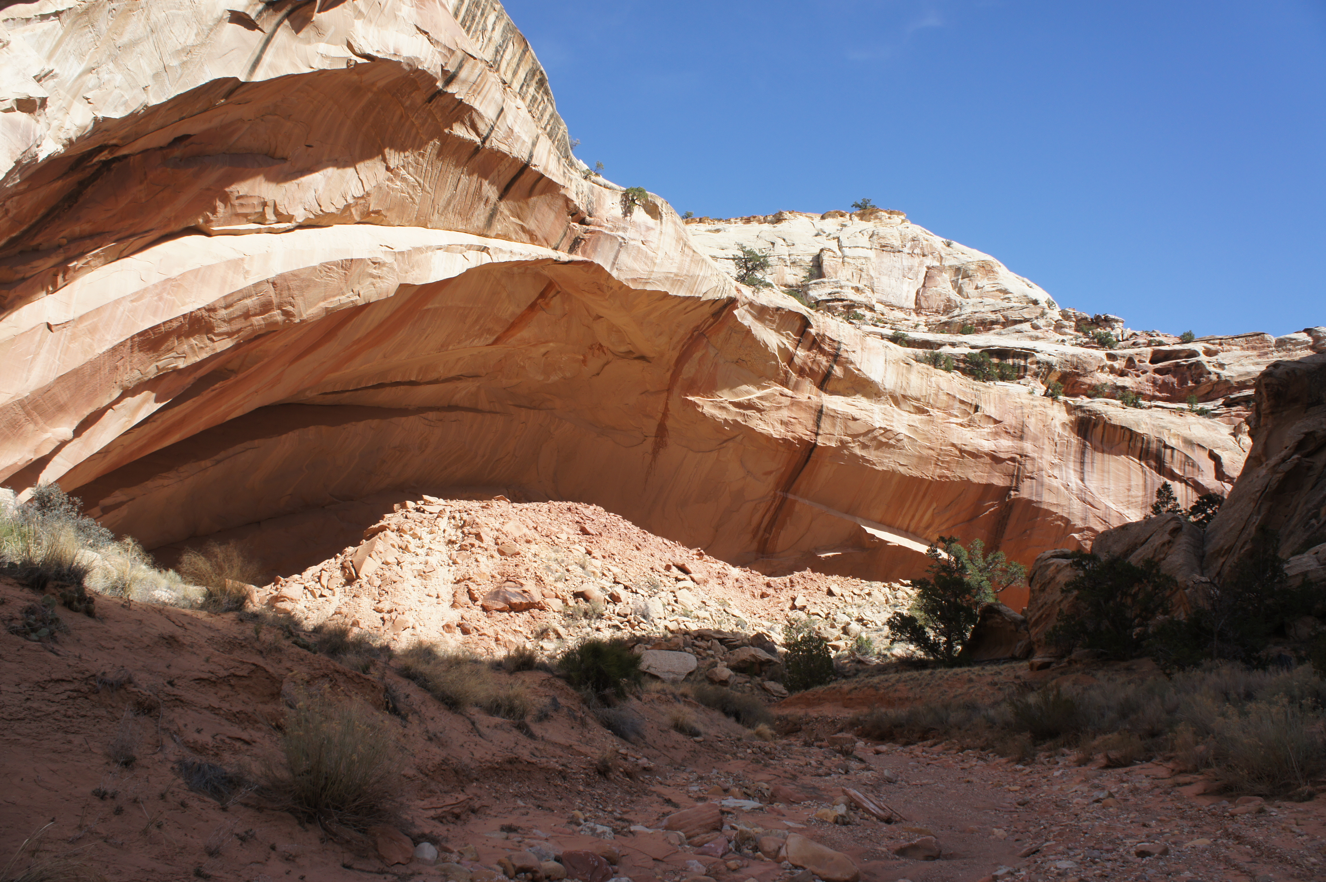
Just beyond, the canyon walls recede perhaps 100-200 feet on the right, revealing a sweeping ring of towering cliffs. Alas, the amphitheater is quickly obscured from view as the wash-lining walls rebound, but a series of varnished alcoves add to allure (two small undercut on the right and one on the left).
Approximately one mile from the junction, the route begins to round a mighty bend at the sight of a pink hoodoo. This is the first appearance of the Kayenta formation, a relatively erosion-resistant sedimentary layer defined by its steps and ledges. While the canyon’s left flank climbs at a more gradual slope, sheer Navajo cliffs continue to rise vertically on the right.
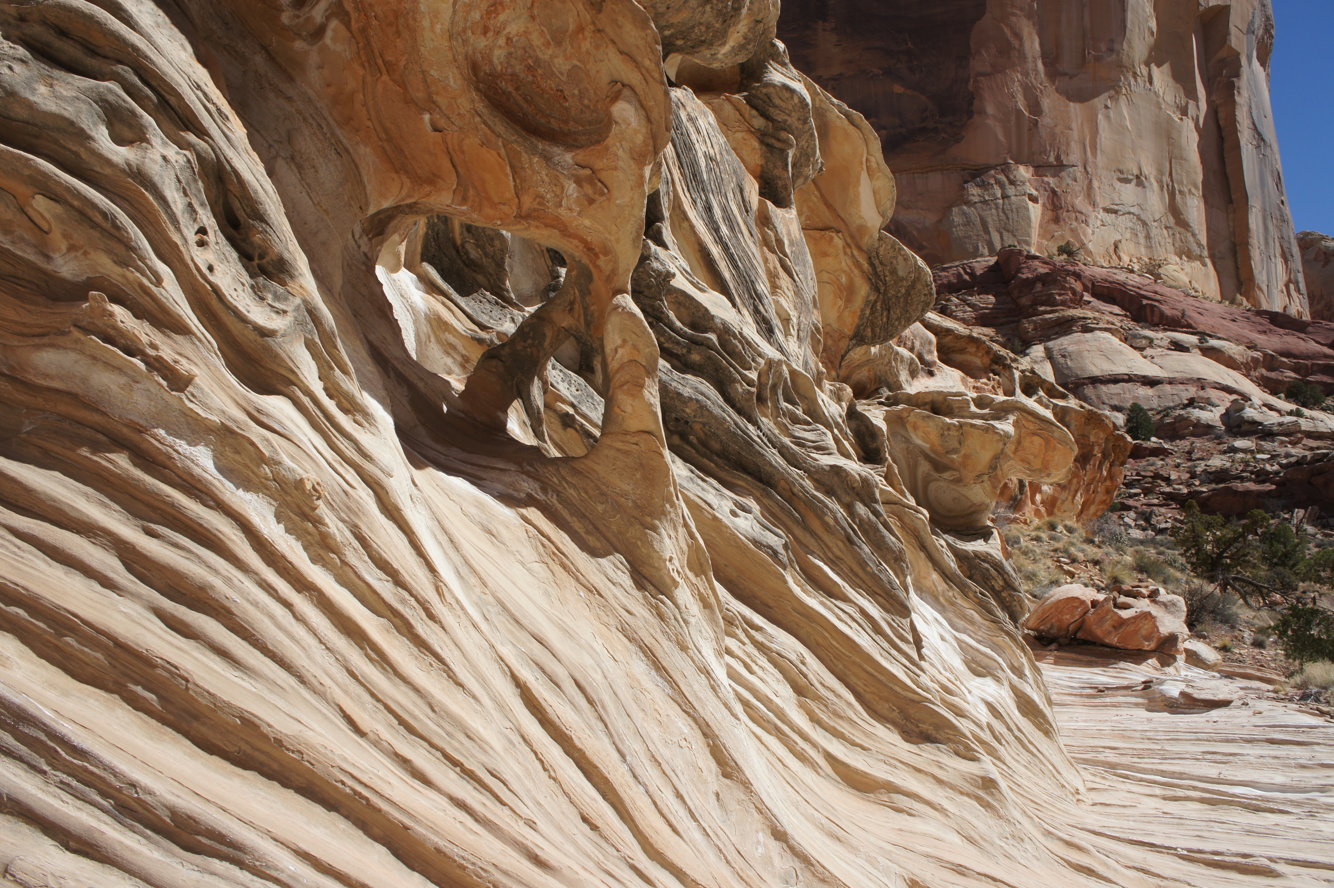
It is about 1 ½ miles from the junction to the entrance of a significant side canyon on the left. Wandering up this canyon a couple hundred yards reveals a spiraling wall on the right, a testament to the extreme tilt of the Waterpocket Fold. A longer walk would bring one to the western edge of the Circle Cliffs, after which the terrain opens up to a relatively flat expanse. Back at the mouth of this canyon, the wavy Navajo sandstone is speckled with tafoni, or honeycomb pockets.
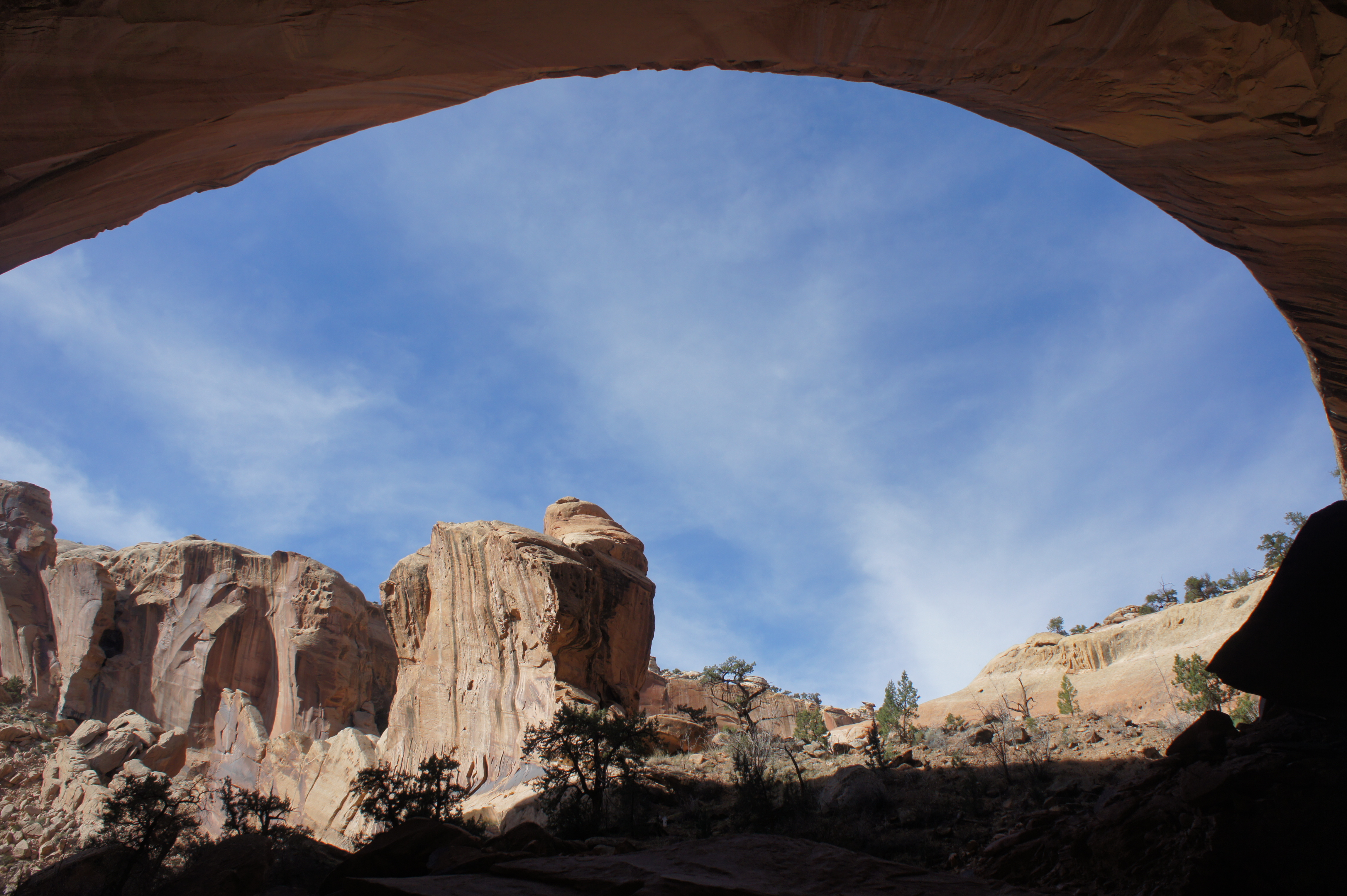
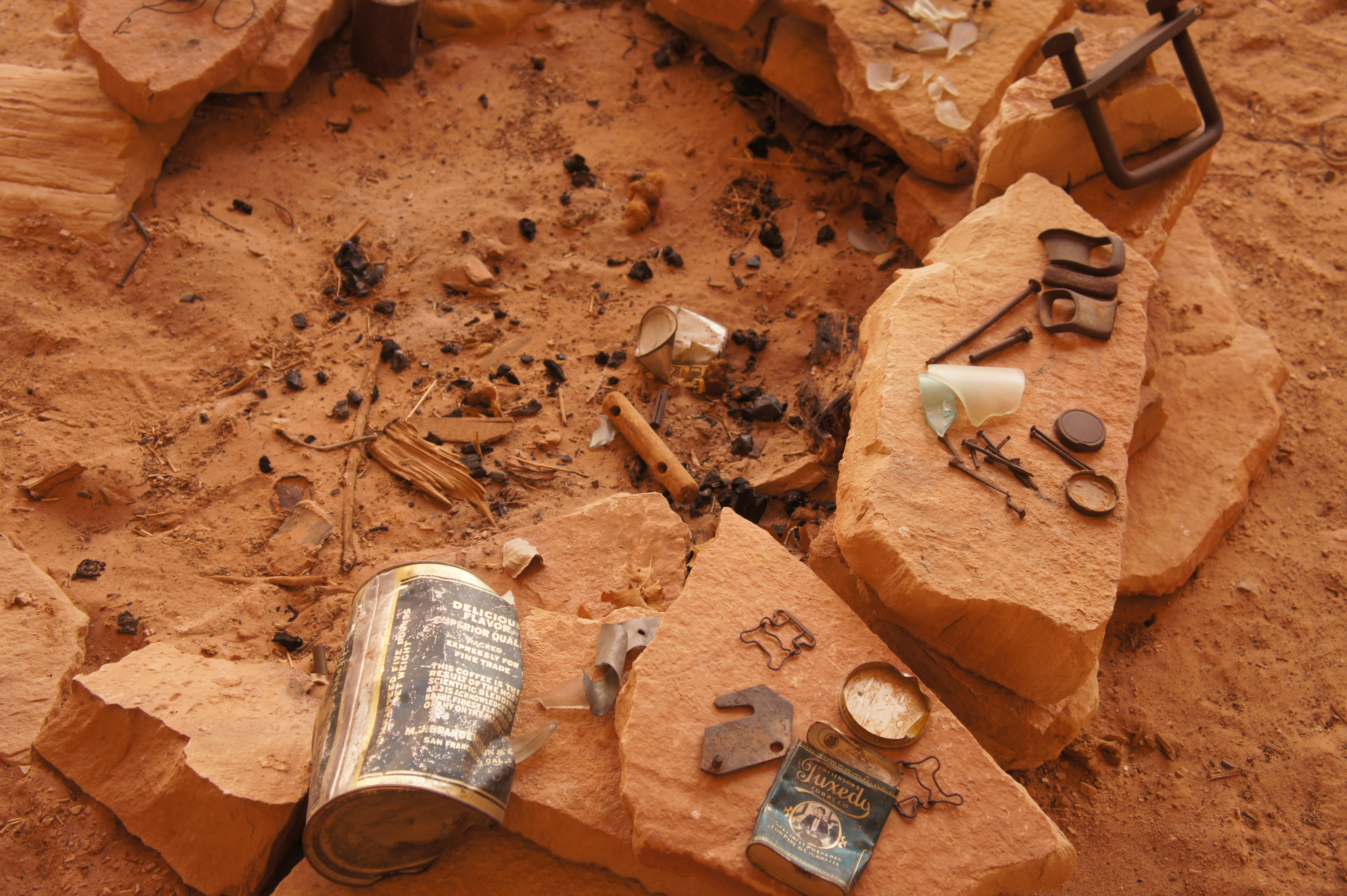
Continuing up the main canyon, Lower Muley’s most famous attraction—a colossal overhang dubbed “Cowboy Cave”—is reached within 15 minutes of walking. Though not a true “cave,” the shady alcove is neatly enveloped by deeply varnished walls. (Photographers should bring a fisheye lens.)
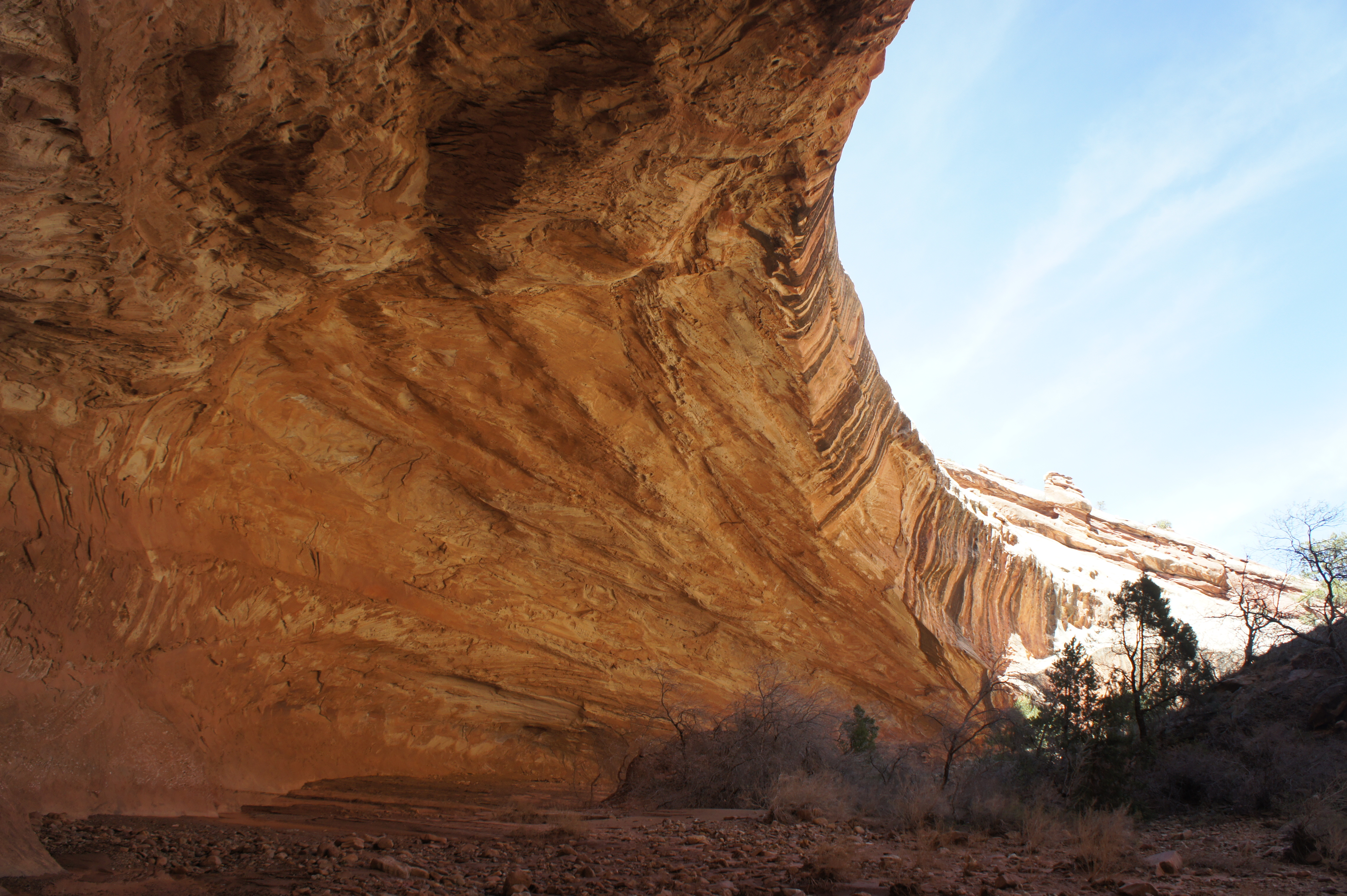
Carvings and trinkets left in Cowboy Cave provide a gateway into a bygone era. Local ranchers used this section of Lower Muley to trail cattle in the 1920s, and this particular undercut offered a comfortable camp, as it is mostly shielded from the summer sun. A few knick-knacks remain at the Cave, including a weathered aluminum case of Patterson’s “Tuxedo” tobacco and a shriveled can that once held “vacuum-packed” M-J-B coffee. Signatures of travelers through Lower Muley in 1920 and 1921 dot the alcove walls.
While camping under the alcove is prohibited (being within sight and sound of the trail), a number of pleasant campsites can be found around the sandy meanders just up-canyon. (While use trails can usually be found shortcutting each bend, avoid creating new paths, particularly across fragile cryptobiotic soil.)
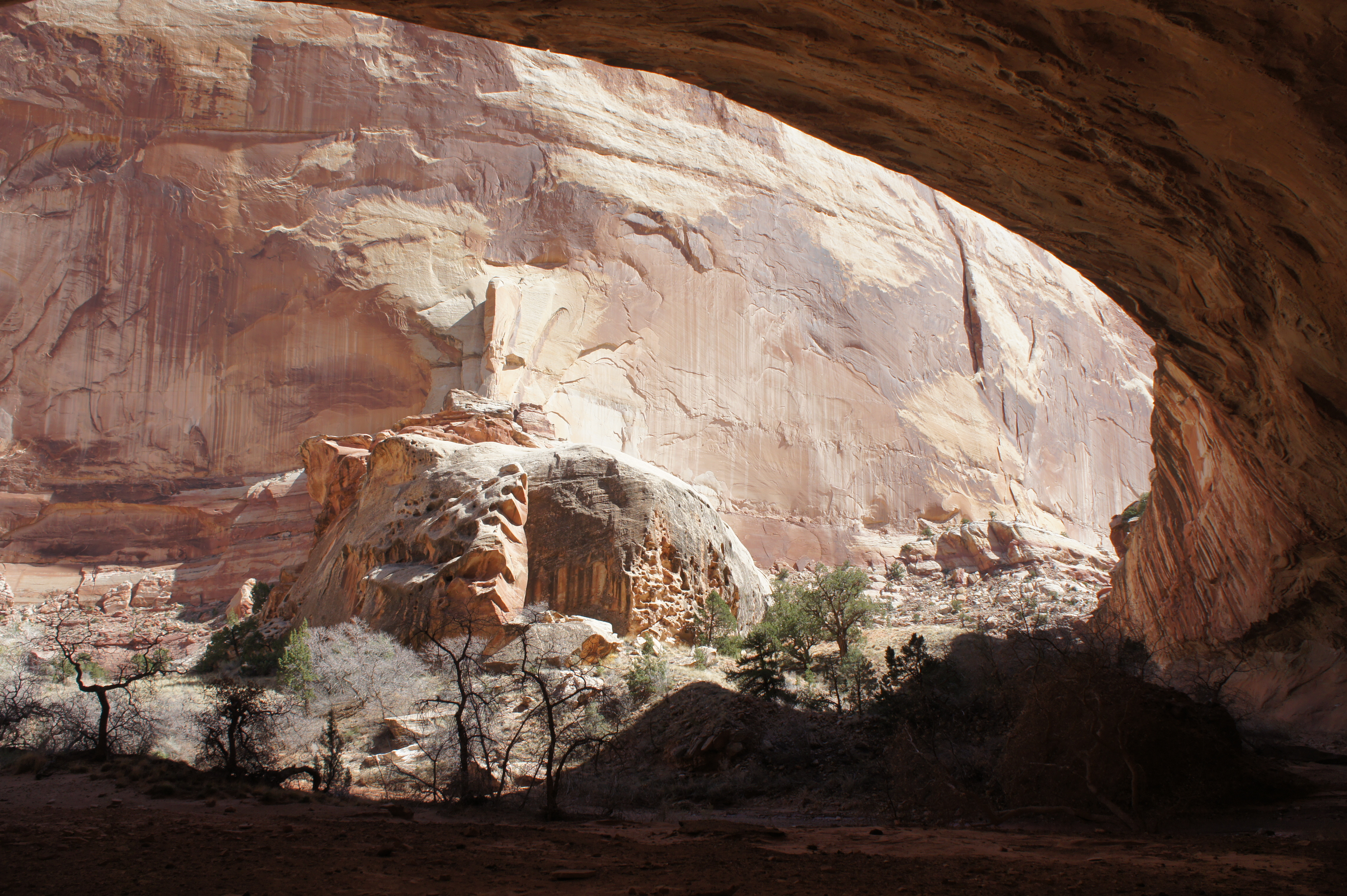
The next right-hand bend sports another varnished alcove that rivals Cowboy Cave in size, though not quite in beauty. It does, however, boast a small archway in the Kayenta above.
Aside from the ever-present Navajo sandstone cliffs to the east, the highlight of the next few miles is a series of tributary canyons that enter Lower Muley from the west. (At least one boasts a narrow slot canyon, though it is access is difficult and requires two exposed bypasses right at the start.) Depending on recent precipitation levels, these tributaries often carry gently flowing water that offers a tastier drink than the muddy pools found in the main drainage. Side canyons also offer potential opportunities for camping.
Within three miles of Cowboy Cave, the sweeping alcoves take a temporary break, and the wash bed subtly edges closer to the wall of Navajo fins on the right. The ridgeline is briefly interrupted by deep fissures that look like enticing adventures but are likely impassable. A relatively modest but well-streaked overhang on the left is followed quickly by the entry of a significant tributary on the right.
Shortly thereafter, following several miles of relatively shallow cliffs on the left, the high canyon walls return in full force. The next couple miles are immensely scenic.
Following a 90-degree right-hand bend, hikers are greeted by a significant boulder jam that proves a minor obstacle. The best option is to skirt the left edge of the rock pile, then turn sharply right, entering a brief, dark passage under a prominent boulder. Climb the log jam at the end of the tunnel, with smooth sailing just beyond.
The boulder clog is followed within minutes by a gargantuan alcove that takes several minutes in itself to pass through. A few unavoidable obstructions in the shadow of the undercut require minor scrambling to surmount.
Finally clear of the giant overhang, the canyon bends west, the north, and a significant, boulder-strewn tributary enters from the left. Over the course of the remaining couple miles to the Post Cut-off, the main drainage will pass under two more immense alcoves. (There are several more found higher up the canyon walls, just out of reach of the wash bottom.)

Following the second of these large undercuts, observant hikers will spot a cardinal-colored stripe streaking across a Navajo wall to the east. After a few more bends, the wash passes through a relatively thin but brief narrows, beyond which the first traces of the reddish Wingate sandstone (in which the upper four miles of Lower Muley spends most of its time) are visible high on the left.
The emergence of a solitary, dome-shaped chunk of Navajo to the north serves as the best indicator that the Post Cut-off is near. From the first view of this feature, it is less than a five-minute walk to the junction. Signage is relatively hidden on the right-hand side—but try to remember that if you take a sharp left-hand turn to the west, you have gone too far.
Post Cut-off route to the Post Corral
Cresting the Navajo sandstone backbone of the Waterpocket Fold, the 2-mile Post Cut-off route is likely to give pause to the acrophobic. The 700-foot descent consists almost entirely of sloping slickrock, comprising a number of friction climbs that require close attention. In return, however, hikers who brave the steep traverse are rewarded with fantastic views of the Fold, Strike Valley, and the Henry Mountains.
The first bit of exposure comes within minutes of the route junction in Lower Muley Twist Canyon—a brief climb that skirts a minor drop-off. Beyond, the cairned route drops into a small drainage dotted with vegetation on both sides. With an impassable dryfall looming ahead, the path exits the slickrock draw and switchbacks up the right flank before regaining the wash again, this time above the pouroff.
Here the trail simply follows the wash as it edges east through a relatively wide opening between buttes of Navajo sandstone. Three (likely cairned) bypass routes guide hikers in and out of the wash to bypass brushy meanders. Eventually, a sandy trail veers off to the right, not long after the Henry Mountains appear in the distance.
While the expanse opens up to the east, hikers will not gain the route’s highpoint until ascending four minor hills. After the third, one can make out the dusty track of the Notom-Bullfrog Road down in Strike Valley below. The final mound sports a rocky ridge littered with rusty iron deposits—this is the start of the 700-foot descent. Rounded fins of Navajo dot the landscape to the north, rising like castles from the tilted slickrock slope. Bits of the reddish Carmel and orange Entrada can be made out at the base of the Fold below.
Here it is especially important to keep an eye out for cairns, as route-finding becomes slightly perplexing. At this point, the ridge is flanked by deep, precipitous canyons on both right and left; in general, the route stays to the left-hand side, though it does swing right before dropping steeply back north into a minor draw. From here, it would seem on first glance that the route ahead will follow the slickrock ravine down to the bottom of the larger canyon to the north. This passage, however, is obstructed by a near-vertical pouroff. Instead, the route veers right, climbing sharply uphill to the top of a precipitous crag.
From here the route winds to the south, then rounds a bend and switches sharply back to the north. Cairns lead hikers sideways across an angled slope that, though free of vertical drops, requires caution to negotiate. A steep friction descent leads down to a pinkish-colored ridge, after which another rounded corner leads to a second exposed section.
Finally, the route climbs a final time to the crest of a Carmel chevron—a deep red-colored slope tilting upward in the form a triangle, forming a stark contrast with the whitish Navajo. Here it is a welcome surprise to find a dirt path, a pleasant relief from the knee-wracking friction climbs. A well-trodden trail descends the side of the chevron to the right, following the Carmel-Navajo contact down to the base of the Fold. (The ubiquitous white speckles in the red Carmel are traces of the mineral gypsum.)
At last, the home stretch: once one reaches the level valley floor, white metal posts guide hikers east across the sandy sagebrush flat. A short distance from the Post Corral, the trail crosses Halls Creek. From here it is a minute or two back to the wire fence at the Post where the lengthy loop hike began. Be sure to sign out at the trail register before departing in your vehicle.

Pingback: Halls Creek Narrows via “airport route” (Capitol Reef National Park, UT) | Live and Let Hike
Pingback: Cathedral Valley Loop Drive (Capitol Reef National Park, UT) | Live and Let Hike
Pingback: Top 10 Hikes in Capitol Reef National Park’s “Backcountry” | Live and Let Hike
Looks like an amazing trip! Thoughts on water availability in mid May? From what you have written, water didn’t seem to be of too much concern. Thanks
Hi David – The Muley & Cottonwood Tanks in Grand Gulch should be reliable year-round, and springtime will surely bring some water to the tributaries that enter Lower Muley from the west. That said, you might have to persevere a bit, as some of the best camping spots in Lower Muley are not necessarily right next to water sources.
Pingback: Death Canyon Trail to Patrol Cabin (Grand Teton National Park, WY) | Live and Let Hike
Thank you, Andrew! What a great article – I especially appreciate the geology lesson. My friend and I did this hike in the opposite direction (and glad we did – got the hard part out of the way early). It was my first backcountry backpacking trip and frankly, it was a bit overwhelming. I think I want to go back to see everything I missed!
We somehow missed Cowboy Cave, but camped in an alcove that had also seen some historic use.
Our trip was in early October and the only water we found in the Canyon were a few muddy puddles. Depending on the season and whether one is camping in the Canyon, I’d suggest carrying all the needed water.
Pingback: Lower Muley Twist Canyon – Upper Section (Capitol Reef National Park, UT) | Live and Let Hike
Thank you for the photos and detailed trip report. The notes about water sources were particularly helpful, as it’s hard to tell from a map what can be relied upon