
It’s not too often that one can say that they overcame death. But conquering the Death Canyon Trail in Wyoming’s Grand Teton National Park offers such an opportunity. The beauty of the canyon—with its rushing cascades, inviting meadows, and cool forests—belies the ominous name, making this one of the finest hikes in Grand Teton. While the Death Canyon Trail ventures deep into the Teton Range, a patrol cabin—roughly 3.9 miles from the trailhead—serves as a reasonable turnaround point for a day hike. Along the way, hikers will encounter fields of wildflowers, excellent views of Phelps Lake and Jackson Hole, and thundering cascades. While one of the easier canyons in the parks to enter, the trail through Death gains more than 1,000 feet in elevation, and the up-and-down section between the canyon and Phelps Lake Overlook can be particularly brutal on the return journey, especially in the midday sun.

The hike
One would think that the extremely rough, rock-studded road leading to the Death Canyon Trailhead in southern Grand Teton National Park would deter visitors to the area. But the allure of the canyon’s name, location close to Jackson, and development of the newly-opened Laurence S. Rockefeller Preserve have made Death Canyon surprisingly crowded. Granted, the crowds pale in comparison to the throngs of visitors at nearby Jenny Lake or Colter Bay and tend to thin out after the first 1.5 miles of hiking, where the Death Canyon Trail diverts from the popular Valley Trail. Nonetheless, it is unexpectedly difficult to find a parking spot at the end of the Death Canyon Road. (Note: Vehicles with low clearance or poor tread tend to be parked partway down the road, requiring a short walk to the trailhead. Also note that the Death Canyon Trailhead is sometimes called the Whitegrass Trailhead.)
Once a parking spot is secured, however, make your way to the start of the hike, where an information board provides a map and limited information on the area. In addition to the hike up Death Canyon, this is a popular starting point for shorter walks around Phelps Lake and long, multi-day backpacking trips up to the Teton Crest, Alaska Basin, Open Canyon, and beyond.
The trail that starts from here is actually a short connector, a brief 125-yard jaunt along a wide path to a junction with the Valley Trail. This lengthy single-track runs largely for miles through the forest moraines at the base of the Teton Range, connecting Death Canyon to Bradley, Taggart, and Jenny Lakes to the north and Open Canyon, Granite Canyon, and Jackson Hole Resort to the south.
Bear left at the junction, following the Valley Trail as it bears westward through thick woods. Climbing at a mild clip, the trail thins and crosses two gentle streams before breaking out into a series of sloping meadows, dotted with a panoply of wildflowers. Look for scarlet Indian paintbrush, harebell, showy fleabane, and various types of asters, among others. Views back east to Jackson Hole and the Gros Ventre Mountains gradually improve, while the ascent noticeably steepens.
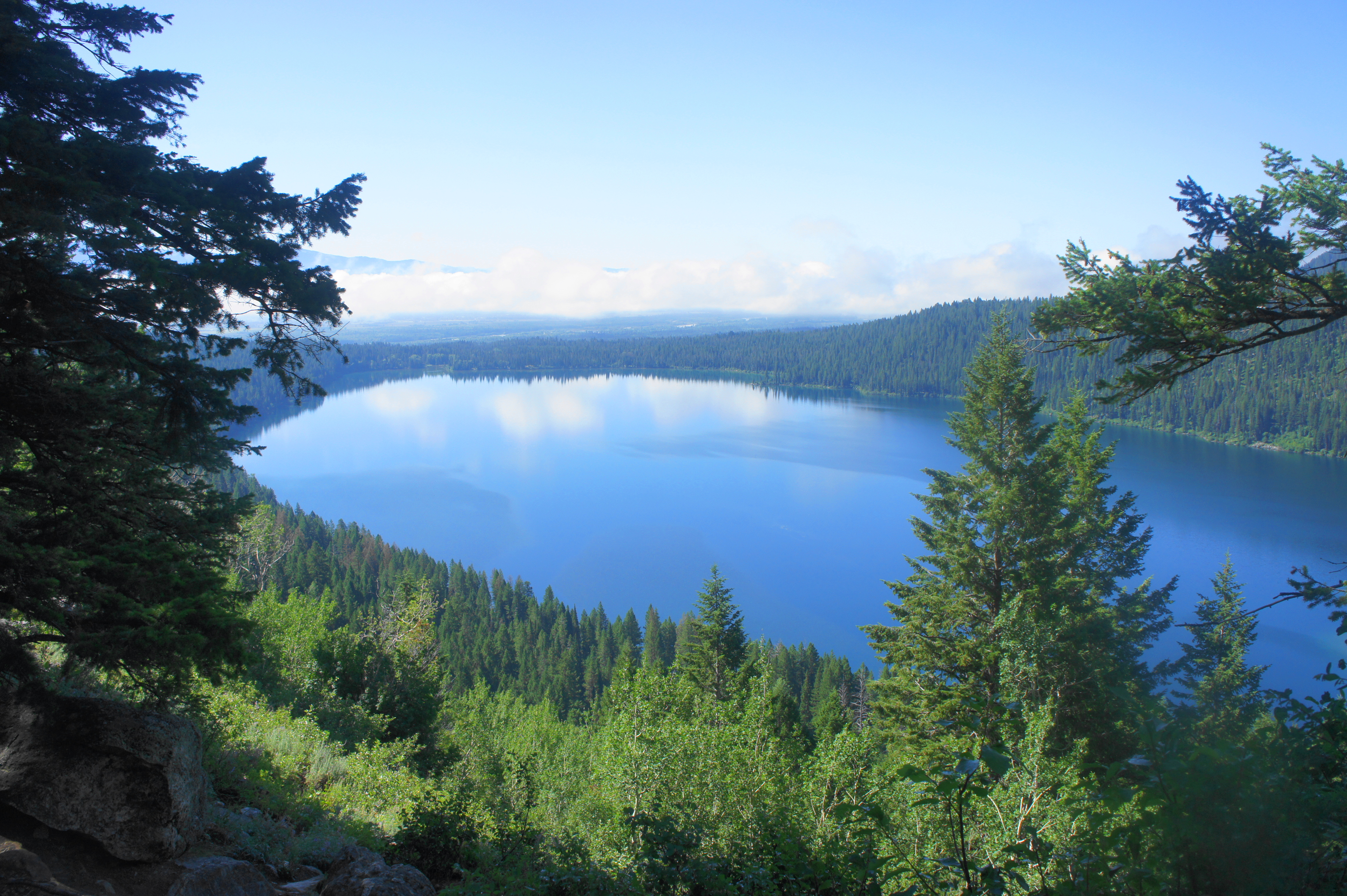
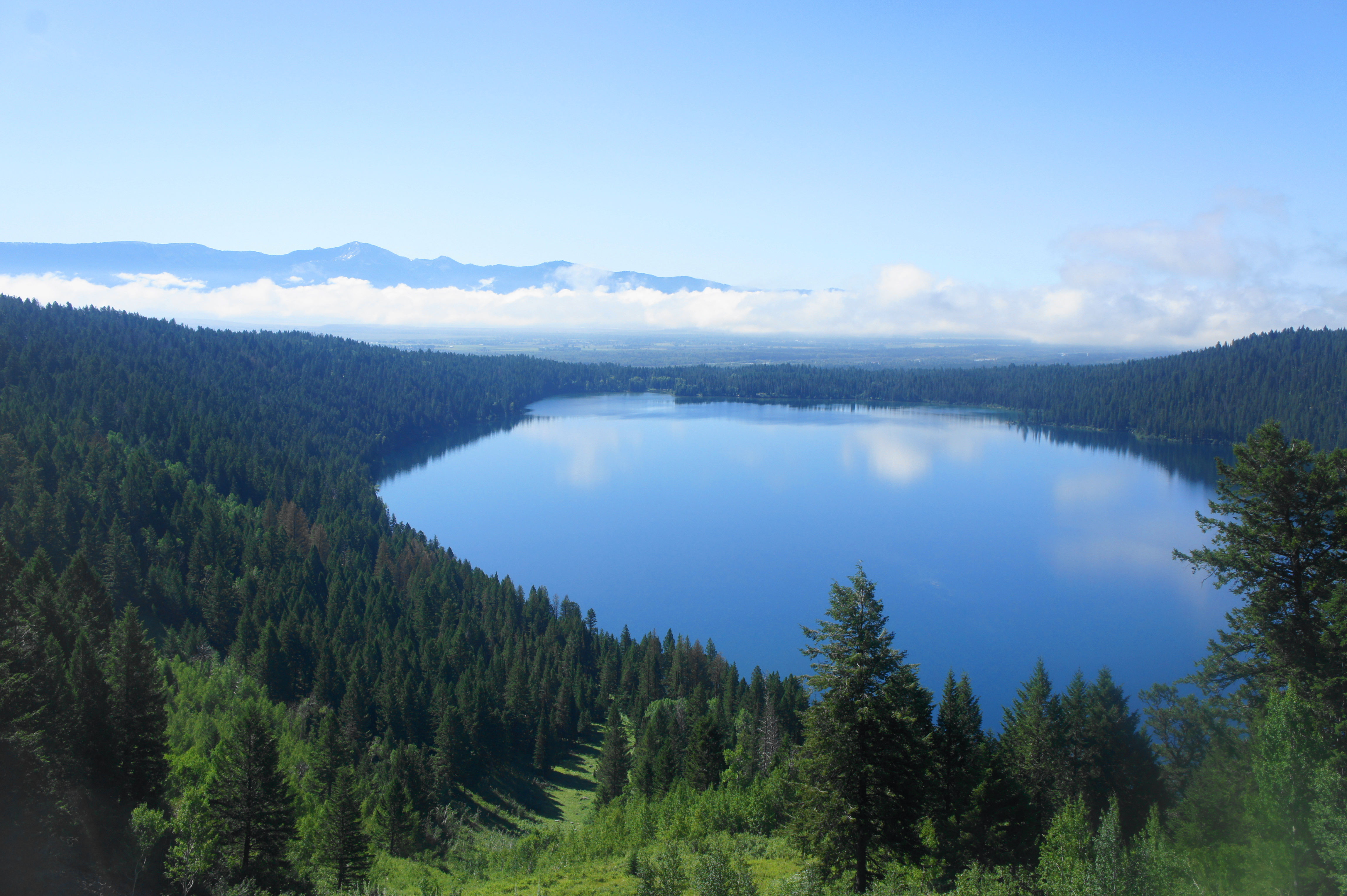
A huge pine tree on the left at around 9/10 mile ushers in the final approach to Phelps Lake Overlook, which is at around 7,200 feet in elevation, a 400-foot gain from the trail’s start. Better views lie beyond, but the overlook offers the hike’s first look at the crystal blue waters of Phelps Lake, the product of glacial melt after the most recent Ice Age. Phelps Lake Overlook is a popular endpoint in itself—hikers looking for a short hike, perhaps with children, are likely to turn around here and return to the trailhead. But those eyeing Death Canyon should continue onward.
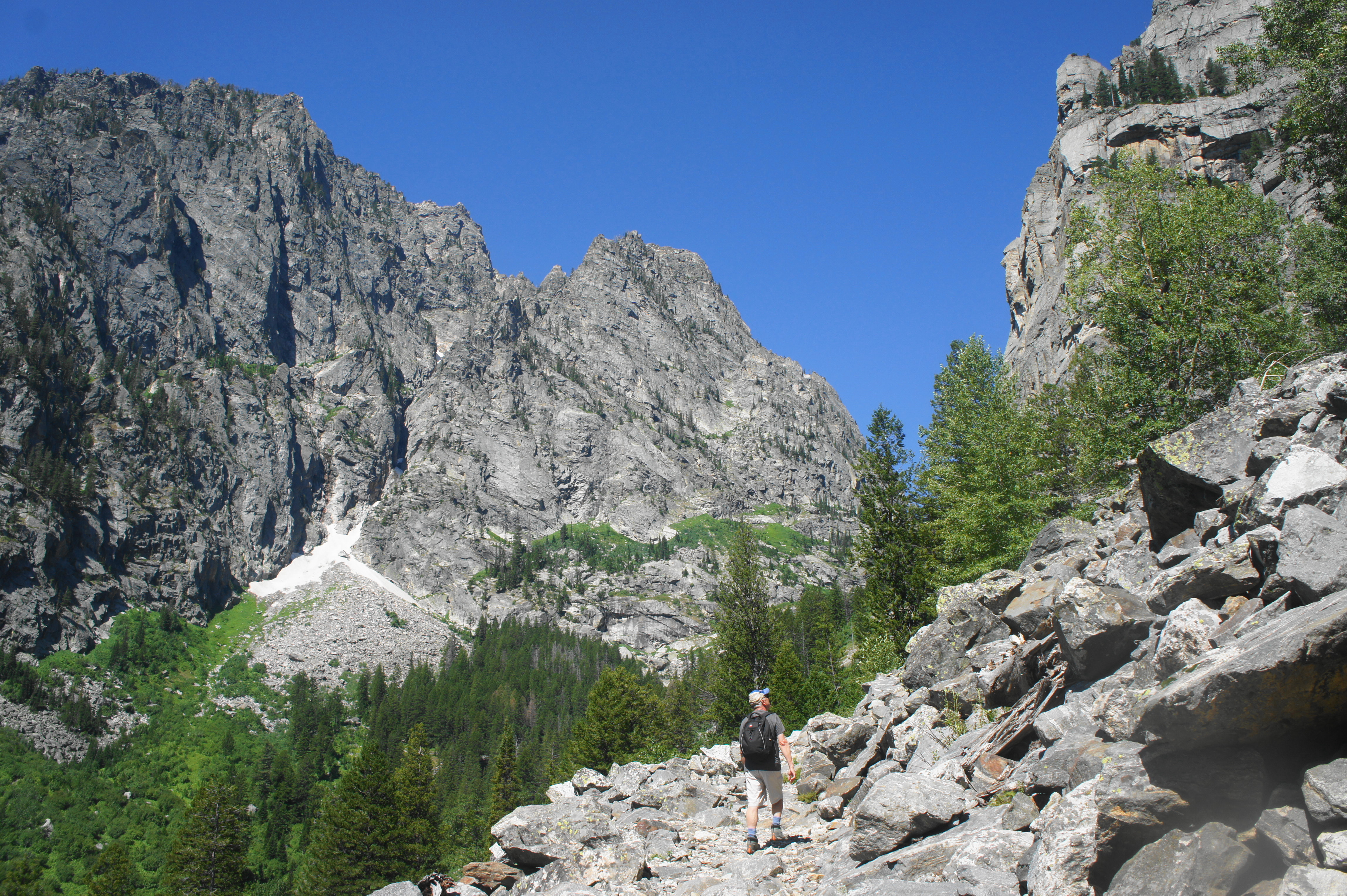
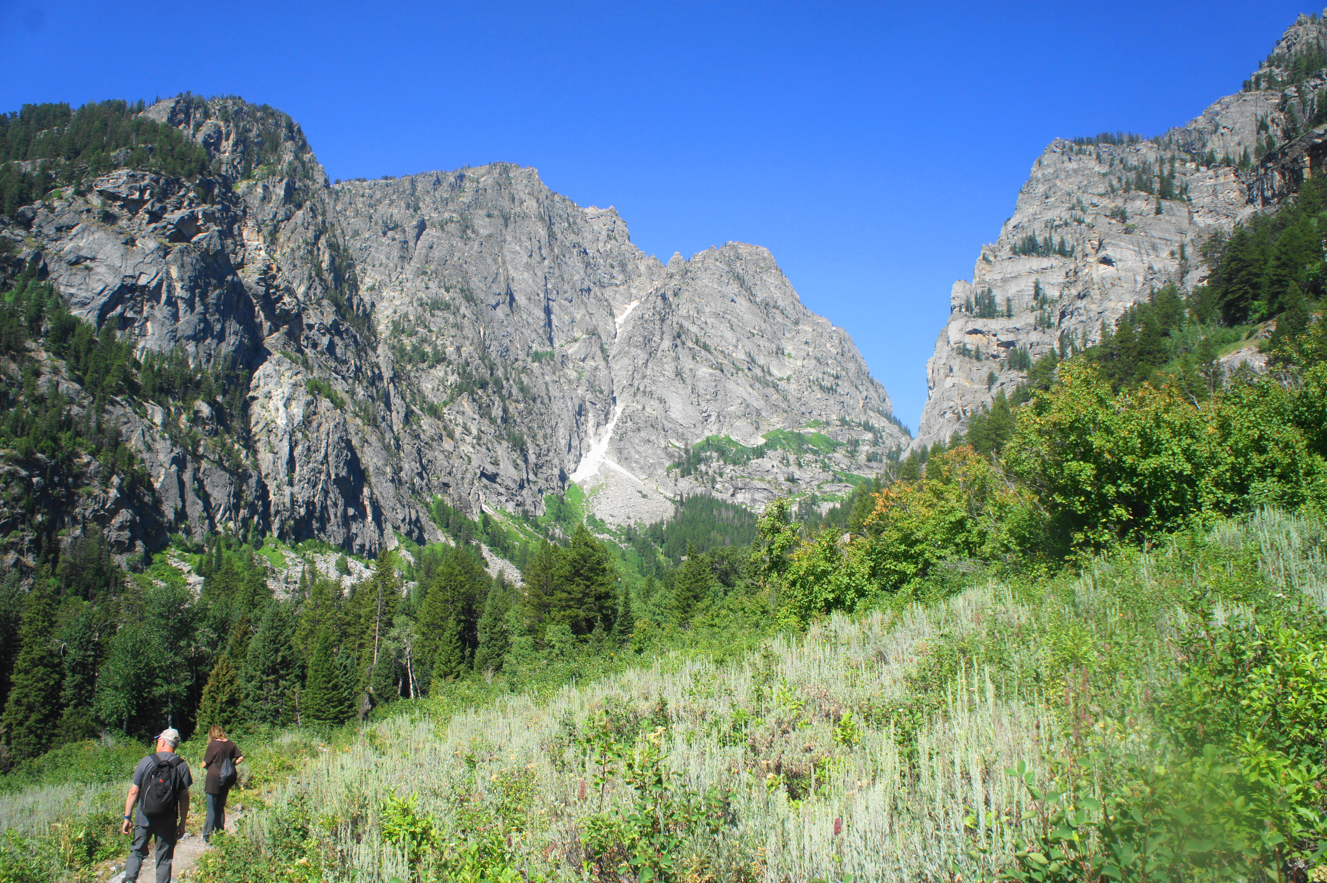
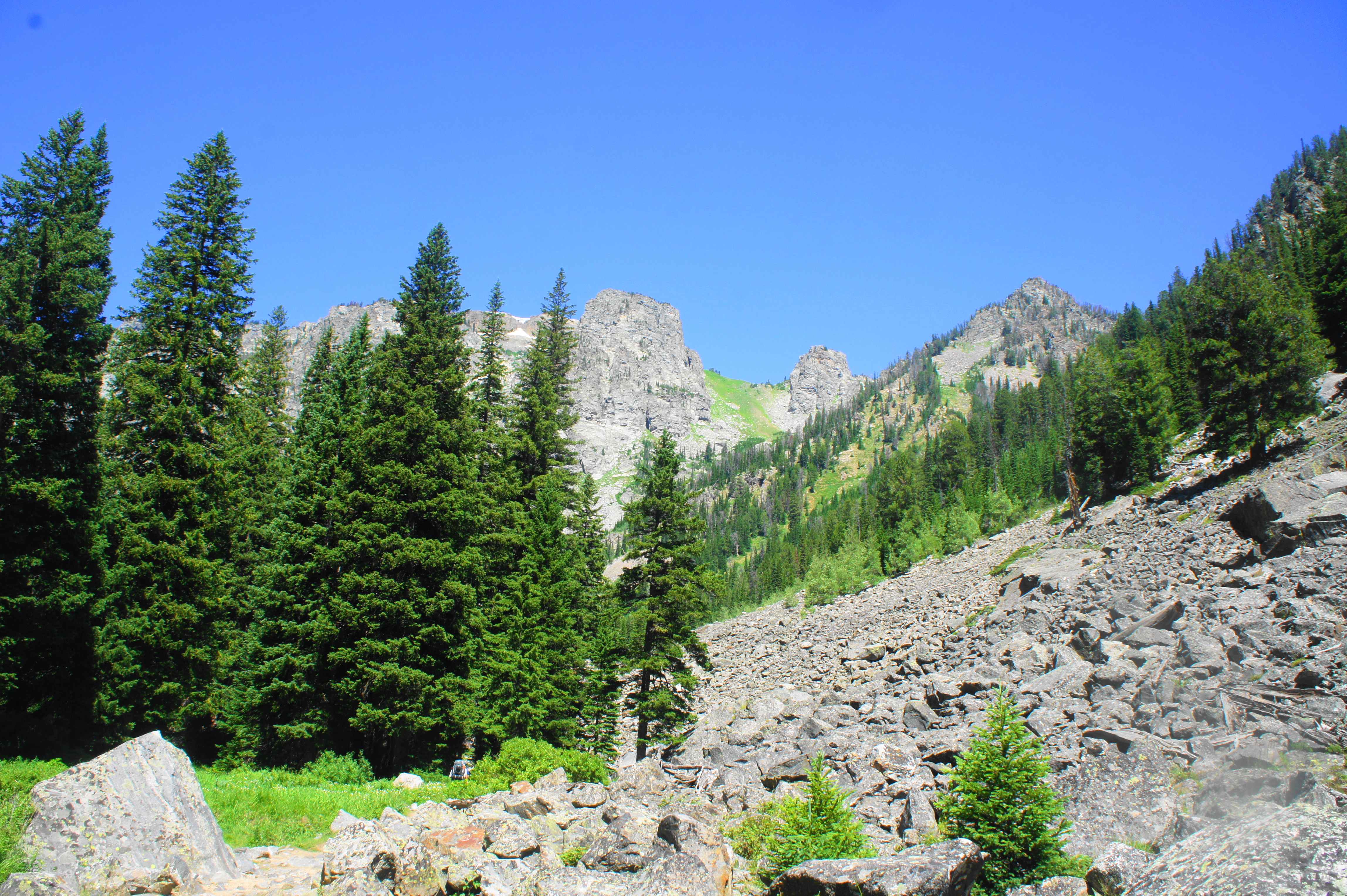
Instead of heading straight toward the dramatic entrance to the canyon, the Valley Trail from here actually drops sharply, shedding more than 400 feet in elevation in around a half-mile. As the trail switchbacks down the hillside, visitors are rewarded with standout vistas: unobstructed views of Phelps Lake to the south, with an open meadow blanketing the slopes to the north and west. A seasonal waterfall, visible at around the 1.6-mile mark, drips off a wall on the right. Meanwhile, one begins to make out the dramatic entrance to Death Canyon to the west—where sheer cliffs of granite and gneiss, rising to more than 2,000 feet, appear to narrow to a near-convergence. Death Canyon is calling…
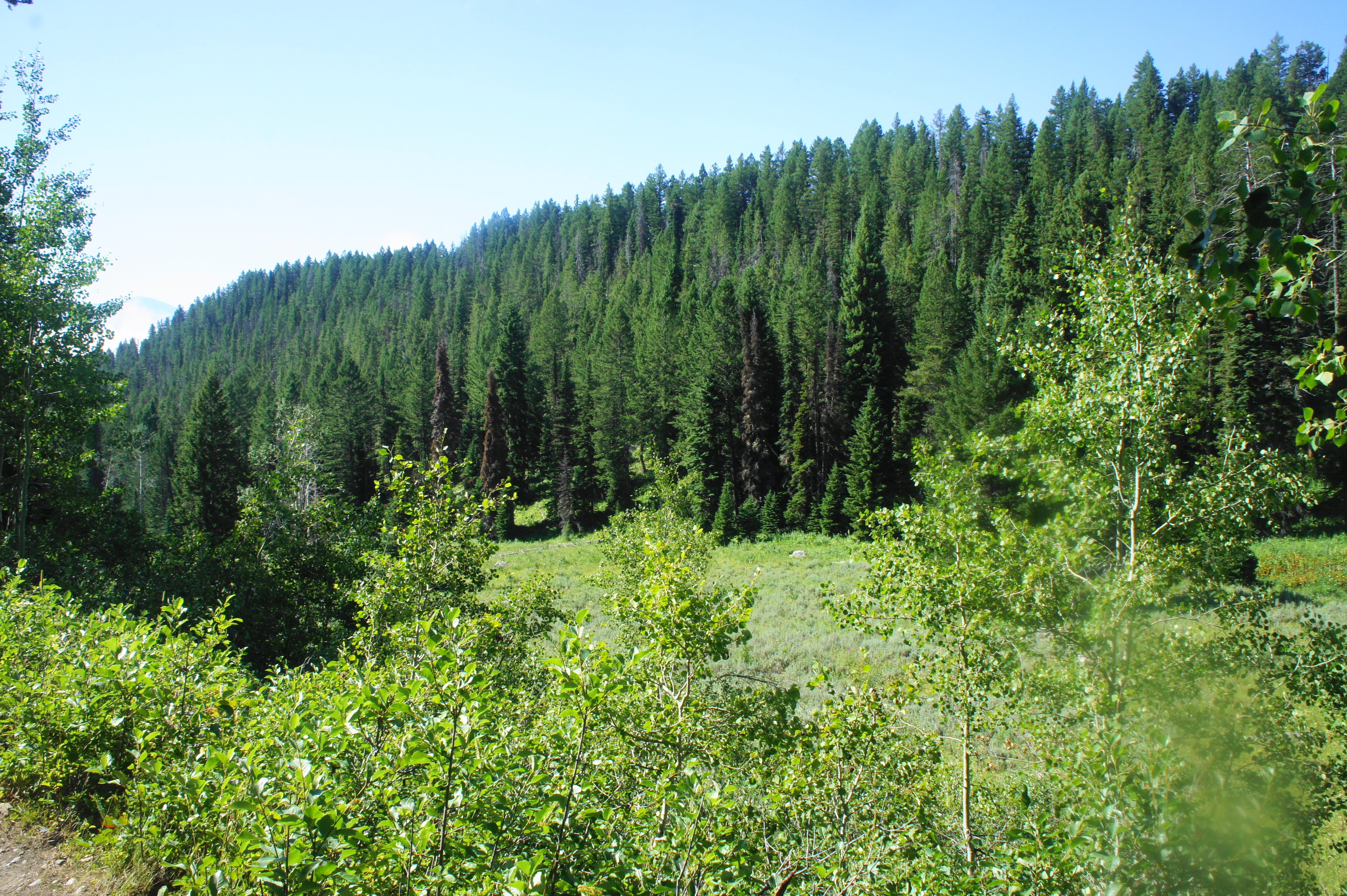
Finally, at around 1.7 miles, the trail bottoms out and splits: many hikers will head left, continuing on the Valley Trail as it wraps around the north flanks of Phelps Lake. But the Death Canyon Trail charts its own course to the right. Another short descent leads westward back into the forest, where hikers can hear—and eventually see—the cascading creek that carved the deep gorge. Towering pines are interspersed with granite slopes, small meadows, and rock slides.
At about the two-mile mark, the trail begins a lengthy ascent, which covers around 1,100 feet in elevation gain in the next 1.6 miles. A flat rock outcrop on the left offers a place to stop for a snack and short rest before the steady climb. As the trail gains height, the rumble of the cascades grows louder—although, for now, hikers will keep their distance from the creek. At 2.25 miles, the route abruptly cuts east, away from the stream and traversing another rock slide. A quarter mile further, a left-hand switchback returns hikers to their westward trace. Additional boulder slides break up the wooded sections, offering increasingly distant views of Phelps Lake.
At about 2.7 miles, a side canyon enters from the right, and the woods become increasingly sparse. Minutes later, the path traverses a ledge section with relatively steep drop-offs to the left. At 3.1 miles, the Death Canyon Trail passes a wide alcove coated with strips of black varnish (reminiscent of similar features in Utah’s canyon country).
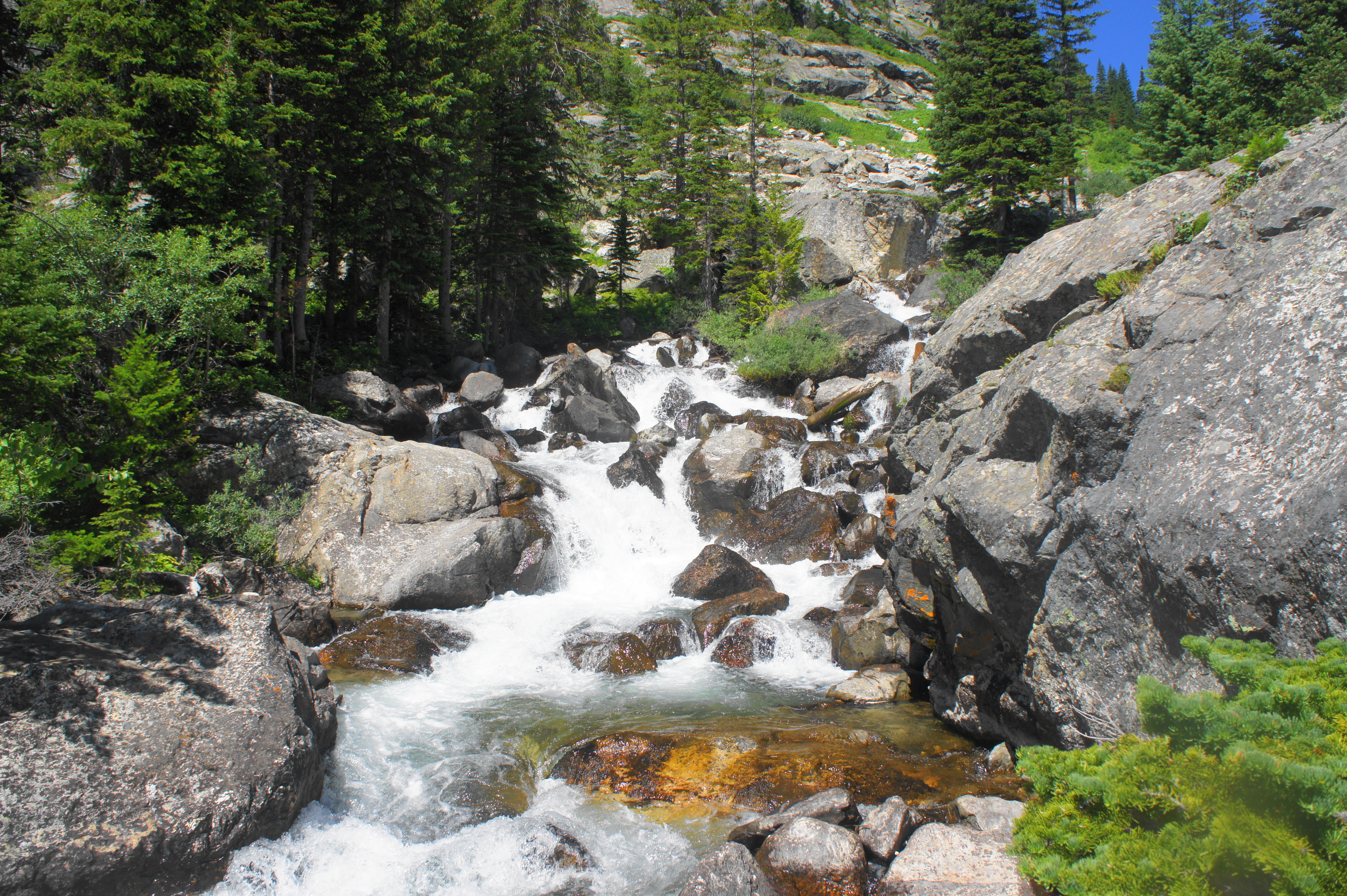
At last, the trail meets the banks of the creek at 3.2 miles—another fine place to stop for a short break. Here the sun shines brightly on the iron-coated creek, with roaring torrents of water cutting down through the canyon.
By now, hikers can begin to make out the end to the ascent above—a line of trees where the incline levels off. But this is still several hundred feet above your present location—and thus the switchbacks return, starting with a right-hand cut that clears another level of climbing. Minutes later, a right-hand switchback offers views again of the varnished alcove.


At 3.3 miles, the trail returns to the creek side, with even more impressive cascades. There is a third opportunity to get close to the creek after another pair of switchbacks, followed by the final ascent.

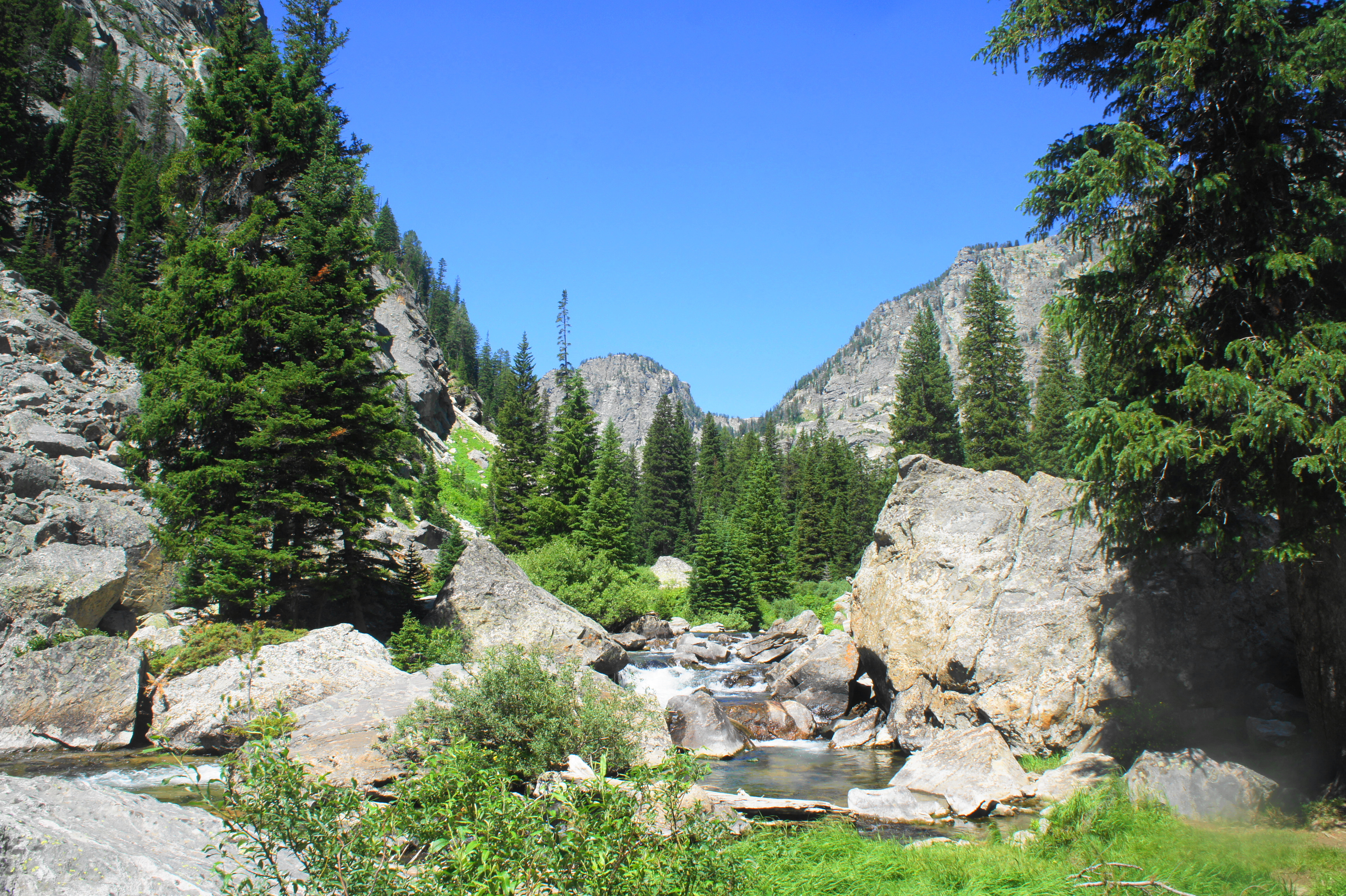
At 3.6 miles, hikers can breathe a sigh of relief when the relentless climb suddenly stops, and the water upstream is quiet and peaceful, gathering in small pools with occasional but minor dips. Upper Death Canyon is largely flat and serene, a popular hangout for moose and other critters. Breaks in the woods offer views of the craggy peaks of the Alaska Basin area to the north, as well as Prospectors Mountain (11,241’) to the south.
At last, at 3.9 miles, hikers will reach the patrol cabin and trail junction—an underwhelming site, but at least a decent turnaround point. Of course, backpackers and endurance day hikers can continue onward, either further up Death Canyon or up the steep ascent on the Alaska Basin Trail to Static Peak Divide. But most visitors will head back from here, returning the way they came.


With this, hikers can claim they have cheated death—at least after returning to the trailhead, by way of the unwelcome 400-foot slog back uphill from the Death Canyon Trail junction to Phelps Lake Overlook. While the entire out-and-back clocks in at around 7.8 miles, trekkers should expect to take longer than the rule-of-thumb, 2-miles-per-hour pace. A comfortable bet is to allot between 5-7 hours for the round-trip, making Death Canyon almost a full-day walk.

Pingback: Bradley Lake, Taggart Lake, and Beaver Creek Trail Loop (Grand Teton National Park, WY) | Live and Let Hike
Pingback: Top 10 Hikes in 2019 | Live and Let Hike
Pingback: Death Canyon Trail to Patrol Cabin (Grand Teton National Park, WY) — Live and Let Hike – Sarah's Attic Of Treasures