
As glaciers carved the various canyons of Grand Teton National Park, they pushed enormous heaps of rocky debris down to the base of the sharp peaks, forming what geologists and climatologists today call moraines. In the centuries—millennia—that passed, the retreating glaciers left behind still, blue lakes, and vibrant evergreen forests and meadows blanketed the moraines, creating the picturesque setting of today. The 5.8-mile hike to Bradley and Taggart Lakes—with a foray down the Beaver Creek Trail thrown in for good measure—traverses this moraine landscape, with excellent views of the Cathedral Group, including Grand Teton. The moderately difficult circuit, with some minor elevation gain, provides an easier alternative to other nearby day hikes that lead sharply uphill into the Teton Range.

The hike
For hikers with the luxury of two cars—or a drop-off and pick-up—the ideal way to see Bradley and Taggart Lakes is via a one-way trek, starting at Lupine Meadows Trailhead and ending at Taggart Lake Trailhead. Most visitors will not have such a luxury, however, and should instead make a loop out of it, starting at Taggart Lake Trailhead, a popular parking area in the heart of Grand Teton National Park. Arrive early or late to minimize the crowds and maximize the likelihood of grabbing a parking spot.
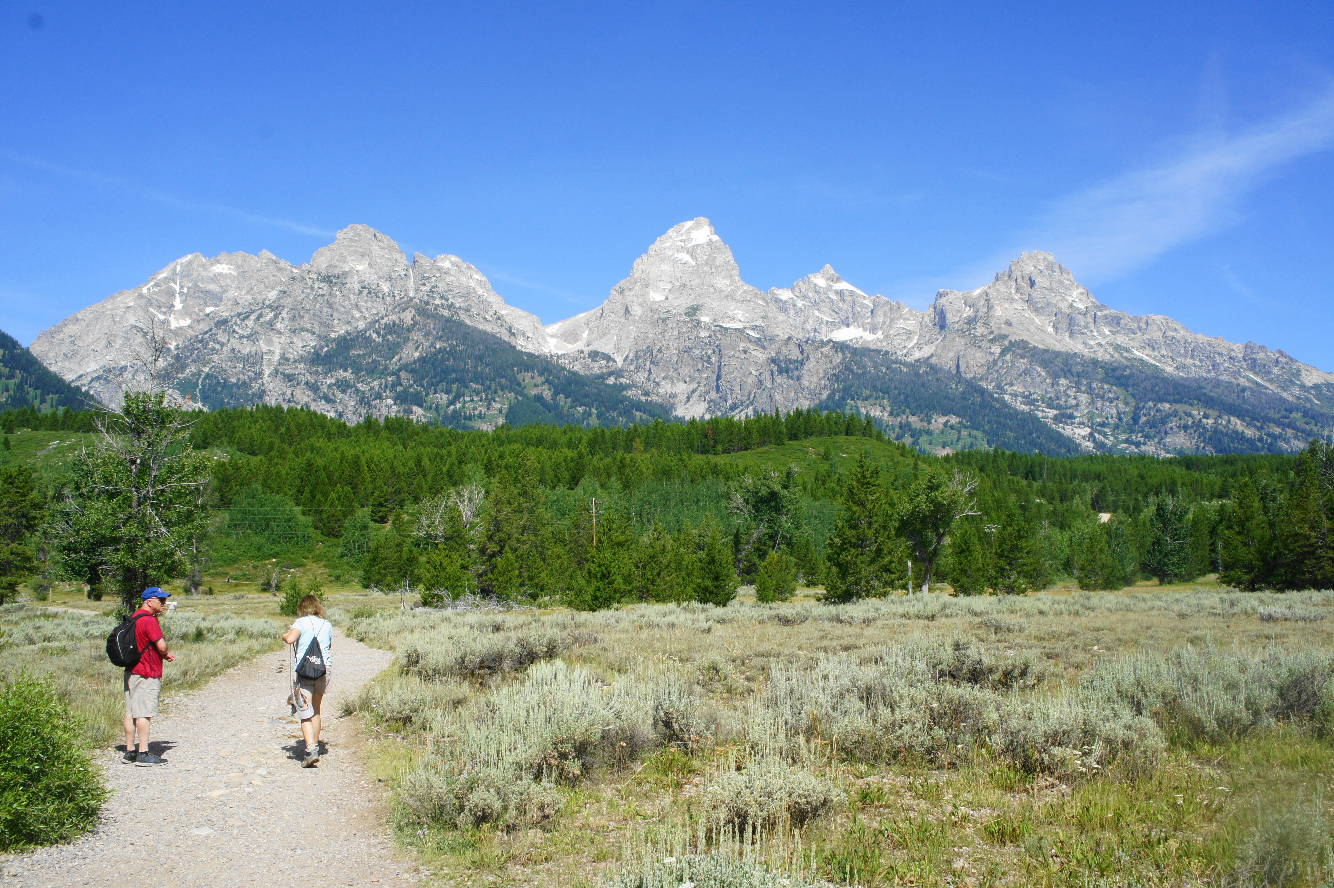
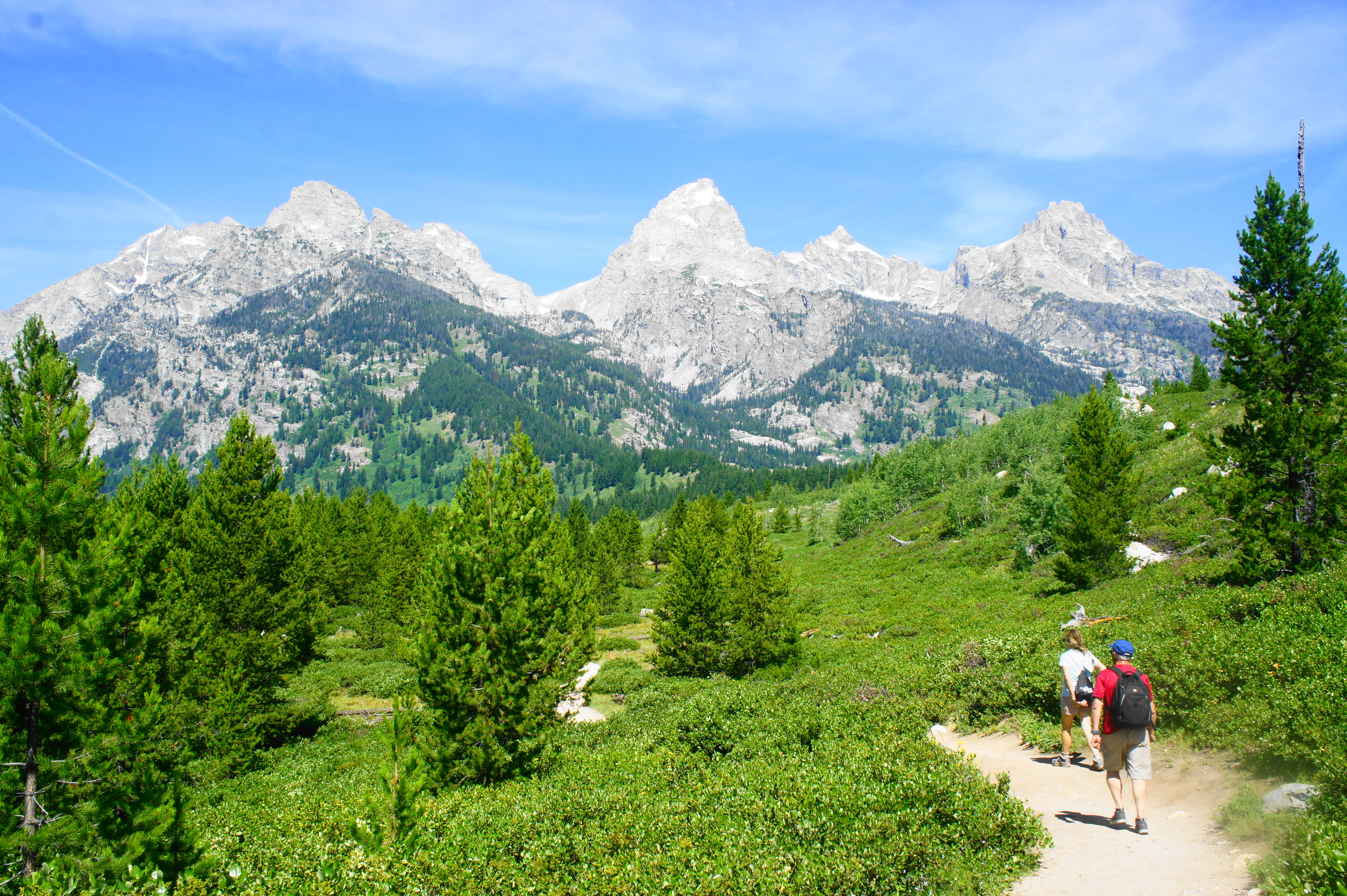
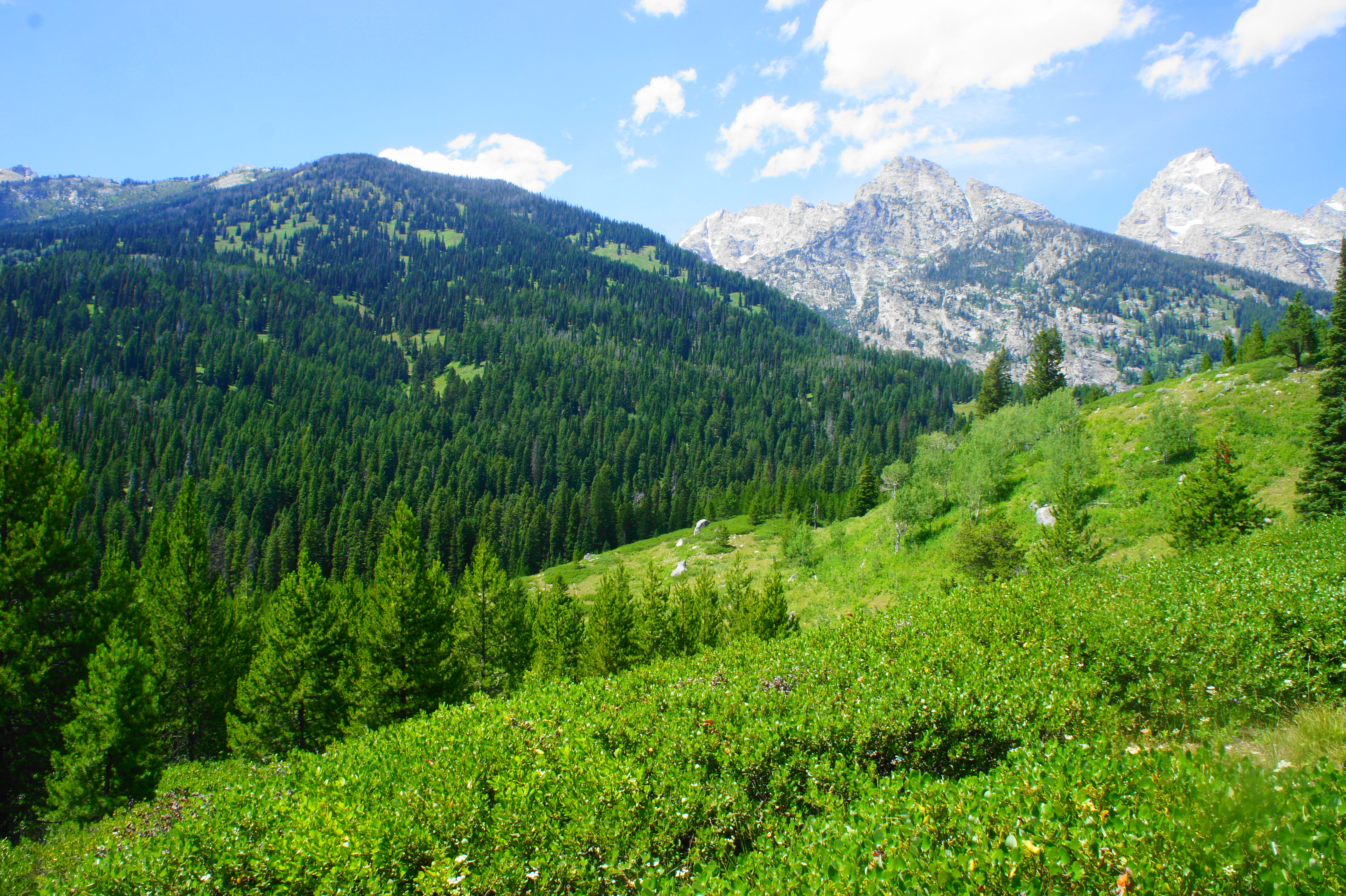
From the Taggart Lake Trailhead (confusingly, also known as the Bradley Lake Trailhead), head straight on the gravel path that leads westward across a sagebrush plain. With few obstructions in the way, the opening section offers excellent views right away: ahead, on a clear day, the Cathedral Group—including Grand Teton (13,770’), Mount Owen (12,928’), Middle Teton (12,804’), Teewinot Mountain (12,325’), and Nez Perce Peak (11,901’)—dominates the skyline. These jagged peaks of the Teton Range are some of the youngest in North America, uplifting for less than 10 million years, at the same time that the bedrock that forms Jackson Hole has continued to drop.
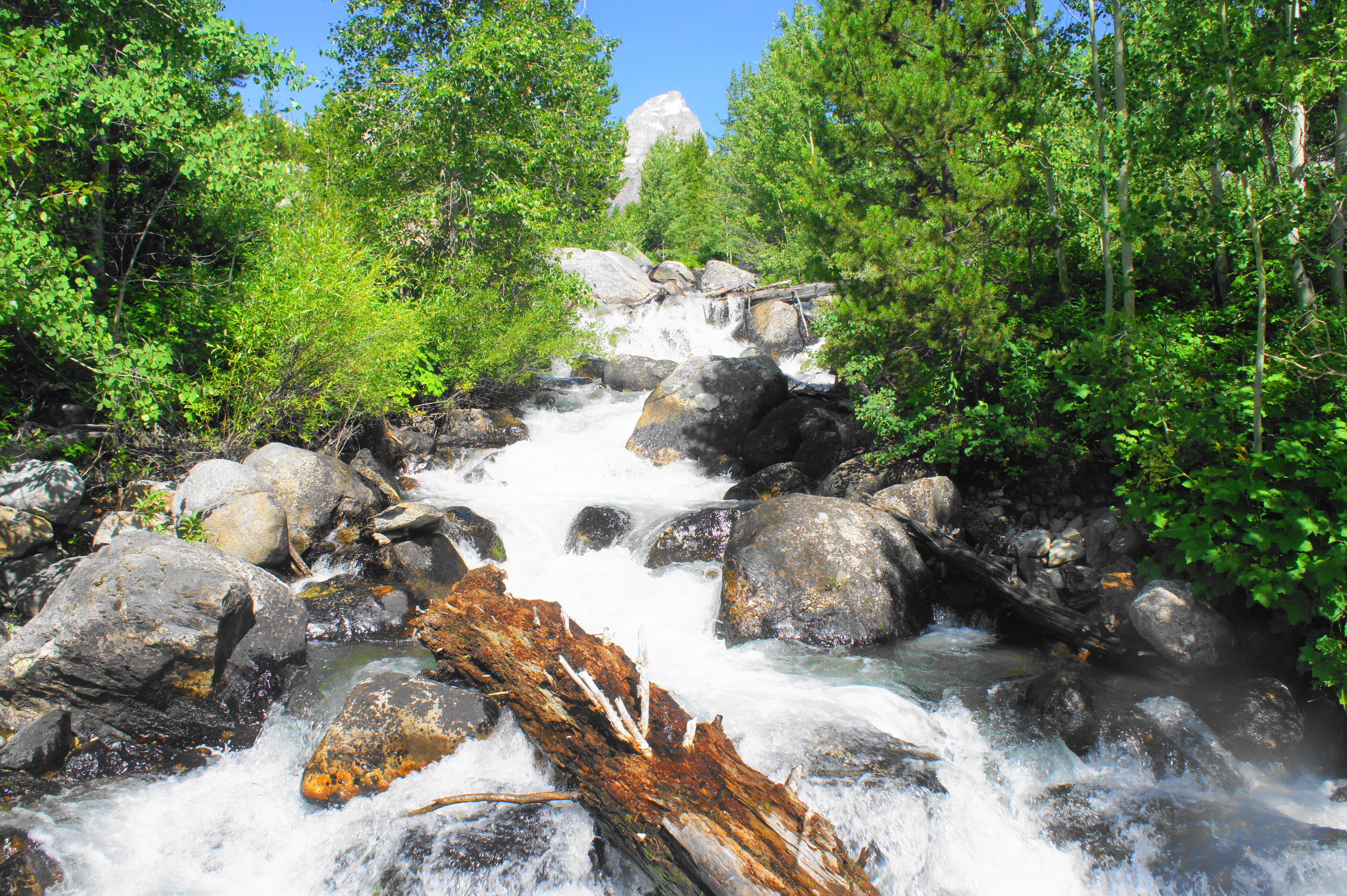
The beauty is marred briefly by an unattractive string of power lines, which hikers pass under after about 200 yards. Here the route splits in four directions: a single-track continues straight, the wide path bears right, while a less visible, rutted double-track veers off to the left. Head north (right) on the broad path toward Taggart and Bradley Lakes. Follow this track for about 2/10 mile as the tree cover gets denser. The route splits again at 3/10 mile, with the old road heading left while the Taggart Lake Trail bears right. Stay right on this narrower path, which climbs gently through an aspen grove and crosses rumbling Taggart Creek. Look up to the left, where Grand Teton peeks above the trees, framed nicely with the tumbling cascades in the foreground.
Continuing northward, the trail passes under power lines again and skirts the western fringes of a horse ranch on the right. As the well-trodden path edges westward, the incline steepens and, after crossing another stream at about 6/10 mile, follows the flowing creek uphill through the moraine. By 9/10 mile, the trail pulls away from the stream valley and the views of the Tetons return. In the lovely open meadow, the Taggart Lake Trail descends slightly and then reaches a junction at 1.1 miles. While most crowds will head left to Taggart Lake, instead bear right on the Bradley Lake Cutoff Trail to head toward Bradley first. This relatively underutilized trail is breathtaking, featuring some of the best vantage points on the hike.
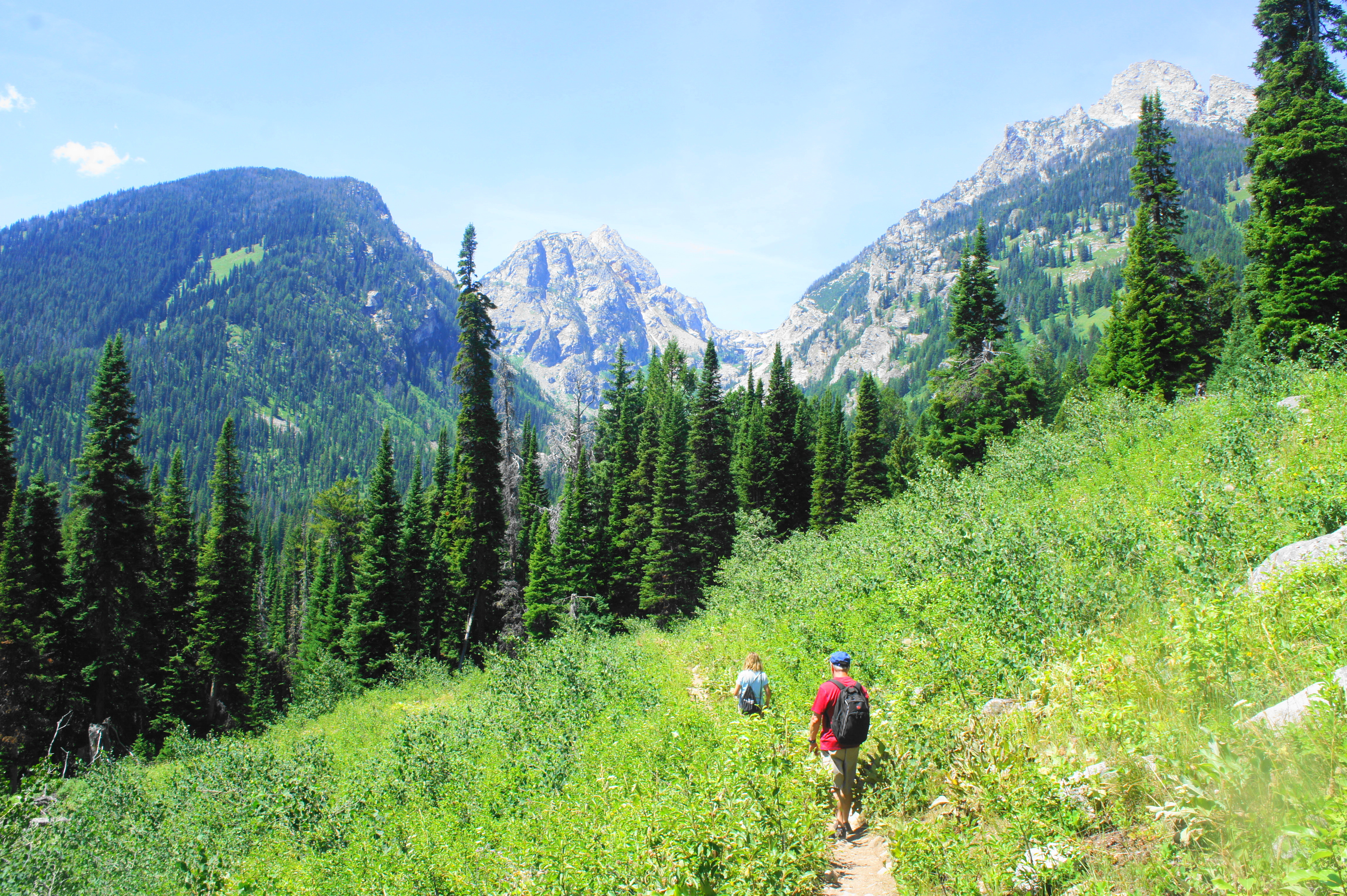
After cutting through another small aspen grove, the cutoff trail again stretches across lush meadows with stunning views of the Cathedral Group. Various canyons cut deep incisions in the mountains, including (from left to right) Avalanche Canyon, Garnet Canyon, and Glacier Gulch. High up Avalanche Canyon, one can make out the outlines of Shoshoko Falls, a cascade that drops more than 200 feet. (Note: Avalanche Canyon is not accessible by official trail, but an occasionally used route leads up to the hike, one of the most strenuous but rewarding in the park.)

After 1/3 mile of slight dips and climbs, the Bradley Lake Cutoff Trail embarks on a sharper ascent at around 1.5 miles. Tree cover blocks views during this section as the path weaves up a set of bends and switchbacks. Along the way, the first views of Taggart Lake appear—from a distance—on the left. After briefing leveling off, the trail amid the aspens and mixed conifers climbs again. At 1.9 miles, the trail finally tops the ridgeline—but Bradley Lake remains hidden behind two additional crests.

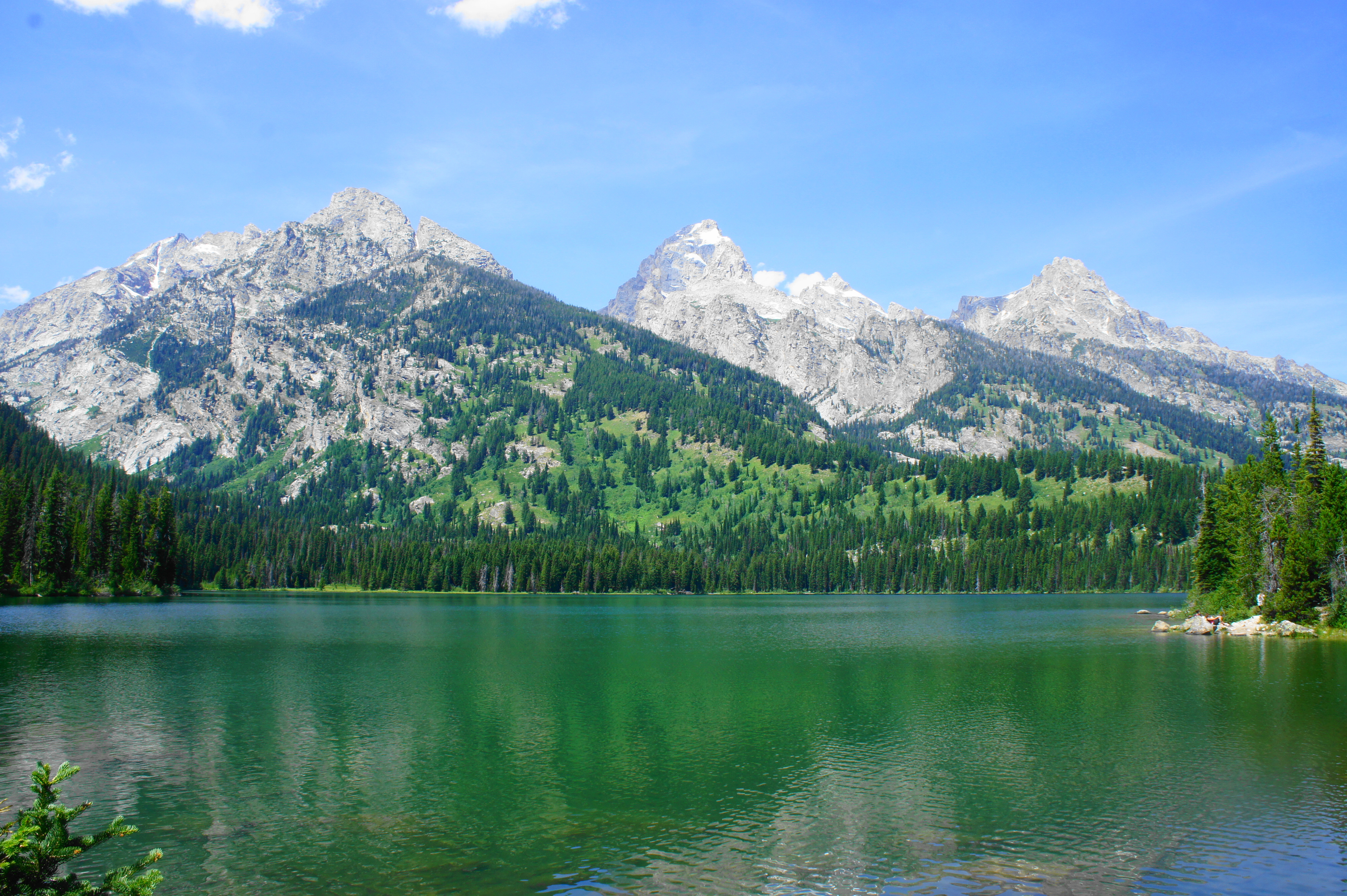
The narrow single-track now descends briefly before picking up the ascent again, clearing a second ridgeline. Switchbacks lead down again, then finally the path climbs to a third ridgeline, this one with obscured views of Bradley Lake. While the loop continues left, head right for a couple minutes to get down to the eastern shores of Bradley Lake. A series of social trails lead to the lake, where wading and swimming are allowed…if you can brave the chilly waters.
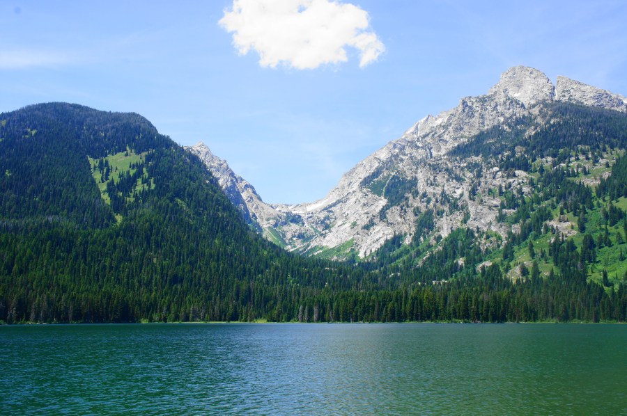
From Bradley Lake, the Teton Range rises more than 6,000 feet—one of the most picturesque spots in Grand Teton National Park. Here hikers have a good view of Garnet Canyon and the steep hillside that provides passage for hikers on the strenuous Amphitheater Lake Trail. Stop for lunch, a snack, or a dip at Bradley Lake before heading back the way you came to the nearby junction.

From this junction, bear west (right) on the Valley Trail, a lengthy track that connects most of the park’s main lakes at the base of the Tetons. After a mild meander, the incline increases at about 2.25 miles, and the trail switchbacks up to crest the main ridgeline between Taggart and Bradley Lakes. The other side has fewer obstructions, allowing for frequent views of Taggart Lake as you approach. After a set of switchbacks to ease the descent, the Valley Trail levels off at around 2.9 miles amid thick tree cover.
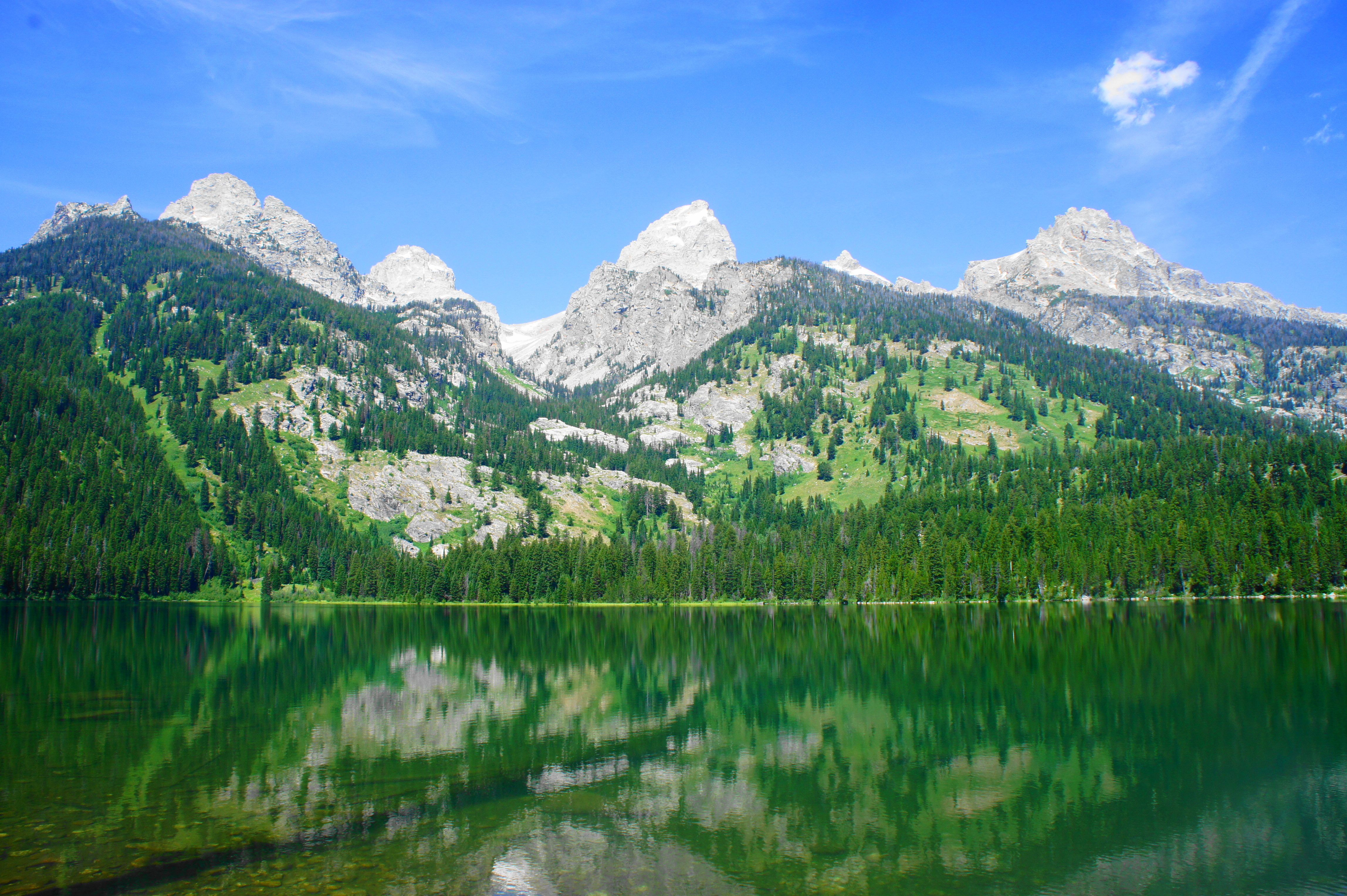
Finally, at about 3.1 miles, spur trails provide the first access to the shores of Taggart Lake. Like Bradley, Taggart Lake is also nestled in the shadow of the Cathedral Group, but with the added bonus of excellent views of Avalanche Canyon and Shoshoko Falls in the distance. Taggart is considerably more crowded, detracting slightly from the otherwise spectacular scenery.

Follow the Valley Trail south as it hugs the eastern shores of Taggart Lake, then reach another junction at 3.5 miles. Heading left takes the quickest—and most popular—route back to Taggart Lake Trailhead. But those looking to extend the hike with a slightly longer loop should continue right toward the Beaver Creek area.
This route continues to follow Taggart Lake toward its southern terminus. A wooden bridge provides passage over an inlet, followed by a moderately steep ascent that clears yet another ridgeline in the moraine. The Valley Trail crests the ridgetop at 3.9 miles, and the views of Taggart Lake and the Cathedral Group are replaced by sweeping vistas over meadows and Jackson Hole to the Gros Ventre Mountains beyond. The winding descent from here combines views both northward to the main Tetons and south to Jackson in one of the hike’s most memorable stretches.
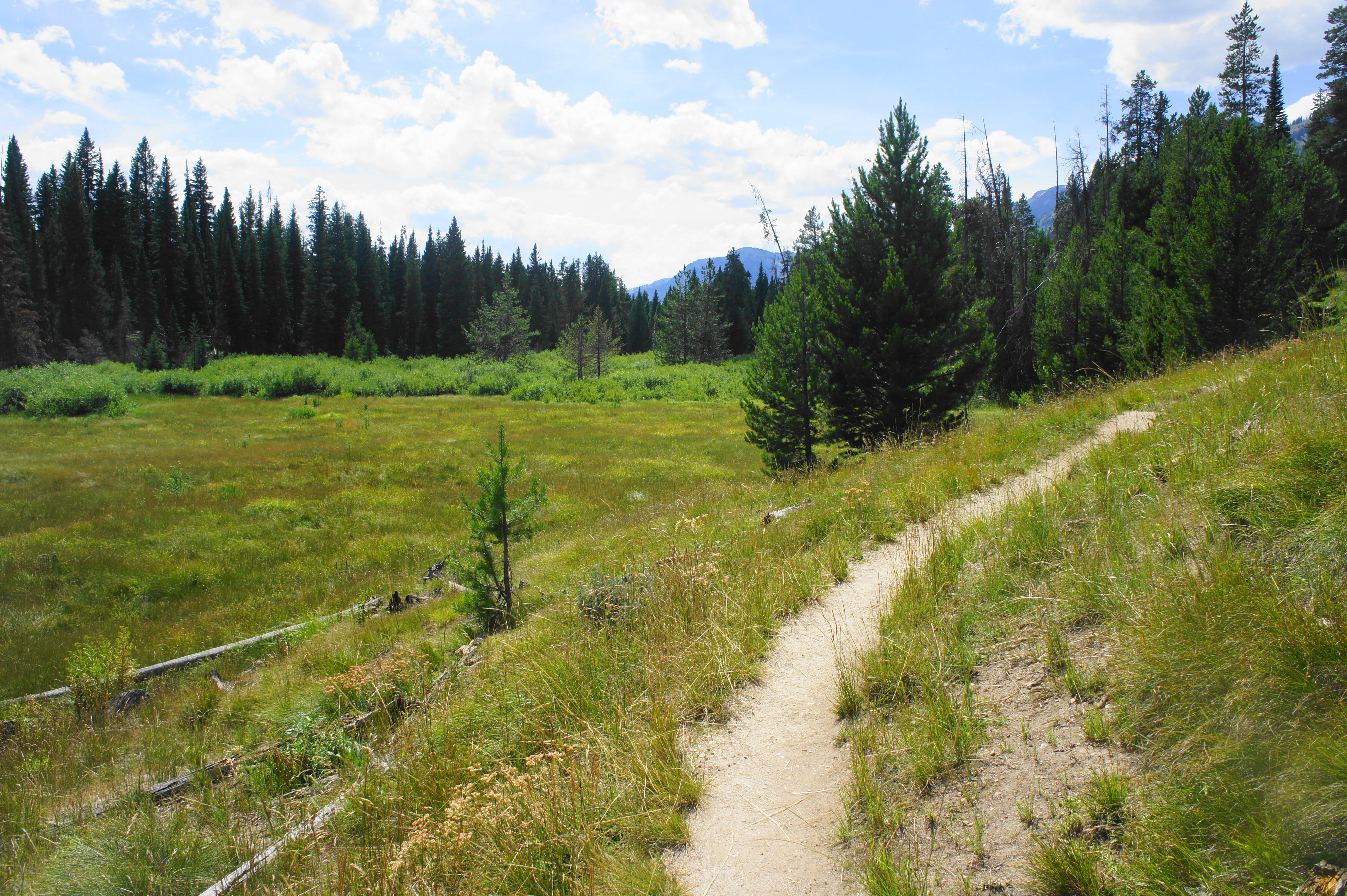
At 4.25 miles, the Valley Trail drops back into the woods and finds relatively level ground, approaching Beaver Creek on the right. Take a left at the next junction, following the gentle stream in a southwesterly direction toward Taggart Lake Trailhead. The Beaver Creek Trail descends at a modest clip before the creek suddenly disappears for a short stretch before reappearing amid broad meadows a half-mile later. The willow-choked stream and open expanses provide excellent opportunities to spot moose and other creatures.
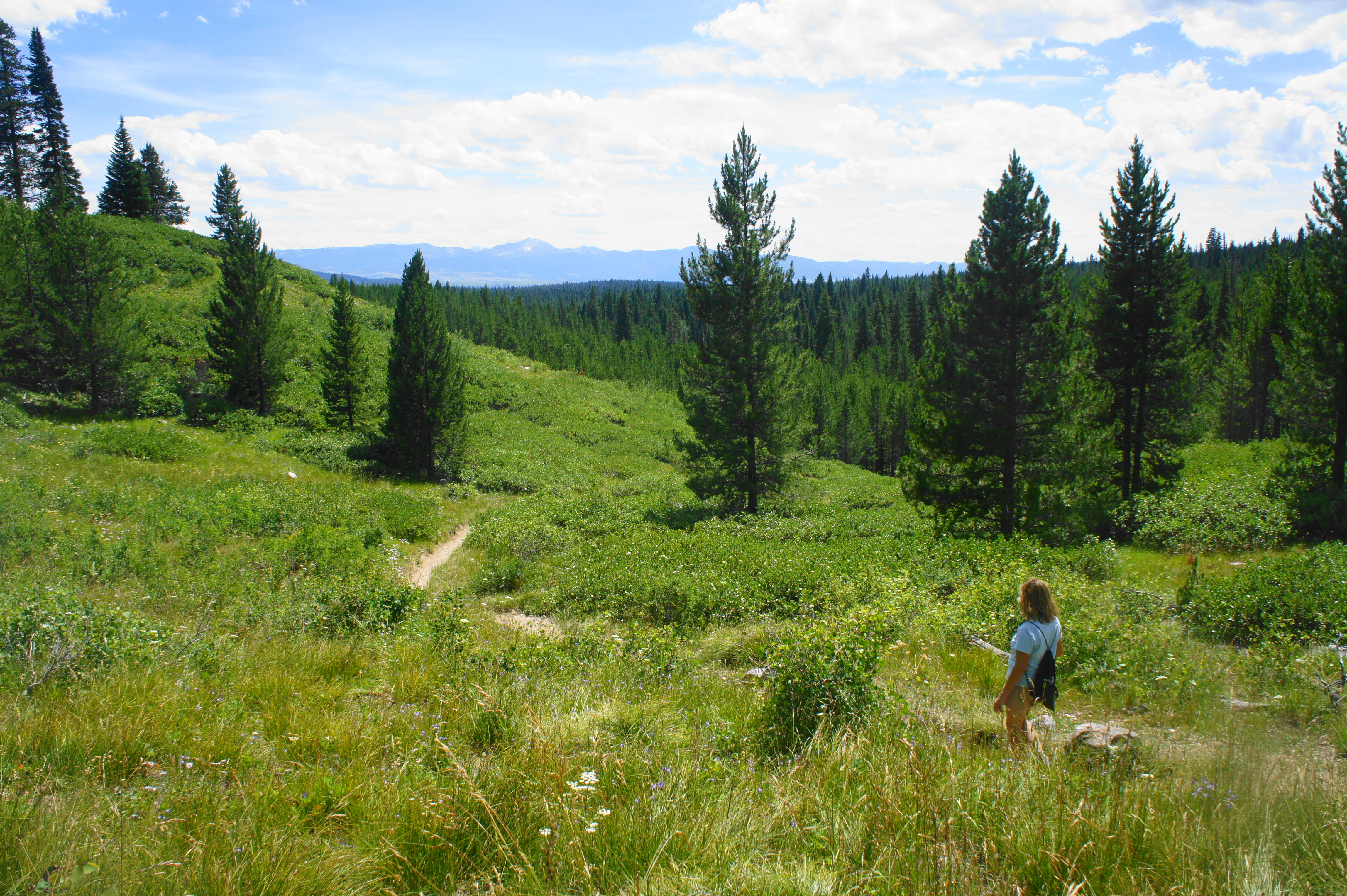
At 5.1 miles, the Beaver Creek Trail begins to cut away from the stream valley and climbs northward. As the smooth hillsides give way to jagged rock outcrops, there are nice views of Jackson Hole and the Gros Ventre Mountains. By 5.5 miles, the trail approaches the opening meadow, within striking distance of the trailhead and Teton Park Road. Bear right at the junction at 5.6 miles, then stay straight as you return to the initial, four-way junction below the power lines. From here it is a short, level walk back to the parking area.
The entire, 5.8-mile circuit is moderately difficult, with only brief and relatively mild ascents. Yet to take in the full beauty of the place, it is recommended to allot 4-5 hours for the round-trip hike.
Extra credit
For a tougher hike that heads into the Teton Range, try nearby Death Canyon, Cascade Canyon, or Paintbrush Canyon. Or take a walk along the easier lakeshore trails at Leigh, String, Jenny, or Phelps Lake.

It’s been great to see you out hiking and posting on the west again, Andrew. We just did a day trip over to the Tetons from Idaho Falls in June and had a great time. Next summer/fall we plan to be there for a longer time to explore more trial and roads. A hiking friend just move to the DC area. I passed on your blog since you have a wealth of hiking ideas for the area.
Ah yes, finally heading west again. You’ll see a lot more from northern California since I have moved out there. DC is nice and all, but it ain’t as awesome as the Sierras or Rockies!
Pingback: Top 10 Hikes in 2019 | Live and Let Hike