“A weird and scenic landscape, peculiar to itself” is how President Calvin Coolidge described the volcanic, lunar-like landscape in south-central Idaho when he created Craters of the Moon National Monument in 1924. In the years before the designation, hearty explorers and geologists had crisscrossed and documented the unique volcanic features of the area, discovering a mishmash of cooled lava beds, cinder cones, fissures, and lava tubes. Among the various landmarks is Inferno Cone, a cinder cone that rises several hundred feet from the surface, offering panoramic views of Craters of the Moon, the Pioneer Mountains, and the surrounding Snake River Basin. The popular Inferno Cone Trail provides short but steep access to the summit.

The hike
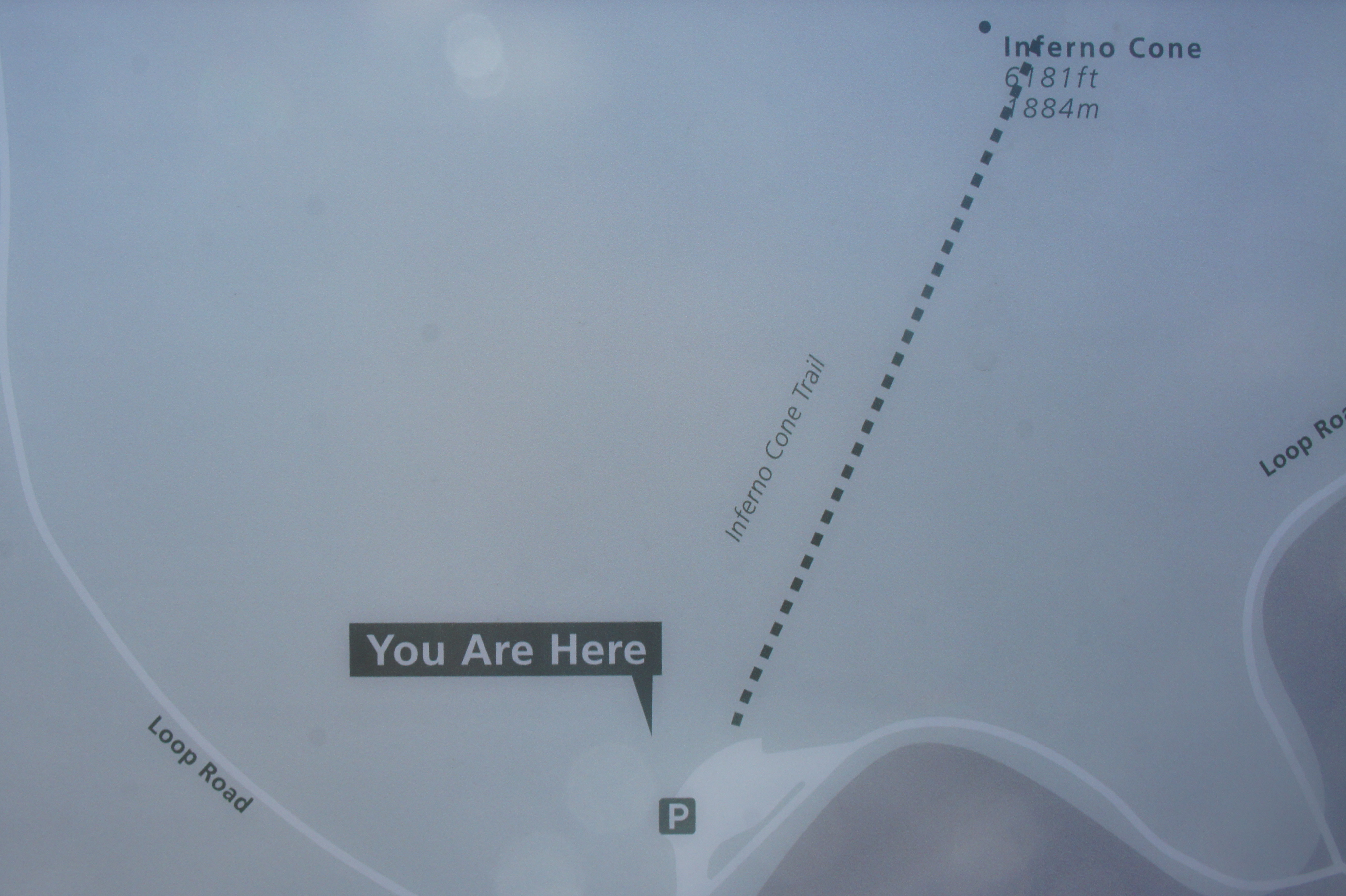
Craters of the Moon National Monument spans a massive 750,000 acres in south-central Idaho, but the vast majority of visitors are confined to the northwest corner of the park, where a 7-mile loop road offers up-close access to the various volcanic features. Inferno Cone is Stop #4 on the Loop Drive Tour. (Note: Stop by the Visitor Center for maps and other information.)
From the parking area, first check out the information panels, which explain that cinder cones, despite appearing to be volcanoes in themselves, are in fact just accumulations of volcanic cinders from nearby explosions. The area all around you, however, was shaped by volcanic activity, and not so long ago: only 2,000 years ago, the area was rocked by eruptions similar to what might find in Hawaii today. Today, the basaltic lava fields are some of the largest and best preserved in the world.
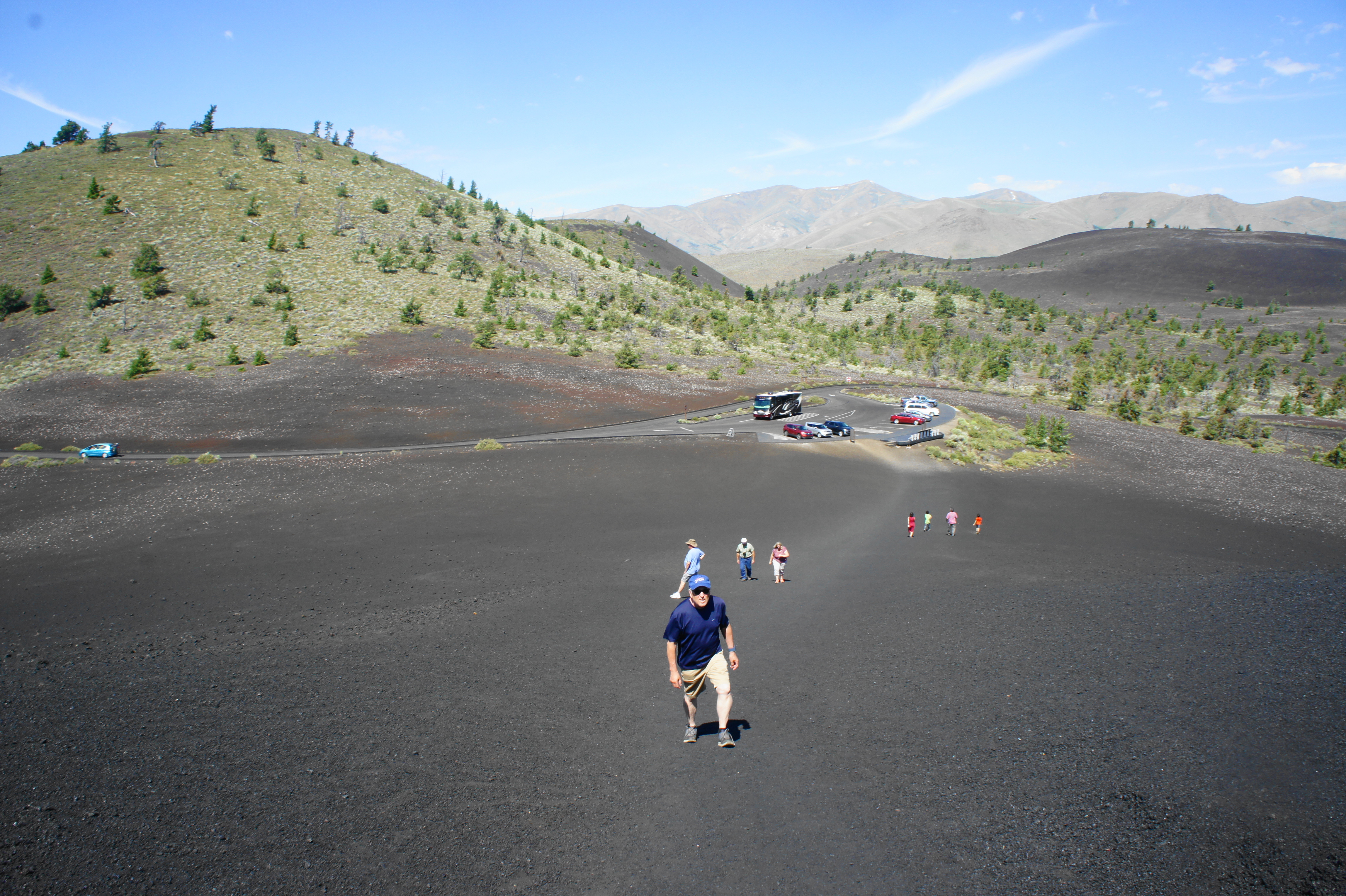
The hike up Inferno Cone is straightforward, covering 160 feet in elevation gain over the course of 2/10 mile. Hikers will crest an initial hump about halfway up, followed by a brief pause and then another steep incline. There are no switchbacks to ease the climb, but the ascent is over soon enough, requiring about 10-15 minutes to reach the summit.

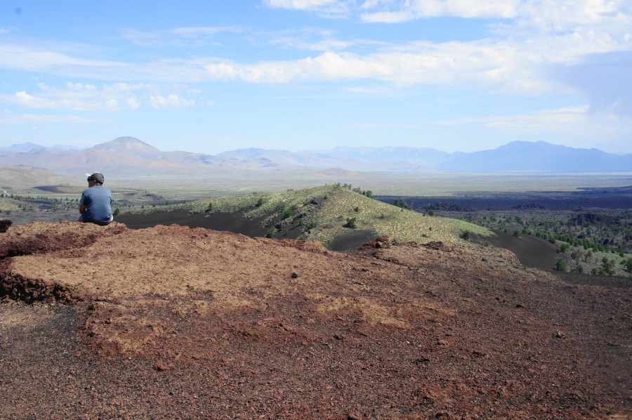
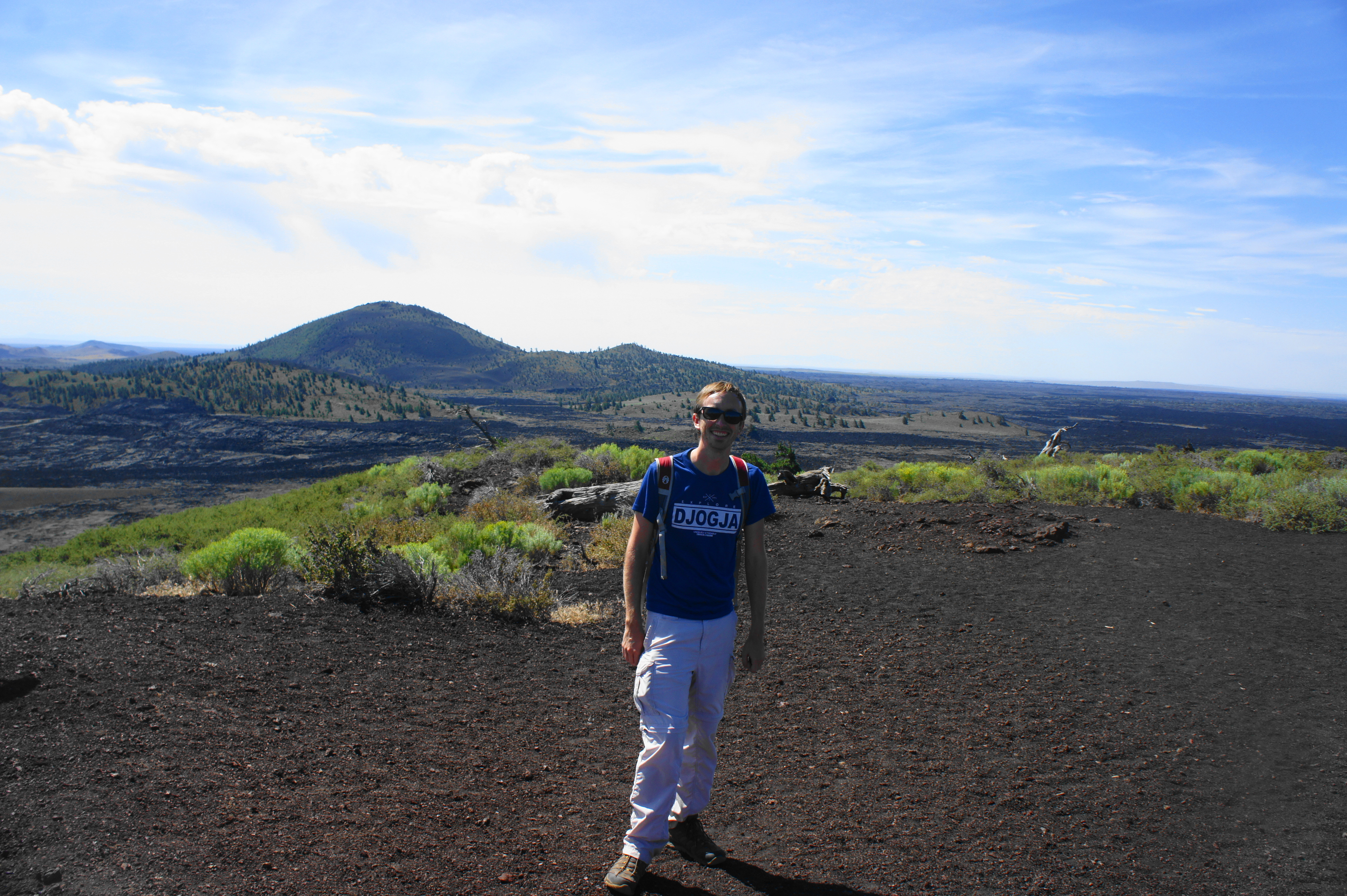
While the ascent traverses only black soil, it comes as a surprise to find vegetation at the top of Inferno Cone. A healthy juniper offers shade in an otherwise exposed area, while patches of sagebrush and low grasses dot the high slopes.

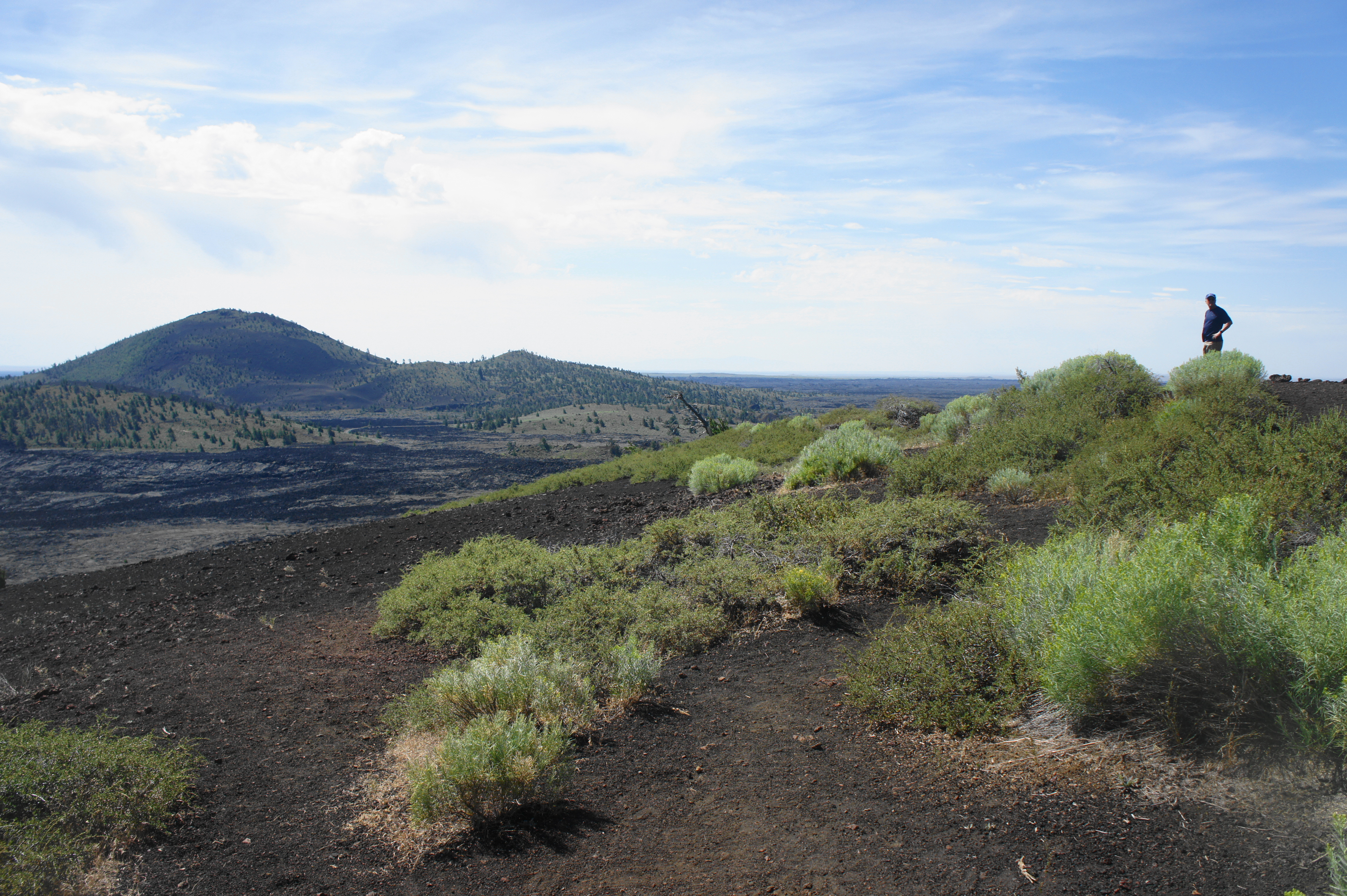
Beyond these hearty plants, there are few obstructions at the summit, facilitating 360-degree views of the area. The northward vista covers Paisley Cone (6,107’), Sunset Cone (6,410’), and the towering Pioneer Mountains beyond. To the northeast is the Lost River Range, which includes the highest peak in Idaho (Borah Peak, 12,662’), as well as Arco, the nearest town and first in the world to be lit by nuclear power. Beyond the juniper, to the east, the Big Southern Butte (7,550’) (outside the park) and a couple of kipukas—islands of sagebrush amid the lava fields—are visible in the distance.

Big Cinder Butte (6,515’) dominates the landscape to the south—this is the highest volcanic peak and largest cinder cone in Craters of the Moon. Beyond Big Cinder Butte, miles and miles of lava flows stretch to the horizon. (Note: This rarely-visited section of the park is reachable by way of the lengthy Wilderness Trail.)
Finally, looking west, one can peer over a collection of small but historically potent spatter cones, lava-spewing vents that were responsible for much of the lava protrusions covering the basin today. These cones are set against the backdrop of the much larger Silent Cone (6,357’), another cinder cone in the park.

Take a half hour or so to soak in the excellent views and admire the various volcanic features at one of the park’s best viewpoints. Then head back the way you came, descending sharply to the parking area for Inferno Cone. Most visitors from here will continue on to Stop #5, the Spatter Cones and Big Crater Area.

Pingback: Caves Trail (Craters of the Moon National Monument, ID) | Live and Let Hike