
With sweeping alcoves and towering walls, Lower Muley Twist Canyon has become one of Capitol Reef National Park’s most popular backpacking destinations. To the ambitious, it can also be conquered in a couple of lengthy day hikes—though an overnight is likely to be more enjoyable. Live and Let Hike will dissect the route into two parts: an 8-mile round-trip out-and-back hike from the Burr Trail Road down-canyon to the start of the “Post Cut-off” route; and a 15-mile loop starting and ending at the Post Corral, including a 5-mile stretch through Grand Gulch and two miles on the challenging Post Cut-off. The following report will tackle the former, a pleasant walk through a meandering canyon with occasional narrows in the Wingate sandstone—and a reasonable half-day hike. Visitors in search of a 2-3 day backpacking adventure may choose to combine this with the 15-mile loop, completing a roughly 23-mile journey through some of Capitol Reef’s most astounding and remote landscapes. The 15-mile circle is described in detail in a subsequent post.


The hike
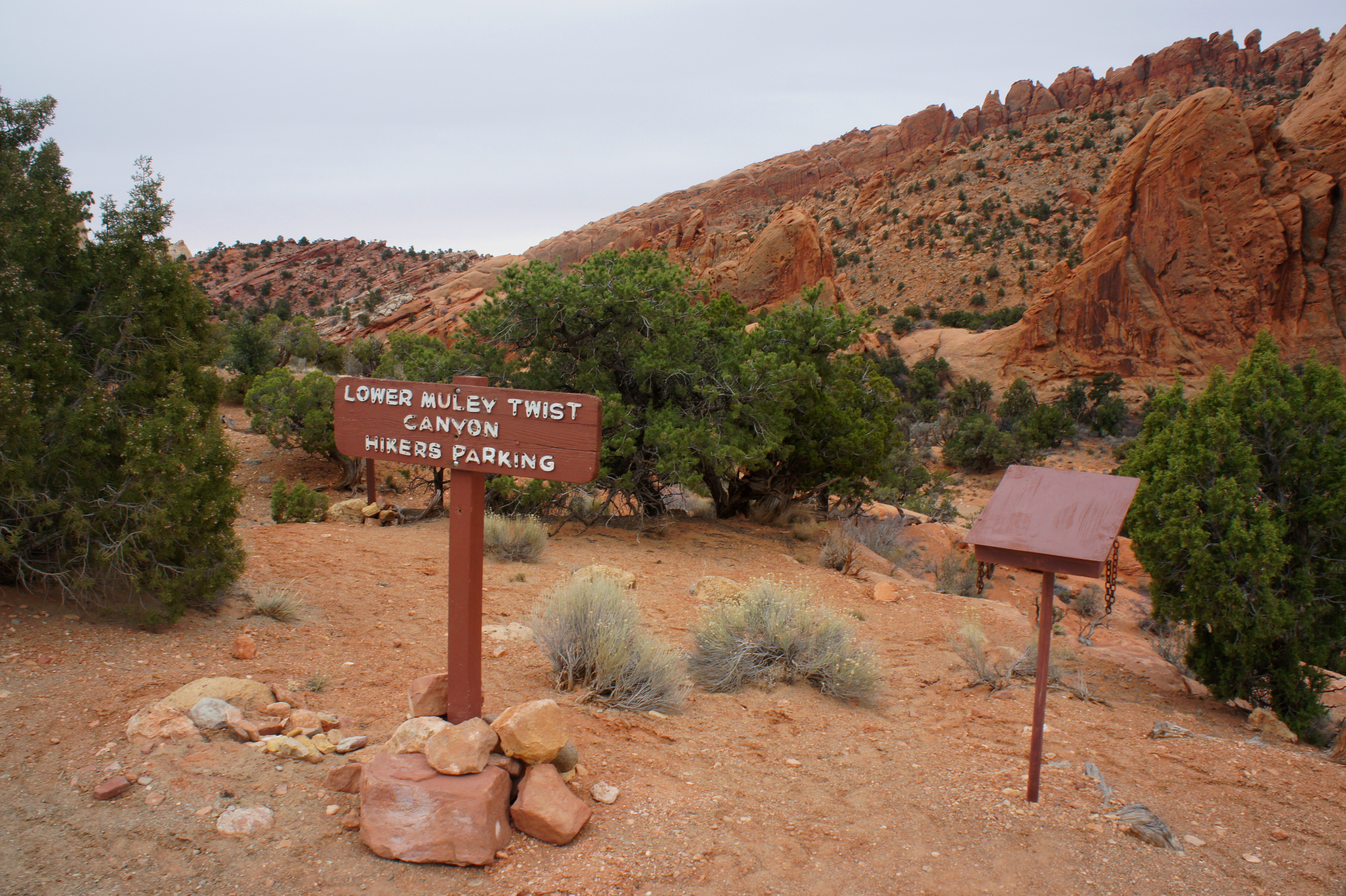
The upper section of Lower Muley Twist Canyon (not to be confused with Upper Muley Twist Canyon, a nearby but entirely different hike) is best accessed from the Burr Trail Road, approximately two miles west of the junction with the Notom-Bullfrog Road, just atop the Burr Trail switchbacks. Assuming good driving conditions, it takes roughly 1.5 hours from the Capitol Reef Visitor Center to reach this point. A burgundy sign reading “Lower Muley Twist Canyon Hikers Parking” marks the trailhead. It can be a tight squeeze, as the parking area accommodates no more than 4-5 vehicles at once. There is also a trail register at the site.
From the trailhead, a cairned path descends steeply to the south, dropping to the sandy floor of Lower Muley Twist Canyon after a few minutes. From here to the Post Cut-off junction, four miles down-canyon, the route simply follows the wash bottom.
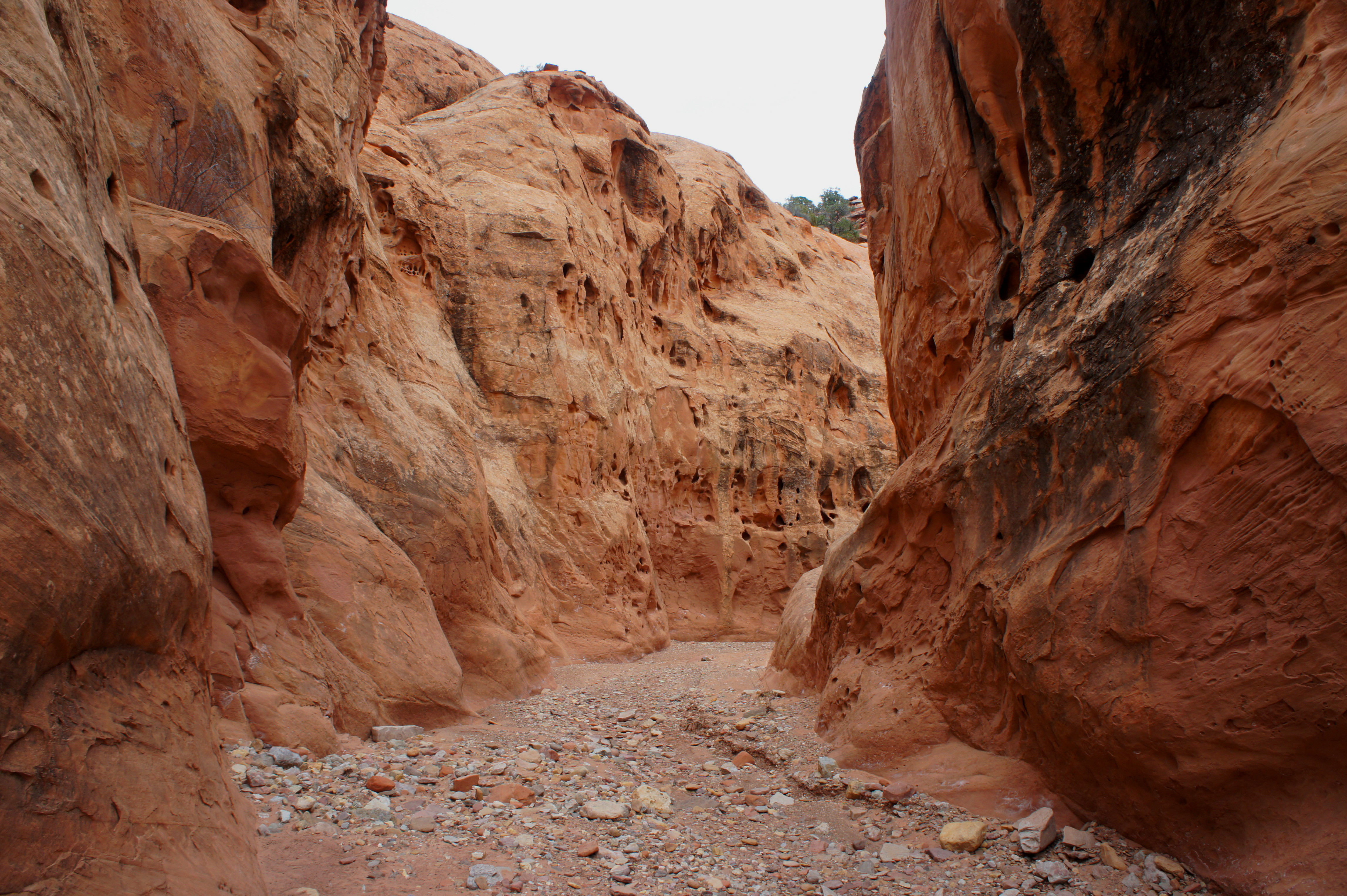
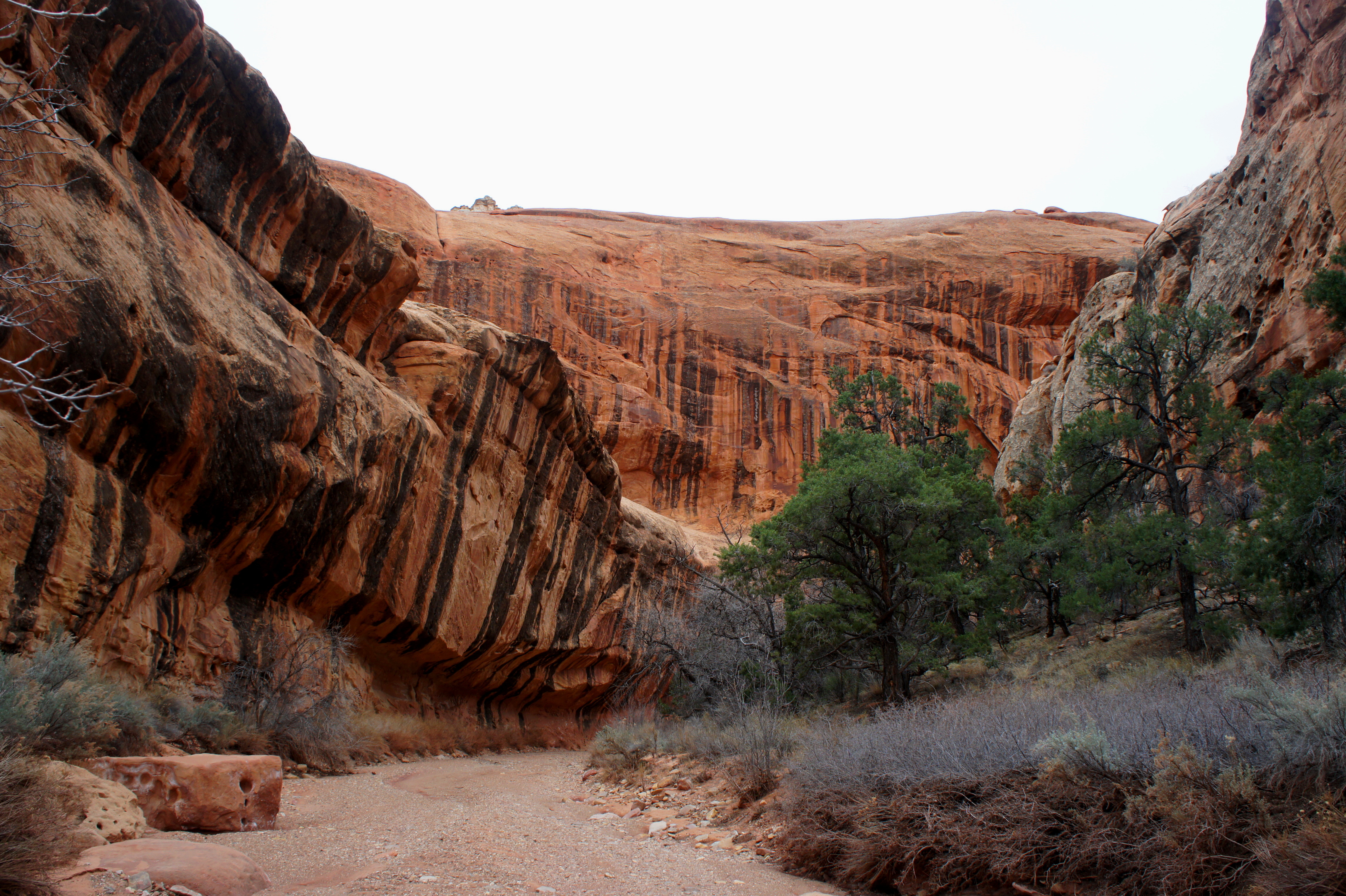
It is impossible to miss the high, red-orange walls bounding Lower Muley Twist on either side. These are composed primarily of Wingate sandstone, a sedimentary rock layer responsible for more cliff-forming landscapes in Utah than any other. Stripped of its durable caprock in the Kayenta formation, the Wingate has in many places eroded into bulky knobs and surging spires. The Wingate also forms the chiseled bedrock throughout much of this section and is responsible for framing the hike’s three sets of narrows.
A first meander bends right, followed quickly by a sharp left-hand curve, a sequence lending credence to Lower Muley Twist’s creative name. The hiker’s tread alternates between pebbled sand and cragged slickrock while passing impressive walls to the east and west.

Roughly ¾ miles from the trailhead, multicolor boulders dot the wash bottom as the canyon flirts briefly with the ledge-carving Kayenta formation. A hulking, cream-colored fin (in the Navajo sandstone) towers above to the east. Beyond, obscured from view, lies the broad Strike Valley and the eastern flanks of Capitol Reef’s famed Waterpocket Fold. Lower Muley Twist, in contrast with the area’s many latitudinal canyons of similar length (e.g., here and here), parallels the Fold running north-south.
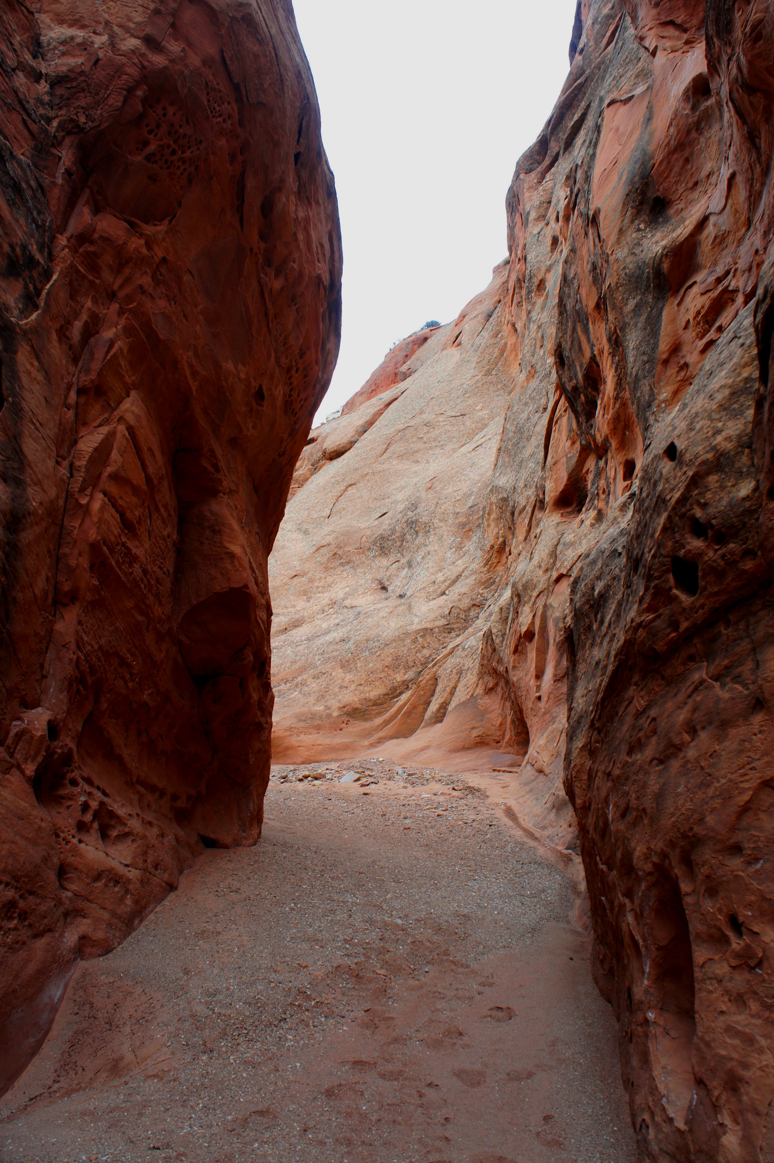
After the short foray into the Kayenta, the red-orange Wingate returns, and hikers soon enter the first string of narrows. While the canyon thins, the walls remain relatively shallow. Shortly beyond, a second set of narrows—about 20-30 feet wide but still not too deep—offers further intrigue.
Upon exiting, the wash broadens again at the base of a tall, three-headed spire that is passed on the left. It is a roughly 10-minute walk from the second narrows to the third—the longest, deepest, and arguably most impressive of the bunch. Here the canyon thins to as little as 10 feet wide, while the walls are laced with honeycomb weathering, or tafoni.
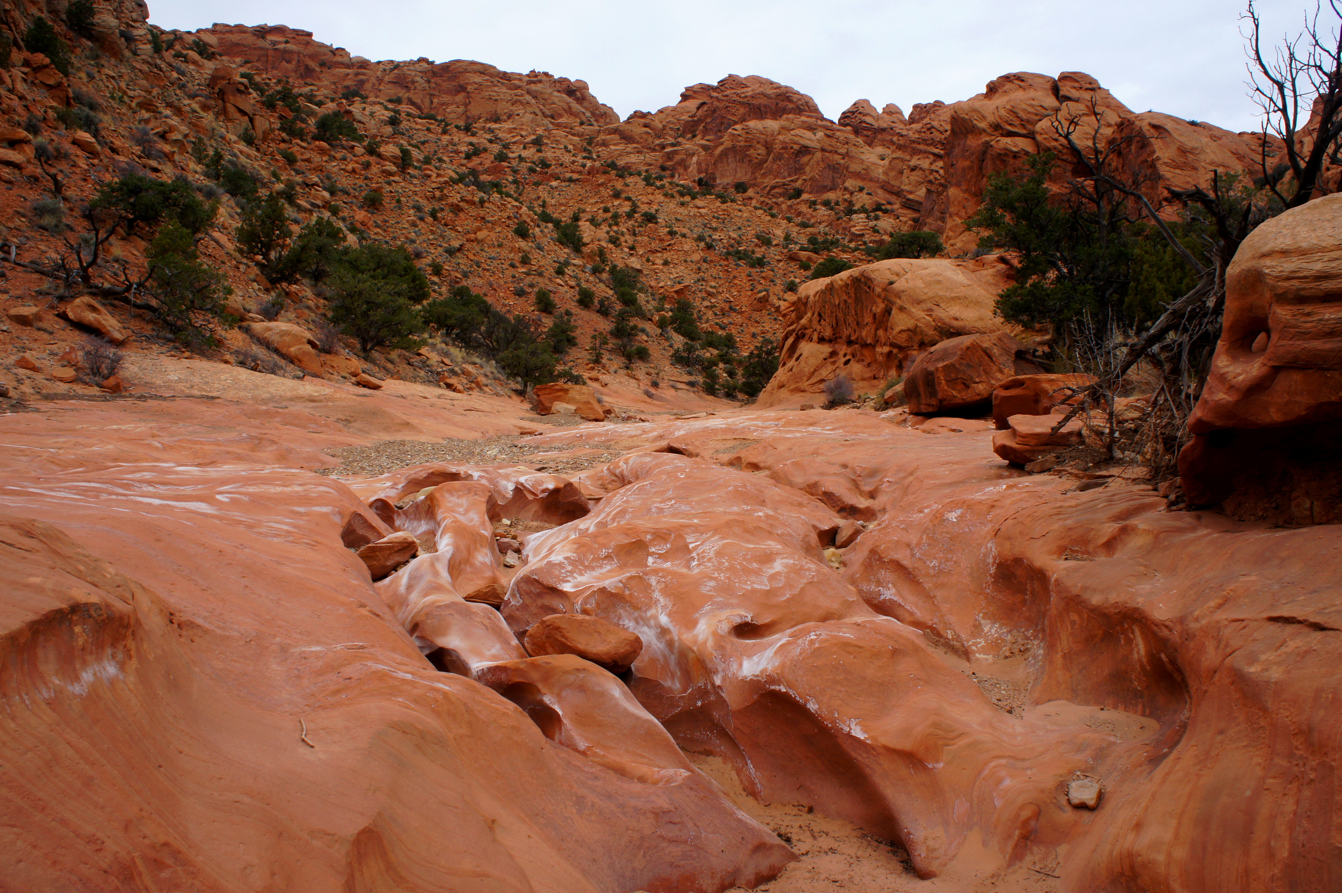
Almost immediately thereafter, the canyon abruptly opens up, with a flat, gaping expanse appearing on the right. This is a rare gap in the Circle Cliffs, which here form the western flank of the Waterpocket Fold. The main drainage bends sharply south, then east, regaining vertical walls on both sides after a brief hiatus.

The landscape beyond is accented by frequent examples of black desert varnish, manganese-coated streaks adhered to rock faces by tiny microbacteria over the course of thousands of years. One varnished overhang encountered within five minutes past the open area is particularly impressive. After another bend, a second alcove adds flavor to the eastern wall. This leg of Lower Muley also supports tall juniper trees and Gambel oaks.
After passing through a section strewn with mighty boulders, a significant side drainage enters from the west. Here the cliffs on the right-hand side rise to more than 800 feet above the canyon floor. A short distance farther, a healthy stand of unusually tall junipers can be found on the right. Use this as a cue to start keeping an eye out for the Post Cut-Off marker on the left. It is less than ten minutes’ walk from this point.
After rounding a left-hand bend, followed by a right-bearing curve, a mammoth outcrop of whitish Navajo sandstone rises to the east, just as the Kayenta benches return to eye level. Before turning right at the next bend, look for a pair of wooden signs on the left, partially tucked away behind a pinyon pine. Large rock cairns may mark the spot.

Ongoing traffic will face a choice: tackling the Post Cut-off, continuing on down-canyon, or turning back. The first option may accommodate day-hikers expecting a shuttle pickup at the Post Corral—making for a one-way hike of six miles—or seeking to finish the loop by way of a steep traverse from the Post, back up the Burr Trail Road, to the Lower Muley Trailhead (10.25 miles total). Hikers continuing down Lower Muley Twist Canyon are, in all likelihood, prepared to spend the night.
Finally, you can always turn around here and return you came, saving the rest of Lower Muley for another day (or two). Be sure to keep an eye out at the end of the 8-mile out-and-back for the cairned route leading out of the wash to the parking area on the east bank.

Pingback: Lower Muley Twist Canyon and Hamburger Rocks (Capitol Reef National Park, UT) | Live and Let Hike
Once again. Andrew, we using your wonderful posts to add to our adventures here in Capitol Reef. Thanks for such accurate details and informations:)
Great! I miss it out there