

To those who know Capitol Reef National Park well, the Old Wagon Trail is often considered the red-headed stepchild of the park’s front-country hikes. Though the 3.8-mile stem-and-loop—starting right off the Scenic Drive—features one excellent viewpoint, it comes at a price: a long and monotonous slog 1,080 feet up the dip slope of pinyon- and juniper-studded Miners Mountain. Whether the hike traces an old wagon route is debatable—the rugged and persistent climb suggests this was no historical thoroughfare. But today it is an established hiking trail—and one that many complete simply to check it off the list.
The hike
If you like gnarly junipers and pinyon pines, this is the trail for you. After departing the Scenic Drive 6.5 miles south of the Capitol Reef Visitor Center (look for a pull-off and sign marked “Old Wagon Trail Hikers Parking”), the trail drops abruptly into a wash then begins the long and steady descent where the ubiquitous trees offer the most intrigue (though the overabundance of rock cairns can be rather amusing). To be fair, views of the multicolor Waterpocket Fold to east improve as the trail climbs the slope, but they are usually at your back.
The first 2/3 mile or so traverses the reddish-pink Torrey Member of the Moenkopi formation, deposited during the Triassic period and now one of Capitol Reef’s most recognizable strata. Beyond, the soil color changes dramatically to yellowish-gold, marking the start of the Moenkopi’s Sinbad Limestone Member. After roughly ¾ mile of hiking, the trail crests a low ridge—temporarily again piercing the Torrey Member—and actually drops around 15 feet to a shady basin where the route forks. This is the beginning of the loop portion of the hike. Follow the arrows, completing the loop in a clockwise direction.
It is roughly a ½-mile climb up the wide but immensely rocky path to a point where the trail skirts the edge of Upper Capitol Gorge. Here an even older rock layer—the whitish-yellow Kaibab limestone—reveals itself in the canyon below.

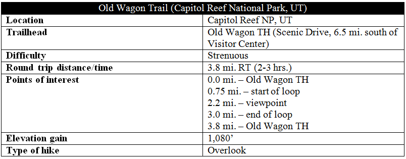
The views are fleeting as the trail curves northwest, away from the rim, and eventually cuts right, into a dense pinyon-juniper forest. The sloping grade abates and even begins to decline as the route bears north. Subtle rock cairns (far less flashy than those dotting the landscape near the trail’s start) guide hikers through the desert woodlands.

A subtle post marks the beginning of the slow descent, where the trail follows a broad clearing (the closest thing to an old road that I could find). Roughly 2.2 miles from the trailhead, a cairned, single-track path exits the wide tread to the left. A couple minutes’ walk leads to the base of a small butte and a faded wooden sign. Ahead is the short spur trail to the viewpoint at the top of the rocky outcrop.
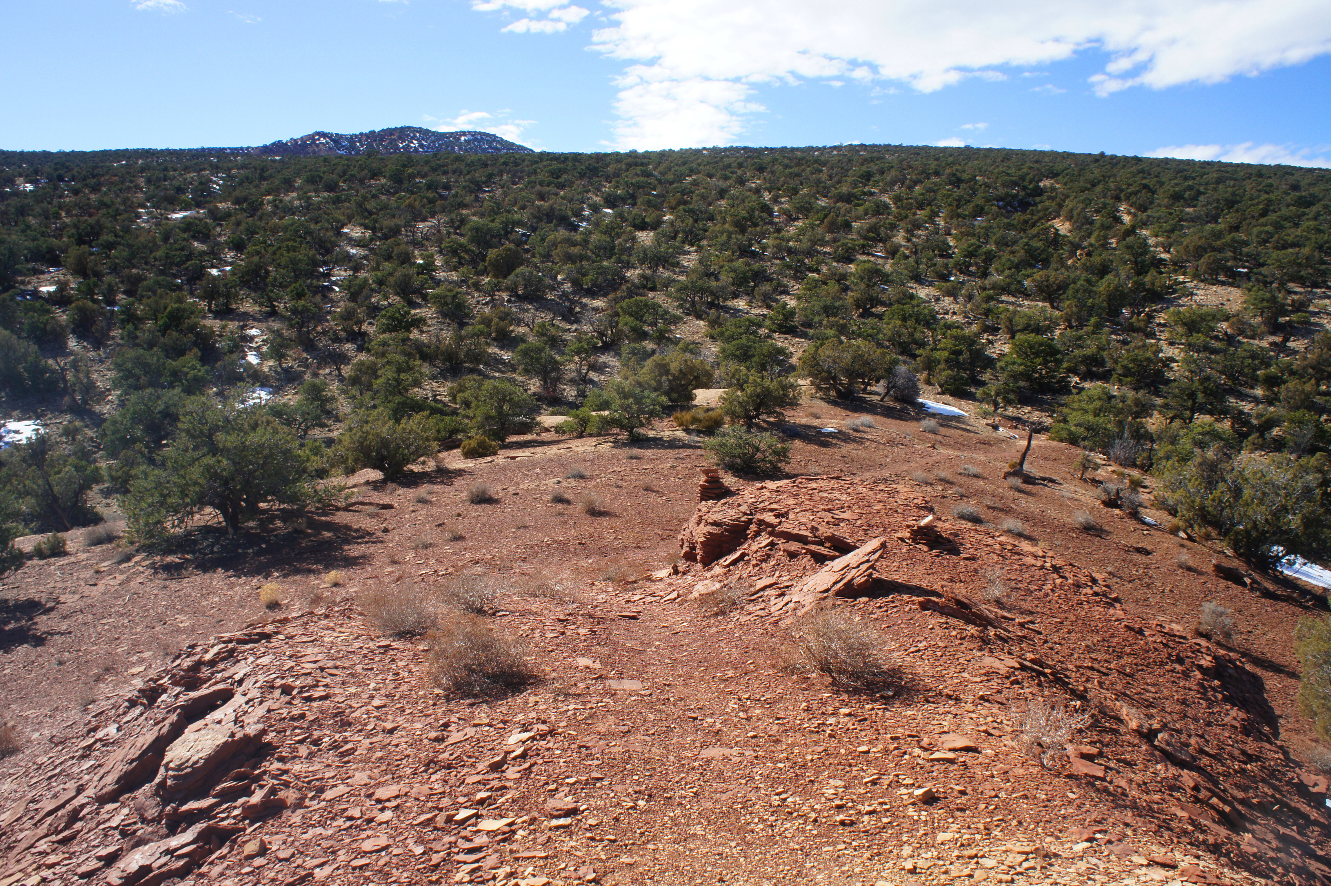
The windy overlook offers fine views of the Waterpocket Fold, perhaps some of the best in the park. Being around two miles west of the cliffsides, visitors are here able to capture a wider view of the Fold than on perhaps any other frontcountry hike. Vistas stretch as far as Meeks Mesa and Thousand Lake Mountain (11,299’) to the northwest and Buck Point (7,653’) to the southeast. On clear days, the Henry Mountains (11,522’) dominate the horizon to the east, while the remote Cathedral Valley District is visible beyond the cliffs to the north. To the west, vistas are lost in the angled slant of Miners Mountain (~7,900’), coated in evergreens.


Reconnecting with main trail, the hike returns to its usual ho-hum status, crossing the old road and edging southeast amid gradually-lessening crowds of pinyons and junipers. The start of the loop (just below the 15-foot slope mentioned above) is reached after a little over three miles of hiking. From here, it is a short, mostly downhill return to the trailhead.

Extra credit
For a better, less tedious hike with similar eastward views, consider the nearby Fremont River Trail (see my recent trail guide here).

Pingback: South Wilderness Trail (Pinnacles National Park, CA) | Live and Let Hike