
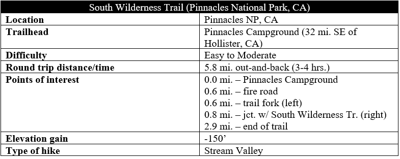
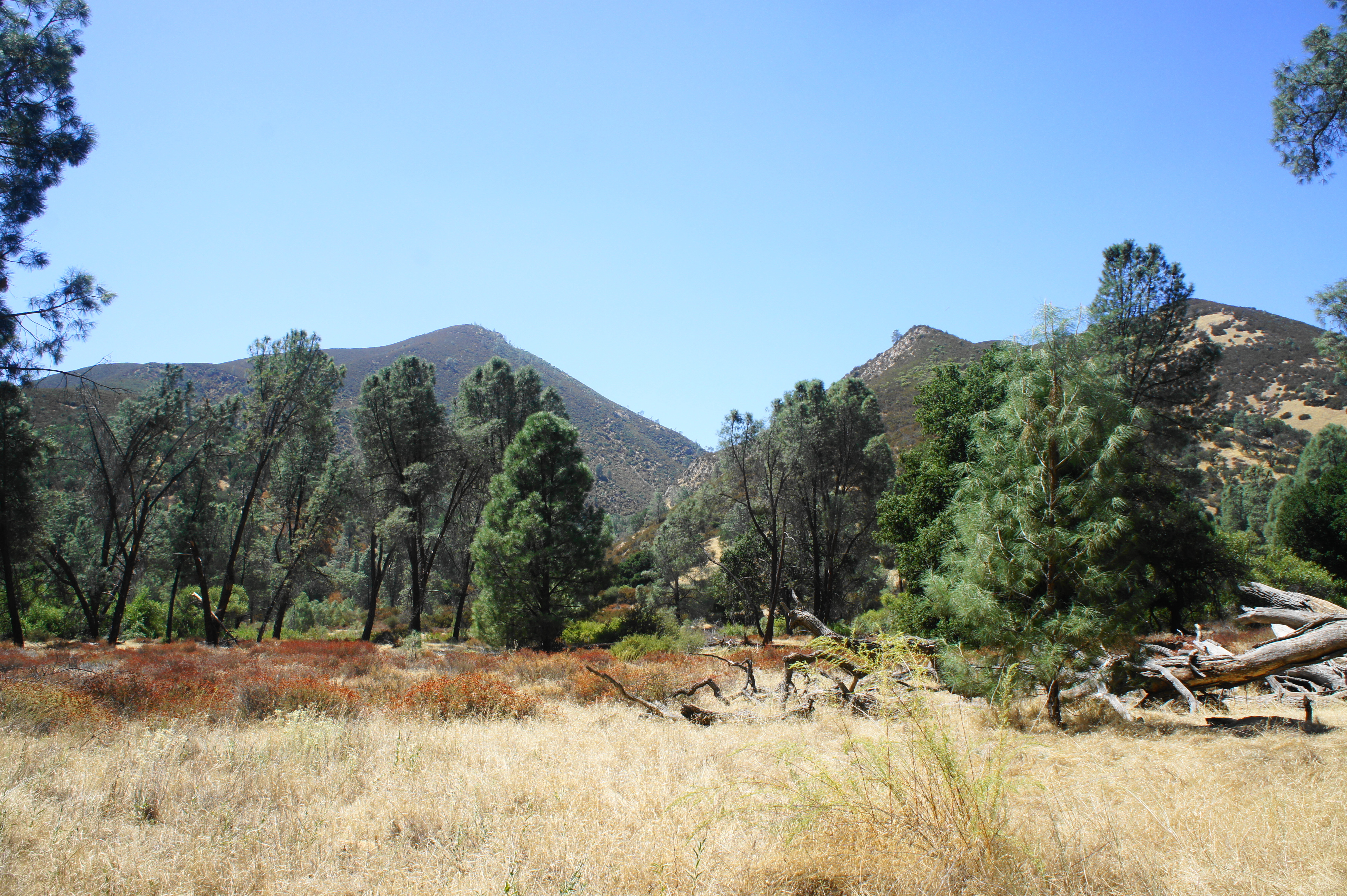
Every national park has one: a trail that, despite lacking any particularly notable beauty, exists seemingly to be hiked only by those seeking the satisfaction of completing every trail in the park. In Capitol Reef National Park, a former focus of this blog, it is the much-maligned Old Wagon Trail. In Pinnacles National Park, it is the pleasant but underwhelming South Wilderness Trail. Starting part way down Pinnacles Highway on the east side of the park, this winding track follows a seasonal stream through thickets of valley oaks and features distant views of Mount Defiance and Chalone Peak, two of the highest mountains in the Gabilan Range. The flat and easy Bench Trail connects Pinnacles Campground with the start of the South Wilderness Trail.

The hike
The Bench Trail, which provides access to the South Wilderness Trail, takes off from the southwest corner of the Pinnacles Campground, just beyond Group Sites 133 and 134. (Note: To access, walk or drive through the RV area and continue to the end of the road; the rest of the campground through the brush to the south.) A single trail sign marks the start of the wide path that weaves through a thicket of shrubs. After 1/10 mile, the path reaches a gate and trail information board. Continue past the gate, with an open field on the right. In the sunny sections, one can see Mount Defiance (2,657’) straight ahead; however, the main Pinnacles area—the High Peaks—is obscured from view.
Roughly paralleling Pinnacles Highway, the road noise never really dissipates along the Bench Trail. By 4/10 mile, the path buts right up against the road; in fact, there is an interpretive wayside along the trail that discusses road traffic and efforts to reduce carbon emissions.
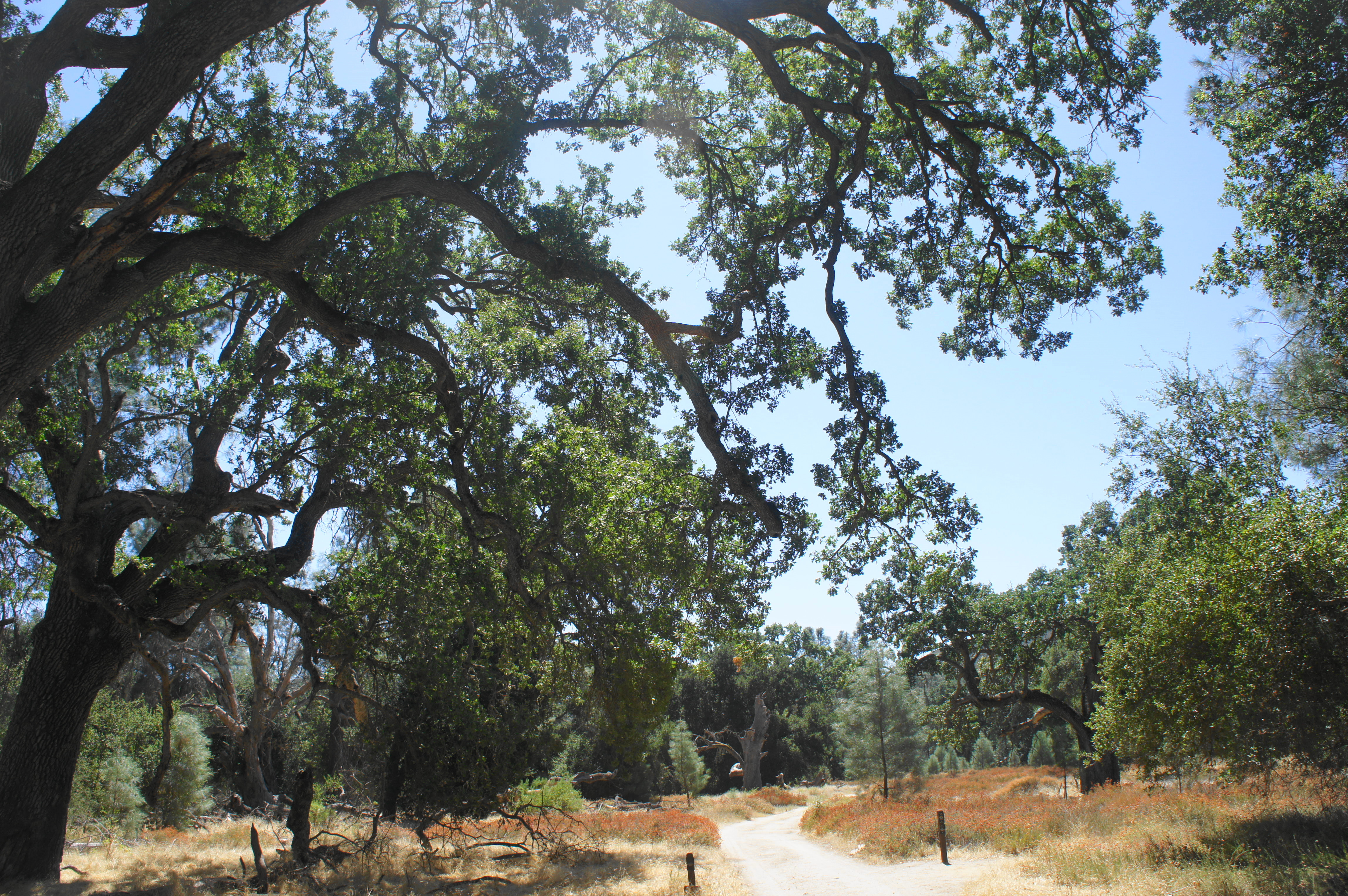
At 6/10 mile, the Bench Trail intersects a gravel fire road heading south. Bear left on the road, then continue straight as the Bench Trail continues off to the right around 70 yards later. This area is one of the prettiest of the hike, with towering valley oak trees providing temporary shade.
After following the fire road for about ¼ mile, look for a signed single-track bearing off to the right: this is the South Wilderness Trail. Following this spur, the modest wash that was on the left gives way to a much larger one on the right: Chalone Creek, which is likely to be mostly—although not completely—dry in summer. Amid a smattering of gray pines and open fields, the trail drops to cross Chalone Creek at about the hike’s one-mile mark.
Follow the faint path up the valley, keeping the creek on your left. At 1.1 miles, two tall pines and a sycamore provide shade on a hot day. Shortly after, the trail runs right up to the base of the hillside on the right but does not climb it, staying in the low floodplain of Chalone Creek.
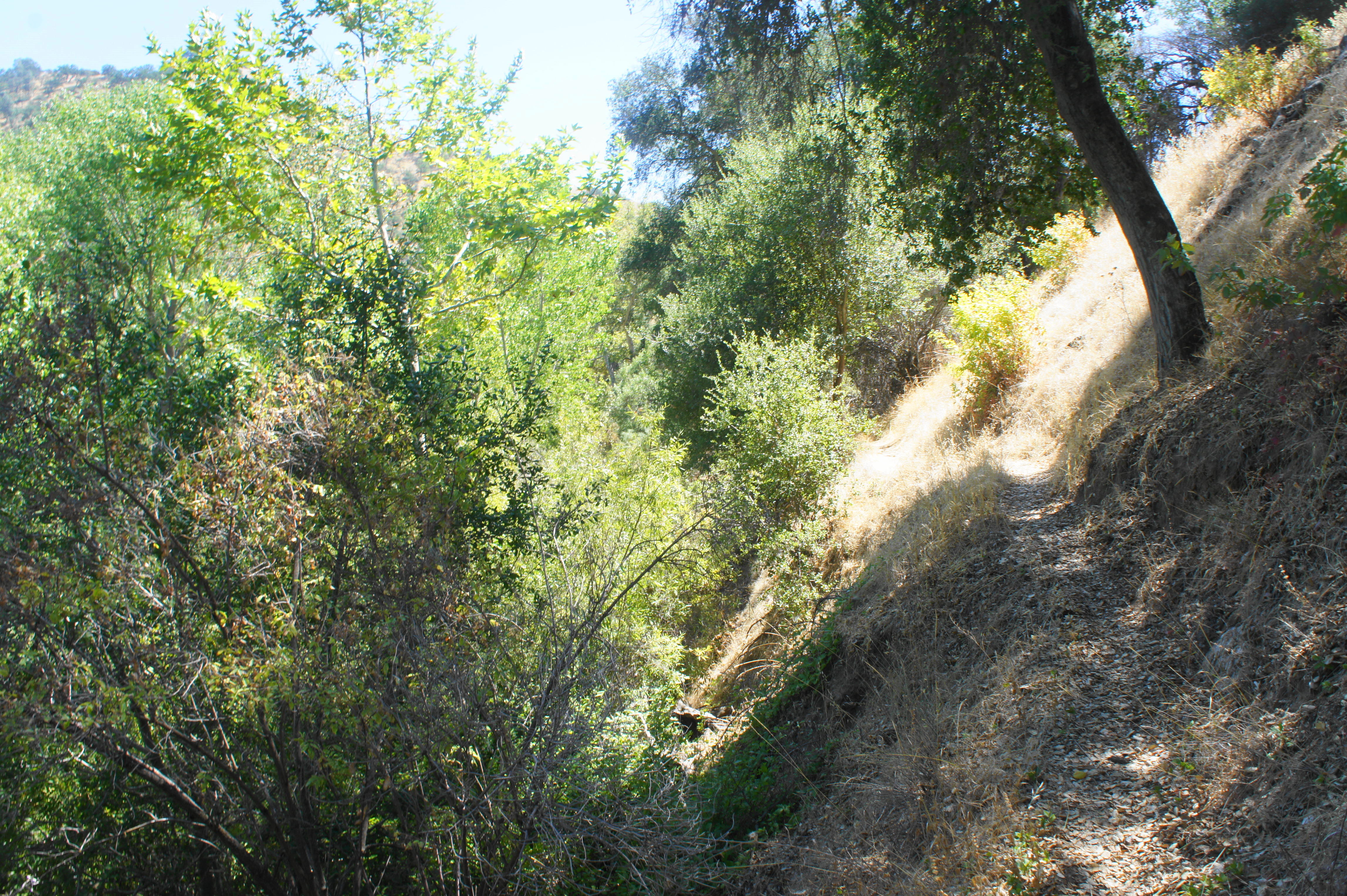
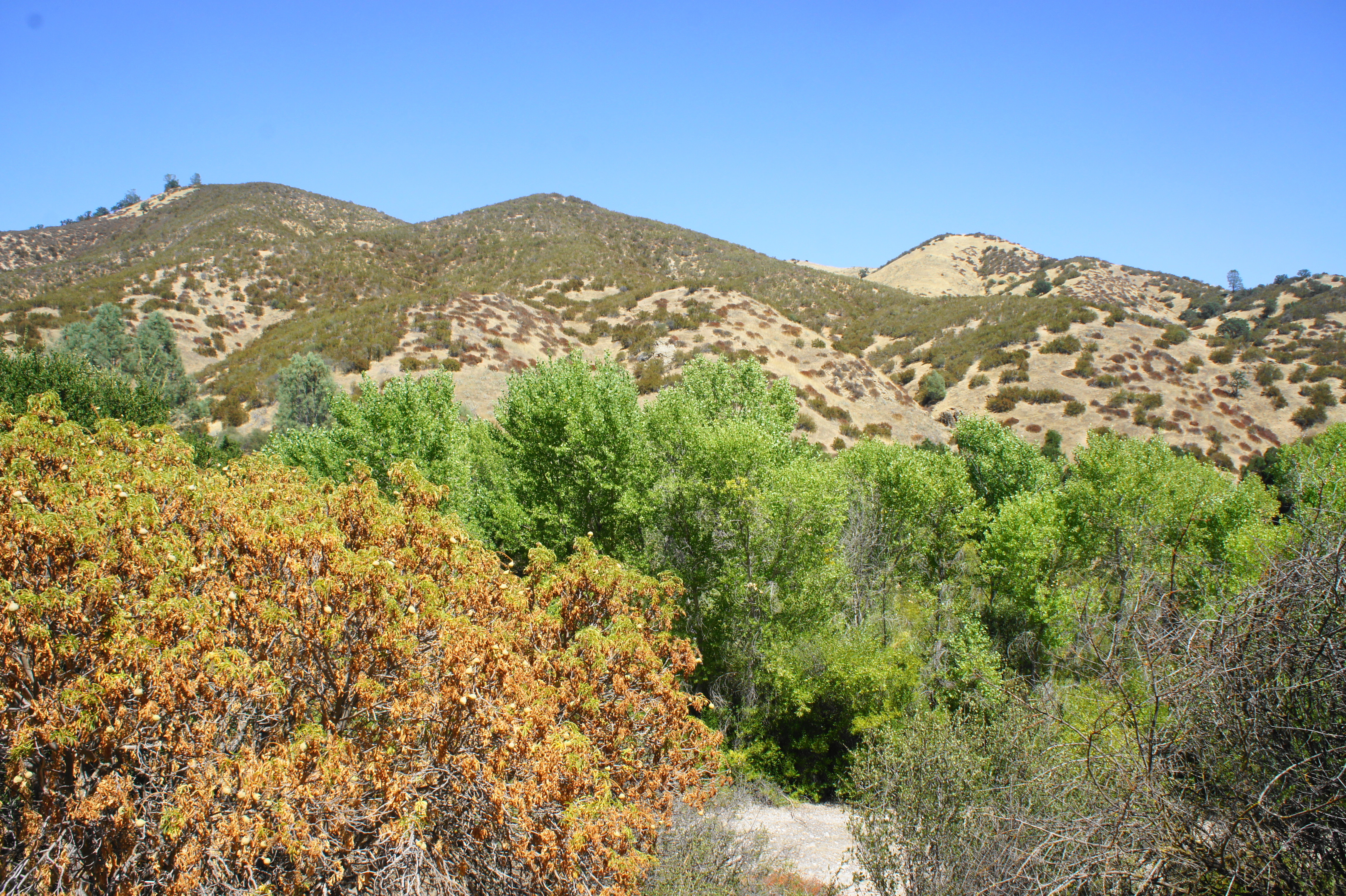
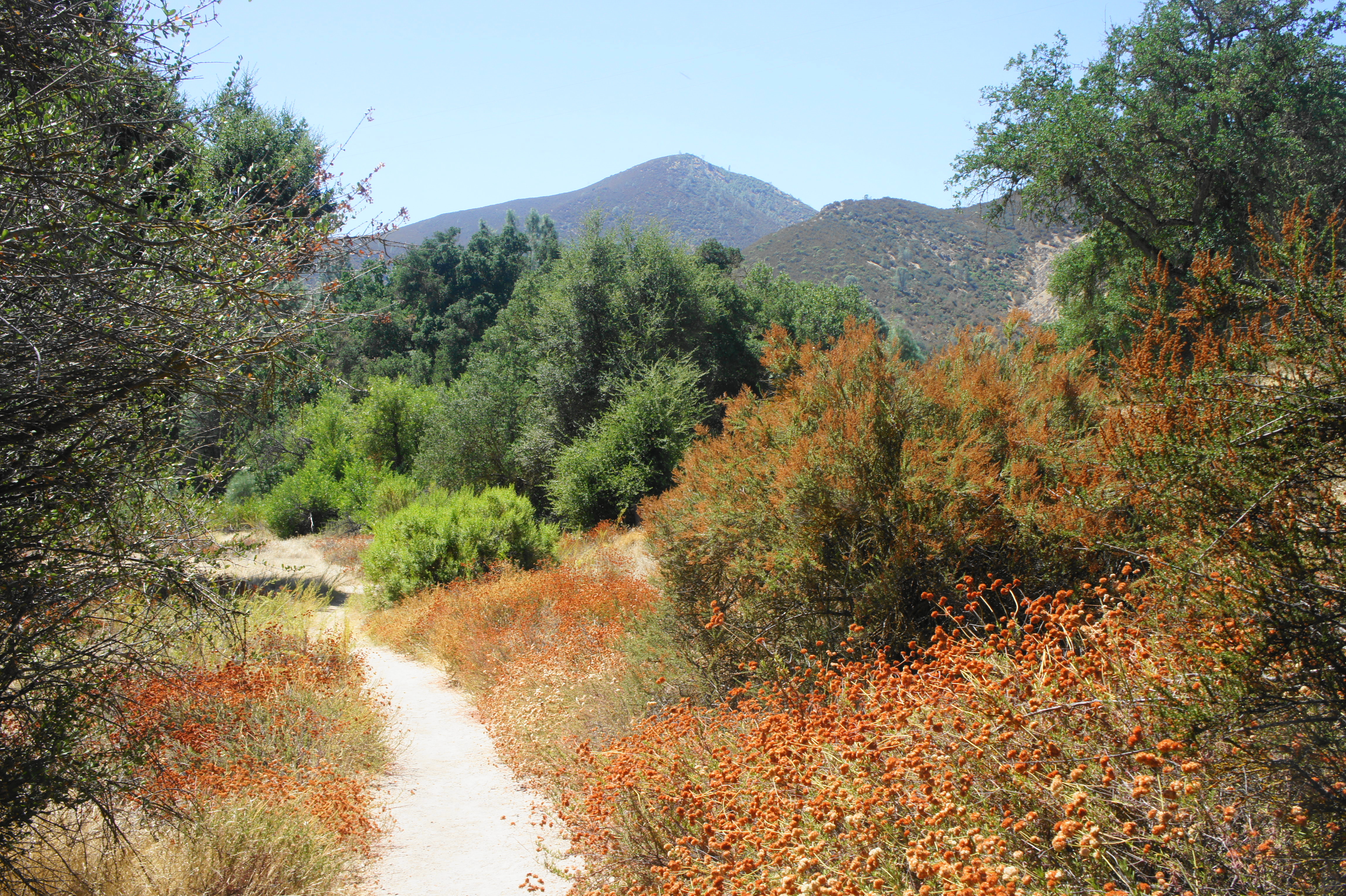
After a half-mile of flat and pleasant hiking, the trail suddenly veers right and climbs 10-15 feet abruptly; here the creek runs almost right up against the hillside, requiring hikers to gain height to clear the terrain. Traversing an elevated bench, the path skirts a side ravine at about 1.8 miles, then the South Wilderness Trail ascends again, following the narrower canyon as it bends right. Chalone Peak (3,304’), the highest point in Pinnacles National Park, is now visible ahead. After this brief interruption, the trail descends back to the floodplain.
As the path encounters a dry, sandy basin at around 2.25 miles, the trail becomes more difficult to follow. Generally, however, it is wisest to simply follow the dry stream bed (a corollary of the main Chalone Creek to the left) as it meanders through the brush. Occasional rock cairns mark the way. At 2.4 miles, the trail crosses another stream bed where the trail continuation is easier to discern. Finally, the path returns to the woods, briefly following the banks of the creek, then climbs to a grassy area with views of the mountains.
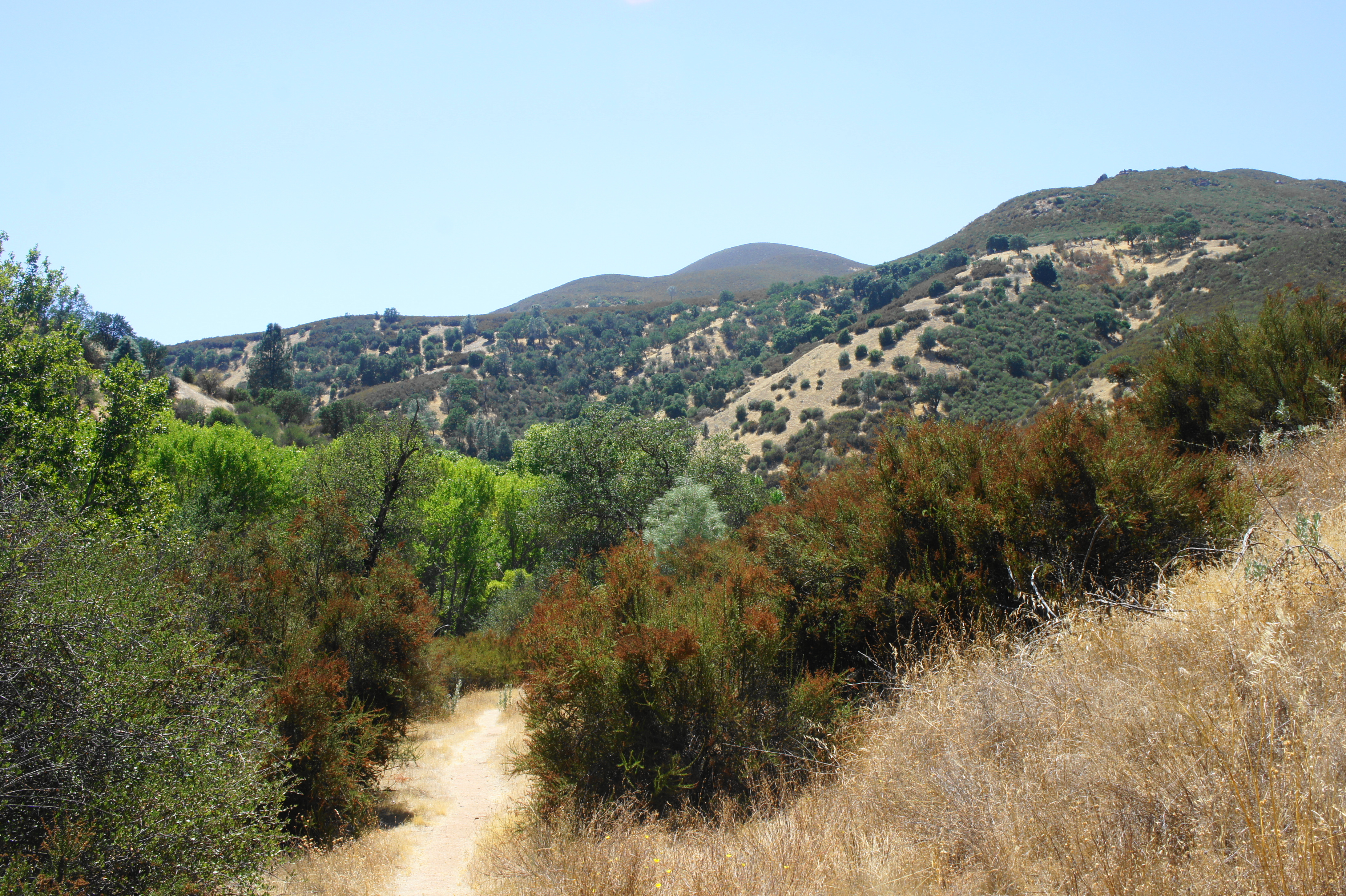
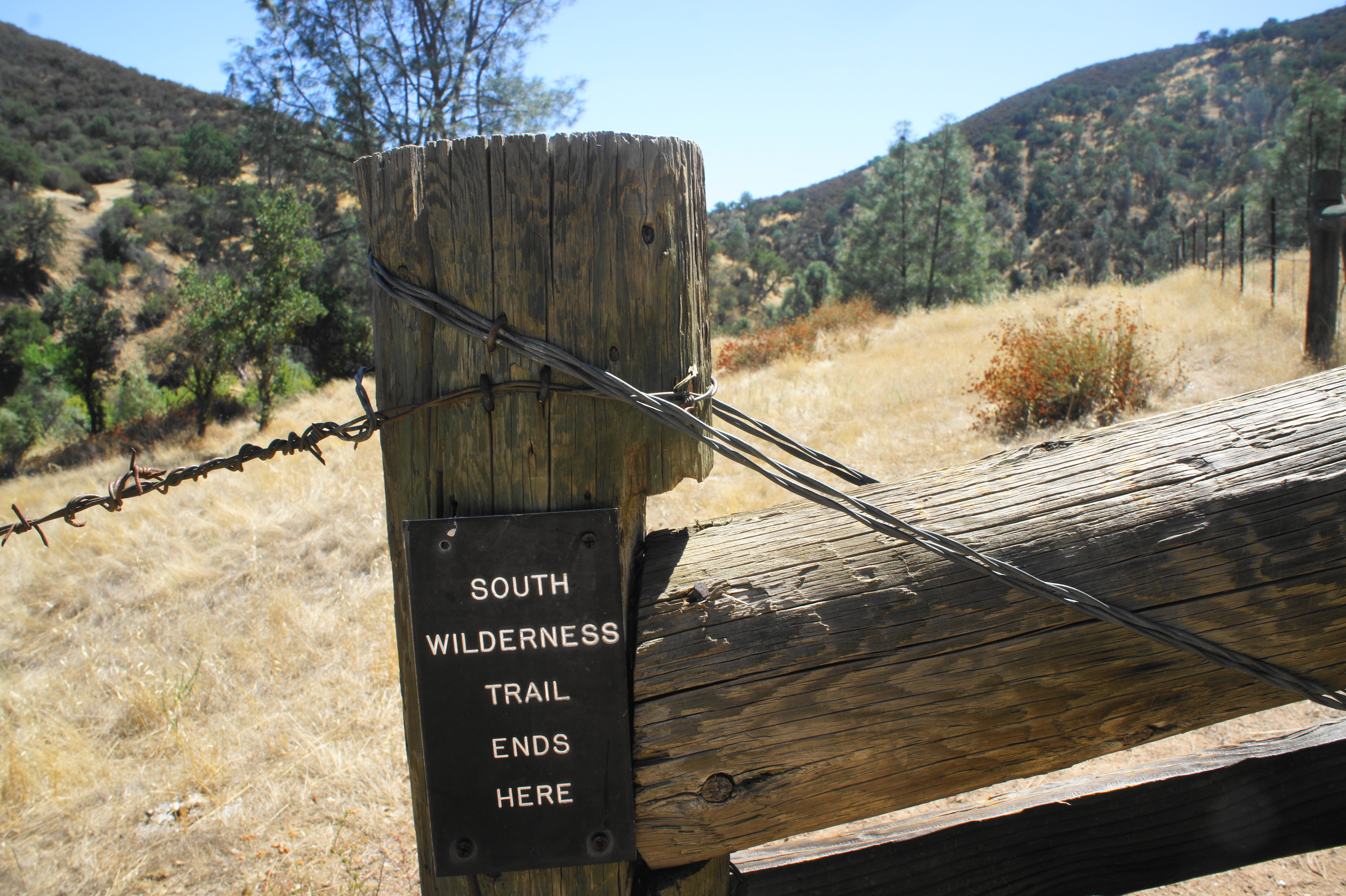
About 2.6 miles from the trailhead, the South Wilderness Trail crests a hill, revealing a turn in the canyon to the right. After a brief downhill, the trail abruptly ends at 2.9 miles at a barbed wire fence, with private property beyond. It is possible to follow a social trail continuing along the fence on the right, but there is little to gain, so this is—for all intents and purposes—the terminus of the hike.
The views from this area are decent: the chaparral valley continues southward, at the base of a series of sloping peaks on the right. None of this hike, however, is overwhelming, and hikers are likely to be captivated less by grandeur than by relief that the trail has ended. Of course, it’s a 2.9-mile return journey to the trailhead, back the way you came. At least a series of nice oaks, pines, and sycamores provide some relief from the hot sun. All told, the out-and-back clocks in at around 5.8 miles, a hike that should take 3-4 hours. The elevation gain is rather negligible, although there are some climbs and dips that make this a potentially moderately difficult hike.
