

The 5.5-mile ramble down Sulphur Creek Canyon in Capitol Reef National Park has been held dear by residents of Utah’s Wayne County for decades. Rising visitation to Capitol Reef—as well as the advent of the Internet—has led to a wider audience, and the popularity of this wet and beautiful hike has risen dramatically in recent years. It’s hard to argue with Sulphur Creek’s allure, especially on a hot summer day: a serene stream cutting through a narrow and mysterious gorge, complete with waterfalls and enticing swimming holes. While many simply venture upstream from the Visitor Center ¾ mile to the closest waterfall, Sulphur Creek is best attacked as a through-hike beginning across the street from the Chimney Rock Trailhead.

The hike
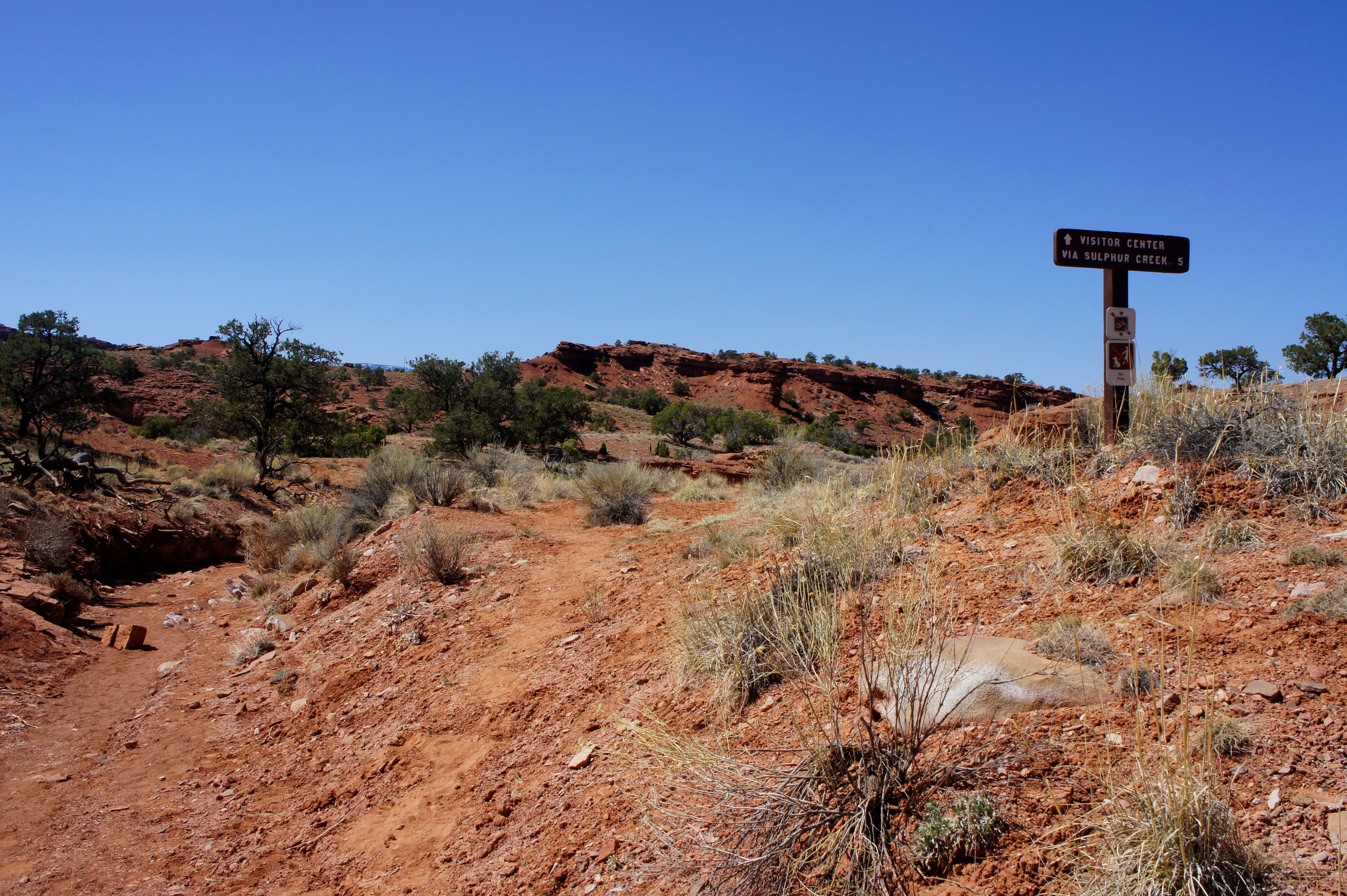
The Chimney Rock Trailhead is located three miles west of the Capitol Reef Visitor Center on the north side of Highway 24. While the parking area is used more often as a launch point for the Chimney Rock loop or backcountry adventures in Upper or Lower Spring Canyon, it also serves as the starting point for the hike down Sulphur Creek back to the Visitor Center. Look for a wooden sign (“Visitor Center via Sulphur Creek 5”) across the road to the south—this is the start of the Sulphur Creek route.
(Note: The primary disadvantage of the Sulphur Creek route is that it is 5.5 miles one-way, necessitating a private vehicle pick-up on the other end or a 3-mile walk back along the road. While not encouraged, hitchhiking is legal and commonplace in Capitol Reef.)
After crossing Highway 24, a sandy use trail takes off to the south, skirting a small, dry drainage before dropping into a much larger wash after roughly 1/10 mile. (Note: I also describe this approach in my January 2015 post titled “Point 6,230’.”) This arroyo is a prominent tributary of Sulphur Creek; it is just under 1.5 miles from here, down the drainage, to the perennial stream. Stay left at the first junction—turning right will simply return one to Highway 24.
The dry wash bed weaves through a relatively shallow canyon with jagged walls composed principally of the Torrey member of the Moenkopi formation, a Triassic-era sedimentary rock layer that is more than 1,000-feet thick in Capitol Reef. The Moenkopi here is chock-full of “ripple rock”—intricately-patterned stones that suggest the presence of mild currents approximately 250 million years ago, when what is now central Utah was positioned near the edge of a sea.
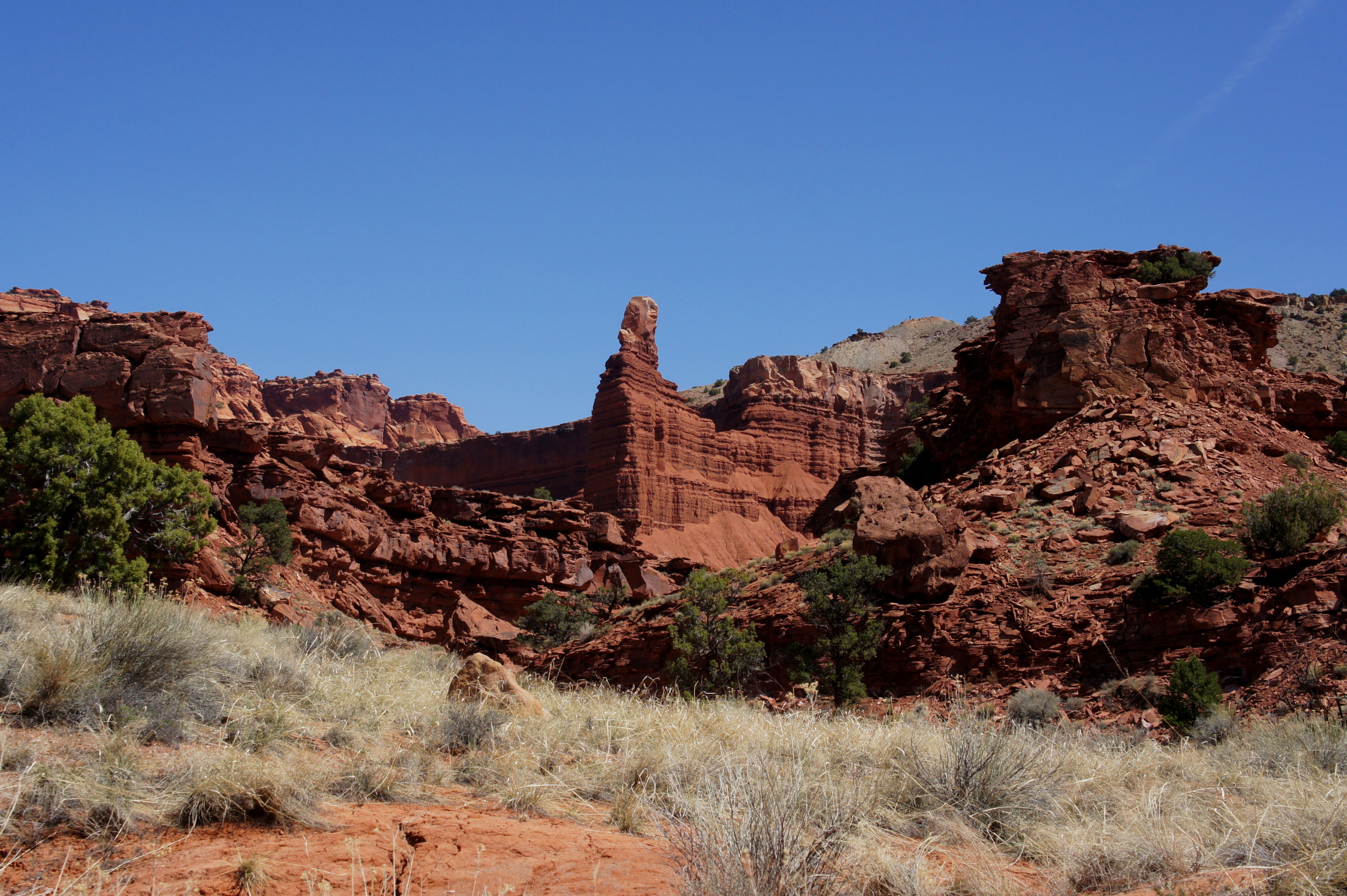
Following a pair of sharp curves, a minor tributary drainage enters from the left. Just beyond, look back to the northeast for a fantastically-framed view of Chimney Rock, an impressive spire composed primarily of the Torrey member. Within another ¼ mile, a much larger side canyon appears on the right (this provides access to Point 6,230’). Almost immediately after, the main drainage passes through the first of several undulating, buff-colored lime beds.
Gradually the canyon walls gain height, and the principal drainage narrows. Two minor dryfalls require attention and secure footing to negotiate. While not particularly strenuous, hikers who have significant difficulty with these obstacles should reconsider entering Sulphur Creek Canyon—where down-climbs are significantly more challenging.
A couple minutes’ walk from the two pouroffs, the dry wash bed meets Sulphur Creek. On a sizzling summer day, the cool, flowing water is a welcome sight. After turning left, hikers with no inhibitions about getting wet can traipse downstream through the creek itself. Others hoping to stay dry are usually able to follow banks or rock-hop across the stream—delaying the inevitable for at least 1.5 miles.
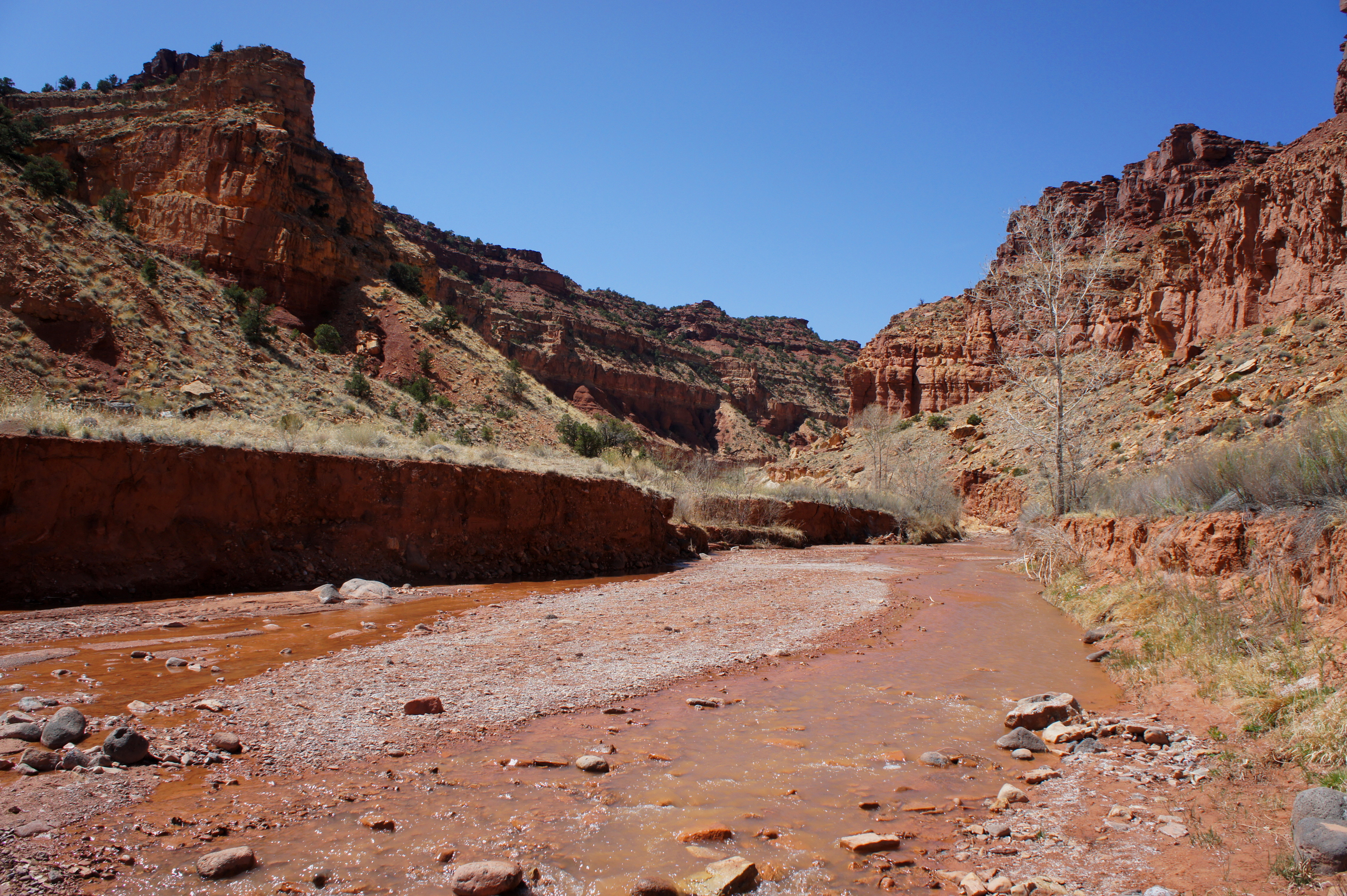
Within minutes of reaching Sulphur Creek, hikers enter a series of sharp bends known as the Goosenecks, a curious feature most often admired from far above at the Goosenecks Overlook. Roughly ½ mile from the confluence, observant visitors can make out the steel railings of the overlook atop the north-side wall.

In the Goosenecks, rock color at eye level transforms from deep red to tan/yellow. Here the canyon has breached what is known as the Sinbad limestone member of the Moenkopi formation. The Torrey member, however—now laced with blocky designs and horizontal stripes—continues to form the upper reaches of the canyon walls above.
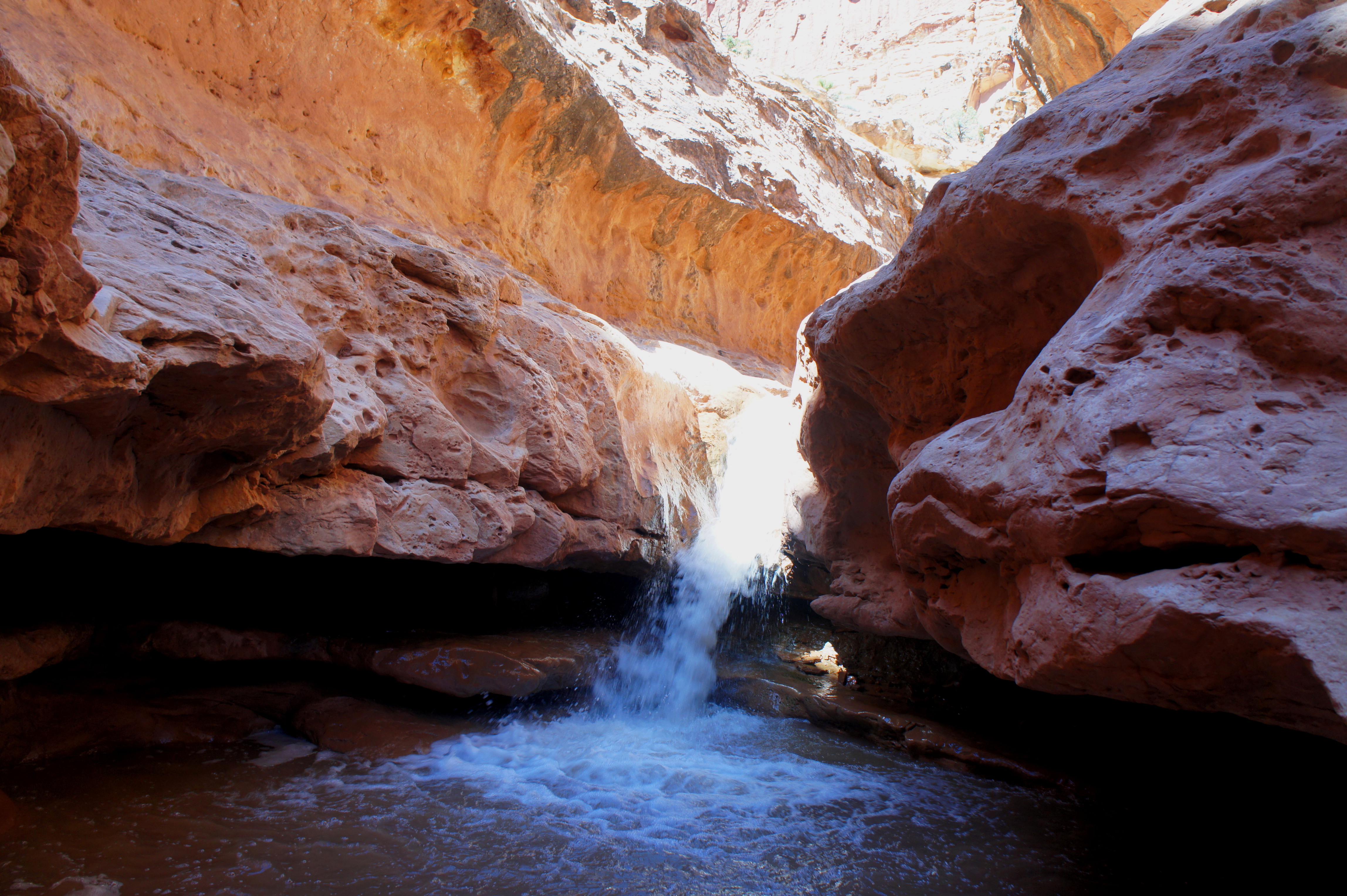
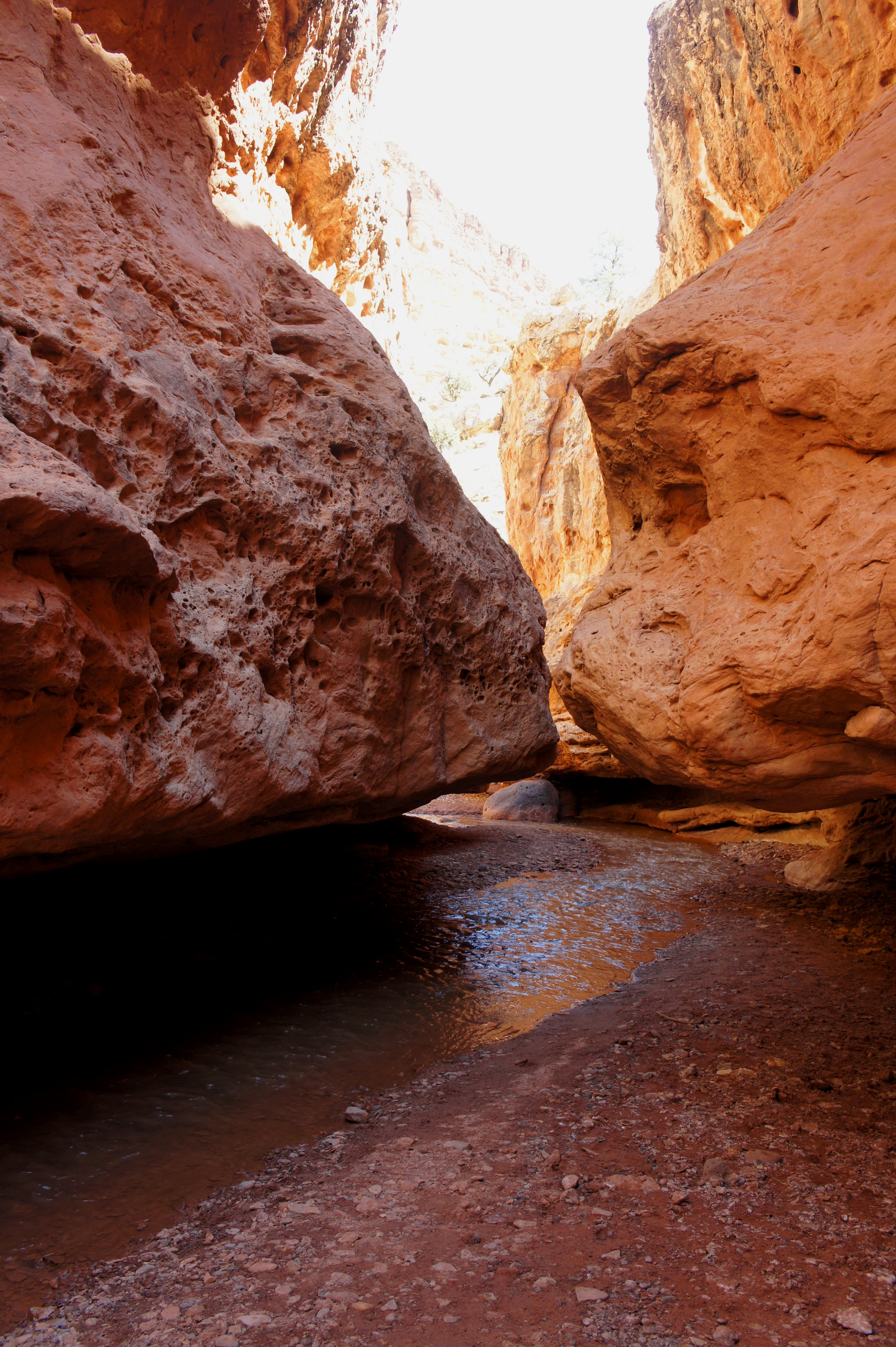
Around three miles into the hike, Sulphur Creek drops abruptly, forming the first waterfall, and enters a set of shady narrows in the Kaibab limestone, the second oldest rock layer exposed in Capitol Reef. The next 1/3 mile packs a tremendously scenic punch—though hikers will be tested by two exposed down-climbs and a considerable amount of wading (or even swimming, depending on water levels).

The first waterfall, like the two that follow, is best bypassed on the right, where a relatively wide, but potentially slippery, bench skirts around the cascade and the dark pool into which it feeds. A 10-foot descent down a ledgey wall is required; hikers will want to tackle this down-climb very slowly to descend safely. Low water levels uncover a rocky beach on which to land, but recent floods or snowmelt may require a drop straight into a pool that is ankle-deep or higher. No matter—since the stretch ahead, regardless of season, will almost always require walking in several inches—even feet—of chilly water.
The frustration of wet boots (still recommended over sandals due to better traction) is easily overcome by scenic views at every turn. A few minutes downstream from the falls, the creek squeezes through a 3- to 4-foot wide notch, followed by a short, relatively open section littered with black, basalt boulders. The spotted walls exude a rainbow of colors, from white to purple to orange to red.

750 feet from the first falls, Sulphur Creek plunges over a second waterfall that again requires a careful down-climb on the right. A narrow passage leads through a hole under a massive basalt slab, then drops down a series of thin ledges to another rocky beach that affords views of the cascade from below.


Impressive narrows—and sporadic wading—continue for the next 30 minutes to an hour. A final pool can be bypassed by ascending a minor shelf on the left, then dropping down to a line of conveniently-placed black boulders that offer passage across to the south bank. (Note: With the next flash flood, these boulders may not remain.) The canyon opens up shortly thereafter, though occasional minor cascades offer continuing aesthetic appeal.

By now the creek bed has entered the White Rim sandstone, Capitol Reef’s oldest exposed rock stratum. But its presence is fleeting, as the tilt of the Waterpocket Fold brings the Kaibab back to surface level, then the Moenkopi once again.
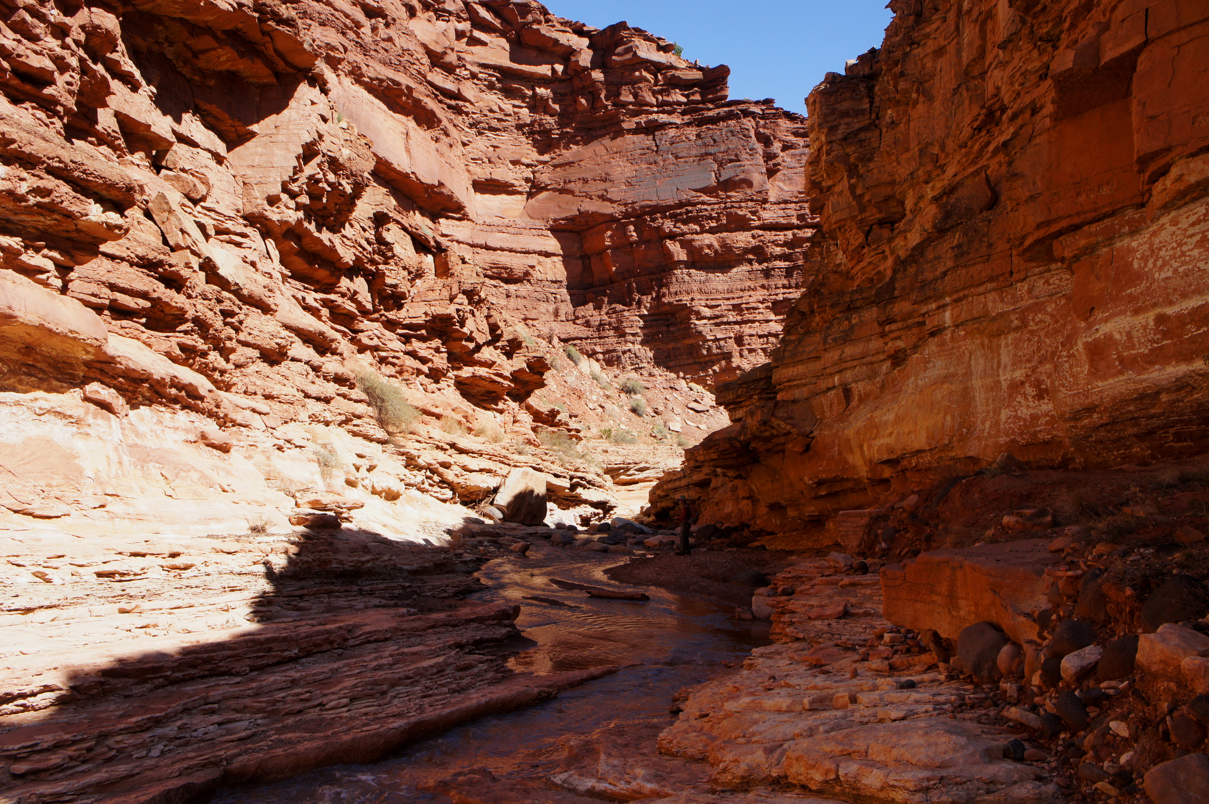
From the end of the narrows, it is around 1.5 miles to the third waterfall, a distance that can be covered in less than an hour but is perhaps better enjoyed at a slower pace. Unless a recent storm has raised stream flow, no additional wading is required.
Just before the third and final falls, Sulphur Creek squeezes through ledgey narrows in the Moenkopi. The 8-foot plunge can be bypassed by skirting the ledge system on the left, but the traverse can be extremely slippery and exposed. Instead, backtrack around 20 yards from the top of the falls and ascend the hill on the right. A cairned, hiker-made trail leads down-canyon and eventually rejoins the creek at a point about 2/10 mile downstream from the waterfall.

From the end of the bypass, it is a little over ½ mile to the hike’s end—a pleasant jaunt through winding bends and occasional groves of cottonwood trees. As the canyon walls gradually recede, Capitol Reef’s much higher escarpment of Wingate and Navajo sandstone comes into view. Bearing left on a hiker-made path following a sharp left-hand bend, a use trail passes the historic Fruita lime kiln, a stone structure used by Mormon pioneers to produce cement. (Note: Please do not touch, as the structure remains extremely fragile!) Continuing on the hiker-made path leads one up and over a low hill, with the back end of the Visitor Center visible just beyond. Following one final creek crossing, the sandy track snakes around the north side of the Visitor Center and terminates at the main parking lot.

For hikers with a vehicle waiting at the Visitor Center, your journey is complete. For those needing to return to Chimney Rock Trailhead, it is a 3-mile walk—or, for the intrepid, a short hitchhike—back to your car.

I really needed your blog when I was traveling through the southwest several years ago. I visited Capitol Reef but there are so many places that I didn’t even know existed.
Good deal – there are thousands of hidden gems in Capitol Reef, let alone the southwest!
Pingback: Top 10 Hikes in Capitol Reef National Park’s “Frontcountry” | Live and Let Hike