
Visible from Highway 24, the monolith known only as Point 6,230’ is an impressive hunk of deep red Moenkopi rock rising above a snaking maze of crumbly canyons in western Capitol Reef National Park. Though not the highest of the rocky promontories in the area, the trek to the point can make for a nice 1-2 hour hike in an area that, despite being so close to the main highway, is rarely explored. After a pleasant ½ mile following a flat wash bottom with scenic walls and bends (the approach route to popular Sulphur Creek), the unmarked route ascends a boulder-strewn side canyon that offers countless opportunities for some relatively easy Class 2 scrambling. The route ends near the top of the monolith, offering striking views in all directions. (Note: Alas, I set out on this hike in search of “The Motorman”—the only named promontory in the area—but eventually realized that this and Point 6,230’ are indeed different. The topo map below demonstrates how one could arrive at this mistake, and the dearth of information about The Motorman online leaves one without any good route descriptions. Nonetheless, this is a worthy hike on its own, and I will eventually renew my search for The Motorman on another day.)
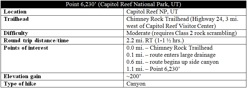
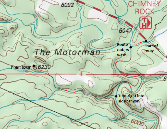
Adapted from: http://www.mytopo.com/maps/
The hike
(Note: This hike was completed in early January, when Capitol Reef was blanketed in up to 5 inches of snow. There may therefore be more of an established trail, but it was not visible at the time.)
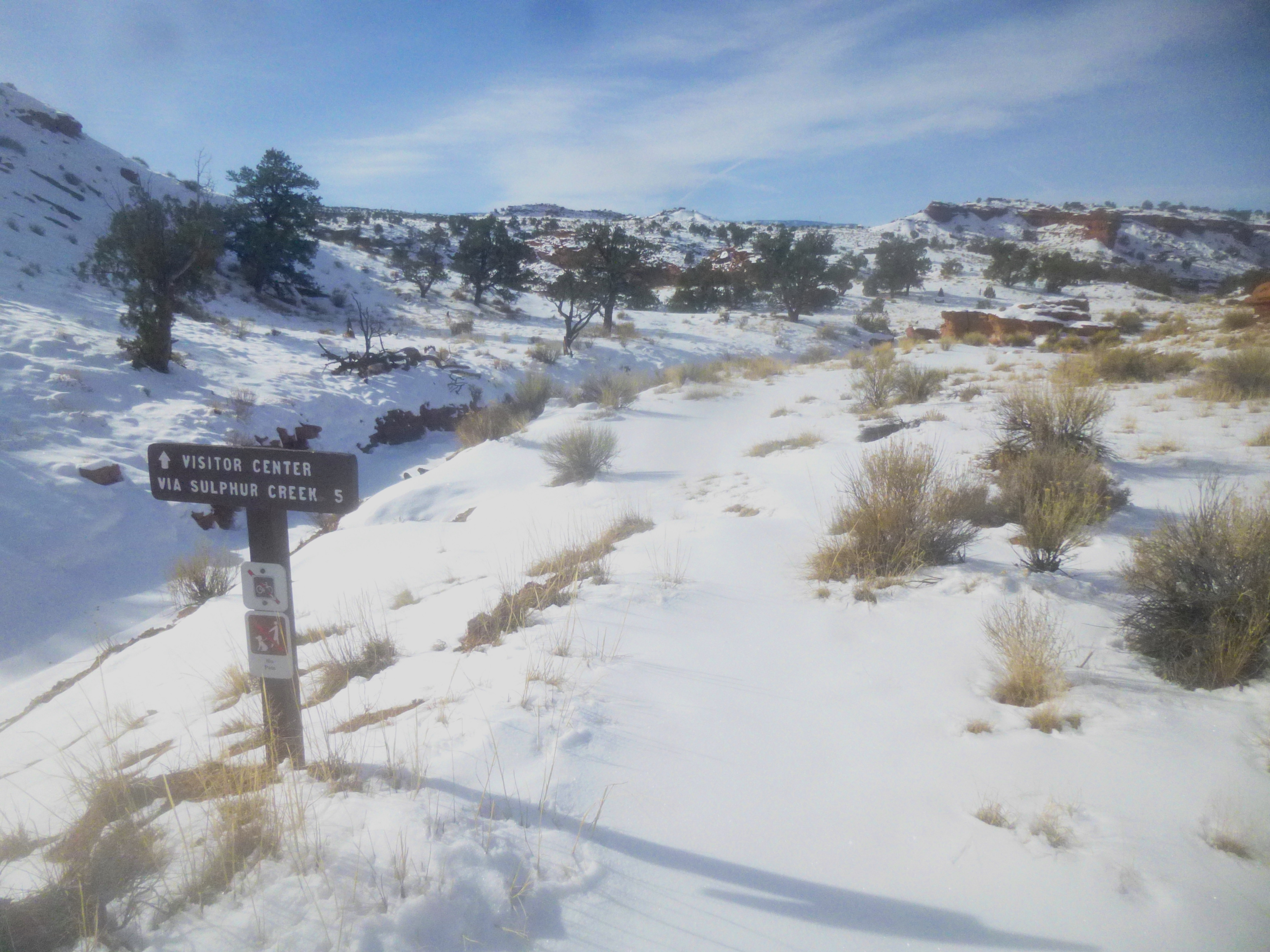
There are undoubtedly a number of ways to approach Point 6,230’, but the least involved path begins across the street from the Chimney Rock Trailhead, located off Highway 24 roughly three miles west of the Capitol Reef Visitor Center. Park at the trailhead on the north side of the road and cross the two-lane highway to the south. Here you will quickly spot a wooden sign reading “Visitor Center via Sulphur Creek 5”—the start of the 5-mile Sulphur Creek Route (best completed in the summer, as much of the route involves walking through water). The path to Point 6,230’ follows only the first 0.6 mile of this route, most of it following the bottom of a dry creek bed, a tributary of Sulphur Creek.
The path past the sign follows a well-worn trail skirting the right flank of a small wash. A large rock cairn indicates where to drop into the much larger dry drainage at roughly 1/10 mile; the next ½ mile involves simply following the wash bottom. (Be sure to head left, i.e., downstream, as going right will lead back toward the road.)
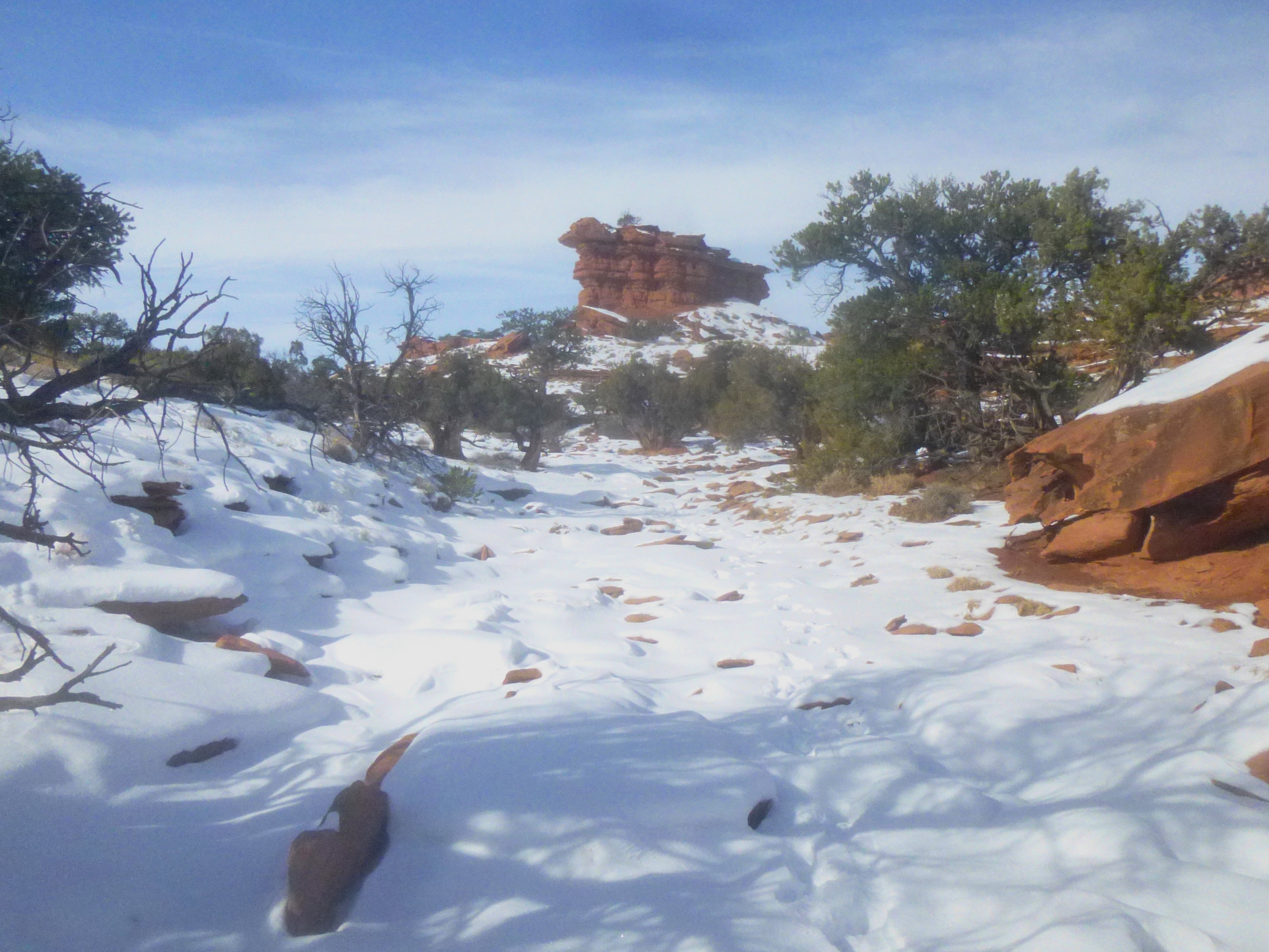
Rounding the first of several bends, the walls of the canyon begin to take form, starting some 20-50 feet high, then climbing to about 100. After about 4/10 mile from the trailhead, a rocky side canyon will appear on your left. From here, follow the main wash around two more bends. At about 6/10 mile, an obvious tributary canyon will appear to your right, the second such side canyon since entering the main drainage (and the first that heads off to the right). This is your exit.

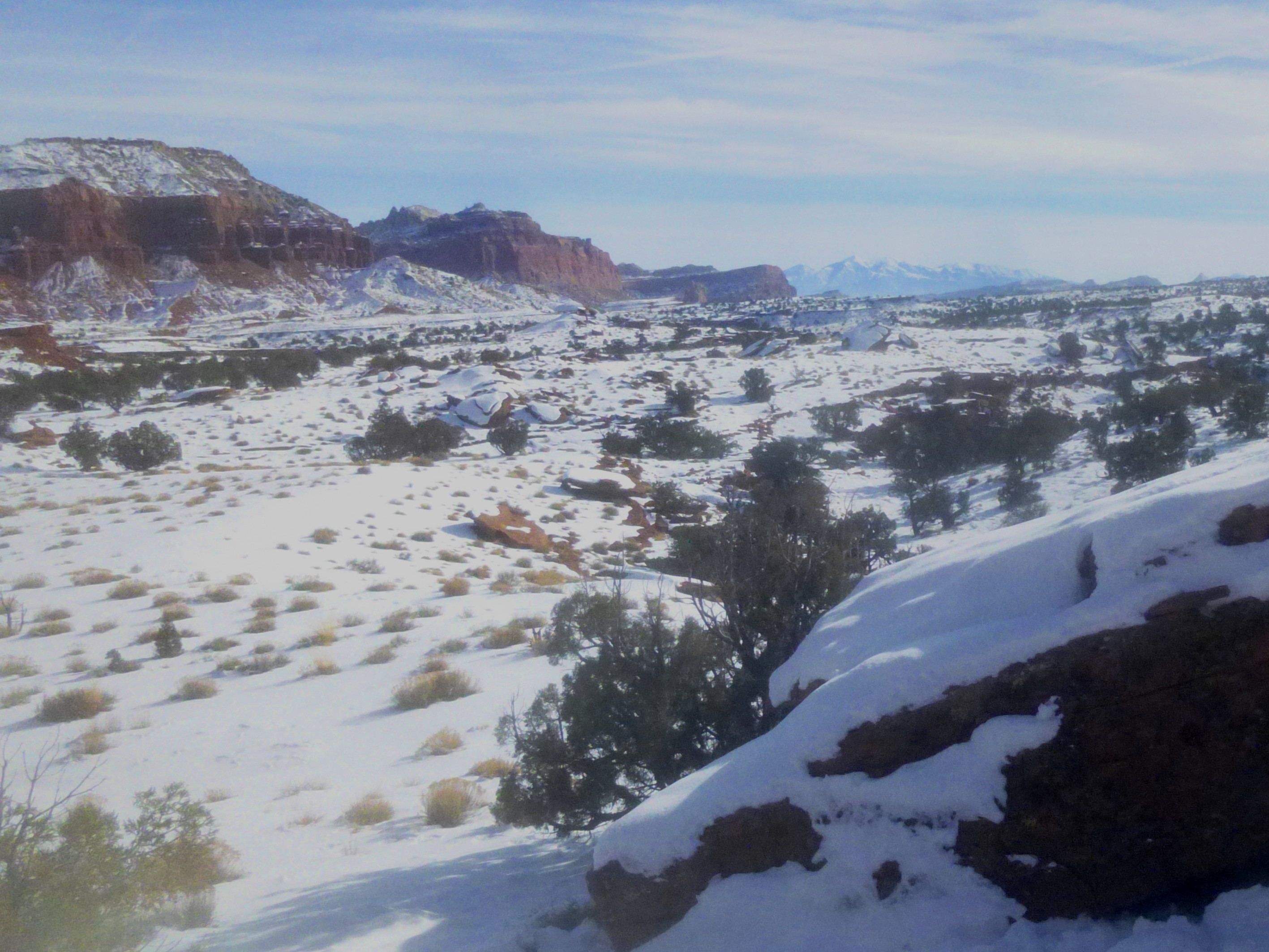
After a short flat stretch, the drainage is obstructed by a morass of hefty boulders. This first obstacle can be bypassed relatively easily by climbing part way up the juniper-dotted slope to your left. Take a minute to enjoy the view back down canyon: Chimney Rock, Mummy Cliff, and the Wingate sandstone cliffs beyond are picturesquely framed by the Moenkopi walls.
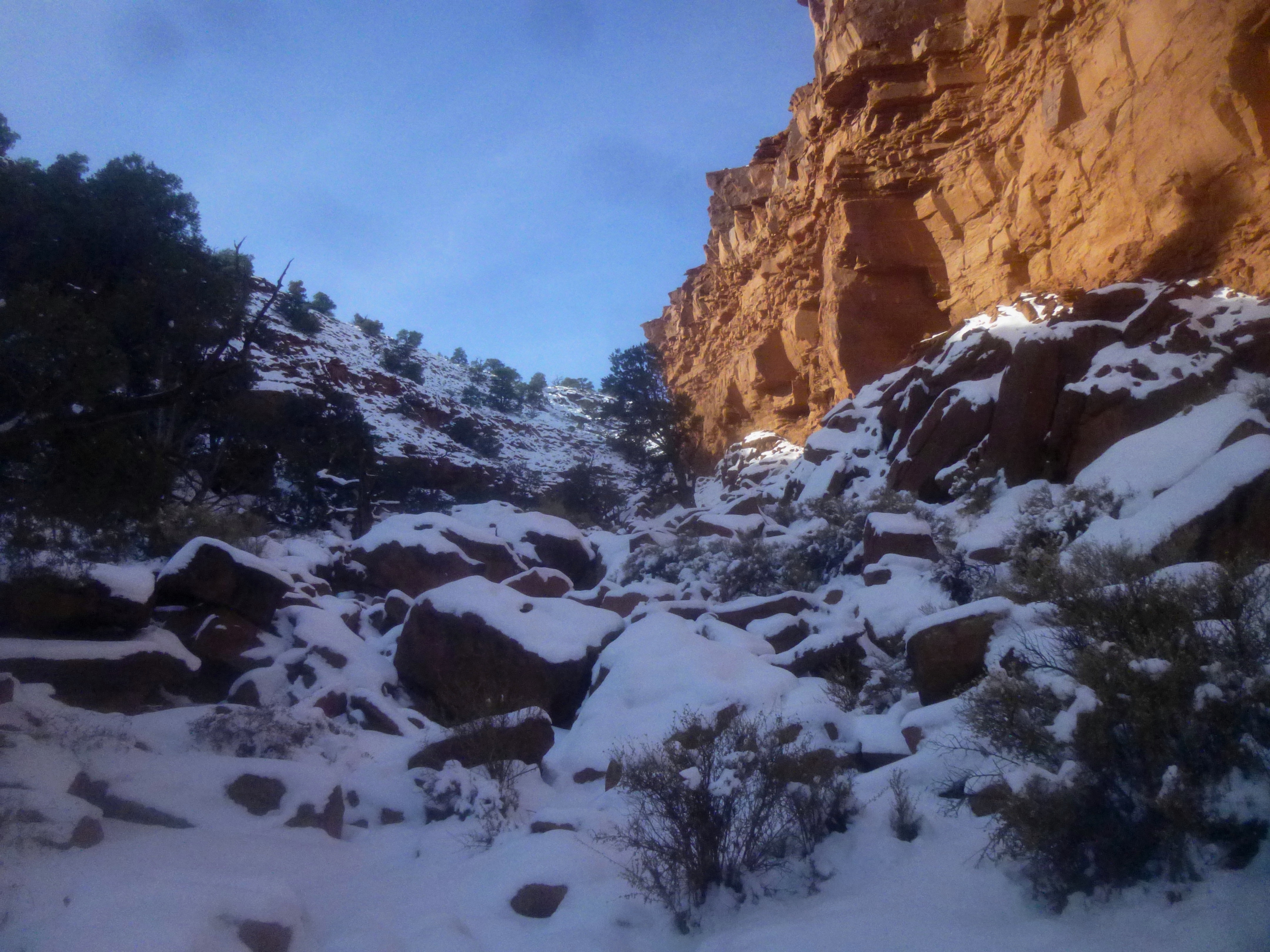
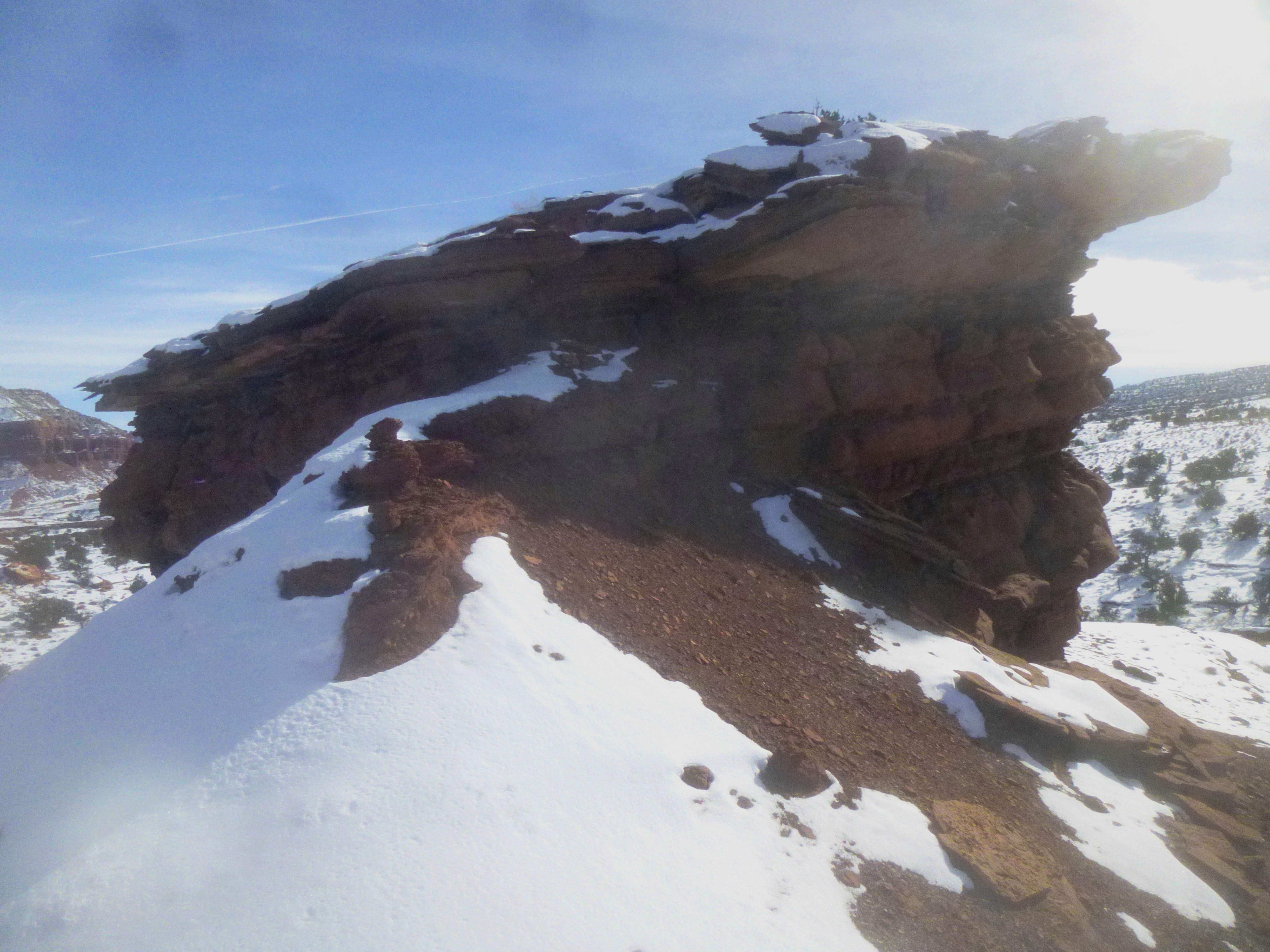
A second set of several dozen boulders 150 yards farther is not so easily skirted. The most challenging climb of the hike comes just as a flat-topped, red-orange spire peeks into view up ahead. A series of sloped boulders have blocked the way up, and the canyon walls have closed in in such a way that prevents the option of bypass. The obstacle is far from insurmountable, however: the easiest approach is to boost yourself up through a narrow cleft on the left hand side, then to scramble the remainder of the way before topping out again.
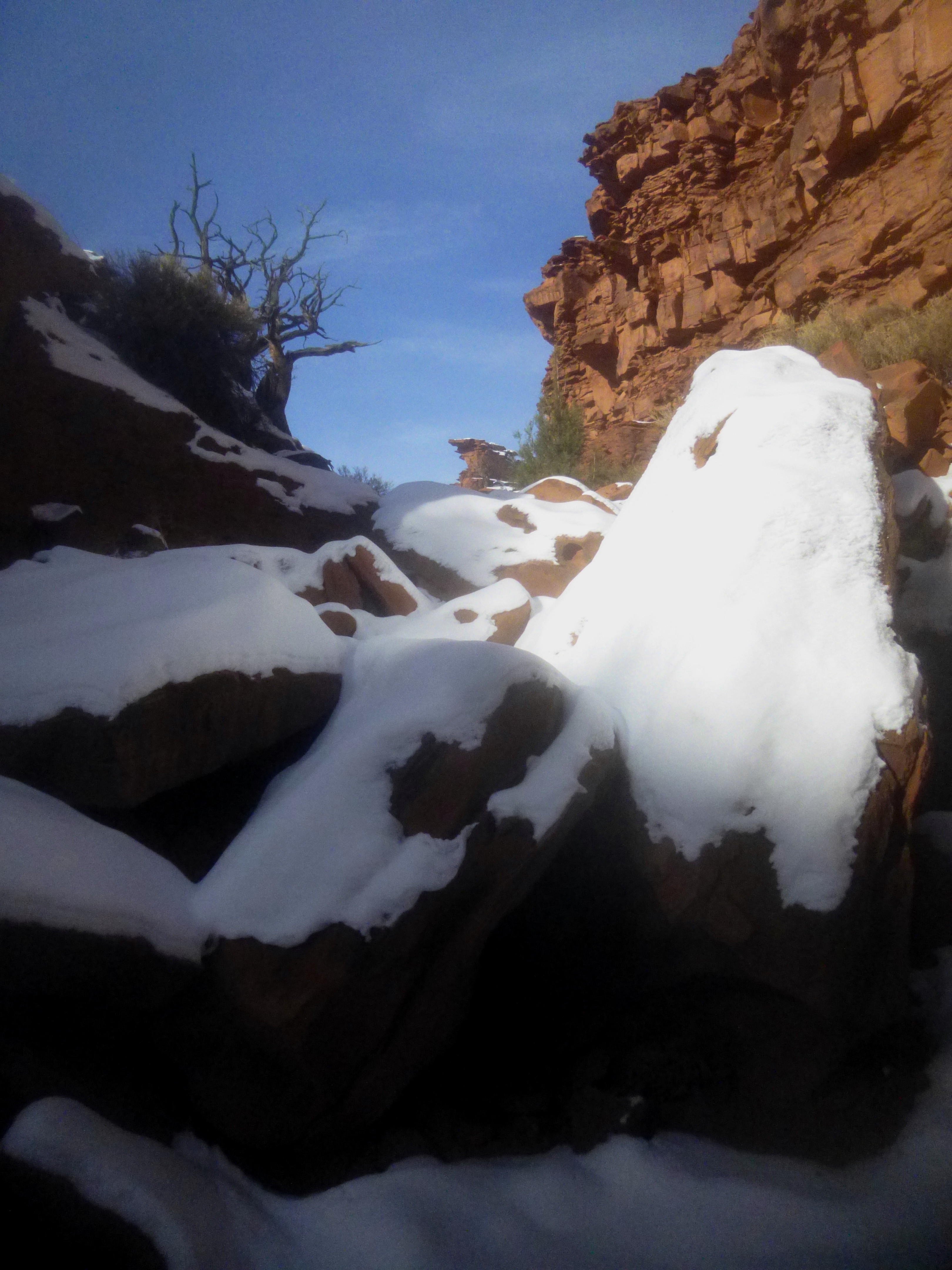
From here, there is another boulder obstruction, though there several ways to climb up and over without leaving the center of the wash. The more adventurous can choose to scale part of the way up the right-hand slope to a narrow ledge that is crumbly (as Moenkopi often is) but nonetheless offers decent footing. Traversing this shelf for the next 200 yards allows you to bypass a number of boulder obstacles.

Eventually it becomes easier to descend back down into the wash bed and continue upstream past a few easily-surmounted rocks. At roughly ¼ mile up the side canyon, the wash levels out and the walls recede, turning the deep, clogged canyon into a relatively rock-free ravine. On the map, you will notice a fork: the left fork, a steep and boulder-clogged tributary, will appear shortly after the wash bottom levels out. Stay right, following the flatter, more obvious wash bed.
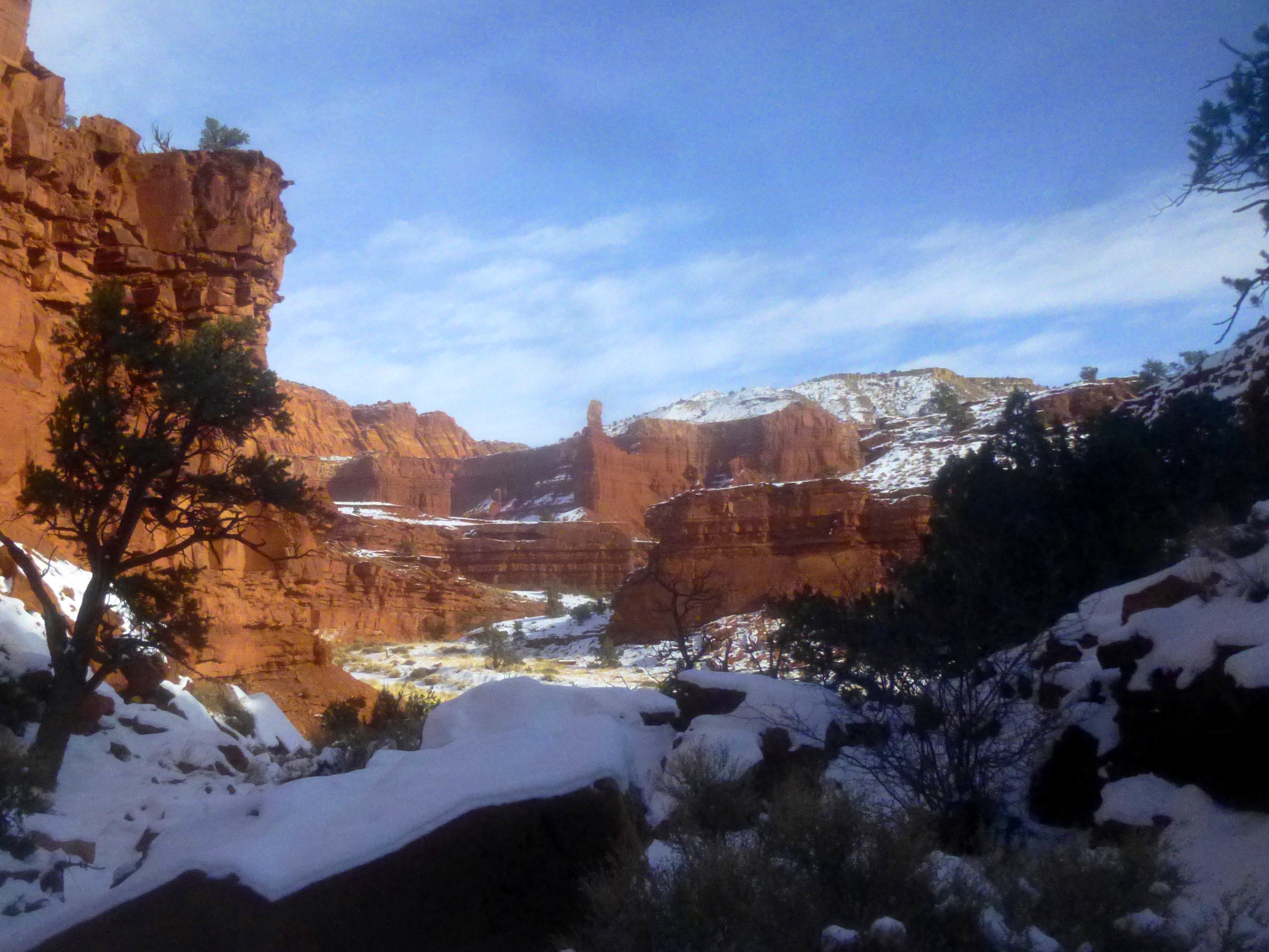
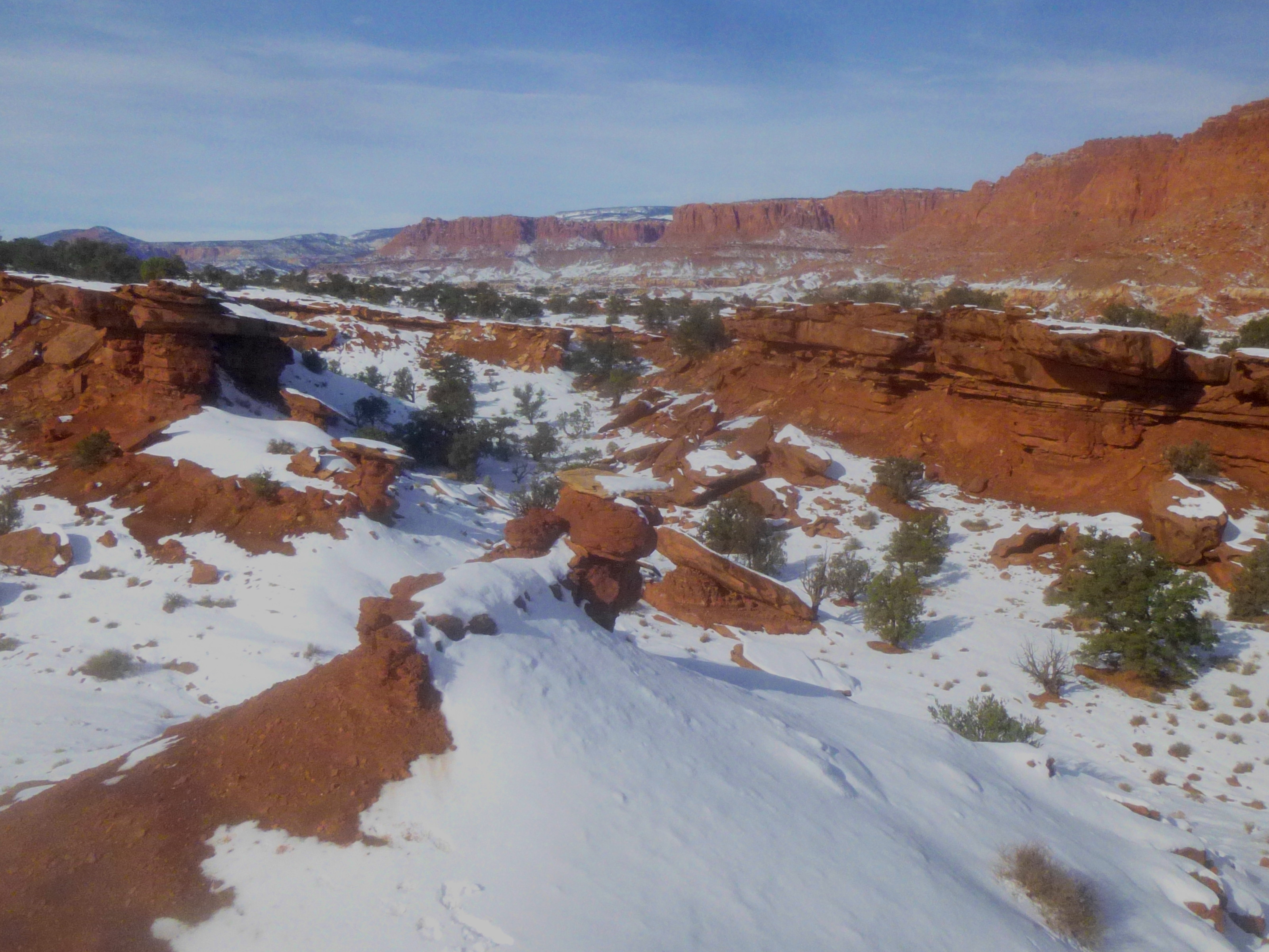
Rounding a bend roughly 1/3-4/10 mile up the canyon, point 6,230’ finally emerges into view; the massive hunk of Moenkopi is hard to miss. Within 150-200 yards, ascend the ridge to your right for easiest access to the monolith.
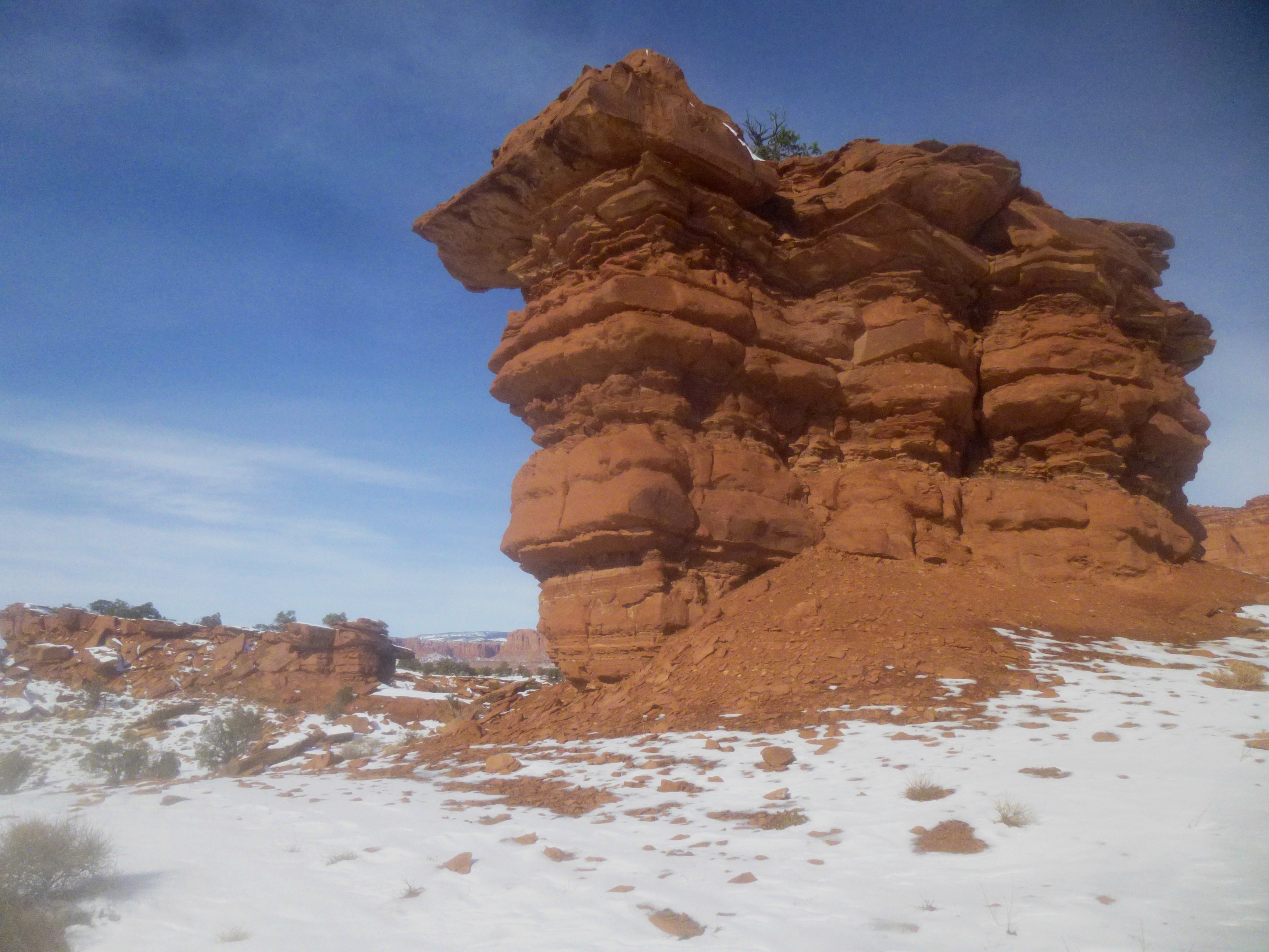
Upon reaching the rock, curve around to the far side for the least difficult ascent: a short slope leads to a spot about four feet from the top. I would not recommend attempting any further: though the rock could probably be easily climbed, Moenkopi rock is notoriously fragile and rock faces can crumble with the slightest touch (do your part to avoid erosion wherever possible!).
From Point 6,230’, enjoy a panoramic view in all directions. To the north and west, a seemingly endless line of towering red-orange cliffs spans the horizon. Views reach as far as Chimney Rock, Navajo Knobs, and the Henry Mountains on a clear day. To the south, scan the maze of Moenkopi canyons, with Boulder Mountain (~11,300) beyond. Though there are higher points off to the south and west (and obviously the red-orange cliffs to the north), Point 6,230’ offers a nice terminus to an interesting off-trail hike. Return the way you came.

Pingback: The Motorman (Capitol Reef National Park, UT) | Live and Let Hike
Pingback: Sulphur Creek (Capitol Reef National Park, UT) | Live and Let Hike