

The Frying Pan Trail in Capitol Reef National Park is to many a connector route—a 3-mile route across high ridgetops linking Cohab Canyon with the Cassidy Arch Trail. It is often completed as part of a shuttle hike between historic Fruita—the park’s lush epicenter—and Grand Wash, or as part of a 10.5-mile loop that adds a 2-mile jaunt through Grand Wash (see here) and two more miles along Highway 24. If you can manage a shuttle to drop you off at Grand Wash, it is an approximately 5.2-mile journey—2/10 mile in Grand Wash, one mile on the Cassidy Arch Trail, three on the Frying Pan, and one in Cohab Canyon—back to the Fruita campground. With extra time, there are several worthy detours, including: (1) a 1-mile round-trip walk across slickrock to the top of Cassidy Arch; (2) a short trip out to a collection of waterpockets; and (3) a 1-mile round-trip hike to the base of a jaw-dropping, 400-foot sheer wall tucked away in Frying Pan Canyon. Highlights from the rest of the Frying Pan Trail include terrific 360-degree views, dense pinyon-juniper forests, and several interesting rock features.

The hike
While the Frying Pan Trail can be approached from either end, the ascent feels noticeably easier and the views more spectacular if followed from south to north. Therefore, start by parking a car (or better yet, get dropped off) at the terminus of the Grand Wash Road, roughly five miles southeast of the Capitol Reef Visitor Center. (Note: during peak season, the parking lot is likely to be quite full.) For 0.2 mile, follow the flat bottom of Grand Wash as it snakes northeast; take a left at the sign indicating the start of the Cassidy Arch Trail. This well-worn path gains 600 feet over the course of a mile, affording excellent views down into Grand Wash, as well as of a collection of whitish Navajo sandstone domes to the east and south. 1.2 miles from the trailhead, the trail forks—veer left to walk the final ½ mile out to Cassidy Arch; stay right to begin the Frying Pan route. (For a more complete trail description of the Cassidy Arch Trail, see my previous post from January 2015.)

Beyond the junction, the Frying Pan Trail resumes the ascent, gaining 400 feet over the course of a mile to the hike’s highpoint. The second half-mile climbs very gradually, allowing hikers to catch their breath. Nearly the entirety of the hike is contained within the range of the ledgey Kayenta formation, though the tips of many Navajo sandstone domes are visible off to the north. Pinyon pines and junipers predominate, and the soil is often a rich red-brown color.

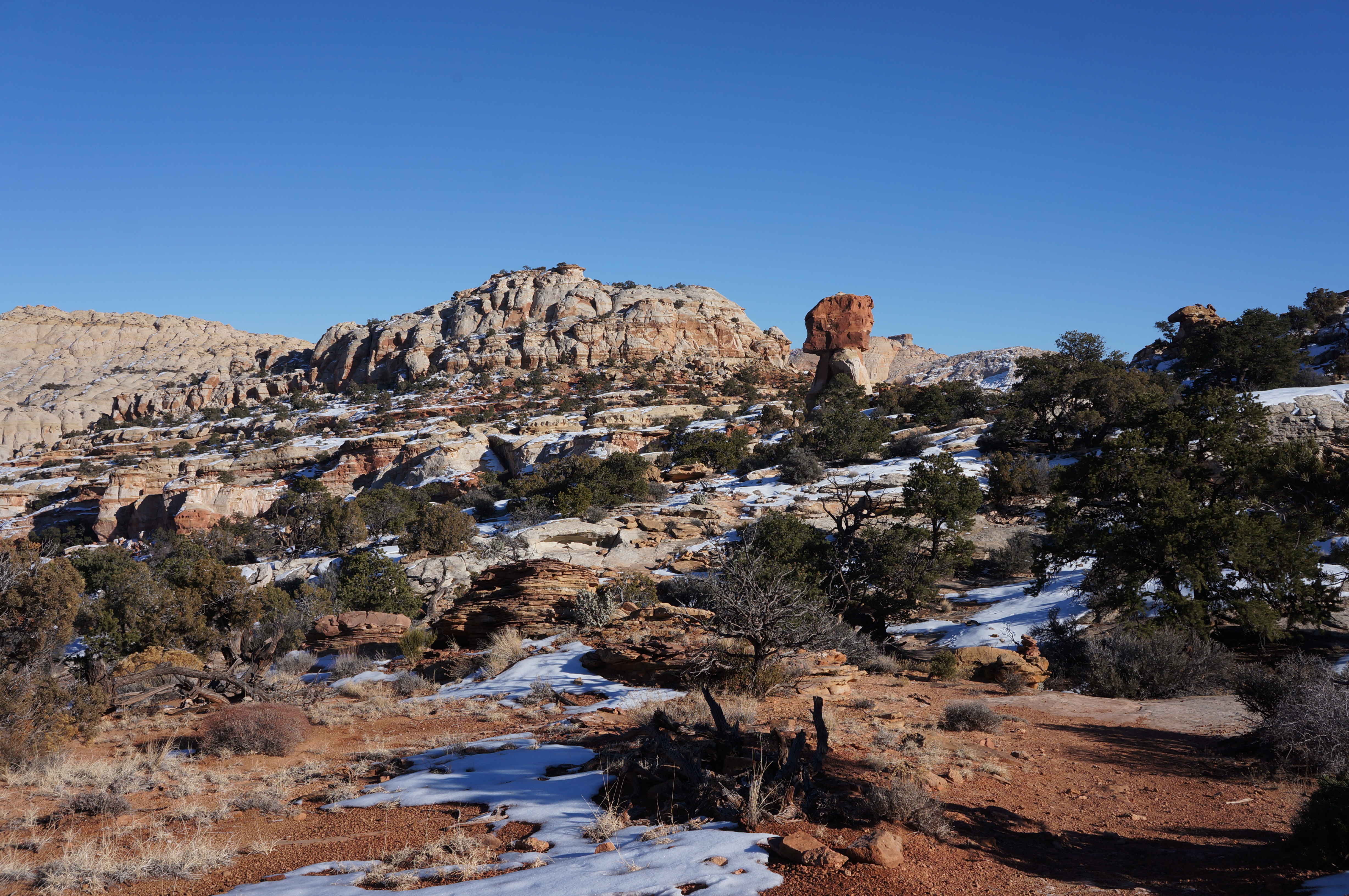
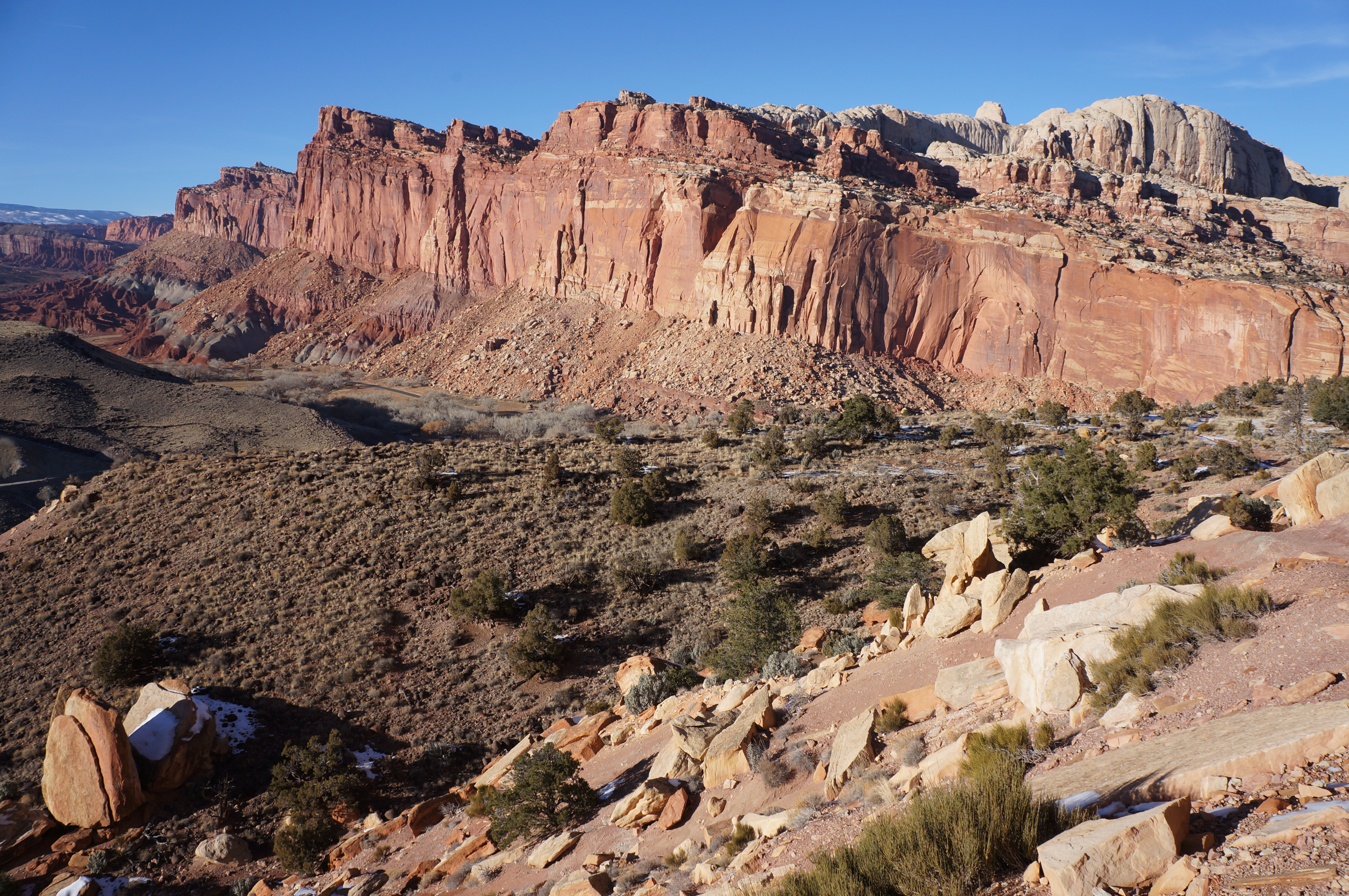
Just over a mile past the junction, the trail crests a ridge, revealing sweeping views in all direction. This is the hike’s highpoint (~6,450); climbable rocks on the left and right provide the best vantage point. To the north, a white band of Navajo domes stretches all the way to Horse Mesa (6,402’), a flattop capped by a different layer called Page sandstone. You can also see beyond these features to the higher elevations between Spring Canyon and Cathedral Valley beyond. To the northwest, views of Fruita are blocked in part by a rim of Kayenta in the foreground, but Boulder Mountain (11,317’) and Thousand Lakes Mountain (~11,300’) cannot be missed. Visibility off to the east on a clear day stretches as far as Factory Butte (6,321’), the Henry Mountains (11,522’), and even the La Sal Mountains (12,721’) near the Colorado border. Finally, the most prominent peak to the south is Ferns Nipple (7,065’), a peculiar-shaped landmark rising above Grand Wash.

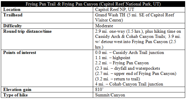
From here, the route begins its mile-long descent into Frying Pan Canyon, a steep ravine defined by its red-orange, honeycombed walls. The shady upper reaches of the canyon’s south fork come into view off to the left before disappearing again behind a thicket of pinyons and junipers. The trail skirts around a dark brown monolith on the right, all the while doggedly descending as the main section of Frying Pan Canyon appears down below. The grade steepens during the final drop to Frying Pan Wash; after a little over two miles of hiking, the trail crosses the sandy arroyo.
Hikers with tired legs and limited time should continue onward with the final 0.8 miles to Cohab Canyon. However, energetic explorers have a couple options for scenic side trips. The first is to walk 150 yards or so downstream to the right, where the wash bed drops off precipitously to a series of photogenic waterpockets below. This hidden spot is a nice spot to stop for a snack or lunch.
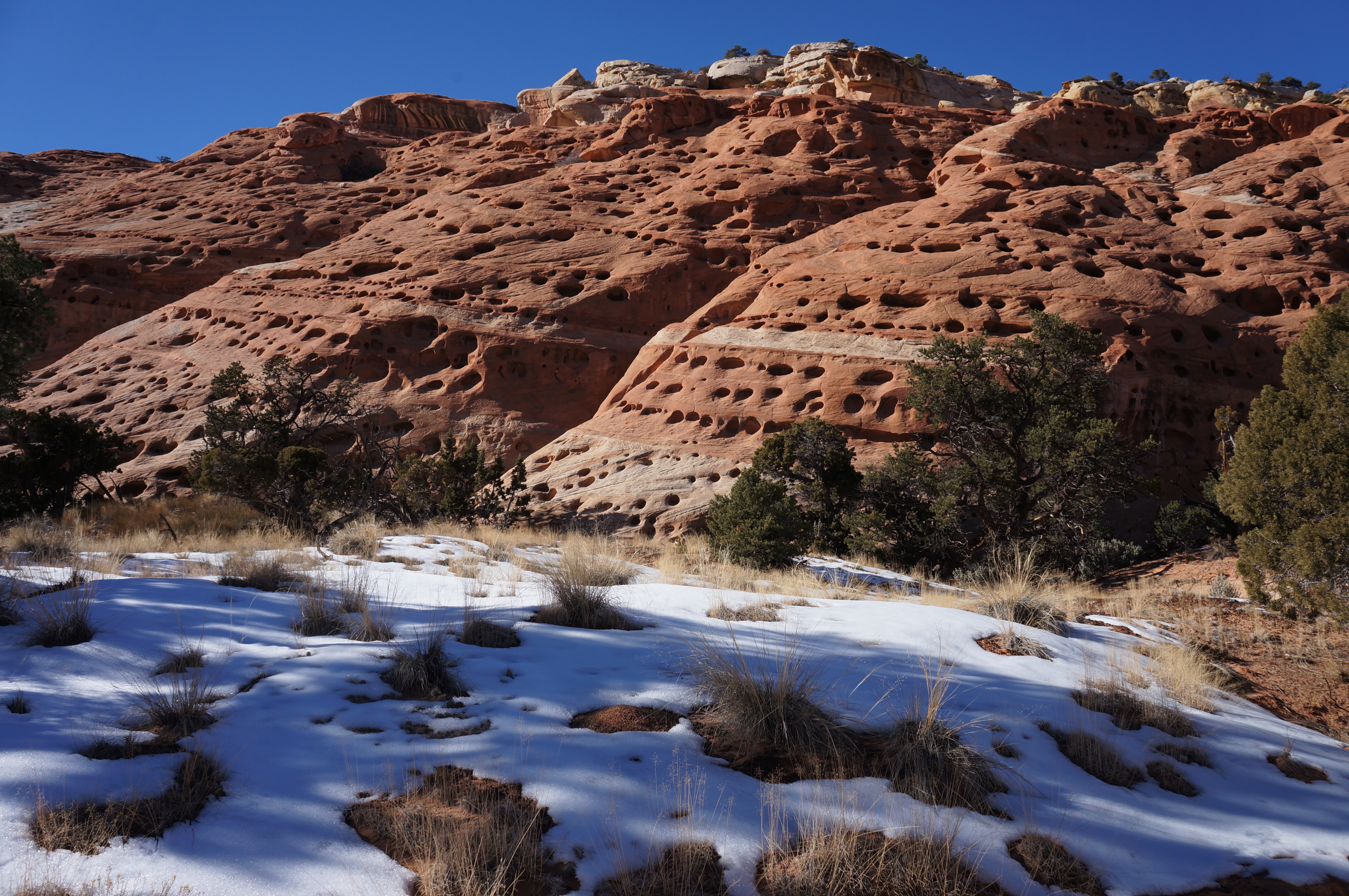
The second, longer detour is to follow the wash upstream to the head of Frying Pan Canyon. After 3/10 mile of walking through the brushy wash bed, the canyon forks. To the left, a tall dryfall (beyond a smaller, easily circumvented pouroff) impedes progress after about 150 yards.
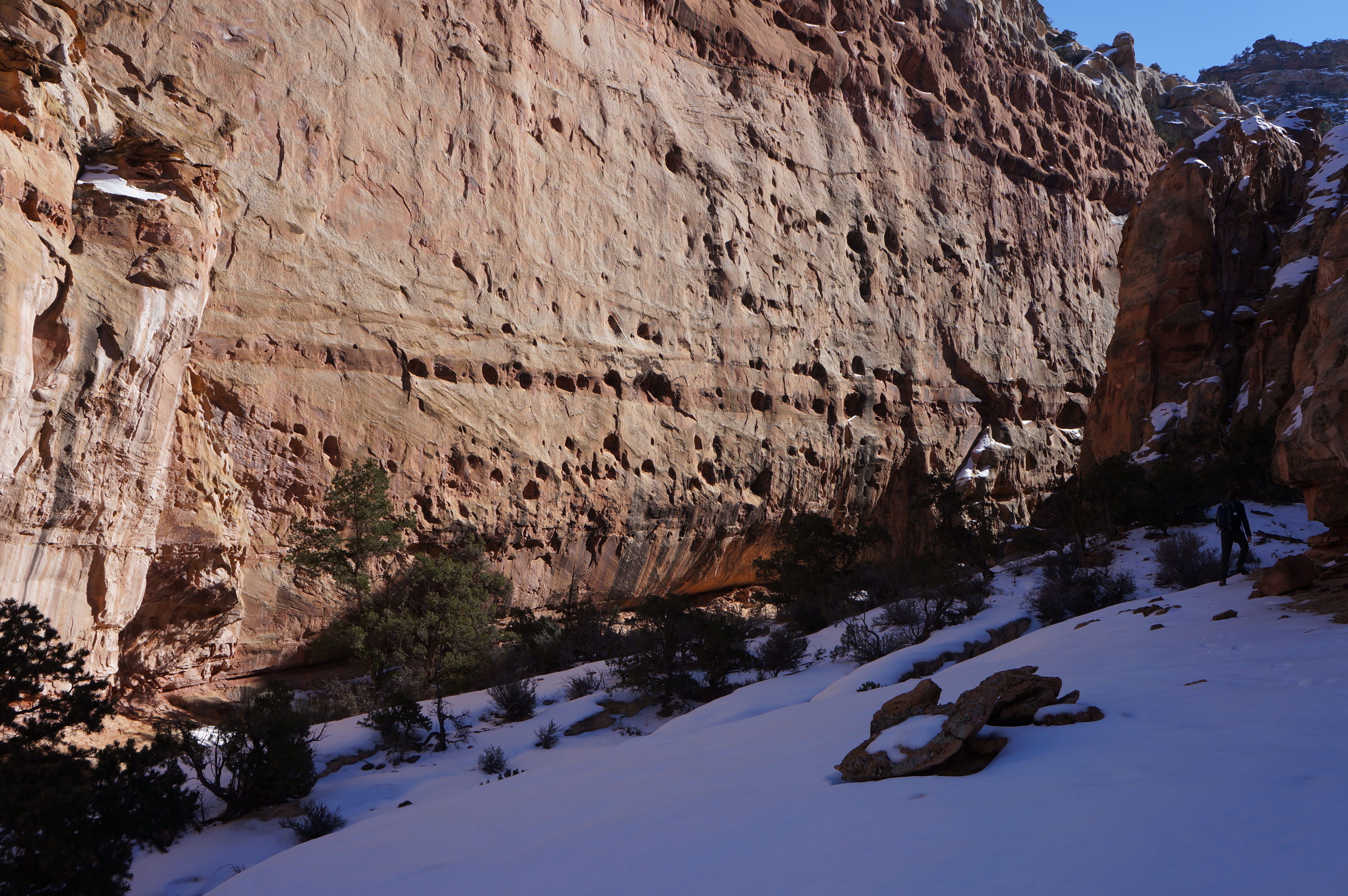
The brush-laden wash in the right fork, however, continues for nearly a quarter-mile, ending at an impressive vertical wall of Wingate sandstone more than 400 feet high. Evidence of a thin incision that stripped away much of the wall suggests that the canyon has seen a rather recent rockfall. Look up to the top left, as well, where an arch is beginning to form. Climb up one of the talus slopes on the left or right for fantastic views of an intimate and peaceful canyon enclosed on three sides. When ready, return the way you came, following the wash bottom ½ mile back to the Frying Pan Trail. The entire side trip will require around 45 minutes to an hour.

From the sandy wash, the trail climbs again, this time gaining around 250 feet in 1/3 mile. Just before cresting the ridgeline, the route passes a huge chunk of sandstone that (to me, at least) looks like a sleeping buffalo (in honor of my favorite sports team, I have named this landmark “Buffalo Bills Rock”).
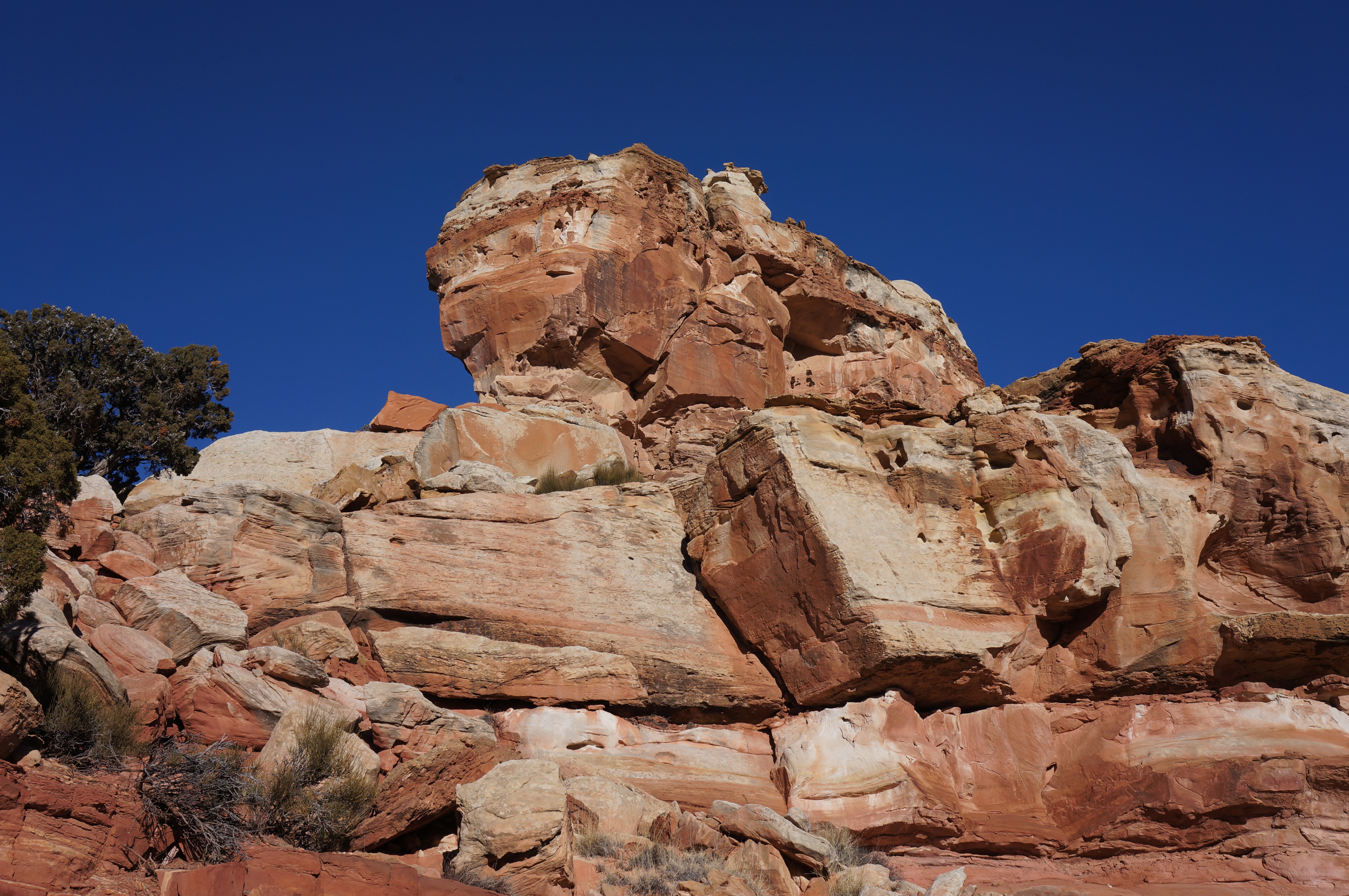
Within a couple minutes’ walk, another notable monolith appears, this one quite clearly resembling the head of a duck. The trail here flattens out for a short period, then begins the final descent into Cohab Canyon, now visible below. The trail edges northeast to drop into Cohab Canyon at one of its less precipitous points, passing numerous examples of nature’s mysterious “moqui marbles.” The abundance of slickrock makes the route hard to follow at times: keep close attention to rock cairns indicating the way ahead.
Finally, after nearly three miles (or four with the detour into Frying Pan Canyon), the trail meets the Cohab Canyon route. From here, follow the Cohab Canyon Trail downhill 0.6 mile east to the Hickman Bridge Trailhead on Highway 24 (this is the suggested route if completing the 10.5-mile loop with Grand Wash) or 1.1 miles west through the most interesting part of Cohab and down to the Fruita campground.

The journey from Grand Wash to Cohab Canyon is a fantastic day hike that covers a wide variety of terrain; if you have only one day of hiking in Capitol Reef’s frontcountry, this is perhaps the best of the best.

Pingback: Cohab Canyon Trail (Capitol Reef National Park, UT) | Live and Let Hike
Pingback: Top 10 Hikes in Capitol Reef National Park’s “Frontcountry” | Live and Let Hike
I think I already thanked you on another of your posts but thanks again for all the info you’ve so carefully put down. It has been of help to me.