

Long before the land was bought by the National Park Service, residents of Capitol Reef country lived in mild fear of the so-called “Wild Bunch,” a band of thieving outlaws led by infamous Utah native Butch Cassidy. Though the group’s legendary hideout—Robber’s Roost—is located roughly 70 miles east of Capitol Reef, oral tradition holds that Cassidy and his gang frequented the area in the 1890s. On at least one occasion, former Fruita resident Elijah Cutler Behunin claims that the Wild Bunch once dined at his cabin along the Fremont River (the cabin has since been refurbished by the Park Service). A century later, Cassidy would likely be tickled to know that a sweeping natural arch high above Capitol Reef’s Grand Wash now bears his name—though no evidence exists that Cassidy ever visited the arch, his legend is now immortalized in stone (if you will…). While the “Wild West” is no longer what it once was, visitors to Capitol Reef can still hike to Cassidy Arch and back in 2-3 hours’ time to get a sense of the terrain through which these notorious outlaws once passed.

The hike
The shortest hike to Cassidy Arch begins at the terminus of the 1.3-mile Grand Wash Road, a well-graded 2WD track that begins approximately 3.5 miles down the park’s Scenic Drive. The parking area, which has a pit toilet, is likely to be crowded during peak season.
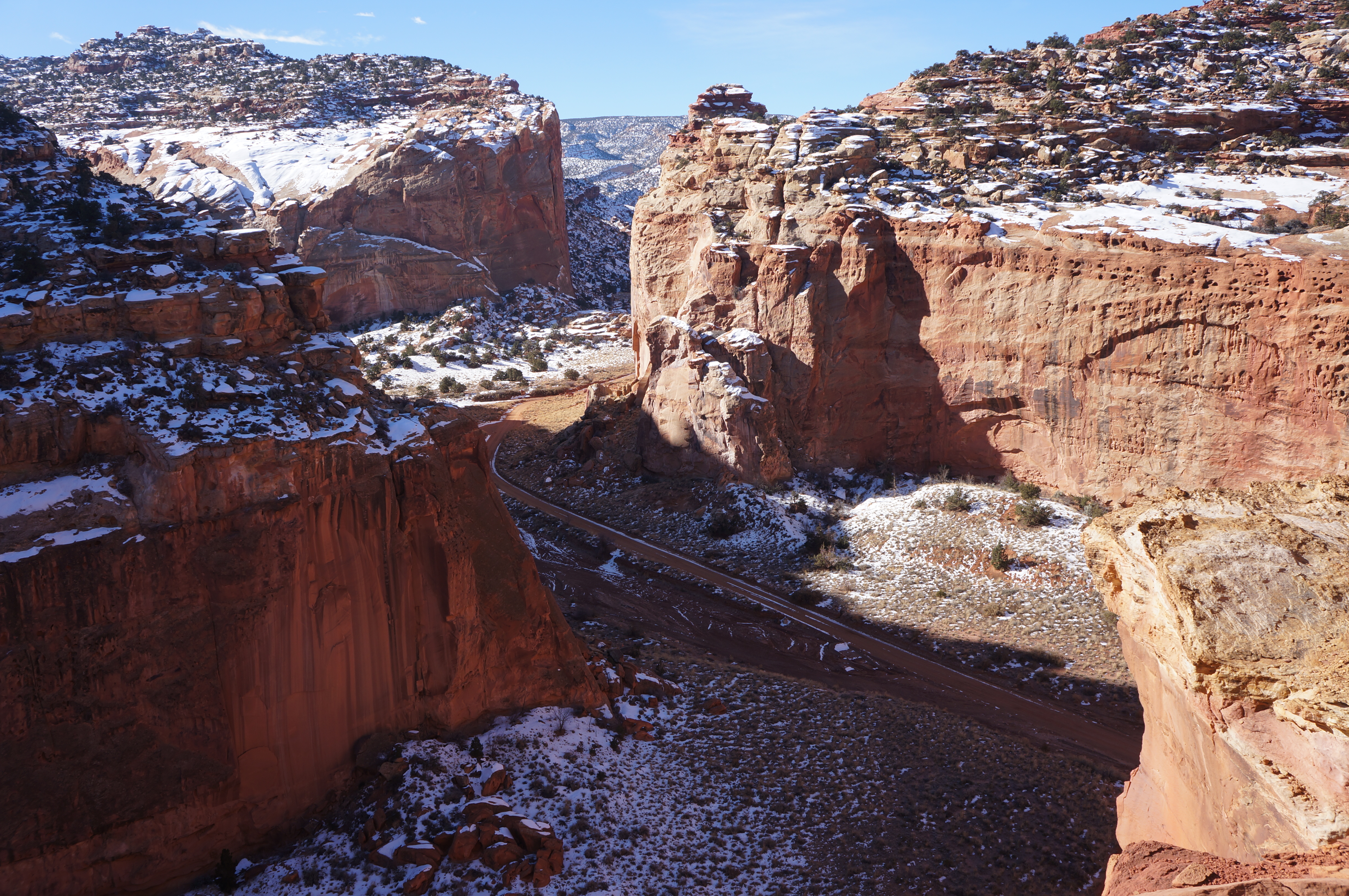
Grand Wash forms an impressive canyon bounded by 700-foot walls of Wingate and Navajo sandstone; the full drainage is best explored by walking the length of the 2.2-mile Grand Wash Trail (see my trail report from December 2014). In fact, the first 0.2 miles of the hike to Cassidy Arch involve walking northeast up Grand Wash before spotting the official start to the Cassidy Arch route on your left. The sign here—which reads “CASSIDY ARCH TRAIL, 1.5 MILES, ELEV. HERE 5400 AT ARCH 6350”—is partly inaccurate, overstating the elevation gain on the hike by more than 300 feet.

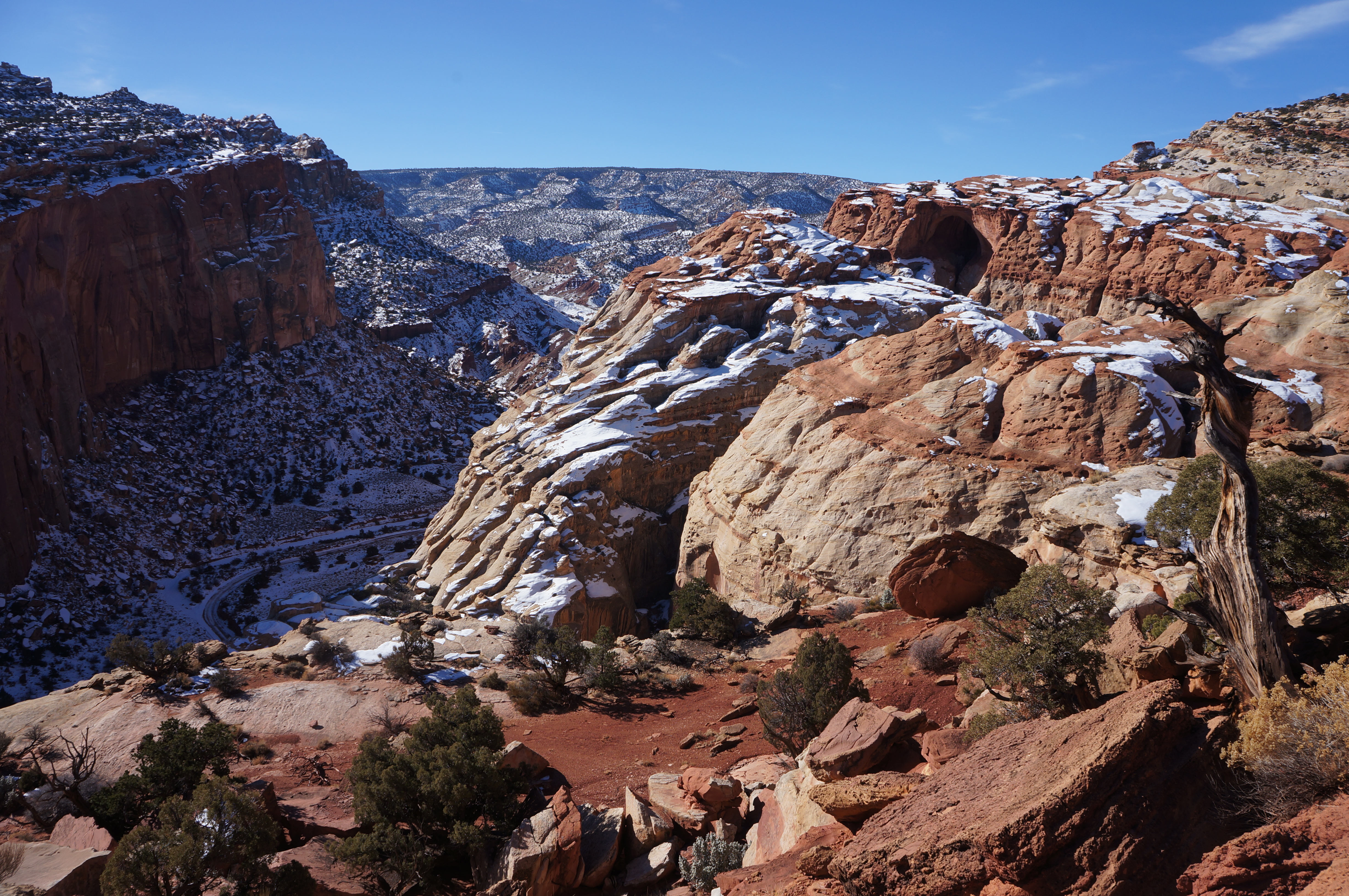
Yet the 600-foot ascent begins with a steep and persistent claim as the trail skirts its way up the northern flank of the canyon. Shortly after the junction, the footpath climbs up out of the Wingate sandstone into the Kayenta formation, which here has seemingly eroded in thin sheets, forming interesting, reddish-pink rock terraces. Across Grand Wash, the ledges of Kayenta form a landscape resembling, with a dusting of snow, “nature’s cinnamon rolls” (credit: Sarah Stodder!).


After 1/3 mile, the trail rounds a bend, affording excellent views of Grand Wash and towering Fern’s Nipple (7,065’), and the grade of the incline lessens. Here the ledgey Kayenta is on full display—interchanging layers of white, tan, and reddish-pink; many perches are dotted with dark green junipers and pinyon pines.

Approaching the dry wash bed ahead, the grade lessens further. Beyond the wash, the cairned trail climbs again, this time amidst a relatively dense thicket of junipers and pines. Cresting a second bend nearly one mile from the trailhead, the shady alcove formed by Cassidy Arch becomes visible off to the west.
At 1.2 miles, the path forks. Continue right for the Frying Pan Trail, which mostly follows the Kayenta high tops for three miles before connecting with the scenic Cohab Canyon Trail. Keep left to complete the journey to Cassidy Arch, now just ½ mile away.

The trail beyond the junction quickly drops out of the pinyon-juniper forest onto open slickrock. (On the winter day we hiked, this section was still covered with large patches of snow.) A final climb up a sandstone slope brings hikers to the highest point on the hike.

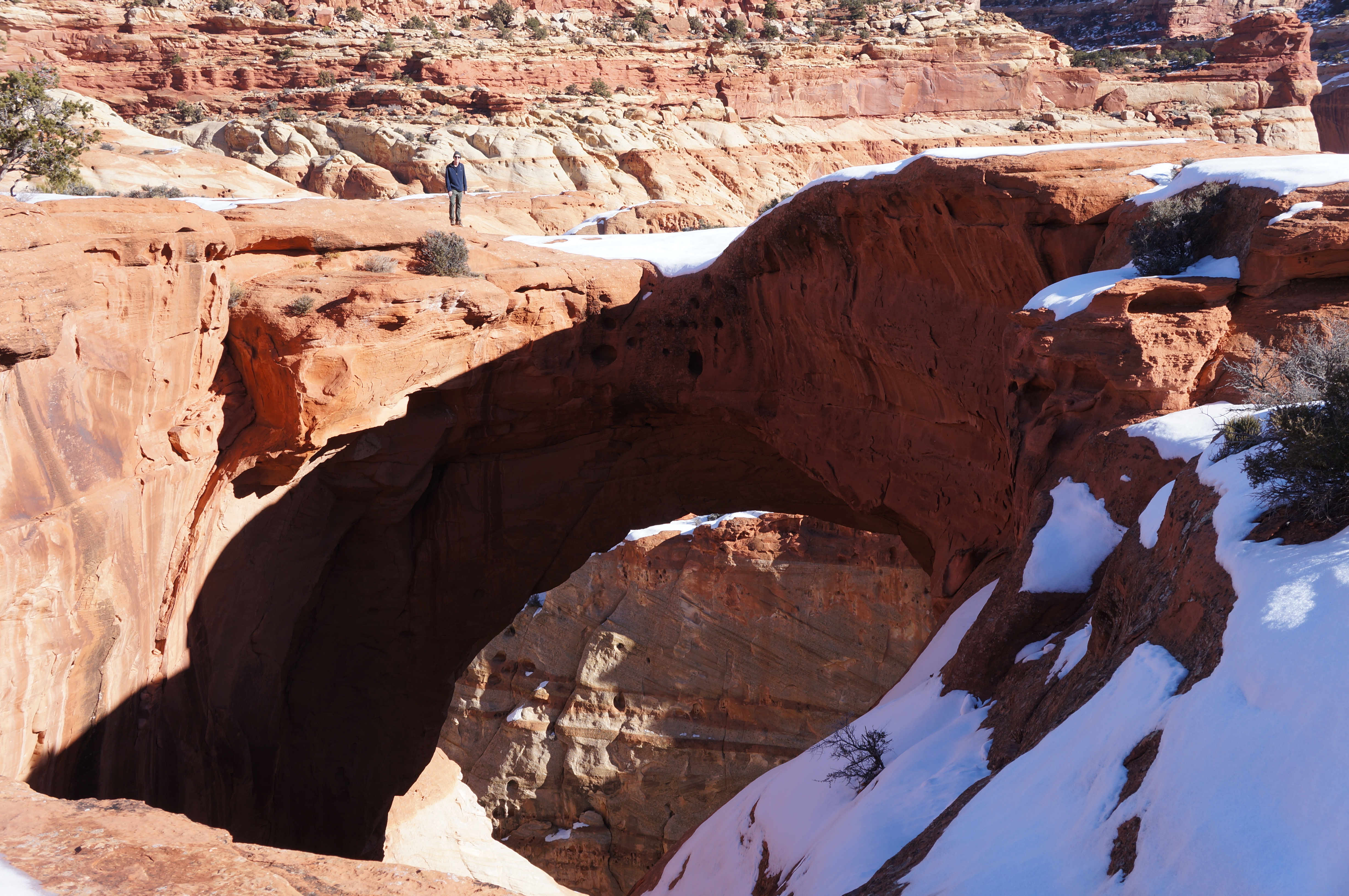
The trail then veers off to the left, down a gradual grade across slickrock to the canyon rim—Cassidy Arch, hidden for much of the hike, appears dramatically ahead. The arch is perhaps unusual in that it is best viewed from above, where visitors can peer down through the gaping hole to Cassidy Arch Canyon and Grand Wash below. Intrepid hikers can skirt the rim to the left or right to walk across the arch itself. The arch is thick and wide enough to feel like crossing over regular slickrock, but the journey appears quite precarious to others watching from afar.
The exposure and lack of shade at trail’s end makes Cassidy Arch a less-than-desirable place to loiter in the summer or with thunderstorms looming. At cooler temperatures, however, it is a worthy side trip to walk out to the western edge of the slickrock flat for magnificent views of Grand Wash, Fern’s Nipple, Miners Mountain (~7,900’), and Boulder Mountain (~11,300’). Grand Wash Road and the Scenic Drive are also visible at the base of the cliffs below.
Return the way you came or, for extra credit, combine with the Grand Wash, Frying Pan, and Cohab Canyon Trails to form an excellent 10.5-mile loop (including a short walk along Highway 24).


Pingback: Frying Pan Trail and Frying Pan Canyon (Capitol Reef National Park, UT) | Live and Let Hike
Pingback: Cohab Canyon Trail (Capitol Reef National Park, UT) | Live and Let Hike
Pingback: Top 10 Hikes in Capitol Reef National Park’s “Frontcountry” | Live and Let Hike
Pingback: Utah – Jamie's Jet-Setting Journeys ✈️🌎