

Not surprisingly, one of the most popular questions at the Visitor Center in Capitol Reef National Park is: “Where should I go for the sunset?” Well, we have a hike for that—aptly named the “Sunset Point Trail.” This short jaunt—2/3 mile round trip—features sweeping vistas of the Waterpocket Fold, Capitol Reef’s defining geological feature, as well as a vertigo-inducing overlooks into Sulphur Creek Gorge, here about 600 feet deep. It’s a nice hike to cap a full-day of exploring—best completed about an hour before the sun drops behind Rabbit Valley and the Aquarius Plateau to the west.

The hike
The Goosenecks Road—the access point for the Sunset Point Trail—departs from Highway 24 roughly 2.4 miles west of the Capitol Reef Visitor Center. Follow the sign for “Panorama Point,” an overlook with a parking area less than 100 yards south of the turnoff. Continue left, passing Panorama Point, as the track turns to dirt. Barring recent precipitation, the drive is usually passable to 2WD passenger cars. Park at the end of the road—the Goosenecks parking area—located just short of a mile from Panorama Point.

Two short trails take off from this spot. A very brief, 800-foot path climbs a gentle slope to the Goosenecks Overlook, while a longer trail—about 1/3 mile one-way—heads east to Sunset Point. Both are well-marked.
Aside from a few initial steps, the Sunset Point Trail gains very little elevation. Views of the Fold to the north and east begin almost immediately; they improve the farther you go along. About ¼ mile from the trailhead, the well-established trail traverses a small ridge, flanked on one side by a mammoth drop-off. Sulphur Creek Canyon—boasting the two oldest rock layers in the park, Kaibab Limestone and White Rim Sandstone—unfurls below.

Though these two older layers date to the Permian period, the Sunset Point Trail remains entirely within the Triassic Moenkopi formation, a best known for its reddish-brown, extremely crumbly Torrey member. A collection of squat, crimson spires appear here and there, breaking up the gently-sloping terraces littered with thousands of broken rock fragments.
The trail ends at the eastern tip of the ridge, marked by a collection of huge, pancaked sheets of rock. (There is a small butte a couple hundred yards farther, but it is difficult—perhaps dangerous—to access.) The park has installed a bench a couple dozen yards back that offers a nice place to sit and enjoy the sunset.
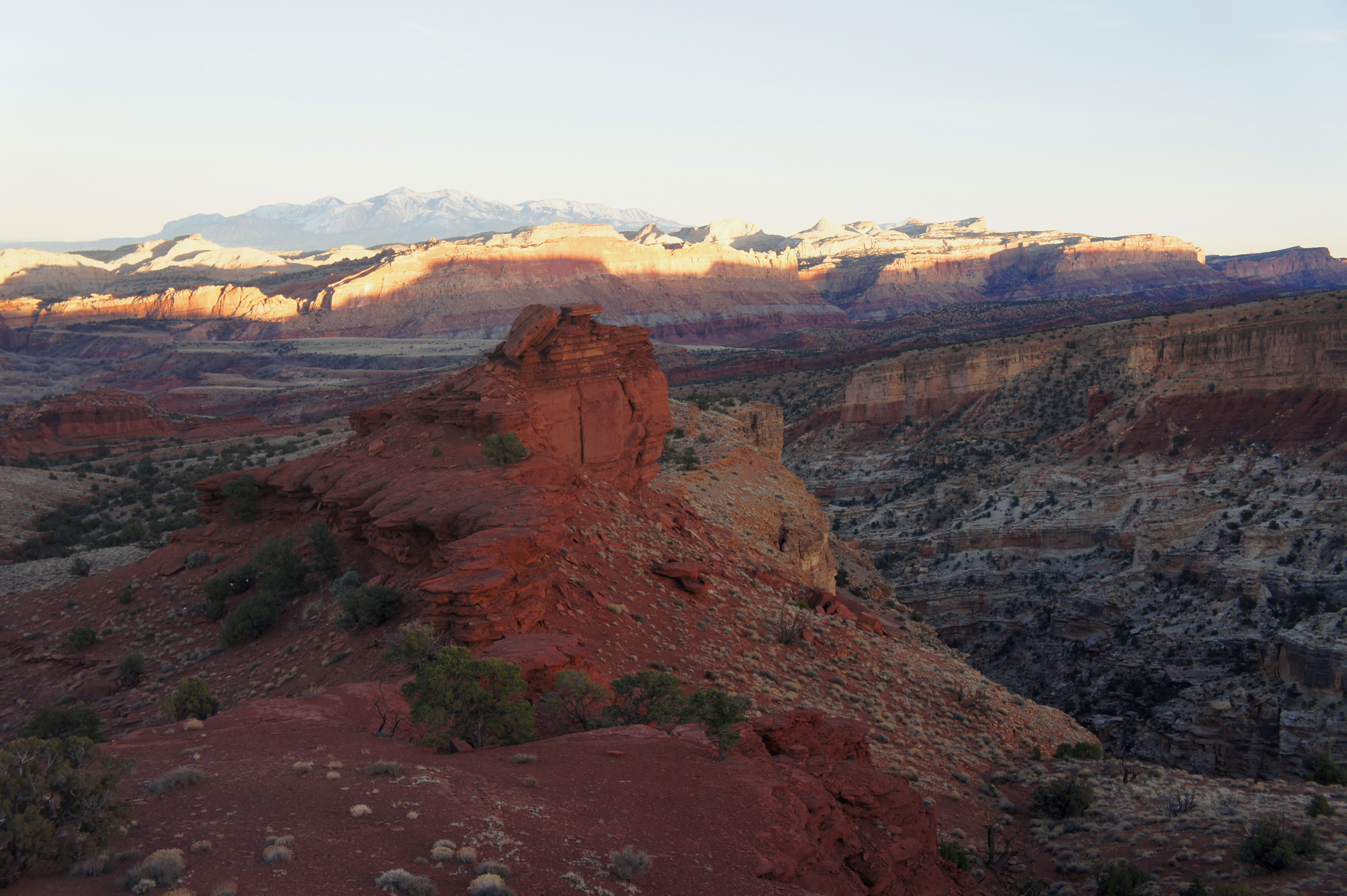
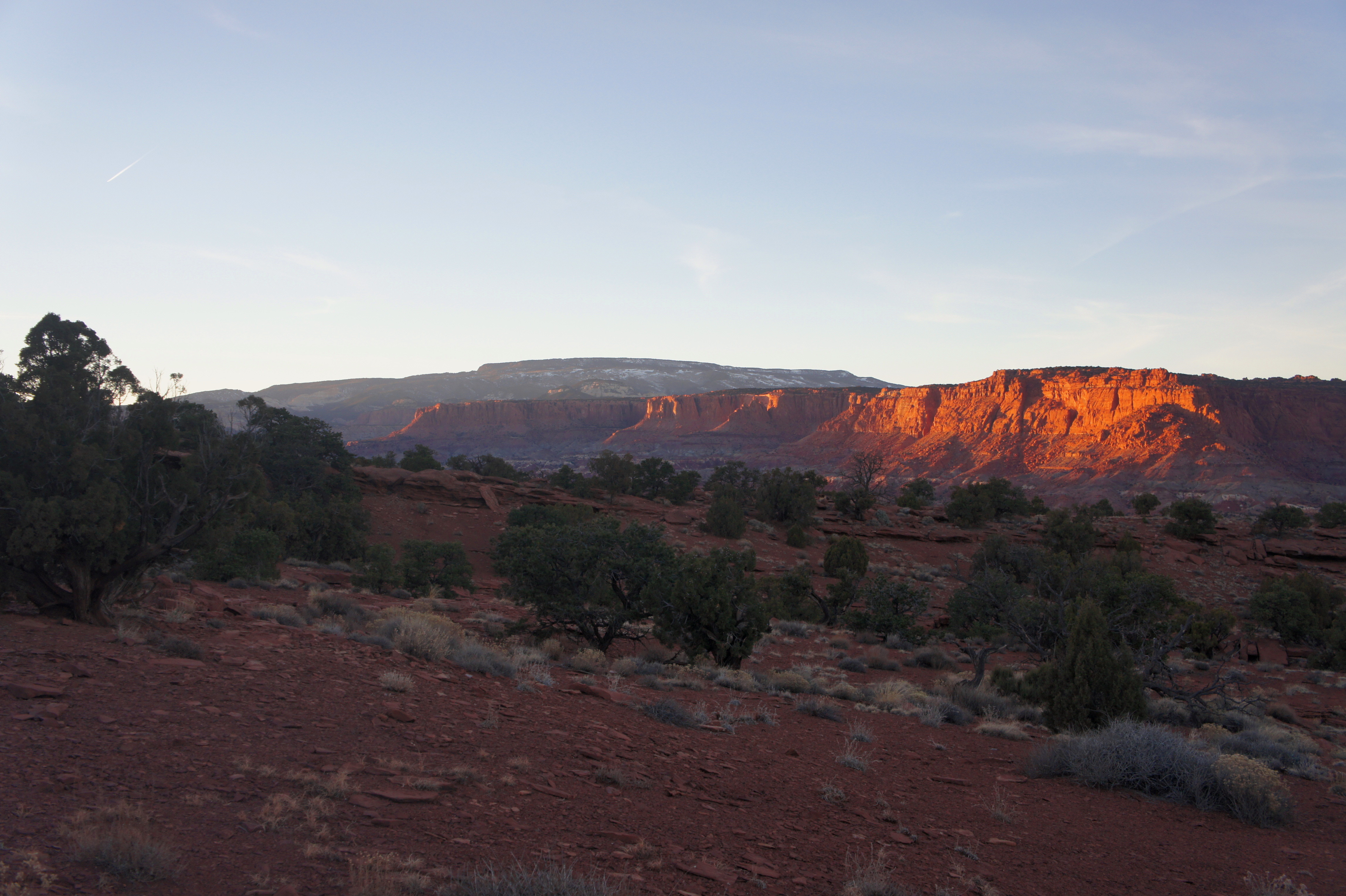
The colors are often most vivid along the Fluted Cliffs and Chimney Rock to the north, which appear blood red in the sun’s last light. Straight ahead, a wall of multicolor cliffs—the heart of the Waterpocket Fold—extends off to the south, interrupted only by a smattering of drainages (like Grand Wash and Capitol Gorge) that have carved deep canyons through the Fold. To the southeast, the chalky cliffs of Sulphur Creek Canyon are topped by an endless sea of pinyon-juniper forest. The relatively dense tree cover extends southwards up Miners Mountain to Boulder Mountain (11,317’) and the Aquarius Plateau. On clear days, the Henry Mountains—on the other side of the Fold—add to the picturesque charm.

As the setting sun casts wide shadows on canyon country, backtrack the way you came to return to your car.

Pingback: Goosenecks Trail (Capitol Reef National Park, UT) | Live and Let Hike
Pingback: Return to Capitol Reef National Park | Live and Let Hike