
The Waterpocket Fold, a massive wrinkle in the Earth visible in its entirety only from space, stretches north-south for nearly 100 miles through Utah’s Capitol Reef National Park. Despite its considerable length, however, this colorful sea of Jurassic and Triassic era rock is only sliced through in a handful of places. Fewer still, the number of perennial streams cutting across the Fold is a mere three. Utah Highway 24 follows the course of the Fremont River, while a series of hiker-made paths crisscross nearby Pleasant Creek. Oak Creek, the third of the group, is more difficult to access but nevertheless conspicuously absent from hiking guides to the area. This makes the hike through Oak Creek Canyon a true hidden gem: a V-shaped valley with sharp cliffs and deep-cutting narrows, it is almost always empty—save for a handful of days per year when local ranchers use Oak Creek Canyon to trail cattle through the Fold.


The hike
While there is no official trail through Oak Creek, there is indeed a trailhead, situated at the end of a 4-mile dirt track on the eastern edge of the Fold. From the Capitol Reef Visitor Center, drive nine miles east on Highway 24, leaving the park, then turn right onto the Notom-Bullfrog Road. Approximately 13 miles down the road, just beyond the Sandy Ranch Junction (access to McMillan Springs and the Henry Mountains), turn right at the BLM sign marked “Oak Creek Canyon 2.”
Alas, the mileage on the sign is inaccurate—it is actually four miles, across less-than-dazzling terrain, from here to the official trailhead. The Oak Creek access road is not accessible to all vehicles: high-clearance is required (four wheel-drive recommended for the final two miles). After about 1.25 miles, the sagebrush-laden flats give way abruptly to a modest forest of junipers and pinyon pines. 2.5 miles in, the road briefly crosses the park boundary before quickly exiting again as the drive bends southwest. (Note: At the “No Camping” sign, a faint hiker-made path bears north before fading away into a slickrock ravine—a backdoor route into Sheets Gulch.)
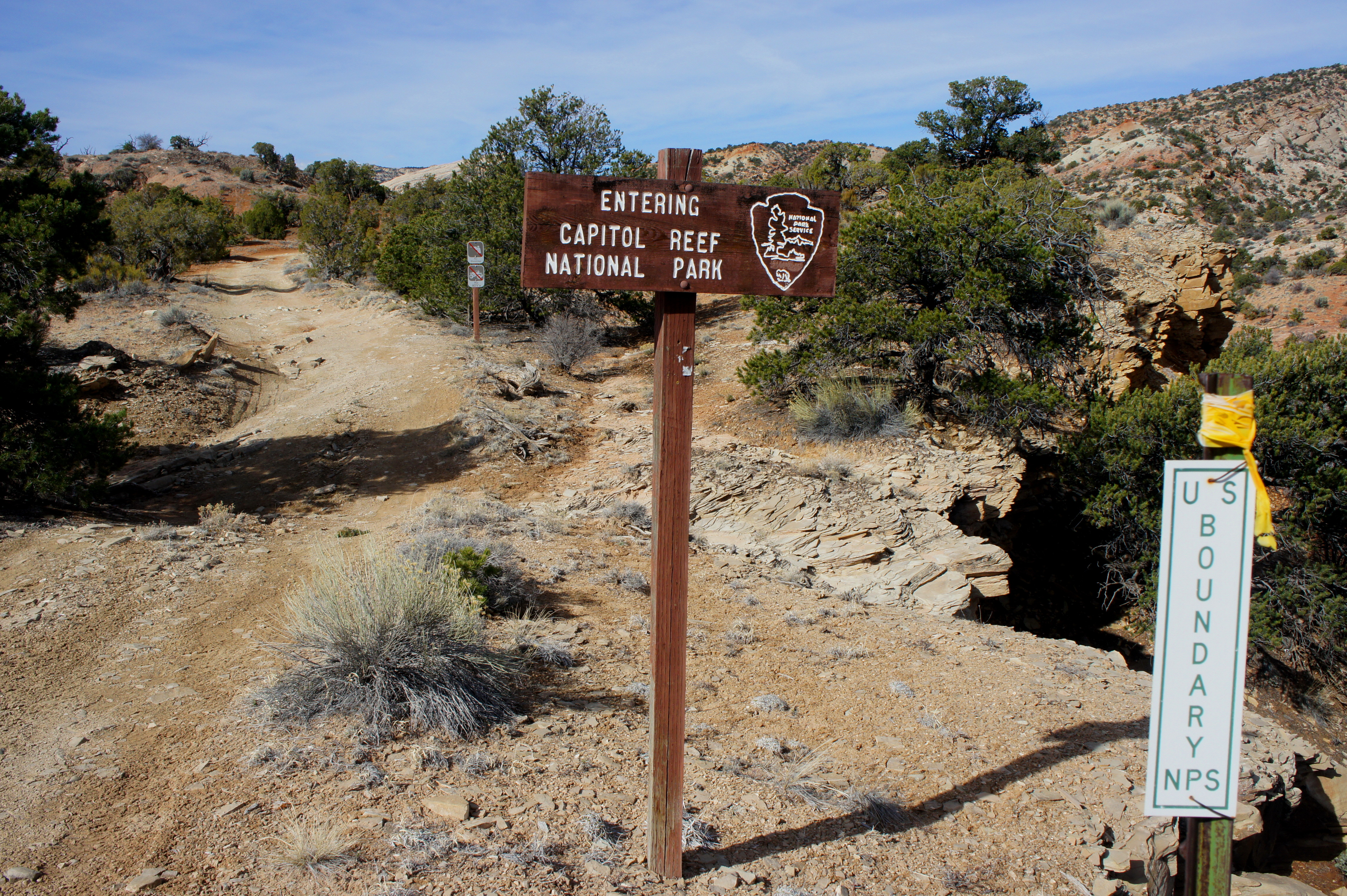
Shortly after this point, the road becomes considerably more rugged. A subsequent wash crossing requires slogging through deep sand, followed by a rocky ascent out of the drainage. At a point three miles from the start, the Oak Creek access road again crosses the park frontier. Some may choose to park their vehicles here and walk the final mile—the track beyond is narrow and wildly rutted. The remainder of the drive involves ascending gradually to a minor pass between buttes, then edging southwest to the trailhead.

While the remote parking area is surprisingly well marked (a fresh sign reads: “Hikers Trailhead”), there is little trace of a trail down to Oak Creek. Here a detailed topographic map and an astute sense of direction are helpful—the descent involves dropping down a steep but brief slope into a dry wash, which should then be followed down-stream (south) until it reaches the main Oak Creek drainage. This stretch, perhaps 1/3 mile long, involves down-climbing a pair of blocky dryfalls, each relatively straightforward and not too hairy.
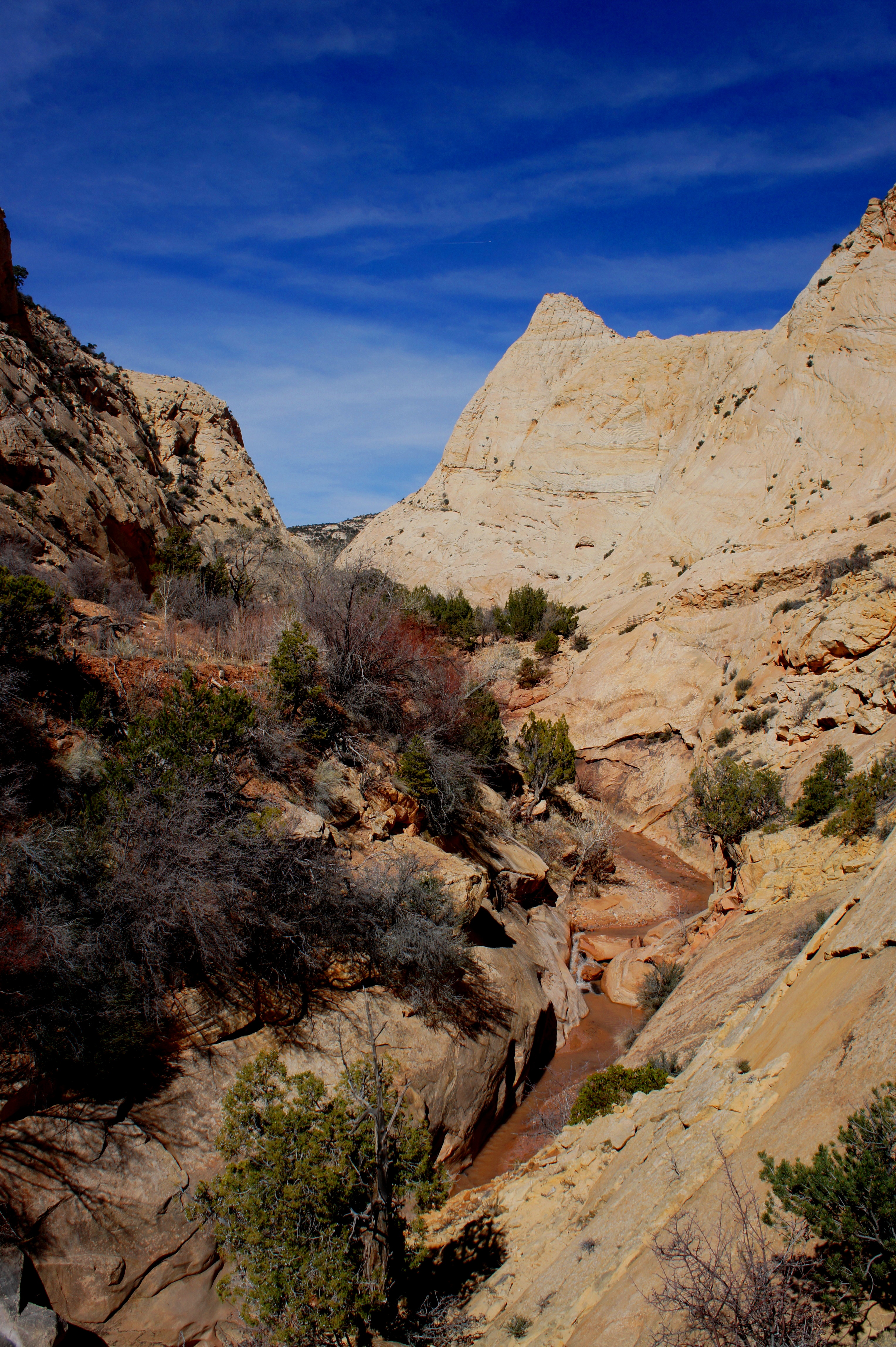
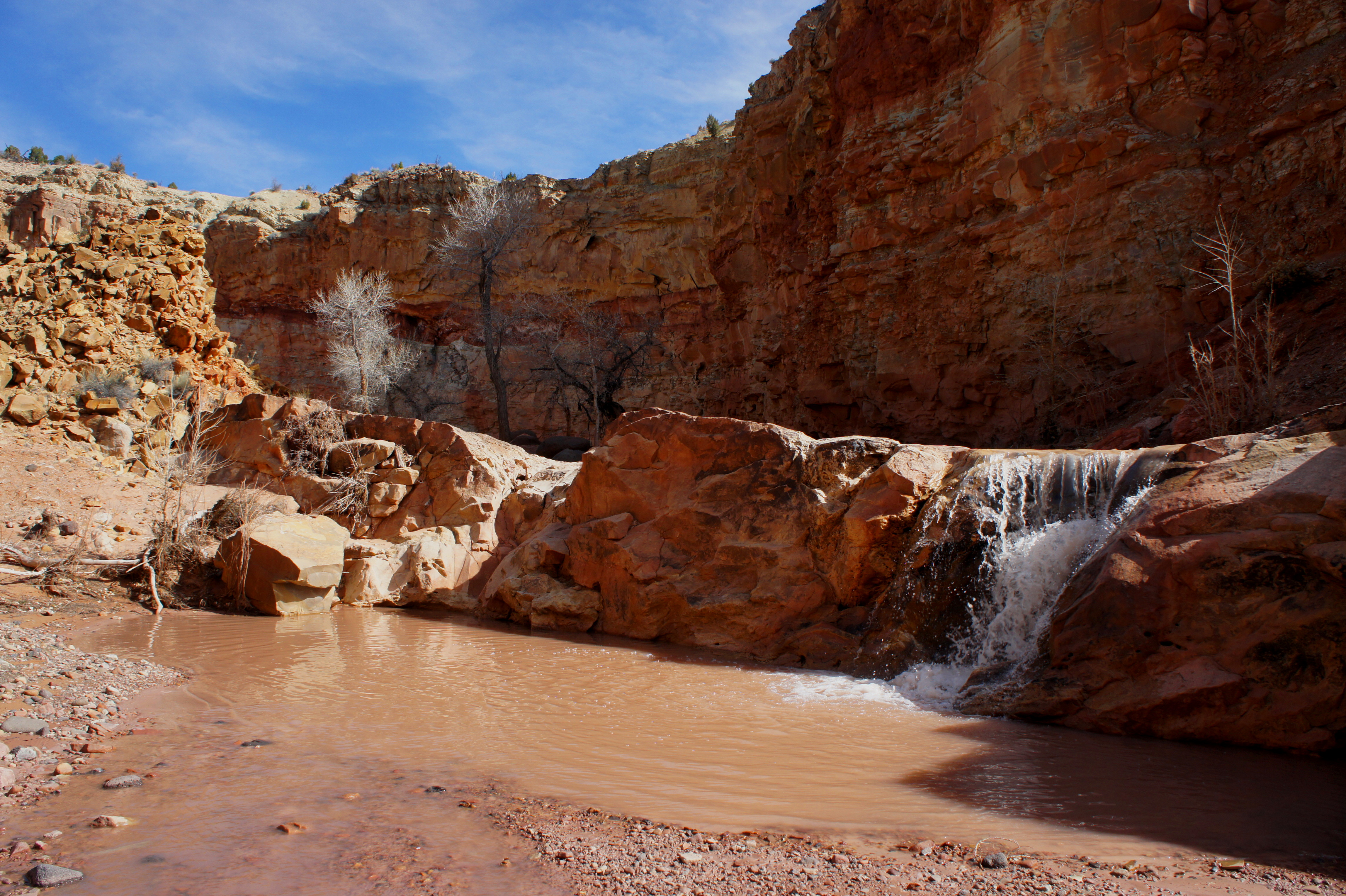
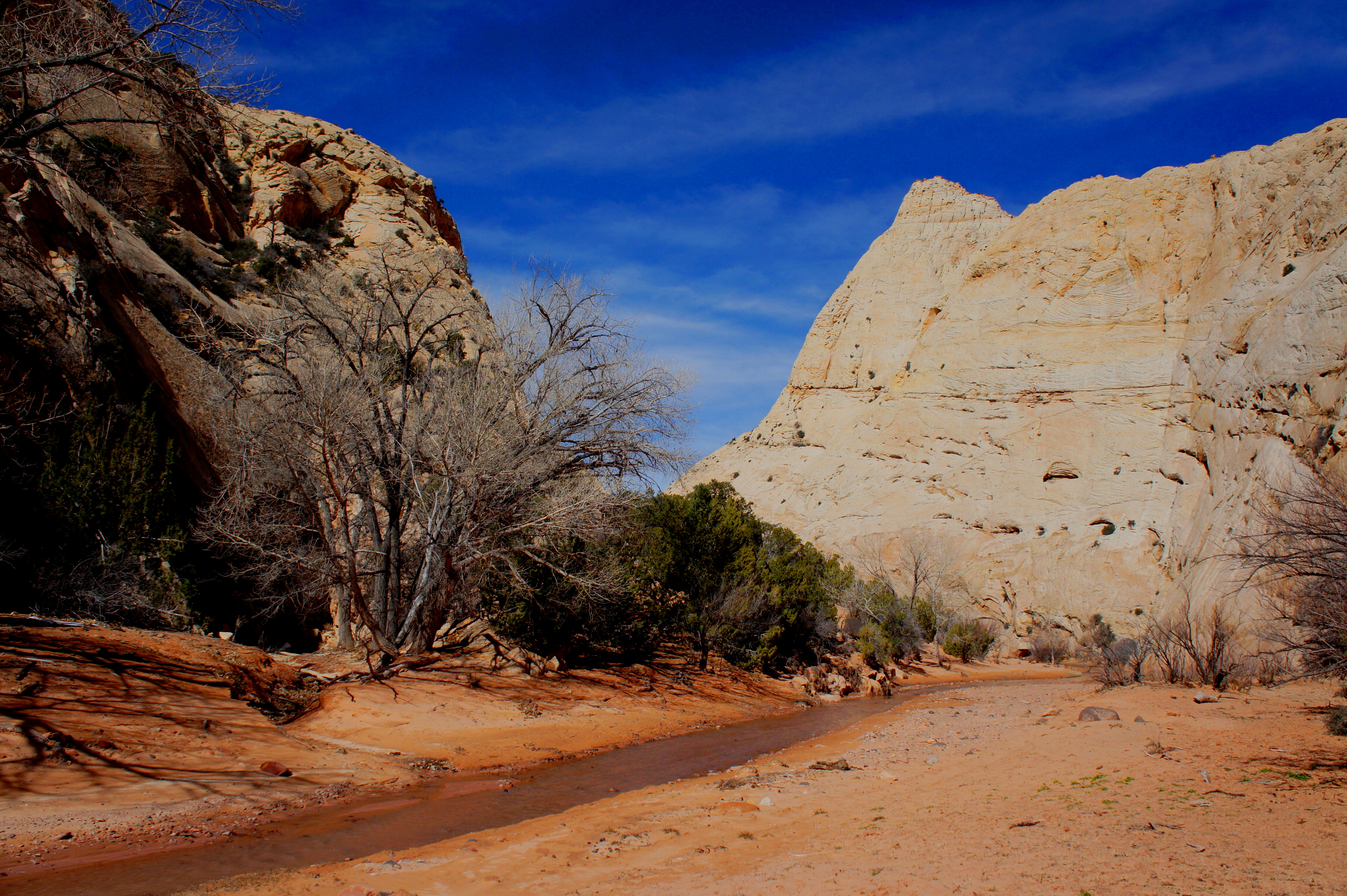
The relatively bland terrain of dusty yellows and browns is improved with the sight of Oak Creek, one of only three perennial streams flowing through the Waterpocket Fold. Bear right at the creek, rock-hopping to the opposite bank, where a relatively wide, rutted track appears. It is a less than ten-minute walk from here to a pretty section where the water tumbles over a gushing, 7-foot waterfall.
Shortly beyond the falls, the man-made track crosses to the right (north) side of Oak Creek, then begins to ascend sharply up to a bench more than 75 feet above the canyon floor. The gorge below constricts to as little as 8-10 feet wide in some places, producing rapids and minor waterfalls. (Note: It is possible to explore these narrows from the bottom, but be prepared for wading and slippery obstacles.)

While the main path maintains a fair distance from the edge, hikers venturing to the brink for a peek down into the narrows should be extremely cautious.
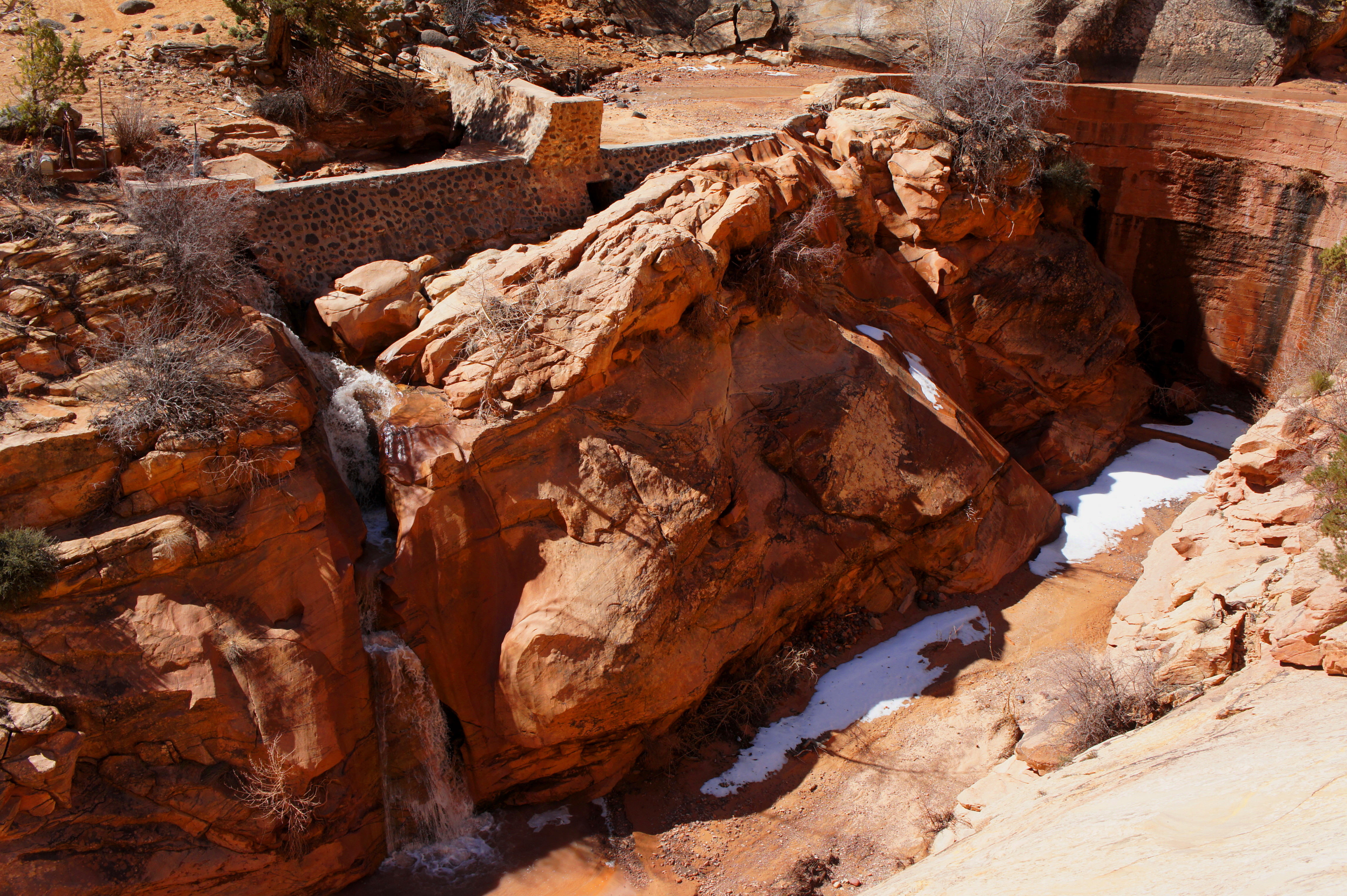
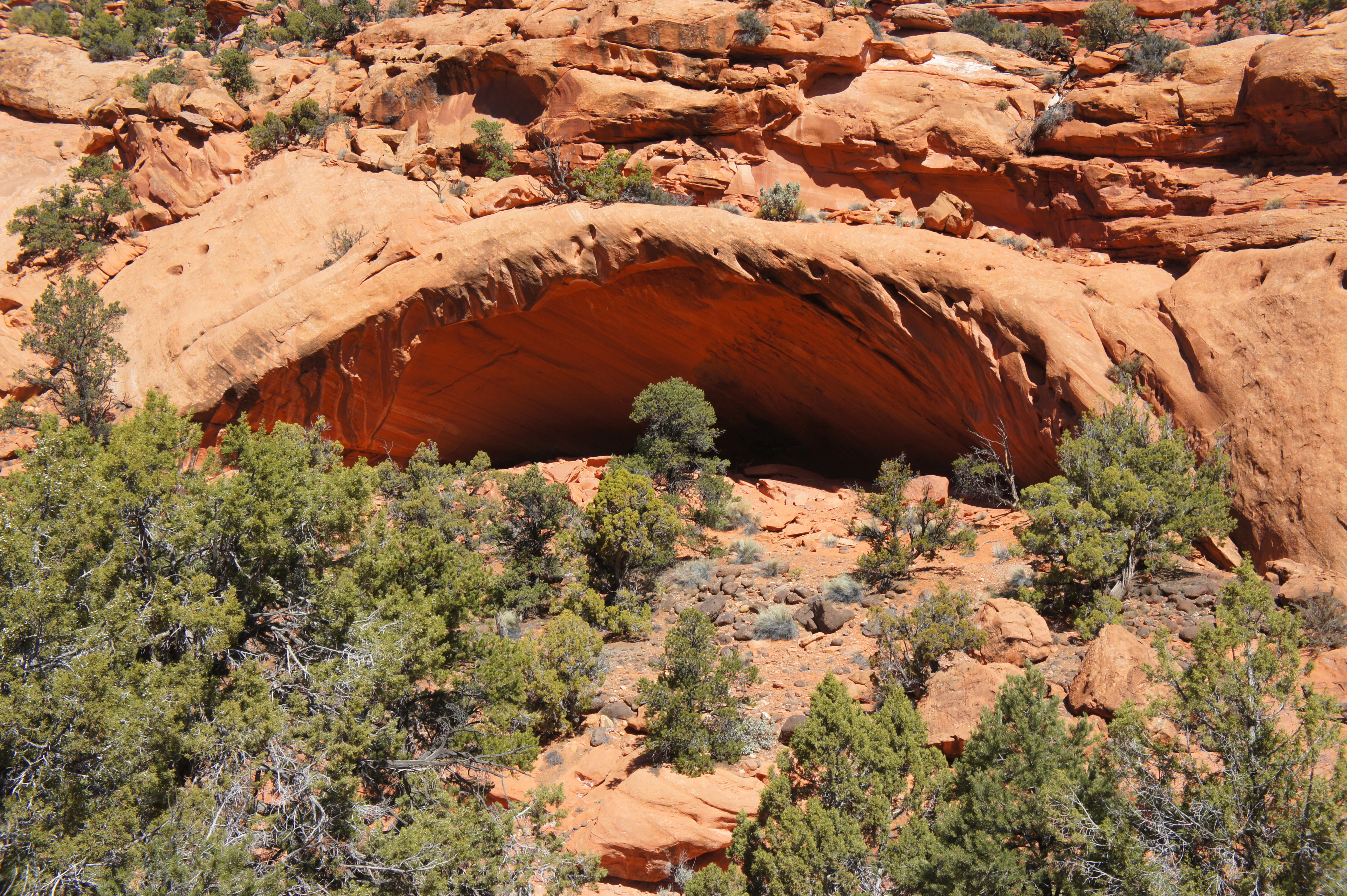
The Oak Creek narrows begin in the Kayenta, but the bypass route soon cuts into the cream-colored Navajo sandstone. Strangely enough, the deep incision comes to an end at what may be one of Utah’s most remote man-made dams. The dam, long abandoned, no longer bears the weight of water upstream; instead, a channel has been carved to divert the stream to a point slightly down-canyon, where the flow drops over a 40-foot cascade to the narrows below.
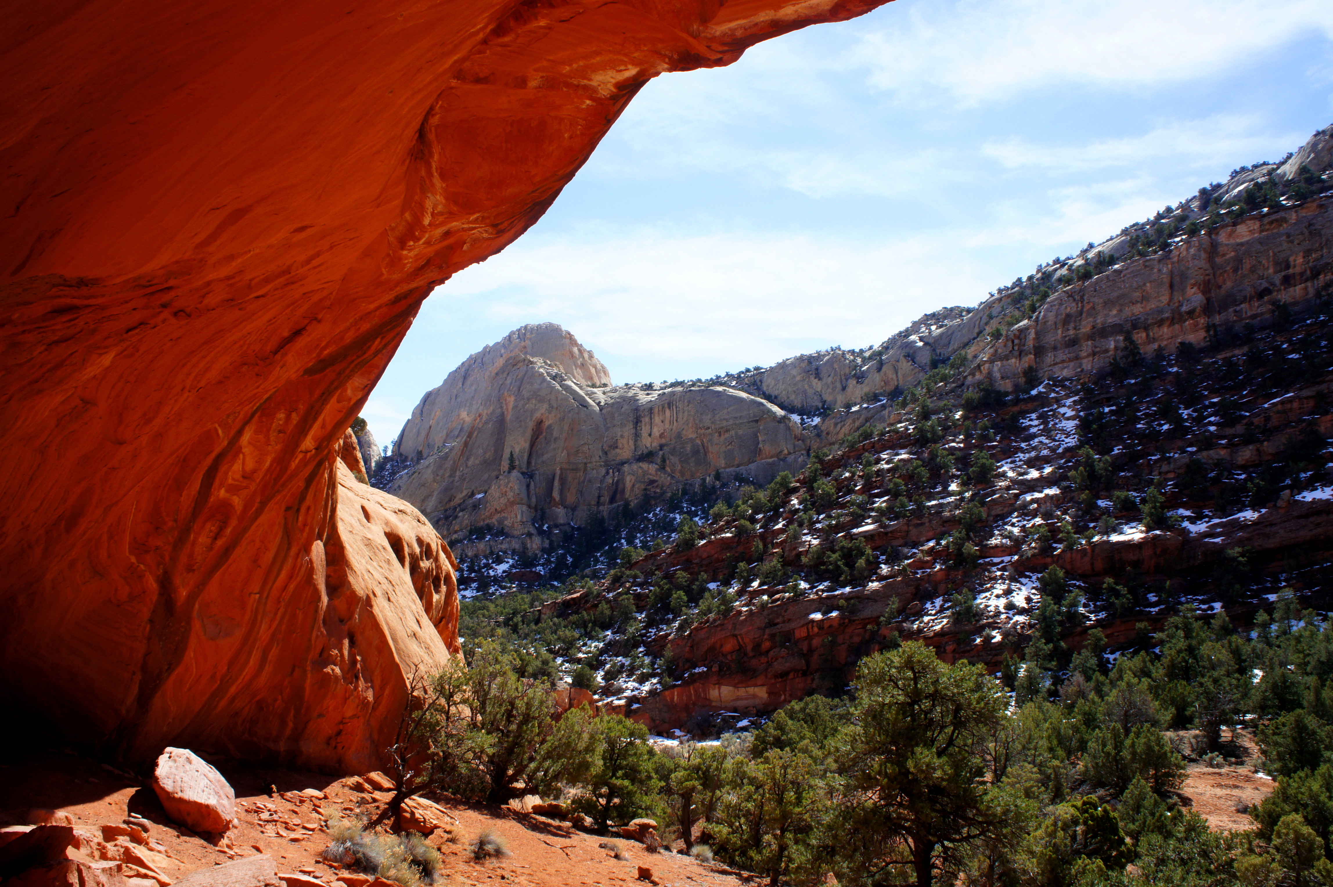
Just past the dam, the old track descends gradually back to floor level. Gone are the precipitous drops and rushing waters; heading up-canyon, Oak Creek is relatively wide and calm. The view west is dominated by a colossal white dome (point 6,528’), which towers nearly 700 feet above the canyon bottom.
The next several miles are relatively flat and peaceful, with dense stands of junipers—as well as occasional cottonwoods—lining the creek bed. Continuing up-canyon, however, requires numerous creek crossings that, in normal conditions, pose only a minor threat of wet feet. It is possible to follow Oak Creek all the way to the western fringe of Capitol Reef and into Dixie National Forest beyond. However, most day visitors will want to pick a spot to turn around within a couple miles of the dam—especially those who left their vehicles short of the Oak Creek trailhead.
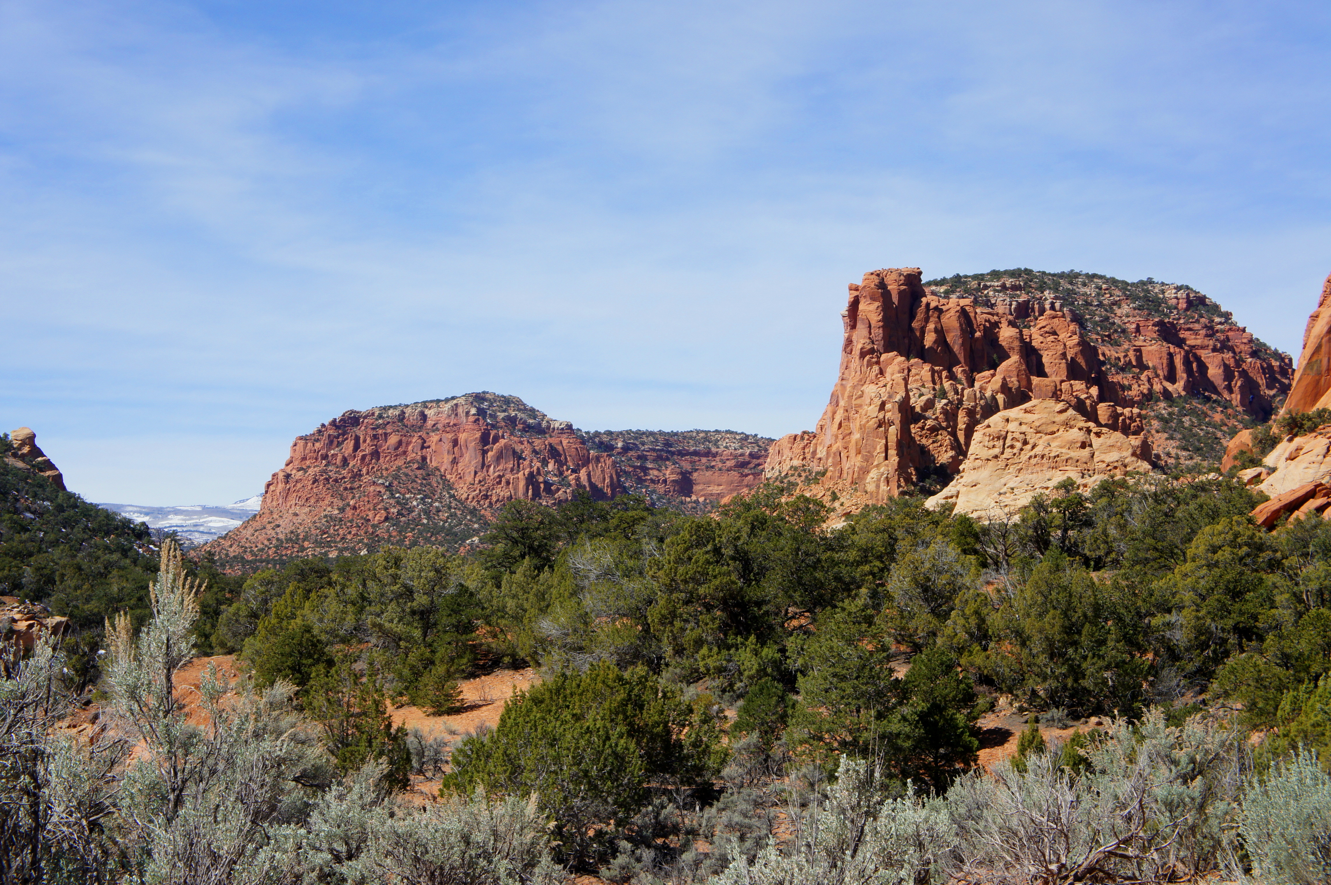
A nice endpoint to aim for might be around 1-1.5 miles past the dam, at the contact point between the ledgey, multihued Kayenta formation and the Wingate sandstone, which glimmers a bright red-orange color. Shortly into the Wingate, a modest alcove appears along the wall on the right—a nice, shady spot for a picnic break. From here, Oak Creek Point (7,013’) is visible up-canyon to the west, as is a sliver of flat-topped Boulder Mountain (11,317’), where Oak Creek originates.
Through-hikers can continue all the way to Boulder Mountain, but most visitors will want to return the way they came. Allot at least 2-3 hours for the round trip to/from the end of the Oak Creek access road.

Neat hike! I’d love to see the dam.
Pingback: Box Canyon Falls Trail (Box Canyon Park, CO) | Live and Let Hike
hello! Do you know the coordinates for the trailhead?
It’s about here: https://www.google.com/maps/place/38%C2%B004'53.1%22N+111%C2%B007'40.2%22W/@38.081424,-111.1304149,17z/data=!3m1!4b1!4m12!1m7!3m6!1s0x874a00ff07e7a253:0xde3bec53484fff07!2sCapitol+Reef+National+Park!8m2!3d38.0877312!4d-111.1354983!16zL20vMDI5a2tw!3m3!8m2!3d38.081424!4d-111.12784!5m1!1e4?entry=ttu
Do you have any information on the route continuing on this trail to Boulder Mountain? I’m having trouble finding anything about it.
Hmm no I do not, but I believe it is possible – Oak Creek Canyon opens up significantly after the turn-around point I describe. There is not much beta on this hike on the Internet at all, let alone a continuation beyond what I describe.
In my family, we call the narrows “Bowns Narrows”, named after William Bown Jr (my great great grandfather). He built the diversion dam at the end of the canyon, in the 1910’s. Thanks for posting this description. It’s a fun and gorgeous hike. I recommend trying the narrows for a fun and easy canyon scrambling experience.
The dam is not abandoned and still diverts water from Oak Creek to the Sandy Ranch. It is fed by natural runoff and also can receive releases from Lower Bowns reservoir and Oak Creek Reservoir (AKA Upper Bowns Reservoir).
Wow, so great to hear this. Thanks for reading and for the historical context!