

Visible from just outside the Visitor Center, the cragged hunk of ochre-colored Wingate sandstone known as “the Castle” is one of Capitol Reef National Park’s iconic landmarks. The monument’s blocky façade—the only surface seen by the vast majority of visitors—disguises a far more rugged northern face, an eroded cluster of spindly fins and needles. An old hiking trail (no longer an official, advertised route for reasons unknown) leads from the Visitor Center to the enigmatic “back side” of the Castle, exploring a hidden canyon lined with mammoth boulders and violet-colored hoodoos. The route described here offers a 1-2 hour hike where, despite leaving from the busiest destination in Capitol Reef, solitude and serenity reign.

The hike
Access to the Castle hike is extraordinarily simple: simply park at the well-marked Capitol Reef Visitor Center, 11 mi. east of the town of Torrey along Highway 24. Cross the highway (north) to virgin territory: sagebrush flats and crimson soil, with mounds of red (Moenkopi formation) and gray-green (Chinle formation) beyond. No obvious path leads north across the flats, but hikers should make their way toward an obvious break in the hillsides. To avoid stomping on fragile cryptobiotic soil, cut west or east to the banks of Sulphur Creek, then follow it north as it rounds a meander. (Note: Though the creek is perennial, it is usually relatively easy to cross it while avoiding soggy boots.)
After crossing Sulphur Creek, bear north across the gentle flats until running into a dry wash. On the south side of one right-bearing bend, hikers will encounter the first vestiges of the trail-that-once-was: a faded wooden sign that reads, “Trail Follows Wash Next ¼ Mile.”

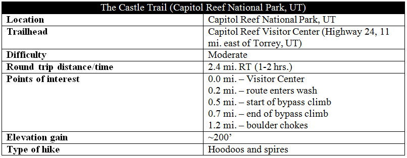
The route beyond does just that, following the dry streambed as it cuts into the Chinle formation layer. The Castle Trail offers perhaps the park’s best opportunities to gaze upon the peculiar, pastel-colored hills of the Chinle’s Monitor Butte member. These mounds are composed of soft bentonite clay, evidence of the swampy, boggy depositional environment in which the Chinle was laid more than 200 million years ago. To some modern-day visitors, these green-gray, extraterrestrial landforms are fascinating—and beautiful—features. To others, they are an eyesore.
A quarter-mile from the wooden sign, a second trace of the old trail emerges on the right bank: a right-pointing arrow, etched into the smooth face of a hefty boulder, labeled above with a man-chiseled “TRAIL.” Here the route leaves the wash and begins a steep and rocky ascent up the right-hand slope. The trail serves as a bypass around a looming dryfall.
For a trail-that-is-no-longer, the bypass route is surprisingly easy to follow. Occasional cairns mark the way, though the footpath edging up the slope is relatively well-worn. While the abundance of loose rock makes this section a “scramble,” there is nothing more difficult than Class 2. Here the trail pierces the more durable Petrified Forest and Owl Rock members of the Chinle formation, noted for their intriguing shades of purple and orange.
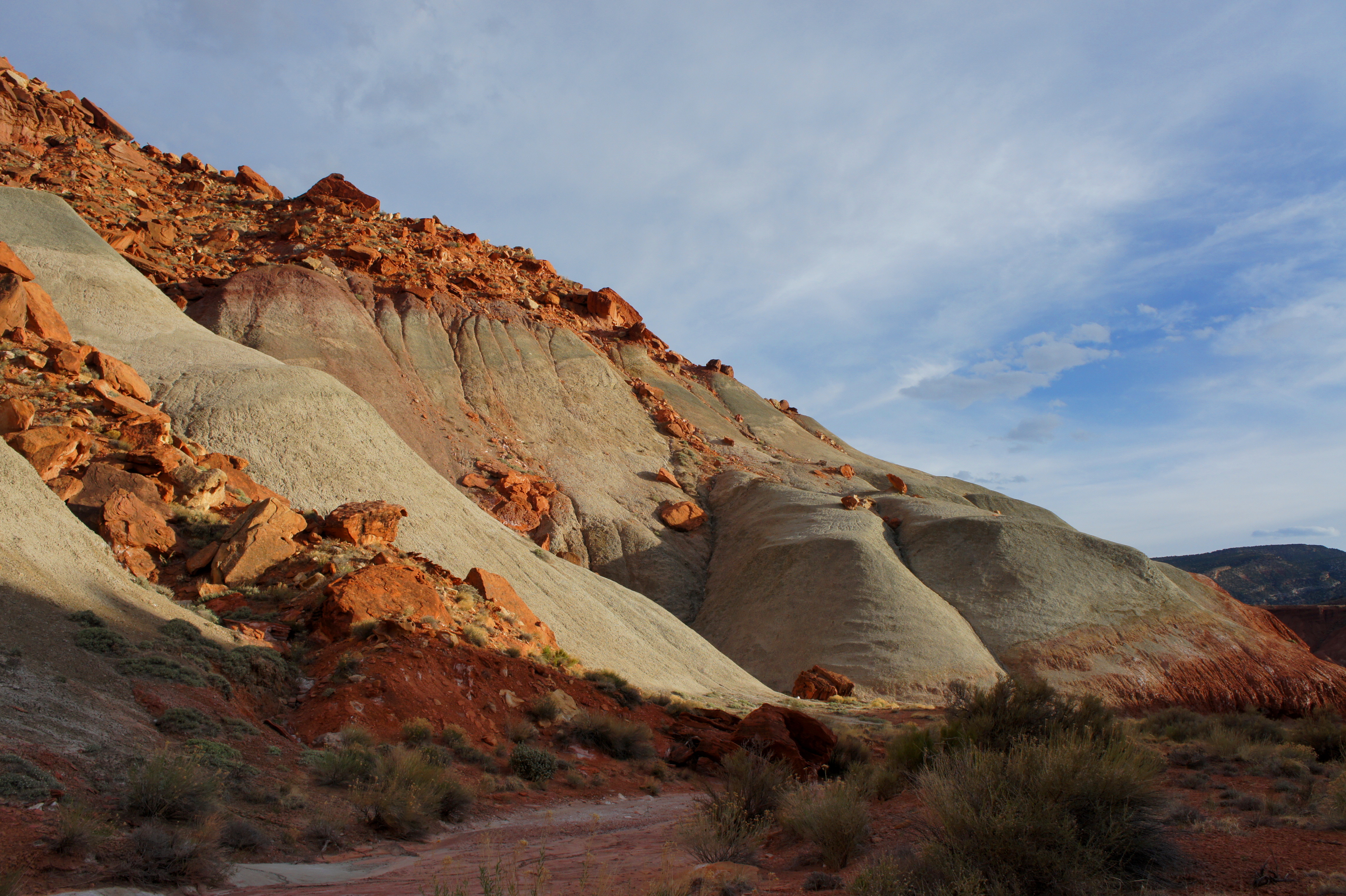
Less than ¾ mile into the hike, the route clears the rocky pouroff and reenters the wash. The flip-side of the Castle towers above to the west, while a look back south offers tremendous views of multihued Chinle slopes. Ahead, the wash takes a sharp left-hand turn, and a good-sized arch is visible atop the Wingate sandstone wall to the north.
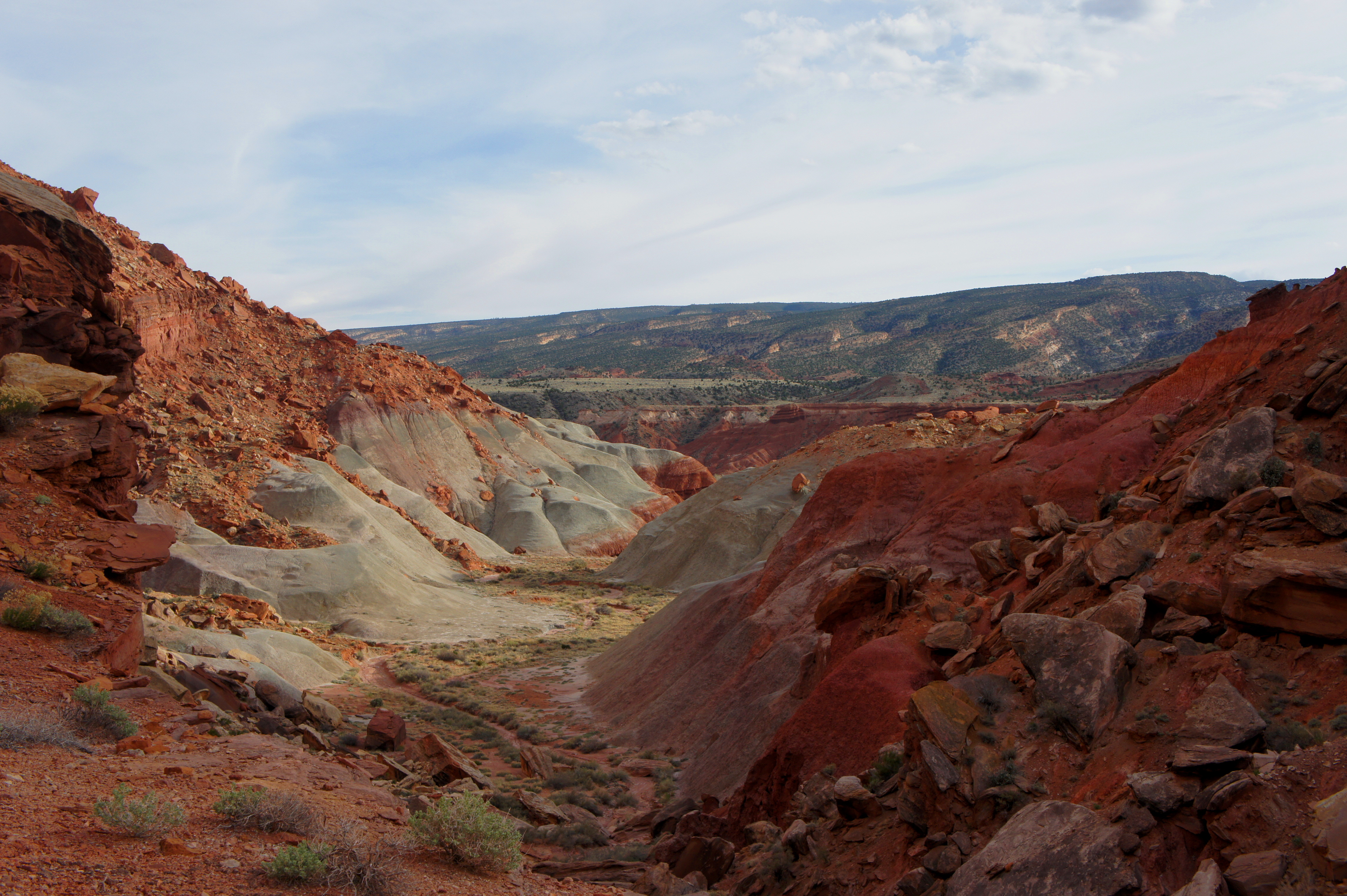
Beyond this point, there is no discernable trail. To continue up the canyon, simply follow the dry wash west. Within minutes, protruding boulders require hikers to dip, duck, and squeeze through a pair of passages that are tight but straightforward. The tan-and-violet hoodoos begin to pop up shortly thereafter on either side. One clump on the left boasts four imaginative, 10- to 20-foot spires.


About ½ mile from the end of the steep bypass, gargantuan stones clog the wash. Though it is possible to scramble farther up the ravine, this boulder choke is an apt turnaround point for a 1-2 hour hike. Return the way you came.


Pingback: Top 10 Hikes in Capitol Reef National Park’s “Frontcountry” | Live and Let Hike
Pingback: Utah’s Mighty 5 – the aquaholic
have you hiked the castle trail lately? it looks amazing! i am wondering if the bypass route and footpath are still fairly easy to follow.
thanks!! anita
Hi Anita – it has been since 2015 that I have hiked it, so I’m not sure of the status. I assume it’s still ok?
We hiked this trail in Oct 2020. I was really glad that I’d printed out the write-up of this trail as this made it much easier to know we were following the right way. Cairns mark the passage up the rocky cliff and it is not a difficult climb. The views and area was amazing. I took it to the chokehold and my husband climbed further – almost reaching the top of the rise. Few people; great views. Not a lot of shaded areas, so took advantage where I could.
Pingback: TEXAS TO WASHINGTON ROAD TRIP – Mountains & Valleys