
In terms of height, Shenandoah National Park’s Hazel Falls pales in comparison to its better-known neighbors, such as South River, Lewis Spring, or Dark Hollow Falls. But tucked away in a narrow, intimate gorge littered with caves, the multi-tiered waterfall is arguably just as spectacular. The relatively easy out-and-back to the falls (from Skyline Drive) clocks in at around 5 ½ miles. Hearty adventurers, however, can tack on an additional 3 ½ by adding the strenuous White Rocks-Hazel River Trail loop, which features several viewpoints and steady climbs. Try the hike in the early spring for the falls’ best flow and less obstructed vistas. (Note: Even in August 2015—generally a poor time to see waterfalls—Hazel Falls was flowing at a pretty good volume.)
The hike
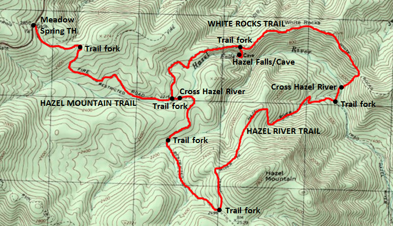
Begin and end this circuit hike at the Meadow Spring Trailhead, situated just over two miles south of the Thornton Gap Entrance Station on the left. On busy weekends, arrive early to get a parking spot—this is also the starting point for popular hikes to Mary’s Rock (across the street) and Buck Hollow.
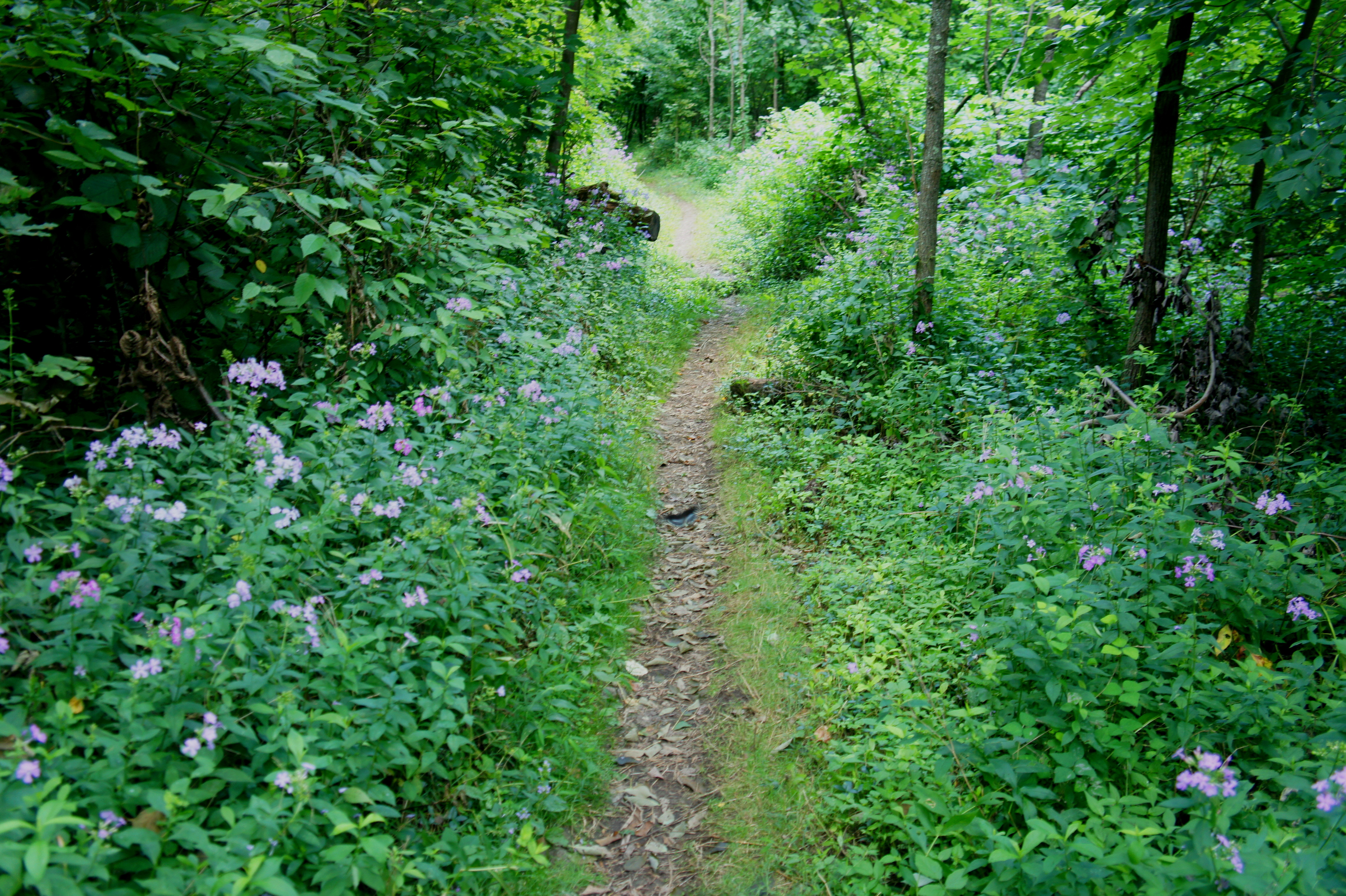
The cement post marking the start of the trail to Hazel Falls is labeled “Hazel Mtn Rd.” No longer fit for driving, the Hazel Mountain Trail is nonetheless wide and partly graveled as it gradually descends from the parking area into dense woodlands. At 4/10 mile, the trail forks—the steep Buck Ridge Trail descends to the left—then begins to drop at a quicker pace as Hazel Mountain (~2,850’) becomes (partly) visible through the trees. Wildflowers and pine trees make a sporadic appearance.
With about ¼ mile remaining to the next junction, hikers will begin to hear the sound of the Hazel River flowing through the ravine off to the right. The Hazel Mountain Trail parallels—but does not approach—the stream before encountering a second trail fork around 1.6 miles from the start. Turn left onto the White Rocks Trail.
The White Rocks Trail feels considerably narrower and shadier than the Hazel Mountain route for the first ½ mile, but within around 20 minutes the dense canopy opens, allowing for occasional views off to the south. Around 2.6 miles from the trailhead (around an hour to 1 ½ hours of downhill walking), hikers reach the spur trail heading down to Hazel Falls. (Note: The 2/10-mile detour is labeled “Cave Falls” on the cement post.)
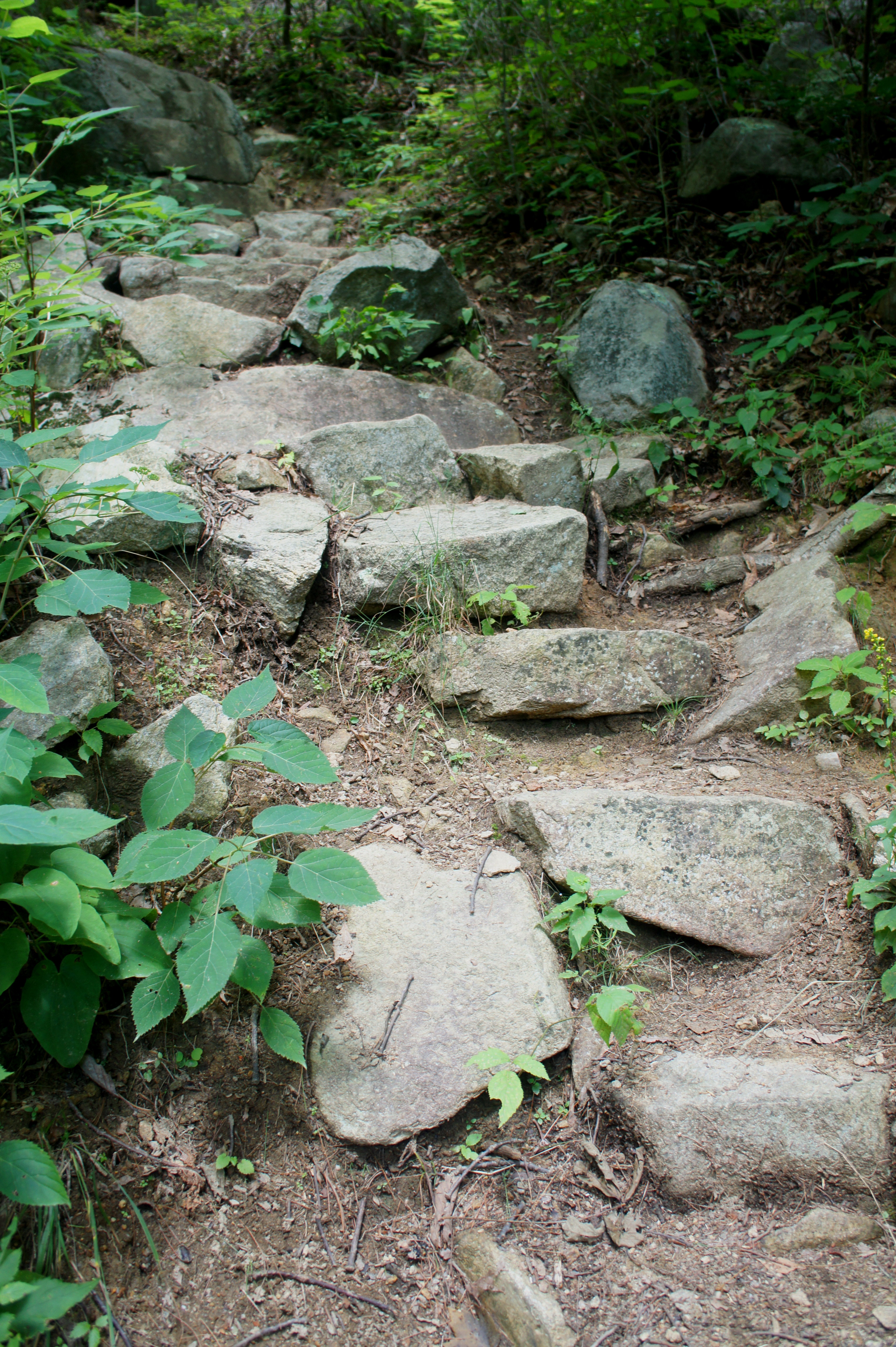
Turning onto the spur, the trail quickly gives way to a roughly 150-foot descent. The steep drop is assisted by the presence of stony steps, but hikers should exercise considerably caution in this short but daunting section.
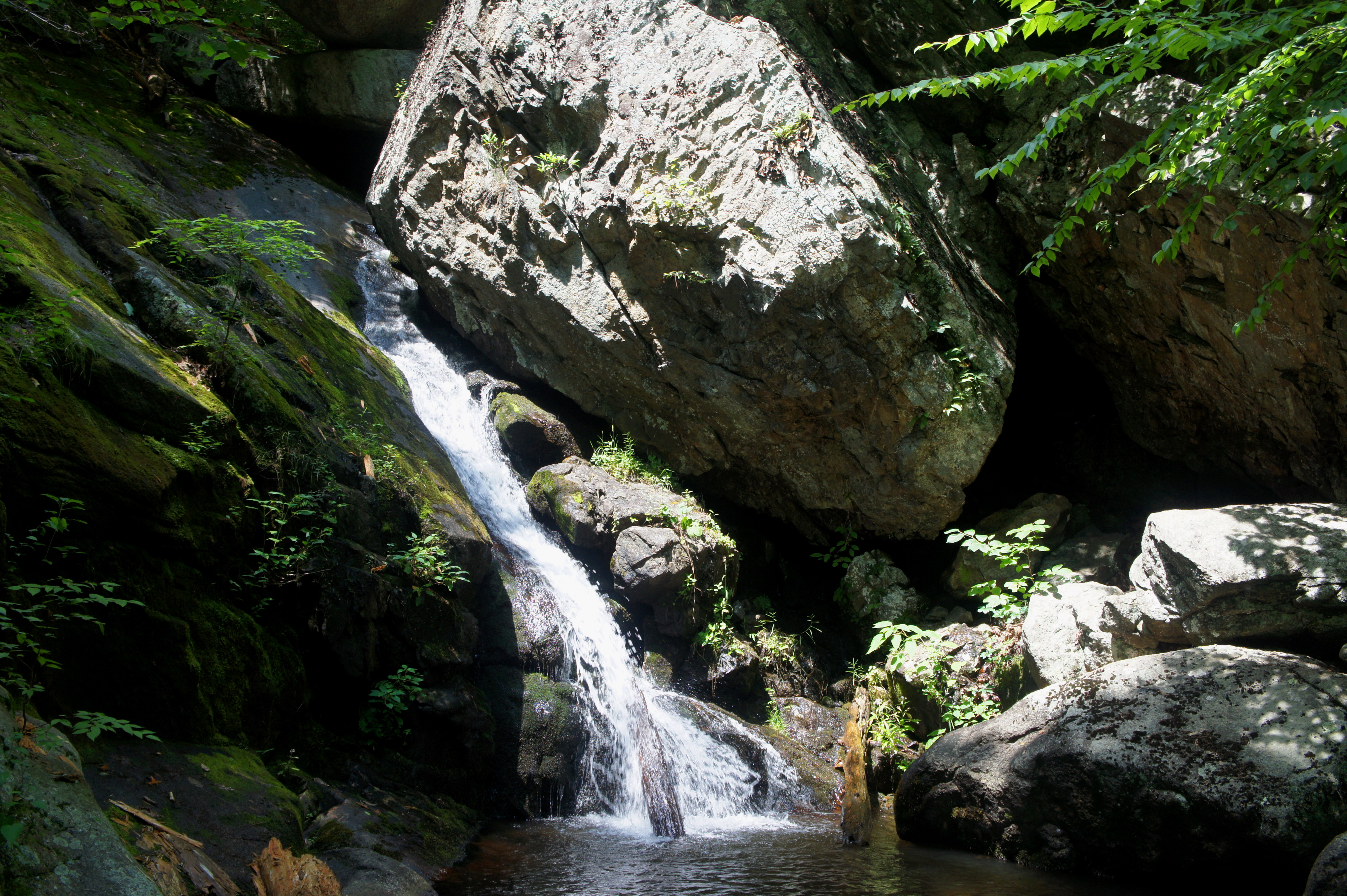
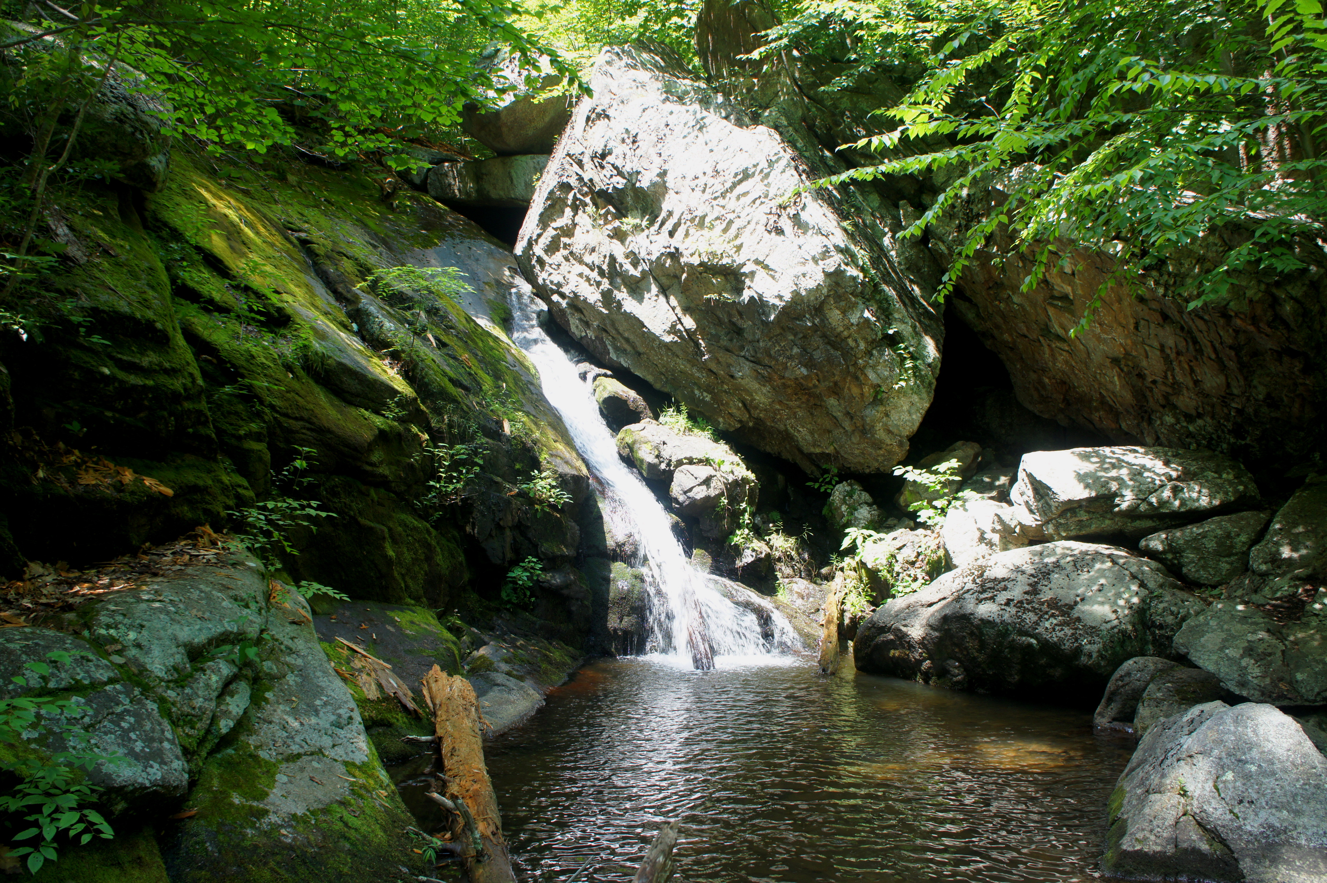
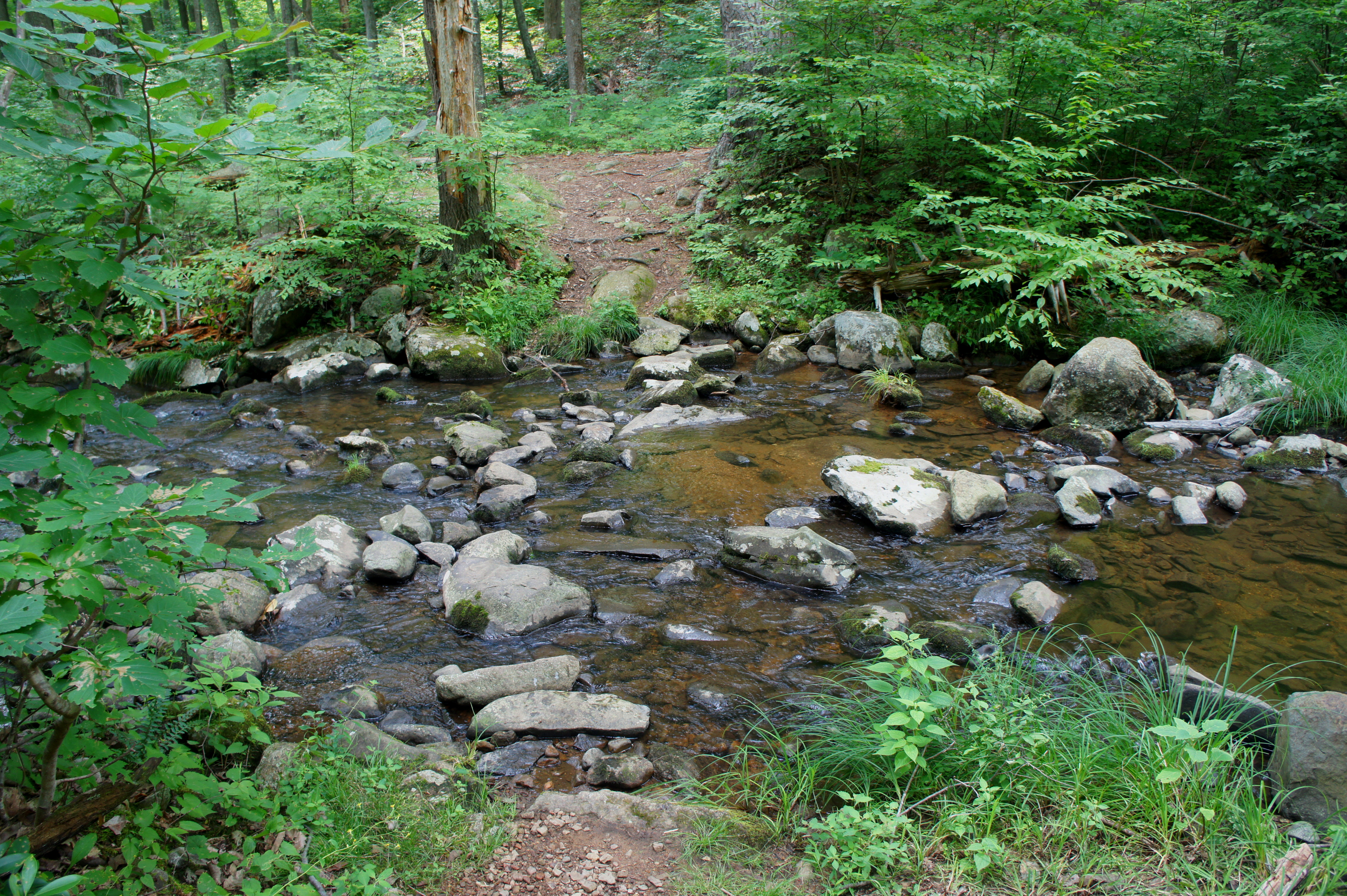
At the bottom of the descent lies a beautiful pool, fed by a gentle, meandering waterfall, zig-zagging down a narrow channel. This in itself is a peaceful and rewarding destination.

But it’s not even the highlight: a higher, more impressive cascade lies a short walk upstream. Here Hazel Falls shoots out of a cavern-like passage before bending around a gargantuan boulder and sliding into another pool. Just to the right of the splendid flume is Hazel Cave, a dark and foreboding spectacle. (Note: There are reportedly a number of other caves in the area, but they are difficult to find.)

This area—a shady grotto of sorts—is a blissful spot to stop for a lunch or snack break. Unlabeled on many maps, Hazel Falls sees fewer visitors than many of the better-known waterfalls in Shenandoah. The result is often a welcome—even cathartic—solitude.
For many day hikers, this will be the terminus of the hike; in that case, return the way you came to complete a 5.6-mile round trip (3-4 hours). For the more adventurous, the rest of the White Rocks Trail awaits. After reversing the steep climb back up to the main hiking route, bear right to continue eastward, passing a nice camping spot adjacent to the trail junction on the left. After about ¼ mile of level walking, the track begins to climb again, this time to the first of four successive summits along the White Rocks ridgeline.
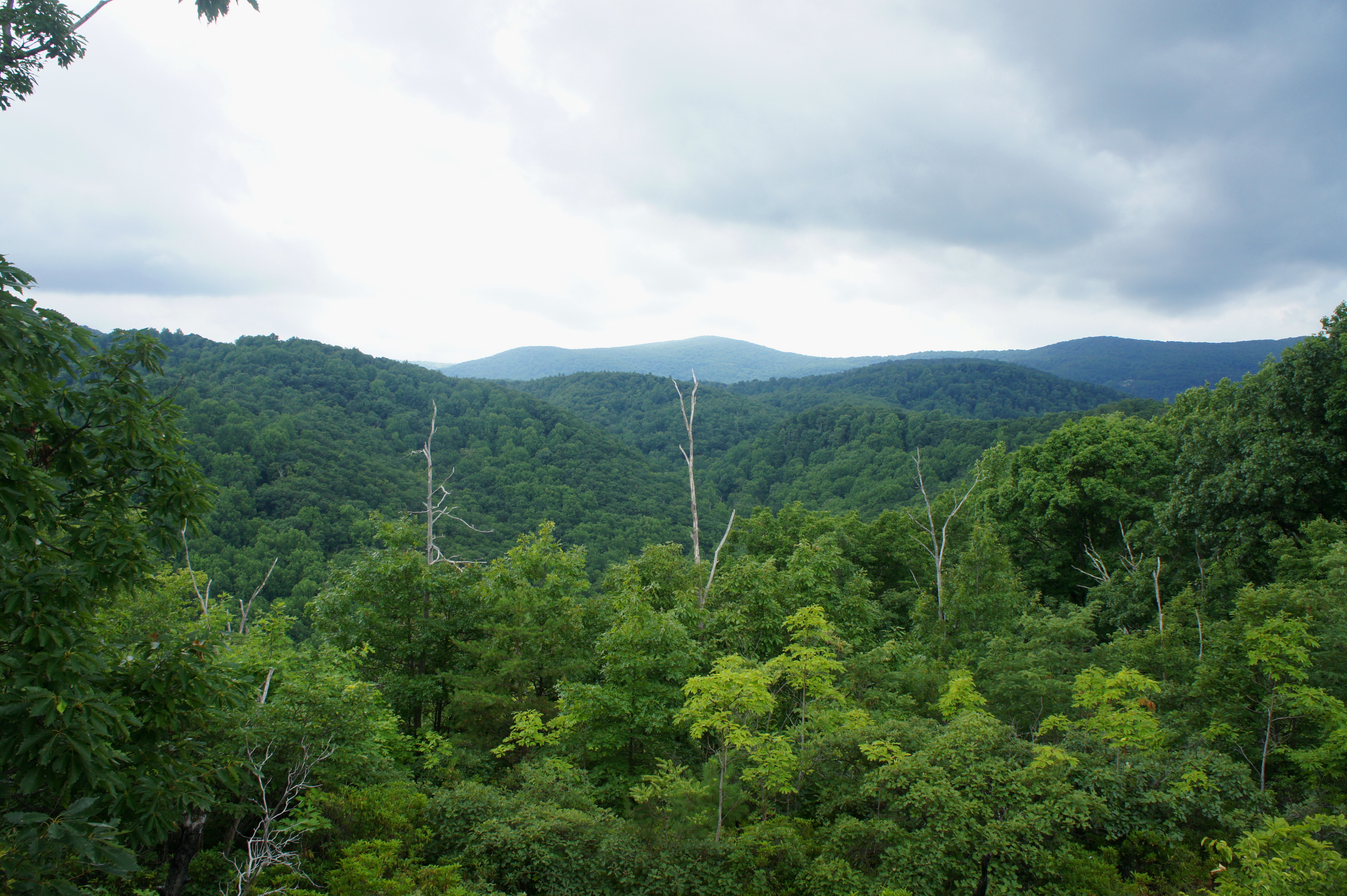
While the first high point offers limited views, the second features vistas off to the left. The prominent peak to the northwest is Mary’s Rock (3,514’), while Pass Mountain (3,052’) and Oventop Mountain (2,468’) are visible across Beech Spring Hollow and the Thornton River to the north.
Just before as the subsequent descent begins to steepen, look for a faint spur trail on the right. This route, through pines and brush, leads to a rock outcrop that offers excellent views to the south—including the Hazel River Valley and Hazel Mountain. Here you can partly trace the route to come—across the ridgeline, down to the valley, and up through a densely-wooded saddle just west of Hazel Mountain.

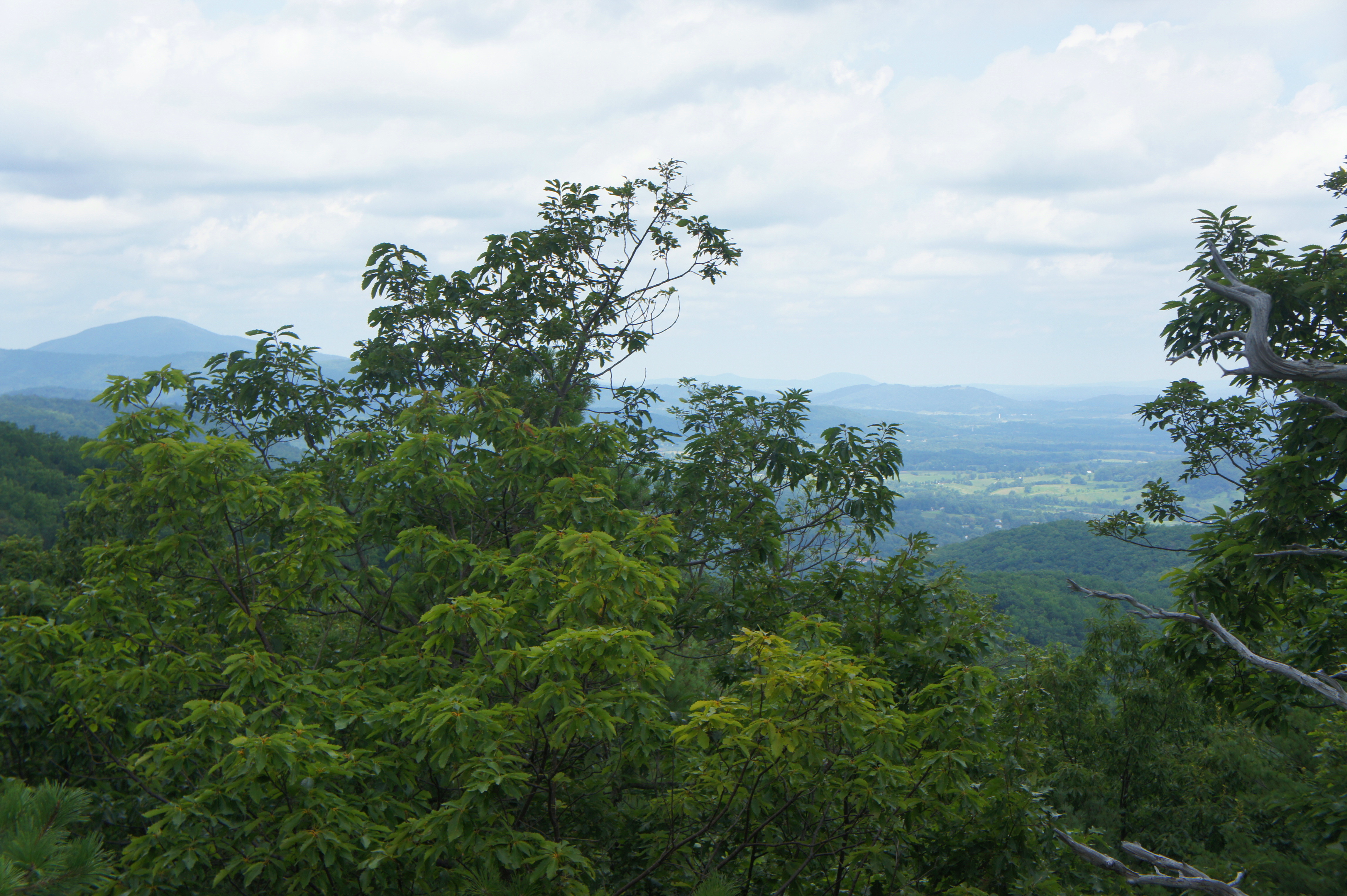
Back on the White Rocks Trail, the route drops sharply, then levels out and ascends again to the top of the third hill. Here the views are again obstructed, but they return on the ensuing ascent to the fourth and final summit. Here, amid a patch of mountain laurel, another rock outcrop on the left provides a nice vantage point to the north and east.
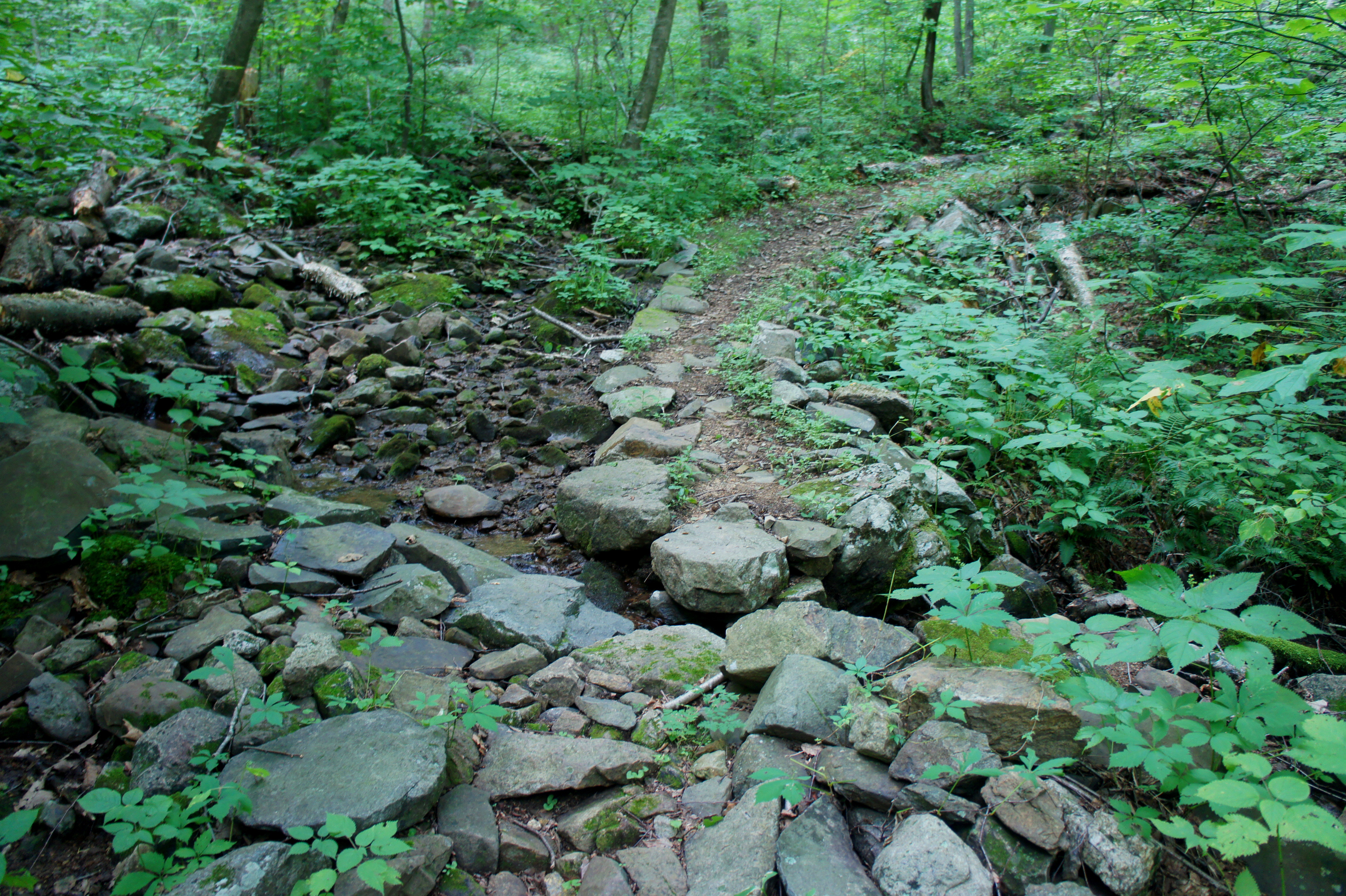
Finally, more than 3.5 miles from the trailhead, the route descends to a low pass with new growth trees, then bears southwest as it steeply drops more than 200 feet in ¼ mile. At the lowest point of the loop, the route traverses Hazel River, another fine spot for a snack break. Crossing the stream, the White Rocks Trail continues for another 2/10 mile to a junction with the Hazel River Trail. Bear right, leaving the river behind.
The Hazel River Trail, marked with yellow blazes, follows an old road bed as it begins the long and arduous ascent to a minor pass between Hazel Mountain and Catlett Mountain (~2,950’). Over the course of 1.8 miles, the Hazel River Trail climbs—never steeply but always persistently—more than 1,000 feet in elevation. Most of the climb is completed in the first half, a southeasterly ascent up a wooded ravine interrupted twice by wide S-curve bends. Evidence of human development is apparent, especially as the trail crosses a minor streambed, where neatly arranged rocks bound the creek to a narrow aqueduct.
In summer, leafy foliage—as well as ubiquitous spider webs—lines the trail, a feeling that seems to heighten the Virginia humidity. With about 250 feet in elevation gain remaining, the trail flattens out briefly as it weaves through a pine grove, where the air regains its freshness.
After topping out at just over 2,500 feet, the track rides the northern slope of Hazel Mountain and descends gradually to yet another junction. Here the Hazel River Trail disappears, and a right turn puts you on the Hazel Mountain Trail heading back toward Skyline Drive.
The 0.7-mile section that follows is mostly downhill, flanking a pretty creek bed, waiting to cross it until just before a sixth trail junction. Here the Catlett Spur Trail enters from the left; stay right. During this 0.6 mile stretch, the Hazel Mountain Trail climbs gradually again, then crosses Hazel River—this time well upstream of the falls—a final time. At 7.4 miles, hikers again reach the junction with the White Rocks Trail.
Having completed the loop, it’s a brief 1.6 miles back up the Hazel Mountain Trail to the trailhead. By the time one arrives back at the car, it’s been a full day of hiking on a strenuous circuit.
Allot 5-7 hours for the round-trip.

Looks like a fantastic hike! Thanks for sharing:)
Did the trip this weekend–loved all the advice. Thanks again!
You bet!
We (healthy 54 yr olds) did this hike yesterday with our big dog. The weather and hike were spectacular–uncharacteristically cool 83 and has been raining, so lots of water and springs running. We got to the trailhead at around 10:30a and barely anyone was on the trail. We expected it to be much more crowded given the cars parked on the side of the road. And even though we got off track a couple times, it made no difference to our enjoyment and the lovely spots we encountered. You can’t go wrong with this trail and we were happy for the critique. We would not have known about it otherwise. (I read your top 10 hikes of 2017.) Well, we used this guide page to help us, and misread the descriptive text for the first major turn…”At 4/10 mile, the trail forks—the steep Buck Ridge Trail descends to the left”. We were just reading kinda quickly and thought this meant for us to go left, but no, GO RIGHT at the first fork. (Besides, this unclear direction, we REALLY liked this guide. It was perfect, otherwise. And besides, we found copious mushrooms, especially bright orange and yellow chanterelles on the Buck Ridge 1 mile section walked. After correcting, we got off our intended route toward the fall and cave once more, due to pilot error, turning right instead of left at the next big fork (we could hear we were close to water), so we only walked a little farther and found a lunch spot at the next stream crossing (which was actually the other end of the loop). But as I said, we did not care one bit! It was gorgeous. We corrected again and got to the falls and cave, where our dog had a great swim in the pools. Ducking behind the rock at the upper falls and getting up close and personal with the water coming down, was really serene. Thanks for the detailed mile trail descriptions and pictures.
Pingback: A Guide to Virginia’s Waterfalls: The Best Spots for a Natural Escape – Visit US